Walks in Brecon Beacons: Best Hikes in the Four Ranges
Plan walks in Brecon Beacons National Park across all four ranges, from the Four Waterfalls Walk to Pen y Fan, with distance, ascent and time for each route.
On this page
Brecon Beacons National Park spreads across four mountain ranges in South Wales, and each one walks differently: the Central Beacons for big ridgelines, the Black Mountain in the west for empty glacial lakes, the Black Mountains in the east for short steep summits, and Waterfall Country for wooded gorge trails. That split matters when you plan, because a two-hour stroll near Ystradfellte and a seven-hour horseshoe above Pen y Fan sit an hour's drive apart. Pick your range first, then your route. The same range-by-range planning applies if you are weighing up hiking in the Lake District or a Welsh park, so match the terrain to the day you have. If you are comparing Welsh upland days more broadly, our walks in Dartmoor: best day hikes, distances and trailheads cover the same range-first approach.
The park was designated in 1957 and covers 1,344 square kilometres (519 square miles), which is large enough that you should not treat the whole thing as one trailhead. Most hikers base themselves in Brecon for the Central Beacons, Crickhowell or Abergavenny for the Black Mountains, and Ystradfellte or Pontneddfechan for the waterfalls. Choose the base to match the walk, not the other way round.
How walks here are graded
Distances in this guide are one-way or circuit totals as published by the route guides, with accumulated ascent in metres and feet where it is given. Treat anything under 8 km (5 miles) with less than 350 m (1,150 ft) of ascent as a half-day, and anything above 15 km (9 miles) with more than 700 m (2,300 ft) as a full day with an early start. The classic horseshoe above Pen y Fan, for example, runs 22.5 km (14 miles) with about 1,100 m (3,600 ft) of climbing and roughly seven hours of walking.
Easy walking in this park still means rough ground. Komoot classes the Four Waterfalls Walk from Cwm Porth as easy at 7.25 km (4.5 miles) with 120 m (394 ft) of ascent in about two hours, and the Sugar Loaf loop from Llanwenarth as easy at 5.11 km (3.2 miles) with 220 m (722 ft) up and 230 m (755 ft) down in around 1 hour 40. Both have short steep sections and slippery surfaces after rain, so boots rather than trainers.
Waterfall Country: the Four Waterfalls Walk
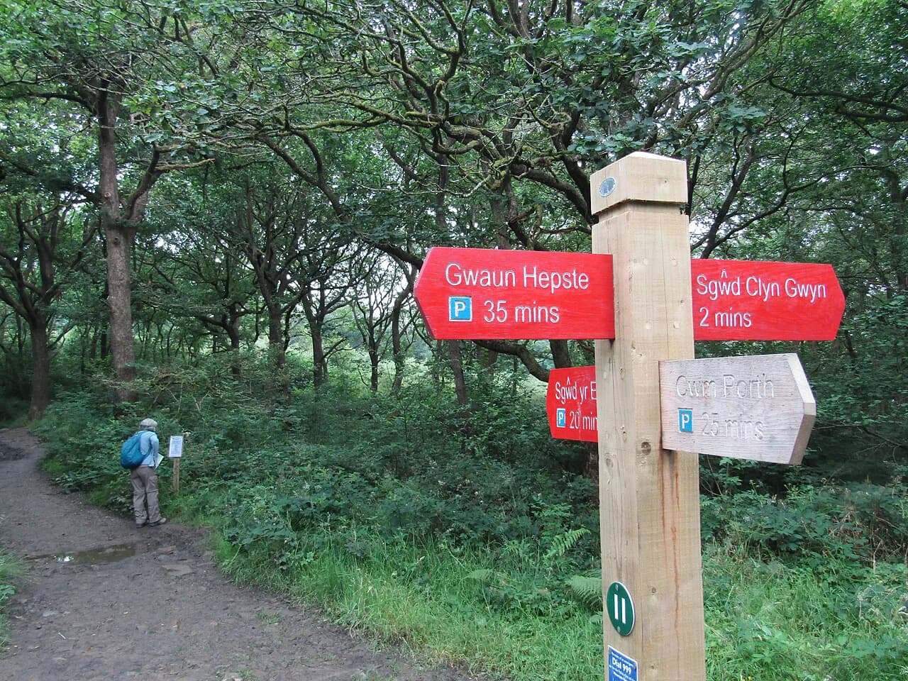
The Four Waterfalls Walk is the best value half-day in the park. From the Gwaun Hepste car park it runs about 10 km (6.2 miles) with 310 m (1,017 ft) of ascent in roughly three hours, following the red track with short green link paths down to each fall. The car park at Gwaun Hepste takes a payment for parking; Cwm Porth is the alternative start and shortens the approach.
The order of the falls depends on your start, but the sequence from Gwaun Hepste brings Sgwd Clun-Gwyn first, then Sgwd y Pannwr, Sgwd Isaf Clun-Gwyn and finally Sgwd yr Eira, where a path drops behind the curtain of water. The descent to Sgwd yr Eira uses a steep flight of steps and the rock is slick year-round, so take the handrail sections slowly and keep children close at the viewpoints above the pools.
Go after rain. The falls run thin in dry spells, and the gorge paths become genuinely slippery in the wet, so grippy footwear matters more here than on the ridges. Morning starts dodge the coach groups that fill the Cwm Porth and Gwaun Hepste car parks by mid-morning.
Waterfall Country: the long circuit linking three trails
If the Four Falls route leaves you wanting more, a 9-mile loop from Dinas Rock car park links the Sychryd Gorge walk, the Four Falls Trail and the Elidir Trail in one circuit past nine waterfalls, two of which you can walk behind. Park at Dinas Rock, roughly 1 km past Pontneddfechan, and walk the loop anti-clockwise so you finish at Sgwd Gwladus and the flat riverside path back to the village.
This is a full day of rough woodland walking with no facilities after Pontneddfechan, where the waterfall centre has the only toilets on the loop. Carry water and food, and expect muddy, root-covered ground between the falls. The extension upstream from Sgwd Gwladus to Sgwd Einion Gam involves unmarked river crossings and a narrow erosion-prone traverse; skip it unless you are confident on that kind of ground.
Henrhyd Falls: the short walk to a single drop
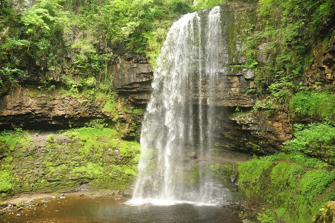
Henrhyd Falls is an out-and-back of 1.2 km (0.75 miles) with 28 m (92 ft) of ascent that takes about half an hour from the car park, and the reward is a 28 m (92 ft) single-drop waterfall you can walk behind via a bridge and forest path. It is the shortest waterfall outing in the park and suits a family hour or a leg-stretch on the drive west.
Flow is everything here. After heavy rain the falls are powerful enough to soak you behind the curtain; in a dry spell they can look tame. The path down to the bridge is straightforward, but the steps behind the falls stay wet, so keep a hand free for the rail.
Pen y Fan via the Horseshoe Ridge
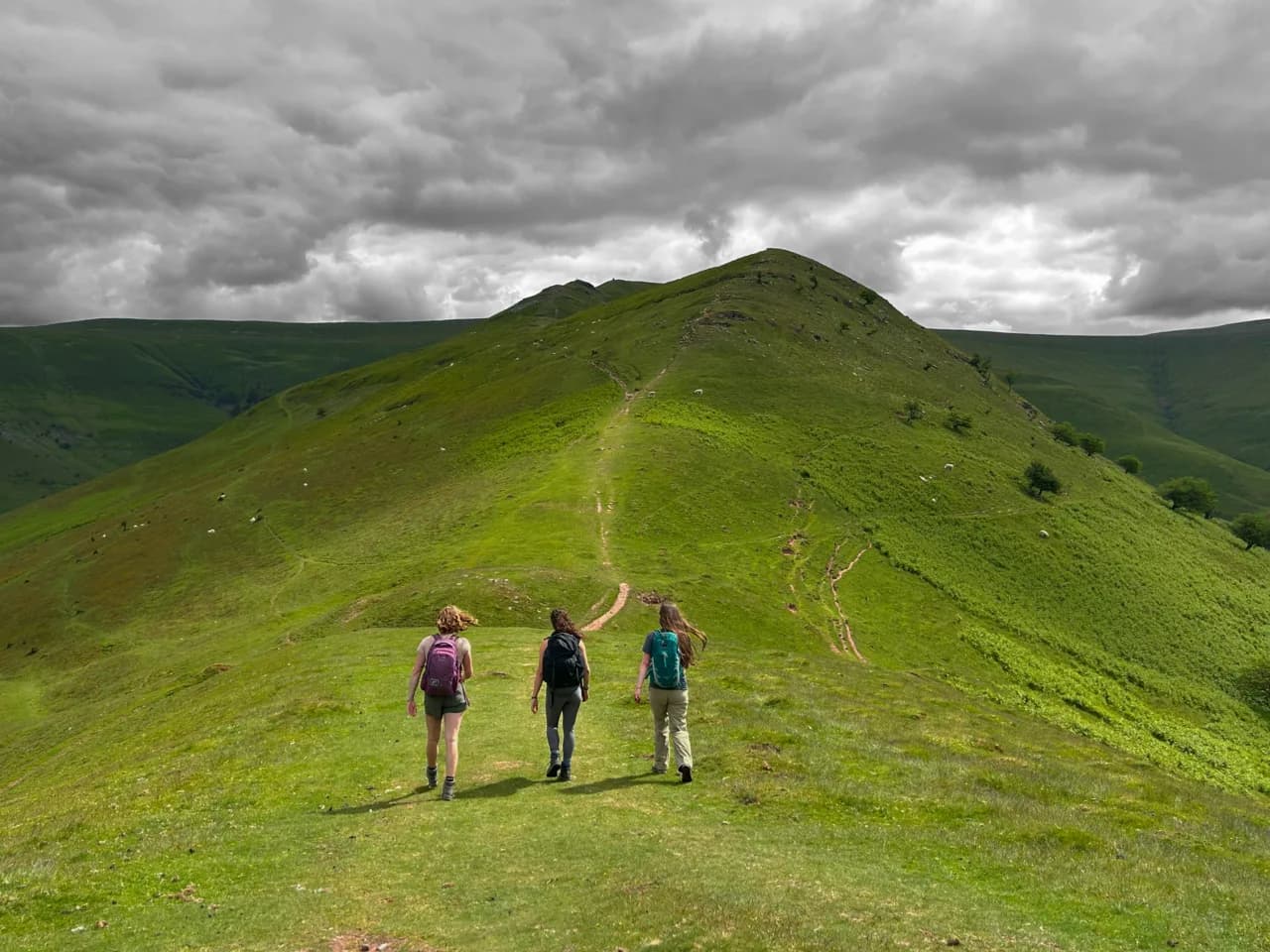
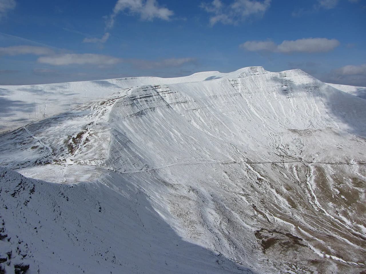
Pen y Fan (886 m / 2,907 ft) is the highest summit in South Wales, and the horseshoe from Taf Fechan Forest is the finest way up. The circuit runs 22.5 km (14 miles) with 1.1 km (3,600 ft) of ascent in about seven hours, climbing through Twyn Mwyalchod and Cefn Cul to the rim before turning onto Corn Du (873 m / 2,864 ft) and Pen y Fan. The ridge is wide and grassy with sweeping views, but it is fully exposed to wind and cloud.
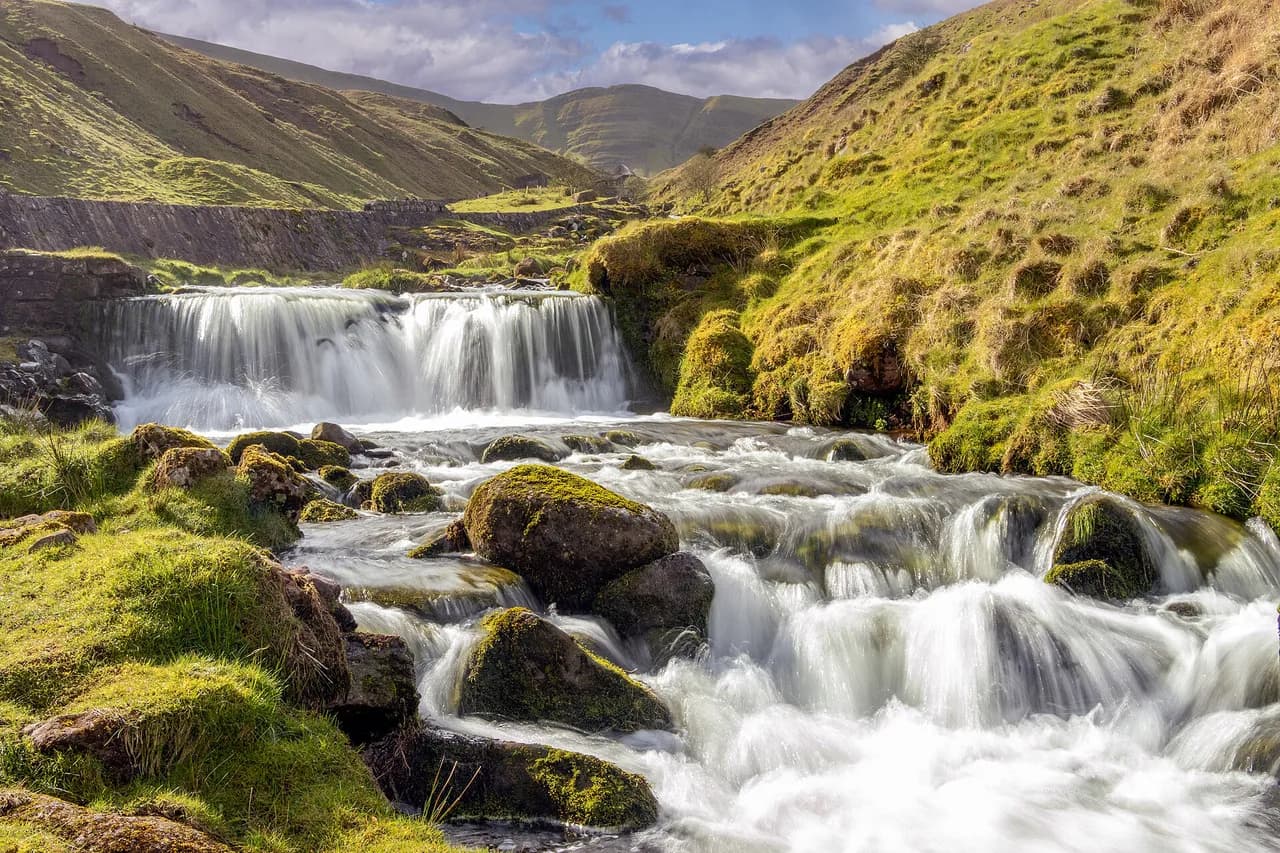
The extension to Fan y Big adds roughly 6 km (3.7 miles), with a short steep climb onto the summit and excellent views back to the Central Beacons. From Fan y Big the descent past the Blaen y Glyn waterfalls follows the Nant Bwrefwr for almost a kilometre of cascades, then finishes with a stiff climb on the road back to Taf Fechan Forest. Plan the day around that last hill rather than the first.
In low cloud or strong wind, the horseshoe loses its point. The path is well defined, but navigation between the summits relies on visibility, and the tops are typically colder and windier than the forest. Save the full circuit for a settled forecast and take a map and compass regardless.
Shorter routes to Pen y Fan and Corn Du
The horseshoe is not the only way up. Shorter out-and-back routes from the Storey Arms side reach Pen y Fan and Corn Du in a fraction of the time, and they suit anyone with a half-day, a family group, or a first visit to the park's highest ground. The trade-off is crowds on the main path and less of the ridge atmosphere that makes the horseshoe worthwhile.
Llyn y Fan Fach and Llyn y Fan Fawr
In the far west of the park, the Black Mountain range holds two glacial lakes below the Carmarthen Fans. The circular walk from the Llyn y Fan Fach car park covers 14.3 km (8.9 miles) with 732 m (2,400 ft) of ascent in about 3 hours 15, climbing past Llyn y Fan Fach to Waun Lefrith, Picws Du and Fan Brycheiniog (802 m / 2,631 ft) before dropping steeply to Llyn y Fan Fawr. The return crosses boggy ground below the crags.
This is quiet country compared with the Central Beacons, and the views over the lakes from the escarpment edge are the reason to come. The western crags are steep and the wind funnels along the rim, so keep off the very edge in gusty weather. Rain and wind arrive fast here, and the descent to Llyn y Fan Fawr gets slippery in the wet.
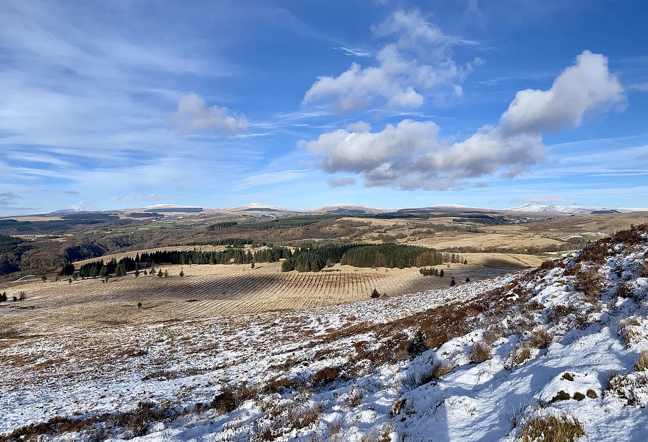
Sugar Loaf from Llanwenarth
Sugar Loaf tops out at 596 m (1,955 ft), four metres short of mountain status, but the 6.5 km (4 miles) out-and-back from the Llanwenarth side gains 293 m (961 ft) in about two hours and delivers a rocky summit with wide views over the eastern park. The Komoot loop from Llanwenarth car park is slightly shorter at 5.11 km (3.2 miles) with around 220 m (722 ft) of climbing.
The path crosses open moorland before a short steep pull to the summit, which makes this the best late-afternoon or sunset objective in the park. It also works in winter when the higher ridges are in cloud, since the summit sits below the worst of the weather. Take a head torch if you plan to come down after dark.
Skirrid Fawr
Skirrid Fawr, or Ysgyryd Fawr, is a steep little outlier of the Black Mountains just north of Abergavenny. The out-and-back from the Old Ross Road gains 295 m (968 ft) over 4.3 km (2.7 miles) in one to one and a half hours, and the Komoot loop version from the National Trust car park runs 5.95 km (3.7 miles) with 280 m (919 ft) of ascent in about two hours.
Pant-Skirrid Wood gives way to open hillside before the summit, and on a clear day you can pick out Sugar Loaf and even Waun Fach to the west. The climb is short but relentless, so it suits a morning with time for lunch in Abergavenny afterwards. Approaching from the far side gives a steeper, rougher line, which some walkers prefer for the challenge.
Waun Fach and the Dragon's Back
From Pengenffordd near the Dragon's Back pub, a circular route climbs through farmland to Waun Fach (809 m / 2,654 ft) and returns along the Dragon's Back ridge. The circuit runs 11.9 km (7.4 miles) with 541 m (1,775 ft) of ascent in about two and a half hours, and wild ponies graze the fields on the lower slopes.
The ridge itself is the prize: a grassy spine with big views across the Black Mountains, easy underfoot but exposed when the wind is up. The summit of Waun Fach is a broad plateau with little to see in poor visibility, so the navigation matters most on the way off. Keep to the main paths on the farmland sections.
Quieter half-days: Craig Cerrig-gleisiad, Blorenge and the canal
Craig Cerrig-gleisiad sits in a national nature reserve with a 4.3 km (2.7 miles) circuit gaining 320 m (1,050 ft) in one and a half to two hours, starting beside the A470 and rising through woodland and across a stream to the ridge of Fan Frynych. The reserve protects rare plants and birds, so keep to the path; the trail is often muddy. Stronger walkers can extend to Fan Fawr.
Blorenge gives another moderate half-day, an 11.3 km (7 miles) circle from Keeper's Pond with 420 m (1,378 ft) of ascent in three to four hours, visiting the Punchbowl and the summit trig point. A shorter 5.3 km (3.3 miles) version works if time is tight. The Monmouthshire and Brecon Canal offers the flattest option in this guide, 8.7 km (5.4 miles) out and back from Brynich Loch with 160 m (525 ft) of ascent, crossing the Cefn Brynich aqueduct over the River Usk.
Where the climbs bite and the views open
On the Pen y Fan horseshoe, the work starts early in Taf Fechan Forest and on the climb past Twyn Mwyalchod, then eases along the wide rim to Corn Du. The steepest section is the drop and re-climb before Fan y Big, which comes late in the day when legs are tired. If you only have one big day in the park, this is the one to spend it on, with the shorter Corn Du route as the fallback in wind.
In the western Black Mountain, the steep ground is at the western end of the circuit above Llyn y Fan Fach and again on the descent to Llyn y Fan Fawr, with a flatter middle section along the rim. Afternoon cloud tends to build over these crags, so start early enough to be off the tops by mid-afternoon.
Trailheads, buses and parking
Most of these walks start from a named car park rather than a bus stop: Gwaun Hepste or Cwm Porth for the Four Falls Trail, Dinas Rock for the long waterfall circuit, Taf Fechan Forest for the horseshoe, the Llyn y Fan Fach car park, Llanwenarth for Sugar Loaf and the Old Ross Road or National Trust car park for Skirrid Fawr. Parking charges and capacity vary by site, so check the national park's own pages for each car park before setting out, and arrive early at the waterfall car parks at weekends.
Public transport around the park is thin outside the main towns. Brecon, Abergavenny, Crickhowell and Merthyr Tydfil have bus connections, but reaching trailheads like Taf Fechan Forest or Llyn y Fan Fach usually means a taxi from town or a car. A car gives you the flexibility to combine a morning waterfall walk with an afternoon on the canal at Brecon.
Base villages for each range
Brecon works as a base for the Central Beacons and the canal, Crickhowell and Abergavenny for the Black Mountains and Skirrid Fawr, and Ystradfellte or Pontneddfechan for Waterfall Country. In the west, Llandovery and Llandeilo are the practical towns for the Black Mountain and Llyn y Fan Fach. There are bunkhouses and campsites around the waterfall villages and in the Usk valley, and hotels and guesthouses in the towns.
Book accommodation early for summer weekends and bank holidays, when the popular waterfall car parks fill and rooms in Brecon and Abergavenny go first. If you plan several days, split your stay: two nights near Ystradfellte for the falls and two in the Usk valley or Brecon for the ridges.
When to go
Spring through early autumn gives the best conditions on the ridges, with long daylight for the seven-hour Pen y Fan circuit and firmer ground on the western bogs. Summer weekends are busiest at the waterfall car parks and on the main Pen y Fan path, while autumn delivers strong waterfall flow and quieter trails. Winter is viable for the low summits like Sugar Loaf and Skirrid Fawr when the higher ridges are in cloud.
Waterfall flow depends on rainfall rather than season. A spell of heavy rain followed by a dry, settled day gives the best combination of full falls and safe footing, which is why shoulder-season trips often beat high summer for Waterfall Country. Check the forecast before committing to a gorge day, since the rock is slippery even when the sky is clear.
Hazards on the ridges and in the gorges
The high ridges are exposed to wind, rain and sudden low cloud, and the weather can change within an hour on the Central Beacons. Snow can lie on the Pen y Fan plateau into spring, and afternoon thunderstorms build over the western crags in summer. Carry a waterproof, spare layer and a means of navigation on any route above 600 m (2,000 ft).
In the gorges, the hazards are wet rock, steep steps and unprotected drops beside the falls. The Sgwd yr Eira steps and the descent to Llyn y Fan Fawr are the two spots to slow right down in the wet. Near the plunge pools, water depth and what lies beneath the surface change constantly, so do not jump from ledges into the water.
What to pack and where to eat
Waterproof boots with grip, a waterproof jacket, a warm mid-layer and a map with compass cover every walk here. Add a head torch for sunset on Sugar Loaf or Skirrid Fawr, and a towel and swimwear if you plan a dip in the plunge pools. Carry cash or a card for car park charges where they apply, and enough water for the day since facilities are sparse outside the towns.
Post-walk food is easiest in Abergavenny, Crickhowell and Brecon, where pubs and cafes stay open through the afternoon. The Dragon's Back pub by the Pengenffordd trailhead is a natural finish for the Waun Fach circuit, and Llanthony Priory, the start of an 8 km (5 miles) circular walk with 470 m (1,542 ft) of ascent, has a pub in the old monastery buildings.
Plan Your Visit
Choose your range first, then the route: Waterfall Country for a half-day of falls, the Central Beacons for the big horseshoe, the Black Mountain for empty lakes, and the Black Mountains for short steep summits. Every route in this guide starts from a named car park, so plan around the drive and the daylight rather than trying to link distant trailheads on foot.
Build in a buffer day if you are targeting Pen y Fan or the western crags, because the weather here often decides the plan. Keep one low-level option like the canal or Henrhyd Falls as a fallback, and save the exposed ridges for settled forecasts.
Explore more Brecon Beacons hiking guides
Frequently Asked Questions
How long is the Pen y Fan horseshoe walk?
The horseshoe from Taf Fechan Forest runs 22.5 km (14 miles) with about 1,100 m (3,600 ft) of ascent and roughly seven hours of walking. Adding Fan y Big and the Blaen y Glyn waterfalls extends it by around 6 km (3.7 miles) and a stiff climb at the finish.
Which walk in Brecon Beacons is best for waterfalls?
The Four Waterfalls Walk from Gwaun Hepste or Cwm Porth is the classic, covering about 10 km (6.2 miles) and 310 m (1,017 ft) of ascent in roughly three hours past four named falls. For a bigger day, a 9-mile loop from Dinas Rock links three waterfall trails and passes nine falls, two of which you can walk behind.
What is the shortest easy walk in Brecon Beacons?
Henrhyd Falls is the shortest, a 1.2 km (0.75 miles) out-and-back with 28 m (92 ft) of ascent in about half an hour, ending at a single-drop waterfall you can walk behind. The Sugar Loaf and Skirrid Fawr give short summit options of around two hours with a real climb.
Which of the park's four ranges should I choose for a day?
Waterfall Country suits a half-day of gorge walking, the Central Beacons suit a full day on ridgelines, the Black Mountain in the west suits quieter circuits around glacial lakes, and the Black Mountains in the east suit short, steep summits. The drive between the western and eastern ends of the park is substantial, so base yourself near the range you plan to walk.
Are there circular walks in Brecon Beacons?
Yes. The Llyn y Fan Fach circuit, the Waun Fach and Dragon's Back route, the Blorenge circle, the Craig Cerrig-gleisiad circuit and the Pen y Fan horseshoe are all circular. The Four Waterfalls Walk also works as a loop when you combine the red track with the green link paths.
When is the best time to walk in Brecon Beacons?
Spring through early autumn gives the longest daylight and firmest ground on the ridges, while autumn tends to bring strong waterfall flow with fewer people on the trails. Winter suits the lower summits such as Sugar Loaf and Skirrid Fawr when the higher ridges sit in cloud.
Sources
Trail notes for your next trip
Optional updates when we add or revise hiking guides.
You might also like
Continue reading
More guides you'll find useful