Four Falls Walk, Brecon Beacons: Route, Parking and Distance
Walk the Four Falls Walk in Bannau Brycheiniog: four waterfalls on the Mellte and Hepste, the ledge behind Sgwd yr Eira, parking and route options.
On this page
The Four Falls Walk is the signature circuit of Waterfall Country, the wooded gorge country of the Afon Mellte and Afon Hepste inside Bannau Brycheiniog National Park. It suits walkers who want four named waterfalls in one half-day outing and are happy on steep, muddy stone steps rather than a flat riverside path. The draw is Sgwd yr Eira, where a natural rock ledge runs behind the curtain of water.
This is gorge walking with repeated climbs and descents, not a gentle stroll. The stone steps are worn and slick even in dry weather, and the ground beside the river stays rough. Plan for boots with real grip, and expect the return climb to the car park to feel longer than the outward descent.
Where the walk starts: Gwaun Hepste and Cwm Porth
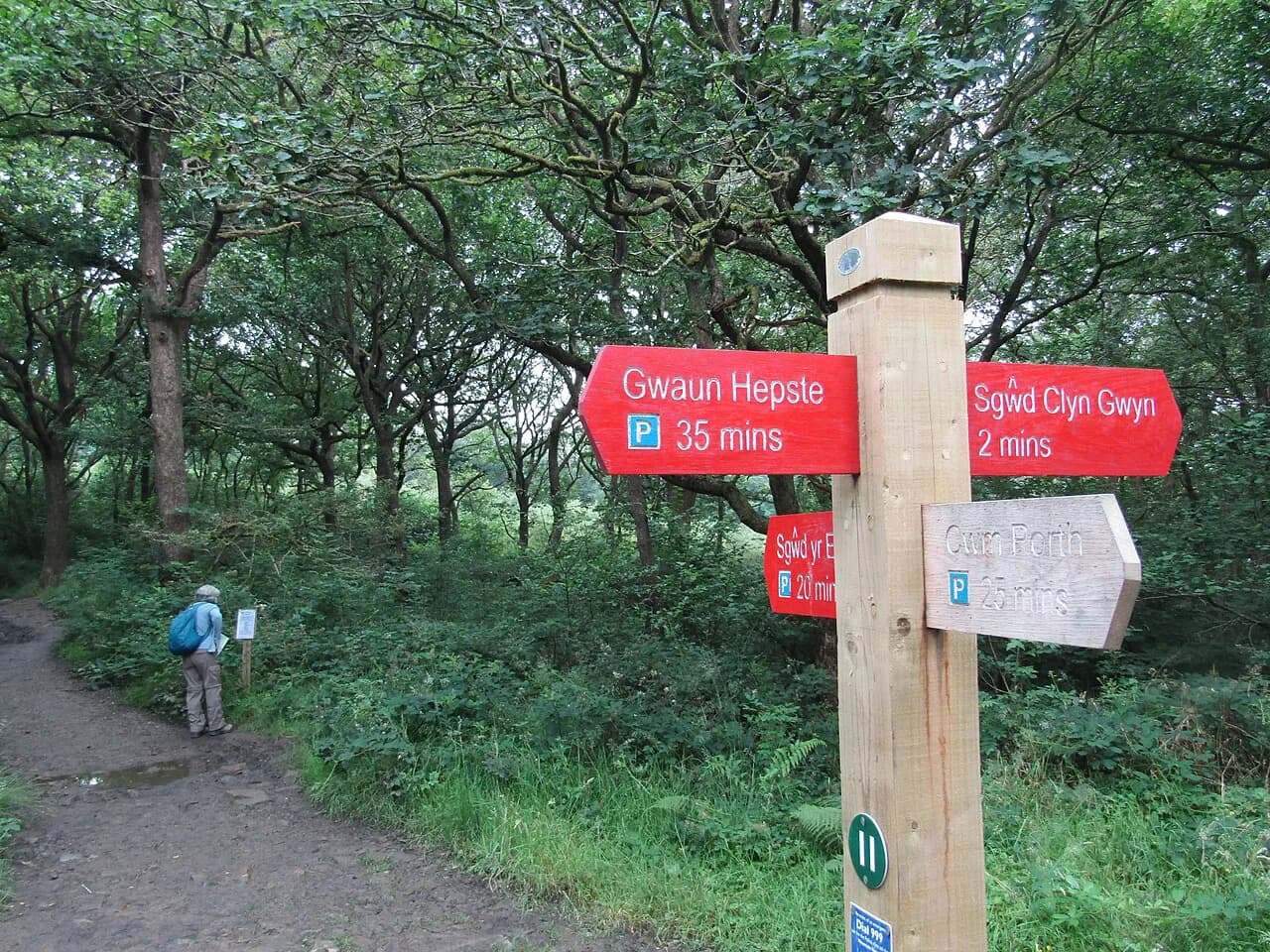
The circuit is most often started from Gwaun Hepste car park (postcode CF44 9JF, Plus Code RF24+JH, near Ystradfellte), which sits above the conifer plantation and gives a straightforward approach to the Four Falls Trail. Because a rural postcode covers a wide area, navigate to the mapped pin as well as the postcode. From the visitor information board, a broad track leads down through the plantation.
Cwm Porth, downstream in the Mellte valley near Pontneddfechan, is the other common trailhead. Starting here shortens the walk in from the plantation and changes where the big climb falls: from Cwm Porth the stiff pull comes earlier, from Gwaun Hepste it closes the day. Walkers who use public transport should treat the Ystradfellte area as remote and plan the return journey before setting out.
Parking and getting to Waterfall Country
Parking at the trailheads is paid and the arrangements are set by the landowner on site, so read the signs and payment instructions when you arrive rather than relying on an old figure.
Both car parks fill quickly on weekends, in school holidays and during spells of good weather, and an early arrival makes the whole day easier. Carry cash and a card so a change of machine does not strand you. Facilities around the trailheads vary, so do not assume toilets or refreshments are open across the entire circuit.
Distance, ascent and walking time
The circuit from Gwaun Hepste is approximately 10 km (6 miles), with a high point around 326 m (1,070 ft), and most walkers need about three to four hours, longer with photo stops or children. Repeated steep steps and climbs make it more physical than the distance alone suggests.
Variations exist and the figures differ by route. A guided version follows a 7 km circuit and describes a walk of 5.5 miles (9 km) taking three to four hours, while other accounts stretch to five hours at a relaxed pace with all four falls visited. Decide your route before you set off and match it to the daylight you have.
Difficulty and terrain underfoot
The Four Falls Walk is rated moderate, with sections that are strenuous because of steep, worn stone steps, exposed rock, roots, mud and uneven riverside ground. It is not suitable for wheelchairs or pushchairs. Ordinary trainers are a poor choice when the stone is wet, and the descent to Sgwd yr Eira is the most awkward stretch of the day.
After rain expect deeper mud and stronger flow at the falls, and never enter fast-moving water. Phone reception is patchy inside the wooded gorges, so download a map or GPX file before you leave the road.
Route description: plantation track to the Four Falls Trail junction
From Gwaun Hepste, follow the broad track descending through the conifer plantation past the visitor information board, then continue on signed waymarkers for the Four Falls Trail. The descent is easy and the uphill pull on the way back is the price you pay for it. At the trail junction, take the signed direction toward Sgwd yr Eira; the approach feels longer than expected but the markers are consistent.
If you are building a longer day in the national park, compare this sheltered gorge route with the open moorland and ridgeline of the Pen y Fan walk before committing to one plan.
Sgwd yr Eira, the waterfall you walk behind
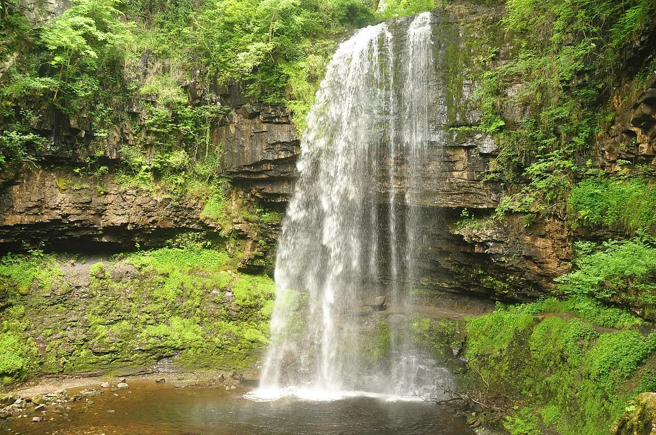
The signed descent to Sgwd yr Eira is steep and the worn stone can be slick, and at the bottom you cross rocks to reach the ledge behind the falling water. The sandstone has eroded into a natural path, which is why the falls are nicknamed the Fall of Snow. The ledge is extremely slippery and the flow is powerful after heavy rain, so keep both hands free and turn back if conditions feel unsafe.
Many walkers prefer to leave this waterfall for the end of the loop so that the walk behind the curtain is the climax of the day, arriving late when the sun may catch it. Making the falls the final stop puts the steep climb back up late in the walk, so save energy for it. Whichever order you choose, treat the rock behind the falls as the crux and take your time.
Sgwd y Pannwr and Sgwd Isaf Clun-Gwyn on the Mellte
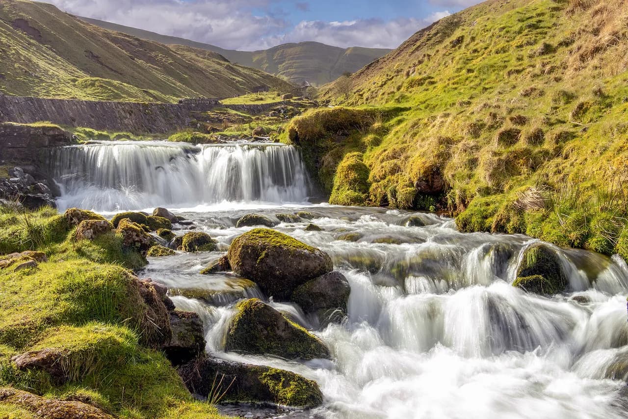
Back on the main route, signs lead to the River Mellte and the longest of the waterfall diversions, a descent to Sgwd y Pannwr, the Fall of the Woollen Washer. Its broad, stepped rock formation looks nothing like Sgwd yr Eira. Continue upstream beside the river to Sgwd Isaf Clun-Gwyn, the lower of the Clun-Gwyn falls, where the water spreads into a horseshoe.
This riverside stretch is rougher underfoot than the plantation track, with wet stones, roots and uneven ground. Climb back to the main trail once you have seen both falls, and keep an eye on the river level if rain has been heavy.
Sgwd Clun-Gwyn and the return climb
The signed trail continues to Sgwd Clun-Gwyn, the Fall of the White Meadow, the upper of the two Clun-Gwyn waterfalls. It is viewed from above, where the Mellte drops over a resistant sandstone ledge into the gorge. Stay within the designated viewpoint and away from unprotected edges, especially when the ground is wet.
From the final waterfall, follow signs for Gwaun Hepste until the route rejoins the plantation track, then settle into the sustained climb back to the car park. Save something for it. The return pull catches out walkers who spent their energy on the descents.
Best months and water levels
The falls are at their most dramatic after rain, when the Mellte and Hepste carry volume and Sgwd yr Eira throws spray across the ledge. Those are also the days when stone steps and riverside rock are at their slipperiest, so match your footwear and pace to the conditions. Autumn and winter weekdays are quieter, while summer weekends bring crowds and queuing at the best viewpoints.
Seasonal variation at the falls is mostly about flow, not access: access to the circuit runs year-round and the guided walks take bookings through the year. Spring and early summer give you longer daylight for a slower day with stops. Choose a settled forecast and start early, and if the group is heading for open summits afterwards, check conditions on the higher hills separately.
What to wear and carry
Wear walking boots or trail shoes with excellent grip, and bring a waterproof jacket and trousers for wet days when the falls are at their best. A change of clothes helps if you take spray behind Sgwd yr Eira. Carry your rubbish out and stay on established paths to protect the fragile gorge environment.
Bring water and food for the whole circuit, since refreshments at the trailheads are not guaranteed to be open on the day you visit. A paper map or downloaded route file keeps you right where side paths branch near the falls, and a small first-aid kit is sensible for a route with slippery rock.
Families, dogs and steep ground
Capable older children can enjoy the circuit, and guided operators suggest it for children from around seven years. There are steep drops, slippery steps and fast-flowing water, so close supervision is essential and pushchairs are out. Fit dogs can complete the route, but they need close control around crowds, livestock and the gorge edge, and you should judge whether they can manage the repeated climbs.
The main hazard is not distance but the wet stone: worn steps, exposed rock and the ledge behind Sgwd yr Eira. Take the descents slowly, keep hands free, and don't cross the rocks below the falls when the river is running high.
Guided options and what they include
Guided Four Falls walks run from Pontneddfechan with a local guide, safety equipment and interpretation of the geology and waterfall formation, following a 7 km circuit that finishes behind Sgwd yr Eira. The guided day lasts about 3.5 to 4.5 hours, starting at 10:30 and returning to the car park around 15:30, and it is priced per person.
A guide removes the navigation decisions at the junctions and provides the kit for the ledge behind the falls, which suits groups, schools and walkers unsure about the slippery ground. Independent walkers pay only for parking and can set their own pace, but they carry their own kit and route file. Schools, teams and walking groups are welcome on the guided format, so choose between a guided date and going it alone.
Nearby waterfall walks in Waterfall Country
Waterfall Country holds more than the Four Falls circuit. The Elidir Trail explores a different stretch of the Mellte near Pontneddfechan, and the Sychryd Accessible Trail is designed for easier going, which makes a useful alternative if the gorge steps are beyond your group on the day. Both sit within the same national park and geopark landscape.
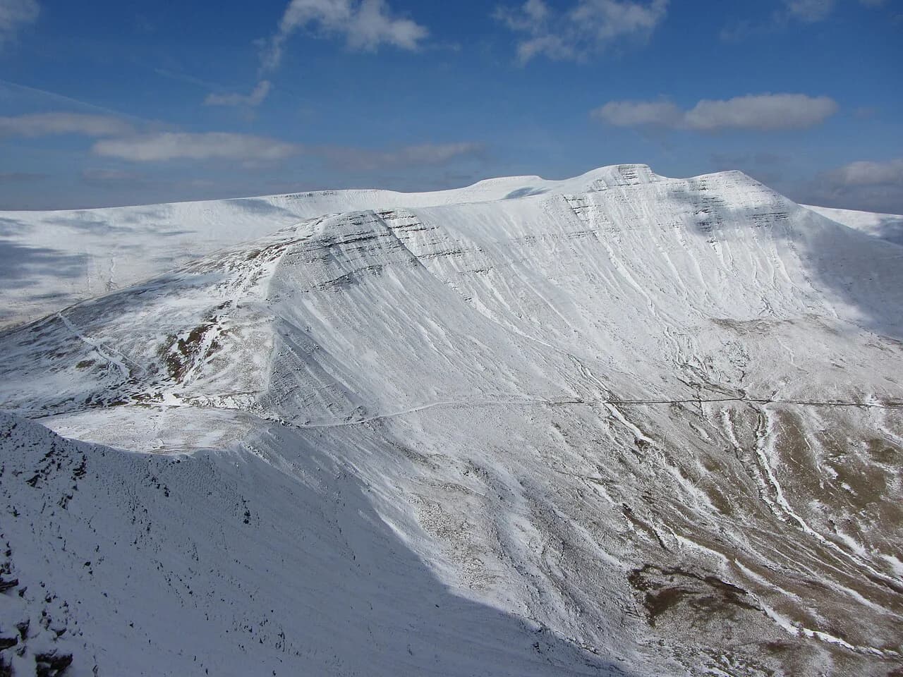
If you want a contrasting day rather than more gorge, the open ground and ridgelines across Bannau Brycheiniog are worth a look. The wider walks in Brecon Beacons cover the range from moorland summits to reservoir circuits and give you options when the falls are in spate. If you would rather compare gorge and valley routes beyond this national park, hiking in Wales covers mountain, coast and waterfall trails elsewhere in the country.
For a quieter day with a small llyn and a wilder moorland feel, the Llyn y Fan Fach walk in the western Bannau Brycheiniog is a different outing altogether from the wooded gorges. It sits outside Waterfall Country, so treat it as a separate day.
Practical summary
Start at Gwaun Hepste or Cwm Porth, arrive early, and expect paid parking and a full car park on fine weekends. Allow three to four hours for the 10 km (6 miles) circuit from Gwaun Hepste, and longer if you stop at every fall. Choose your order so that the climb back from Sgwd yr Eira suits your legs, and treat the wet steps and the ledge behind the falls as the day's crux.
Come with gripped boots, waterproofs and a downloaded route file, and plan for patchy phone signal in the gorges. If the ground is beyond your group, the Elidir Trail and Sychryd Accessible Trail offer easier alternatives in the same corner of the park.
Plan Your Visit
The Four Falls Walk rewards an early start and a sensible route choice more than any particular fitness level. Pick your trailhead, settle the walking order, and allow a comfortable half-day so the descents and the climb back out do not feel rushed.
Boots, waterproofs and a downloaded map cover the essentials, and a spare layer makes the ledge behind Sgwd yr Eira enjoyable rather than cold and wet. Treat the falls as the highlight of a longer stay, and pair the gorges with the open hills of Bannau Brycheiniog on a second day.
Frequently Asked Questions
How long is the Four Falls Walk?
The circuit from Gwaun Hepste is approximately 10 km (6 miles) with around 326 m (1,070 ft) of high ground, taking most walkers three to four hours. Guided versions describe a shorter 7 km circuit and a 5.5 miles (9 km) route, so match your chosen route to your daylight and pace.
Can you walk behind a waterfall on the Four Falls Walk?
Yes. A natural eroded sandstone ledge runs behind Sgwd yr Eira, the Fall of Snow. The approach and the ledge are extremely slippery, and the flow is powerful after heavy rain, so keep both hands free and turn back if conditions do not feel safe.
Where do you park for the Four Falls Walk?
Gwaun Hepste car park (postcode CF44 9JF) is the usual start for the full circuit, and Cwm Porth is the alternative nearer Pontneddfechan. Parking is paid, so read the signs and payment instructions on arrival, and arrive early on weekends and holidays.
Are the four waterfalls suitable for children?
Capable older children can manage the route, and guided operators suggest it for children from around seven years. There are steep drops, slippery steps and fast-flowing water, so close supervision is essential and the route is not suitable for pushchairs or wheelchairs.
What is the best time of year for the Four Falls Walk?
The falls are most dramatic after rain, when flow is high and Sgwd yr Eira throws spray, but that is also when the stone steps are slipperiest. Autumn and winter weekdays are quieter, while summer gives the longest daylight. Choose a settled forecast and start early.
What should I wear for the Four Falls Walk?
Wear walking boots or trail shoes with excellent grip, and bring a waterproof jacket and trousers for wet days. A change of clothes helps if you take spray behind Sgwd yr Eira, and carry your rubbish out because bins are not guaranteed along the route.
Sources
Trail notes for your next trip
Optional updates when we add or revise hiking guides.
You might also like
Continue reading
More guides you'll find useful