Skirrid Walk: Route, Parking and Summit Guide
Walk Ysgyryd Fawr from the National Trust car park near Abergavenny: a 4.5 km out-and-back with 294 m of ascent, a steep woodland climb and an exposed summit.
On this page
The Skirrid, or Ysgyryd Fawr, is the smallest and most northerly of the three hills that ring Abergavenny, and its short out-and-back ascent delivers a full mountain feel in half a day. You get a steep woodland pull, an open ridge and a rocky summit that looks straight across the Usk Valley to the Sugar Loaf and the main Black Mountains. It suits fit walkers, active families and anyone with two to three hours who wants a real summit without a long approach. If you want to compare it with other short upland days, hiking in Wales offers a wider menu of mountain, coast and waterfall trails beyond these hills.
This guide treats the route as an out-and-back climb from the dedicated National Trust car park on Old Ross Road, north-east of town, because that is the line the route description follows. If you are building a few days around Abergavenny, the walks in Brecon Beacons guide covers the wider national park and how the Skirrid fits alongside longer days.
What the Skirrid walk offers and who it suits
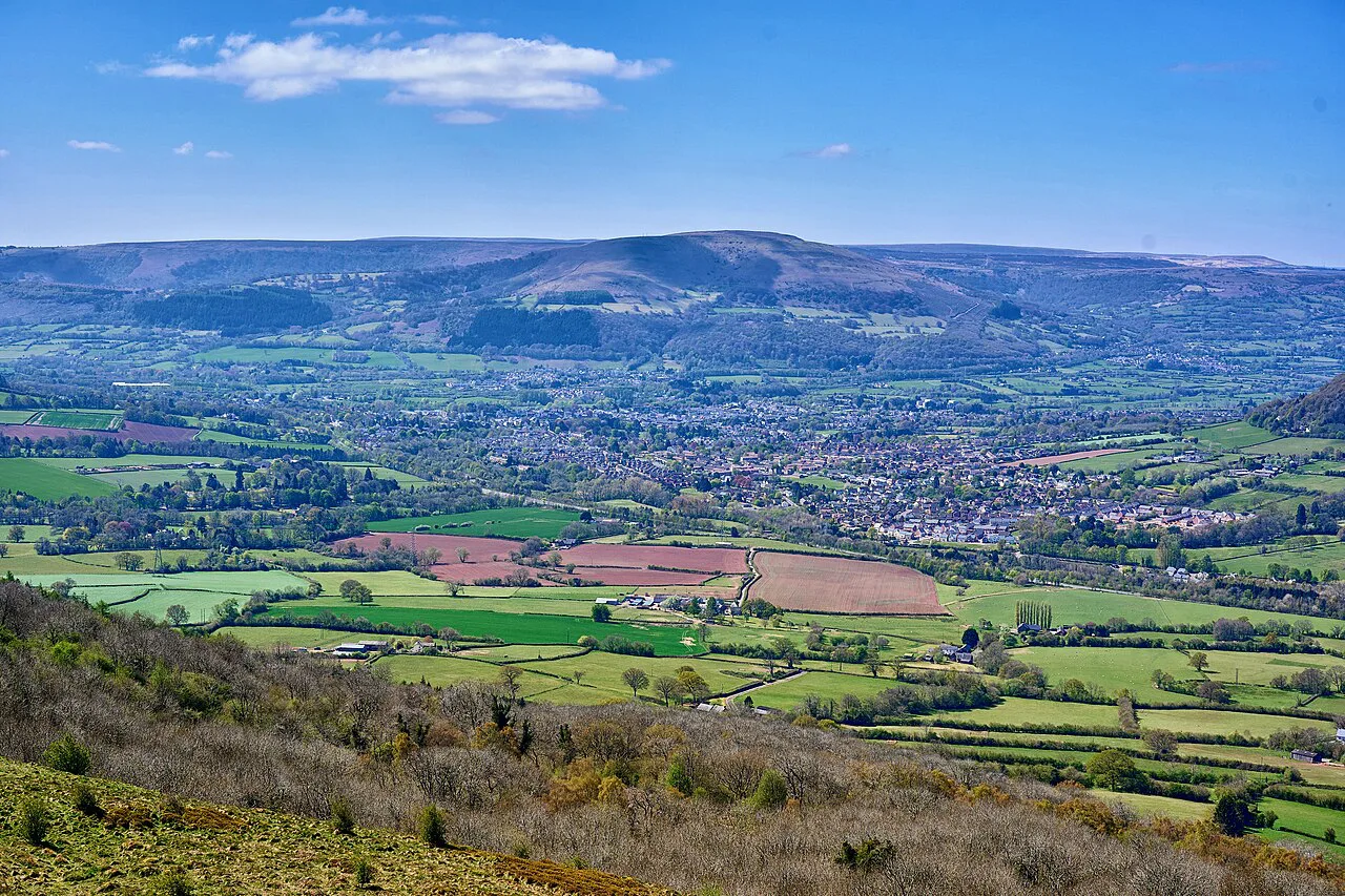
The Skirrid tops out at roughly 486 m (1,594 ft) and sits inside Bannau Brycheiniog, the Brecon Beacons National Park, in Monmouthshire. The reward is disproportionate to the effort: the summit ridge opens views over Abergavenny, the Sugar Loaf across the valley, the Black Mountains and, on a clear day, towards Herefordshire and the English border. Because the climb is short and non-technical, it works well as a first hill day, a sunset outing or a leg-stretcher before a bigger Brecon Beacons National Park route.
The trade-off is that almost all the climbing comes early, in woodland, and the upper ridge is exposed. If you want a gentler introduction to the hills around Abergavenny, the Sugar Loaf Walk, Brecon Beacons is a longer but steadier option on the neighbouring hill; if you want a bigger day, look at the Pen y Fan walk further west in the park.
Where the walk starts: National Trust Skirrid car park
Start and finish at the dedicated National Trust Skirrid car park on Old Ross Road, north-east of Abergavenny. From the car park, walk to the National Trust information board at the far end, take the path through the gap in the hedge, turn right and follow the track to its top. Parking charges and member arrangements are posted on site, so read the signs when you arrive rather than relying on an old figure.
The National Trust describes the waymarked Skirrid trail as an energetic walk through woodland and out onto open mountainside before a steep climb to the summit. That is the line to follow: gates and the information board make the start obvious, and the woodland track funnels you onto the hillside without route-finding.
Abergavenny is the practical base, with cafés, pubs and accommodation in town and a short drive or taxi ride out to the car park. Crickhowell works well if you are spreading several days across the Black Mountains. There are no bus or rail details for the trailhead to plan around here, so arrange your own transport to Old Ross Road and treat the car park as your fixed start and end point.
Distance, ascent and walking time
The out-and-back route measures about 4.5 km (2.8 miles) with roughly 294 m (965 ft) of total ascent, and fit walkers can be up and down in around 1 hour 40 minutes. Allow closer to 2½ hours if you want time on the summit, which is worth it for the view. The return leg is the same path in reverse, so the descent adds no new navigation but repeats the muddy woodland section.
Do not confuse this line with a loop. A separate circular variant near Abergavenny is logged at 3.1 miles and about 1 hour 55 minutes, which is a different route with different figures, so pick one and plan around it rather than blending the numbers.
The route section by section: car park to woodland gate
The opening 0.5 km from the information board is a gentle woodland track that eases you in before the work begins. Follow it to the top, where a pedestrian gate sits beside wooden double gates; this is the point where the flat warm-up ends and the climb starts. Keep straight uphill here, ignoring the smaller paths that branch off through the trees.
The steep woodland climb
The hardest stretch is roughly 0.8 km of steep woodland path immediately after the gate, and after rain or through winter it can turn extremely muddy and slippery. Boots or shoes with reliable grip make a genuine difference here, and trekking poles help on the way down when the ground is wet. The climb is short, but it will get you breathing if you are new to hillwalking, so pace it rather than chasing a time.
Onto the open ridge and the false summit
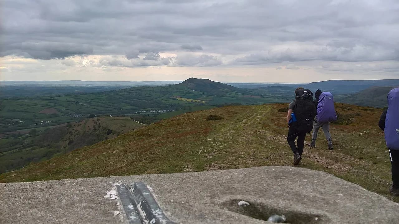
Once you break out of the trees the angle eases and the route opens onto grass and stony path for about 0.5 km. Views appear towards the Sugar Loaf and Abergavenny, and the first rise ahead is a false summit. Continue past it: the trig point sits farther along an exposed ridge path of roughly 0.45 km, and stopping at the first top would sell the walk short.
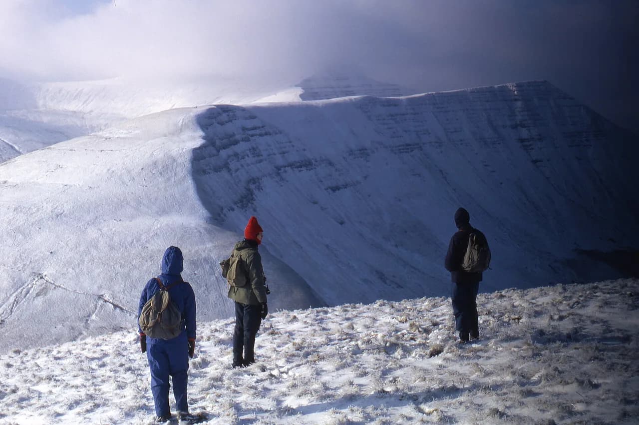
The ridge and summit are exposed to strong wind and winter weather, and mist can make the upper line less obvious than it looks from below. Carry a windproof and waterproof layer even when the car park feels sheltered, and keep a map or GPS track to hand for poor visibility.
The Ysgyryd Fawr summit and its views
The rocky summit area above the Sugar Loaf and Abergavenny is the natural place to stop, with the trig point marking the high point of Ysgyryd Fawr. In clear weather the panorama takes in the Usk Valley, the Black Mountains, the Malvern Hills and the Forest of Dean. It is also a fine sunset spot, with the sun dropping behind the mountains of Bannau Brycheiniog, though you then need to descend the muddy woodland in fading light.
Returning the same way
Retrace the ridge path back over the false summit and through the middle gate, then drop into the woods. The steep woodland descent is where the mud most often causes a slip, so slow down and take it deliberately rather than pushing the pace. Pass back through the pedestrian gate by the wooden double gates and follow the final track to the car park.
Because you return on the same line, navigation is straightforward in clear conditions; the main planning decision is leaving enough daylight for the wooded descent. A downloaded track is useful insurance if cloud sits on the ridge.
When to go: seasons, mud, wind and visibility
Spring and summer give the longest days and the driest ground, though afternoon weather on the ridge can change fast. Autumn brings colour on the hillsides along with wetter, greasier paths in the woodland. Winter is the most demanding season here: mud, wind, low cloud, snow and ice can make this short walk feel like a serious outing, so carry layers and be ready to turn back.
Peak conditions make the Skirrid a busy short day out from Abergavenny, so an early start or a late-afternoon ascent gives you a quieter summit. Whichever season you choose, check the forecast for wind and visibility rather than just rain.
Footwear, kit and water on the route
There are no facilities anywhere on the route, so carry all the water and food you need, plus a warm layer for the exposed top. Walking shoes or boots with reliable grip are the key item, given the mud on the lower path. A map and a GPS track add reassurance when mist hides the upper ridge.
Walking with children and dogs
The walk can suit active children with proper footwear and enough fitness for the steep climb, though adults need to judge the mud, wind and individual child on the day. Dogs that are fit for the climb are fine too; keep them under effective control around other walkers, gates and any grazing animals you meet. Follow any livestock signs on the day rather than assuming a fixed pattern of grazing.
Base for the walk: Abergavenny
Abergavenny makes the most convenient base, with cafés, pubs and restaurants in town and easy access to the Skirrid, the Sugar Loaf and the Blorenge. Crickhowell is another strong choice if you are spending several days exploring the Black Mountains. Together the three Abergavenny hills give you options from a short summit dash to a longer half day, which helps when weather rules out the higher tops.
If you want to widen the trip beyond these hills, the Four Falls Trail and the Llyn y Fan Fach walk make good contrasting days in the national park. Each asks more driving and more time than the Skirrid, so plan them as separate outings rather than additions to the same afternoon.
Is the Skirrid hard? Fitness and difficulty explained
The Skirrid is rated moderate: short and non-technical, with no scrambling, but with a steep initial woodland climb that needs a reasonable level of fitness. The effort is concentrated in the first stretch, so if you can climb steadily for a while you will manage the rest comfortably. Compared with the Pen y Fan walk, it is a much shorter day with less total ascent and a simpler line.
What Skirrid means in Welsh
You will see the hill signed as Ysgyryd Fawr, Skirrid Fawr and simply the Skirrid, and all three names refer to the same summit on maps, signs and route descriptions. The National Trust trail page and the route guide use the names interchangeably, so do not read a different hill into the alternatives.
Plan Your Visit
Treat the Skirrid as a two-hour mountain fix rather than a full day: park on Old Ross Road, follow the track and gates to the steep woodland climb, then continue past the false summit to the trig point. Allow extra time on top for the views to Herefordshire and the Black Mountains, and remember that the muddy descent is the part to take slowly.
If the forecast is poor on the ridge, the wider walks in the Brecon Beacons give you lower and more sheltered alternatives close to Abergavenny. Either way, carry your own water, wear grippy footwear and start early enough to be down before dusk.
Frequently Asked Questions
How long is the Skirrid walk?
The out-and-back route from the National Trust car park is about 4.5 km (2.8 miles), with roughly 294 m (965 ft) of ascent to a summit of about 486 m (1,594 ft). A separate loop variant near Abergavenny runs to about 3.1 miles and is a different route with its own figures.
How long does it take to walk up the Skirrid?
Allow around 1 hour 40 minutes for the full ascent and descent at a steady pace. Most walkers should budget closer to 2½ hours so there is time to enjoy the summit ridge views without rushing the muddy wooded descent.
Where do you park for the Skirrid walk?
Use the dedicated National Trust Skirrid car park on Old Ross Road, north-east of Abergavenny. Charges and member arrangements are displayed on site, so read the notices when you arrive instead of relying on an older figure.
Is the Skirrid walk circular?
The route described here is out and back, returning from the summit along the same path. A separate loop variant exists near Abergavenny, so decide which line you are following before you set out.
How difficult is the Skirrid walk?
It is moderate. There is no scrambling, but the initial woodland climb is steep and requires reasonable fitness, and the upper ridge is exposed to wind and poor visibility.
Is the Skirrid muddy?
Yes, the steep woodland section can become very muddy and slippery after rain and through winter. Footwear with reliable grip and a slow descent in wet conditions make the biggest difference.
Is the Skirrid suitable for children and dogs?
It can suit active children with suitable footwear and enough fitness for the steep climb, and fit dogs are fine too. Keep dogs under control around other walkers, gates and any grazing animals, and follow the signs on the day.
What does Skirrid mean in Welsh?
The hill appears as Ysgyryd Fawr, Skirrid Fawr and simply the Skirrid, and all three names refer to the same summit above Abergavenny.
Sources
Trail notes for your next trip
Optional updates when we add or revise hiking guides.
You might also like
Continue reading
More guides you'll find useful