Pembrokeshire Coast Path: Distance, Difficulty & Wales Route
The Pembrokeshire Coast Path runs 186 miles (299 km) along Welsh cliff tops with about 35,000 ft of ascent. Plan your route, direction and daily stages.
On this page
The Pembrokeshire Coast Path is one of Britain's most varied stretches of coastal scenery, and it suits hikers who want big sea views, constant small climbs and the option to walk a week rather than the full route. Because it is a National Trail, the whole line is waymarked and linked to a dense network of public footpaths, which makes day sections and circular variants easy to build. This guide is for planning a trip in Wales around the path itself, not for ticking off a stage list.
What the Pembrokeshire Coast Path is and who it suits
The Pembrokeshire Coast Path National Trail runs 186 miles (299 km) through the Pembrokeshire Coast National Park, covering some of the most varied coastal scenery in Britain. It is a long-distance trail, but the terrain is not technical: most of it is walked on established paths with no scrambling, so the main demands are fitness, footing and a tolerance for repeated climbs.
That combination makes it a good first National Trail for walkers with reasonable hill fitness, and a comfortable week's outing for anyone who wants a coastal route without alpine exposure. If you are comparing Welsh options before committing, the wider hiking in wales guide sets the coast path alongside mountain routes that ask for different skills, and hiking in Brecon Beacons shows how the same fitness question plays out on inland ridges.
Families and less confident walkers are not excluded: the park publishes over 200 circular walks and a set of short, step-free routes, so a group can split between cliff-top miles and easier ground and still meet for dinner. The trade-off is that the full trail rewards people who can commit consecutive days, while shorter trips get more out of picking one half.
Distance, ascent and how many days to allow
The headline length is 186 miles (299 km), but the cumulative ascent and descent is around 35,000 ft (10,700 m), which is often described as the equivalent of climbing Everest. That figure matters more than the mileage: it means almost every day on the path is a series of short, sharp climbs in and out of coves, so your daily distance should be shorter than on a flatter trail of the same length.
No fixed number of days applies to everyone; the right plan follows from the daily distance and ascent you can repeat comfortably. A hiker who is happy with long days will cover the trail in fewer stages, while anyone new to consecutive walking should plan shorter days and add rest days rather than push through. Work out a realistic daily ascent budget from your training, then divide the total climb by it.
Because there is no single official itinerary, treat any published stage plan as a starting point and adjust it to where beds and buses are. The practical test is whether you can walk the same daily distance and climb on four consecutive days before the trip, not just once.
Which direction to walk: south to north vs north to south
Walking south to north lets you build fitness gradually, because the southern sections are considered easier than the northern ones and the harder ground comes later in the trip. Many walkers therefore start at the southern end and let the route get tougher as they get fitter.
The reverse, north to south, front-loads the harder days, which suits fit walkers who want the toughest sections done first and prefer to finish on gentler ground. Whichever direction you pick, plan your longest days for the middle of the trip and keep the first and last days modest. Transport is the other deciding factor: bus connections along the coast let you start or finish at several points, so check services before fixing a direction.
The southern and northern halves compared
The southern half, from Amroth through Tenby and onward toward St Davids, is generally the gentler introduction, with the route easing you into coastal walking before the sharper northern climbs. If you only have a few days, this is the half that suits mixed-ability groups best, because the easier sections make it simple to shorten a day on the coastal bus.
The northern half, from St Davids to St Dogmaels, is where the repeated climbs stack up and where you feel the cumulative ascent most. It is also the wilder stretch in feel, with fewer easy escape points, so carry enough food and water for the full day and plan a shorter distance than you would in the south.
Choosing a half is often more satisfying than squeezing the full trail into too few days: a five-day southern trip or a week in the north both give a coherent experience, and neither requires the logistics of a full thru-hike.
Route description: the southern half, from Amroth to St Davids
The southern end begins at Amroth and heads east and north through the resort towns of Tenby and on toward the cliffs around Stackpole and the beaches near Freshwater West, with plenty of village access along the way. Short, punchy climbs in and out of coves characterise this half, and the towns make it straightforward to split days around accommodation and resupply.
As the route approaches St Davids, the landscape opens into exposed cliff-top walking with wide sea views and fewer trees for shelter. Keep something in reserve for wind: on an exposed headland, a headwind can double the felt effort of a day that looked short on paper. Walk this half south to north and the climb profile builds gently toward the cathedral city finish.
Route description: the northern half, from St Davids to St Dogmaels
North of St Davids the path pushes into a more remote stretch, with cliffs, rocky inlets and fewer villages between overnight stops. The climbs are frequent rather than long, so the day's total ascent, not its distance, is the figure to plan around. This is the half to walk with a slightly shorter daily target and a clear weather window.
Near the northern finish at St Dogmaels the path meets the Teifi estuary, and the coast path connects into the Wales Coast Path, the longer route that runs around the whole Welsh coast. If you want to extend the trip, the wales coast path is the natural continuation, and it also explains how this section fits into a bigger national route.
Plan escape points carefully in the north: where villages are further apart, a coastal bus stop may be several kilometres inland from the cliff-top line. Check the bus map before you set out each morning so that a change of plan remains a short walk rather than a long road trudge.
Terrain, difficulty and exposure on the cliff tops
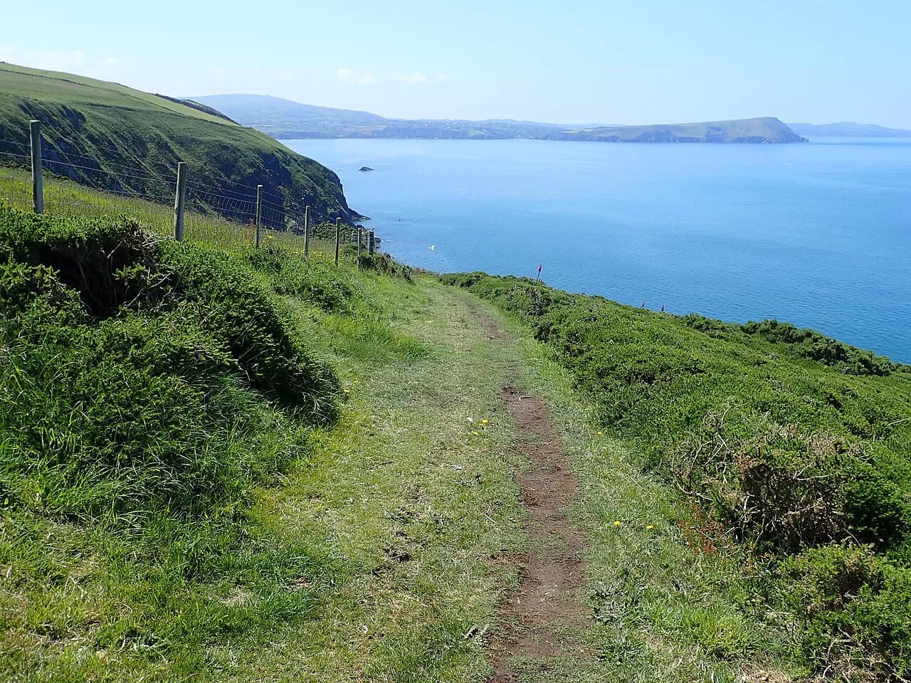
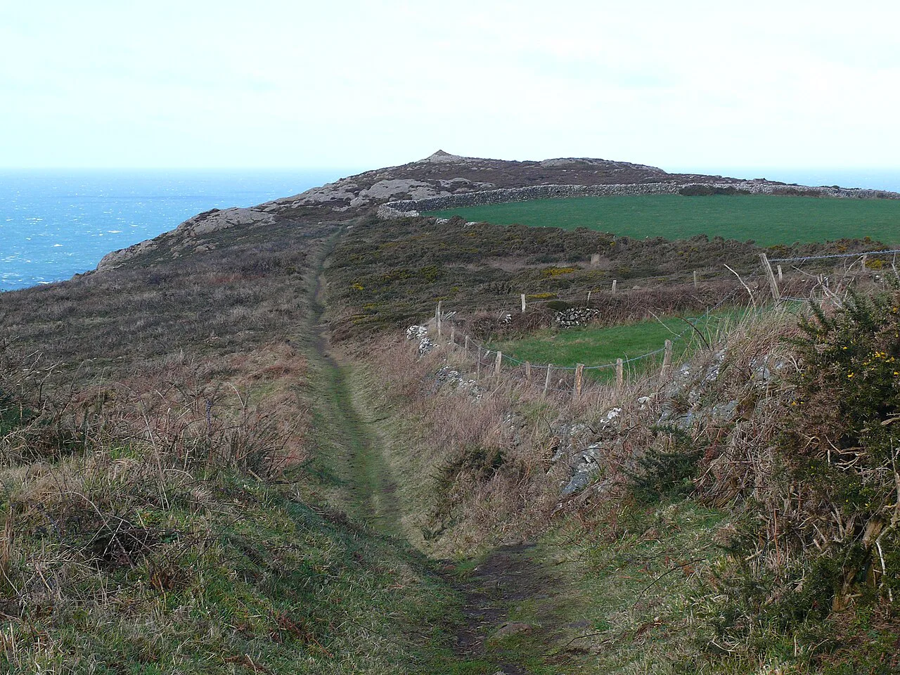
The terrain is not technical and is therefore accessible to most walkers, but steep sections can become slippery and muddy after poor weather, so sturdy boots with good grip and a steady foot are the sensible choice. Walking poles help on the repeated descents into coves, where wet grass and mud are common.
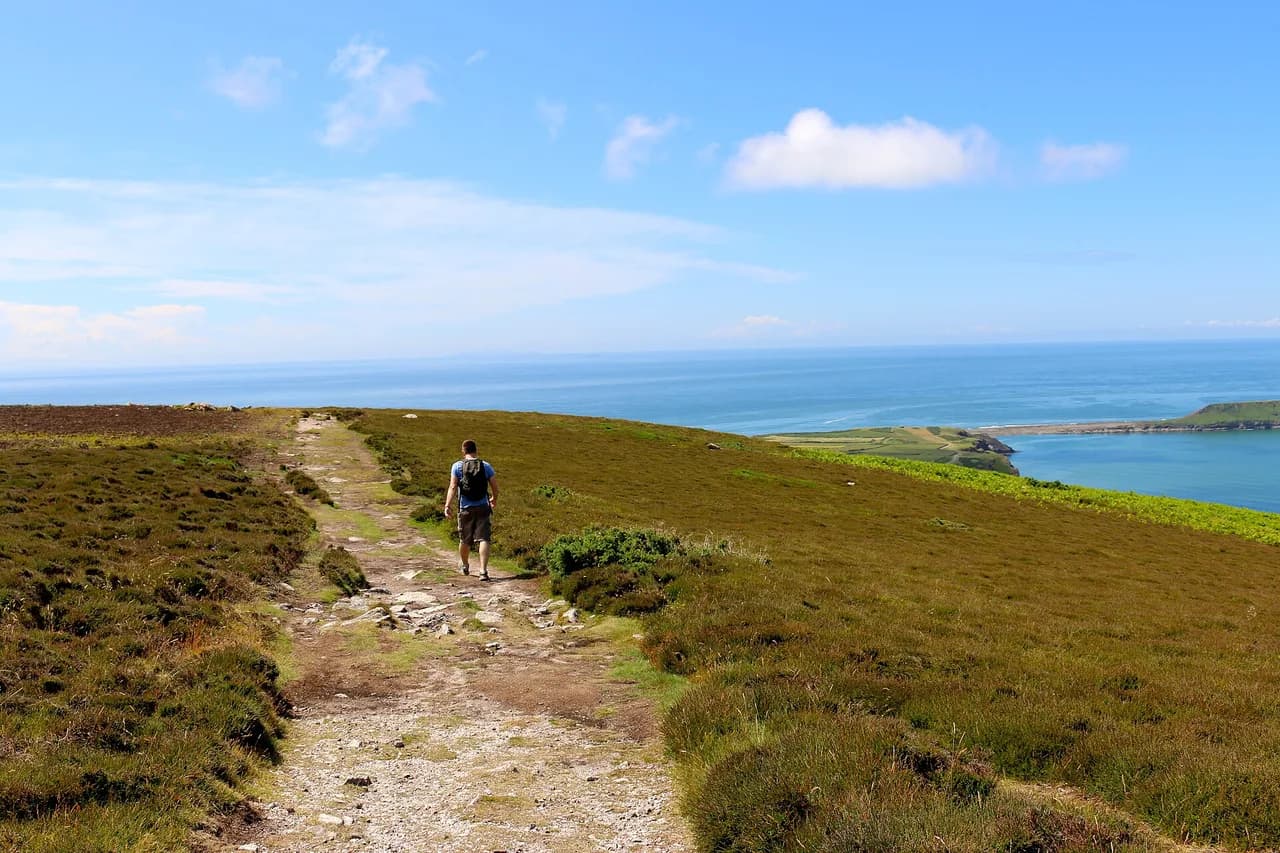
Much of the trail runs along cliff tops, so it suits walkers with a head for heights; the exposure is real where the path runs close to the edge, particularly in gusty weather. Keep to the inland side of narrow sections when the wind is strong and give yourself room on eroded corners. Coastal weather can change fast, so carry a waterproof shell even on a forecast of sunshine.
Getting to the start and back from the finish: buses and coastal services
The Pembrokeshire coast has an excellent bus service that can shorten or skip sections, which is the single most useful planning tool for a partly walked trail or a bad-weather day. Even if you never use it, knowing a bus option exists gives you the confidence to commit to a long cliff-top day.
Use the park's own travel and parking pages to find coastal bus stops and car parks near the trailheads, since the best-placed villages are not always the ones with the most frequent service. Two-car families can park one car at each end of a day section; everyone else should plan days that begin and end near a bus stop.
For the full trail, arrange transport to the southern start and back from the northern finish before you leave, and keep the return leg flexible enough to absorb a missed connection. Booking your last night near a transport hub removes the risk of finishing a long walk with a tight onward journey.
Towns and villages to use as overnight bases
Tenby is the obvious southern base, with the widest choice of places to stay and easy access to both the start of the trail and the coastal bus network. St Davids suits a mid-trail break or a northern start, and St Dogmaels anchors the northern finish. Smaller villages along the way give quieter nights but fewer fallback options if the weather turns.
Choose bases by the shape of your days rather than by their reputation: a village that sits a kilometre inland can add a tiring walk at the end of a cliff-top day, while a town directly on the path lets you finish where you sleep. The park's walking pages list circular routes from many settlements, which helps on rest days.
Book well ahead for summer weekends and school holidays, and ask whether your host offers luggage transfer if you are walking the full trail in one direction. Where transfer is not available, plan your itinerary so you carry everything and keep the pack light.
When to walk: best months, weather and ground conditions
Late spring and early summer give long days, drier ground and the best chance of settled weather, while early autumn keeps the light good and the paths quieter. Winter walking is possible but the short daylight and wet, muddy ground make big-mileage days unrealistic, so shorten your plan. Welsh coastal weather can bring rain and wind in any month, so build a rest day into a week's itinerary rather than expecting every day to go as planned.
Ground conditions change quickly after rain: the steep sections become slippery and muddy, so allow extra time on the descent-heavy days and start earlier in the day. Wind is the other factor that shapes a coastal itinerary, and an exposed cliff day in strong wind should be swapped for a sheltered circular walk inland.
Shorter options: circular walks, day sections and easier trails
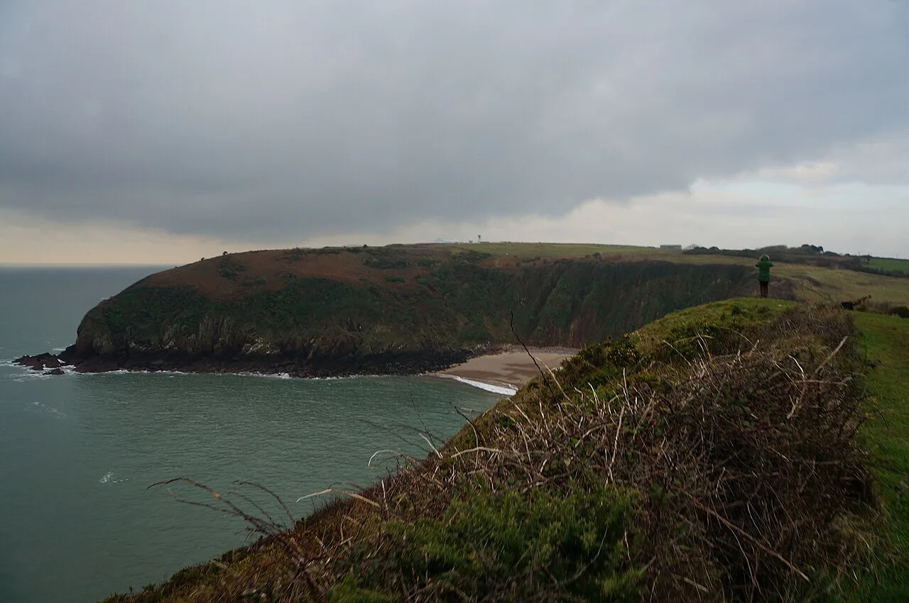
The park publishes over 200 circular walks, which means you can walk a satisfying loop from a base town without committing to the full trail or arranging two-car shuttles. These are the right choice for a short trip, a rest day, or a group with different appetites for distance.
Day sections along the coast path itself work best between bus stops, so pick a stretch with a service at both ends and leave the car behind. Coastal buses let you walk a linear section in either direction and return in the evening, which is more efficient than out-and-back walking on the same cliff. Check the last bus of the day before you set off.
For families with young children, choose a section with an early escape point rather than the most dramatic headland; the park's easy-access routes are a better fit for pushchairs than the cliff-top line.
Accessible walking: wheelchair routes, easy-access viewpoints and beaches
If anyone in your group avoids steps and steep inclines, the park's access-for-all pages list wheelchair walks, easy-access beaches and viewpoints reachable by car, plus beach wheelchairs and mobility scooters available to hire at some sites. These make a shared trip workable when only part of the group walks the cliff path.
Book beach wheelchairs and any mobility equipment ahead through the park, because supply at each site is limited and the hire is not walk-up. Pair a cliff walk for the fitter members with an easy-access viewpoint for the rest of the party, and meet at a coastal bus stop or beach car park.
Dogs and the Countryside Code on the Pembrokeshire Coast Path
Well-controlled dogs are usually welcome on the Pembrokeshire Coast, and the park asks owners to follow the Countryside Code while walking the path. On cliff-top sections and around livestock, a lead is the practical choice, and you should carry water for the dog on long days with no village stop.
Plan each day around where a dog can drink and rest, and avoid the longest exposed stretches in hot or windy weather. Accommodation that accepts dogs is not universal along the trail, so confirm it when booking bases.
Safety: cliff edges, mud, tides and coastal weather
Cliff-edge exposure is the main hazard: much of the trail is on cliff-top paths, and wet grass or mud on the approach to an edge is where slips happen. Keep back from the lip, especially in gusty weather, and take the inland line on narrow, eroded sections.
Below the path, tides govern any beach or cove you descend to, so check the tide times before planning a low-level finish or a beach lunch stop. Coastal weather can swing from sunshine to rain and wind within a day, so carry a waterproof shell, an insulation layer and enough food for a delayed onward journey.
Plan Your Pembrokeshire Coast Path Trip
Decide first whether you are walking a half, a week or the full 186 miles (299 km), because that single choice determines your direction, bases and transport plan. South to north suits hikers building fitness; shorter trips get more from choosing the gentler southern half or a set of circular walks from one base.
Lock in accommodation near bus stops, build a rest day into any week-long plan, and treat the daily ascent rather than the mileage as your planning number. The Pembrokeshire Coast National Park Authority's walking pages and coastal bus information are the two things to read when finalising dates.
Frequently Asked Questions
How long is the Pembrokeshire Coast Path?
The Pembrokeshire Coast Path National Trail runs 186 miles (299 km) through the Pembrokeshire Coast National Park in Wales, with roughly 35,000 ft (10,700 m) of cumulative ascent and descent along the way.
How many days does the Pembrokeshire Coast Path take?
There is no fixed number of days; it depends on the daily distance and climb you can repeat comfortably. Because the ascent is big for the mileage, most hikers plan shorter days than they would on a flatter trail of the same length and add rest days for a week-long trip.
Which direction should you walk the Pembrokeshire Coast Path?
Walking south to north builds fitness gradually, since the southern sections are considered easier than the northern ones and the harder ground comes later. North to south suits fitter walkers who want the toughest days done first.
What is the most difficult part of the Pembrokeshire Coast Path?
The northern half, from St Davids toward St Dogmaels, is where the repeated climbs stack up and the route feels more remote. Plan shorter daily distances there and carry enough food and water for the full day.
Are there shorter day walks on the Pembrokeshire Coast Path?
Yes. The park publishes over 200 circular walks, and coastal buses let you walk linear day sections between stops. These suit short trips and mixed-ability groups better than committing to the full trail.
How do you get between sections of the Pembrokeshire Coast Path?
The Pembrokeshire coast has an excellent bus service that can shorten or skip sections, and it is the main tool for walkers who want to walk one-way day stages. Plan days between bus stops and check the last service before setting out.
When is the best time of year to walk the Pembrokeshire Coast Path?
Late spring and early summer give long days and drier ground, and early autumn keeps the light good with quieter paths. Winter walking is possible but short daylight and muddy ground make big days unrealistic.
Are dogs allowed on the Pembrokeshire Coast Path?
Well-controlled dogs are usually welcome on the Pembrokeshire Coast, and owners should follow the Countryside Code. Use a lead around livestock and on cliff-top sections, and carry water for the dog on long days.
Sources
Trail notes for your next trip
Optional updates when we add or revise hiking guides.
You might also like
Continue reading
More guides you'll find useful