Aysgarth Falls Walk: Yorkshire Dales Routes to Choose
Walk all three tiers of Aysgarth Falls from the national park centre, then extend to West Burton and Cauldron Falls on a longer Wensleydale circuit.
On this page
Aysgarth Falls is one of the most accessible waterfall walks in the Yorkshire Dales, and it suits almost anyone who can manage a gentle riverside path. The River Ure drops over three limestone steps here, and a short trail from the national park centre lets you see all of them in under an hour of walking. If you want a longer day, the same trailhead opens onto a field-and-village circuit to West Burton and its own waterfall.
Where Aysgarth Falls sits in Wensleydale
Aysgarth Falls lies in Wensleydale, in the North Yorkshire Dales, roughly seven miles west of the market town of Leyburn and about ten miles from Hawes. The falls are in the Yorkshire Dales National Park, and the village of Aysgarth sits just above the river. The three tiers — Upper, Middle and Lower Falls — run downstream along the River Ure, so the order you walk them matters.
Upper Falls is the upstream tier, close to Yore Bridge, and the path reaches it first from the visitor centre. Middle and Lower Falls sit further downstream, linked by a woodland path on the northern bank. The northern-bank path is the only way to see all three tiers on foot, so plan your route around that side of the river.
West Burton, the village at the heart of the longer circuit, sits a few miles east of Aysgarth and is reached on foot through fields and minor lanes. Cauldron Falls, also known as Redmire Force, drops just off the village green at West Burton. The two waterfall sites make a natural pairing, with Aysgarth as the shorter visit and West Burton as the extension.
Trailhead and parking at the Aysgarth Falls National Park Centre
The Aysgarth Falls National Park Centre is the logical start for both walks. It has a car park, a café, toilets and information displays, and the falls path begins from the centre. Parking carries a charge, while viewing the falls themselves is free, according to the Hiking Photographer's route guide. Arrive early on summer weekends, when the centre car park fills.
From the car park, the path to Upper Falls is a short walk west, and you can retrace your steps to the centre before taking the woodland path downstream to Middle and Lower Falls. That there-and-back spur for Upper Falls is the key route detail: it is not a loop, so you double back before heading downstream. The visitor centre is also the place to pick up local information before setting out.
Getting there by car and by bus
By car, the usual approach is the A6108 from Leyburn, which leads directly to Aysgarth and the falls. Leyburn is about a 20-minute drive from the A1(M) Leeming Bar junction, so Aysgarth works well as a day trip from the eastern side of the Dales. The A684 also passes nearby and is useful for routes from Hawes and the western dales.
Public transport is limited. The DalesBus service runs on summer Sundays, connecting Aysgarth with nearby towns, so a car-free visit is possible but seasonal. The nearest train station is in Leyburn, from where you would continue by bus. Check the current DalesBus timetable before relying on it, and have a backup plan if you are travelling outside summer.
The classic falls circuit: distance, ascent and walking time
The three-tier falls walk is short: about 1.3 miles (2 km) from the visitor centre, taking 30 to 45 minutes at an easy pace. The path is well maintained and largely level, with a few short slopes and steps near the viewpoints. Allow extra time for stops at each tier, because the falls change with the water level and reward a slower visit.
The walk is graded easy, and most of the route is on clear paths suitable for families. The riverside rocks below Lower Falls are the one place where you leave the maintained path, so watch your footing there. For a quick comparison, a separate mapped Upper Falls segment of 0.4 miles (0.6 km) with 39 feet (12 m) of elevation gain is rated easy and takes 0.5 to 1 hour, according to AllTrails.
Route description: Upper Falls, then Middle and Lower Falls
Start at the visitor centre car park and walk west to Upper Falls first. Yore Bridge gives the classic view of the upper tier, and in dry weather you can walk close to the top of the falls. From here, retrace your steps to the centre and pick up the woodland path downstream.
Middle Falls has its own viewing platform a little downstream of Upper Falls. Continue on the marked path to Lower Falls, which many visitors rate as the most photogenic of the three. The path runs along the northern edge of the River Ure, so keep to it rather than cutting across the riverbank.
Viewpoints and the riverside rocks below Lower Falls
Most people stop at the main Lower Falls viewpoint, but a quieter low vantage point sits about 100 m further downstream. Look for a small gap in the bank and scramble down to the water level, then work back upstream along the riverside rocks on the right bank to reach it. The rocks are uneven and can be slick, so wear grippy shoes and avoid the scramble when the river is high.
The low viewpoint is the one place on the short walk where you leave the maintained path. If the water is running strongly, stay on the marked trail and enjoy the falls from above; the view is still good. In dry spells the riverbed rocks are exposed and the scramble is easier.
The longer circuit to West Burton and Cauldron Falls: distance, ascent and time
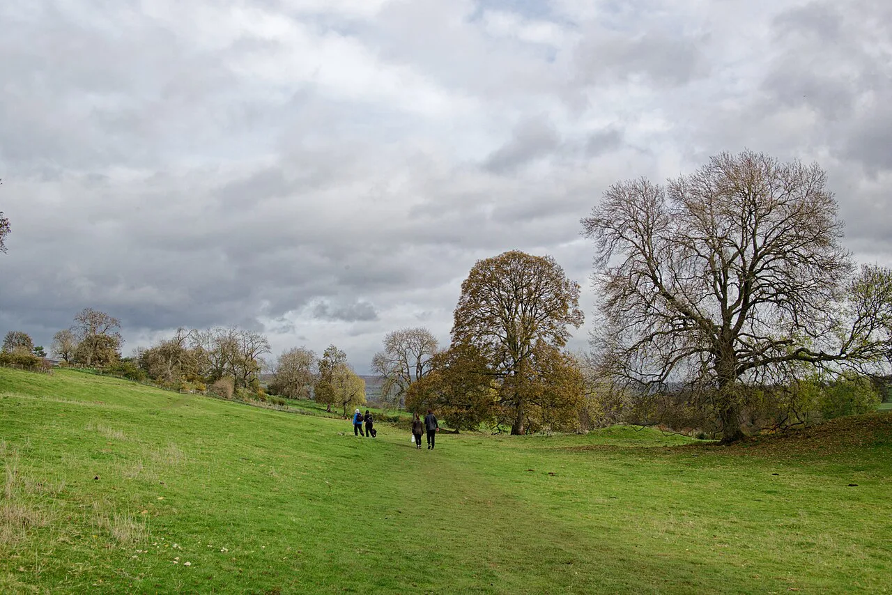
The West Burton circuit is 4.4 miles (7 km) and takes about two hours at an easy pace, again starting from the visitor centre. It is graded easy, but the field paths and stiles make it feel longer than the distance suggests. Add time for Cauldron Falls and a look around West Burton village.
This circuit does not include the northern-bank views of the Aysgarth tiers, so tag the short 1.3-mile falls walk onto the start if you have not seen the three tiers before. If you have already visited the falls, the West Burton loop works well on its own. The walk is a good half-day option in Wensleydale, and the wider national park has plenty of other options in our guide to walks in yorkshire dales.
Route description: St Andrew's Church, the Ure and Hestholme Bridge
From the visitor centre, cross the bridge and head to St Andrew's Church, whose churchyard covers four acres and has been a place of worship since the 10th century. Follow the southern bank of the River Ure to Hestholme Bridge, passing close to Middle Falls on the opposite side. From Hestholme, the route crosses the A684 and continues through fields and small gates toward West Burton.
Cauldron Falls sits a few minutes from West Burton village green, in a natural amphitheatre setting. The village has a pub, a butchers and a tea room, though opening times vary, so carry supplies if you plan to rely on them. From West Burton, the path returns through fields to Aysgarth.
Wayfinding on the field paths after Hestholme Farm
After Hestholme Farm, the field paths are less clearly marked than the riverside trail, often shown only by footmarks in the grass. Keep referring to a map at each field boundary, especially where several paths meet. The section around Hestholme Bridge, where you cross the A684, is the place to pay closest attention.
Carry a paper map or a downloaded offline map on your phone, because signal in the fields is unreliable. Gates and stiles are frequent, so allow time for them and keep dogs on a lead around livestock. The route is straightforward in good visibility but confusing in mist or fading light.
Facilities at the centre and in West Burton
The Aysgarth Falls National Park Centre has a café, restrooms, information displays and a gift shop, making it a practical base before or after either walk. The centre is also where you can check local trail information and pick up maps. West Burton village has a pub, a butchers and a tea room, but their opening hours vary, so check before planning a meal stop.
When to go: water levels, autumn colour and summer weekends
The falls are at their most dramatic after rain, when the River Ure runs high and the tiers fill the gorge. In dry spells the upper rocks are exposed, which makes the low viewpoint below Lower Falls easier to reach. Autumn brings color to the woodland along the northern bank, while summer weekends are the busiest time at the car park.
Spring and autumn give the best balance of water and quiet, though the field paths on the West Burton circuit can be muddy after rain. Winter visits are possible but the days are short, so start early if you plan the longer circuit. Whatever the season, check the weather forecast before setting out.
What to wear and the ground underfoot
The short falls walk is mostly on maintained paths, but the riverside rocks below Lower Falls are uneven and slick. Wear shoes with grip and keep hands free for the short scramble. The West Burton circuit adds field paths, stiles and a road crossing at the A684, so waterproof boots are the better choice for that route.
Carry a waterproof layer and a map, and pack out all litter. The riverside path is popular with families, so expect other walkers and dogs on fine weekends. A small first-aid kit is sensible for the rocky sections.
Family access and pushchair-friendly sections
The paths around Aysgarth Falls are well maintained and include routes suitable for families, with some sections pushchair and wheelchair accessible. The Upper Falls spur from the visitor centre is the easiest section for wheels, while the woodland path to Middle and Lower Falls has steps in places. The West Burton circuit is not pushchair-friendly because of stiles and field paths.
Rules and costs for the falls and the car park
Viewing the falls is free, but parking at the national park centre car park carries a charge. Pay at the machine or as directed on site, and display any ticket clearly. The falls and the riverside path are on national park land, so follow any notices about dogs, fires and litter.
There is no lift or cable car at Aysgarth; access is on foot from the visitor centre. If you are relying on public transport, the DalesBus summer Sunday service connects Aysgarth with nearby towns, but it does not run year-round. Check the current DalesBus timetable before your visit.
Nearby options: the Herriot Way and Yorkshire Three Peaks
If you want a longer walk in the wider national park, the Herriot Way is a four-day circular trail through classic Dales villages and sweeping moorland. The Yorkshire Three Peaks — Whernside, Ingleborough and Pen-y-Ghent — is a much bigger challenge and lies further west, outside the immediate Aysgarth area. For a different waterfall day, the ingleton waterfalls trail in the western Dales follows the River Twiss and River Doe through a wooded gorge. If you enjoy planning days around waterfalls and easy riverside paths, our guide to hiking in the Peak District covers similar choices at another national park.
Plan Your Visit
The Aysgarth Falls walk is an easy half-day outing that suits families and casual walkers, with the option of a longer field circuit to West Burton. Start at the national park centre, see Upper Falls first, then follow the northern-bank path downstream to Middle and Lower Falls. If you have the time and the weather is fair, add the 4.4-mile circuit to Cauldron Falls.
Frequently Asked Questions
How long is the Aysgarth Falls walk?
The three-tier falls walk from the national park centre is about 1.3 miles (2 km) and takes 30 to 45 minutes at an easy pace. The West Burton and Cauldron Falls circuit is 4.4 miles (7 km) and takes about two hours.
Do you have to pay to see Aysgarth Falls?
Viewing the falls is free. Parking at the national park centre car park carries a charge, so pay at the machine and display your ticket.
Is there a cafe at Aysgarth Falls?
Yes, the Aysgarth Falls National Park Centre has a café, restrooms, information displays and a gift shop. It is the natural base before or after either walk.
Can you walk from Aysgarth Falls to West Burton?
Yes. A 4.4-mile (7 km) circular route runs from the visitor centre through St Andrew's Church, along the southern bank of the River Ure to Hestholme Bridge, then through fields to West Burton and Cauldron Falls. After Hestholme Farm the field paths are shown mainly by footmarks, so keep a map handy.
Are the paths at Aysgarth Falls suitable for pushchairs?
Some sections are pushchair and wheelchair accessible, particularly the Upper Falls spur from the visitor centre. The woodland path to Middle and Lower Falls has steps in places, and the West Burton circuit has stiles and field paths, so it is not pushchair-friendly.
How do you reach Aysgarth Falls without a car?
The DalesBus service runs on summer Sundays connecting Aysgarth with nearby towns, so a car-free visit is possible in season. The nearest train station is in Leyburn, from where you would continue by bus; check the current timetable before travelling.
Sources
Trail notes for your next trip
Optional updates when we add or revise hiking guides.
You might also like
Continue reading
More guides you'll find useful