Cirque de Gavarnie Hike: Trailhead, Route and Timing
Plan the Cirque de Gavarnie hike from Gavarnie village: trailhead and parking, the walk to the waterfall, timing, best months and the refuge extension.
On this page
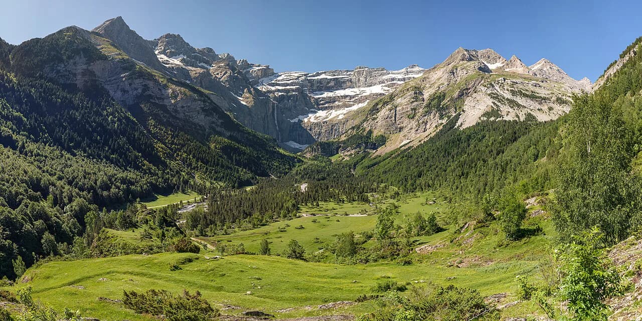
The Cirque de Gavarnie hike delivers one of the great mountain arenas of the French Pyrenees: a horseshoe of cliffs roughly 3,000 m (about 9,800 ft) wide at the top and some 1,500 m (4,900 ft) high, holding one of Europe's highest waterfalls and sitting inside the Pyrenees National Park. The walk suits anyone who can spend a few hours on foot, from families content with the flat riverside approach to hikers who want the steep balcony path below the walls and the falls.
The route is short by Pyrenees standards, so the real planning questions are the trailhead, how far along the cirque floor you go, and whether you add the climb to a mountain refuge. This guide walks through the village start, the terrain underfoot, the best months, hut logistics and the graded extensions, so you can size the day to your group.
What the hike delivers
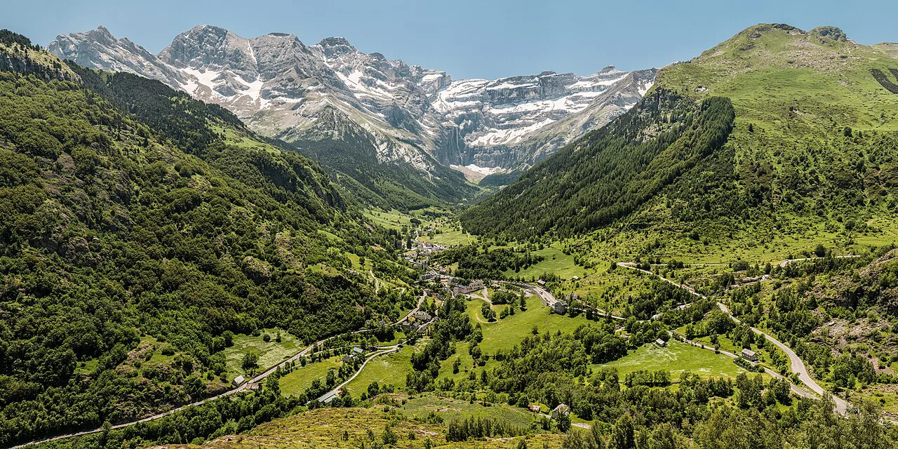
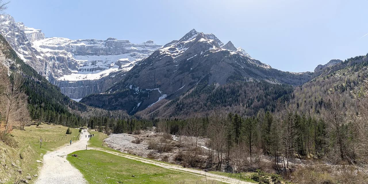
The cirque is a natural amphitheatre of vertical rock at the head of the Gavarnie valley, listed as UNESCO World Heritage and lying within the Pyrenees National Park. From the valley floor you look up at the cliffs, the snow patches that linger on the rim, and the Gavarnie falls dropping down the back wall. It is scenery you can reach on foot from a village, which is what makes the hike unusual.
The day works for a wide range of hikers because the first stretch from the village is flat and easy, following the river with pleasant picnic spots. The proper hike beyond that point is steeper and pebbled, so young children or anyone unsteady on rough ground will find it harder. Decide at the start how far you intend to go and you will enjoy the day more.
Trailhead and parking
The hike starts in Gavarnie village, at the foot of the cirque. Several paid parking areas in the village let you leave a vehicle for 24 hours or more, which is what makes an overnight at a refuge possible without moving the car. You pay on site; the Gavarnie Valleys tourist office publishes the current terms, so check rates and dates before you travel rather than expecting free parking.
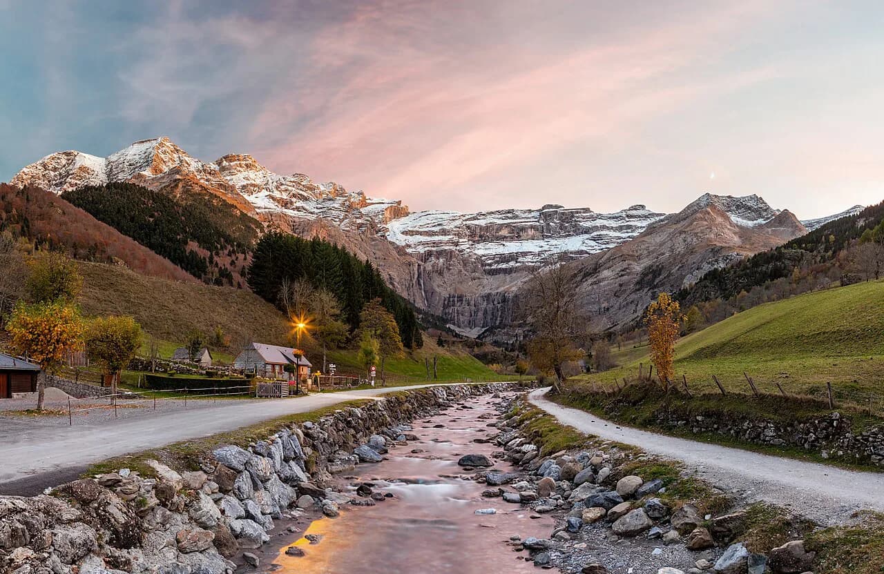
From the village you walk across a small bridge over the Gave and follow the road that runs alongside the river toward the cirque. There is no driving up to the cirque itself: it is a walk-only destination, and bicycles are not allowed on the path either. That rule shapes the day, because it means every metre of the approach is on foot.
Getting there
By road, Gavarnie is reached on the D921, which follows the Gave de Pau through Luz-Saint-Sauveur and up the valley to the village. This is the standard approach for anyone based in the Val d'Azun, Argelès-Gazost or Luz itself, and it puts the trailhead at the end of the drive.
Bus services also reach the village, which makes a car-free day possible, though the schedule changes with the season. The Valleys of Gavarnie tourist office lists current transport options and times for the valley, so build your day around the return service rather than the outbound one.
Distance, ascent and time
The out-and-back walk from Gavarnie village to the foot of the cirque is commonly reported at around 8 km (5 miles) return, taking roughly 1 hour 30 minutes up and about an hour down for walkers who stop for photos. Treat that as a half day with time at the falls, not a quick stroll, and carry water accordingly.
If you take the variant to the foot of the big waterfall, add roughly an extra hour of walking on top of the base route. The cirque tourist office describes that branch as a detour that repays the effort with a close view of the falls, so plan the day around it if the waterfall is your reason for coming.
Beyond the cirque floor, the climb to the Refuge des Espuguettes is a separate, steeper objective reached via a slightly exposed passage on the Pailla cornice. Give it its own margin of time and energy, and do not fold it into a short afternoon unless your group is comfortable on airy ground.
Route description
Leaving the village, cross the bridge over the Gave and follow the riverside road into the valley. The path is straightforward and easy to follow, with the cirque walls growing ahead of you and the falls visible long before you reach them. This is the stretch that works for almost everyone, including pushchairs on the flat beginning.
At the cirque entrance the ground steepens and becomes pebbly, and you continue on a path below the cliffs toward the hotel and cafe that marks the inner end of the valley walk. Keep the river to one side and aim for the buildings at the base of the walls; from there the waterfall path continues closer to the falls.
The best viewpoint for the falls is from the open ground on the cirque floor, where the whole back wall opens up in front of you. If you continue toward the base of the waterfall, the angle tightens and the spray and noise take over; the trade-off is fewer people and a very different sense of scale.
Exposure and terrain
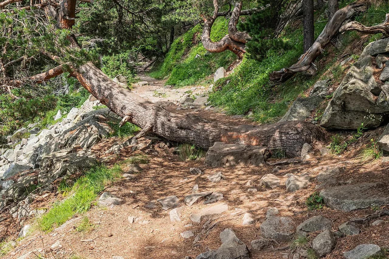
The upper part of the walk is steep and pebbled, and some of the path runs along the top of very steep ground. Keep an eye on children near the edges and wear shoes with real grip rather than trainers with smooth soles.
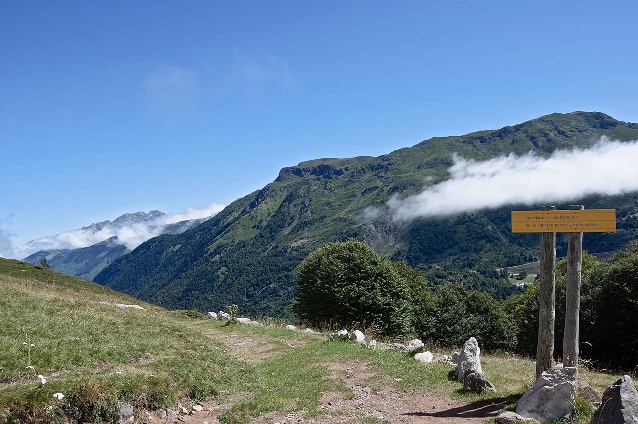
Dogs are welcome on the valley walk but must be kept on a lead at all times, and they cannot go beyond the boundary into the national park; a yellow sign marks where you stop. If you are bringing a dog, plan the turn-around at that sign and leave the upper cirque for another day.
Afternoon storms build quickly on open ground, so if thunder starts, drop off ridges and stay away from trees, rock edges and metal. The sensible response is to descend early rather than press on to the falls, because the exposed sections are the last place you want to be in lightning.
Extending the day to the Refuge des Espuguettes
From the cirque side, the path climbs to the Refuge des Espuguettes on the mountain pastures above Gavarnie, reached via the slightly aerial Pailla cornice passage. The reward is a view back over the cirque and toward the Brèche de Roland, and the hut itself sits right at the foot of the pastures.
The refuge has a dormitory of around fifty places with mattresses, duvets and pillows, but no showers; there are toilets and sinks. A collective evening meal cooked on site with local products is served at 19:00, and you can book a picnic to take away for the next day.
The refuge opens from May to September, and booking is essential if you want a bed. Treat the walk up as a proper hill day rather than a short add-on, because the cornice passage and the height gain make it a different proposition from the valley floor.
The Gavarnie to Piméné two-day loop
The Gavarnie-Piméné loop is a two-day trek of 21 km (13 miles) with about 1,505 m (4,940 ft) of ascent, described by the valley tourist office as a good first introduction to mountain roaming. Day one covers 8 km (5 miles) in about 4 hours up to the Espuguettes pastures; day two covers 13 km (8 miles) in about 6 hours and includes the high point at the Pic du Piméné.
The second day is the technical half: the path climbs steep slopes from the pastures to the Piméné pass, crosses to the other side of the valley, reaches the small Piméné pass and finishes on an aerial ridge to the summit. You return the same way to the refuge before descending via the Pailla plateau and switchbacks through pine forest to Gavarnie. This is where tired legs show, so start early and watch the weather.
For fitter day hikers, the Piméné ridge gives views toward the Mont Perdu and the Vignemale, and it makes a natural link if you are working through a broader Pyrenees itinerary or a longer coast-to-coast route such as the gr10.
Huts and overnight
On the cirque day itself there is no hut on the valley floor, but the Refuge des Espuguettes above the village provides the obvious overnight if you want to split the walk and be up high for the morning light. Book through the refuge directly and confirm the meal arrangement when you reserve.
For a two-day trek, carry a sleeping bag liner, headlamp, toilet paper, survival blanket, first aid kit and solar charger, as the tourist office recommends for a first roaming trip. Allow about 1.5 litres of water per person per day and take a proper topographic map at 1/50,000 scale.
Hut-to-hut walks elsewhere in the Pyrenees follow the same pattern, so once you have the Espuguettes logistics sorted, the same booking and packing habits serve you on longer routes such as the haute route pyrenees.
When to go
Summer is the natural season for the cirque walk, when the paths are clear and the falls are running; the hut itself is open from May to September, which sets the practical window for the overnight version. Spring and autumn days are quieter and the colours are good, but expect snow patches on the upper paths.
Early and late in the season, snow can linger on the passes and upper paths, so carry traction or be ready to turn back at the steep sections. In winter the cirque is snow-covered and the falls freeze; that is a different outing with different skills, not a casual extension of the summer hike.
Rules that shape the visit
There is no driving to the cirque and no cycling on the path, so the day is entirely on foot. Camping is forbidden inside the Pyrenees National Park, which means any overnight should be in a refuge or in the village rather than a wild pitch.
Check the national park regulations before you set out, and tell someone your itinerary or leave a note in your vehicle or accommodation. Take your waste home with you and give the pastures and wildlife room, especially where livestock graze.
What to bring
Wear walking shoes with grip and pack layers for wind and rain, even on a fine morning, because conditions change fast below the cirque walls. A comfortable pack, sunglasses and sunscreen matter on the open sections, and a map at 1/50,000 scale keeps you oriented when the paths fork.
Drink before you start and take regular sips rather than waiting until you are thirsty, especially on the steep upper path. Carry rubbish bags out with you and leave the cirque exactly as you found it.
Guides and pairing the cirque with other valley days
If this is your first mountain walk, or you want to combine the cirque with the refuge and the Piméné ridge, a local mountain guide can take the navigation and pacing off your hands and add the local knowledge the route deserves.
The Valleys of Gavarnie also publish other multi-day circuits, including routes through the Troumouse area and Cauterets, which let you build a longer stay around the cirque day. If you are heading further east, the Carros de Foc circuit in Aigüestortes i Estany de Sant Maurici National Park offers a very different hut-to-hut experience with the Refugi d'Amitges as a key stop.
Plan Your Visit
The Cirque de Gavarnie hike rewards a simple plan: arrive in Gavarnie village, park for the day, and walk the riverside road to the cirque floor before deciding whether to add the waterfall path or the climb to the Refuge des Espuguettes. Size the day around your group's comfort on steep, pebbled ground and leave the two-day Piméné loop for when you can book the hut and start early.
Go in summer for the clear paths and open hut, or in the shoulder months for quieter trails and snow patches on the upper sections. Either way, the cirque is one of the Pyrenees' most accessible big-mountain days, and it fits neatly into a wider tour of the range. If you are weighing up a warmer-weather alternative for the same kind of big day out, our guide to hiking in Mallorca covers the Serra de Tramuntana trails.
Frequently Asked Questions
How long is the hike to Cirque de Gavarnie?
From Gavarnie village to the foot of the cirque is commonly reported as around 8 km (5 miles) return, taking about 1 hour 30 minutes up and roughly an hour down. Adding the waterfall footpath costs about another hour of walking.
Can you drive up to the Cirque de Gavarnie?
No. The cirque is a walk-only destination from the village, and bicycles are not allowed on the path either. Park in the village and continue on foot.
Where do you park for the Gavarnie cirque hike?
Several paid parking areas in Gavarnie village allow you to leave a vehicle for 24 hours or more. Pay on site and check the current terms with the valley tourist office.
Can you reach the Cirque de Gavarnie by bus?
Bus services reach Gavarnie village, though schedules vary by season. The Valleys of Gavarnie tourist office lists the current options and times.
Are dogs allowed on the Cirque de Gavarnie hike?
Dogs are welcome on the valley walk but must be kept on a lead at all times. They cannot go beyond the boundary into the Pyrenees National Park, where a yellow sign marks the stop.
When is the best time to hike to the Cirque de Gavarnie?
Summer gives clear paths and running falls, and the Refuge des Espuguettes is open from May to September. Spring and autumn are quieter but can have snow on the upper paths.
Can you camp at the Cirque de Gavarnie?
Camping is forbidden inside the Pyrenees National Park. Plan overnight stays in a refuge or in Gavarnie village instead.
How hard is the climb to the Refuge des Espuguettes?
The refuge sits above the cirque and is reached via the slightly aerial Pailla cornice passage, so it is a proper hill climb rather than a short add-on. Book a bed in advance and allow extra time.
Sources
Trail notes for your next trip
Optional updates when we add or revise hiking guides.
You might also like
Continue reading
More guides you'll find useful