Hiking in Mallorca: Best Trails in the Serra de Tramuntana
Plan hiking in Mallorca's Serra de Tramuntana: day hikes with distance and ascent, bases, transport to trailheads, and the seasons that suit each route.
On this page
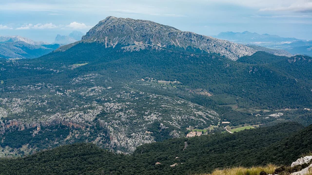
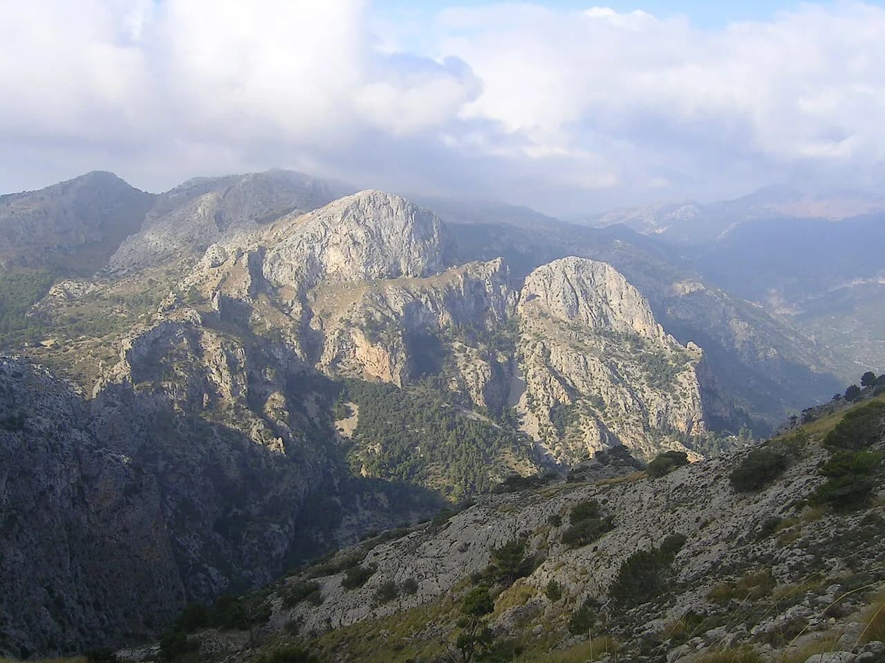
Mallorca's Serra de Tramuntana is a limestone range along the west coast, a UNESCO World Heritage site with 11 summits above 1,000 m (3,281 ft) and the island's highest peak, Puig Major, at 1,445 m (4,741 ft). The trails range from gentle valley walks between orange and lemon groves to exposed cliff paths and scree-covered summit routes, so the range suits hikers of very different fitness levels and appetites for exposure.
The choice comes down to three things: how much ascent your legs want, whether you are comfortable on cable-protected rock and loose stone, and whether you have a car. Spring and autumn give the most reliable walking weather, while summer heat pushes walking to the early morning. Most trailheads in the range are reached by road, with one notable bus-supported traverse between Deià and Port de Sóller.
When to go
April, May and October are the prime walking months in the Tramuntana: sunshine, little rain, thinner crowds and temperatures you can climb in. Summer delivers intense heat that makes steep ascents tough, so plan summit days for sunrise and carry more water than you think you need.
The island stays walkable year-round, but spring and autumn are the seasons that suit long days on foot. Carry waterproofs whatever the forecast: this is mountain terrain, and conditions change fast. Late autumn can bring heavy rain, which makes the ravine paths and loose scree sections slicker than the figures suggest.
Where to base yourself
Sóller, Bunyola and Valldemossa sit inside the mountains with trailheads close at hand, which makes them the strongest bases for hikers. Sóller and Port de Sóller anchor the western coast routes, including the traverse to Deià and the climb to Puig des Teix, while Bunyola is the start point for the Penyal d'Honor ascent and Alaró puts you near the castle climb.
Lloseta, a village at the foot of the range near the Ma-13 road, works as a central base for drivers: it gives quick access to the mountains and about half an hour to the capital to the south and the northern peninsulas. Deià suits hikers who want the coastal walk from their doorstep and don't mind using the bus to reach Port de Sóller at the other end.
Getting to trailheads
A rental car is the practical choice for a relaxed hiking holiday, because the starting points of most walks in the range are not served by public transport. Parking at the popular trailheads is limited, so arrive early in the morning to secure a space; carry a little cash for parking and small stops.
For the Deià to Port de Sóller walk, you can leave the car in a free lot near the bus stop in Port de Sóller and take bus 203 uphill to Deià; the service runs roughly hourly and advance tickets can be bought through the bus company's website. Check the bus company's own timetable and fare before you travel, since these are the details that change.
Easy and short hikes
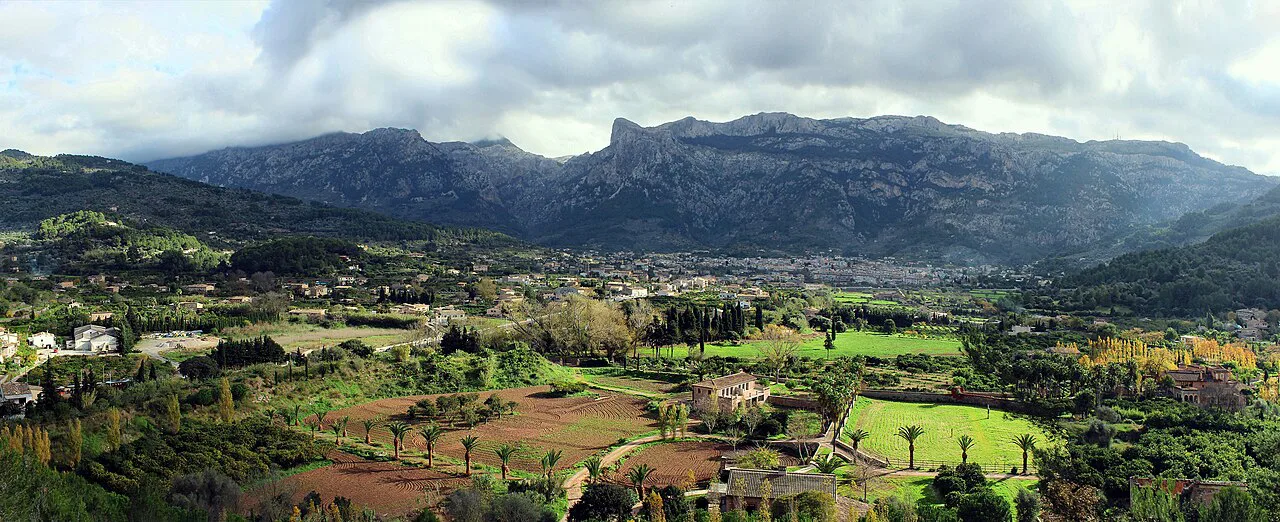
The Sóller Valley walk is a gentle 7.6 km (4.7 mi) circuit with 205 m (673 ft) of ascent, threading between orange and lemon trees and passing through villages with mountain views. It suits a rest day or a first afternoon on the island, and it needs little more than walking shoes.
The Barranc de Biniaraix is short but serious: 5 km (3.1 mi) with 401 m (1,316 ft) of ascent, climbing through a ravine with top-notch views of peaks and valleys. Walking it counter-clockwise is the better direction for the views. Do not mistake the low distance for an easy day; the gradient is steady and relentless.
Moderate coastal and ridge hikes
The Deià coastal walk covers 13 km (8.1 mi) with 530 m (1,739 ft) of ascent, starting in the mountains and looping back along rugged coastline with spots to swim. It is a moderate day that rewards an early start and a willingness to stop for a dip.
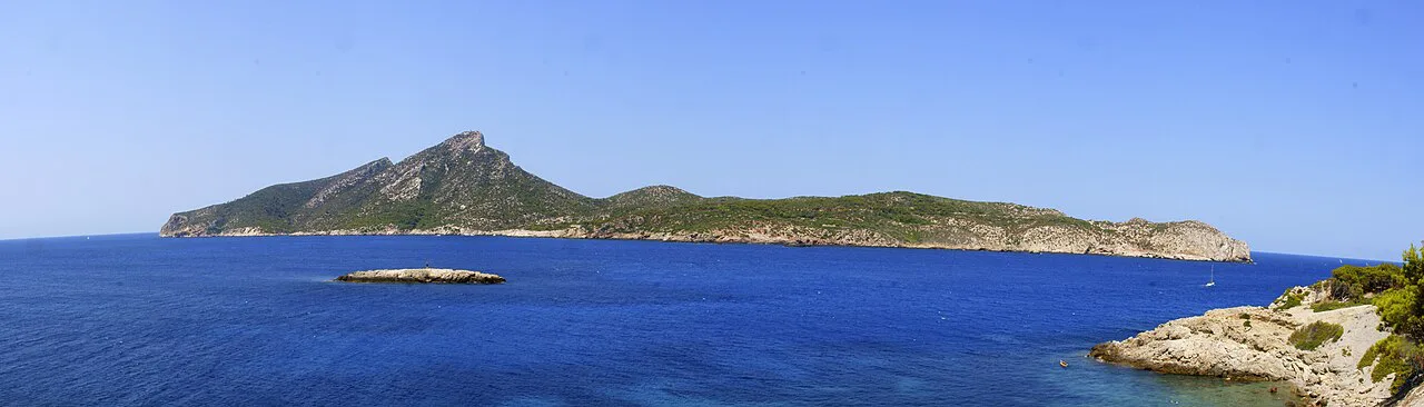
La Trapa and Cala en Basset is an 11.67 km (7.25 mi) moderate route with 555 m (1,821 ft) of ascent, taking in the La Trapa viewpoint over neighboring Dragonera Island and a cove reachable only by boat or on foot. Sóller to Cala Tuent runs 9.7 km (6 mi) with 356 m (1,168 ft) of ascent parallel to the coast, with a stop at Finca Balitx d'Avall for a drink; it is one-way, and a return on foot would be almost 20 km (12.4 mi), so arrange pickup at Cala Tuent.
Deià to Port de Sóller on the GR221
This 15 km (9.3 mi) traverse gains 400 m (1,312 ft) and descends 530 m (1,739 ft), dropping from Deià to Cala Deià, following the coast for about 2 km (1.2 mi), then climbing to join the GR221 Mallorca long-distance trail through olive groves and past large fincas to Port de Sóller. Allow four to five hours and finish with a drink on the terrace.
Because the start and finish differ, the bus link is part of the route planning: park at Port de Sóller and ride up to Deià, then walk back to the car. The coastal stretch above Cala Deià is exposed, with a steep drop to the water, so keep children and dogs close on the narrow sections.
Summit hikes
Bunyola to Penyal d'Honor is a 12.4 km (7.7 mi) climb of roughly 600 m (1,969 ft) from the village to a peak with 360-degree views over the range and the island; the figures come from a published route description that flags its own elevation figure as inaccurate, so treat the ascent as approximate. Puig des Galatzó is shorter but spicier at 10 km (6.2 mi) with 892 m (2,927 ft) of ascent and huge views over the island and coast.
Puig des Teix climbs 720 m (2,362 ft) over 13.5 km (8.4 mi) from Valldemossa, a steep and challenging day with phenomenal island views. Alaró Castle is 12.4 km (7.7 mi) with 625 m (2,051 ft) of ascent to a fortress with panoramic views over the range. Both are full-day outings; start early and carry layers for the summit wind.
For a bigger summit objective in the same range, the Puig de Massanella Hike reaches the island's second-highest peak on a long, rough day that rewards an early start and solid navigation. If you are comparing island summit days across the Canaries as well, hiking in tenerife covers Teide National Park and other high routes worth weighing against this one. For a mainland counterpart to these summit days, hiking in Pyrenees in the Pyrenees hiking guide sets out alpine trails, bases and seasons beyond the Balearics. For mainland alternatives, see Hiking in Spain: 8 Great Trails and Where to Start.
Cúber reservoir and Puig de l'Ofre
Start at the parking area on the north side of Cúber reservoir for a 12 km (7.5 mi) route with 520 m (1,706 ft) of ascent that visits three summits in four to five hours. The first climb to Puig de sa Rateta (1,107 m / 3,632 ft) is steep and the path is sometimes hard to follow, so watch for cairns; from the top you see Cúber, Gorg Blau and Puig Major.
The route continues over Puig de na Franquesa (1,067 m / 3,501 ft) to Puig de l'Ofre (1,099 m / 3,606 ft), then descends by a wide gravel road back to the reservoir. The faint trail and goat paths make this a navigation day rather than a signposted walk, and afternoon light goes early in the mountains, so do not start late.
Tossal Verds
The Tossal Verds circuit covers 11.3 km (7 mi) with 595 m (1,952 ft) of ascent, circling the peak via a remote mountain hut with views over the surrounding mountains and the water of Cuber reservoir. It includes a short, exciting section equipped with chains; that section is the reason to bring a head for exposure and to keep your hands free.
The route is classed as challenging, and the combination of distance, ascent and cable terrain makes it a poor choice for a first day in the range. Build up with a shorter ravine or valley walk first, then take on the circuit in dry weather.
Puig Tomir
Puig Tomir is a 5.5 km (3.4 mi) climb with 470 m (1,542 ft) of ascent, taking three to four hours and starting from the parking area on the Coll des Pedregaret. The gate to the col is closed to vehicles on Sundays and public holidays, which adds about 2.5 km (1.6 mi) of asphalt road each way if you arrive on those days.
The ascent crosses scree slopes and a scree gully, with steeper sections protected by cables and stirrups, then eases onto a gently rising plateau to the 1,103 m (3,619 ft) summit marker. Loose stone makes the descent slower than the figures suggest; trekking poles help, and the summit view west over the high mountains and east over the coast is the reward.
Penya des Migdia from Ermita de la Victòria
This 5 km (3.1 mi) walk with 300 m (984 ft) of ascent takes two to three hours from the Ermita de la Victòria on the peninsula between the bays of Pollença and Alcúdia. A gravel road gives way to a staircase and then a narrow path, with the option of a short detour to Puig des Romani (387 m / 1,270 ft) for a quieter panorama.
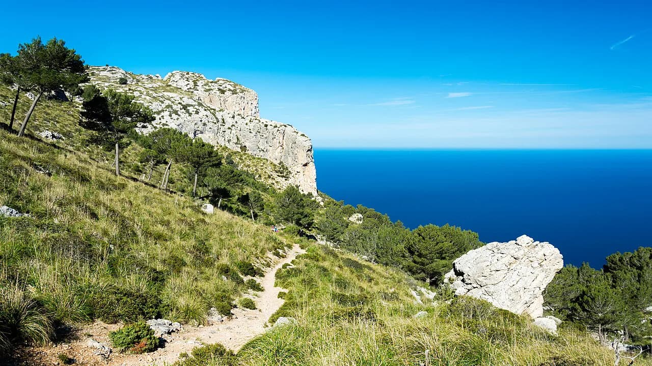
The highlight is a narrow path that clings to the rock above a steep drop to the sea, followed by a gate carved into the rock that you crawl through and a short hands-on-knees final climb to a four-hundred-year-old cannon. This is not a route for anyone uneasy with heights, and the scrambling sections demand dry conditions.
Huts and long-distance options
The GR221, the long-distance route through the Serra de Tramuntana, overlaps several of these day hikes, including the Deià to Port de Sóller stage, so you can sample it without committing to a multi-day trek. The Tossal Verds circuit also passes a remote mountain hut, giving a sense of how the range links up on foot.
If you prefer your days organized, Mallorca walking holidays and self-guided formats package stages of the Tramuntana Sierra with luggage transfer and accommodation; compare what each format includes against the daily distances above.
Hazards to plan around
Exposure is the defining hazard on the coastal routes: the Penya des Migdia path runs above a steep drop to the sea, and the Deià coastal stretch is narrow in places. Loose scree and cable-protected steps on Puig Tomir and the chains on Tossal Verds require steady feet and dry weather; turn back if rain arrives.
Summer heat is the other real risk, so start at sunrise, carry more water than you expect to need, and treat the inland summits as morning objectives. Carry waterproofs on every hike, because mountain weather can change quickly even on a blue-sky morning.
The best base for your shortlist
Choose Sóller or Port de Sóller if your list is coastal and western: Deià, Cala Tuent, and the bus-linked traverse. Choose Valldemossa for Puig des Teix, Bunyola for Penyal d'Honor and Alaró Castle, and Lloseta if you want a central, car-based base for the reservoir hikes and the northern peninsulas.
If you have no car, build the trip around Deià and Port de Sóller and the bus 203 link, adding valley walks from town. Drivers can chase the summit routes and the Cúber and Tossal Verds circuits, but should still start early to find parking.
Plan Your Visit
Pick two or three hikes that match your fitness and your base rather than trying to tick off the whole range in a short trip. Pair an easy valley day with one summit or coastal objective, and keep a rest day for the beach coves at Cala Deià, Sa Calobra or Cala Tuent.
Book accommodation in Sóller, Valldemossa, Bunyola or Lloseta early for spring and autumn, reserve a rental car if your shortlist includes the reservoir or northern trailheads, and check the bus 203 timetable with the operator before relying on it for a one-way traverse. The GR221 and the GR221 stage descriptions give you the long-distance context if you want to extend a day hike into a multi-day route.
Explore more Mallorca hiking guides
Frequently Asked Questions
What are the best hikes in Mallorca for a first visit?
Start with the Sóller Valley walk for an easy introduction and add either the Deià coastal walk or the Deià to Port de Sóller traverse for coast and views. Hikers with more appetite for ascent can move on to Puig des Teix or Penyal d'Honor.
Where should I stay in Mallorca for hiking?
Sóller, Bunyola and Valldemossa sit inside the Serra de Tramuntana close to trailheads. Lloseta works well as a central base for drivers, and Deià suits walkers who want coastal routes from the village.
Can you hike in Mallorca without a car?
Yes, but your options narrow. The Deià to Port de Sóller route is supported by bus 203, and the Sóller valley and coastal paths can be walked from town. Most other trailheads in the range are reached by road.
What is the hardest hike in Mallorca?
Puig des Galatzó packs the most climbing at 892 m over 10 km, while Puig Tomir adds scree, cables and stirrups to its 470 m of ascent. Puig des Teix and Alaró Castle are also long, steep days.
When is the best time to go hiking in Mallorca?
April, May and October give the most reliable walking weather with sunshine, little rain and manageable temperatures. Summer is hot enough to require sunrise starts, and winter can be wet but remains walkable.
Is the GR221 worth hiking?
The GR221 links the range's villages and passes through olive groves and fincas, and several day hikes overlap it, including Deià to Port de Sóller. It is worth sampling on a day walk before committing to a multi-day trek.
Sources
Trail notes for your next trip
Optional updates when we add or revise hiking guides.
You might also like
Continue reading
More guides you'll find useful