Hiking in Gran Canaria: Best Trails, Base Towns and Seasons
Plan hiking in Gran Canaria: Roque Nublo, Guayadeque, Tamadaba and Bandama routes, with distances, ascent, base towns and the best months to walk.
On this page
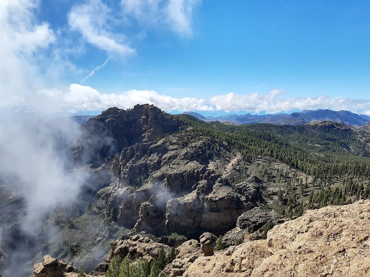
Gran Canaria rewards hikers with unusual range for an island its size: a high volcanic centre crowned by two lofty peaks, pinewoods and cloud forest on the wetter north side, and arid barrancos draining toward the coast. You can walk above the clouds in the morning and be back in a warm resort valley by late afternoon, which makes the island work for both dedicated walking weeks and day trips.
The choice you make first is where to sleep. Bases on the central plateau put the big summit routes on your doorstep, while the southern resorts suit short transfers to Bandama and Guayadeque but mean a long climb by road to reach Tejeda and the high ground.
Where the main hiking areas lie
Four zones cover most of what a visitor wants. The Cumbre Central around Tejeda holds Roque Nublo and Pico de las Nieves, with the Altavista Ridge linking the high ground toward Artenara and Tamadaba in the west. Tamadaba Natural Park spreads over more than 7,000 hectares of rugged terrain, dense forest and steep cliffs, with the Barranco Hondo cutting through it and Roque Faneque as a landmark.
In the east, the Barranco de Guayadeque is a green valley framed by cliffs, with cave dwellings used over centuries along its sides. North of the centre, the Caldera de Bandama offers a rim path and a crater-floor descent, and the northern villages of Firgas and Moya give access to short shaded walks at Azuaje and Los Tilos de Moya.
The south has its own character. The Amurga massif near the resort areas is dry, unpopulated and cut by deep ravines, with native and endemic plants, cactus and broad-leaved scrub that turns surprisingly green after winter rain. It is the least forgiving of the areas listed here and the one that demands the most preparation.
Roque Nublo: two ways to walk it
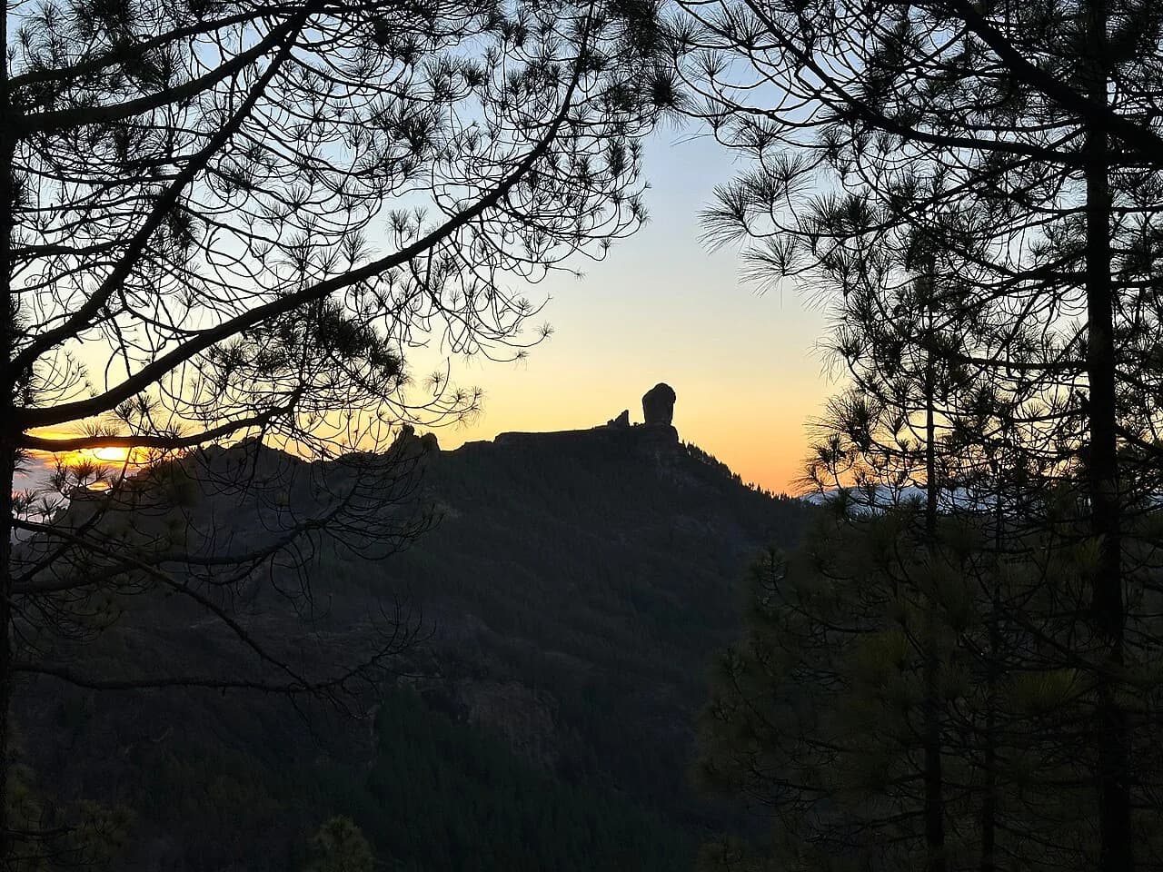
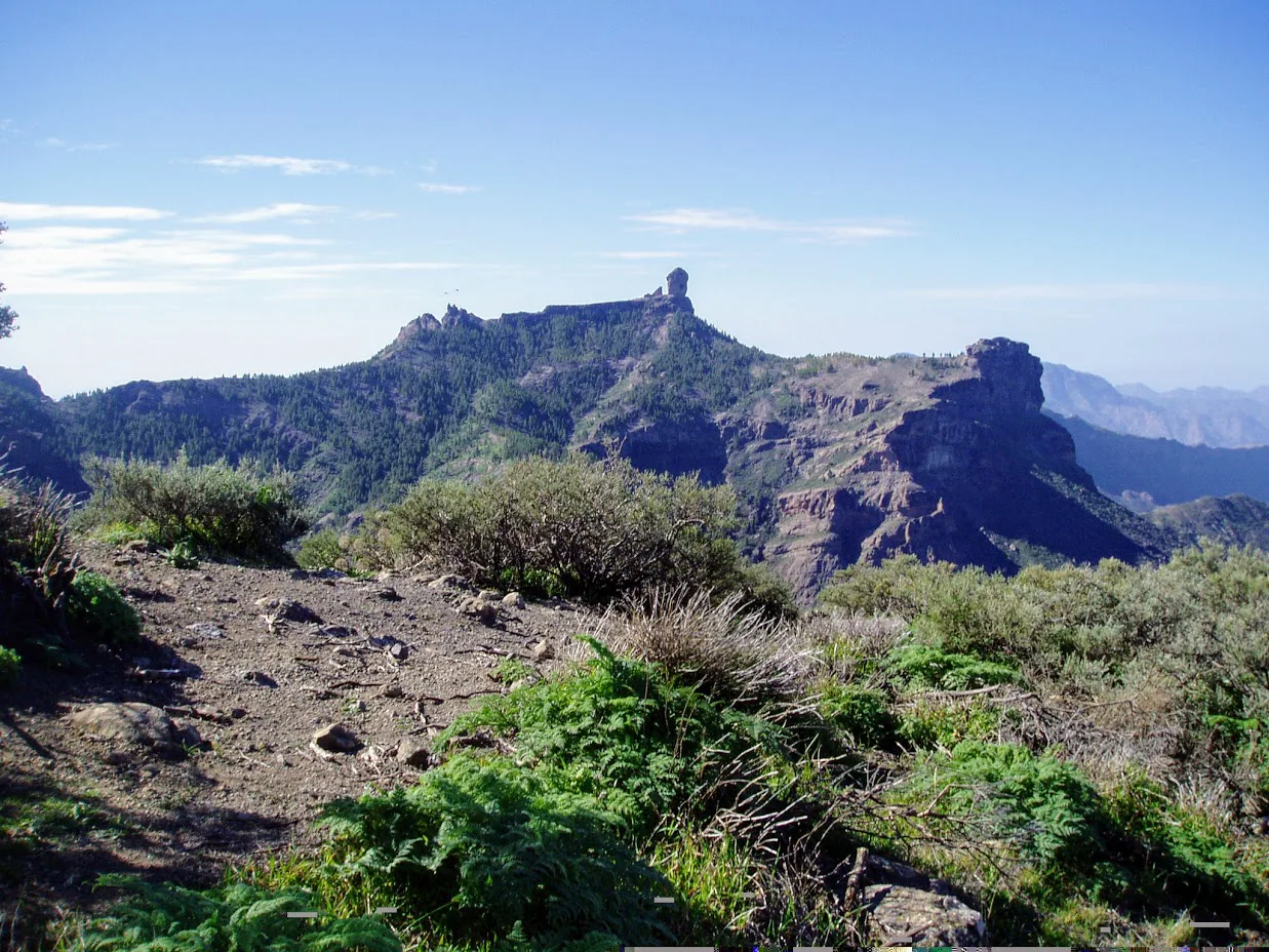
Roque Nublo rises to 1,813 m (5,948 ft), a dramatic outcrop above the edge of a plateau and the island's most distinctive landmark. Walks Worldwide gives the full Roque Nublo day as 20 km (12.4 mi) with 800 m (2,625 ft) of ascent and the same descent, crossing steep slopes around the rock before a descent through evergreen forest to a col, where a bus can return you to Tejeda.
If you are based in Tejeda and want a shorter day, a circular route runs from the town via La Caluta to Roque Nublo and back, taking roughly four to six hours, with side-routes marked along the way. The town's tourism office stocks a flyer for this walk labelled Ruta 2, which is how the route is presented locally rather than as an official park designation.
The rock itself can be reached more directly from a roadside trailhead below the plateau, which suits a half day and travellers with a car. Whichever approach you take, the final stretch sits above eroded ravines with precipitous drops, so keep children and anyone uneasy with exposure close on the upper path rather than on the outer edges.
Pico de las Nieves and the Altavista Ridge
Pico de las Nieves is the island's highest point at 1,949 m (6,394 ft), and the high ground around it is where the best walking of the trip is found. A typical day from a drop-off at the Mirador Degollada de Becerra covers 10 km (6.2 mi) with 415 m (1,362 ft) of ascent and 925 m (3,035 ft) of descent into Tejeda, with an optional detour to the summit.
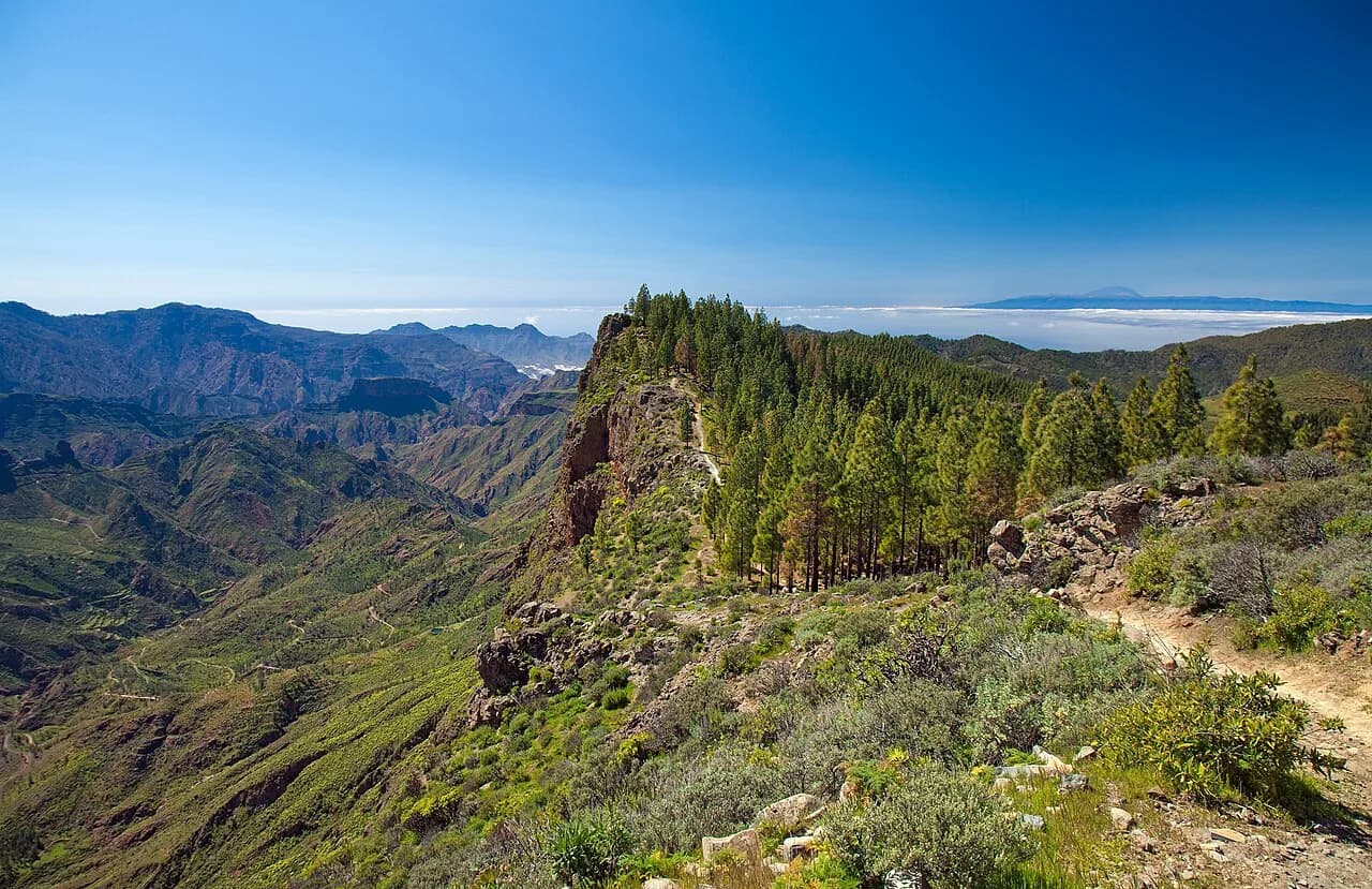
The Altavista Ridge crosses a huge extinct crater at the edge of Tamadaba Natural Park, running above the clouds with views as far as Tenerife on clear days. If those glimpses of the neighbouring island tempt you, our guide to hiking in Tenerife covers its trails by region and difficulty. The published route is 13 km (8.1 mi) with 500 m (1,640 ft) of ascent and 450 m (1,476 ft) of descent, finishing at Artenara where a vehicle can collect you.
These are high, exposed days. Temperatures at altitude behave like mountains rather than like the coast, with abrupt changes and genuine cold in winter and at dusk, so pack a windproof layer and warm gloves even when you leave a sunny resort.
Barranco de Guayadeque
The valley's easiest walking starts at the parking area at the end of the asphalted road, where a loop trail winds through the green valley past cave dwellings and suits families with children and novice hikers. A museum sits on the road as you climb, on the left, showing life in the area over recent centuries.
Harder routes leave the valley from Montaña Las Tierras and climb toward the Caldera de Los Marteles, with extensions to the summits of La Gora and Las Nieves available for strong walkers. Treat the loop and the climbs as separate outings: the loop is a shaded stroll, the climbs are full days with real height gain.
The villages of Agüimes and Temisas make practical bases for this side of the island and put you within a short drive of the trailhead. Fill water bottles before you leave the village, since the cave-dwelling stretch of the valley offers shade but few services.
Tamadaba Natural Park and the Barranco Hondo
Tamadaba is fitter-walker country. The park covers rugged high ground with dense pine forest and steep cliffs, and the Barranco Hondo opens views across the surrounding landscape from its rim. Roque Faneque is the park's signature rock feature, and the walking here is quieter than the Roque Nublo honeypots.
Artenara is the natural base, a small mountain village set among the crags on the park's eastern side. From here you can walk into the park on foot, or use the village as a pickup point after a traverse across the Altavista Ridge from the Tejeda side.
Cloud and wind are the practical issues. This is the island's cloud-catching side, so carry a shell and expect the views to open and close through the day; the compensation is forest that stays green through the dry months.
Caldera de Bandama
Bandama is a volcanic crater about 200 m (656 ft) deep and nearly 1 km (0.6 mi) across, part of a larger volcanic complex with several other craters and lava fields, and it formed in a series of explosive eruptions roughly 5,000 years ago. Two walking options give different days: a trail around the rim for panoramic ocean and interior views, and a path down to the lower plain inside the crater walls.
Choose by what you want from the day. The rim delivers the big views with minimal effort and works well on a short visit, while the descent puts you among the vegetation that cloaks the caldera floor. Vineyards in the surrounding area produce wine, which makes an easy pairing with a half-day walk.
Bandama sits close enough to the northern suburbs that it fits a half day at either end of a city stay in Las Palmas. Drive or take a taxi up to the top; the access road reaches the rim directly.
Azuaje and Los Tilos de Moya
The Azuaje ravine in the north has lush vegetation and water that keeps flowing for months after the rains, with the ruins of an old spa near the start of the ravine close to the GC-350 road. The strongest option is to park in Firgas and walk down the hillside as visitors did in the late nineteenth century, reaching the spa and returning up the ravine floor to a path that climbs back to the village. Start in the morning and you will be back in Firgas by midday for lunch in one of its restaurants.
Expect wet feet and one steep section where a fixed rope helps you climb. As there is water and dense vegetation, locals value the spot highly, and a Sunday after the rainy season can be busy and noisy rather than quiet.
Los Tilos de Moya
Los Tilos de Moya protects a small patch of laurisilva in the Moya ravine, a humid subtropical cloud forest of large trees, lianas and laurel-like leaves left over from vegetation that once covered much of Europe. A loop of less than 2 km (1.2 mi) lets you see it without much effort, and the tree cover gives shade and cool air even on warm days.
There is a little uneven ground in places, but this is among the easiest routes on the island for families with children. Pair it with Azuaje for a full day in the north, since the two ravines sit close together.
Amurga: dry massif walking in the south
Amurga is a totally unpopulated mountain massif in the southeast, built from deep narrow ravines and odd rock formations, including the Arco del Coronadero, a natural rock bridge you can cross on foot if you have a head for heights. The landscape is extremely arid, with native and endemic plants and cactus that turn exuberant after winter rain, when water runs down the ravines and forms waterfalls and pools.
There is no road access, and treks require a good level of fitness and secure footing. Go with someone who knows the area, carry plenty of water and bring sun protection; the old cultivation terraces and pre-Hispanic remains you pass should be left untouched.
Because the massif is close to the southern tourist areas and offers some of the wildest terrain on the island, it suits experienced walkers with a spare day rather than a first hiking outing.
Distances, ascent and walking times
The figures below come from published route descriptions and are useful for planning days, not for setting records. Build in extra time for photographs, navigation and the heat.
The classic Tejeda to Roque Nublo day is 20 km with 800 m of ascent and descent, while the Tejeda circular via La Caluta takes roughly four to six hours. From the Mirador Degollada de Becerra to Tejeda the route is 10 km with 415 m of ascent and 925 m of descent, and the Altavista Ridge is 13 km with 500 m up and 450 m down. A Tejeda to La Cruz de Tejeda day covers 14 km with 700 m of ascent and 750 m of descent, and the Camino de los Romeros from San Pedro to Puerto de las Nieves is 10 km with 500 m up and 650 m down.
Two shorter outings have their own simple numbers. The Los Tilos de Moya loop is under 2 km, and the Barranco de Guayadeque loop from the end of the road is short and family-friendly. Neither needs a full day on its own.
Getting to trailheads
Self-drive is the practical way to reach most mountain trailheads. The central plateau car parks at Mirador Degollada de Becerra, Roque Nublo and Bandama are all served directly by road, while the Guayadeque trailhead sits at the end of the asphalted lane above the valley.
Public transport works on specific links rather than everywhere. The Roque Nublo day can finish at a col where a bus returns you to Tejeda, and transfers and taxis reach trailheads such as the Mirador or Artenara at the end of a traverse.
If you would rather not plan the logistics yourself, escorted trips handle the transfers and route notes for you, and they make sense for anyone limited to a short break.
Base towns for each hike
Tejeda is the strongest base for the central peaks, putting the Roque Nublo circuit, the La Cruz de Tejeda crossing and the Pico de las Nieves approaches within easy reach. The town also has a spice centre with a botanical garden and laboratory where you can learn about traditional uses of medicinal plants and herbs.
Artenara works for Tamadaba and the Altavista Ridge finish, while Firgas is the natural base for Azuaje and the northern ravines. For Guayadeque, Agüimes and Temisas sit within a short drive of the valley, and the southern resorts give access to Bandama and Amurga but add a long mountain road to any central-plateau day.
A week split between two bases, one on the plateau and one in the north or south, gives you the high routes in cool mornings and the shaded or coastal walks later. A single resort base means choosing between the two rather than doing both.
When to go
October to April brings lower temperatures and is the preferred window for walking holidays on the island, which stays a year-round destination thanks to its mild subtropical climate. Spring adds the flowering Tajinaste around villages such as Tenteniguada, at about 800 m (2,625 ft) above sea level.
Winter is not a guarantee of comfort on the high ground. At altitude, temperatures change abruptly and cold bites at dusk and in the middle of the day on exposed ridges, and snow can fall on the summits, so treat the season as an advantage at low levels rather than a promise of warmth everywhere.
Summer flips the logic. The barrancos and the southern massifs become hot and shadeless, and the sensible response is to walk early, carry plenty of water and sun protection, and save the exposed routes for cooler months.
What to carry and how to read the terrain
Volcanic ground on Gran Canaria varies from firm picon paths to loose scree and steep, irregular steps, so footwear with a proper tread matters more than it does on a park path. A single pole helps on the long descents from the high ground into Tejeda, where the height loss is far greater than the climb.
Water and sun protection are the two essentials on every route, and they matter most in Amurga, Guayadeque and Bandama. Carry a windproof shell for the plateau and the Tamadaba rim, and pack warm gloves for winter summit days.
Plan Your Visit
Set your base first: Tejeda for the central peaks and the Altavista Ridge, Firgas for the northern ravines, Agüimes or Temisas for Guayadeque, and the southern resorts only if you accept a longer transfer to the mountains. Then match the day to your fitness and the season, saving the exposed high routes and the dry Amurga traverses for the cooler months.
Explore more Gran Canaria hiking guides
Frequently Asked Questions
What is the best hike in Gran Canaria for a first visit?
Roque Nublo is the signature outing. A circular walk from Tejeda via La Caluta takes roughly four to six hours, and the town's tourism office stocks a flyer for it. A shorter roadside approach suits a half day if you have a car.
How long does the Roque Nublo hike take?
The full day described by walking operators covers 20 km with 800 m of ascent and descent, which is a long outing. The Tejeda circular route is shorter, taking roughly four to six hours.
Where can I hike in Gran Canaria without a car?
Some links work on public transport, including a bus from a col below Roque Nublo back to Tejeda. Most mountain trailheads are best reached by car, taxi or an organised transfer, so check the current service before committing.
Are there easy hikes in Gran Canaria for families?
Yes. The loop at Los Tilos de Moya is under 2 km, and the Barranco de Guayadeque loop from the end of the asphalted road is relatively easy and suits children and novice hikers.
What is the best month to go hiking in Gran Canaria?
October to April brings cooler walking conditions and is the preferred window for walking holidays. Winter can still bring cold on the high ground, and summer heat makes the shadeless barrancos hard work.
Do I need a guide to hike the Amurga massif?
A companion who knows the area is strongly advised. There is no road access, footing is rough and the terrain demands good fitness, plenty of water and sun protection. The pre-Hispanic remains should be left untouched.
Sources
Trail notes for your next trip
Optional updates when we add or revise hiking guides.
You might also like
Continue reading
More guides you'll find useful