GR221 Mallorca: Plan the Tramuntana Route and Stages
Plan the GR221 across Mallorca's Serra de Tramuntana stage by stage, with distances, ascent, walking times and how to split the days between villages and refuges.
On this page
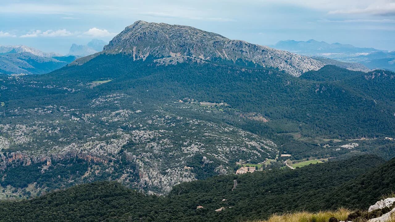
The GR221 is Mallorca's long-distance route across the Serra de Tramuntana, running from the southwest port of Port d'Andratx to Port de Pollença in the north. It suits hikers who want a multi-day traverse with village beds and mountain refuges rather than a single summit day, and who are comfortable with long daily distances and rough ground. The route links coast paths above the sea, old stone-terrace country and the high reservoir at Cúber, so the character changes markedly between stages.
Daily totals matter more than the headline figure. One recorded traverse of the line runs 135 km (84 mi) with about 6,160 m (20,200 ft) of ascent and 5,860 m (19,200 ft) of descent, while a five-part collection covering the same corridor totals 156 km (97 mi) and 5,580 m (18,300 ft) of climbing. The difference comes from where each walker starts and finishes and how the days are cut, so treat any single distance as a planning estimate rather than a fixed course.
Start and finish: Port d'Andratx to Port de Pollença
The route begins at Port d'Andratx on the southwest coast and ends at Port de Pollença on the north coast, crossing the full width of the Tramuntana. Signposting divides the trail into eight stages: Port d'Andratx to Estellencs, Estellencs to Esporles, Esporles to Deià, Deià to Port de Sóller, Port de Sóller to Tossals, Tossals to Lluc, Lluc to Pollença, and Pollença to Port de Pollença. Those eight stages are the logical skeleton for any itinerary, even if you merge or split them.
The villages along the way are the real anchors of a GR221 trip. Estellencs, Esporles, Deià, Sóller and Pollença all sit on or near the line and break the walking into manageable chunks; the refuges at Tossals, sa Coma d'en Vidal and Lluc serve the higher, remoter stretches. Planning around these places is more useful than fixing a rigid daily distance, because it lets you match each day to the beds and resupply actually available.
Route at a glance: distance, ascent and highest point
Across the full line, expect to climb and descend repeatedly rather than follow one long ridge. The recorded traverse gives roughly 135 km (84 mi) with 6,160 m (20,200 ft) up and 5,860 m (19,200 ft) down, and most walkers would take somewhere between 7 and 16 days to complete it. That range reflects how much you want to walk each day and how many rest or short days you build in.
The highest point on the recorded line reaches about 1,320 m (4,330 ft), and the route mixes surfaces heavily. Mountain hiking path and singletrack make up the bulk of the distance, with some footpath, track and short road sections, and a small amount of alpine hiking path. That mix tells you more about the trail than the total: expect rough, stony ground underfoot and a few short stretches on tarmac approaching villages.
The classic stage breakdown
The eight signposted stages give a useful default split. Stage 1 runs Port d'Andratx to Estellencs; Stage 2 Estellencs to Esporles; Stage 3 Esporles to Deià; Stage 4 Deià to Port de Sóller. Stage 5 leaves Port de Sóller for Tossals, Stage 6 continues from the Tossals refuge to Lluc, Stage 7 drops from Lluc to Pollença, and Stage 8 is the flat run from Pollença out to Port de Pollença.
These stages are not equal in effort. Stage 1 alone breaks into two very different halves, and the later stages around the Tossals refuge and Cúber reservoir cover long, exposed ground. Read the stage lengths before committing, and consider splitting Stage 1 into two days or merging the final Lluc–Pollença–Port de Pollença stretch depending on your fitness and timetable.
Stage 1 in detail: Port d'Andratx to Estellencs
Stage 1 begins on the edge of Port d'Andratx. From the right side of the port, about 100 m before the Club de Vela, you take Carrer Aldea Blanca, walk roughly 200 m and turn left onto Carrer de Cala d'Egos, which becomes an earth track up to a pass and a communications tower. A footpath then climbs to another pass, descends, and joins the main track toward Sant Elm.
The middle section runs from Sant Elm to La Trapa in about 1h 15min. From the beach you head to Plaça de Mossen Sebastià Grau near Bar Es Molí, take Avinguda de la Trapa as it turns into the Camí de Can Tomeví, pass the house of Can Tomeví and climb steeply through forest to a pass before dropping to La Trapa. La Trapa itself is a fine lookout, with views across to the island of sa Dragonera and Cala en Basset.
The first half of Stage 1, Port d'Andratx to La Trapa, is listed as about 3h 45min with around 600 m (1,970 ft) of ascent and 330 m (1,080 ft) of descent, rated medium. The second half, La Trapa to Estellencs, is much tougher: about 7h 15min with 800 m (2,620 ft) up and 920 m (3,020 ft) down, rated medium-high. Splitting them makes a sensible two-day start, with Sant Elm or La Trapa as the overnight break.
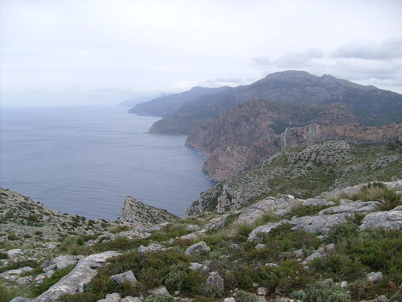
The La Trapa to Estellencs section passes the private mountain hut of Ses Fontanelles and crosses the Pas d'en Ponsa, a rock step where the route is marked with cairns through scrub and over stiles. This is the part that demands attention: watch for the cairns, follow the wall crossings and be prepared for slower going than the distance suggests. The Pas Gran and the flanks of Mola de s'Esclop (928 m, 3,045 ft) give the widest views south toward sa Dragonera and north toward the higher Tramuntana.
Mid-trail stages: Estellencs to Port de Sóller
From Estellencs, the route works east across the middle Tramuntana toward Esporles and then Deià, following terraced slopes and old paths between stone-wall villages. This is the stretch that connects the first coastal cliffs with the olive and citrus country above Sóller, and it is where you can most easily arrange short days by stopping in villages.
The recorded line gives a sense of pace between these villages. The section from Banyalbufar to Port de Sóller in the five-part collection totals 41.5 km (25.8 mi) with 1,850 m (6,070 ft) of ascent and 1,970 m (6,460 ft) of descent, and the Port de Sóller to Alarò section is 32.7 km (20.3 mi) with 1,350 m (4,430 ft) up and 1,120 m (3,670 ft) down. These are big days, so treat them as guideposts and split them to match available beds.
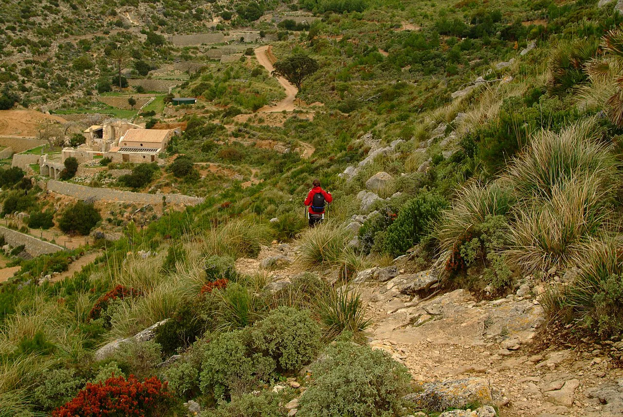
The walking here is mostly mountain hiking path and singletrack, which makes for steady progress but hard work underfoot. Figure in extra time if you like photographs; the terraced slopes and the approach to Deià are among the route's most distinctive landscapes. If you want a single famous day out of this stretch, the descent to the coast at Port de Sóller is the one with the most dramatic finish.
Sóller to Lluc: Tossals, Cúber and the high interior
The central mountain section runs from Port de Sóller up to the Tossals refuge and on to Lluc. The recorded line shows the stage from Port de Sóller to Alarò at 32.7 km (20.3 mi) with 1,350 m (4,430 ft) of ascent and 1,120 m (3,670 ft) of descent, and the final recorded part from the Cúber reservoir to Port de Pollença at 40.2 km (25 mi) with 810 m (2,660 ft) up and 1,570 m (5,150 ft) down. The high ground around Cúber is where you feel most exposed to weather.
These are the days to plan most carefully. The refuges at Tossals and Lluc are the natural overnight stops, and the gap between them crosses high, open country where afternoon storms can arrive quickly. Start early, carry water and a shell layer, and treat the cloud building over the peaks as your signal to push on to shelter. If this kind of exposed high-mountain day appeals, the Pyrenees hiking guide offers a different range of multi-day routes to weigh against Mallorca. If you enjoy this kind of exposed high-mountain day, the Tenerife hiking guide covers similar terrain on another island.
Final stages: Lluc to Pollença and Port de Pollença
The last stages are the gentlest. From Lluc, the route descends to Pollença, and the final stage is the flat run out to Port de Pollença, where the trail meets the north coast and the beaches. That flat finish is a relief after the high interior, but it is also the stage most easily shortened or altered if you are short of time.
The recorded line measures the Cúber-to-Port-de-Pollença stretch rather than the Lluc finish, but the pattern holds: long distance, modest climbing, and a long road and track approach. If you want a tamer closing day, split at Pollença and take the coast path out separately; the town has food and buses, which makes it the easiest place to adjust a plan.
How hard is the GR221?
The GR221 is a hard multi-day hike rather than a technical scramble. The recorded line is graded hard with more than 5,000 m of combined climbing and descent, much of it on mountain hiking path and singletrack, and it requires very good fitness, sturdy shoes and experience of long days. It is not a route for a first long-distance walk unless you build up to it over several trips.
The roughest ground lies in Stage 1's La Trapa to Estellencs traverse and in the high interior around Tossals and Cúber, where cairns, stiles and stony paths slow you down. The village-to-village stretches in the middle are more forgiving underfoot, though still long. If you are unsure, start with a two-stage section around Estellencs and Esporles and see how the daily totals feel.
Where to sleep: refuges and village accommodation
Beds are the real constraint on a GR221 itinerary. The route's own stage list names the Tossals refuge between Port de Sóller and Lluc, the private mountain hut Ses Fontanelles on Stage 1, and Lluc as the stop before the final descent to Pollença. Villages such as Estellencs, Esporles, Deià, Sóller and Pollença provide the rest of the overnight stops.
Book refuge beds and village rooms through the hut operators, the Consell de Mallorca's GR221 pages or the relevant booking services before you fix your days. Hut capacity is limited and the middle of the trail has few alternatives, so a plan built around the available beds is more reliable than a plan built around equal daily distances.
When to go
Spring and autumn are the best months for the GR221. Summer heat makes the long, exposed days around Cúber and the Tossals refuge genuinely demanding, so plan early starts and generous water, and expect afternoon storms on the high ground. Winter is quieter but can bring cold, wind and wet weather on the passes, so pack accordingly.
Whatever the month, watch the cloud building over the higher peaks: the Tramuntana can produce sudden rain on what started as a clear morning. Carry a lightweight shell and a warm layer even in summer. If you are walking in the depths of summer, consider shorter stages and make use of the villages for midday shelter.
Getting to the start and back from the finish
Both ends of the route sit on the coast and are reached by bus from Palma, which has the island's main airport and transport hub. Port d'Andratx at the start and Port de Pollença at the finish are both served by regular services; check current timetables with the Mallorca transport authority before travel, as patterns change with the season. For the middle stages, Estellencs, Esporles, Deià, Sóller and Pollença all have bus connections that make it possible to walk sections in either direction.
Luggage transfer is available in some parts of the island but is not part of the route itself, so decide early whether you are carrying your bag between refuges or using village-based day walks. If you are linking stages by bus, plan the day around the timetable and leave a buffer: a missed afternoon service can strand you in a village with limited beds.
Water, food and resupply
The villages are your resupply points. Estellencs, Esporles, Deià, Sóller and Pollença all have food and drink, and those are the moments to top up water and buy provisions before heading back onto the higher ground. The stretch between Sóller and Lluc, and again around Cúber, is the longest without easy village resupply, so carry enough for the day and the following morning.
There are no reliable natural water sources marked along the route in this guide, and the high ground is exposed. Treat water as a logistics problem: fill up in the villages, carry a filter or purification tablets as backup, and do not plan to top up at the refuges without checking their facilities first.
Full traverse or two or three stages?
The full traverse suits hikers with a week to two and a half weeks who want the complete crossing and are comfortable with 20 to 30 km days. The recorded line suggests most walkers take between 7 and 16 days, which gives you an idea of the flexibility. If you want the whole route but have less time, shorten the road and village sections and keep the high ground.
For a shorter trip, two or three stages make a satisfying taste. The classic combination is Stage 1 in two days, from Port d'Andratx to Estellencs, then a second visit for the mid-trail villages around Deià and Sóller. That gives you the coastal cliffs and the terraced valleys without committing to the full crossing.
Short alternatives and day sections
Bus connections make the route easy to sample. Estellencs, Esporles, Deià and Sóller all sit on the middle stages and can be reached from Palma by bus, so a walker can join or leave the trail at any of them. The flat final stage from Pollença to Port de Pollença is the easiest to add to a beach day, and the Lluc to Pollença descent works well as a half-day.
For a more demanding day out from the GR221 corridor, the Barranc de Biniaraix is a classic Sóller-side excursion that adds steep, stepped ground to the tramuntana experience. It is worthwhile if you have an extra day at the Sóller end and want a taste of the rougher gullies that the main route avoids. Keep it as an add-on, not a substitute for the through-walk.
Other Serra de Tramuntana hikes worth a day
If you have a spare day, the high peaks offer summit alternatives. Puig de Massanella is a fine objective for a fit walker based around Lluc or Pollença, and it makes a good complement to the GR221's through-walk. Treat it as a separate day out with its own planning, not an extension of the long-distance route.
If you would rather have the logistics arranged, guided walking holidays in Mallorca can combine the GR221 with luggage transfer and village accommodation. They suit walkers who want the route without planning each day, though you trade some flexibility for the schedule. Use them as an option if the bed-to-bed organisation is what puts you off the full traverse.
Plan Your GR221
The GR221 is one of Europe's great island long-distance walks, and its stages can be cut to suit a week or a fortnight. Start with the eight-stage split, then adjust around the villages and refuges that have beds available. Read the stage notes on the official GR221 pages and the recorded route data before you commit, and build in a rest day if you can.
If you want to go deeper into the island's other trails, the hiking in Mallorca guide covers the wider Serra de Tramuntana network. Whatever your plan, keep your days modest enough to enjoy the terraces, the cliffs and the high reservoir at Cúber — the route rewards those who walk it at a sustainable pace.
Frequently Asked Questions
What is the GR221 route on Mallorca?
The GR221 is a long-distance trail across the Serra de Tramuntana from Port d'Andratx in the southwest to Port de Pollença in the north. It passes Estellencs, Esporles, Deià, Sóller and Lluc, and is divided into eight signposted stages.
How long does the GR221 take to walk?
The recorded traverse of the line runs around 135 km with 6,160 m of ascent, and most walkers would take between 7 and 16 days, depending on daily distances and rest days. The eight-stage split gives a default structure you can shorten or lengthen.
How many stages does the GR221 have?
There are eight signposted stages: Port d'Andratx to Estellencs, Estellencs to Esporles, Esporles to Deià, Deià to Port de Sóller, Port de Sóller to Tossals, Tossals to Lluc, Lluc to Pollença, and Pollença to Port de Pollença.
Where does the GR221 start and finish?
It starts in Port d'Andratx on the southwest coast and finishes in Port de Pollença on the north coast, crossing the Serra de Tramuntana from one side of Mallorca to the other.
Do you need to book refuges on the GR221?
Beds at the Tossals refuge, the private hut Ses Fontanelles and the accommodation at Lluc are limited, so plan your stages around available beds and arrange them with the hut operators or booking services before you set out.
When is the best time of year to hike the GR221?
Spring and autumn give the most comfortable conditions. Summer heat makes the high, exposed sections around Cúber and Tossals demanding, and winter can bring cold and wet weather on the passes.
How hard is the GR221 compared with other long-distance trails?
It is graded hard, with repeated climbs and descents over rough mountain hiking path and singletrack, and needs very good fitness and sturdy footwear. It is not a technical scramble, but the daily totals and the rough ground make it a serious multi-day route.
Sources
Trail notes for your next trip
Optional updates when we add or revise hiking guides.
You might also like
Continue reading
More guides you'll find useful