Hiking in Malta: Best Coastal and Country Trails
Plan hiking in Malta with seven routes from Dingli Cliffs to Gozo's salt pans, plus distances, walking times, difficulty, bus access and the best months.
On this page
Malta rewards walkers who trade the bus window for limestone underfoot. In a single day you can follow the island's highest sea cliffs, cross a garrigue ridge to a 17th-century watchtower, or take the ferry to Gozo for salt pans and a temple older than the pyramids. Distances are short and most routes finish near a village where you can eat, which makes the archipelago well suited to a first walking holiday.
This guide splits the main routes by island and by effort, so you can pick by the hours and energy you have rather than by name alone. Coastal exposure, not distance, is what makes a Maltese walk feel hard: the Dingli and Marfa routes are mostly open, and summer heat changes them completely. Walk in spring or autumn, start early, and treat the Gozo and Comino crossings as fixed points in your day.
Why Malta suits a walking holiday
The islands are compact and densely served, so a walking day rarely needs a car. Many routes are circular and many are well served by buses from the main centres, which lets you link a cliff walk in the morning with a village afternoon. The rewards are varied: dramatic limestone cliffs dropping to the sea, rocky garrigue scrub, hidden green valleys and UNESCO-listed temples within a few kilometres of each other.
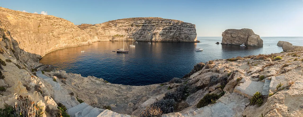
Malta, Gozo and Comino each offer something different. Malta carries the long coastal routes and the historic towns, Gozo is greener and quieter with the salt pans and the Ġgantija temples, and Comino is a small island loop around the Blue Lagoon. Distances and grades across the archipelago are set out in this collection of Malta hikes, and treating the islands as one trip is easy because the ferry from Ċirkewwa on Malta's northwestern tip reaches Mġarr Harbour on Gozo in 25 minutes.
When to go
Spring and autumn are the walking seasons, when the countryside is greener after the rains and temperatures suit long days on exposed ground. Summer heat is the real constraint: the Watch Towers route is quite exposed and noticeably tougher in the heat, and the same applies to the Dingli cliffs. If you walk between June and September, start at first light, plan a short route and avoid the midday sun.
Winter is walkable, but after rain the limestone paths become slippery and some trails turn muddy, so footwear with grip matters more than in dry months. Wind can transform an exposed cliff path even on a sunny day, and the coastal routes give you little shelter. On the coast, carry a light shell and check the wind before committing to a full-day traverse.
The Watch Towers Walk from Għadira
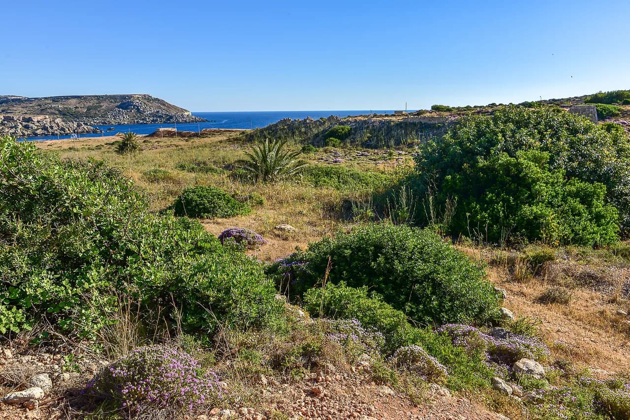
The longest of the classic Malta routes starts and finishes at Għadira, near the nature reserve on the island's northern coast. It runs 14.5 km (9 mi) and takes 2.5 to 4 hours, graded moderately hard. The trail climbs to the top of Marfa Ridge beneath St Agatha's Red Tower, crosses dry-farmed land, garrigue and wooded patches, passes a geological formation on a short detour, and returns past Paradise Bay.
The route is a mix of paved paths and rugged, rocky or sometimes muddy trails, with steep sections around the cliffs. It is exposed almost throughout, so wind and sun are the factors to plan around rather than the distance. Give it a full day and carry more water than the mileage suggests.
Dingli, Fawwara and Wied iż-Żurrieq
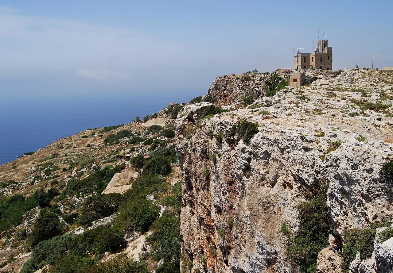
This 11.2 km (7 mi) walk takes about 3 hours and is graded easy to moderate, and it delivers the finest sea views on the island. The Dingli Cliffs stand 253 m (830 ft) above sea level and run for 2 km along the south coast, with the uninhabited islet of Filfla offshore. The route then passes through Fawwara's caves, wildflower meadows and fields toward the prehistoric temples of Ħaġar Qim and Mnajdra, ending at Wied iż-Żurrieq bay above the Blue Grotto.
Filfla is a wildlife preserve and off limits to visitors, so enjoy it from the cliff edge rather than planning a crossing. From the bay you can take a boat to the Blue Grotto or eat in one of the local restaurants before catching a bus. This is the route to choose if you want big views without a hard day.
The Salt Pans Walk from Victoria, Gozo
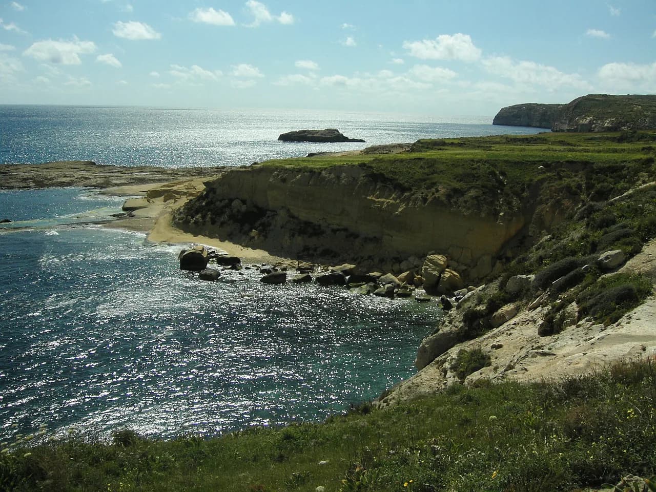
Gozo's best-known circular walk begins and ends in Victoria, the island's main town, which sits about a 20-minute bus or taxi ride from Mġarr Harbour. The 12 km (7.5 mi) route takes 2 to 3 hours and is graded moderate, crossing the green Sara valley on the town's northern edge before reaching the baroque Parish Church of St George. It then follows Wied il-Għasri down to the coast at Reqqa Point, where traditional salt pans are worked by evaporation, and continues past Xwejni Bay to Qbajjar Bay, which has restaurants and public conveniences.
The return leg crosses dusty country roads and valleys back to Victoria, where the central square is a good place to finish. Plan the walk around the ferry timetable rather than the other way round, since the crossing is your fixed anchor. If you want more time on the island, base yourself in Victoria and add another day from the Gozo walks collection.
Xagħra Heritage Trail on Gozo
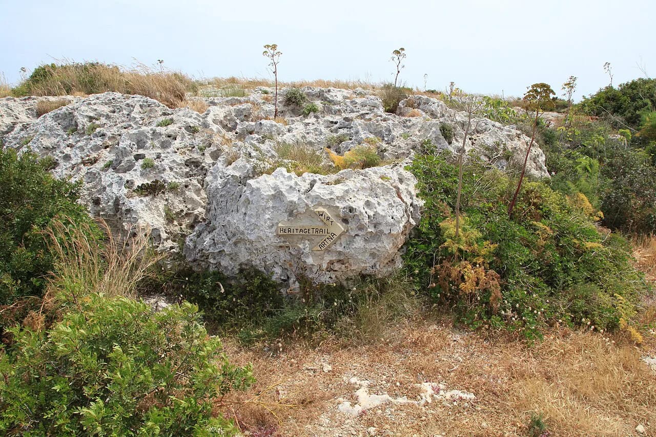
The Xagħra Heritage Trail is 6.8 km (4 mi) and takes about 2.5 hours, graded moderate, and most of that time goes on the sites rather than the walking. It links Calypso's Cave, the stalactites of Ninu's Cave, Xerri's Grotto, the Xagħra Stone Circle, a windmill and several churches. The highlight is the Ġgantija temple complex, a UNESCO World Heritage site built by a culture that flourished on the island between 3600 and 2500 BC.
The trail mixes country roads and established paths with uneven, rocky and steep sections, so it suits shoes with tread rather than sandals. Allow extra time if you want to enter the caves and temples. It is the best Gozo day for walkers who care more about history than distance.
The Windmills Walk from Żurrieq
This gentle 8.8 km (5.5 mi) circuit takes 2 to 3 hours at an easy pace and starts and finishes in Żurrieq's village square. It passes the Xarolla Windmill, one of the few with working mechanisms, along with the Ta' Marmara, Tas-Salib and Ta' Qaret windmills, the Ġibjun Gardens, the Wardija Watchtower, the hamlet of Bubaqra, Safi Parish Church and ancient rock-cut tombs.
Maltese windmills have a distinctive cylindrical tower attached to a two-storey house, and the island once had more than 69 of them. This route is the easy half-day option for a mixed-ability group, with village facilities at both ends. Pair it with the coast at Wied iż-Żurrieq if you want a longer day.
The Three Villages Walk through Attard, Lija and Balzan
The shortest route here is 7 km (4.3 mi) and takes 1 to 2 hours at a very easy grade, threading through the three central villages between Valletta and Mdina. In Attard you pass San Anton Palace and Gardens, now the President's residence, and in Lija the baroque palazzos include Villa Francia. Balzan adds narrow cobbled streets and townhouses with bright balconies and ornate doorways.
The timing reflects the leisurely character of the walk rather than its length, so budget for bakery and cafe stops. It is the route to choose on a hot day, with children, or as a rest day between coastal hikes. Buses connect the villages with Valletta and Mdina, which makes a one-way finish straightforward.
Comino Walk from the Blue Lagoon
Comino is the smallest island in the archipelago and its circular route is 7 km (4.3 mi), taking about 2 hours at an easy grade. It starts and ends at Bejn il-Kmiemen, the Blue Lagoon, and can be extended along the wild cliffs on the east side where few visitors go. The best panorama comes from the roof of St Mary's Tower, which opens to visitors when its flag is flying.
To limit overcrowding, visits to the Blue Lagoon require a free, pre-booked timeslot booked through blcomino.com. Hunting is not allowed on the island and vehicles are restricted to those used by residents, so the paths stay quiet away from the lagoon. Bring everything you need, because facilities are concentrated near the landing point.
Short coastal and countryside options
For a gentler coastal day, walk from Marsaskala to Marsaxlokk via Tas-Silġ, roughly 7 km across countryside before the fishing boats signal the finish. The waterfront in Marsaxlokk is the reward, with a table by the harbour a better ending than a bus stop. It suits first-time walkers and anyone combining a walk with lunch.
The Baħrija circuit in western Malta is the quiet alternative, starting near Tal Fiddien and passing the Victoria Lines, San Martin Chapel, the Church of the Immaculate Conception, Mtaħleb and Kunċizzjoni. There are no headline attractions, just country roads, cliffs and open views. Pick it when you want solitude rather than photo stops.
Which walk suits your fitness and time
For a first visit with limited hours, the Three Villages Walk and the Windmills Walk fit into half a day with little exposure. The Dingli route gives the best views for moderate effort, while the Watch Towers Walk is the long day, suitable for fit walkers who can handle a full day in the open. The Xagħra and Salt Pans routes reward a Gozo day, and Comino suits a short boat trip. If you enjoy this mix of short coastal and village trails and want to repeat the formula elsewhere, hiking in Cyprus offers Troodos peaks and Akamas coast walks in a similarly compact package.
Two short days can cover the main island, one cliff route and one village walk, leaving a third for Gozo or Comino. If you would rather have the logistics arranged, malta walking holidays come in guided and self-guided formats that differ mainly in how much of the transport, luggage and route planning is handled for you. Compare what each includes before choosing, since operators organise these differently.
Getting between trailheads
Buses run from the main centres to most of these trailheads, and several routes can be walked point to point. The Gozo Channel ferry from Ċirkewwa to Mġarr takes 25 minutes and runs year round, with a faster passenger-only catamaran from Valletta as an alternative. From Mġarr, buses and taxis reach Victoria in about 20 minutes.
Comino is normally reached by boat from Malta or Gozo, and the Blue Lagoon timeslot should be booked before you travel. On the main island, Mdina, Valletta, Żurrieq and Għadira all have bus connections, so you can leave the car behind. Check the Gozo Channel operator's timetable for the day you cross, as services vary by season.
What to carry and how to handle the hazards
Carry water, sun protection and shoes with grip for rocky, uneven limestone. Cliff edges along the Dingli and Marfa routes are unfenced in places, so keep back from the rim, particularly in wind. After rain, expect slippery rock and mud on the rougher sections.
Exposure is the main hazard: there is little shade on the coastal routes, and wind can make an easy path feel serious. Start early, turn back if the weather changes, and avoid committing to exposed sections in strong wind or midday heat. On Gozo and Comino, plan the return leg around the ferry or boat you intend to catch.
Where to base yourself
For the northern routes, Għadira and Mellieħa put the Watch Towers Walk on your doorstep. Dingli and Żurrieq suit the cliffs and temples, while Mdina and Rabat give you historic streets plus access to the countryside. Valletta and the harbour towns work well for the Three Villages Walk and for buses across the island.
For Gozo, Victoria is the obvious base: the Salt Pans Walk starts there and buses reach the rest of the island. Comino works as a day trip from either Malta or Gozo rather than a base. Arrange your accommodation around the routes you want most, not the other way round.
Plan Your Visit
Malta's walking is at its best in spring and autumn, when the cliffs, garrigue and villages are pleasant for a full day out. Choose one long coastal route, one village or windmill circuit, and at least one day on Gozo or Comino; that mix gives you the island's range without overloading your legs.
Book the Blue Lagoon timeslot before you travel, fit your days around the Gozo Channel crossings, and start early on exposed routes. The distances are modest, so the quality of your trip depends more on which route you pick for the weather than on how far you walk.
Explore more Malta hiking guides
Frequently Asked Questions
Is Malta good for hiking?
Yes. The islands are compact, well served by buses and ferries, and offer a range of routes from the 14.5 km Watch Towers Walk to the 7 km Three Villages stroll. Coastal exposure in summer is the main constraint, so spring and autumn are the best seasons for longer walks.
What is the best hike in Malta?
The Dingli, Fawwara and Wied iż-Żurrieq route is the standout for views: 11.2 km along the island's highest cliffs, past the Ħaġar Qim and Mnajdra temples, taking about 3 hours at an easy to moderate grade. For history, the Xagħra Heritage Trail on Gozo is hard to beat.
How long does the Dingli Cliffs hike take?
The walk is about 11.2 km (7 mi) and takes roughly 3 hours at an easy to moderate pace. Allow more time for stops at the cliffs, the cart ruts and the temples, and carry water because the route is exposed.
When is the best time to hike in Malta?
Spring and autumn give the best combination of green countryside and comfortable temperatures. Summer routes are exposed and shade is scarce, so if you walk then, start early and keep the day short. Winter is walkable but paths can be muddy after rain.
Can you hike on Gozo and Comino?
Yes. Gozo has the 12 km Salt Pans Walk from Victoria and the 6.8 km Xagħra Heritage Trail, while Comino has a 7 km circular route from the Blue Lagoon. Comino's Blue Lagoon visits need a free, pre-booked timeslot, so book before you travel.
Do you need a car to reach Malta's trailheads?
No. Buses link the main centres with trailheads such as Għadira, Żurrieq, Mdina and Marsaskala, and the Gozo Channel ferry plus a short bus or taxi ride reaches Victoria. A car adds flexibility for early starts, but is not essential.
How do you get to Gozo for hiking?
Take the Gozo Channel ferry from Ċirkewwa on Malta's northwestern tip to Mġarr Harbour, a crossing of about 25 minutes that runs year round. From Mġarr, buses and taxis reach Victoria in about 20 minutes. A faster passenger-only catamaran also runs from Valletta.
Sources
Trail notes for your next trip
Optional updates when we add or revise hiking guides.
You might also like
Continue reading
More guides you'll find useful