Malta Coastal Walks: Route Options, Distances and Seasons
Plan coastal walks in Malta: the full loop around the island, short cliff and harbour sections, distances, ascent, hazards and the best months to walk.
On this page
Malta rewards walkers who like options: you can circle the whole island over a week or more, or pick off short coastal days between harbour towns and cliff tops. The island is compact, buses link most trailheads and towns, and the sea is never far from the path. This guide separates the long circuit from the day walks so you can match a route to your fitness, your available days and the season you are traveling in.
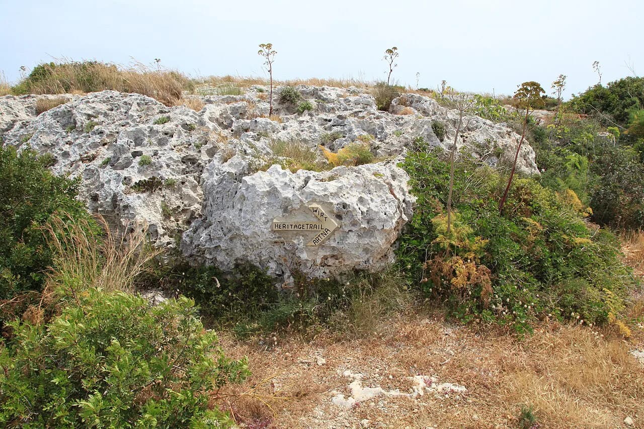
What Malta does not offer is a single waymarked coastal path from end to end. The full circuit stitches together coastal footpaths, minor roads and dirt tracks, and the walking is often pathless or signposted only intermittently, so a map and route file matter more than trail markers.
Why Malta suits coastal walking
Few European islands pack so much coastline into so little ground. Malta is one of the smallest countries in the world by area, which means coastal stages are short, towns with food and lodging sit close together, and a day on the cliffs can end with a bus ride back to your base. If you like the sound of linking short coastal stages between harbours and cliffs, hiking in Sardinia offers a comparable island-scale approach.
That compactness also makes the walking flexible. You can treat the island as one continuous route or as a menu of half-day and full-day sections, stringing together harbour towns, bays and cliffs without needing to carry a tent or commit to back-to-back big days.
Buses are the key to this flexibility. Instead of moving hotels every night, you can settle in one well-placed town and ride out to the start of each walk, which usually works out cheaper and simpler than a nightly change of address. If you would rather have the logistics handled, guided and self-guided options exist, and our guide to malta walking holidays explains what each format typically includes.
The full circuit: the Malta Coastal Walk at roughly 155 km
The route known as the Malta Coastal Walk runs around the entire island, described by its route pack as a 155 km (96 mi) circuit that is interesting, safe and varied. Treat that as the reference line rather than a fixed trail: it links existing paths, roads and tracks rather than following a built coastal way.
One documented walk of the island came in just short of 150 km (93 mi) with around 2,400 m (about 8,000 ft) of climbing over ten days of walking. Broken that way, the daily distances are modest and the ascent is spread thin, which is why the circuit suits hikers who want sightseeing alongside walking rather than a hard endurance challenge.
Pacing is the main decision. A slow ten-day circuit leaves room for rest days, town visits and detours; hikers comfortable with roughly 20 km (12 mi) days can compress the route, and one account suggests six or seven days would have been enough for a faster party.
For broader route planning across the island's paths, lifts and towns, start with our hiking in malta overview and then choose which sections of the circuit to walk in full.
Stage logic: where short days work and where the scenery thins
The island loop divides naturally into short days, some as little as 10 or 11 km (6 to 7 mi). That makes it a good fit if you are building up distance, carrying a light pack, or traveling with someone who prefers a slower pace.
Not every kilometre earns its place. The western and southern cliffs, the harbours and the approach to Valletta carry the scenery; industrial estates, working ports and stretches alongside main roads carry the filler. A route that links everything on foot will include some of the duller ground, while a selective itinerary that buses past it keeps the quality high.
Accommodation follows the same pattern. Valletta, Marsaxlokk, St Paul's Bay and St Julian's give plenty of choice, but the quieter stretches around Dingli and Golden Sands have thin pickings, and staying in Rabat and riding the bus to the coast is often the better solution.
The trade-off is simple: a clean full circuit means accepting some road and port walking, while a curated version means shorter walks and more bus time. If you only have a few days, build the itinerary around the coast between the Blue Grotto and Dingli and the east-coast harbours, and skip the rest without regret.
Valletta to the Three Cities: an urban link better done by boat
The capital sits at the heart of any island circuit, and the crossing to the Three Cities is one of its most atmospheric moments when you arrive by water. Walking the whole link is the weaker option: the direct route runs through town, industrial ground and roadside verges, and the coast itself is cut off by port land.
Do the practical thing instead. Explore Valletta in the morning, then take a boat across the harbours to the Three Cities and walk the lanes of Birgu, Senglea and Cospicua on foot. You get the historic arrival, the waterfront, and none of the road slog.
This is also the natural place to start or finish a multi-day route, since Valletta has the densest transport and lodging on the island. If you are linking Malta with its smaller neighbor, our comino walk guide covers the island between Malta and Gozo, reached via the Ċirkewwa ferry terminal in the north.
Marsascala to Marsaxlokk Bay: east-coast harbours, bays and cliff paths
The walk between the two east-coast fishing harbours is one of the best short days on the island: a moderately difficult rural route taking around four hours between Marsascala and Marsaxlokk Bay. It passes bays you can only reach by boat, clifftop ground and old cave dwellings still in use, which gives it more variety than its length suggests.
Both ends are towns with restaurants, buses and lodging, so you can walk it one way and ride back. Marsaxlokk's fish market and waterfront make a good finish, and the morning light on the limestone is at its best if you start early.
This section also works as part of a longer east-coast run, connecting north toward the Three Cities or south toward Zurrieq. Carry water: the path crosses open ground with little shade, and the settlements are not evenly spaced.
Zurrieq to Siggiewi: a 14 km south-coast day with swimming stops
The south coast day from Zurrieq to Siggiewi covers around 14 km (8.7 mi) and takes most of a day, with Mediterranean views for much of the way. It is designed to be broken by swimming, so pack accordingly if you walk it in the warmer months.
The section near the Blue Grotto and on toward Dingli is among the strongest scenery on the island, which is why a common plan is to bus past the industrial ground around Birzebugga and Zurrieq and start walking from the coast near the grotto.
Zurrieq has limited lodging, so many walkers base themselves elsewhere and treat this as a day out. Siggiewi and the Rabat area give more choice, and both connect by bus.
Buskett Gardens and Dingli Cliffs loop: about 3 hours to the island's high point
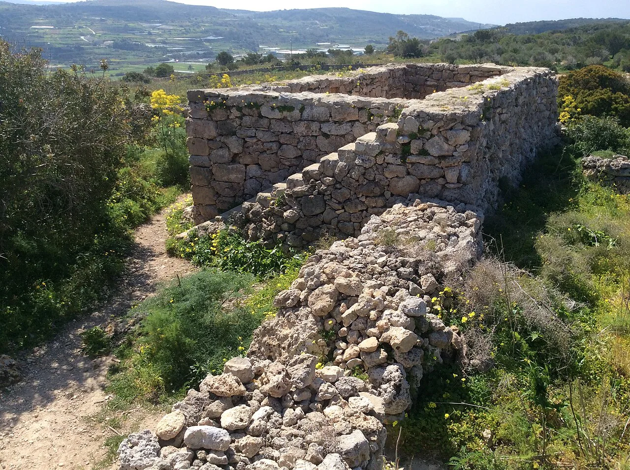
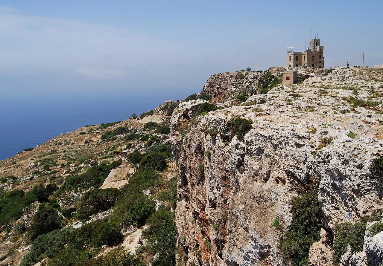
A loop from Buskett Gardens out past Ta' San Gorg caves to the Dingli Cliffs and back covers the island's highest ground in around three hours. It is a compact half-day with a bit of everything: woodland shade at the start, cave mouths in the cliff face, and open clifftop at the turnaround.
The cliffs themselves are viewed rather than walked on the edge; the approaches are where you need care, with steep drops, paths running close to the rim and a few spots that need hands. Wear proper shoes and keep well back from the edge.
Buskett is easiest to reach from Rabat, which also has the best spread of lodging near this part of the island. If you prefer company and a planned itinerary, check whether a Dingli Cliffs day features in the guided programs listed on our malta walking holidays page.
St Paul's to St Julian's: a road-heavy northern link worth skipping by bus
The northern link between St Paul's Bay and St Julian's is the weakest stretch of the circuit. A large part of it runs alongside a road, and while the last few kilometres into St Julian's are attractive, the middle is not worth your time if days are short.
Take the bus if you are completing the loop, or simply treat St Julian's and Sliema as a separate urban walk. The seafront from Sliema around to St Julian's gives you marina views, cafés and swimming spots without the roadside miles.
For a gentler northern outing, the Għadira Nature Reserve area near Mellieħa pairs well with the beaches and the ferry crossing to Gozo. Our hiking in malta guide sets out how the northern reserves and coastal paths fit together.
The Victoria Lines: an unmarked fortified line across the island in about 8 hours
The Victoria Lines are a chain of fortified walls and trenches running across the island, and walking their length takes around eight hours. They are not marked on maps and are broken by gaps, so you cannot simply follow them end to end without plotting your own line in advance.
Treat this as a full day of rough, varied walking with a route file and a map, and plan an exit point. The line crosses the whole island, which means buses can pick you up from several points along the way if you run out of daylight or energy.
Access, buses and where to base yourself
Bases matter more than stages on Malta. Valletta gives you the best transport hub and the historic center; Marsascala, Marsaxlokk and St Julian's put you on the water with plenty of restaurants; Rabat sits close to Mdina, Buskett and the Dingli cliffs and has good lodging.
For the northwest, Mellieħa has more choice than Golden Sands, where a single large hotel serves the bay. Booking outside high season opens up cheaper rooms and quieter paths, and the bus network means you can stay in one town and reach most coastal starts without a car.
Parking exists at popular coastal trailheads but fills quickly in summer, and buses are the simpler option for one-way walks. Check the current routes and timetables with the island's public transport operator before you commit to a stage that depends on a specific bus.
Distance, ascent and time: what a full circuit adds up to
The circuit is usually described as 155 km (96 mi). A ten-day walk of the island came in just under 150 km (93 mi) with roughly 2,400 m (8,000 ft) of ascent, which gives you a realistic picture of daily load: short distances, modest climbing, and plenty of time for stops.
A faster hiker can complete the loop in six or seven days, which means roughly 21 to 25 km (13 to 16 mi) a day on a route of just under 150 km. That pace leaves less room for sightseeing and makes the bus-skip decisions more important, since the duller stretches cost more when every day is long.
Walking time on the short days follows the terrain rather than a formula: the Marsascala to Marsaxlokk section runs to about four hours, the Dingli loop about three, and the Zurrieq to Siggiewi day fills most of a day at 14 km. Add time for cliff-edge sections, where surefootedness slows you down.
Hazards and terrain: cliff edges near Dingli, clambering and surefootedness
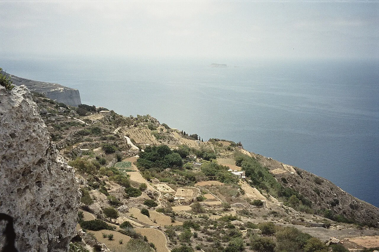
The approach to Dingli is the section that demands most attention: steep drops, paths close to the rim and a few rocky steps needing hands. The cliffs themselves are fenced off by their own geometry, but the ground leading to them is exposed and not for anyone uneasy with heights.
Elsewhere the island is generally moderate. Good fitness, hiking confidence and sure feet are the baseline, with decent shoes rather than trainers, and care on loose limestone and wet rock.
Navigation is the other real hazard. Paths marked on maps are sometimes cut by building work or blocked by gates and private-land signs, so carry a route file, a map and a power bank, and be ready to reroute onto roads when a coastal line fails.
Walking alone is common outside the busier spots such as the Dingli cliffs, so tell someone your plan and avoid finishing in darkness. Malta is small enough that help is rarely far away, and buses give you a bail-out option on most stages.
When to go: spring and autumn versus summer heat and winter mud
Spring and autumn are the sweet spots, with March and April and September and October offering warm but walkable conditions with the sea still inviting. That combination is the reason the island works so well for coastal walking outside the peak tourism months.
Summer heat makes July and August uncomfortable for anything beyond early-morning or short coastal strolls, with little shade on the cliff paths. Winter walking is possible and mild, but storms turn tracks to mud quickly and rain can disrupt the exposed sections.
Build weather flexibility into the plan: keep one or two short days in reserve for the best conditions on the Dingli cliffs and the south coast, and accept that wind and rain can push a coastal day inland.
Lodgings on the route: hotels, guesthouses and booking outside high season
Malta has plenty of lodging along the coast, from hotels in Valletta and St Julian's to guesthouses in Rabat and Marsaxlokk. Rates swing widely with the season, and booking outside high summer gives you more choice and better value.
Some stretches are thin: Dingli has little on offer, Golden Sands has a single large hotel, and Zurrieq is limited. Plan around those gaps by staying in Rabat, Mellieħa or Sliema and using buses rather than forcing a hotel into every stage.
Food and water are easy in towns but scarce on the path, so carry lunch and refill before you set out. Bakeries open early, and most towns have a grocery store for picnic supplies.
Continuing on Gozo: the compact coastal walk on the smaller island
Many walkers who finish the Malta circuit take the ferry north for the smaller island's coastal path, which is more defined and works well as a three-day add-on. Our gozo walks guide covers the stages and bases on the island, including the Gozo Coastal Walk and the cliffs above Ramla Bay.
The crossing from Malta is short, and the contrast is part of the appeal: quieter roads, tighter coastal paths and a slower pace. It's worth adding if you have the days, though it sits outside the Malta circuit itself.
Plan Your Visit
Choose your Malta coastal walk by the days you have and the season you walk. A full circuit of roughly 155 km over six to thirteen days suits hikers who want the whole island, while a menu of short days fits anyone with a long weekend or a preference for cliff tops and harbours over road miles.
Build the itinerary around the western and southern cliffs, the east-coast harbours and the boat approach to the Three Cities, and skip the road-heavy northern and industrial stretches by bus. Base in Rabat, Valletta or Mellieħa, carry a route file, and keep a spare day for the best weather.
Frequently Asked Questions
Is there an official coastal trail in Malta?
No single waymarked path runs around the island. The Malta Coastal Walk is a described route that links existing coastal footpaths, minor roads and dirt tracks into a continuous circuit of roughly 155 km (96 mi), and long stretches carry no trail markers. Plan with a map and a route file, and expect to reroute where paths are cut by building work or closed by private-land gates.
How long does it take to walk around Malta?
Most walkers spread the circuit over six to thirteen days. One ten-day walk of the island covered just under 150 km (93 mi) with about 2,400 m (8,000 ft) of ascent, which keeps daily distances modest and leaves time for towns and rest days. Hikers comfortable with roughly 20 km (12 mi) days can compress the loop into six or seven days.
What is the best time of year for coastal walks in Malta?
Spring and autumn give the best balance, with March and April and September and October offering warm walking and sea temperatures that still invite a swim. July and August are too hot for long cliff days, and winter can bring storms that turn tracks to mud, though mild, walkable days do occur between them.
How difficult are Malta's coastal walks?
Most of the route is moderate walking on coastal paths, tracks and roads, with short daily distances and modest climbing. The exception is the ground approaching Dingli, where steep drops, paths close to the rim and a few rocky steps demand sure feet and proper shoes. Navigation is the harder skill, since markers are sparse and some mapped paths are blocked.
Can you walk Malta's coast in a day?
Not the whole island, but several coastal sections fit comfortably into a day. Marsascala to Marsaxlokk Bay takes around four hours, the Buskett Gardens and Dingli Cliffs loop about three hours, and Zurrieq to Siggiewi covers around 14 km (8.7 mi) over most of a day. Buses at both ends let you walk one way and ride back.
Where should you stay for coastal walking in Malta?
Rabat works well for the Dingli cliffs, Buskett and Mdina, Valletta for the harbours and the Three Cities, and Mellieħa for the northern coast and the Gozo ferry. Marsascala, Marsaxlokk and St Julian's put you on the water with plenty of restaurants and buses. Staying in one town and riding out to each trailhead is often simpler than moving hotels every night.
Sources
Trail notes for your next trip
Optional updates when we add or revise hiking guides.
You might also like
Continue reading
More guides you'll find useful