Hiking in Spain: 8 Great Trails and Where to Start
Plan hiking in Spain across the Picos de Europa, Pyrenees, Sierra Nevada, Mallorca and the Canary Islands, with trail lengths, access and the best months.
On this page
Spain fits an unusual spread of hiking into one country: limestone gorges and high peaks in the north, dry Sierra Nevada summits in the south, and volcanic island terrain offshore. That range means your trip shapes itself around your fitness and your season rather than one flagship trail. A hiker with a week can walk a classic day route or two in the north, while a winter visitor heads south or to the islands.
The northern mountains stay green through summer, the interior mixes flat ground with high ranges, and the far south and the islands walk well even in winter. The country is generally well marked, and a GPX track lets you set your own pace where signage thins.
Where hiking in Spain fits by region and season
Think of the country as three hiking zones. The north, from Galicia and the Picos de Europa across the Basque Country and the Pyrenees, is green and damp and best in the warmer months. The interior, including Cuenca and the Sierra de Gredos, offers gorges, granite peaks and quiet paths. The south and the islands, from Andalusia to Mallorca and the Canaries, carry milder winter weather.
April through June and September into October are the broadest windows for walking across the country — the shoulder seasons carry warmth without the summer heat, which can push past 40°C in some regions.
That season logic sets the order of everything below: Picos and Pyrenees hikes get summer and early autumn, Andalusia and the islands get winter and spring, and the Camino runs year-round with a spring-to-autumn preference. For the northern range specifically, the Pyrenees hiking guide breaks down the best trails, bases and seasons. Group your route choices by that fit before you fix dates, and the transport and hut planning follows.
Picos de Europa: the Ruta del Cares between Poncebos and Caín
The Ruta del Cares is a 12 km (7.5 mi) day walk cut into the rock of the Divine Gorge between Poncebos and Caín, spanning the border of León and Asturias. The trail is linear, so you finish at the opposite end from your start, and the path hugs a gorge wall for much of the way.
Because the endpoints differ, the return matters more than the walking. This is remote mountain country where a car gives you the most freedom: park at one end, arrange a pickup or second vehicle at the other, and use the drive back to explore the villages along the way.
The Picos sit in Spain's oldest national park, with steep limestone peaks and deep gorges, and trails here are well marked. Weather changes quickly, so pack a warm layer and carry enough water for the exposed gorge section. If you want a multi-day version, the Horsetail Route to the Refugio de Góriz gives you a hut night above the valley.
Picos de Europa: the Horsetail Route to the Refugio de Góriz
The Horsetail Route climbs from the Ordesa side toward the Refugio de Góriz, gaining height through a glacial amphitheater with waterfalls and cliffs. It is a mountain walk with sustained uphill and sections of loose ground, and it rewards fit hikers who want a hut at the top rather than a valley return.
An overnight at Góriz turns the route into a two-part day and puts you in position for an early start the next morning. Treat the hut as a basic mountain refuge: reserve through the Góriz refuge management ahead of a summer date, carry your own sleeping liner, and check hut opening and reservation rules with the refuge before you rely on a bed.
The climb is exposed to afternoon storms, so start early and be off the highest ground by midday. The return descent is hard on the knees, and poles help on the steep sections.
Pyrenees: Pico Sobarcal and the summit skills it demands
Pico Sobarcal stands inside the Spanish Pyrenees near the French border, with a summit at 2,259 m (7,411 ft) and a 14 km (8.7 mi) round trip. The last section climbs steeply and calls for real mountaineering skills and gear, so this is a route for hikers with scrambling experience rather than a first summit.
Access is remote, and a rental car is the practical way to reach the trailhead. If you plan to combine Sobarcal with other Pyrenees days, base yourself in a valley town with road access and use the drive in as part of the day. Snow can linger on the high passes into early summer and return in autumn, so check conditions with the park before a shoulder-season attempt.
If you have ambitions beyond Spain, the GR11 traverses the Spanish Pyrenees and is a different commitment entirely; the broader best hikes in europe list is the place to see how it compares with long routes in other countries and how to fit it into a longer trip.
Sierra Nevada: Mulhacén from Capileira
Mulhacén rises to 3,479 m (11,414 ft), the highest point in mainland Spain and the whole Iberian Peninsula. The easiest one-day approach uses a bus from Capileira up to the Mirador de Trevélez, from where the summit climb takes roughly three hours.
The height is the main difficulty: at this altitude the air thins, and even a fit hiker moves slowly on the final pull. Walk it in the warmer months, start early, and carry more water than the distance suggests. The bus from Capileira is a seasonal mountain service, so check the timetable before planning around it.
Capileira works as the base for the peak and for shorter walks in the Sierra Nevada; Granada is the city gateway. Plan the bus up and the walk down as one linked day, or stay in Capileira and spread the effort over two.
Catalonia: Montserrat and the Sant Jeroni route
Montserrat is a mountain and monastery complex in Catalonia, easily reached as a day trip from Barcelona by train. Several routes climb to the monastery, and the Sant Jeroni route is the strongest choice, using a funicular to gain height before the final climb.
From the top you get views over the Pyrenees and the valleys of the surrounding natural park, plus a visit to the monastery itself. Check the funicular operating season before you rely on it; without the lift, the route starts lower and the day gets longer.
The train from Barcelona makes the trailhead reachable without a car, and the walk is a straightforward day outing for hikers of moderate fitness. Come early on weekends, when the monastery complex draws crowds.
Andalusia: the Caminito del Rey in the Desfiladero de los Gaitanes
The Caminito del Rey runs through the Desfiladero de los Gaitanes, a gorge carved by the Guadalhorce river near Málaga. The 8 km (5 mi) trail follows walkways pinned to a cliff face, some 100 m (328 ft) above the gorge floor, and the restored path is a linear day walk.
A ticket is required, and the walkways sell out, so book weeks or months ahead for a fixed date. A helmet is issued for the walkway, and allow at least 3 to 4 hours for the full route. The ticket price and booking windows change, so confirm them on the official Caminito site when you book.
Independent access works well: take the train from Málaga to El Chorro village, then the shuttle bus to the trail entrance. Guided day trips from Málaga, Granada and Seville include transport to the trailhead, which suits hikers who would rather not coordinate the shuttle.
Mallorca: the GR221 through the Serra de Tramuntana
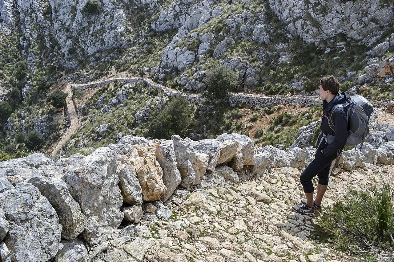
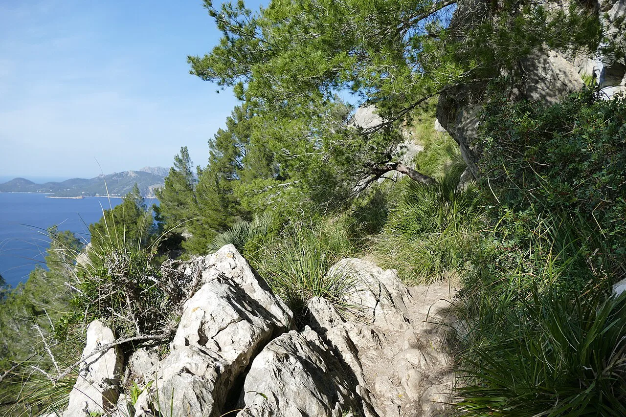
The GR221, known as the Dry Stone Wall route, runs 135 km (84 mi) through the Serra de Tramuntana, from Port d'Andratx to Port de Pollença. Most hikers complete it in about eight sections, which works out to just over a week of walking.
The trail climbs sharply from the coastline and links villages such as Esporles, Deià and Port de Sóller, all with food and accommodation. Walk the full route or pick a section or two as a short multi-day trip. Spring and autumn suit the island best, when temperatures are more comfortable than midsummer.
Accommodation is in villages and small hotels rather than mountain huts, so plan your stages around the beds you can book and reserve ahead in the popular months. Spring and autumn suit the island best, when temperatures are more comfortable than midsummer.
Canary Islands: La Palma, Tenerife and La Gomera
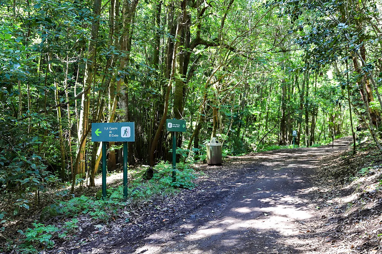
The Canary Islands add volcanic terrain to Spain's hiking menu. La Palma has craters, volcanic rock and green valleys, with the Caldera de Taburiente National Park the standout area. Tenerife pairs the black lava fields of Teide National Park with the green, humid forests of the Macizo de Anaga, and La Gomera mixes laurel forest, cliffs and old village paths.
An official long-distance trail, the GR131, links some of the most beautiful places across the islands, so you can walk a multi-day route island by island. Winter is the big advantage here: the climate is milder than the mainland and trails stay walkable in the middle of winter. Trails are well marked and the islands are compact enough to sample several routes in one trip.
Galicia, Costa Brava and Cuenca: lower, quieter hiking days
Galicia is green, damp and hilly, with old villages and ruined monasteries hidden in the landscape, and trails away from the pilgrim routes where you will hardly meet anyone. The Costa Brava offers the Camí de Ronda, a coastal path along rocky ground, hidden coves and Mediterranean viewpoints, and the mix of sea, hills and villages suits both short walks and longer hiking days.
Cuenca is best known for its old town perched on rock, but the surrounding landscape has deep gorges, rock formations and wide viewpoints on well-marked, easy trails. North of the city, the Parque Natural de la Serranía de Cuenca adds forests, cliffs and river valleys for longer days. Anyone who has walked the Fisherman's Trail in Portugal will recognize the appeal of a coastal path you can finish in a day.
If you prefer mountain days to coastal ones, walks in italy covers the Alps and Apennines and shows how Spain's northern ranges compare with classic alpine terrain.
The Camino de Santiago as a long-distance option
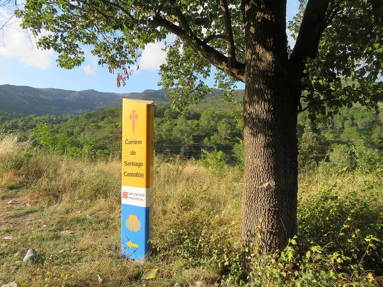
The Camino, or camino de santiago, is Spain's signature long-distance route, and it is a different format from a mountain hike. The pilgrim trails are well marked with yellow arrows and blue signs, and the infrastructure is organized, so you can walk for weeks without complicated planning.
Routes vary in length, and the Camino Francés is the most popular, starting at Saint Jean Pied de Port on the French border. The Portuguese Coastal Camino is flatter and offers beach views. All the trails converge at the Cathedral in Santiago de Compostela in Galicia.
Expect villages, country roads and vineyards rather than wilderness — a Camino is not usually a nature hike. That makes it a good pick for hikers who want daily distances and beds sorted, and a poor fit for those chasing summits.
Huts and overnight options
Hut-based routes in Spain are mostly in the high mountains. The Refugio de Góriz on the Horsetail Route is a basic mountain refuge with bunks, and huts throughout the Pyrenees and Picos are typically run by alpine clubs or park operators.
Book ahead for summer dates through the mountain hut, and carry a sleeping liner and cash for extras; hut opening seasons vary and are published each year. On lower and coastal routes, including the GR221 and the Canary Islands, you stay in villages and small hotels, so plan stages around what you can reserve.
If you prefer a fully supported format, guided and self-guided trips combine the trail with booked lodgings and luggage transfer; they cost more but remove the daily logistics.
When to go
April through June and September into October are the broadest windows for walking in Spain, with warm weather and less of the summer heat. The north stays green through summer, so Picos and Pyrenees trips work in July and August if you start early and watch the afternoon storms.
The south and the islands walk well in winter, when Andalusia's climate is mild and the Canaries stay comfortable. Avoid the high Sierra Nevada in deep winter unless you have snow skills, and treat midsummer in the south as a dawn-to-midday affair.
Getting to trailheads
Public transport reaches more Spanish trailheads than you might expect. Montserrat runs a train from Barcelona and a funicular up the mountain, Mulhacén uses a bus from Capileira to the Mirador de Trevélez, and the Caminito del Rey pairs a train to El Chorro with a shuttle to the entrance.
The Picos de Europa's Ruta del Cares and the Pyrenees summit routes are best served by car, because the trailheads are remote and the linear descents need a pickup. Joining a guided day trip is the simplest car-free solution for the Caminito del Rey.
For long-distance travel between regions, trains and coaches connect most of Spain, and booking through a rail or coach comparison site makes it easy to compare routes from France or Portugal.
What to pack and how to handle exposure
Pack UV sunglasses and high-factor sunscreen, good trail shoes, insect repellent and a filter bottle or water treatment, and carry a warm layer even on warm days in the north. Water is scarce on high routes such as Mulhacén, so carry more than you think you need.
Exposure, scrambling and snow are the real hazards. The Caminito del Rey walkways hang above a gorge, Pico Sobarcal demands mountaineering gear on the summit section, and snow lingers on Pyrenees passes early and late in the season. Afternoon storms build quickly in the mountains, so plan to be off high ground by midday.
Tell someone your route and return time before you set off, especially on solo walks and on the linear gorge routes where a missed pickup can strand you.
Base towns and which hikes each serves
For the Picos de Europa, stay in a village in the Cares valley for the gorge walk and the Horsetail Route, and use the local roads to reach both trailheads. For the Sierra Nevada, Capileira is the base for Mulhacén and shorter walks, with Granada as the city gateway. For Montserrat, Barcelona works as a base because the train and funicular do the climbing.
On Mallorca, base yourself in the Serra de Tramuntana villages — Esporles, Deià or Port de Sóller — and walk the GR221 in stages. On the Canaries, pick one island as a base and use ferries between La Palma, Tenerife and La Gomera only if you have time. Galicia and the Costa Brava suit slower trips, with coastal towns as bases for day walks.
Plan your Spanish hiking trip
Start with the season, not the trail. If your dates are fixed to summer, head north to the Picos, Pyrenees or Galicia, where the weather stays greener and cooler. If you are traveling in winter, look south and to the islands, where Andalusia and the Canaries keep trails walkable. The same season-first logic shapes hiking in Switzerland, where summer conditions decide which alpine routes are open.
Then match the route shape to your logistics: linear walks like the Ruta del Cares and the Caminito del Rey need a return plan, summits like Mulhacén and Sobarcal need an early start and the right gear, and long routes like the GR221 and the Camino reward a week or more. Whatever you choose, book the tickets and huts that sell out first, check opening seasons in advance, and leave room for a rest day.
Frequently Asked Questions
What is the most famous hiking trail in Spain?
The Camino de Santiago is Spain's best-known long-distance route, with several variants converging at the cathedral in Santiago de Compostela. For a single day hike, the Caminito del Rey and the Ruta del Cares are the two most recognizable.
How long does the Caminito del Rey walk take?
Allow at least 3 to 4 hours for the full 8 km route through the Desfiladero de los Gaitanes, including the walkways and the approach paths.
Do you need a ticket for the Caminito del Rey?
Yes. A ticket is required and the walkways sell out, so book weeks or months ahead for a fixed date, and confirm the booking process on the official Caminito site.
What is the best month to hike in Spain?
April through June and September into October give the broadest comfortable conditions across the country. The north stays green in summer, while the south and the islands are at their best in winter and spring.
Can you hike in Spain in winter?
Yes. Andalusia has a mild winter climate, and the Canary Islands stay walkable through the middle of winter. High routes in the Sierra Nevada, Pyrenees and Picos need snow skills or a change of plan.
How hard is Mulhacén?
It is a tough day hike. At 3,479 m the altitude is the main difficulty, and the easiest approach uses a bus from Capileira to the Mirador de Trevélez, from where the climb takes roughly three hours. Walk it in the warmer months and start early.
How many days does the GR221 take?
Most hikers complete the 135 km route in about eight sections, which works out to just over a week. You can also walk individual stages as a shorter trip, staying in villages along the way.
Is the Camino de Santiago a mountain hike?
Not usually. The Camino routes pass through villages, country roads and vineyards rather than high mountains, though some stages cross hilly terrain. For summit routes, look to the Picos, Pyrenees and Sierra Nevada instead.
Sources
Trail notes for your next trip
Optional updates when we add or revise hiking guides.
You might also like
Continue reading
More guides you'll find useful