Carros de Foc: The Pyrenees Hut-to-Hut Loop Guide
Plan the Carros de Foc hut-to-hut loop in the Catalan Pyrenees: six stages, daily distance and ascent, refuge nights, and the T4 terrain to expect.
On this page
The Carros de Foc is a circular hut-to-hut route connecting every mountain refuge in Aigüestortes i Estany de Sant Maurici National Park, high in the Catalan Pyrenees. The classic loop runs about 65 km (40 mi) with roughly 3,730 m (12,240 ft) of ascent across six days of walking, and it suits hikers who already have multi-day experience and are comfortable on rocky, occasionally technical ground. If you are weighing up other multi-day options across the range, our guide to hiking in the Pyrenees puts this loop alongside the long-distance routes. For a warmer, island alternative to the Pyrenees, hiking in Mallorca offers coastal mountain trails in the Serra de Tramuntana.
Unlike the GR10 or other point-to-point Pyrenean traverses, the Carros de Foc is a closed circuit: you start and finish in Espot, using the same trailhead. That makes logistics simpler, but it concentrates the hardest stages in the middle of the week, when your legs are tiredest. Read the stage figures for each leg of the route so you know where the long descents fall before you book refuges.
What the Carros de Foc loop is and who it suits
The route took shape in 1987, when the refuge caretakers of the park began visiting each other's huts, creating a circular walk that links all nine refuges. Most of the route follows T2 terrain, where paths are clear but uneven and rocky, and a handful of stretches reach T4, steeper and rougher with hands-on scrambling. The full six-day itinerary comes in at 64.3 km (39.9 mi) with 3,730 m (12,240 ft) of ascent and the same descent, averaging about 10.7 km (6.6 mi) and 622 m (2,040 ft) of climbing a day.
You need a good base of fitness, because individual days swing between 7.9 km and 13.8 km, and the opening climb alone gains more than 1,000 m. If you have done hut-to-hut hiking before and can carry a full pack over rough ground for four to five hours a day, the loop fits. If you are new to multi-day walking, study a shorter Pyrenees hut to hut hiking itinerary first.
Where the circuit runs and how long it takes
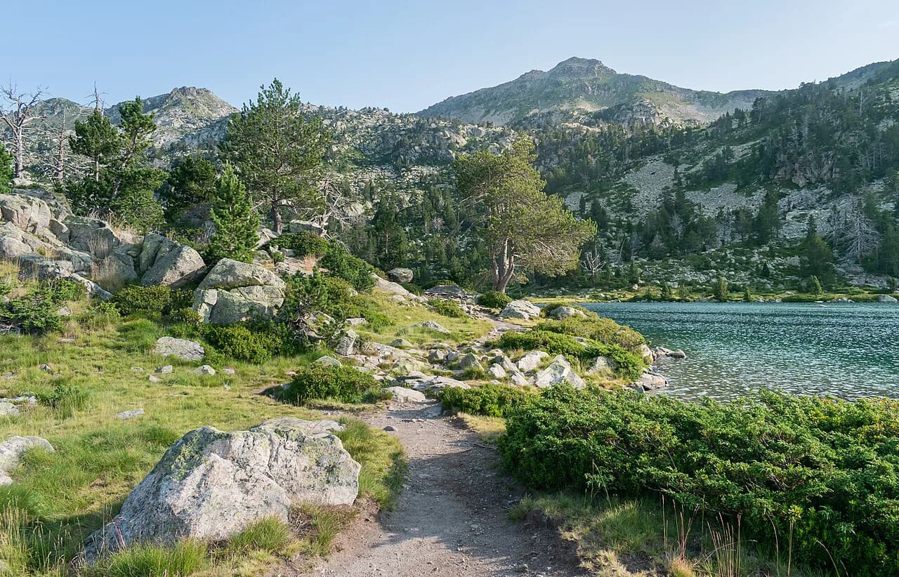
The loop sits entirely inside Aigüestortes i Estany de Sant Maurici National Park, the only national park in Catalonia and one of the largest protected areas in the Catalan Pyrenees. It starts and ends at Espot, the main base village on the park's eastern edge, and passes through lake-filled valleys beneath peaks that top out above 2,300 m (7,550 ft) on the first day's climb.
Walking time averages about four hours and forty minutes a day on the standard itinerary, but that is moving time for a steady hiker; the fastest and slowest stages run from three hours forty minutes to five hours thirty minutes. Signposted times on this circuit tend to be optimistic for loaded packs, so add margin to the longer days. You can also add a rest day or split a stage if you want a more relaxed pace.
Getting to the trailhead at Espot
Espot is a small village in the Pallars Sobirà region, reached by road from Lleida or Barcelona. The first day's walk begins on an asphalted road out of the village before turning onto forest paths, which means you can start directly from your accommodation or a nearby parking area. If you are driving, leave your car in Espot for the duration of the circuit, and return there at the end.
The first section of the route follows the road and easy forest paths, so it is possible to shorten this part by taking a taxi from Espot toward the higher trailhead, cutting out the tarmac and some of the early climb. Taxis need to be arranged in advance; ask your accommodation or a local operator. There is no rail link to Espot, so most hikers arrive by car or bus from Lleida or Barcelona.
Stage by stage: distance, ascent and walking time
The six-day itinerary is the most common format, but stages can be shortened or combined if you have more or less time. Day 1 is the biggest single climb, Day 4 has the most technical ground, and Day 6 finishes with a long descent of 1,340 m. Plan your rest stops around the two 11 km-plus days and the 13.8 km final day.
Day 1: Espot to Refugi d'Amitges
Distance 11.8 km, ascent 1,040 m, descent negligible, about 4 hours 20 minutes. This is the longest sustained climb of the week and it starts on asphalt before moving onto forest paths and boardwalk sections. At around 4.8 km you cross a boardwalk and bridge area, and at 7.5 km you reach the first lake. The path becomes steeper and rockier after about 8.3 km as you approach Lake Ratera and climb past two small sister lakes to the hut at 2,340 m.
Do not treat this as a warm-up; start early and pace yourself on the tarmac. A taxi shortcut makes the most sense here if you are short on time or want to avoid the road walk, saving several kilometres and a few hundred metres of ascent. Give yourself a buffer for afternoon thunderstorms, which build quickly on this side of the park in summer.
Day 2: Refugi d'Amitges to Refugi Colomèrs
Distance 10.7 km, ascent 520 m, descent 740 m, about 4 hours 45 minutes. The day crosses open, rocky terrain with occasional rubble fields, then descends into a wide, lunar-looking valley after about 2.8 km. Near Lago de Naut there is a short hands-on scrambling section, followed by roughly 2 km of flatter walking before the path climbs again toward Tuc Gran de Sedrosa. The final kilometres are a T3 section down to Refugi Colomèrs beside the lake.
Watch your footing on the rubble; it is slow, ankle-turning ground. The Colomèrs valley is one of the most scenic sections of the loop, with numerous small lakes and quiet, open ground. If you have energy left, the short walk to the lake shore near the hut makes a good sunset stroll before dinner.
Day 3: Refugi Colomèrs to Refugi Ventosa i Calvell
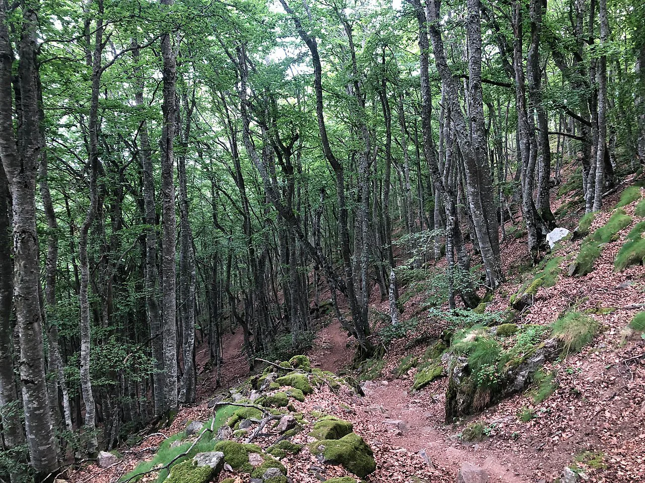
Distance 7.9 km, ascent 520 m, descent 460 m, about 3 hours 40 minutes. This is the shortest stage of the classic six-day route, which makes it a good half-day or a chance to sleep in. It starts directly from the lake with a steady climb that steepens toward Tuc deth Cap deth Pòrt de Caldes, the high point of the day at around 3 km. After that the path descends and then climbs once more before a longer descent on a T2 trail through greener terrain to Refugi Ventosa i Calvell.
Because this day is short, many hikers use it to dry gear and rest before the technical ground ahead. If you are carrying a heavy pack, this is the day to reorganise your load for the T4 section coming on Day 4.
Day 4: Refugi Ventosa i Calvell to Refugi de l'Estany Llong
Distance 8.8 km, ascent 650 m, descent 850 m, about 4 hours 55 minutes. This is the technical crux of the loop: after 1.5 km of easy walking toward Estany Gran de Colieto, the route turns steep, rocky and hands-on for roughly 3 km, with sections that reach T4. You will need your hands for balance, and the trail is not always obvious in the broken rock, so a GPS track or map is essential. After passing Estany de Contraix the toughest ground is behind you, and the final 4 km are mostly downhill to the hut.
If the weather is poor, this is the stage to consider carefully: wet rock makes the scrambling much slower and more exposed. Start early, leave the hut with enough daylight to move at half speed, and stay alert as the route crosses the broken rock above Estany de Contraix. The reward for a clear day is a long traverse through some of the wildest terrain in the park.
Day 5: Refugi de l'Estany Llong to Refugi Colomina
Distance 11.3 km, ascent 750 m, descent 340 m, about 4 hours 55 minutes. After the technical day before, this stage feels more manageable but still requires steady climbing for the first 6 km on narrow mountain paths. Once the main climb is done, the route passes lakes, streams and open views, then follows an old railway track along Lake Estany Tort toward Refugi Colomina. The hut sits high beside another lake, a fine spot for a last evening on the circuit.
The old railway track gives a flat grade that is welcome after the previous day's rough ground. Keep an eye on the weather; this section is exposed to afternoon storms, and there is little shelter along the lake shore.
Day 6: Refugi Colomina back to Espot
Distance 13.8 km, ascent 250 m, descent 1,340 m, about 5 hours 30 minutes. The main challenge is the long descent, which starts gently for the first 2 km before two short climbs lead to Collada de Saburó at around 3 km. From there the path drops steadily, passing the Estany Negre de Peguera dam and Refugi Josep Maria Blanc, where you can pause for a break, then follows a wider track down to Espot for the final 5 km.
Take the descent slowly; tired legs and loose stone are a poor combination. If you have time, the dam and the small refuge beside the lake are worth a short stop before the final walk out. Once you reach Espot, you have completed the circuit, and a taxi or your car will be waiting in the village.
Huts on the route and how booking works
The route uses the park's mountain refuges, which are basic but welcoming: dormitories only, no private rooms, and full-board arrangements that include breakfast, lunch and dinner at the huts. The standard route links nine refuges, while the six-day itinerary stays in six of them.
Book ahead, especially in July and August, and confirm whether your booking includes meals and bedding. Many hikers book through an operator that arranges the huts and provides a digital guide and navigation app, but you can also book each refuge directly with its warden or managing body. Carry euros in small notes for drinks and extras, and ask at the hut about card payment.
Terrain, exposure and the T4 sections
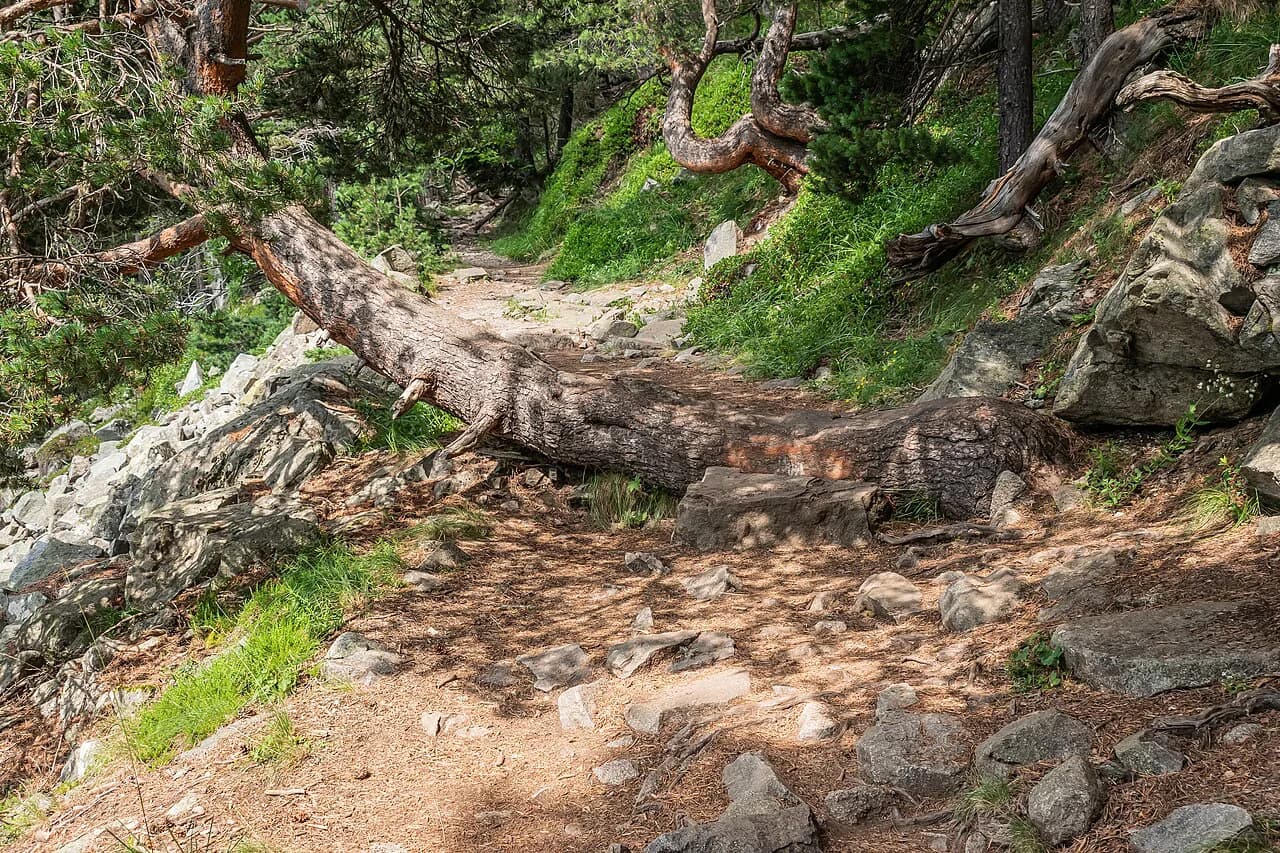
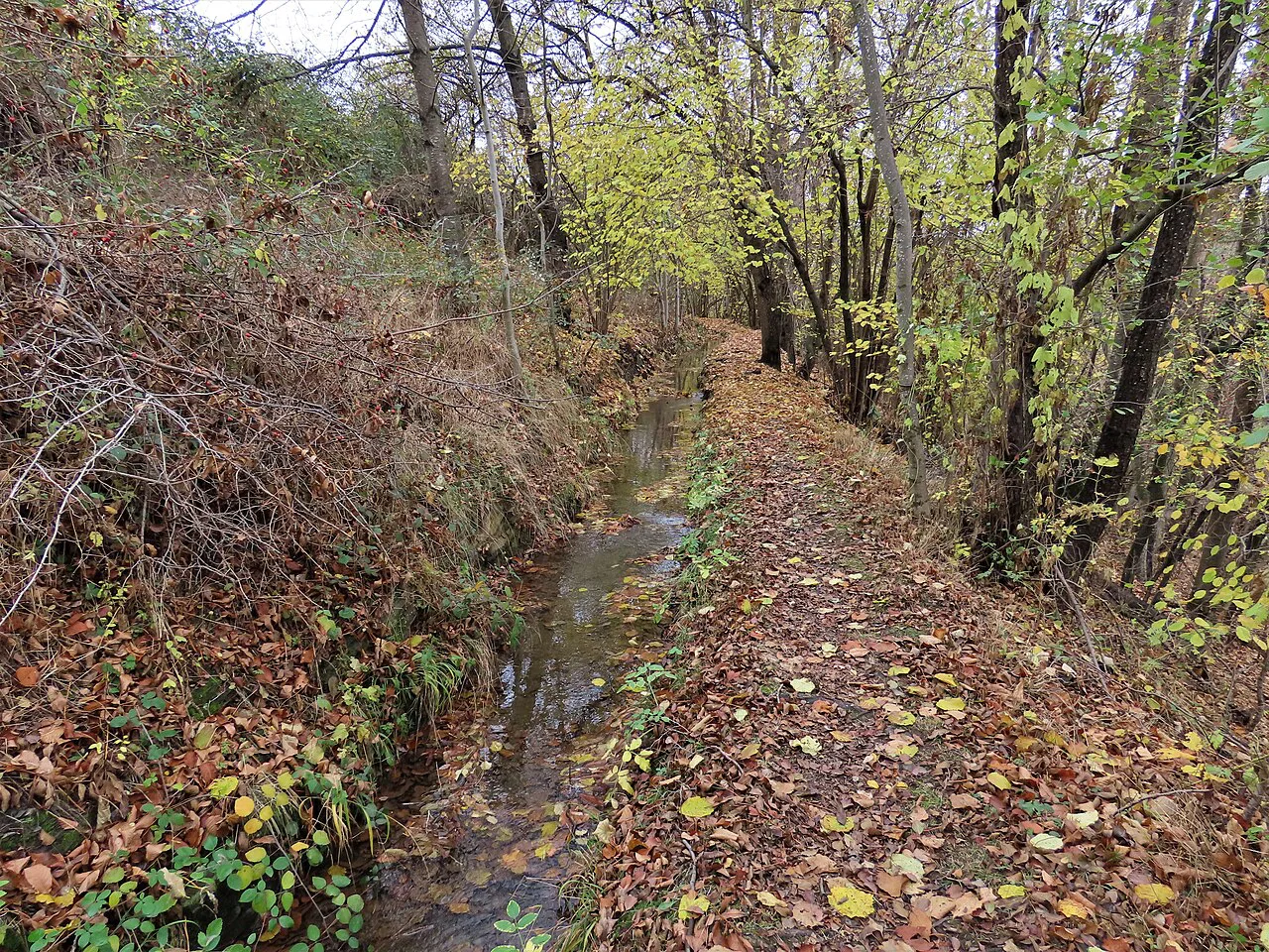
The loop is mostly T2 under Swiss hiking-scale conventions, meaning clear but uneven and rocky paths. The exceptions are the occasional T3 and T4 sections: Day 2 has a short T3 descent, Day 4 has a sustained T4 stretch of about 3 km, and Day 3 includes some rougher ground near the high point. T4 means steeper, rougher, more exposed terrain where you may need your hands and where a fall could be serious.
Exposure is limited on most of the route, but the T4 ground on Day 4 and the rocky traverses on Day 2 deserve respect. Carry a map and compass or a loaded GPS track, and know how to use them. If you are uncomfortable on exposed scrambling, consider hiring a guide for Day 4 or skipping that stage via a lower alternative.
When to go and snow on the passes
The main hiking season runs from late June to mid-September, when the refuges are staffed and the high passes are usually free of snow. Snow can linger on north-facing slopes and in gullies into early July, and early autumn storms can bring fresh snow to the highest points by late September. July and August are the busiest months and the most reliable for dry rock on the T4 sections.
Afternoon thunderstorms are a real hazard in the Pyrenees from June through August, and they build quickly. Plan to be off the high ground by early afternoon, especially on Days 1, 3 and 4, and carry waterproofs and an insulating layer even in midsummer. For another long Pyrenean option on the Spanish side, the GR11 guide covers the Senda Pirenaica.
The Carros de Foc Plus variant
The Plus version extends the classic loop to eight stages, adding two refuges, Pla de la Font and Gerdar, that are not on the standard circuit. It totals 89.3 km (55.5 mi) with about 5,750 m (18,865 ft) of ascent and 5,760 m of descent, so roughly 25 km more distance and 2,000 m more climbing than the standard route. The reward is quieter corners of the park and a longer, more varied circuit.
Stage lengths in the Plus version range from 7.3 km to 15 km, and two stages carry a harder rating because of their ascent. It starts at Refugi Ernest Mallafré rather than Espot, which adds a logistics step at the beginning. Only choose the Plus if you have a spare day or two and are confident on the T4 ground, as the extra refuges sit in remoter terrain.
Packing and food on the circuit
Pack light but prepare for all weather: a waterproof shell, warm mid-layer, hat and gloves, sun protection, a headlamp, a basic first-aid kit and a water bottle or bladder of at least two litres. The huts sell drinks and snacks, but you should carry lunch food and emergency rations in case a hut is full or a stage runs long. A sleeping bag liner is required in most refuges.
Full-board bookings typically provide breakfast, a packed lunch and dinner, but the quality and timing vary between huts. Some huts offer vegetarian options and can accommodate dietary needs if you tell them in advance. Carry cash for drinks and extra snacks, and refill water at huts and streams where safe.
Plan Your Visit
The Carros de Foc rewards hikers who prepare: book your refuges early, study the stage figures, and know which day demands the most from you. The classic six-day loop is a solid first multi-day route in the Catalan Pyrenees, while the Plus variant suits those with extra time and experience on technical ground. Either way, build in a buffer for weather and enjoy the lakes, passes and quiet refuges of Aigüestortes.
Frequently Asked Questions
How long does the Carros de Foc take?
The classic loop is usually walked in six days, covering about 65 km with roughly 3,700 m of ascent. The Carros de Foc Plus variant takes eight days and covers about 89 km.
How hard is the Carros de Foc?
Most of the route is T2, but there are short T3 sections and a sustained T4 stretch of about 3 km on Day 4. It suits hikers with multi-day experience who are comfortable on rocky, sometimes exposed ground.
Do you need to book the refuges on the Carros de Foc?
Yes, especially in July and August. You can book directly with each refuge or through an operator that arranges the huts and provides a guide. Book well ahead to secure a bed.
Where does the Carros de Foc start and finish?
The circuit starts and finishes in Espot, a village on the eastern edge of Aigüestortes i Estany de Sant Maurici National Park. The first day climbs to Refugi d'Amitges and the last day descends from Refugi Colomina.
What is the best month for the Carros de Foc?
Late June through mid-September is the main season, when the refuges are open and snow has mostly cleared from the passes. July and August offer the most reliable weather, but they are also the busiest.
Is the Carros de Foc Plus harder than the classic loop?
Yes. The Plus adds two refuges and about 25 km more distance, with roughly 2,000 m more ascent, over eight days. It also includes sections rated harder than the classic route.
Sources
Trail notes for your next trip
Optional updates when we add or revise hiking guides.
You might also like
Continue reading
More guides you'll find useful