Haute Route Pyrénées (HRP): Stages, Huts and Logistics
The HRP crosses the Pyrenees from Hendaye to Banyuls-sur-Mer over 740 km of high, largely unmarked terrain. Here are the stages, huts, seasons and access.
On this page
The Haute Randonnée Pyrénéenne (HRP) is the Pyrenees at their wildest: a high-level traverse from Hendaye on the Atlantic to Banyuls-sur-Mer on the Mediterranean, conceived by Georges Véron in 1968. It suits experienced, self-reliant backpackers who are comfortable navigating unmarked ground, carrying several days of food and sleeping in huts or under a tent. If you want a waymarked valley route instead, the GR10 in France and the GR11 in Spain follow lower, more pastoral lines.
The route is a concept rather than a single marked trail: it stays as high as possible and crosses the border repeatedly to find the most logical and spectacular line through the range. That freedom is the appeal, and it is also the work. The western, central and eastern sections each have their own character, and planning your resupply and hut nights around those changes is what makes a multi-week crossing possible.
What the HRP is
The HRP runs coast to coast across the Pyrenees, linking Hendaye in the French Basque Country with Banyuls-sur-Mer in French Catalonia. It is a walker's route in the truest sense: there is no single waymarked trail, and the line stays as high as possible, often hopping between France, Spain and Andorra to take the best path through the mountains. That makes it a different proposition from the valley-based long-distance routes on either side of the border.
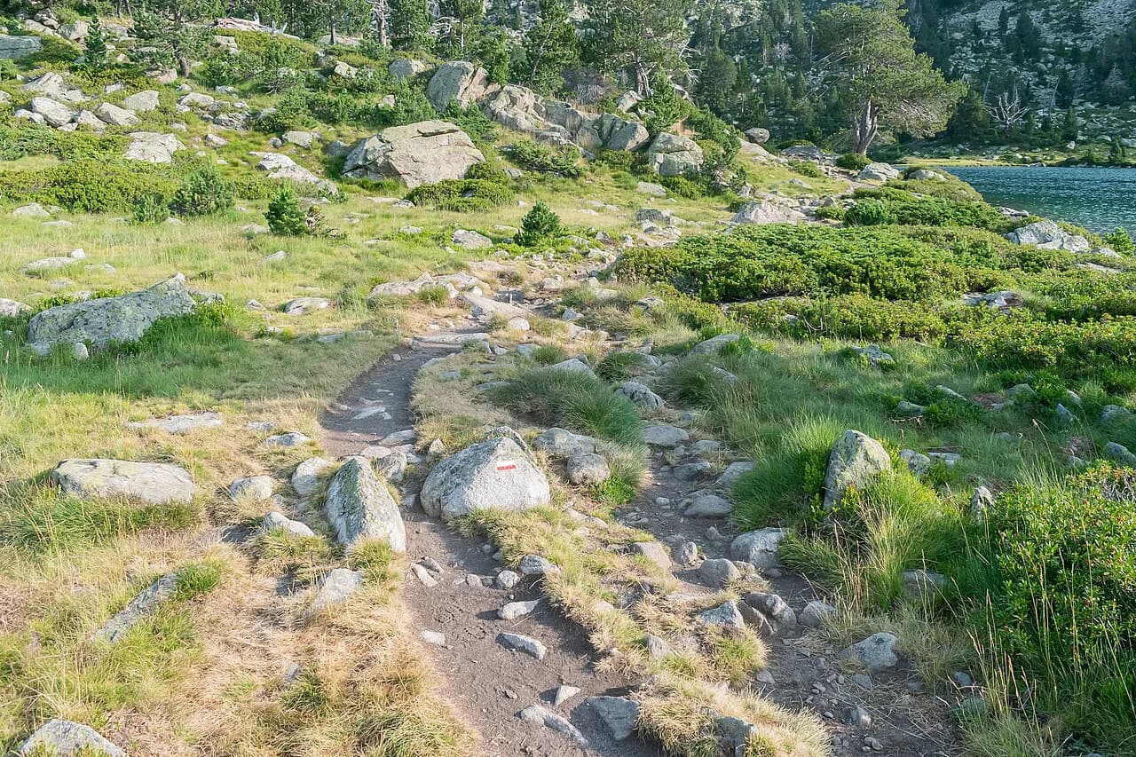
Because the route is not signed as a continuous trail, navigation is the defining skill. You will follow a mixture of old paths, stock tracks, cairns and open ground, and you need to be able to read a map and compass when cloud closes in. A GPS track and a paper map of each section are the baseline, not a luxury.
HRP versus the GR10 and GR11
The GR10 in France and the GR11 in Spain are waymarked, valley-oriented routes that cross the range from coast to coast on their respective sides of the border. The HRP deliberately avoids that pattern, staying high and crossing the frontier repeatedly to find the most spectacular and logical line. The result is a wilder, more exposed and more demanding walk than either GR.
Choose the HRP if your navigation is solid, you are happy carrying a tent and several days of food, and solitude matters more than waymarks. Choose the GR10 or GR11 if you want a signed route with more villages and shorter carries. The GR10: Hiking the French Pyrenees from Hendaye to Banyuls-sur-Mer page covers the French option in detail.
Distance, ascent and time
The HRP is roughly 740 km (460 miles) long with about 44,000 m (144,000 ft) of ascent, and it is rated difficult. Those figures describe a full end-to-end crossing, not a week's holiday; most hikers need several weeks on the ground, and the daily vertical gain adds up even when the horizontal distance looks modest.
Plan your itinerary around the hardest sections rather than an average daily distance. The central Pyrenees, around Gavarnie and the Parc National des Pyrénées, contain the highest and most sustained climbing, so build in shorter days there and allow extra time for weather. If you cannot take a full crossing, pick a two- or three-week section and treat it as a standalone route.
Getting to Hendaye and back from Banyuls-sur-Mer
Hendaye, the Atlantic terminus, is well connected by train to major French cities and, via the border town of Irun, to the Spanish rail network. Banyuls-sur-Mer at the Mediterranean end also has good public transport connections, which makes a one-way journey practical: take the train to Hendaye, walk east, and return home from Banyuls-sur-Mer.
Book your outward train to Hendaye and your return from Banyuls-sur-Mer before you set off, since the end of a multi-week walk is no time to be improvising a long journey home. If you are crossing from Spain, Irun is the natural gateway to Hendaye. Carry a small amount of cash and a charged phone for the final transfer, and confirm departure times with the rail operator when you book.
The route through the Pyrenees
The western section from Hendaye climbs away from the Atlantic into the Basque Pyrenees, where the terrain is greener and the passes lower. As you move east, the range grows higher and more barren, and the central Pyrenees around Gavarnie form the most mountainous stretch of the route. The eastern section drops toward the Mediterranean through drier, more Mediterranean hills and ridges.
Treat each section as a different walk. The west rewards you with easier access and more villages, the centre demands the most careful planning for snow and storms, and the east brings long, dry ridges and a finish on the coast. That variation is why a section-by-section plan, with resupply points marked, works better than a single average daily distance.
Central Pyrenees and the Parc National des Pyrénées
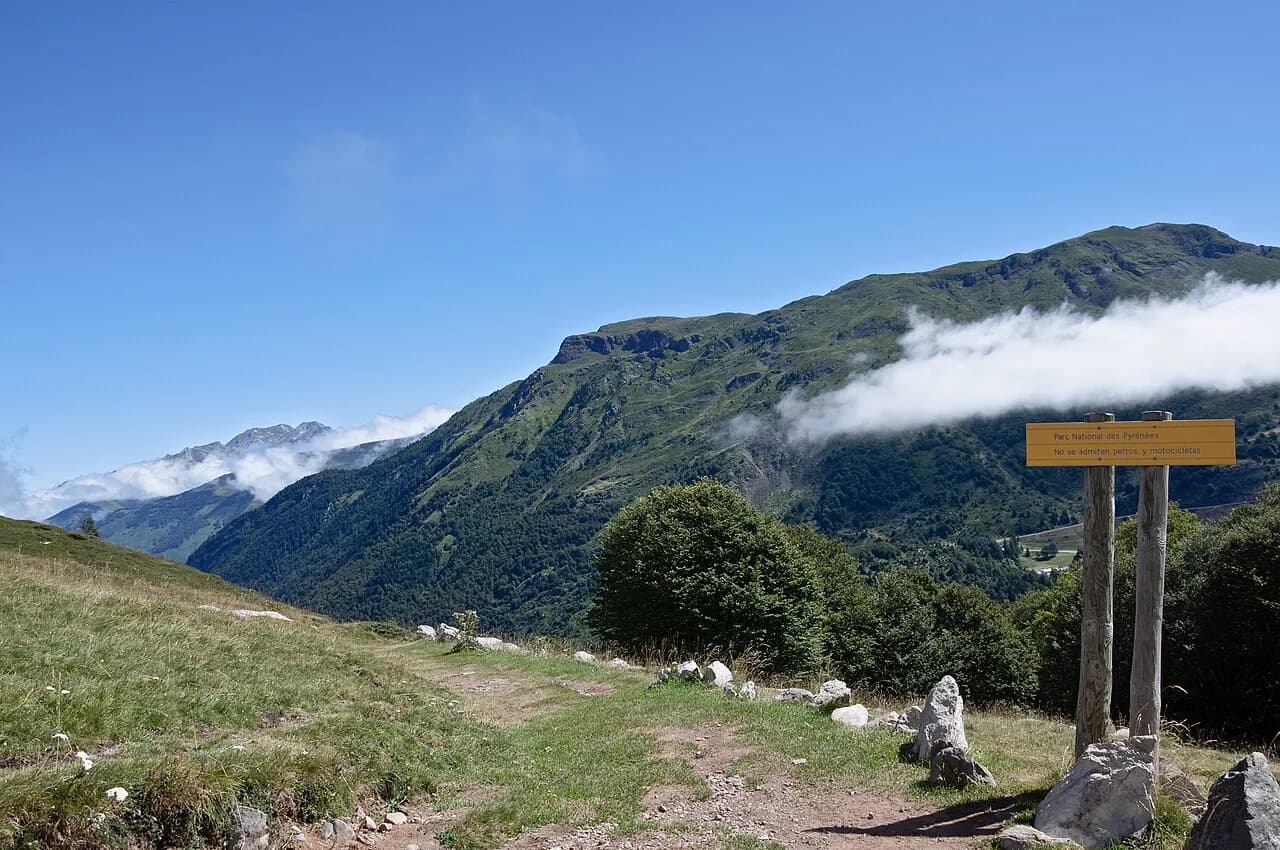
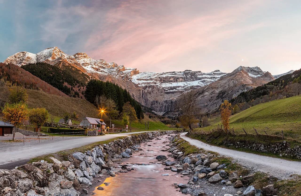
The central Pyrenees, including the Parc National des Pyrénées around Gavarnie, are the heart of the route and the part that most hikers remember. Here the HRP crosses high passes and remote basins where the weather can change quickly and snow can linger on north-facing slopes into summer. This is the section where you should build in spare days.
For a wider look at the range's trails, huts and bases, the hiking in pyrenees guide sets the HRP alongside the other long routes and day hikes. If you are planning a shorter hut-based trip rather than a full crossing, Pyrenees Hut-to-Hut Hiking covers the practical side of linking refuges.
Gavarnie and the Cirque
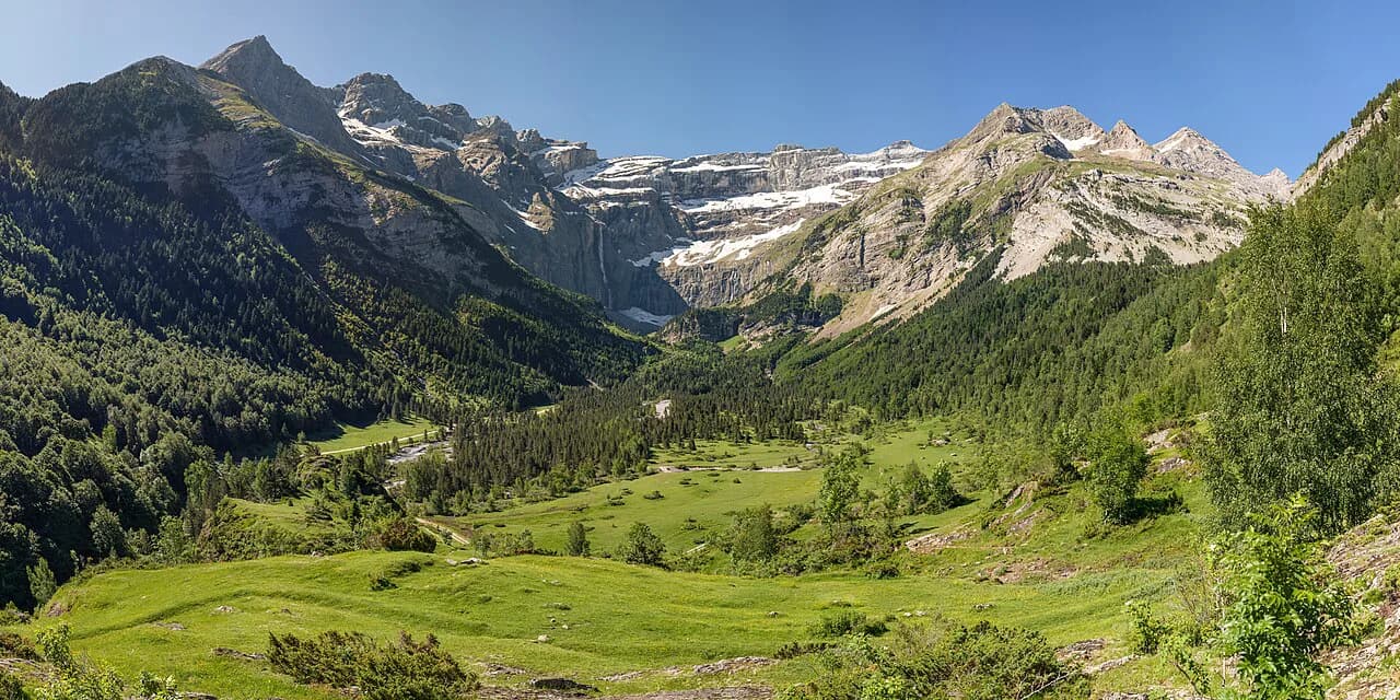
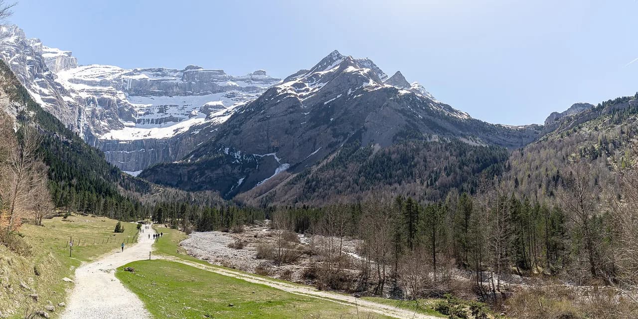
Gavarnie is the best-known base on the French side of the central Pyrenees and a natural staging point for the HRP. The village sits below the Cirque de Gavarnie, and the surrounding Parc National des Pyrénées offers some of the most dramatic high ground on the route. Use Gavarnie to restock, dry out gear and adjust your plan before the highest passes.
The HRP stretch near Gavarnie is an 88.3-mile (142 km) point-to-point route that is generally considered challenging, which gives you a sense of the scale even when you only walk part of it. Plan your days here conservatively: afternoon storms are common in summer, and exposed passes are no place to be caught above the cloud.
Navigation: waymarks, maps and GPX
The HRP is not a single waymarked trail; it is a walker's route that stays as high as possible and crosses the border to find the most logical and spectacular path. That means you will navigate from maps, GPX tracks and your own judgment rather than following painted blazes. Carry a paper map and compass as backup, and know how to use them in poor visibility.
Self-reliance is the defining demand of the HRP: the route passes through some of the most remote areas in Western Europe, where you may not see another person for a full day. Plan each day's navigation in advance and carry enough food and fuel to reach your next resupply even if you lose a day to weather.
Huts and shelters on the route
Accommodation on the HRP comes in three forms: staffed mountain refuges, unstaffed shelters known as cabanes, and wild camping. Staffed refuges give you a bed, a meal and a chance to dry gear, but they are spaced out and booking ahead is sensible in peak season. Unstaffed cabanes are basic shelters with no services, and wild camping fills the gaps where neither exists.
Refuge Wallon, a large classic refuge in the heart of the Parc National des Pyrénées, is a key hub in a popular section of the route. Refuge de Tuquerouye, the highest and oldest refuge in the Pyrenees, is a small unstaffed shelter in a spectacular high-altitude setting, while Refugio de Viados is a well-regarded Spanish refuge known for its food and strategic central location. Each demands a different level of self-sufficiency, so plan your days around what each one offers.
Wild camping is a necessary part of the HRP because huts can be days apart, but rules differ between the French and Spanish sides and within national park boundaries. The Parc National des Pyrénées publishes the rules that apply inside its boundaries, so read them before you rely on a tent for a given night. Pitch late and leave early where wild camping is allowed.
Resupply
Resupply is one of the main logistical challenges of the HRP. The route passes through very remote areas and only occasionally touches small villages, so you need to carry several days of food between shops. Plan your resupply points before you leave and build in a margin for delays.
The Spanish refuges, including Refugio de Viados, can be useful for a meal and a bed in the central section, but do not assume they sell supplies for the days ahead. Carry enough food to get you to the next village even if a resupply point is closed, and treat every shop as a chance to top up rather than a guarantee.
When to go
The best window for the HRP is July to mid-September, when the high passes are most likely to be clear of snow and the days are long. Outside that window, late-lying snow on passes can make the route significantly harder and more dangerous, particularly in the central Pyrenees.
Even in midsummer, snow can linger on north-facing slopes and in gullies, so carry an ice axe and crampons if you are starting early in the season or crossing the highest passes. Check conditions with the Parc National des Pyrénées or local refuges before committing to a high variant. Afternoon storms are common, so start early and aim to be off exposed ground by mid-afternoon.
Hazards and how to respond
The main hazards on the HRP are exposure, unmarked ground in cloud, snow on high passes and afternoon storms. The response is straightforward: start early, carry the gear to survive a cold, wet night, and be prepared to turn back or drop to a lower route when the weather closes in. Navigation errors are most likely in cloud, so keep a close eye on your map and GPS.
Snow on passes early and late in the season can turn a straightforward walk into a mountaineering problem. Carry an ice axe and crampons if there is any doubt, and know how to use them. If you are unsure of conditions, ask at a staffed refuge before you set out.
Gear and fitness
The HRP demands a tent, a sleeping system, several days of food and the navigation kit to match. Your pack will be heavy, so build fitness with long days carrying weight rather than short fast hikes. Test your kit on a multi-day trip before you commit to a full crossing.
Layers matter more than any single item: the range can be hot in the valleys and cold and windy on the passes in the same day. Carry a waterproof shell, warm insulation and a headlamp, and keep your map and phone dry. If you are new to multi-week routes, the GR11 Guide gives a waymarked alternative for building experience.
Guidebooks and planning resources
The standard guidebook is Pyrenean Haute Route by Ton Joosten, published by Cicerone Press. It covers the route in stages with maps and practical notes, and it is the book most HRP hikers carry. Pair it with a current map set and a GPX track, since the route is not waymarked continuously.
For planning, use the official park and hut sources for current rules and opening information, and the regional tourism offices for transport. The hiking in pyrenees guide gives an overview of the range's other routes and bases if you want to combine the HRP with shorter walks.
Where the HRP fits among Europe's long high routes
The HRP is one of Europe's great long high routes, comparable in ambition to the Alps' high-level traverses but wilder and less waymarked. It rewards hikers who want solitude and self-reliance over signposts and villages. If you want a hut-based circuit rather than a coast-to-coast crossing, the carros de foc loop in Aigüestortes i Estany de Sant Maurici National Park is a compact alternative with Refugi d'Amitges as a classic base.
For a waymarked coast-to-coast on the Spanish side, the GR11 (Senda Pirenaica) is the obvious comparison, and it shares the same Atlantic-to-Mediterranean logic. The HRP remains the high, unmarked option for hikers who are ready for it. If you are weighing up other European high routes before committing, hiking in Calanques offers a very different Mediterranean mountain experience.
Plan Your Visit
The HRP is a serious multi-week undertaking: roughly 740 km with 44,000 m of ascent, a July to mid-September season, and a mix of staffed refuges, unstaffed cabanes and wild camping. Plan your resupply and hut nights first, then build your daily distances around the central Pyrenees, where the terrain and weather are hardest. Arrive at Hendaye with your navigation and kit tested, and you will give yourself the best chance of reaching Banyuls-sur-Mer.
If a full crossing is more than you want, walk a section such as the Gavarnie area or use the GR10 or GR11 as a waymarked alternative. Either way, book your transport in advance and read the current rules from the park and hut operators before you go.
Frequently Asked Questions
How long does the Haute Route Pyrénées take?
The full route is roughly 740 km (460 miles) with about 44,000 m (144,000 ft) of ascent, so most hikers need several weeks. Plan around the hardest sections rather than an average daily distance, and build in spare days for weather in the central Pyrenees.
Is the HRP waymarked?
No. The HRP is a walker's route rather than a single waymarked trail, staying as high as possible and crossing the border to find the best line. You need solid map and compass skills and a GPX track as backup.
How hard is the Haute Route Pyrénées compared with the GR10?
The HRP is harder and wilder than the GR10. The GR10 is waymarked and follows valleys with more villages, while the HRP stays high, is unmarked and often carries you days from resupply. Choose the GR10 if you want signposts and shorter carries, and the HRP if you want solitude and are confident navigating.
Do you need to camp on the HRP?
Wild camping is a necessary part of the HRP because huts can be days apart, though rules differ between France and Spain and within national park boundaries. Carry a tent and be ready to use it, and read the Parc National des Pyrénées camping rules before you rely on a given night.
When is the best time to hike the HRP?
July to mid-September is the best window, when high passes are most likely to be clear of snow. Outside that window, late-lying snow can make the route significantly harder, and afternoon storms are common even in midsummer.
Where does the Haute Route Pyrénées start and finish?
It starts at Hendaye on the Atlantic and finishes at Banyuls-sur-Mer on the Mediterranean. Hendaye has rail links from France and, via Irun, from Spain, and Banyuls-sur-Mer has good public transport connections for the journey home.
Sources
Trail notes for your next trip
Optional updates when we add or revise hiking guides.
You might also like
Continue reading
More guides you'll find useful