Tour du Mont Blanc Self-Guided: Route & Hut Booking
Plan a self-guided Tour du Mont Blanc: split the stages, book huts and gîtes early, use lifts and buses to trim days, and pick the right months to walk.
On this page
The Tour du Mont Blanc is the classic circuit of Western Europe's highest peak, crossing France, Italy and Switzerland on a well-marked trail with a hut or village gîte at the end of every day. It suits fit hikers who can climb for several hours with a pack, and who are willing to let accommodation availability shape the itinerary. No technical climbing is involved on the standard route, but the days are long and the passes are high.
Going without a guide is a planning exercise more than a navigation one. The trails are signposted and the stages are well known, so the real work is choosing a direction, fixing a stage sequence, and securing beds before the season fills. This planning guide to the Mont Blanc hiking circuit covers the numbers, the alternatives and the trade-offs.
What a self-guided circuit involves
The full loop runs through three countries around the Mont Blanc massif, linking Chamonix in France with Courmayeur in Italy and the Swiss Val Ferret villages. You carry your own day pack between overnight stops and organize your own meals outside what the accommodation provides. The route is waymarked across all three countries, so you can follow it without a guide.
What a self-guided trek demands is mainly endurance and time. Most walkers need between nine and eleven days of walking to close the loop, plus travel days at each end. The terrain is never technically extreme, but repeated days of 800 to 1,100 m (2,600 to 3,600 ft) of climbing add up, and the highest passes sit above 2,500 m (8,200 ft).
Self-guided formats sold by operators bundle the logistics you would otherwise handle alone: pre-booked rooms, luggage transfer between overnight stops, transfer arrangements and a roadbook with maps and GPS tracks. A hiker who books everything independently does the same work stage by stage, which is feasible but slower to arrange.
Distance, ascent and time
Published figures vary with the variants you include. The classic full loop is commonly quoted at nearly 160 km (about 99 mi) with more than 10,000 m (32,800 ft) of altitude gain, which corresponds to nine to eleven walking days at a steady pace. Operator listings describe the circuit as fairly demanding but non-technical, with well-marked trails throughout.
Stage lengths on a typical self-guided itinerary sit between roughly 11 and 20 km (7 and 12 mi), with daily ascents mostly between 500 and 1,100 m (1,600 and 3,600 ft) and descents sometimes larger. A representative day from Trient to Champex is given as 13 to 16 km with 1,100 to 1,300 m of climb depending on the variant chosen.
Plan on five to seven hours of moving time per stage, and add stops. Shorter days exist where a lift or bus removes part of the climb, which is how seven-day versions of the circuit are built. If you have two weeks, a nine-to-eleven-day rhythm leaves room for weather and rest.
Which direction to walk
The established flow is anti-clockwise from Chamonix, and most hikers follow it. Walking clockwise has a practical appeal: you travel against the crowd, the first hour or two of each morning is nearly empty, and you meet a different set of people at each night's stop. There is little difference in steepness between the two directions.
Choose anti-clockwise if you want the company of other trekkers and the most guidebook descriptions matching your days. Choose clockwise if quiet mornings matter more to you. Whichever you pick, keep the direction consistent when you reserve beds, because your stage endpoints depend on it.
The classic stage sequence
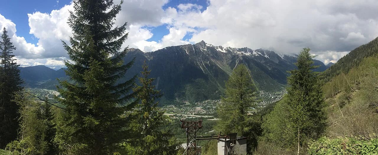
A common clockwise sequence starts in Chamonix with the Planpraz cable car to the balcony trail above the valley, passing the Chéserys lakes before dropping to Argentière. The next day crosses the Col de Balme on the French-Swiss border above Le Tour and descends to Trient. These two days give the circuit its opening views of the north face of the range and the Argentière glaciers.
From Trient the trail reaches Champex either by the Bovine balcony path above the Rhône valley or by the higher Fenêtre d'Arpette. The Bovine option is the gentler choice; the Arpette window is the more exposed, higher line and holds snow later into the season. If you enjoy linking balcony trails into a longer ridge-and-summit itinerary, the Annecy hiking guide shows how similar terrace paths above a lake work. Then follow the Swiss Val Ferret to La Fouly before climbing the Grand Col Ferret at 2,537 m (8,324 ft) into Italy.
The Italian side gives the balcony of Mont de la Saxe above Courmayeur, then the climb to the Col de la Seigne back into France and the descent toward Les Chapieux. The following day crosses the Col des Fours at 2,665 m (8,743 ft) and the Col du Bonhomme before dropping to Notre Dame de la Gorge and Les Contamines-Montjoie. A final stretch through Les Houches closes the loop, with the option of the Col du Tricot for views of the Dômes de Miage.
Trailhead access and transport
Chamonix is the natural start and finish. The easiest approach is by air to Geneva, with direct shuttles from the airport to Chamonix, and buses also run from the town of Geneva. Trains connect Paris Gare de Lyon with Chamonix for travelers arriving by rail.
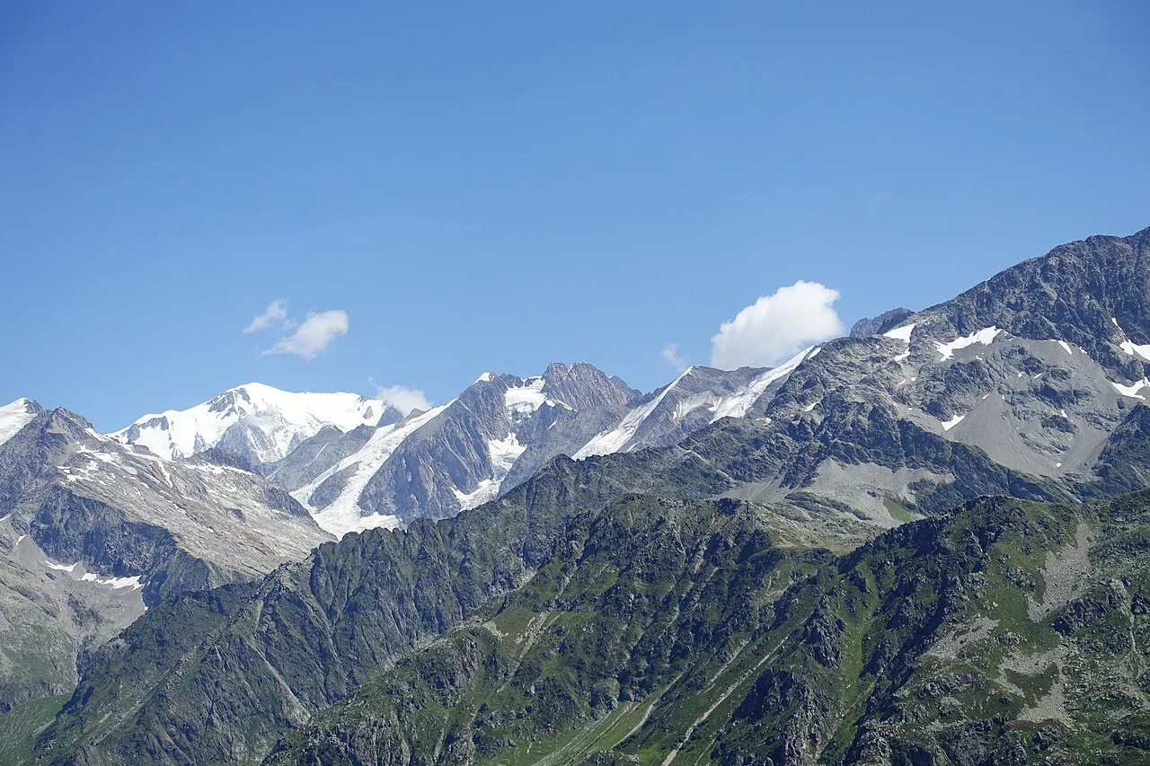
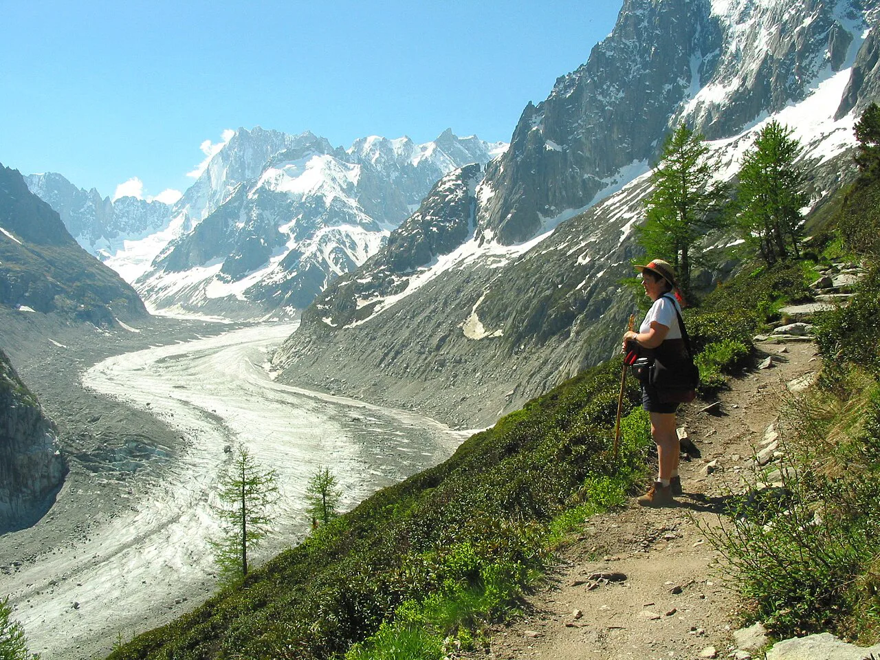
Local lifts and buses trim the start of several days. The Planpraz and Flégère cable cars above Chamonix put you straight onto the balcony trails, the Le Tour bus reaches the Col de Balme side, and a bus into the Val Veny serves the Italian approach to the Col de la Seigne. The Montenvers railway returns walkers from the Mer de Glace.
Chamonix lift schedules tighten at the end of the season, and some lifts close or run only at weekends in September, which can remove shorter walking options on the final day. Check the lift company's dates against your own itinerary before you commit to a stage that depends on a cable car.
Refuges, gîtes and inns
Mountain refuges sit in the middle of stages and generally offer half-board: a dormitory or small room, an evening meal and breakfast, with lunch baskets usually booked the evening before arrival. Village gîtes and inns are more comfortable because they are on the road network, and they work well as rest points.
Booking timing shapes the trip more than fitness does. High-season beds in the popular refuges can be sold out as early as February, so reserve as soon as your dates are fixed and specify dietary needs at the time of booking. Some places take bookings online, others only by phone.
Demand has grown faster than beds along the route, so flexibility on dates helps. A self-guided itinerary sometimes shifts to more expensive inns or rooms with shared bathrooms to keep the sequence intact. Accepting those changes is often what gets a high-season circuit confirmed.
Luggage transfer and self-guided formats
Luggage transfer moves one bag of about 10 kg (22 lb) per person between overnight stops, so you walk with only a day pack. Operators offering self-guided versions typically combine private rooms in hotels and comfortable gîtes, breakfasts, most dinners, the transfers in the program and a roadbook with maps and GPS tracks.
What stays your job is the walking itself and the decisions on the ground: reading the weather, choosing the variant for the day, and carrying water and layers. Local bus tickets and cable car rides are usually outside package prices, so budget for them separately and buy as you go.
When to go
The season runs from mid-June to mid-September. In mid-June and early July the meadows are in flower and the trails are still quiet, but snow can linger at altitude and on shaded slopes such as the Fenêtre d'Arpette. Ask the tourist offices or hut wardens about conditions on the high variants before committing.
Mid-July to mid-August brings the longest, driest days and the busiest trails, with lively evenings in the huts and many groups on the path. From mid-August to mid-September the crowds thin and temperatures remain good, though daylight shortens and some huts begin to close late in the period.
Two event periods crowd the trail and fill valley beds: the Chamonix marathon at the end of June and the Ultra-Trail du Mont-Blanc at the end of August. Book around them rather than through them if you want a quiet circuit.
Hazards and how to manage them
Afternoon thunderstorms are frequent in summer, so aim to be off the highest ground by early afternoon and leave the long pass sections for the morning. Exposed traverses such as the balcony above Courmayeur and the Fenêtre d'Arpette deserve extra care in wind, rain or old snow.
Snow patches can persist into early summer on north-facing slopes and return with early-autumn storms. Carry poles for balance and ask locally before taking a high variant; if the snow is hard or the weather is closing in, the lower valley route is the sensible alternative.
What to carry
A 30 to 40 l (1,830 to 2,440 cu in) pack suits a circuit with hut nights, and boots with good ankle support and grippy soles are the right choice for rocky passes. Take poles to share the load on long descents, plus sun protection rated for glacier glare, a warm layer and thin gloves for cool mornings.
Drinking water is generally easy to find along the route, but carry a filter or purification tablets as a backup on hot days. Pack a paper map and compass alongside any GPS, since phone batteries drain quickly over long days.
Shortening the circuit
If two weeks are not available, a seven-day version is possible by cutting the first or last stage or by using public transport between sections, for example the bus or shuttle between La Fouly and Champex. The result is a sportier pace but still a continuous loop.
A four-day section between Les Houches and Courmayeur makes a compact introduction to the circuit, taking in the mountain pastures, glacier views and the Col des Fours. It finishes in the Aosta Valley and lets you sample the Italian side of the massif without committing to the full loop.
Where to base yourself
Chamonix works as a base for the French stages, with the lifts and buses to Le Tour, Planpraz, Flégère and the Mer de Glace on the doorstep. Courmayeur covers the Italian balcony and the Val Veny approach to the Col de la Seigne, and the Swiss Val Ferret villages of Champex and La Fouly serve the Swiss stages.
Plan Your Visit
The self-guided Tour du Mont Blanc rewards planning more than fitness heroics: pick a direction, fix a stage sequence that matches your available days, and reserve beds early enough that accommodation does not dictate everything else. Then choose your month with the crowds and snow in mind.
Build your itinerary around the lifts and buses that trim or connect stages, and carry gear suited to high passes and afternoon storms. With those pieces settled, the circuit is one of the most satisfying long walks in the Alps.
Frequently Asked Questions
How many days does a self-guided Tour du Mont Blanc take?
Most hikers walk the full loop in nine to eleven days of walking, adding travel days at each end. Seven-day versions exist by shortening or linking stages with public transport or lifts, but those days are longer and leave less margin for weather.
Do you need a guide for the Tour du Mont Blanc?
No guide is required for the standard circuit, because the route is waymarked in all three countries and the stages are well documented. You do need solid fitness and basic map and compass skills, plus the ability to judge weather on high passes.
How far in advance should you book huts on the Tour du Mont Blanc?
Book as early as your dates are fixed. High-season beds in popular refuges can be fully booked by February, so a late spring booking may only be possible with changes to your stage sequence or room standard.
Which direction should you walk the Tour du Mont Blanc?
Anti-clockwise from Chamonix is the established flow and matches most descriptions. Clockwise gives quieter mornings and a different set of faces each evening, with no real difference in steepness between the two.
When is the best time to hike the Tour du Mont Blanc self-guided?
Mid-June to early July is quiet and flowery but can hold snow on high variants, mid-July to mid-August is busiest with the longest days, and mid-August to mid-September is quieter with good temperatures until the huts begin to close.
Can you shorten the Tour du Mont Blanc with buses and lifts?
Yes. Cable cars above Chamonix, buses to Le Tour and the Val Veny, the Montenvers railway and links between Swiss villages let you trim stages or build a shorter seven-day circuit.
Is luggage transfer available on the Tour du Mont Blanc?
Self-guided operators commonly move one bag of about 10 kg per person between overnight stops, so you carry only a day pack. Independent hikers can arrange similar transfers through local operators in each valley.
Sources
Trail notes for your next trip
Optional updates when we add or revise hiking guides.
You might also like
Continue reading
More guides you'll find useful