
Great Gable Walk: Route, Distance, Ascent and Difficulty
A Great Gable walk crosses steep, rocky ground above Borrowdale and Wasdale. Compare the Seathwaite and Wasdale routes, distance, ascent and walking time.
On this page
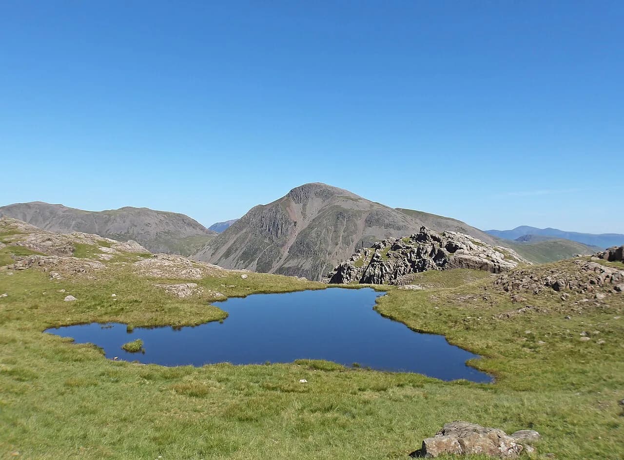
Great Gable rises where Borrowdale, Wasdale and Ennerdale meet, a broad dark summit with the Scafells to the south and the high fells falling away on every side. This is a mountain day for fit hillwalkers who are comfortable on steep, rocky ground with some hands-on moves, not a gentle fell stroll. The two realistic lines start from Seathwaite in Borrowdale and from Wasdale Head, and they give quite different days.
If you are still choosing where to base yourself in the region, the wider hiking in lake district covers the main fell groups and how the valleys connect. Great Gable is one of the classic summits in the set of The Wainwrights, the 214 Lakeland fells catalogued by Alfred Wainwright, which is useful context for how the day is usually judged.
Where Great Gable sits
The summit stands on the watershed between Borrowdale to the north-east, Wasdale to the south-west and Ennerdale to the north-west. That position explains the day: whichever valley you start from, you climb out of a deep hollow onto an exposed top with long views and no shelter. Seathwaite sits at the head of Borrowdale and Wasdale Head at the head of Wasdale, and both give a compact mountain day without a long approach march.
Styhead Pass is the natural crossroads below the mountain, carrying a path between Borrowdale and Wasdale, with Styhead Tarn just below the pass on the Borrowdale side. Windy Gap is the notch between Green Gable and Great Gable, and it marks the point where the summit day turns from approach into steep climbing. These named points keep navigation simple in cloud, because they are the places where paths meet.
Seathwaite route: Taylorgill Force, Base Brown and Styhead Tarn
From the roadside by Seathwaite Farm, the route climbs past Sourmilk Gill into the hanging valley of Gillercomb, then works around Base Brown towards Taylorgill Force. The path past the waterfall is rough and includes some light scrambling near the top of the falls, so you gain height quickly here. From there the line continues up to Styhead Tarn and the pass, giving a first clear sight of Great and Green Gable across the water.
From Styhead the climbing steepens steadily towards the summit, with the tarn and the Scafells behind you as you gain the ridge. The top arrives suddenly and is exposed to wind from any direction. Keep the cairn and the crags in sight in poor visibility, because the ground beyond the summit drops away sharply.
Summit, Westmorland Cairn and Green Gable
The summit cairn sits near the edge above Wasdale, and a short walk brings you to the Westmorland Cairn, a stone mound with an uninterrupted view down Wast Water and the Wasdale valley. The drop below the cairn is real, so keep back from the edge on wet rock. From the summit you can continue to Green Gable, dropping to Windy Gap between the two fells and climbing the short, stony pull to the second summit cairn.
The descent from Green Gable leads down to Gillercomb, a hanging valley above Seathwaite with Gillercomb Crag on the left, and back to the farm by Sourmilk Gill. The sequence of the day runs Styhead Tarn, Windy Gap, summit, Westmorland Cairn, back over Windy Gap to Green Gable, then Gillercomb. Knowing that order matters on tired legs, because the descent is not a single straightforward line.
Distance, ascent and time
The Seathwaite round is 10.5 km (6.5 miles) with 964 m (3,163 ft) of ascent, taking about 4 hours 15 minutes on the hill. Those figures cover the climb by Taylorgill Force, the summit, the Westmorland Cairn and the return over Green Gable. Treat them as walking time rather than a full day out, and add stops for the views and for food at the summit.
The time holds only for good conditions and a steady pace, so build in extra time for cloud, wind or wet rock on the upper ground. In a day that turns, the steep sections slow you down more than the flat approach.
Wasdale Head start: Gavel Neese and Beck Head
From Wasdale Head, a strong route runs by Burnthwaite and Moses Trod above Gable Beck, then climbs by Gavel Neese to Beck Head, the col below Kirk Fell and Great Gable. From Beck Head the North Traverse crosses under Gable Crag to Windy Gap, which gives a longer and more scenic approach than a direct up-and-down. The summit follows, then the Westmorland Cairn, Windy Gap, Aaron Slack and Styhead Tarn.
That Gable Girdle day, as this version is known, suits hillwalkers who have already climbed the mountain and want the traverse rather than the simplest line. Aaron Slack gives a steep and loose descent towards Styhead, so take it carefully when the rock is wet. From Styhead, the path down Borrowdale or back over to Wasdale Head closes the loop.
Terrain and difficulty
The Wasdale Head approach is a tough and demanding trail on very steep, rocky and loose terrain as it climbs towards the summit, with sections of bare scree and eroded paths. The same character applies on the Seathwaite side above Taylorgill Force and on the final pull. Expect to use your hands briefly in places, and wear boots with grip rather than trainers.
Great Gable is not an easy walk: the distance is modest for a Lake District summit, but the ascent is concentrated and the ground is rough. If you are new to the fells, a lower or simpler objective such as the catbells walk gives you a fell day with less exposure and better escape options. For fit walkers with some scrambling experience, the Gable is a reasonable step up.
Exposure and weather
The summit and the ridges around Windy Gap collect cloud and wind, and the mountain takes the full force of a westerly airstream off the Irish Sea. Snow can lie on the upper ground into spring and return early in autumn, changing a straightforward path into a slip hazard. Carry waterproofs and warm layers even on a clear morning, and turn back if the wind makes the summit edge hard to hold.
Afternoon rain is common here, and wet rock slows the steep sections past Taylorgill Force and the descent by Aaron Slack. Start early enough to be off the summit before the day turns, and keep a map and compass handy because the summit plateau has few features in mist.
Getting there: Seathwaite and Wasdale Head
Seathwaite sits at the end of a narrow lane from Rosthwaite at the head of Borrowdale, and Wasdale Head is reached by road from Gosforth up the Wasdale valley. Both are valley-head starting points with limited roadside and valley parking, and arriving early gives you a better chance of a space. The narrow lanes on the Borrowdale side need care, especially where passing places are required.
If you plan to link the two valleys, the walk over Styhead Pass is a direct route between them, and it can be done on foot without a car. Check the return leg in advance and plan the day around daylight rather than relying on a late lift home.
Parking and arrival
Parking at Seathwaite is roadside near the farm, and it fills early on fine weekends, so aim to start in the morning. The same applies at Wasdale Head, where the valley-end spaces are the only option. There are no parking charges or capacity figures published here, so check the notice at the car park when you arrive and have a fallback plan if the spaces are full.
When to go
Late spring to early autumn gives the best chance of dry rock on the main routes and long enough daylight for the Seathwaite round. Winter shortens the day, and the mountain is better reserved for walkers with winter experience and the right equipment. The seasonal pattern here is a mountain one, not a coastal one, so treat a settled forecast as a bonus rather than a guarantee.
If you are used to easier summits and want to build confidence on ridgelines first, striding edge offers a classic Lake District ridge day with the option to turn back at High Spying How. Keep in mind that the Gable is rougher underfoot than a simple ridge line, and use it once your route-finding and pace on steep ground are established.
What to carry
Take boots with grip, a map and compass, waterproofs, warm layers and enough water for a hill day with no reliable water source on the upper route. Food at the summit is part of the plan, because the day's ascent is concentrated and the climbs feel longer without a proper break. Add a head torch in shoulder seasons and a spare layer for the summit.
Where to stay
Seathwaite, Rosthwaite and Wasdale Head are the practical bases for this mountain. Seathwaite keeps the day compact, while Rosthwaite gives you more on the Borrowdale lane and a short drive to the trailhead. Wasdale Head shortens the summit line on its side of the mountain but gives a rougher approach.
A two-night base lets you take the Gable one day and a lower valley walk the next, which is a sensible way to handle the rough ground. Read up on hiking in the Lake District before you commit, so you know the other options in Borrowdale and Wasdale.
Plan Your Great Gable Day
Choose Seathwaite if you want the compact round with Taylorgill Force, Styhead Tarn, the summit and Green Gable on the return, and budget about 4 hours 15 minutes on the hill. Choose Wasdale Head if you want the Gable Girdle traverse with the North Traverse and Aaron Slack, and accept the steeper, looser ground. Either way, start early, carry proper kit and keep the summit for a day with room for the weather to turn. If you want to weigh this against quieter fells of a similar height, the Yorkshire Dales hiking guide shows the alternative in a neighbouring national park.
The mountain rewards a steady pace rather than a rush, and the landmarks of tarn, Windy Gap and cairn make the route easy to follow once you know the order. Pick your line, check the forecast, and leave the day with time to spare.
Frequently Asked Questions
Is Great Gable an easy walk?
No. The distance is modest, but the ascent is concentrated and the ground is steep, rocky and loose on the upper sections. It suits fit hillwalkers who are comfortable with some short hands-on scrambling and a long exposure on the summit.
How long is the Great Gable walk from Seathwaite?
The round from Seathwaite, by Taylorgill Force to Styhead Tarn and the summit, with Green Gable on the descent, is 10.5 km (6.5 miles) with 964 m (3,163 ft) of ascent. Allow about 4 hours 15 minutes on the hill, plus stops.
Where does the Great Gable walk start?
The two usual starts are Seathwaite at the head of Borrowdale and Wasdale Head at the head of Wasdale. Both give a direct route by Styhead Pass or Beck Head, and the two valleys can be linked on foot over Styhead.
How much ascent is the Great Gable walk?
The Seathwaite round climbs 964 m (3,163 ft) over 10.5 km (6.5 miles). The Wasdale Head route climbs more steeply from the valley, so treat the ascent as concentrated rather than spread out.
What is the hardest part of the Great Gable walk?
The steep pull above Taylorgill Force and the climb from Windy Gap to the summit on the Seathwaite side, and the loose descent by Aaron Slack on the Wasdale side. Wet rock makes both sections slower.
When is the best time for the Great Gable walk?
Late spring to early autumn gives the best chance of dry rock and long daylight. Snow can lie on the upper ground into spring and return early in autumn, so winter conditions need experience and the right equipment.
Sources
Trail notes for your next trip
Optional updates when we add or revise hiking guides.
You might also like



Continue reading
More guides you'll find useful





