
Haystacks Walk from Gatesgarth: Route, Distance and Time
A fell walk from Gatesgarth to Haystacks via Scarth Gap, with the scrambling, distance, ascent, walking time and the Warnscale Bottom descent explained.
On this page
Haystacks suits hikers who want a proper fell day without a long approach: a farm car park at the head of Buttermere, a steady climb to a famous pass, a short hands-on scramble and a summit plateau full of tarns and rocky knolls. It rewards people who enjoy rough ground and big views over Buttermere and Crummock Water more than those who want a manicured path all the way.
The classic circuit starts and finishes at Gatesgarth Farm and takes in Scarth Gap, the summit, Innominate Tarn and Warnscale Bottom. It is one of the quieter ways to get a genuine Lake District fell top, and it works well as a half day if the weather is settled. For a wider menu of routes across the region, see this guide to hiking in Lake District.
Where the walk starts: Gatesgarth Farm and Peggy's Bridge
The walk begins at Gatesgarth Farm, near the head of Buttermere, where you cross the road and pass through a gate beside the farmyard entrance. The path is signposted for Buttermere and Ennerdale, and it leads through fields to Peggy's Bridge at the head of the lake.
From the bridge the route turns onto a steep path alongside a stand of pines, then joins the broad Scarth Gap path above and turns left. The climbing is steady from here rather than brutally steep, which makes the early section a good warm-up before the rockier work higher up.
Parking at Gatesgarth Farm
Gatesgarth Farm has a small car park right at the start of the route, so you can walk from the car to the field gate in a couple of minutes. It fills quickly on fine weekends, and there is no second car park at the head of the valley, so an early start is the practical choice.
A parking charge applies at Gatesgarth Farm; one recent report put it at £4 and noted it was taken in cash, so carry coins rather than relying on a card. Treat the amount as liable to change and read the notice at the car park on the day.
Distance, ascent and walking time
The Gatesgarth circuit measures 8.0 km (5.0 miles) with about 600 m (1,970 ft) of ascent, and the author of that route gives a minimum walking time of roughly two and a half hours. Add time for photographs on the summit and a stop at Innominate Tarn; most hikers spend three to five hours out.
Another account of the same route records 5.6 miles (9.0 km) and 1,900 ft (580 m) of climbing from the same car park, which shows how much the figures vary with the exact line taken on the summit. Either way, this is a modest half-day fell walk rather than a full mountain day.
Do not confuse these numbers with the longer Buttermere and Haystacks circuit, which runs 14.53 km (8.4 miles) with 673 m (2,208 ft) of gain and starts from the village rather than the farm. That version adds lake-shore walking at both ends and takes considerably longer.
The climb to Scarth Gap
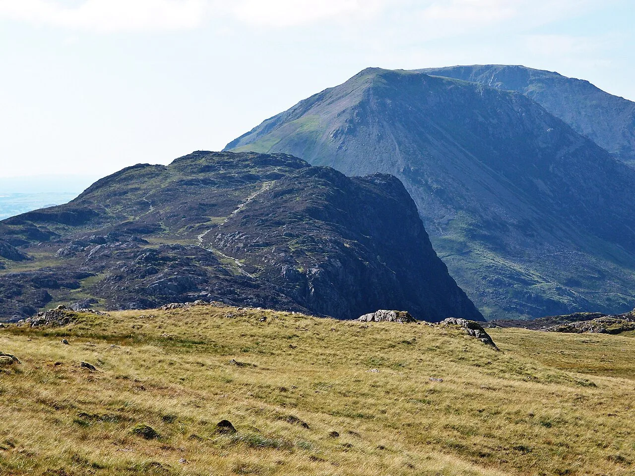
Above the pines the path climbs steadily across open fellside to a wall, passes through the gap and continues on a route marked by cairns to Scarth Gap itself. The pass is a crossroads: Ennerdale and Wasdale can be reached from it, and High Crag rises to the right while Haystacks sits to the left.
At the top of the pass, take the obvious engineered steps heading up the face of Haystacks. The gradient eases you into the steeper ground above, and looking back gives you Buttermere and Crummock Water laid out below.
The rocky ascent from Scarth Gap to the summit
Higher up, the path deteriorates and there are five or six short scrambly sections where you use your hands on rock steps and natural ramps. Nothing requires technical moves, and if a step looks awkward you can usually find an easier line just to the left or right among the worn footholds.
This is the one stretch that demands care in wet or icy weather, since the rock steps and gravelly patches get slippery. In early spring you may still see scratches from winter climbers' crampons on the rock, a reminder that snow and ice linger here later than on the valley paths.
The summit area, tarns and Innominate Tarn
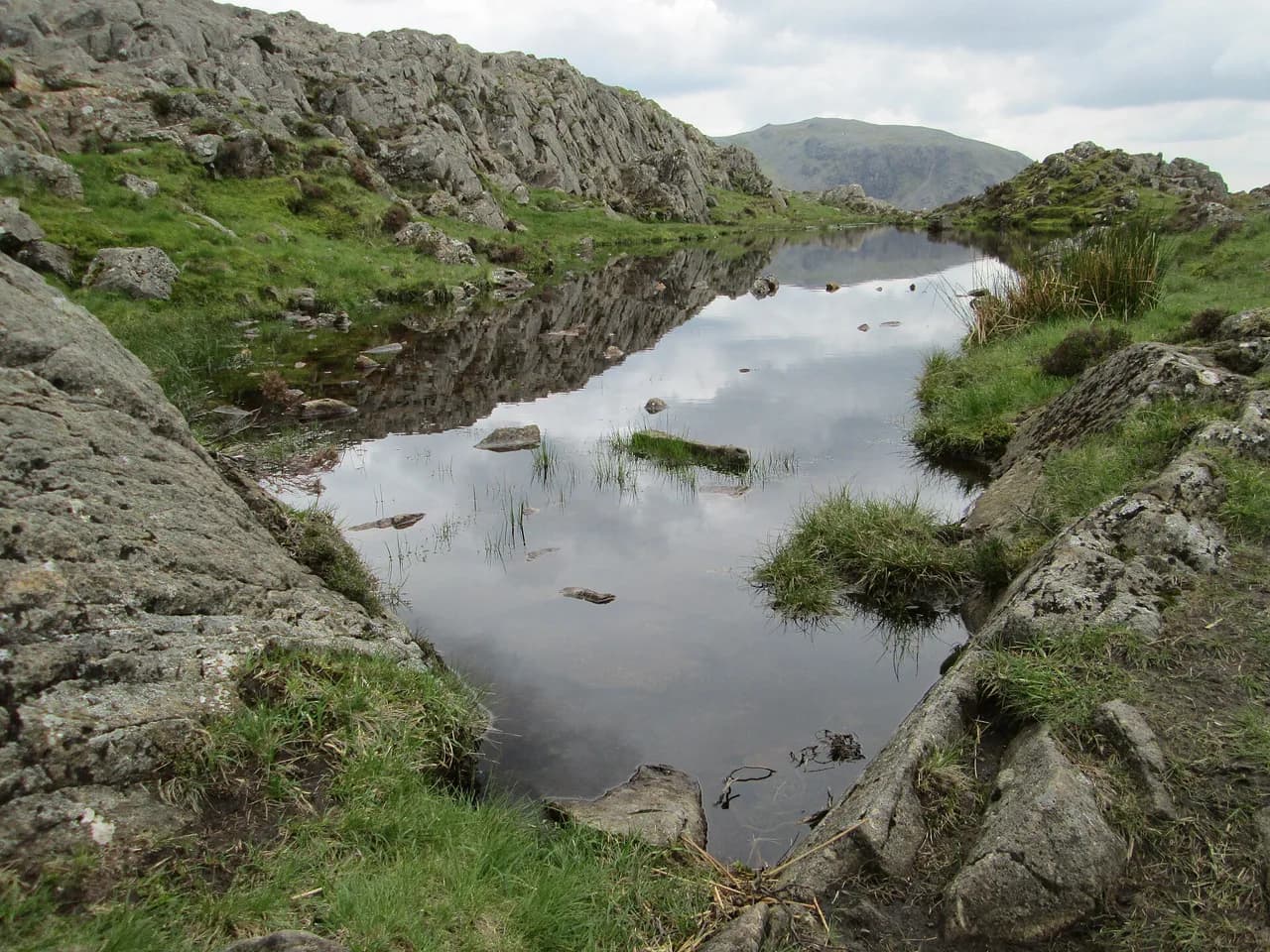
The top is a confusing jumble of knolls, hollows and small tarns, with two short ridges and a tarn between them; the far cairn with an old fence post is generally taken as the true summit. Each bump gives a different view, but the same terrain makes Haystacks a poor place to be caught in mist, so carry a compass and know your line before you climb.
From the summit, cross southeast to pick up the paths beyond, which converge at Innominate Tarn, the spot where the ashes of Alfred Wainwright were scattered. From there the route continues to Black Beck Tarn, where you can either cross the grass bank ahead or climb the steps onto Green Crag for the better outlook.
The descent by Dubs Quarry and Warnscale Bottom
Past Green Crag the path turns left and shortly meets a large domed rock; the left-hand option drops steeply, so instead bear right, pass a rocky knoll and descend towards the river. Cross by the stepping stones with Dubs Quarry ahead, then turn left and pick up the path above Warnscale Beck.
The Warnscale path is easy but occasionally steep and covered in loose gravel, so place your feet deliberately rather than striding out. There are two descent lines from the summit area, one on each side of Warnscale Beck, and they meet at valley level; both give long views down the valley towards Buttermere.
At the road above the cottage, turn left to follow the track back to the Gatesgarth car park. The walk finishes where it began, with the High Stile range of High Crag, High Stile and Red Pike standing above you across the valley.
Water, terrain and hazards
Water can be taken from the tarns on Haystacks and from Warnscale Beck, so a filter or treatment tablets save you carrying a full day's supply up the climb. The terrain is rough throughout: rock steps above Scarth Gap, a pathless-feeling plateau at the top, and loose gravel on the descent.
The real risks are navigational rather than technical. The summit plateau is a maze in cloud, and the descent depends on finding Innominate Tarn and then the right path past Green Crag; in clear weather the route is obvious, and in poor visibility it is not.
When to go: best months and conditions
Late spring through early autumn gives the most reliable dry rock for the scrambly section and the longest daylight for a leisurely summit stay. Summer afternoons can bring cloud onto the top, as one June report found when the light went flat just as the summit was reached, so an early start usually pays.
Winter and early spring demand more of you: ice on the rock steps and snow lingering on the pass turn a straightforward fell walk into something closer to a winter outing. If you go then, take an ice axe and crampons and the skills to use them, or choose a lower route.
Huts and bothies on the route
There are no huts or bothies on the Haystacks circuit itself, so plan the day as a there-and-back from Gatesgarth rather than as part of a longer hut-to-hut traverse. The White Hut bothy sits near the head of Buttermere, passed early on the outward leg, but it is below the climb rather than on the summit route.
If you want a bed for the night, base yourself in Buttermere village or further down the valley and treat Gatesgarth as a day-hike trailhead. Buttermere also gives you the option of the longer lake circuit on a second day.
Getting to Buttermere and Gatesgarth without a car
Buttermere and the head of the valley sit at the end of narrow lanes, and the simplest car-free approach is to base yourself in the village and walk or ride the short distance to Gatesgarth. Timetables for valley buses change with the season, so check the current service before you travel rather than assuming a year-round connection.
Once at Gatesgarth, everything on the circuit is on foot and the route returns to the same point, so no shuttle or second car is needed. That makes it an easy walk to slot into a Buttermere-based stay even if you have left the car behind.
Haystacks from Honister and other start points
Honister, at the top of the pass beyond Buttermere, gives a higher and shorter approach to the same summit, and it is a sensible alternative if the Gatesgarth car park is full. The trade-off is a start high on the fell with a steep pull either way, and the Honister slate mine area is outside the immediate Buttermere basin.
From Honister the natural companions are Grey Knotts and Brandreth, which can be combined with Haystacks for a longer horseshoe. Do not underestimate the extra distance: the Gatesgarth figures above no longer apply once you start from the pass.
Haystacks and Fleetwith Pike in one day
Fleetwith Pike rises directly opposite the Gatesgarth start, and the walk up Haystacks shares its opening with the Fleetwith Pike route from the same car park. Combining the two makes a full day of about 1,000 m (3,300 ft) of ascent, with the steep Fleetwith Edge as the sharp end of it.
If you want only one summit, Haystacks is the more varied day: rock steps, a plateau of tarns and a gentle valley descent. Fleetwith Pike gives a straighter, more exposed climb with a single big viewpoint over Buttermere.
Plan Your Visit
Book a day with a settled forecast, park early at Gatesgarth with cash for the charge, and carry a map and compass for the summit plateau. Start before mid-morning in summer to have the top to yourself and to be down before afternoon cloud builds. If you enjoy this kind of rough, hands-on fell day, the Peak District hiking guide shows how the scrambly routes compare.
If you have a second day in the valley, the Buttermere lake circuit and the higher High Stile ridge make natural follow-ons, and the wider Lake District offers plenty more fell days of this length and character.
Frequently Asked Questions
Is Haystacks a difficult climb?
It is a moderate fell walk with a short hands-on scramble. Above Scarth Gap there are five or six rock steps where you use your hands, but no technical moves are needed and easier lines can usually be found to the side. The bigger challenge is navigation on the knobbly summit plateau in poor visibility.
How long does it take to walk Haystacks from Gatesgarth?
The circuit is 8.0 km (5.0 miles) with about 600 m of ascent, and the minimum walking time is roughly two and a half hours. Most hikers take three to five hours once summit time and photographs are included.
What is the easiest way up Haystacks?
The Gatesgarth route via Scarth Gap is the standard and gentlest line, with a steady climb to the pass and the scrambling kept short. Starting from Honister shortens the approach but puts you straight onto steep fell ground.
Can you park at Gatesgarth Farm?
Yes, there is a small car park at Gatesgarth Farm right at the start of the walk. A charge applies and was taken in cash at the time of one recent report, so carry coins and read the notice on the day.
Where is Innominate Tarn?
Innominate Tarn sits on the Haystacks summit plateau, reached by crossing southeast from the summit cairns. It is the spot where Alfred Wainwright's ashes were scattered and the key landmark for finding the descent paths in clear weather.
Can you climb Haystacks from Honister?
Yes, Honister gives a higher and shorter approach to the same summit and can be combined with Grey Knotts and Brandreth for a longer horseshoe. The distance and ascent differ from the Gatesgarth figures, so plan for a longer day.
Sources
Trail notes for your next trip
Optional updates when we add or revise hiking guides.
You might also like



Continue reading
More guides you'll find useful





