
Fairfield Horseshoe Hike: Ambleside Circular Route Guide
Walk the Fairfield Horseshoe from Ambleside: distance, ascent, walking time, the ridge section by section, parking, bus access and the best months to go.
On this page
The Fairfield Horseshoe is the great full-circle ridge day above Ambleside and Rydal in the English Lake District: eight summits linked by broad, mostly grassy ridges around the deep valleys of Rydal and Scandale. It suits fit hikers who can keep going for a long day on open fell, want big views over Windermere, Grasmere and Rydal Water, and are comfortable navigating a large, flat summit in cloud. There is no scrambling of any consequence and nothing technical, but the length and the height gain make it a serious outing rather than a stroll.
One walker's logged circuit came to 11.1 miles (17.9 km) with 3,632 ft (1,107 m) of ascent in about 6 hours 15 minutes, rated hard, while another recorded 10 miles (16 km) and 3,356 ft (1,024 m) over roughly 6 hours. The variation reflects different start points, minor route choices and the fact that these are personal recordings. Whichever line you take, plan on a full day and start early enough to be off the tops before the light goes.
Where the route starts and finishes
The horseshoe is a circuit, so you finish where you begin. The most direct start is Ambleside itself, from Rydal Road car park just past the bridge at the northern end of town, where you walk up through the backstreets and out onto the fell. The alternative is Rydal, a short drive or a stretch of the Coffin Route up the valley, which puts you at the foot of the steeper Nab Scar side; roadside spaces at Rydal Church are the traditional spot, with an honesty box beside the church for the parking.
An Ambleside start, on the Sweden Bridge Lane line, gives you the gentler of the two climbs out of the valley and a full circuit back into town with shops, cafés and buses on hand. A Rydal start climbs straight up the steep lane past Rydal Mount onto Nab Scar, getting you onto the high ground sooner but putting the steepest gain of the day first, straight from the car.
Trailhead access and parking
From Ambleside, park at Rydal Road and leave via the wooden footbridge on the east side near the outdoor shops; from there it is left at the main road, a quick right up Smithy Brow, then left onto Kirkstone Road and left again onto Sweden Bridge Lane. This first kilometre or so through town is the easiest place on the whole route to go astray in a maze of small streets, so keep the map out until the lane becomes a track.
At Rydal Church the roadside parking once held up to twenty cars but was reduced after storm damage to the road and drains in winter 2015, so arriving early in the morning is the reliable way to find a space. An early start also gets you onto Nab Scar before the day warms up, which matters on a climb that goes straight uphill from the valley.
Getting there by train and bus
The nearest railhead is Windermere, a short bus ride from Ambleside, which makes the horseshoe one of the easier big Lakeland circuits to do without a car. Ambleside is walkable from the bus stop on the A591 at the edge of town, and Rydal sits on the same valley corridor. Check the current timetable with the bus operator before you commit to a late finish, since the last service back to the station is the constraint that decides your start time.
Distance, ascent and time
Treat the horseshoe as a 16–18 km (10–11 mile) day with around 1,000–1,100 m (3,300–3,600 ft) of ascent, which is roughly 6 hours of walking for a steady pace plus stops. A logged circuit from Ambleside came to 11.1 miles with 3,632 ft of ascent in 6 hours 15 minutes, rated hard, while a Rydal-based round recorded 10 miles and 3,356 ft in six hours.
The ground underfoot is generally firm and grassy along the ridge, with the main exception the peaty, boggy stretch between High Pike and Low Pike on the eastern arm. Count on longer if you stop for photographs at every summit, and add time for the final valley walk back into Ambleside, which is roughly another 2 km after the descent from Rydal.
Clockwise or anticlockwise
Both directions climb the same two ridges over Nab Scar and Low Pike, so the choice is really about which climb you want first. Anticlockwise from Ambleside uses Sweden Bridge Lane and the long, gradual climb up Low Pike, High Pike and Dove Crag toward Hart Crag, saving the steeper Nab Scar for the descent. Clockwise from Ambleside or Rydal climbs Nab Scar straight up from the valley, then rolls over Heron Pike and Great Rigg before Fairfield, and finishes down the gentler axis over High Pike and Low Pike.
A long-time walker of the circuit notes that the Sweden Bridge side is a long but undemanding climb, whereas the Nab Scar and Heron Pike approach to Great Rigg tends to take a lot out of your legs early, and recommends the gentler start if you want to feel fresh on Fairfield. My own lean is to go anticlockwise from Ambleside for a first attempt: you ease into the day, hit the high plateau with legs still working, and descend the steeper ground while you can still concentrate.
Leg one: Sweden Bridge Lane and the valley to the ridge
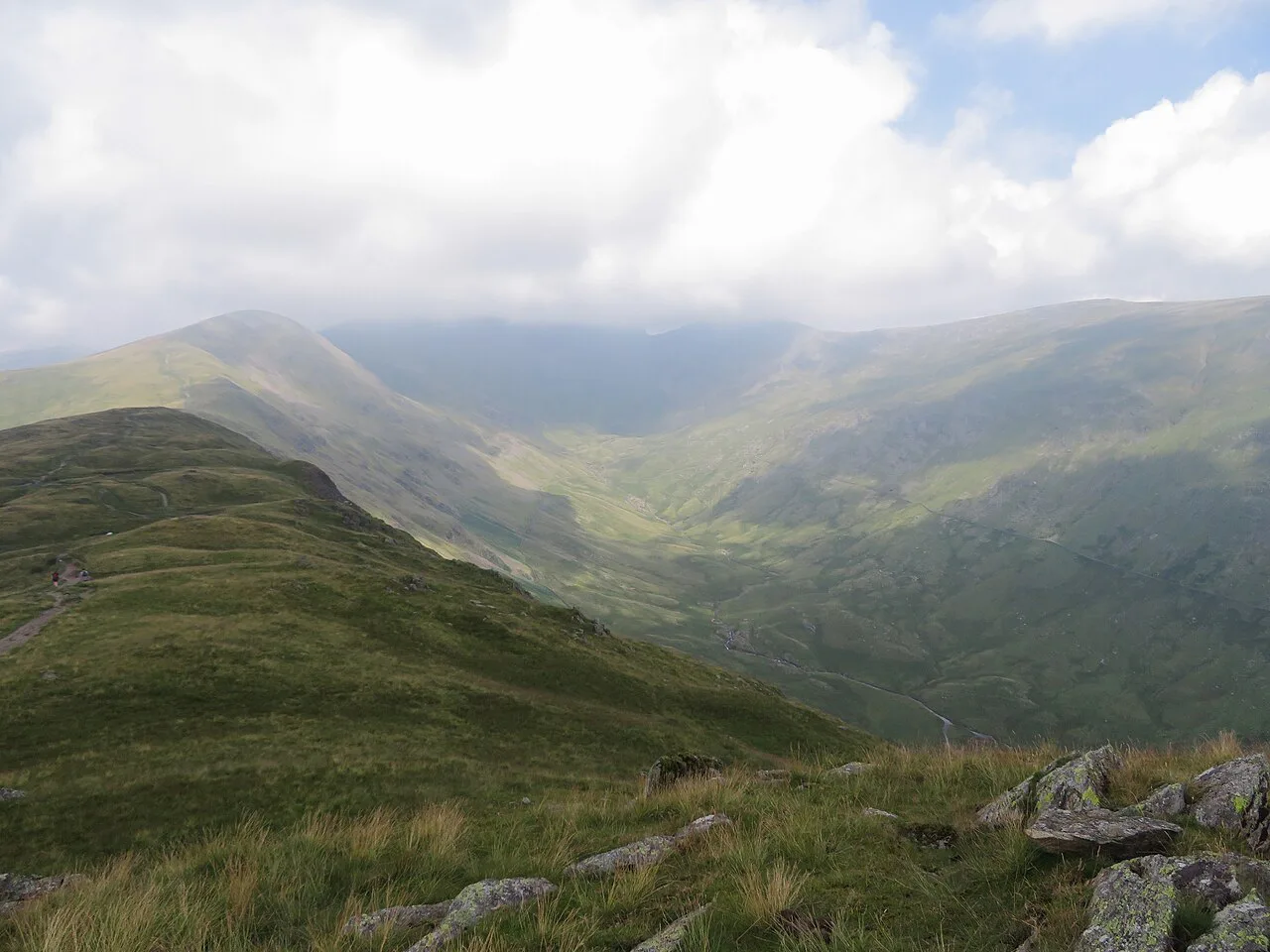
Heading anticlockwise, the route leaves Ambleside on Sweden Bridge Lane, quickly narrows to a track, and works up the eastern side of a beautiful U-shaped valley carved by glaciers. The valley was planted with young trees in 2019 to slow water runoff and reduce flood risk downriver, and the path steepens at the valley head as you gain the ridge. There are no facilities on this stretch, so fill water and sort food in town before you set off.
Leg two: Nab Scar, Heron Pike and Great Rigg
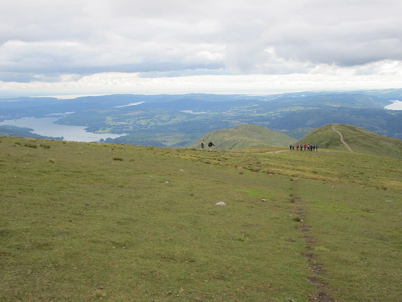
Whichever way you go, the western arm runs over Nab Scar and up to Heron Pike, then on across Erne Crag and Rydal Fell to Great Rigg. From Nab Scar the view opens over Rydal Water and Grasmere toward Loughrigg and the Coniston fells, and the ridge is broad and grassy with only a short rocky step at the top. This is the section with most walking on grass and less on stone, so expect it to be slower after rain.
From Great Rigg a wide shoulder leads to the top of Fairfield, and it is worth pausing to look back at the ridge you have just climbed. If you are planning a second big Lakeland day, the same sketchbook of fells forms the basis of all the routes in our guide to hiking in the Lake District.
Leg three: Fairfield summit plateau
Fairfield's summit is a large, rough and very flat grassy expanse with several cairns, so choosing the actual top matters less than keeping your bearings. In poor visibility walkers have historically become disoriented and descended by the wrong path; if cloud is down, take a compass bearing before you leave the plateau and confirm you are heading south for the return arm. With a clear day, the views to Helvellyn, St Sunday Crag, the Scafells and the sea are the best of the walk.
Leg four: Link Hause, Hart Crag and the return ridge
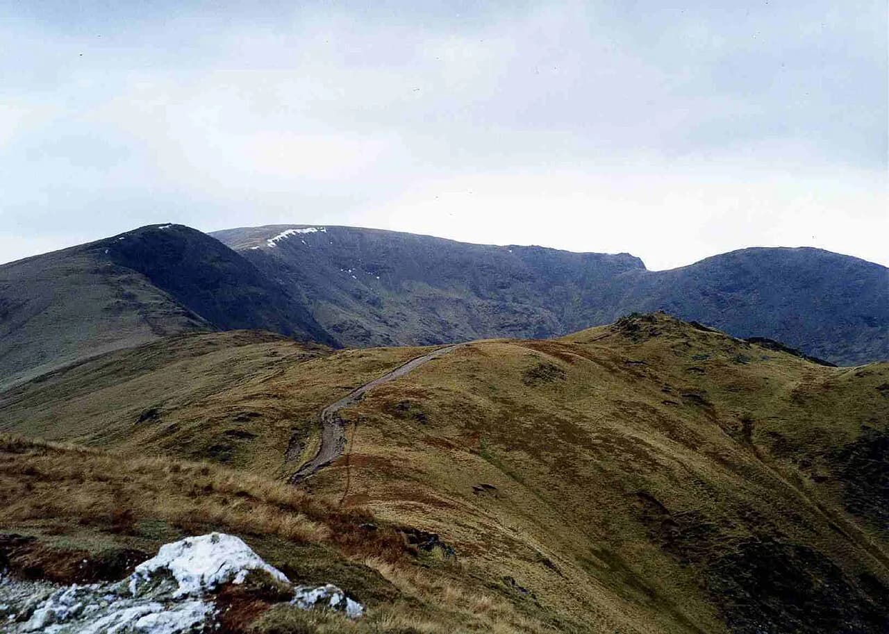
From Fairfield the route drops to Link Hause and climbs Hart Crag, then continues over Dove Crag and the two eastern tops of High Pike and Low Pike back toward the valley. Link Hause and the ridge beyond it are exposed to wind, and a cold day here can feel far worse than the valley temperature; keep a warm layer and gloves within reach. After High Pike the path descends on peaty ground toward Low Pike, and this is the wettest stretch of the circuit after rain.
High Pike and Low Pike are the two summits most often ticked off by folk completing The Wainwrights, the list of Lakeland fells described by Alfred Wainwright. If you are collecting them, note that many walkers save Stone Arthur, the rocky spur over Grasmere, as a separate short day rather than adding it to this round.
Leg five: Low Sweden Bridge and back to Ambleside
Below Low Pike the ground descends to Low Sweden Bridge, passing a short rocky step that needs a little care when wet, then a good stone path runs through Rydal Park past Rydal Hall and its waterfall. From Rydal there is a further 2 km of field and road-side walking back into Ambleside, so leave a little in the tank for the finish rather than sprinting the last of the ridge.
What you see from the ridge
The appeal of the horseshoe is the steady, almost continuous panorama. From the western arm you look down on Rydal Water and Grasmere, with Windermere and Esthwaite Water beyond; from the north side, Helvellyn, Dollywagon Pike, St Sunday Crag and Grisedale Tarn come into view. On the eastern arm, Scandale and Little Hart Crag sit below you to the right, with Windermere and Morecambe Bay in the distance.
Weather, exposure and hazards
The risks here are those of a long high ridge rather than technical terrain: strong wind and windchill on the passes and summits, snow lying on the tops into spring, and cloud dropping over the Fairfield plateau without warning. A party on the ridge in March met 30–35 mph winds with gusts of 35–45 mph over Link Hause and a feels-like temperature near minus 14°C, so carry a windproof and warm layers even on a bright forecast. Have a turnaround time and an alternative low-level walk in mind.
Afternoon storms are a real summer feature, and the horseshoe has little shelter between the valleys, so aim to be on the return ridge before the day builds. Snow on the high ground early and late in the season turns a walk into a winter outing, so take an ice axe and crampons or choose another route if the tops are white. If the forecast promises thunder, keep off the exposed ridge.
When to go
The horseshoe is best from late spring to early autumn, when daylight is long enough for a 6-hour day and the ridge dries out. Mid-week days in this window give the quietest summits, and an early start lets you enjoy the best light on the western arm. Winter days suit only experienced hill walkers with winter kit and short, carefully planned daylight.
Shorter and alternative variants
If you want to be high quickly, an alternative ascent from Ambleside uses Nook Lane instead of Sweden Bridge Lane, the first left off Smithy Brow, and reaches the ridge about 1.5 km west of the main route, missing the U-shaped valley. It is still a circuit and cuts out some of the gentler valley walking. The Rydal start, via Rydal Mount and a steep lane, does much the same job from the other side.
A one-way option continues northeast from Fairfield to Patterdale and Ullswater, but there is no direct bus back to Ambleside, so the return has to be arranged with a lift or another day's walking. If you want a shorter Lakeland circuit with a similar outlook, the Catbells walk above Derwent Water is a good half-day alternative, and further east the ridge over Striding Edge on Helvellyn is a step up in exposure. If you are weighing up a longer trip beyond the Lakes, our hiking in the Peak District covers the same decisions of route length and ridge exposure on another classic English circuit.
What to carry and where the ground stays wet
Pack a map and compass, waterproof jacket and trousers, warm layers and gloves, plenty of water and food, since there are no cafés or huts on the ridge. Most of the circuit is on Ordnance Survey Explorer OL7, with the top of Fairfield falling on OL5, so take both sheets or a single map that covers both. Boots rather than trainers are the sensible choice for the wet ground below High Pike, and gaiters help on that stretch.
Food and beds near the start and finish
Ambleside has the widest choice of accommodation, cafés and pubs, which is one good reason to start and finish there rather than at Rydal. At the Rydal end, Rydal Hall offers rooms and cabins and a teashop near the route, a handy base if you want the steep Nab Scar climb straight from your door. Book beds in Ambleside or Rydal well ahead for summer weekends and school holidays, and confirm your room before planning an early start.
Plan the Fairfield Horseshoe day
Give the Fairfield Horseshoe a full day, choose your direction by which climb you want at the start, and use Ambleside's car park or Rydal's roadside spaces with an early arrival. Go prepared for wind, cloud on the plateau and wet ground below High Pike, and you get one of the finest long ridge days in the Lake District.
Frequently Asked Questions
Is the Fairfield Horseshoe hard?
It is rated hard in some walkers' records because of its length and height gain rather than any technical difficulty. The paths are broad and grass or stone, with no scrambling, but a 16–18 km circuit with 1,000–1,100 m of ascent is a demanding full day for most hikers. Be honest with yourself about your fitness and start early.
How long does the Fairfield Horseshoe take?
Allow about six hours of walking plus stops. Two recorded circuits came in at around 6 hours 15 minutes and six hours respectively, and those did not include long breaks. If you stop often for photographs or walk in winter, plan on longer and carry a headtorch as a backup.
Where do you park for the Fairfield Horseshoe?
The two options are Rydal Road car park at the northern end of Ambleside, and the roadside spaces at Rydal Church. Rydal's spaces once held around twenty cars but were reduced after storm damage to the road in 2015, so early arrivals have the best chance. There is an honesty box by the church for the roadside parking.
Can you do the Fairfield Horseshoe by public transport?
Yes. Take the train to Windermere, then a short bus ride to Ambleside or Rydal. Confirm the current timetable with the bus operator before you travel, since the last service back to Windermere will decide how early you must start.
Is clockwise or anticlockwise better?
For most first-timers, anticlockwise from Ambleside is the more comfortable choice: the Sweden Bridge valley gives you a long, gradual climb to the ridge, and you descend the steeper Nab Scar ground while still fresh. Clockwise is a good second visit, and some walkers prefer the gentler finish.
What is the best month to walk the Fairfield Horseshoe?
Late spring to early autumn offers the longest days and the driest ridge, and mid-week is quietest. Snow can lie on the tops into spring, and winter turns the horseshoe into a serious winter walk needing ice axe and crampons. Afternoon storms are possible in summer, so plan an early start.
Which summits are on the Fairfield Horseshoe?
Walking anticlockwise from Ambleside, the tops are Low Pike, High Pike, Dove Crag, Hart Crag, Fairfield, Great Rigg, Heron Pike and Nab Scar. Erne Crag and Rydal Fell sit between Nab Scar and Great Rigg, and Link Hause is the pass between Fairfield and Hart Crag.
Can you shorten the Fairfield Horseshoe?
You can reach the ridge faster by using the Nook Lane ascent from Ambleside, which misses the U-shaped valley, or by starting at Rydal. Both still give a long half-horseshoe day. A Patterdale finish makes a shorter one-way day but needs a lift back to the start, since there is no direct bus.
Sources
Trail notes for your next trip
Optional updates when we add or revise hiking guides.
You might also like



Continue reading
More guides you'll find useful





