
Tarn Hows Walk: The Lake District's Easy Circular Trail
Walk the Tarn Hows circuit in the Lake District: a mostly level gravel path around the tarn with mountain views, plus trailhead and route details.
On this page
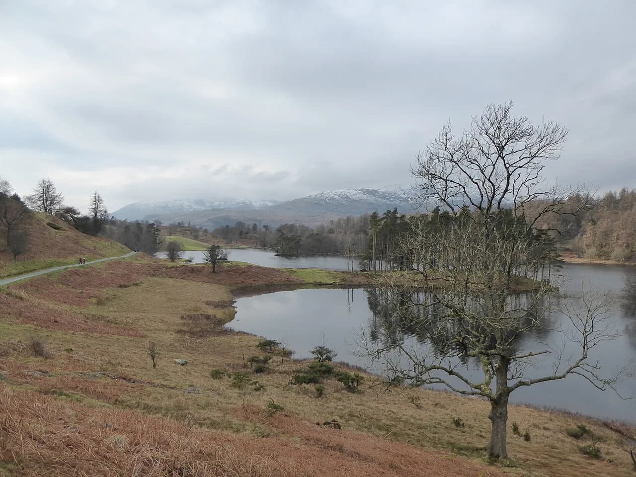
Tarn Hows delivers one of the Lake District's finest panoramas for very little effort: a wooded tarn cupped by conifers, with the Coniston fells and the surrounding peaks rising behind it. The circuit suits families with young children, prams, mixed-ability groups and anyone who wants a short walk with a big view rather than a summit day. It is a walk you do for the setting, not to bag a peak.
What the Tarn Hows walk offers and who it suits
The appeal is simple: a single lake in its own bowl, a path that loops right around it, and mountain views that open up as you go. The estate was reshaped in the 1860s by James Garth Marshall, who combined the original small lakes into one body of water and planted the surrounding trees; Beatrix Potter and the National Trust later bought and restored the land, and the estate is now managed so that people of all abilities can walk around the lake.
This is a destination walk rather than a through-route: the tarn sits in a hollow, so you loop it and return to where you started. If you are comparing options for a first day in the Lakes, treat this as the low-effort, high-reward choice and save the summits for another day of hiking in the Lake District.
Where Tarn Hows is and how to reach the trailhead
Tarn Hows lies in the Lake District between Coniston and Hawkshead, in the Westmorland and Furness area of Cumbria, with the postcode LA21 8DP used for the site. Coniston village is the nearest practical base, and Windermere and Ambleside are within easy driving range for a half-day outing.
The approach is by narrow country lanes, so allow extra time if you are towing or driving a large vehicle, and expect to meet oncoming traffic on the single-track sections. There is no railway station at the tarn itself; the nearest railheads are at Windermere and, on the west side, Foxfield, from which you would need a taxi, bike or a long connecting walk. Check current bus and train times with the relevant operator before you commit to a car-free day, as seasonal services change.
Parking at Tarn Hows
Parking is at the National Trust car park beside the tarn, which puts you directly at the start of the circuit with no approach walk. Spaces are limited relative to the site's popularity, and the car park fills quickly on fine weekends, school holidays and in autumn when the colors bring the crowds. Arriving early or late in the day is the most reliable way to avoid circling.
Charges and any member arrangements are set by the National Trust, and the trust publishes current parking information on its own Tarn Hows page; check that before you travel, because payment methods and charges do change. If the main car park is full, do not park on the narrow lanes, which block farm and emergency access.
Distance, terrain and walking time
Published distances for the circuit vary with how the loop is measured: one guide gives 1.5 miles (2.4 km), while a family-focused route description gives 3 km (1.9 miles).
Treat the circuit as roughly 2.5 to 3 km (1.5 to 1.9 miles) depending on the exact line you take. No source gives a reliable ascent figure, so plan on gentle gradients rather than a flat promenade: the path is hard-packed, level gravel for the most part, but there are sections of relatively steep ascent and descent around the tarn.
For most walkers the loop takes well under an hour of moving time, and two hours with children, a picnic and photo stops is realistic. The terrain is firm enough for a pram or a basic wheelchair on the main path, though the steeper pulls and any muddy patches after rain will slow a wheeled push. Walk it clockwise or anticlockwise as you please; the views change but the effort is similar.
Route description around the tarn
From the car park, the path drops gently to the water and then follows the shoreline, with the tarn on one side and conifer plantation on the other. The western shore carries the most open views across the water to the fells, while the eastern side runs more through trees. Keep the water on your left or right and you cannot get lost; there are no junctions to puzzle over.
The pulls come where the path lifts over small rises between the shore and the surrounding woodland, and these are short rather than sustained. Benches and viewpoints appear at intervals, making it easy to break the circuit into short stages for younger walkers or anyone pacing themselves. The path is a maintained estate track, so footwear choice is undemanding: trainers or light shoes are fine in dry weather, with something grippier for wet autumn leaves.
Views and what you see from the path
The setting has drawn artists and photographers for generations, and it is easy to see why: the water reflects the conifers, and the Langdale and Coniston fells frame the view. The tarn is also a working landscape, with rare Belted Galloway cattle and Herdwick sheep grazing beside the water.
If you want a longer day with a summit, the higher fells around Coniston and the Langdale valleys are outside the tarn bowl but within the same part of the national park. The Wainwrights, Alfred Wainwright's catalogue of Lakeland summits, are the natural next step once a flat loop stops feeling like enough. For a very different kind of day, the ridge walk over striding edge or the lower catbells walk give you the Lake District ridge experience that Tarn Hows deliberately does not. If you would rather compare low-level circuits elsewhere before committing to a summit day, our Yorkshire Dales hikes offer the same easy-loop contrast.
When to go: seasons and conditions
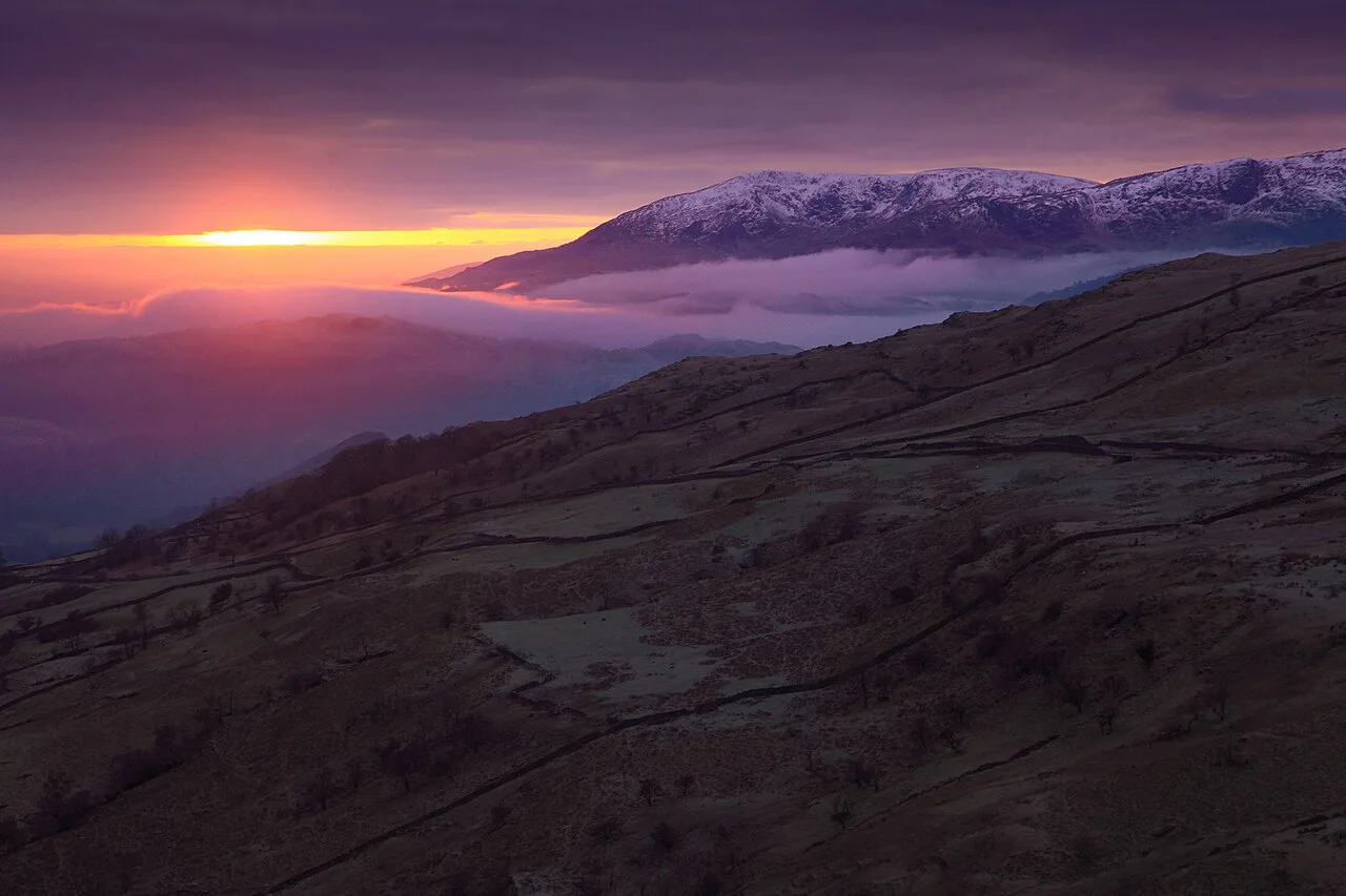
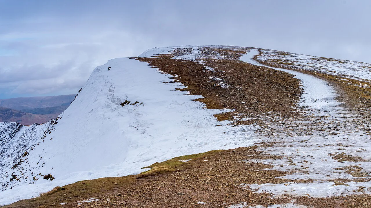
Autumn is the classic season here, when the larch and beech turn and the low light picks out the fell tops; spring brings fresh green and fewer people, and summer offers the longest days but the fullest car park. Winter visits can be beautiful in frost or snow, but the lanes can be icy and the path slick, so allow for slower going and shorter daylight.
The Lake District is one of the wettest parts of England, and the gravel path drains well but still holds puddles after heavy rain. Waterproof jackets and a spare layer are sensible year-round, and midge repellent helps on still summer evenings near the water. Avoid the busiest bank holiday weekends if you want the loop to yourself.
Facilities, grazing animals and path etiquette
The tarn is a short visit rather than a full-day facility: there is no village at the water, so bring your own food and water and take litter home. Coniston and Hawkshead have the nearest shops and cafés for before or after the walk. For current facilities and any estate notices, the National Trust's Tarn Hows page is the authoritative source.
Cattle and sheep graze the estate, so keep dogs under close control or on a lead around livestock, especially in spring when there are lambs and calves. Give animals space and walk around rather than through a herd, and close any gates you open. The path is shared with families and wheeled users, so keep to one side and let faster walkers pass.
Walking Tarn Hows with a dog
If you are bringing a dog to Tarn Hows, the first thing to plan around is the livestock. The estate is grazed by rare Belted Galloway cattle and sturdy Herdwick sheep, which share the ground with walkers on and around the tarn. Plan your lead use before you arrive rather than once you are through the gate, and remember that the animals are not confined to a distant field: the tarn sits within working countryside, so they may be close to the path. Checking your dog at the first sight of stock keeps the walk straightforward for everyone.
The second consideration is the surface. The circular route is described as hard-packed, level gravel with gentle gradients, and as a firm gravel path with some areas of relatively steep ascent and descent around the tarn. For a dog this is easy underfoot, but the combination of gravel and changeable gradients means the loop is best taken at a steady pace, particularly where the path dips and climbs. An accessible path is not the same as a flat one, and a dog that pulls on descents will make those short steeper sections harder than they need to be.
Beyond the immediate surroundings of the tarn, the estate has a wider footprint. The land was developed with an array of tree species which now dominate the area, and the body of water itself was reshaped, with the flow of water redesigned. That means trees, water and open ground in close succession, giving a dog plenty to notice on a short circuit. Because Beatrix Potter and the National Trust purchased the land and later restored it, the estate is managed as a place where people of all abilities can walk around the lake, so you will be sharing the path with a wide range of visitors and should expect to keep your dog close at busy points.
Are there livestock on the Tarn Hows walk and what does that mean for dogs?
Yes, there are livestock grazing by the tarn: rare Belted Galloway cattle and sturdy Herdwick sheep. These animals are not confined to distant fields; they graze around the tarn, so you and your dog may encounter them at close quarters. The cattle are large and imposing, and the sheep are sturdy and used to hill life. Both are essential to the management of this landscape.
Because of the grazing animals, the Tarn Hows path is not an off-lead free-for-all. The National Trust estate is a place where people of all abilities can walk around the lake, and the path is shared with many visitors. Keeping your dog under close control—ideally on a lead—when livestock are present is the responsible choice. Even the most obedient dog can be unpredictable around cattle, and a loose dog can cause stress to sheep and cattle alike.
The circular loop runs about 3 km (1.9 miles), with a firm gravel path that has some areas of relatively steep ascent and descent around the tarn. This is good news for dogs and owners alike: the going is easy underfoot, with no rough, rocky or muddy sections to negotiate, though you will meet a few short pulls. That makes the walk manageable without worrying about tricky terrain.
In practice, keeping your dog on a short lead near the cattle and sheep, and giving them space, will make the walk enjoyable for everyone. The estate is a place where people of all abilities can come and walk around the lake and enjoy the dramatic landscape of the Lake District—with a dog, that same welcome applies.
Plan Your Visit
Tarn Hows is the walk to choose when you want Lake District scenery without a summit: a short, firm-surfaced circuit with the water at its center and the fells all around. Base yourself in Coniston or Windermere, start early to secure a parking space, and treat the loop as a relaxed half-day rather than a route to rush.
If you enjoy this low-level walking, use it as a warm-up and then move on to something with more climb; the rest of the national park offers plenty of contrast, from easy valley paths to exposed ridges. Check the National Trust's current Tarn Hows information for parking and estate notices before you set out.
Frequently Asked Questions
How long does it take to walk around Tarn Hows?
Most walkers complete the circuit in well under an hour of steady walking. With children, a picnic and photo stops, allow around two hours. The published loop distances vary between roughly 2.4 km and 3 km, so pace yourself accordingly.
Is the Tarn Hows walk pushchair-friendly?
The main path is hard-packed gravel with gentle gradients, and it is described as fully accessible on the level sections. There are a few relatively steep pulls around the tarn and puddles after rain, which will slow a pram or wheelchair. Dry-weather visits are the easiest.
Where do you park for the Tarn Hows walk?
Parking is at the National Trust car park beside the tarn, which sits at the start of the circuit. Spaces are limited and fill early on fine weekends and school holidays. The National Trust publishes current charges and arrangements for the site.
What is a tarn?
A tarn is the local word for a small mountain lake. Tarn Hows itself began as three natural lakes that were combined into one body of water in the 1860s by James Garth Marshall, who planted the surrounding trees.
Sources
Trail notes for your next trip
Optional updates when we add or revise hiking guides.
You might also like



Continue reading
More guides you'll find useful





