
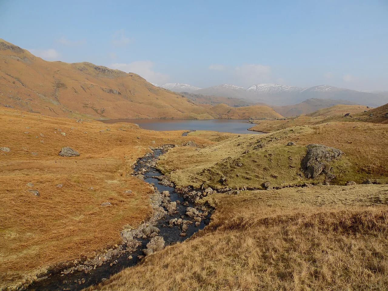
Easedale Tarn Walk from Grasmere: Route, Distance and Ascent
The Easedale Tarn walk from Grasmere climbs past Sourmilk Gill to a quiet tarn below Tarn Crag. Here is the route, distance, ascent and the loop back.
On this page
The Easedale Tarn walk is the classic half-day outing from Grasmere: a valley track, a waterfall, a mountain lake and a summit option, all starting from the village centre without a car. It suits hikers with ordinary fitness and a pair of boots, and it rewards anyone willing to trade a little mud for a quiet shoreline. The tarn sits in the Central Fells of the Lake District, below Tarn Crag and the ridge toward Helm Crag.
What the Easedale Tarn walk offers and who it suits
The route delivers three things in a short day: a waterfall climb, a lake big enough to feel wild and a view back over Grasmere toward Windermere if you continue to the summit. It fits hikers who want a real mountain day without exposure, scrambling or a long approach drive. The tarn loop is rated moderate, needing good fitness, mostly accessible paths and sure-footedness where the ground turns rough.
Families and casual walkers can treat the tarn as the day's goal and turn around there; stronger hikers add Tarn Crag for the summit panorama. The one thing that catches people out is the wet ground around the far shore rather than the angle of the path. Waterproof boots make the full circuit far more enjoyable than trail shoes.
Trailhead: leaving Grasmere village on Easedale Road
The walk begins on foot from the middle of Grasmere, heading out along Easedale Road opposite Sam Read's bookshop. That makes the village itself the trailhead: you leave your accommodation, walk through the streets and are on the fell path within minutes. Parking in the village is the obvious option for drivers, and the loop route starts right next to a car park.
Follow the signs for Easedale Tarn and cross Goody Bridge, where a footbridge signposted on the left leads into the fields. This is the first decision point of the day, so keep the map or route loaded on your phone before you set off from the village.
Distance, ascent and walking time
The full loop from Grasmere village to Easedale Tarn and back measures 9.85 km (about 6.1 miles) with 240 m (about 790 ft) of ascent, and hikers typically take around 2 h 54 min. That figure includes the circuit around the tarn and the return through the valley, so the out-and-back to the shoreline is shorter in both distance and time.
Adding Tarn Crag transforms the day into a longer fell circuit of 8.5 miles with 1,900 feet of ascent, roughly doubling the climbing. Choose the summit version only if you have the legs for a full day out and the weather is clear enough to make the view worthwhile.
Route description: Goody Bridge, the slate track and the field path
Beyond Goody Bridge a slate and stone track runs across the field alongside the water, then begins to climb toward the tarn. The path is clear and signed, with the first part of the tour visible from the village itself across White Crag.
The alternative is the field path on the right-hand side of Easedale, which walkers use to avoid the busier valley line toward the tarn. Either way the gradients are gentle at first, and the views back to Grasmere and over to Windermere open up as you gain height.
Sourmilk Gill waterfall and the stepped climb
Sourmilk Gill is the landmark that tells you the real climb has started, with the waterfall dropping through the fold in the hills beside the path. Above it the route becomes a stepped stone staircase, which is the main physical effort of the day and the section that rewards a steady pace rather than a fast one.
This is also where the walk feels most enclosed, with water on both sides and the tarn still hidden ahead. Keep an eye on the weather here: the stones run with water after rain and mist can close in quickly on the upper valley.
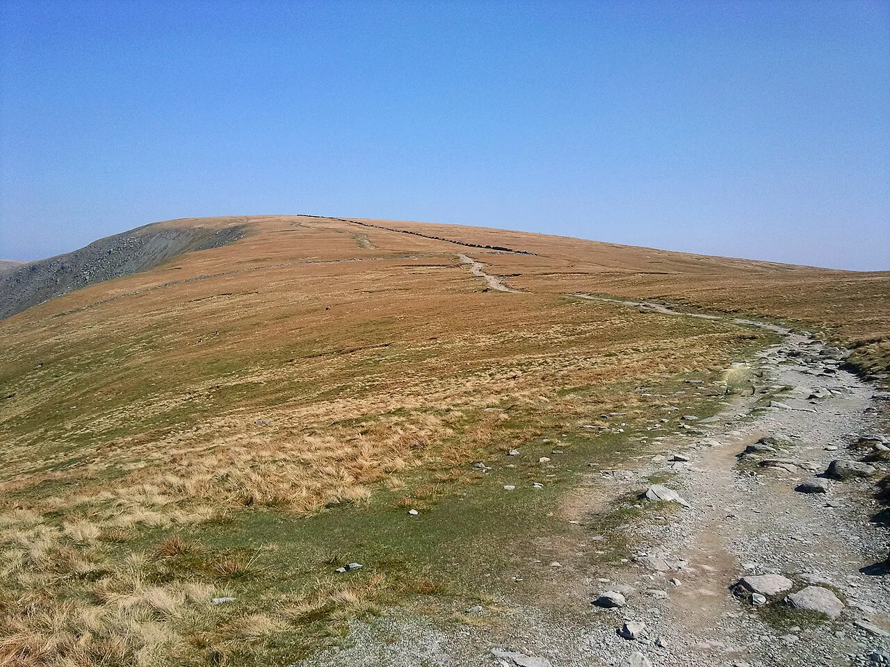
Easedale Tarn: shoreline, the boggy far end and the quieter Codale Tarn detour
The tarn fills a bowl below Tarn Crag, and the shoreline offers plenty of spots to stop for a relaxed lunch with the water at your feet. The far end of the tarn is boggy but can be worked around, so waterproof boots are the sensible choice if you plan to complete the full circuit rather than turn back on the near shore.
From the tarn a short detour leads to Codale Tarn, a much quieter pool tucked below Tarn Crag. Walkers who drop to Codale Tarn before rejoining the Easedale path get a genuinely peaceful stretch and a different angle on the fell above.
Extending to Tarn Crag summit and what the extra ascent buys you
Tarn Crag rises above the tarn and, on a clear day, gives a view back over Grasmere with Windermere in the distance. The summit is the payoff for the extra climbing, and the summit ridge connects toward Helm Crag and the fells above the village.
The upper slopes are more exposed than the valley track, so wind and low cloud matter more here than they do beside the water. If the summit is in cloud when you reach the tarn, the sensible trade is to save the extra ascent for a clearer day and enjoy the shoreline instead.
The descent: retracing the valley or the loop back to Grasmere
The simplest descent retraces the stepped path past Sourmilk Gill and follows the track back to Goody Bridge and the village. The fuller circuit continues from the tarn past Codale Tarn and down through Easedale, passing Easedale Gill and the old quarry buildings before rejoining the valley path.
The loop is the better choice if you want variety and don't mind wet ground, while the out-and-back keeps the day short and the navigation simple. Either way you finish in Grasmere, where gingerbread from Sarah Nelson's is the traditional reward.
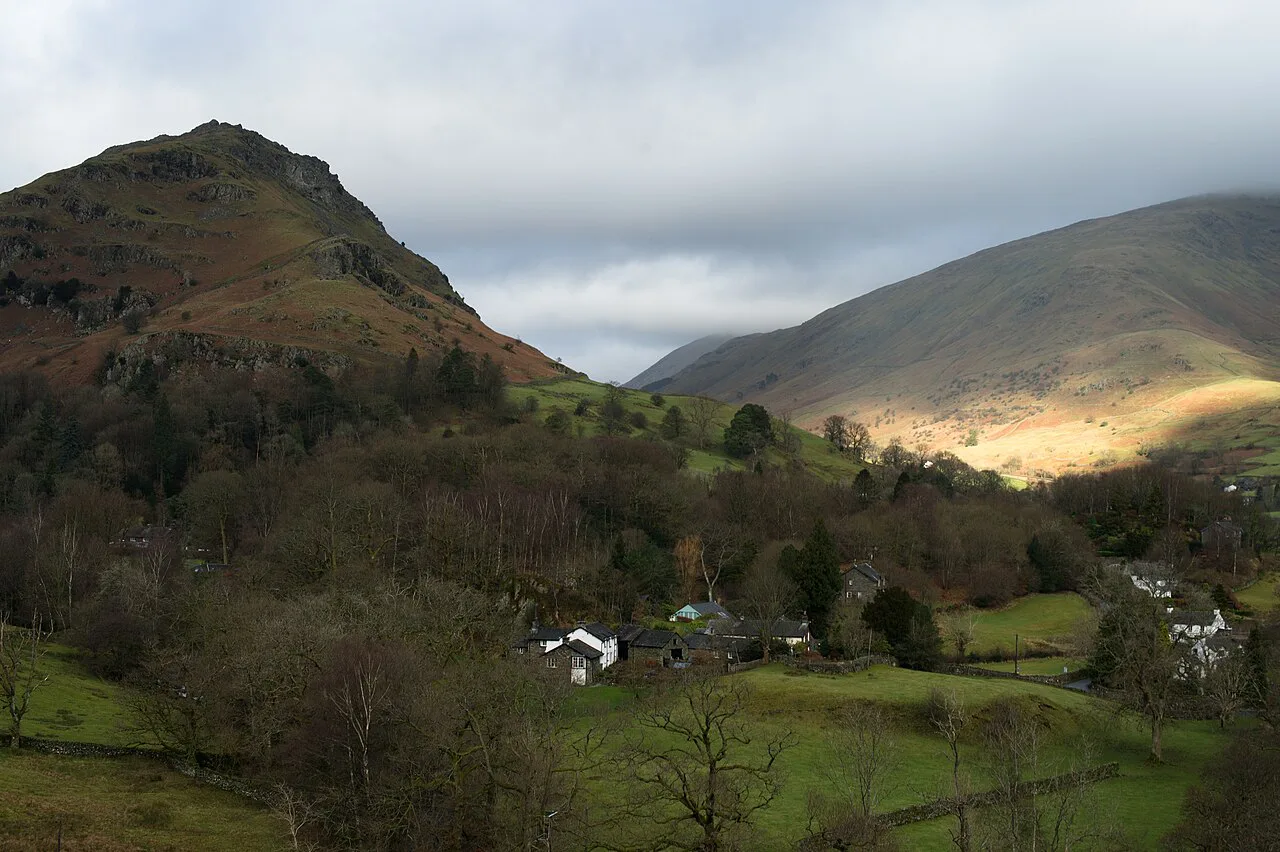
When to go: seasons, mist and wet ground underfoot
Spring and autumn give the best combination of clear views and quiet paths, and a wet March day still delivers waterfalls and atmosphere in the valley. Summer brings the driest ground but also the busiest track toward Easedale Tarn, so start early if you want the shoreline to yourself.
Mist is common on the fells and can sit low over the tarn while the village below is clear. Carry a map and compass, know which side of the valley you are on and be ready to turn back from the summit extension if the cloud thickens.
Huts, bases and where to stay in Grasmere
Grasmere is the natural base, with the walk starting from the village centre and no car needed. Accommodation in the village ranges from hostels to inns, and staying locally means you can walk out of the door rather than drive in.
There are no mountain huts on the tarn route, so this is a day walk rather than a hut-to-hut stage. For the wider picture of fells, valleys and bases across the region, the guide to hiking in the Lake District sets out the main areas and how they connect. If you are weighing up other regions for a similar valley-and-lake day, hiking in Scotland offers a useful comparison of terrain and bases.
If you plan to collect summits, Tarn Crag counts as one of the Wainwrights, the fell tops catalogued by Alfred Wainwright. That makes the Easedale circuit a natural early entry in a longer list.
Practical notes for the walk
Wear boots with good grip, carry waterproofs and take water and food, since the route has no facilities once you leave the village. The stepped path beside Sourmilk Gill is the steepest sustained section, so pace yourself there and save energy for the shoreline and any summit extension.
The route crosses the Lake District National Park, so follow the usual fell etiquette: keep to the path across the fields, close gates and take litter out with you. Check path conditions before you set out.
Taking a dog on the Easedale Tarn walk
One of the attractions of the Easedale Tarn walk from Grasmere is that the same footpaths suit a dog as well as a person. On a walk to Tarn Crag recorded on Andrews Walks, the route began from parking in the middle of Grasmere and went out of the village along Easedale Road, opposite Sam Read’s bookshop. The party reversed the intended direction to avoid a group of schoolchildren heading for Easedale Tarn and climbed along the right-hand side of Easedale without meeting anyone else on the ascent. A dog on that climb was at ease on the easy going to the top, and on the descent to Codale Tarn, described as a lovely quiet spot, Bonnie enjoyed a cooling swim.
Water appears at several points along the route, so a dog that likes to swim has options beyond the tarn itself. The Komoot route for the Easedale Tarn and Grasmere village loop lists Sourmilk Gill Waterfall and the Easedale Valley Waterfall as highlights, and notes Easedale Tarn as a place with excellent spots to get down for a relaxed picnic. The same route passes the Llanerchog Stone Bridge and cobbled path, then climbs on a slate and stone track, with stone steps clearly marked, towards the tarn.
Ground conditions matter for four-legged walkers as much as for their owners. The Komoot route is graded Moderate, with good fitness required and sure-footedness needed. A walker’s comment on that route records that the far end of Easedale Tarn is a bit boggy but easily got around, and advises waterproof boots for a full circuit. That same route covers 9.85 km with 240 m of ascent and is given as 02:54 in walking time, figures worth weighing against a dog’s stamina. In mist, the account of a wet March day describes the lake reached through heavy mist, with the descent made twice as fast as the climb.
Plan Your Visit
The Easedale Tarn walk is the best-value day out from Grasmere: a short climb, a mountain lake and an optional summit, all from the village centre. Decide in advance whether you are doing the tarn loop or the longer Tarn Crag circuit, and pack for wet ground either way.
Start early, keep an eye on the cloud above the tarn and leave time for the descent through the valley. The result is a classic Lake District half-day that suits most hikers with boots and a map.
Frequently Asked Questions
How long is the Easedale Tarn walk from Grasmere?
The loop from Grasmere village to Easedale Tarn and back is 9.85 km (about 6.1 miles) with 240 m (about 790 ft) of ascent, and hikers typically take around 2 hours 54 minutes. Walking only to the shoreline and back is shorter in both distance and time, because the published figure includes the circuit around the water.
Is the Easedale Tarn walk hard?
It is rated moderate: you need good fitness, the paths are mostly accessible and there are short stretches where sure-footedness matters. The stepped stone staircase above Sourmilk Gill is the main effort, and the ground at the far end of the tarn is boggy, so waterproof boots help on the full circuit.
How much ascent is there on the Easedale Tarn walk?
The tarn loop climbs 240 m (about 790 ft) from the village. If you extend the day to Tarn Crag, the fuller circuit measures 8.5 miles (about 13.7 km) with 1,900 ft (about 580 m) of ascent, so the summit roughly doubles the climbing.
Can you walk to Easedale Tarn from Grasmere village without a car?
Yes. The route leaves the middle of Grasmere along Easedale Road, opposite Sam Read's bookshop, so the village itself is the trailhead. Drivers can park in the village, and the loop route begins right next to a car park.
Is the Easedale Tarn loop boggy?
The far end of the tarn is boggy but can be worked around, which is why boots with grip beat trail shoes on the full circuit. The descent past Codale Tarn and down through Easedale also runs over wet ground after rain.
How do you add Tarn Crag to the Easedale Tarn walk?
Continue above the tarn to the summit of Tarn Crag, then descend to Codale Tarn and rejoin the Easedale path back to Grasmere. The summit gives a view back over Grasmere with Windermere in the distance, and it is worth the extra ascent only when the cloud is above the top.
Sources
Trail notes for your next trip
Optional updates when we add or revise hiking guides.
You might also like



Continue reading
More guides you'll find useful





