
Scafell Pike Walk: Routes, Distance, Ascent and Walking Time
Plan a Scafell Pike walk from Wasdale, Seathwaite or Langdale: route choices, distance, ascent, rough ground, navigation and the best months to go.
On this page
Scafell Pike rewards hikers who want a genuine mountain day rather than a stroll: rough rock underfoot, a sustained climb and a summit plateau that opens views as far as Wales and Ireland on a clear day. At 978 m (3,209 ft) it is England's highest point, set inside the Lake District National Park.
The walk suits fit hillwalkers with some scrambling confidence and map-and-compass skills. There are several distinct approaches, and the right one depends on how much time you have, how steep you want the day to be and where you can base yourself for the night.
What the Scafell Pike walk involves
The summit stands at 978 m (3,209 ft) in the Lake District National Park, and the standard routes all involve sustained uphill walking followed by a long descent on uneven rock. Footing is the real test: loose stones, boulder steps and wet slabs slow progress far more than the distance suggests.
Paths are not reliably signposted, and cloud can hide the landmarks that tell you which way to descend. Treat navigation as part of the route choice rather than an afterthought, and carry a paper map and compass even if you use a phone app.
If you are working through the Lakeland fells, Scafell Pike is one of the 214 summits catalogued by Alfred Wainwright, and many hikers pair it with nearby tops such as Great End or Ill Crag on the way back. The Wainwrights list is a useful way to plan a season of days rather than a single outing.
Where Scafell Pike is and how the trailheads differ
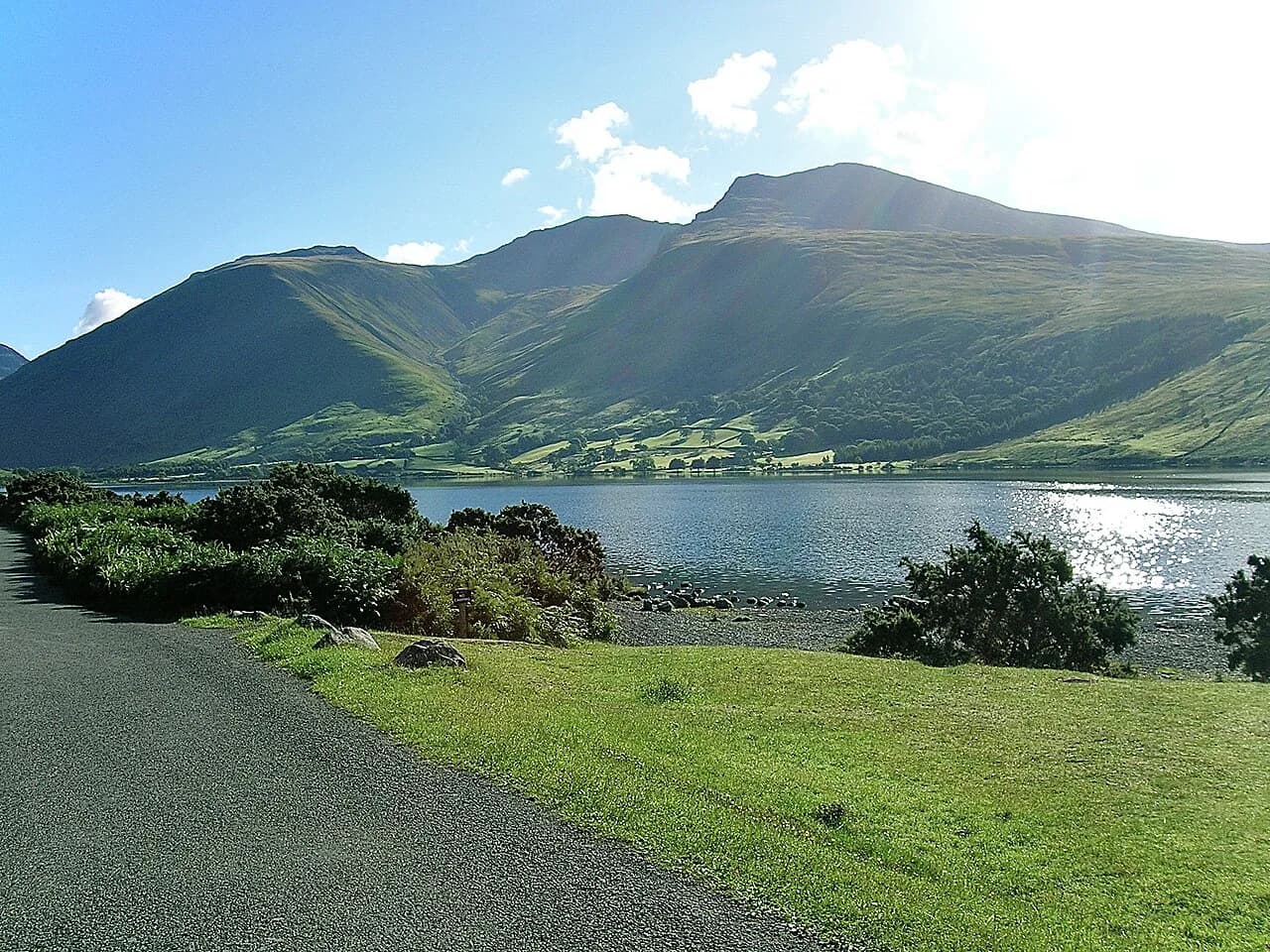
Scafell Pike sits in the western Lake District, above the valley of Wasdale and its lake, Wast Water, with Borrowdale to the north-east and Great Langdale to the east. The summit is the highest of a rocky group that includes Scafell, Broad Crag and Great End.
The main starting points are Wasdale Head, Seathwaite in Borrowdale, Great Langdale and the Eskdale side. Wasdale gives the shortest, steepest line to the top; Seathwaite and Langdale give longer, more varied mountain days; Eskdale approaches are the quietest and the longest.
Choosing a route: short and steep versus long approaches
Pick by the shape of the day you want, not by distance alone. The Wasdale line is the quickest way up but climbs hard and relentlessly; the Seathwaite and Langdale routes spread the same height gain over more ground and add ridge scenery, at the cost of a longer, more committing day.
Anyone new to rough Lakeland ground should start with a shorter fell day such as the Catbells walk above Derwent Water before committing to Scafell Pike's boulders and descent. Judge yourself on how you felt on the way down, not at the summit.
Wasdale via Brown Tongue and Lingmell: trailhead, distance and time
From Wasdale Head the route climbs past Brown Tongue to Hollow Stones, then gains Lingmell Col before the final pull to the summit plateau. It is the shortest approach in terms of ground covered, but the gradient is sustained and the upper section is loose and rough.
Allow more time than the distance suggests and set a turnaround time that leaves enough daylight for the descent. Because this line is steep in both directions, tired legs on the way down are the usual reason a Wasdale day runs long.
The National Trust asks walkers on its Wasdale Hollow Stones route to keep dogs on a short lead because livestock graze there. Take dog waste away with you rather than leaving bags beside the path.
Seathwaite and the Corridor Route
From Seathwaite in Borrowdale the walk begins with an easy mile along the beck to Stockley Bridge, then climbs steadily past Styhead Tarn. From the tarn the Corridor Route traverses beneath the crags toward Mickledore, the ridge that links Scafell with Scafell Pike.
The Corridor Route is rocky in places and includes a steep step down a rocky ledge where you need your hands. In wet conditions that obstacle demands care, though most walkers manage it with steady footing.
The route's advantage is the scenery it strings together: Pulpit Rock, the views into Wasdale from Lingmell, and Mickledore itself before the final climb. A short diversion to Lingmell gives the best unbroken views of the Wasdale valley.
The full Scafell and Scafell Pike circuit from Seathwaite
The classic circuit from Seathwaite Farm covers 17.5 km (11 miles) with 1,639 m (5,377 ft) of climbing and takes roughly 7 to 10 hours, graded strenuous. It adds Scafell via Lord's Rake, a steep scree gully, and returns over Broad Crag, Great End and Esk Hause before descending beside Grains Gill.
Lord's Rake is the crux: scree slides underfoot and slows the climb, and the exit gives a startling view down to Wast Water. This is a step up from a summit-only route, so save it for a day with a settled forecast and plenty of daylight.
Ill Crag and Broad Crag sit close to the return line, so peak baggers can add them without much extra distance. From Esk Hause the way back runs past Sprinkling Tarn and down Grains Gill to Stockley Bridge.
Great Langdale via Bowfell and Esk Pike
The Langdale approach is the long ridge day: up from the valley over Bowfell and Esk Pike to Esk Hause, then on to the summit. It is the most scenic way to combine several high summits in one outing, and the least suitable for anyone unsure of their endurance.
This line keeps you on high ground for hours, so wind, cloud and rain matter more than on the shorter Wasdale climb. Start early, and be ready to turn at Esk Hause if the weather or the group's pace is going the wrong way.
Eskdale approaches and what they demand
Eskdale gives the quietest and longest lines to the summit, with more approach walking before the real climbing begins. They suit hikers who want solitude and a full day out rather than the shortest possible route.
Because these routes are less frequented, navigation confidence matters more: fewer boots wear the line and cloud can remove what few landmarks there are. Carry the map and compass and know how to take a bearing before you commit.
Route description landmarks
Use the named features as checkpoints: Brown Tongue and Hollow Stones on the Wasdale line, Lingmell Col above them, and Mickledore between Scafell and Scafell Pike. From Mickledore the summit climb is short but rough, and Broad Crag and Great End sit along the north-eastern return.
The summit plateau is a boulder field, and the correct descent may not be obvious in mist. Note your line of ascent, take a bearing for the way down, and do not guess a direction just because it slopes downhill.
Distance, ascent and walking time for each main route
For the Seathwaite circuit, plan on 17.5 km (11 miles), 1,639 m (5,377 ft) of climbing and 7 to 10 hours, graded strenuous. The moving time alone is long, and breaks, navigation stops and the rocky descent all add to it.
For the Wasdale, Langdale and Eskdale lines, treat published figures as route-specific and confirm the numbers for the exact line you intend to walk. Then add a margin for the descent and an agreed turnaround time.
Terrain, exposure and scrambling
Expect rough rock throughout, with hands-on moves on the Corridor Route ledge and loose scree in Lord's Rake. Wind and rain make the same ground much harder, and the summit plateau gives little shelter.
Snow and ice on the upper section call for winter skills and equipment; without them, choose a day and route without winter conditions or go with qualified instruction. On clear summer days the main hazard is simply fatigue on the descent.
If you want exposed ridge scrambling as a step toward harder ground, Striding Edge on Helvellyn across the national park is the classic next outing. Build up on days like that before adding Lord's Rake to a Scafell Pike circuit.
Navigation
There are no significant signposts on Scafell Pike and mobile coverage is unreliable, so at least one person in the group should be competent with map and compass. Practise before the day rather than learning on the summit plateau.
Leave someone your planned route, start and finish points and expected return time, and tell them when you are back. In an emergency call 999 or 112 and ask for Police, then Mountain Rescue.
When to go
Summer gives the longest daylight and the best chance of a clear summit, but afternoon cloud and rain arrive quickly in the Lake District. Start early, watch the mountain forecast, and keep enough time for the descent before dark.
Spring and autumn are quieter but can hold snow and ice high on the route, and winter demands proper skills and kit. In any season, low cloud affects navigation, not just the view.
Getting to the trailheads and parking
Wasdale Head is reached by road at the end of the valley beyond Wast Water, and Seathwaite sits at the end of the Borrowdale road. Both are small hamlets with limited space, so arriving early matters on fine weekends.
For current parking charges, bus connections and road conditions, check the National Park and local operator pages before you travel, since these details change seasonally.
Huts, accommodation and bases
Wasdale Head and Seathwaite both make practical bases, with the shortest drive to their respective trailheads. Great Langdale suits the ridge approach and gives access to a wider choice of pubs, campsites and bunkhouses. If it is the base-not-route decision you are weighing, the Scotland hiking guide covers the same trade-off between trailhead villages and remoter starts.
There is no hut on the summit route itself, so plan your day as a return to the valley rather than a mountain hut night. Book accommodation ahead in summer, when Wasdale and Borrowdale fill up.
Dogs and children on the walk
Scafell Pike is a poor first fell walk for a dog: the summit boulders are tiring on paws, and the descent is long. Build experience on shorter rocky walks and carry water for the dog, and keep it on a short lead where livestock graze.
Children who walk the route themselves need recent experience of rough ground and steep descents. Carrying a baby or toddler adds weight on uneven rock, so practise with the carrier first and be ready to choose a shorter day.
Guided walks and when a mountain leader helps
A guided day removes the navigation burden and suits hikers new to the mountain, poor visibility or a winter attempt. Operators run small-group open days and private walks, with prices set per operator.
If you are unsure about route-finding or winter conditions, a qualified leader is a better investment than extra kit. Otherwise, build the skills on easier fell days and go independently.
Plan Your Scafell Pike Walk
Decide first whether you want the short, steep Wasdale climb or the longer Seathwaite and Langdale days, then match the route to your fitness and navigation confidence. The Seathwaite circuit's 17.5 km (11 miles) and 1,639 m (5,377 ft) of climbing are a serious step up from a summit-only route.
Check the mountain forecast the evening before and again on the morning, agree a turnaround time, and carry a map and compass you know how to use. Steep ground, rough descent and early darkness are what turn a good day into a long one.
Frequently Asked Questions
What is a good time to climb Scafell Pike?
Start early enough to complete the whole return in daylight, with a margin for breaks, navigation stops and the rocky descent. Summer gives the longest days; spring and autumn can hold snow and ice high on the route, and winter demands proper skills and equipment.
What are the different routes to climb Scafell Pike?
The main approaches are from Wasdale Head via Brown Tongue and Lingmell, from Seathwaite in Borrowdale via the Corridor Route, from Great Langdale over Bowfell and Esk Pike, and from Eskdale. Wasdale is the shortest and steepest; the others are longer mountain days.
Is Scafell Pike harder than Snowdon?
It depends on the routes you compare. Scafell Pike's summit boulders, rough ground and navigation demands make it harder than a long, gradual Snowdon ascent, but a rocky Snowdon route is a fair comparison. Judge by the specific routes rather than the height of each mountain.
Where is Scafell Pike?
Scafell Pike is in the western Lake District in England, above Wasdale and Wast Water, within the Lake District National Park. At 978 m (3,209 ft) it is England's highest summit.
How long does the Scafell Pike walk take from Wasdale?
The Wasdale route is the shortest approach to the summit, but it gains height steeply and the descent is rough underfoot. Plan the day around the whole return rather than the ascent alone, and confirm route-specific figures before you set out.
Do you need a map and compass for Scafell Pike?
Yes. Paths are not reliably signposted and cloud can hide the summit plateau, and mobile coverage is unreliable. Carry a paper map and compass you know how to use, plus a phone with maps downloaded offline.
Sources
Trail notes for your next trip
Optional updates when we add or revise hiking guides.
You might also like



Continue reading
More guides you'll find useful





