
Rydal Water Walk: Lake District Circular Route Guide
Walk the Rydal Water circular from Rydal village in the Lake District: distance, ascent, route landmarks, parking and the best months to go.
On this page
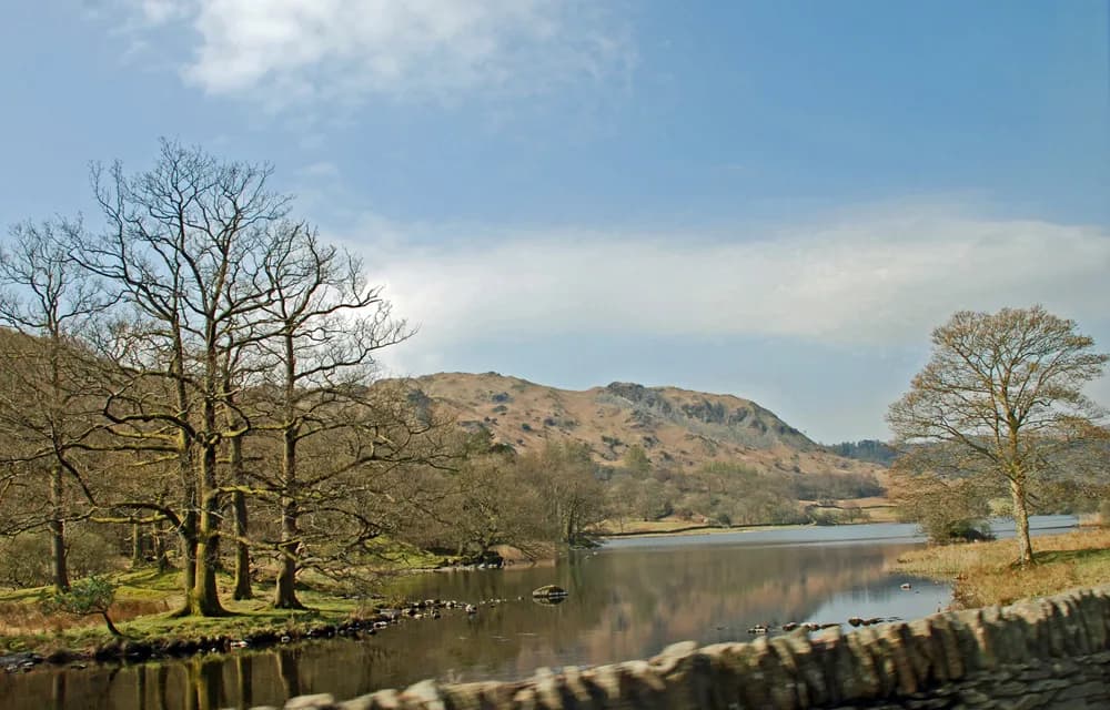
The Rydal Water walk circles one of the smallest lakes in the English Lake District, a gentle loop beneath Nab Scar and the lower slopes of Loughrigg Fell. It suits families, first-time Lake District walkers and anyone who wants a short half-day with real mountain views but almost no climbing. You start and finish in Rydal village, so the walk works as a stand-alone outing or an easy add-on to a bigger day of hiking in the Lake District.
Why the Rydal Water walk suits families and first-time walkers
The route stays low and follows clear paths around the water, with open views across the lake to Loughrigg Fell and Nab Scar. It is short enough for children and for walkers who are new to longer days on the fells, and there is no scrambling or exposed ground. For experienced hikers it makes a relaxed rest-day leg, or a warm-up before tackling bigger objectives.
Where the walk starts: Rydal village car park and the A591
The circular begins at the car park in Rydal village, just off the A591 between Ambleside and Grasmere. From the car park the route runs east along the A591 for about 0.2 km (0.1 mi) and then turns left onto a minor road, passing a tea room before picking up the trail on the left. That first stretch on the pavement and the lane is the only road walking, and it sets you up for the lakeside path.
Getting to the trailhead: driving from Ambleside and parking pressure
From Ambleside, drive north on Rothay Road and the A591 for roughly 2.9 km (1.8 mi) and turn right into the Rydal car park. Parking near the trailhead fills quickly at busy periods, so arriving early is the practical way to secure a space rather than circling the village lane. If the car park is full, you can walk in from Ambleside or use the local bus services along the A591; timetables change by season, so check the current listings before you set out.
Distance, ascent and time
The Rydal Water circular is measured at 4.5 km (2.8 mi) with about 205 m (673 ft) of total elevation gain, and most walkers take 1.5 to 2 hours. The ascent figure counts every rise and dip around the shore, which is why it looks high for a lakeside loop; the total climb from the low point to the high point is much smaller. A route measured with the Rydal Mount extension comes in at 2.9 mi with 344 ft of gain and a 1 to 1.5 hour time, so the figures differ because the measured lines differ, not because the walk changes.
Route description: the north shore beneath Nab Scar
From the trailhead the path heads west along the foot of Nab Scar for about 1.5 km (0.9 mi), with the water on your left and views across it to Loughrigg Fell. This is the most open, most photographed part of the walk, and the ground can be boggy after rain, so waterproof footwear earns its place here. At the junction at the western end, turn left and drop through woodland for about 0.3 km (0.2 mi) to reach the road.
Cross the road to pick up the trail again, keeping straight for roughly 0.2 km (0.1 mi) past the picnic area to reach a footbridge over the River Rothay. These northern miles are gentle, and if you only have an hour to spare this out-and-back section gives you the lake views without committing to the full loop.
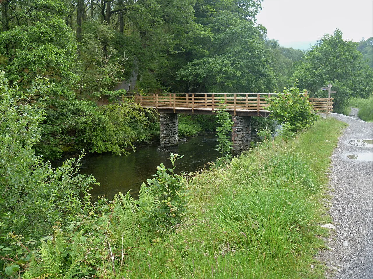
River Rothay crossing, picnic area and toilets
The River Rothay crossing marks the southern end of the lake and the point where the loop turns back east. Toilet facilities stand near the road crossing before the picnic area, which makes this a sensible halfway stop for families. Keep left after the second bridge and follow the trail as it runs along the southern edge of Rydal Water beneath Loughrigg Fell.
Loughrigg Fell lower slopes on the south shore back to the start
The return leg follows the foot of Loughrigg Fell for about 2 km (1.2 mi) along the southern shore, giving you the opposite view of the water and back toward Nab Scar. The path undulates a little but stays well below the fell tops, and a final bridge over the River Rothay brings you back to the trailhead. If you want a longer hill day from the same start, the ridge above you lines up with the higher fells described in the Wainwrights, the 214 Lakeland summits catalogued by Alfred Wainwright.
Extending the walk to Rydal Caves
A short extension south from the main circuit reaches Rydal Caves, a man-made cavern open to explore without a ticket. The detour adds time and a little rough ground, so decide at the junction rather than committing the whole group to it. Head torches help inside, and the cave floor is uneven and can be wet.
Rydal Mount and Rydal Hall Gardens as add-ons
Rydal Mount, Wordsworth's home, and Rydal Hall Gardens both sit close to the start and finish, making them natural add-ons if you want to stretch the day beyond the loop. Admission arrangements and garden access vary by season, so check opening times for each property before you build them into your plan. For a longer day out, the walk pairs well with the bigger fell routes described in the wider guide to Striding Edge, though that ridge is a serious outing and needs its own day.
When to go: seasons and ground underfoot
The circular is walked from March to October, which covers spring bluebells, high-summer crowds and the first autumn colour on the surrounding fells. Crowd levels on the route are moderate, and they concentrate at weekends and in school holidays, so a weekday morning gives you the quietest lakeside miles. Ground conditions matter more than the calendar: the north-shore path is the boggiest section, and it stays soft well into spring.
What to wear and what to carry
Proper walking footwear with a waterproof membrane is the single most useful item on this route, because the boggy stretches around the northern shore will find any gap in a trainer. Beyond that, a light waterproof shell and a warm layer cover the changeable weather, and the low altitude means you can travel light. Pack water and a snack even for the short loop, since the tea room in Rydal is the only easy refreshment stop on the route itself.
Facilities, camping and dogs
Dogs are allowed on the Rydal Water circular but must be kept on a leash, so bring a lead even if your dog is usually reliable. Rydal Hall Campsite sits close to the route, which makes an overnight stay practical if you want to walk early or combine the loop with the caves and gardens. For a full list of bases, amenities and alternative low-level walks, use the guide to hiking around the Lake District.
Where to stay: Ambleside and Rydal as bases
Ambleside is the most practical base, with the widest choice of accommodation, shops and restaurants, and the trailhead only a short drive north. Staying in Rydal itself puts you within walking distance of the start and gives you first access to the car park before day visitors arrive. Either base keeps you well placed for the rest of the Lake District, including low-level classics such as the Catbells walk above Derwent Water. Beyond England, the long-distance options in the Scotland hiking guide offer a very different kind of walking day.
Plan Your Rydal Water Walk
The Rydal Water walk is the Lake District at its most approachable: a 4.5 km (2.8 mi) lakeside loop with 205 m (673 ft) of cumulative climb, finished in under two hours and easy to lengthen with Rydal Caves, Rydal Mount or the gardens. Arrive early for a parking space, wear footwear you don't mind getting muddy, and treat the March to October season as your planning window. Check the current bus timetable and property opening arrangements with the operators before you travel.
Frequently Asked Questions
How long is the walk around Rydal Water?
The circular is 4.5 km (2.8 mi) with about 205 m (673 ft) of cumulative elevation gain, and most walkers finish it in 1.5 to 2 hours. A measured variant that includes Rydal Mount comes in at 2.9 mi with around 344 ft of gain and a 1 to 1.5 hour time, because it follows a different line.
Where do you park for the Rydal Water walk?
The natural start is the car park in Rydal village just off the A591, about 2.9 km north of Ambleside. It fills quickly at busy times, so an early arrival is the reliable strategy; alternatively walk in from Ambleside or use the local bus along the A591.
What is the best time of year to walk Rydal Water?
The route is walked from March to October. Spring and autumn give quieter paths and softer light, while summer weekends are the busiest. The north-shore path stays boggy after rain, so waterproof footwear matters in any month.
How long does the Rydal Cave walk take?
Rydal Caves is a short extension south of the main circuit rather than a separate route, so it adds time onto the 1.5 to 2 hour loop. The cave is a man-made cavern open to explore without a ticket, and its floor is uneven and often wet, so a head torch is useful.
Are dogs allowed on the Rydal Water walk?
Yes, dogs are allowed on the circular but must be kept on a leash. Bring a lead for the whole route, including the woodland and road crossings near the western end.
Can you camp near Rydal Water?
Rydal Hall Campsite sits close to the route and gives you an overnight base within walking distance of the trailhead. Booking arrangements and facilities should be confirmed with the site before you travel.
Sources
Trail notes for your next trip
Optional updates when we add or revise hiking guides.
You might also like



Continue reading
More guides you'll find useful





