
Skiddaw Walk from Keswick: Route, Distance and Time
Plan the Skiddaw walk from Keswick via Spooney Green Lane, Latrigg car park and Little Man, with distance, ascent, walking time and summit conditions.
On this page
The Skiddaw walk gives you a big Lakeland summit without technical ground: a wide bridleway and a clear gravel path carry you from Keswick town to a bare, rocky top at 3,054 ft (931 m). It suits hikers with a full day and steady legs rather than climbers, because the reward is space and panorama rather than scrambling.
Because the line of ascent is so well defined, the climb is easy to plan around your fitness. You can start in the town centre and take the long version, or drive partway up and join the same path for a half-day outing on the same mountain.
What the Skiddaw walk offers and who it suits
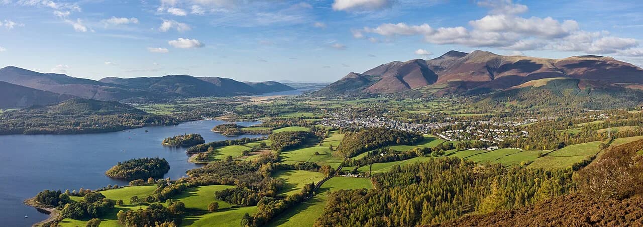
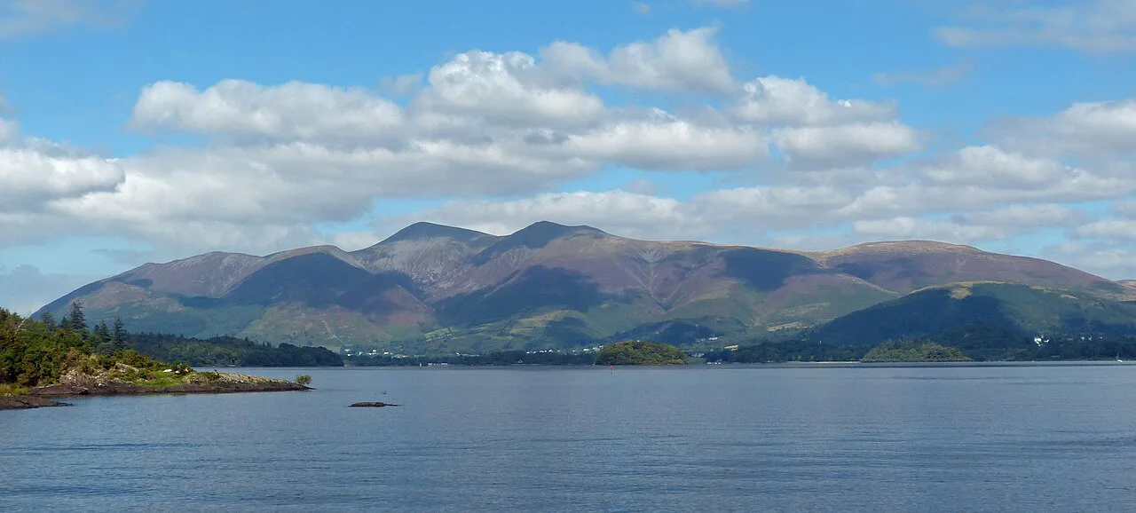
Skiddaw is a sprawling northern fell, and its presence rather than its intricacy is what makes the day. From the summit you look south across Lakeland to the higher ranges and down over Derwentwater and Bassenthwaite, with Buttermere and the western valleys in the same sweep.
Choose it if you want a genuine mountain day on good paths and are comfortable with roughly six hours of walking. Look elsewhere for a short family outing; the full route is graded moderate and the summit plateau is very exposed in poor weather.
Where Skiddaw is and how the route is laid out
Skiddaw stands in the Northern Fells of the Lake District National Park, immediately north of Keswick, and is often described as England's fourth-highest mountain. The usual ascent from Keswick is out-and-back on the same line, so navigation is simple and the day's shape is predictable. If you enjoy big, wide-shouldered summits like this, the Scotland hiking guide points to comparable mountain days north of the border.
Think of the climb in three parts: a gentle lane and bridleway skirting Latrigg, a short steep zig-zag section above the car park, then a broad, cairned ridge running to the summit. That layout means almost all the serious climbing is concentrated in one pitch, and the top half is a steady walk on open ground.
Getting to the trailhead: Keswick town start and Latrigg car park
From Keswick, walk out along the Windermere road, turn into Station Road past Fitz Park, cross the bridge by the youth hostel and continue past the museum to the leisure pool. Behind the pool you pick up a footpath beside the road, then turn onto the bridleway signposted for Skiddaw, which crosses the A66 on a footbridge.
Drivers can cut the walk considerably by parking at the top of the road below Latrigg, where the same path passes through a gate at the top end of the car park. Keswick itself has plenty of accommodation and walker-oriented shops, so basing yourself in town removes any need for a car at all.
Distance, ascent and walking time
The full round trip from Keswick covers 10.1 miles (16.3 km) with about 3,209 ft (978 m) of ascent and 3,196 ft (975 m) of descent, estimated at roughly 5 hours 50 minutes and graded moderate. The shortened version from the Latrigg car park is about 6 miles (9.7 km), three miles each way.
A popular loop from Keswick runs 16.4 km (10.2 miles) with around 880 m (2,887 ft) of ascent in about 5 hours 54 minutes, which gives a sense of how similar the alternatives are in effort. Add time for the summit and for the steep zig-zags, which slow most parties more than the distance suggests.
Route description: Keswick to Spooney Green Lane
Leaving the leisure pool, the path runs behind a hedge alongside the road, crosses a side road and continues to the signposted bridleway. This is Spooney Green Lane, and it soon crosses the A66 via a footbridge before climbing past a fork where you keep left, having skirted the lower slopes of Latrigg.
The track then passes a conifer plantation behind a wire fence and rises to the car park at the top of the road. Blencathra, also called the Saddleback, is straight ahead here; you turn left through a kissing gate and another gate to reach the mountain path proper.
The steep zig-zags and the Hawell Memorial
Past the gates you pass a stone cross, the Hawell Memorial, which commemorates Edward and Joseph Hawell, father-and-son shepherds on Skiddaw and breeders of Herdwick sheep in the nineteenth century. Continue along the fence line to a wide, clear gravel path, then through another gate onto the zig-zags, the steepest stretch of the walk.
Take the zig-zags steadily rather than fast; they are short but they set the tone for the upper mountain. This is also the point to check the cloud base and wind, since everything above is open ground with no shelter.
Little Man and the ridge to the summit
At the top of the zig-zags the summit ahead is Little Man, but the route veers right before that top, passing through a gate onto a gentle incline that points at Skiddaw itself. Another gate and a short climb bring you to a cairn, from which a line of cairns guides you along the ridge to the summit.
The ridge is broad and barren, and in clear weather the cairns make the line obvious. In cloud or strong wind, keep a bearing and watch for the cairn sequence rather than relying on the path alone.
The summit: views south over Derwentwater and Buttermere
The summit is rocky and open, and its strength is the view south: Lakeland's highest ranges, including Scafell Pike and Helvellyn, unfold across the horizon. Below, Derwentwater dominates the scene on the way up, while Bassenthwaite, quieter and ringed with woods, is the lake seen from the top.
Walkers consistently rate a clear, low-wind day here far above a cloudy one, so pick your date with the forecast rather than fitting the summit into a fixed itinerary. If you want a shorter warm-up fell with water views instead, the Catbells walk across Derwent Water is the classic contrast.
Descent options: retracing the route or the Dodd Wood side
The straightforward descent retraces the outward route to Keswick, which is fast on the gravel path and keeps navigation simple. Some walkers instead descend the western side via Dodd Wood, which is noted for late visibility and sunset views; treat that as an informal alternative and carry a map if you take it.
If you are bagging summits, Skiddaw belongs to the Wainwrights, the 214 Lakeland fells catalogued by Alfred Wainwright, and the ridge out to Little Man and Long Side gives you more of them in a single day.
Shorter walk from Latrigg car park
Starting at the top of the Latrigg road halves the effort: about six miles (9.7 km) round trip and roughly 3,200 ft (975 m) of ascent saved on the lower lanes. You join the same gravel path above the gate, so you keep the zig-zags, the Hawell Memorial, Little Man and the cairned ridge.
This version suits a half-day, a later start or a day with a doubtful forecast, because you can turn back at the car park without a long walk out.
Other Skiddaw routes: Applethwaite and Long Side, Threlkeld and Castlerigg
From Applethwaite, a loop over Skiddaw and Long Side runs 15.0 km (9.3 miles) with 1,080 m (3,543 ft) of ascent and is rated hard, taking in more of the northern ridge. From Threlkeld, a longer circuit via Castlerigg Stone Circle and Little Man covers 26.9 km (16.7 miles) and 1,160 m (3,806 ft) of ascent, a full day for very fit walkers.
Both alternatives add ridge time and views at the cost of distance, so choose them only if the Keswick route already feels comfortable. For a shorter day on airy ground, Striding Edge on Helvellyn is a different kind of outing entirely, with scrambling rather than a broad path.
When to go: seasons, summit temperature and views
Mild valley days can still mean a summit around ten degrees colder, and the top is very exposed in bad weather, so treat the mountain as a separate climate from Keswick. Pack a shell and warm layer even when the town feels spring-like, and turn around if the cloud closes in and the wind rises.
The line of cairns is your main guide on the upper ridge, so carry a map and compass and know how to follow a bearing if visibility drops. Snow and ice linger on the northern fells beyond the valley season, and the open ridge offers little shelter from wind or rain. Hikers heading for Aira Force and Aira Beck can save that low-level day for exactly this sort of weather.
Where to stay and eat in Keswick after the walk
Keswick is one of the largest towns in the Lake District, with plenty of accommodation and places to shop and eat, and an unusually dense cluster of shops for walkers. Staying in town means the walk starts at your door and ends near a hot meal.
Book beds for summer weekends well ahead, since the town is invariably busy in season, and plan your food shopping around the walk rather than after it if you want an early start on the ridge.
Can I take my dog up Skiddaw from Keswick?
Skiddaw is a mountain, and the route up from Keswick is described as still a mountain even though the well laid path makes it possible to walk up relatively easily. The same description notes that on mild days the summit temperature is likely to be 10 degrees lower than the valley and that on bad weather days the summit is very exposed. If you are walking with a dog, that combination of a long climb and a colder, exposed summit shapes how you plan the day.
The full route from Keswick town is 10.1 miles, with an estimated time of 5 hrs 50 mins, a total ascent of 3209 ft and total descent of 3196 ft, graded moderate. A shorter option starts from the car park part way up the mountainside: 6 miles in total, 3 each way. For a dog, the shorter start cuts the distance substantially while still reaching the ridge and summit.
The route passes through several gates, including a kissing gate near the top end of the car park, and goes through a gate at the top end of the car park, another before the zig-zags, and further gates before and after the gentle incline towards Skiddaw. The path also runs alongside a conifer plantation bounded by a wire fence, and the ridge is marked by a row of cairns. Expect to manage your dog at each gate and to keep it close where the path passes the fence. The steepest section is the zig-zag path after the gates, so give yourself time there rather than rushing.
One landmark on the way is the Hawell Memorial Cross, which honours Edward and Joseph Hawell, father and son, who were shepherds on Skiddaw and prize breeders of Herdwick Sheep in the 19th century. It is a stone cross passed on the ascent, useful as a marker on the way up and on the return leg.
Plan Your Skiddaw Walk
Decide first whether you want the 10.1-mile day from Keswick or the shorter version from the Latrigg car park, then build the rest of the plan around the weather window. Whichever you choose, the route is the same above the car park: steep zig-zags, the Hawell Memorial, Little Man and a long cairned ridge to the top.
If you want more days in the national park after this one, browse the full Lake District hiking guide for lower fells and valley walks that pair well with a big northern summit.
Frequently Asked Questions
How long does the Skiddaw walk take from Keswick?
The round trip from Keswick is estimated at about 5 hours 50 minutes, covering 10.1 miles (16.3 km) with roughly 3,209 ft (978 m) of ascent. Allow extra time on the summit and on the steep zig-zags, which slow most parties more than the distance suggests.
How far is the Skiddaw walk?
From Keswick town the route is 10.1 miles (16.3 km) there and back. Starting from the Latrigg car park shortens it to about 6 miles (9.7 km), three miles each way, on the same upper path.
Can you shorten the Skiddaw walk from the Latrigg car park?
Yes. Parking at the top of the road below Latrigg cuts out the lanes and bridleway from town, leaving the zig-zags, the Hawell Memorial, Little Man and the cairned ridge to the summit. It suits a half-day or a later start.
Is Skiddaw harder than Catbells?
Skiddaw is a much bigger day, with a long ridge and a summit over 3,000 ft, while Catbells is a shorter fell above Derwent Water. Choose Skiddaw for a full mountain day and Catbells for a few hours with water views.
Where is Skiddaw?
Skiddaw stands in the Northern Fells of the Lake District National Park in Cumbria, England, directly north of Keswick. It is often described as England's fourth-highest mountain, with a summit at 3,054 ft (931 m).
Is Skiddaw dangerous in bad weather?
The upper mountain is very exposed and can be around ten degrees colder than the valley, and the broad ridge gives little shelter. Carry a map and compass, know how to follow a bearing, and turn back if cloud or wind builds.
Sources
Trail notes for your next trip
Optional updates when we add or revise hiking guides.
You might also like



Continue reading
More guides you'll find useful





