Avakas Gorge Cyprus: Trailhead, Route & What to Expect
Plan the Avakas Gorge hike in the Pegeia Forest above Paphos: the gorge layout, the narrow tunnel, wading and rockfall hazards, and how to reach the trailhead.
On this page
Avakas Gorge is a limestone canyon in the Pegeia Forest above the west coast of Cyprus, close enough to the sea to combine with a beach afternoon but incised deep enough to feel like a hidden valley. The appeal is concentrated: a shaded stream bed, cliffs that rise around you, and a tunnel-like section where the walls close in. It suits hikers who are comfortable on wet rock and stepping stones and who want a half-day outing rather than a full mountain day.
Plan it as a canyon walk, not a summit day. The route follows a river floodplain that carries water year-round, so footwear and timing matter more than fitness, and the gorge's shade makes it a sensible choice when the coast is hot.
Where Avakas Gorge sits in the Pegeia Forest
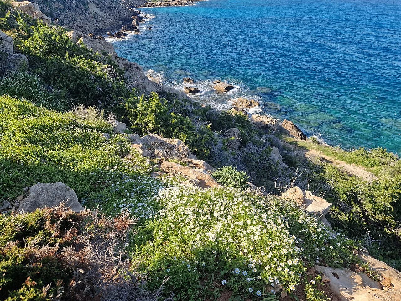
The gorge runs roughly 8 km (5 miles) east to west and forms the centerpiece of the Peyia Forest, an area of juniper scrub and chalky terrain above the coast. It lies less than 2 km (1.2 miles) inland from the sea, yet the incision is so deep that you cannot pick out its line from the shoreline; the entrance is reached along a dirt track that leaves the coastal strip and climbs into the forest.
The nearest coastal landmark is Ayios Yeorgios tis Peyias, a stretch of sea cliffs and caves about halfway up the western coast, and the resort area of Paphos sits to the south. Treat Paphos as your supply base and the coast road as your approach; the gorge itself has no village, shop or water tap at its mouth.
Trailhead and parking
Access is by road: a nondescript dirt track leads from the seashore into the juniper forest, and from where you leave the car the route continues on foot along the stream bed and a narrow goat path. The surface suits a normal car in dry weather but is rough and unpaved, so drive slowly and expect to share the track with walkers.
No published parking fee, gate time or opening schedule applies to the trail, so arrive in daylight and build in margin for the walk in and out. If you are relying on a lift back to Paphos, agree a pickup time at the coast before you start, because there is no facility at the gorge to arrange one.
Distance, ascent and time
The commonly quoted 8 km refers to the gorge's east-west extent rather than a waymarked trail distance, so treat the walk as a half day from the coast road back to the same point. The gorge works well as an out-and-back route with the tunnel as the natural turning point.
Height gain is modest by mountain standards but the ground is slow: boulders, mud and running water on the gorge floor mean your pace drops sharply once you enter the stream bed. Budget more time than the flat coastal approach suggests, especially if you want to linger under the cliffs.
Route description: floodplain, cliffs and the tunnel
The walk begins on a small river floodplain where large gypsum boulders sit in the open, their crystals glinting in the sun. Several hundred metres further on the gorge proper starts, with tall cliffs rising above the banks and throwing deep shadow across the valley floor.
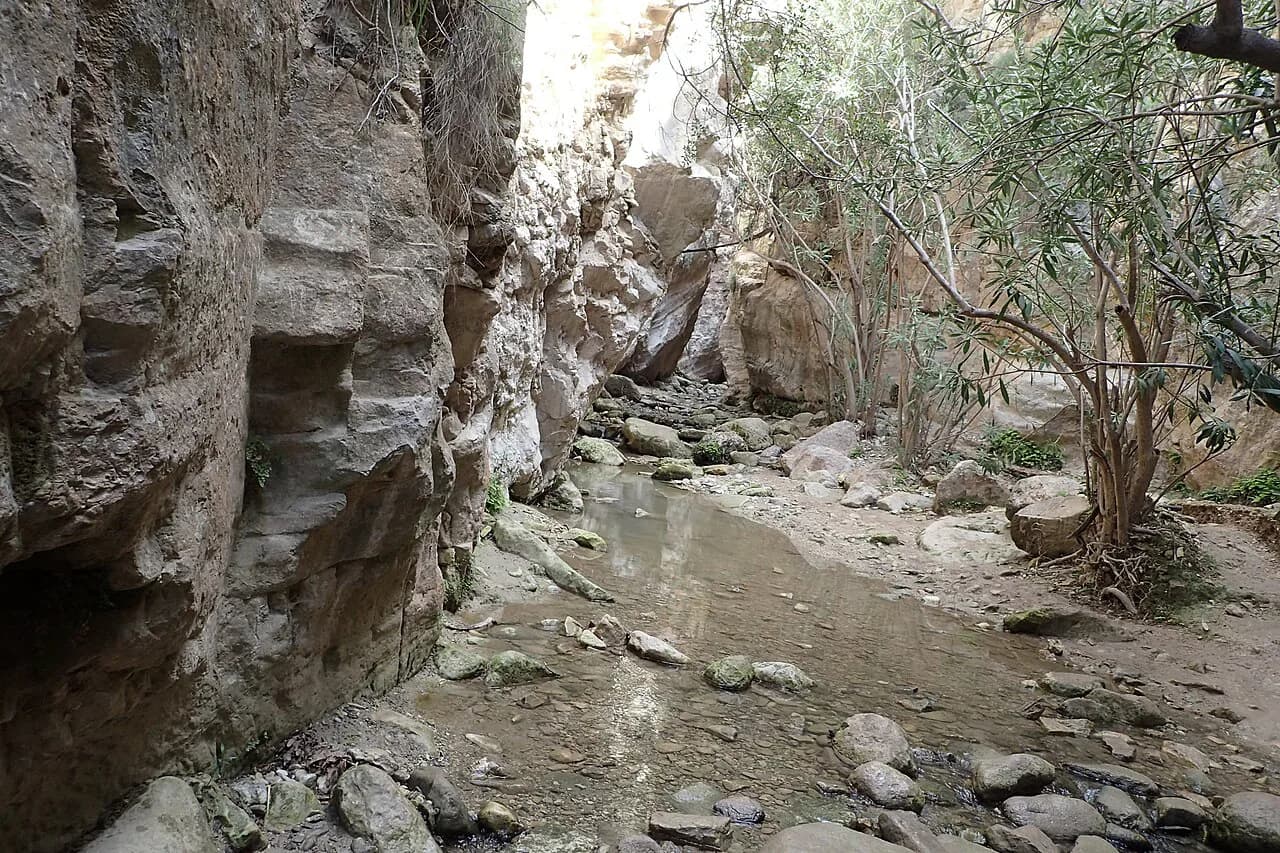
The highlight comes soon after you enter the stream bed: sheer limestone walls about 30 m (100 ft) high close gradually into a natural tunnel roughly 100 m long, narrowing to around 2 m (6.5 ft) at its tightest. The temperature drops noticeably as you step inside.
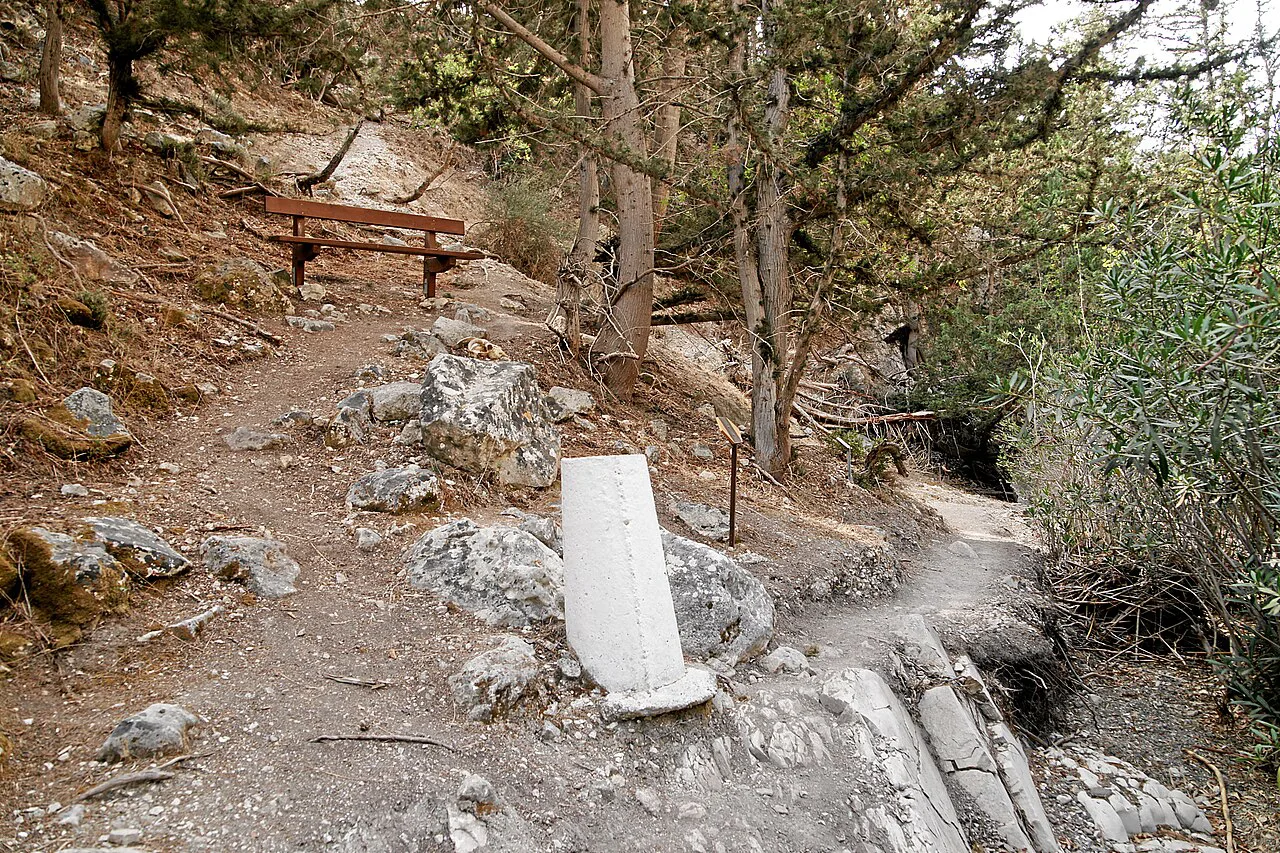
Beyond the tunnel the gorge opens into an amphitheater where the rock walls climb above 200 m (650 ft) and boulders the size of two-story houses lie on the floor. Narrow goat paths traverse the canyon sides by following natural ledges in the limestone; they are unmarked and steep, so most walkers are better off staying low and retracing the stream bed.
The hanging rock and the gorge's reversed geology
Near the narrowest point of the tunnel a large boulder of coralline limestone is wedged overhead, dislodged from higher deposits in a past earthquake and jammed between the walls where it still sits. Look for the horizontal striations and groove marks on the smoothed walls below it, left by abrasion as the stream cut down through the rock.
The cliffs themselves are geologically inverted: softer chalky marls of the Pliocene form the lower two-thirds, with older Miocene coralline limestone on top. That reversal is unusual, and the contact between the two rock types is the band to watch for as the walls rise above you.
Water, shade and what to wear
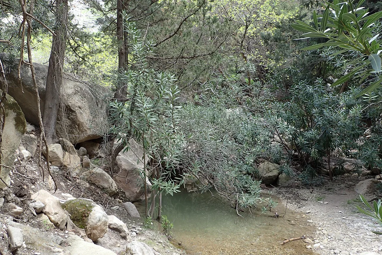
Water runs along the bottom of the gorge year-round from springs, and the tunnel floor carries mud as well as wet rock. In autumn the stream is normally less than a foot deep, shallow enough that a slip is inconvenient rather than serious, so shoes with grip and a tolerance for getting wet beat heavy boots.
Spring flow peaks in winter when the aquifers are full, and a spring in the middle of the tunnel discharges strongly then before subsiding to a trickle in summer and autumn. Carry your own water: the gorge has no shop or tap, and the shaded tunnel stays cool even in summer heat.
The gorge's microclimate is the reason to walk it in the middle of a hot day. Inside the tunnel the air is several degrees cooler than the coast, and parts of the walls never see direct sunlight, so a layer for the shade is worth packing even when the car park is baking.
Rockfall and slippery rock
Rockfall is a real feature of this landscape: the area has been shaped by tectonic events and falls occur relatively frequently from the upper cliffs. Move through the amphitheater without lingering directly beneath the steep upper slopes of the canyon walls.
Inside the tunnel, the combination of running water, mud and rounded boulders makes footing the main hazard. Use the stepping stones where they exist, keep your hands free for balance, and avoid the gorge floor altogether during or immediately after heavy rain, when the stream rises.
When to go: seasons, water and birds
Spring and autumn are the best windows. Migratory birds pass through at those times and the flow in the stream is manageable; autumn in particular combines low water with good birding on the cliffs.
Summer works because the tunnel is shaded, but the exposed walk in from the coast is hot, so start early and carry more water than the short distance suggests. Winter brings the strongest spring flow and the wettest, muddiest floor, which makes grip and waterproofing the deciding factors.
Wildlife to watch for
Jackdaws are the constant presence, sometimes arriving in clouds of hundreds to wheel around the amphitheater, and you will also see rock doves, wood pigeons, ravens and kestrels over the cliffs. Griffon vultures are recorded in the gorge but encountered less often.
Pink-flowering oleander and deciduous trees crowd the stream bed, and horizontally growing cypress trees cling to the rock walls further in. Small waterfalls and scree slopes add to the scenery, so allow time to stop rather than treating the gorge as a corridor to walk through quickly.
Where to base yourself on the Paphos coast
Paphos is the practical base: it has the largest spread of accommodation and food on this stretch of coast and the shortest drive to the dirt track that leads to the gorge. Ayios Yeorgios tis Peyias, on the cliffs to the north, is quieter and keeps you closer to the trailhead.
If your trip is built around trails rather than beaches, the higher villages of the Troodos Mountains give you a second base for cooler walking days. Split the stay: the coast for the gorge, the hills for the long woodland routes, as set out in this guide to hiking in cyprus. Island-hoppers weighing short winter-sun breaks can also compare this half-day gorge with the multi-day coastal and country trails covered in the Malta hiking guide.
Avakas Gorge in combination with other Paphos-area outings
The gorge takes half a day, leaving room for the coast: the sea cliffs and caves at Ayios Yeorgios tis Peyias make an easy pairing, and a swim and a late lunch afterwards fit the shape of the day.
For a longer walking itinerary, head inland to the pine forests and marked nature trails around the Troodos range, where the gradients and distances are more mountain-like than anything on the coast. That contrast is what makes a Cyprus walking week work: canyon one day, forest ridge the next.
On the island's highest ground, the Artemis Trail, Troodos circles the summit zone through black pine and juniper and gives a very different day out from a limestone gorge. If you are choosing between the two, take Avakas for shade and scenery at low level and the high trail for open views and cool air.
Plan Your Avakas Gorge Day
Build the day around the tunnel: start early if you are walking in from the coast, wear shoes you do not mind soaking, and turn around at the amphitheater rather than trying to force a line up the unmarked goat paths. Carry your own water, and keep an eye on the upper cliffs while you cross beneath them.
Check the stream level locally before setting out, since heavy rain changes the floor from a stepping-stone puzzle into a muddy stream. Everything else about the hike rewards a slow pace: the hanging rock, the sculpture marks on the walls, and the jackdaws gathering above the gorge.
Frequently Asked Questions
How long is the Avakas Gorge walk?
The gorge itself runs roughly 8 km east to west through the Pegeia Forest, but that is the canyon's extent, not a marked trail distance. Plan a half-day out-and-back walk from the coast road to the tunnel and back, and allow extra time on the boulder-strewn stream bed where progress is slow.
Can you drive to Avakas Gorge?
Yes. An unpaved dirt track leads from the seashore into the juniper forest toward the gorge, and you continue on foot from where you park. The surface is rough, so drive slowly in dry weather and expect walkers on the track.
Do you get wet walking through Avakas Gorge?
Usually only your feet get wet. Water runs along the floor of the gorge year-round and the tunnel carries mud and slick rock, but in autumn the stream is normally less than a foot deep and careful stepping-stone work often keeps boots dry. In winter and after rain, expect deeper water and much more mud.
What is the narrowest point of Avakas Gorge?
The natural tunnel narrows to around 2 m at its tightest, with walls about 30 m high closing in over a stretch of roughly 100 m. A large coralline limestone boulder from higher deposits is wedged in the tunnel ceiling near that narrow point.
When is the best time to hike Avakas Gorge?
Spring and autumn give the best combination: manageable water levels, tolerable heat and migrating birds on the cliffs. Summer is workable because the tunnel is deeply shaded, but start early for the exposed walk in. Winter brings the strongest spring flow and the muddiest floor.
Is Avakas Gorge suitable for children?
Older children who are steady on uneven, wet rock generally cope well, since the walk is short and the drama is concentrated in the tunnel. The boulders, mud and running water make it awkward for very young children, and the rockfall risk under the amphitheater cliffs argues for keeping the group moving rather than picnicking below the slopes.
Sources
Trail notes for your next trip
Optional updates when we add or revise hiking guides.
You might also like
Continue reading
More guides you'll find useful