Eiger Trail Hike from Eigergletscher to Alpiglen: Guide
The Eiger Trail runs below the Eiger North Face from Eigergletscher to Alpiglen. Plan the route, lift access, timing, difficulty and best months to hike.
On this page
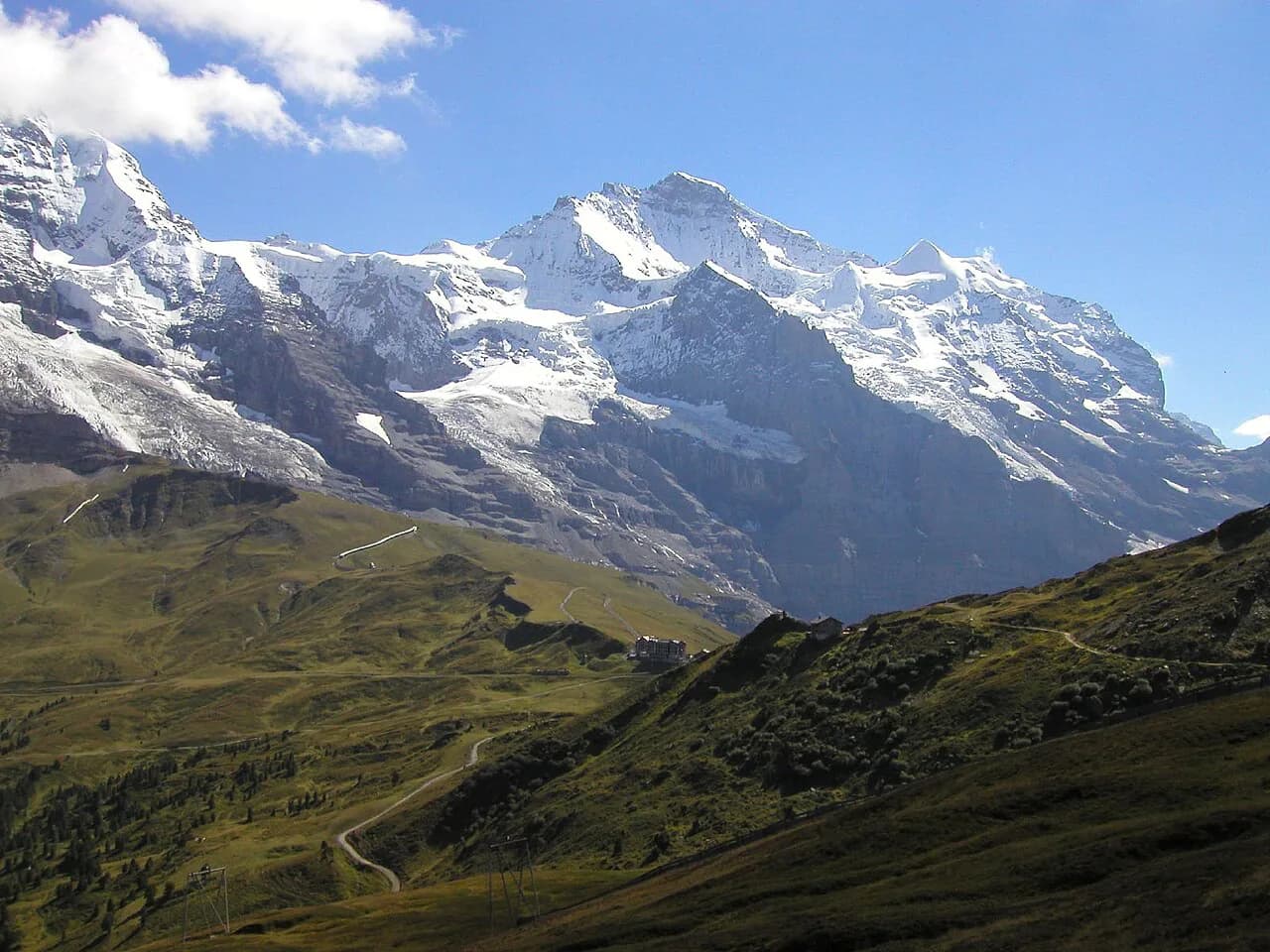
The Eiger Trail is the closest most hikers get to the Eiger North Face, the mile-high wall of limestone and ice that looms over Grindelwald. The trail traverses the slope beneath it from Eigergletscher station to Alpiglen, giving you the face above and the Grindelwald valley below for most of the walk. It suits moderately fit hikers with half a day to spare, and it is one of the most rewarding outings in the Jungfrau region.
Where the Eiger Trail runs and who it suits
The route runs between two points on the mountain railway above Grindelwald: Eigergletscher, the station just below the Eiger itself, and Alpiglen, a small stop further down the valley. You walk one way between them, under the North Face, with the valley of Grindelwald opening below. The downhill direction from Eigergletscher is the standard choice because it puts most of the climbing behind you on the lift and leaves more descending than ascending.
The hike suits hikers who are comfortable on rocky ground and can handle a sustained steep descent. It is not a summit climb and needs no technical gear, but the path has sections where you step over rocks and use your hands briefly, and the closing descent into Alpiglen is hard on the legs. Hikers with knee trouble should consider walking it the other way, uphill from Alpiglen, so the steep section becomes a climb rather than a pounding descent. For a wider look at how this fits with the other walks around the village, see the grindelwald hiking overview.
Eigergletscher trailhead and lift access from Grindelwald
The approach from Grindelwald is by the Eiger Express, the cable car that climbs to Eigergletscher station, where the trail begins just outside. The ride is short, roughly a quarter of an hour, and the cars run on a seasonal schedule that the lift operator publishes, so plan the day around the first and last departures of the season you are travelling in. Because the same line carries visitors heading up to the Jungfraujoch, the cable car can be busy while the trail itself is far quieter once you set off.
There is no trailhead car park in the usual sense: you leave the car in Grindelwald and ride up, which keeps the day simple if you are based in the village. Check the operating information for the Eiger Express before you commit to a date, especially at the very start and end of the summer season.
Distance, ascent and walking time
Allow two to three hours for the one-way walk from Eigergletscher down to Alpiglen at an unhurried pace, longer if you stop often for photographs of the North Face. Fit hikers moving steadily will be at the faster end of that range; groups and photographers at the slower end. The walking is mostly descending in this direction, with a short rocky opening and one steep final drop.
Route description: Eigergletscher to Alpiglen
From Eigergletscher station, signs point you onto the trail, which begins across open rocky ground below the station. This opening stretch is largely flat and stony rather than a climb, so you find your rhythm quickly while the North Face comes into view ahead and above. Watch your footing on the loose stones here; it is easy walking but not smooth path.
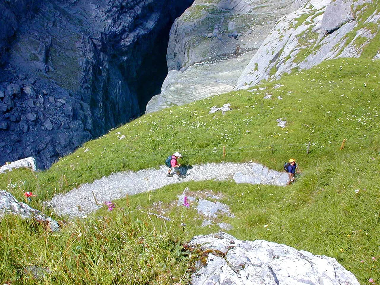
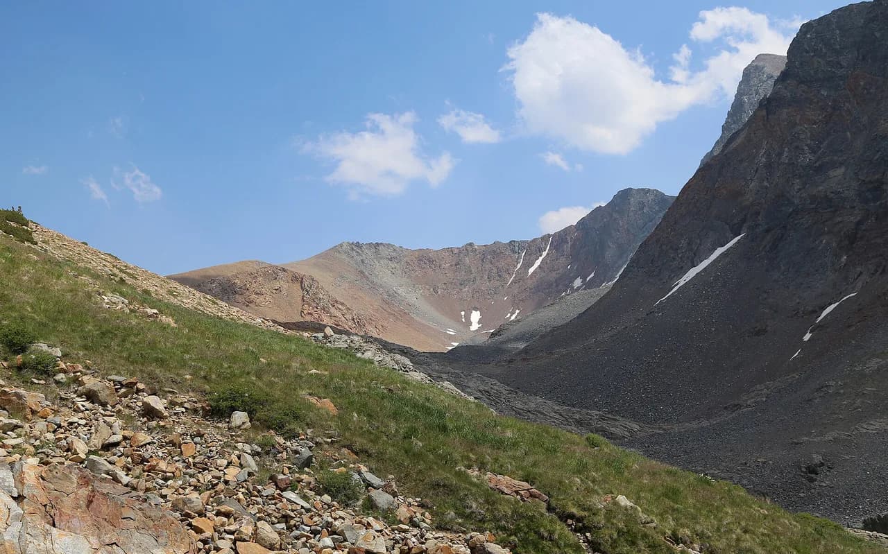
The middle of the route traverses the slope beneath the face, keeping the wall high on your left and the valley falling away on your right. This is the section people come for: the rock of the North Face fills the skyline, and on clear days the view runs down the Grindelwald valley. The path is narrow in places with a drop on the valley side, so keep children close and give way carefully when you meet other walkers.
The last leg drops steeply down to Alpiglen, and it is the part that tests legs and concentration rather than fitness. Take it slowly, especially if the rock is wet, and expect your quads to feel it the next day. Alpiglen itself is a handful of buildings and a station on the railway, with the terrace of the mountain inn a welcome sight at the bottom.
The Eiger North Face and the rocky opening section
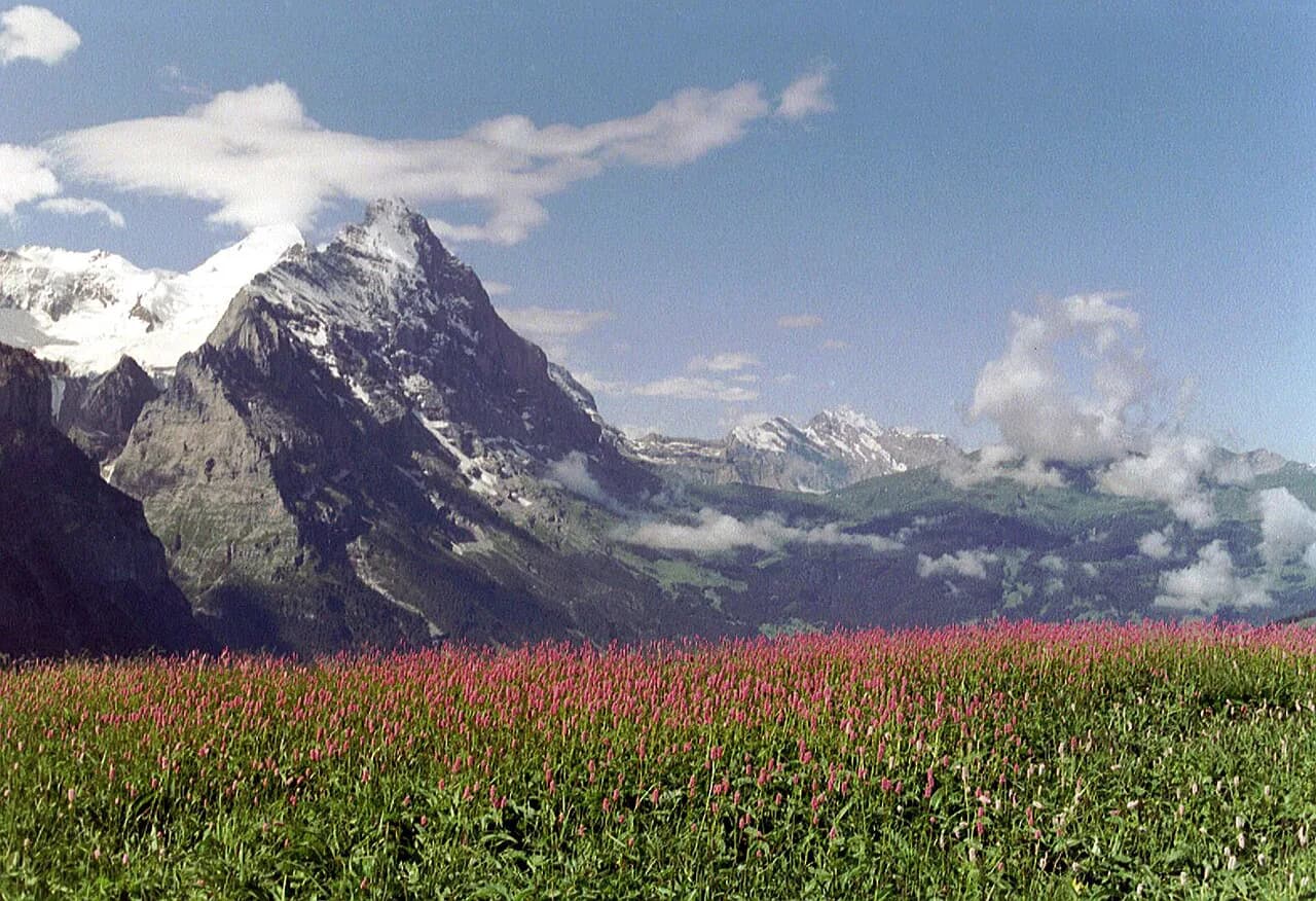
The North Face is the reason to walk this trail rather than any other in the valley. It rises almost directly from the slope you are traversing, so you spend the middle hour of the hike looking up at a wall that climbers tackle over days. The rock is limestone, streaked and broken, and the face changes character constantly with cloud and light. Loose stone falls from it from time to time, which is one reason to keep moving through the section directly beneath the wall rather than lingering under it.
The steep descent into Alpiglen
The descent is short in distance but steep enough that it takes longer than the map suggests. Switchbacks and rough steps lead down through grass and scree to the railway line at Alpiglen. In wet weather the rock slabs and roots get slippery, and trekking poles make a real difference to your knees on the way down.
Return from Alpiglen: train to Kleine Scheidegg or Grindelwald
From Alpiglen you catch the Wengernalpbahn, the mountain railway that links Grindelwald with Kleine Scheidegg, and ride back to Grindelwald or up to Kleine Scheidegg to extend the day. The train stops at Alpiglen station, a couple of minutes' walk from the inn, so there is no need to retrace the trail on foot. Timetables change by season, so look up the departure times for your date before you set out in the morning.
Hikers who describe the route as a loop starting and finishing at Grindelwald are usually linking the trail with the railway on both ends rather than retracing their steps. The alternative is to continue on foot from Alpiglen up to Kleine Scheidegg, which adds a steady climb to the day and puts you at the hub of the region's other walks and railways.
Walking it uphill from Alpiglen instead
Reversing the route means taking the train to Alpiglen and climbing to Eigergletscher, turning the steep final descent into a steep climb at the start. This suits hikers with sore knees or a preference for ascending rough ground over descending it, and it makes the North Face reveal itself gradually as you gain height. The trade-off is that you finish at a lift station rather than a railway stop, so you ride the Eiger Express down to Grindelwald at the end. Either direction covers the same ground; the difference is where you spend your effort.
When to go: hiking season and lift operating dates
The trail is a summer walk and is not maintained for winter use; the hiking season runs roughly from the snowmelt in early summer to the first autumn snow, and late in the season you can meet fresh snow on the higher ground. The Eiger Express runs on a seasonal schedule rather than all year, so the hike is only possible when the lift is operating. Check the operating information for your dates before booking accommodation around the walk.
Weather, rockfall and trail conditions
Afternoon thunderstorms build quickly in the Bernese Oberland, and the exposed middle section beneath the North Face is no place to be in lightning; start early and aim to be down by early afternoon. Rain makes the rocky opening and the final descent slippery, and snow can linger on the traverse well into June. Loose rock falls from the face above the trail, so keep moving through the section directly under the wall and wear a helmet if you are walking with a group in unsettled conditions.
What to wear and carry
Sturdy boots with decent tread are the main requirement, since much of the route is rough stone and the descent is steep. Carry a waterproof shell and a warm layer even on a sunny morning, because the weather turns fast at this altitude, plus water and food: there is a mountain inn at Alpiglen but nothing on the trail itself. Trekking poles are worth the weight for the descent.
Practical: fares and tickets for the lift and train
One traveller reported paying about CHF 45 for the full fare covering the ride up to Eigergletscher and the train back from Alpiglen, or around CHF 22.50 with a Swiss Half Fare Card, which is worth pricing against your other journeys if you plan several lift and rail trips in Switzerland. Treat those numbers as a guide rather than a quote: fares vary by route, season and ticket type, and Jungfraubahn and the Wengernalpbahn publish current prices. Buy tickets at the station or through the Jungfrau Railways app before you start, so the return leg is already sorted when you reach Alpiglen.
Nearby hikes in the Jungfrau region
The Eiger Trail pairs naturally with the ridge walk from mannlichen to kleine scheidegg, which shares its railway access and gives wide views of the Eiger, Mönch and Jungfrau without the steep descent. For a gentler day, the bachalpsee hike from Grindelwald First is a short climb to a lake with the Wetterhorn reflected in it, and the glacier canyon grindelwald walk visits the gorge and Crystal Museum below the village. If you want vertical exposure rather than a walk, the grindelwald via ferrata offers a guided or self-guided route on the rock above the valley.
Plan Your Visit
The Eiger Trail works best as a morning: ride the Eiger Express up to Eigergletscher, walk the two to three hours down to Alpiglen under the North Face, and take the train back to Grindelwald in time for lunch. Book your lift and rail tickets in advance, start early to beat the afternoon storms, and save your knees for the final descent. It is the single best half-day walk in the valley for hikers who want big scenery without a summit, and if you are basing yourself in the town below the face, the Interlaken hiking guide covers the day hikes within easy reach.
Frequently Asked Questions
How difficult is the Eiger Trail?
It is a moderate walk rather than a technical climb. The opening section is flattish and rocky, the middle traverses beneath the North Face with a drop on the valley side, and the final descent into Alpiglen is steep enough to be hard on the knees. Moderately fit hikers with boots and trekking poles will manage it comfortably in two to three hours downhill.
How long does the Eiger Trail take?
Allow two to three hours for the one-way walk from Eigergletscher to Alpiglen, plus time at the top and bottom for the lift and train. Photographers and slower groups should plan for the longer end of that range, and anyone walking uphill from Alpiglen should add time for the climb.
Where does the Eiger Trail start and finish?
It starts at Eigergletscher station, reached by the Eiger Express cable car from Grindelwald, and finishes at Alpiglen on the Wengernalpbahn railway. Both ends are stations, so you can ride up to the start and take the train back from the finish.
Do you need a lift to reach the Eiger Trail?
Yes if you want the standard downhill direction: the Eiger Express carries you from Grindelwald to Eigergletscher, and its seasonal operating schedule sets when the hike is possible. Walking up from Grindelwald to the start is a long climb and not the usual approach.
Is the Eiger Trail downhill or uphill?
The classic direction is downhill, from Eigergletscher to Alpiglen, which puts most of the climbing on the lift. Walking it uphill from Alpiglen is the alternative for hikers who prefer climbing rough ground to descending it, and it ends at the cable car.
When is the best time to hike the Eiger Trail?
Mid-summer to early autumn gives the most reliable conditions, once the snow has gone from the traverse and before the first autumn falls. The lift runs on a seasonal schedule, so check its operating dates for your travel window before you build the hike into your itinerary.
How do you get back from Alpiglen?
Take the Wengernalpbahn from Alpiglen station, a couple of minutes from the mountain inn, back to Grindelwald or up to Kleine Scheidegg. Look up the departure times for your date in the morning so you know how much time you have on the trail.
Sources
Trail notes for your next trip
Optional updates when we add or revise hiking guides.
You might also like
Continue reading
More guides you'll find useful