Männlichen to Kleine Scheidegg: Panorama Trail Hike Guide
Hike the Panorama Trail from Männlichen to Kleine Scheidegg above Grindelwald: gondola and cable car access, distance, route landmarks and the train back.
On this page
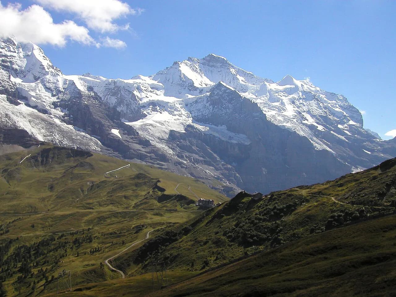
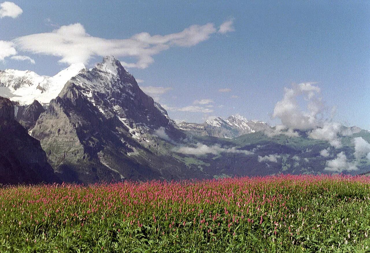
The Männlichen to Kleine Scheidegg walk is the classic high traverse above Grindelwald: a broad, gently descending track along the Hohenweg at around 2,100 m (6,890 ft), with the Eiger, Mönch and Jungfrau filling the skyline ahead and the Wetterhorn and Schreckhorn behind. It suits hikers who want big views without a long climb, and it works as a one-way route with a lift at the start and a train at the finish.
Because the walking is mostly downhill from the Männlichen ridge, the hike is a good first day in the Bernese Oberland and a sensible option for families with children who are used to mountain tracks. The full Grindelwald hiking network has steeper alternatives if you want more climbing.
Where the hike goes
The route runs from the Männlichen ridge station southeast along the Hohenweg 2100m, also signed as the Panorama Trail or Panoramaweg, to Kleine Scheidegg on the saddle between the Lauberhorn and the Eiger. You start at roughly 2,223 m (7,293 ft) and finish at about 2,061 m (6,762 ft), so the day is a net descent on easy grades rather than a climb.
The Männlichen ridge separates the Grindelwald valley from the Lauterbrunnen valley, which is why the views open in two directions: east to the Wetterhorn and the Eiger north wall, west down the Lauterbrunnen valley to the Jungfrau, Breithorn and Tschingelhorn. Kleine Scheidegg is also the railway junction where trains from Grindelwald and Lauterbrunnen meet the Jungfraujoch line. If you want to walk the western side of the ridge as well, the Lauterbrunnen hiking guide covers the valley routes beneath it.
Getting to the Männlichen trailhead
From Grindelwald, the usual approach is the gondola from Grindelwald Terminal, the valley station for both the Männlichen gondola and the Eiger Express. Local buses run from the Grindelwald Bahnhof to the Terminal stop in about 8 to 12 minutes, the train takes about five minutes, and the walk from the station takes around 20 minutes; the gondola ride itself takes about 30 minutes.
From Wengen, a separate cable car climbs from the village to Männlichen in about five minutes, with the bottom station northeast of the Wengen train station behind Dorfstrasse. Wengen is reached by cog railway from Lauterbrunnen in about 14 minutes, so this approach needs a village transfer rather than a single lift from Grindelwald.
Männlichen has no road access, so every hiker arrives by lift; there is no trailhead car park at the top. If you are driving, park at Grindelwald Terminal and ride the gondola up. The gondola and cable car timetables and ticket prices are published by the lift operator.
Trailhead details at Männlichen
At the top station, the Kleine Scheidegg signs point south and southeast from the east side of the lift building, onto the broad gravel track of the Hohenweg. Signs in the other direction point north to the Männlichen viewpoint via the short Royal Walk themed trail, a separate detour from the traverse.
The start feels open and easy: you walk out onto meadow above the tree line, with the Tschuggen slopes to your right and the Grindelwald valley falling away below. The track is wide enough to walk two abreast, which makes the first kilometre a relaxed warm-up rather than a route-finding exercise.
Distance, ascent and time
The Männlichen to Kleine Scheidegg leg is about 4.5 km (2.8 miles) one way, with roughly 160 m (531 ft) of descent and a walking time of around 1 hour 30 minutes on the signs. The path loses height steadily rather than in steep steps, so the time is set by how often you stop for photographs.
If you continue from Kleine Scheidegg to Wengen via the Eigergletscher viewpoint, Biglenalp and Mettlenalp, the day grows to about 17.4 km (10.8 miles) with around 946 m (3,103 ft) of descent and a signposted time of roughly 2 hours 20 minutes from the Haaregg junction to Wengen alone. Treat that as a full day and start early; the traverse alone is a half day.
Route description
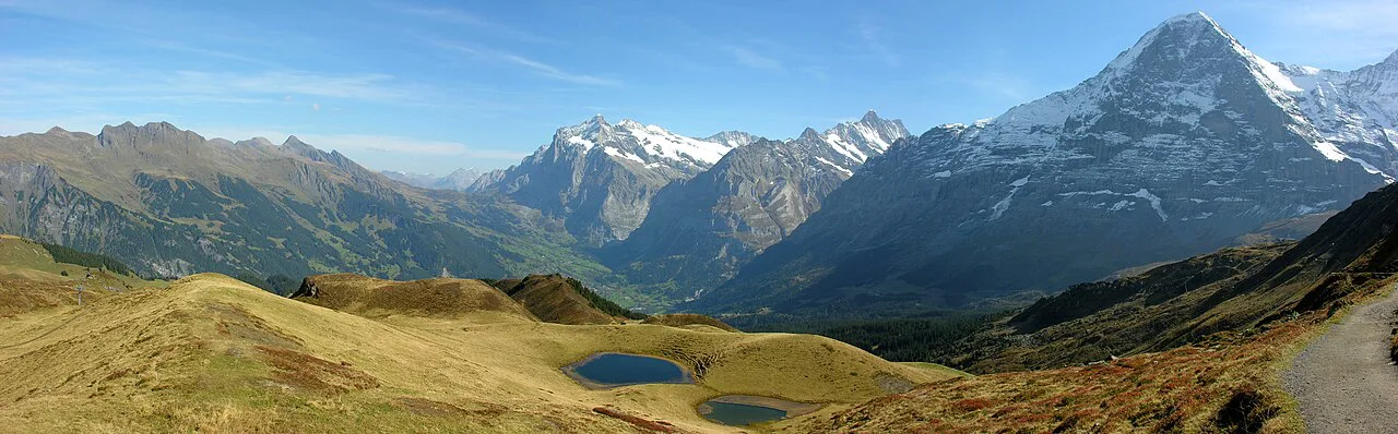
From the lift station, follow the broad gravel track southeast beneath the slopes of the Tschuggen, with the Wetterhorn, Schreckhorn and the massive north wall of the Eiger above the Grindelwald valley to your left. After about 2.4 km (1.5 miles) the track curves right around a ridge spur, crosses under the Honegg chairlift and then descends the south-facing slopes of the Tschuggen toward the Lauberhorn.
At about 3.4 km (2.1 miles) the path crosses the creek draining the slopes between the Tschuggen and the Lauberhorn, then turns southeast along the base of the Lauberhorn. Ignore the branch climbing right toward the Lauberhorn at about 4 km (2.5 miles) and keep straight on toward Kleine Scheidegg; the Eiger, Mönch and Jungfrau views from this stretch are the reason to walk the route.
Rotstockli viewpoint and arrival at Kleine Scheidegg
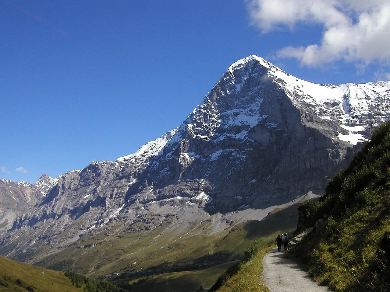
Shortly before Kleine Scheidegg the path passes the Rotstockli, a small overlook at about 2,110 m (6,923 ft) where the Eiger north wall rises directly overhead. From there the track drops on moderate grades to Kleine Scheidegg at about 2,061 m (6,762 ft), a working railway junction with restaurants, a souvenir shop and toilets that are busy with Jungfraujoch day-trippers.
If the Eiger north wall leaves you wanting more, the Eiger Trail Hike from Eigergletscher to Alpiglen covers the ground below the wall in the opposite direction and makes a natural second day.
Getting back to Grindelwald or Wengen
Kleine Scheidegg has trains in both directions: down to Grindelwald and down to Lauterbrunnen via Wengernalp and Wengen. The simplest return for a Grindelwald-based hiker is the train down to Grindelwald, while a Wengen-based hiker can ride down to Lauterbrunnen and take the cog railway back up to Wengen.
The alternative loop is to ride the cable car from Wengen back up to Männlichen and then the gondola down to Grindelwald Terminal, which turns the traverse into a circuit rather than an out-and-back. That option depends on the lift timetable, so decide your return before you set off.
When to go
The traverse is a summer and early-autumn walk: the highest point is just above 2,200 m (7,220 ft), so late-spring snow can linger on the Tschuggen and Lauberhorn slopes well after the lifts reopen. The Männlichen operator publishes a hiking trail status page that lists paths closed by snow or maintenance, so consult it before travelling on a shoulder-season day.
Clear mornings give the sharpest views of the Eiger, Mönch and Jungfrau, and afternoon cloud build-up is common in the Bernese Oberland summer. The lift operator publishes the operating calendar; plan the walk for a day when both the gondola and the train are running.
Hazards and exposure
This is an exposed high traverse: the track is open to the sky, with little shade or shelter between the Männlichen station and Kleine Scheidegg, so sun protection and water matter more than on a forest walk. Afternoon thunderstorms build quickly here; turning back at the first thunder or starting early is the sensible response.
The path itself is a broad gravel track with no scrambling or technical ground, but snow patches can survive late into the season on shaded stretches beneath the Tschuggen, and wet gravel is slippery on the descent toward Kleine Scheidegg. Hiking shoes with a decent tread are enough on a dry summer day.
Huts and stops on the way
There is no serviced hut between Männlichen and Kleine Scheidegg, but the lift station at Männlichen and the cluster of restaurants at Kleine Scheidegg both provide food, drink and toilets at either end. Carry water for the traverse itself, since the middle section crosses open pasture with no facilities.
If you extend the day toward Eigergletscher, the small lake at Fallbodensee on the way makes a natural rest stop, with an exhibit on the Eiger north wall routes on its south shore. The continuation to Wengen passes Biglenalp and Mettlenalp, both farm alps rather than huts.
Making it longer
The obvious extension is to continue from Kleine Scheidegg toward Eigergletscher and the glacier viewpoint, then descend past Biglenalp and Mettlenalp to Wengen. This adds the Eiger glacier, the Fallbodensee lake and a long, rooty descent through meadows and trees, with the Mönch and Jungfrau overhead for most of the way.
On the Grindelwald side, the Bachalpsee Hike from Grindelwald First is a separate half-day outing from a different lift, and the glacier canyon walk below the village offers a shorter alternative when the high trails are still snowbound.
Who the hike suits and which direction is easier
The traverse suits hikers of modest fitness, families with children who can walk for a couple of hours, and anyone who wants the classic Eiger-Mönch-Jungfrau panorama with the minimum of climbing. It is not a summit day and needs no equipment beyond shoes, layers and water.
Männlichen to Kleine Scheidegg is the easier direction because it is nearly all downhill; walking the reverse means a steady climb of around 160 m (531 ft) from Kleine Scheidegg with the big peaks behind you. Most hikers therefore take the lift up and walk down, using the train for the return.
Plan Your Visit
Treat the Männlichen to Kleine Scheidegg traverse as a half-day ridge walk: gondola up from Grindelwald Terminal or cable car up from Wengen, an hour and a half of easy descending with the Eiger north wall ahead, then a train back down. Base yourself in Grindelwald if you want the shortest lift access, or in Wengen if you prefer a quieter village and the cable car approach.
Add the Eigergletscher and Wengen extension if you have a full day and good weather, and save the Bachalpsee and glacier canyon walks for days when you want variety. Carry water, start early enough to avoid afternoon storms, and check the Männlichen trail status before a shoulder-season trip.
Frequently Asked Questions
Is the Männlichen to Kleine Scheidegg hike easy?
Yes. It is a broad gravel track that loses about 160 m (531 ft) over 4.5 km (2.8 miles), with no scrambling and a walking time of around 1 hour 30 minutes. The exposure is the open high-mountain weather rather than the terrain.
Can you do the hike with the Wengen cable car?
Yes. A cable car climbs from Wengen to Männlichen in about five minutes, and Wengen itself is reached by cog railway from Lauterbrunnen. At the end you can either take the train back down to Lauterbrunnen and up to Wengen, or ride the Wengen cable car up to Männlichen and the gondola down to Grindelwald Terminal to make a loop.
How long does the hike from Männlichen to Kleine Scheidegg take?
The signs give about 1 hour 30 minutes for the Männlichen to Kleine Scheidegg leg, and most hikers take a little longer with photo stops. Adding the Eigergletscher and Wengen continuation turns it into a full-day walk of roughly 17.4 km (10.8 miles).
Is the trail downhill?
In the Männlichen to Kleine Scheidegg direction, yes: you start at about 2,223 m (7,293 ft) and finish at about 2,061 m (6,762 ft) on easy grades. Walking the reverse means a steady climb of around 160 m (531 ft) with the big peaks behind you.
What is there to see along the Panorama Trail?
The Eiger, Mönch and Jungfrau dominate the route, with the Wetterhorn, Schreckhorn and the Eiger north wall above the Grindelwald valley. Landmarks include the Tschuggen slopes, the Honegg chairlift crossing, the creek below the Lauberhorn and the Rotstockli overlook just before Kleine Scheidegg.
Is Männlichen to Kleine Scheidegg suitable for families?
It is one of the more family-friendly high routes above Grindelwald: a wide track, a short half-day distance and no technical ground. Children still need warm layers and sun protection, because the traverse is fully exposed to the weather.
Sources
Trail notes for your next trip
Optional updates when we add or revise hiking guides.
You might also like
Continue reading
More guides you'll find useful