Kerry Way: Stage Guide, Distance and When to Walk It
Plan the Kerry Way from Killarney with stage distances, daily ascent, terrain, lodging pinch points in the Black Valley and Glencar, and walking months.
On this page
The Kerry Way is a waymarked circuit of roughly 200 km (125 miles) through County Kerry, starting and finishing in Killarney and linking the lakes, the Black Valley and a string of villages near the Atlantic coast. It suits walkers who want a week or more of low-level walking with a bed and a pub at the end of most days, rather than a high-mountain expedition. The route can be walked as a full loop or broken into short sections, so a three-day taster is as valid as the whole circuit.
What the Kerry Way is and who it suits
The Kerry Way is one of Ireland's longest signposted walking trails, a loop that begins and ends in Killarney and runs anticlockwise through forestry, national park and private farmland. Because it is largely a lower-level route, it is within reach of fit walkers who are comfortable with full days out rather than climbers looking for exposed ridges. Most of the trail follows paths and unsurfaced roads with no traffic, though a few linking pieces use surfaced roads.
County Kerry holds Ireland's highest mountains, including Carrauntoohil at 1,039 m (3,409 ft), but the Kerry Way deliberately stays below them, with its highest point given as 385 m. That keeps the days aerobic rather than technical, and it means the weather you meet is mostly valley weather rather than summit weather. If you want the summits too, plan them as separate days from Killarney rather than as a detour on a Kerry Way stage. Reading the Ireland hiking guide alongside this stage plan helps you see how low-level waymarked routes like this one fit into the country's wider trail network.
Where the route starts and finishes
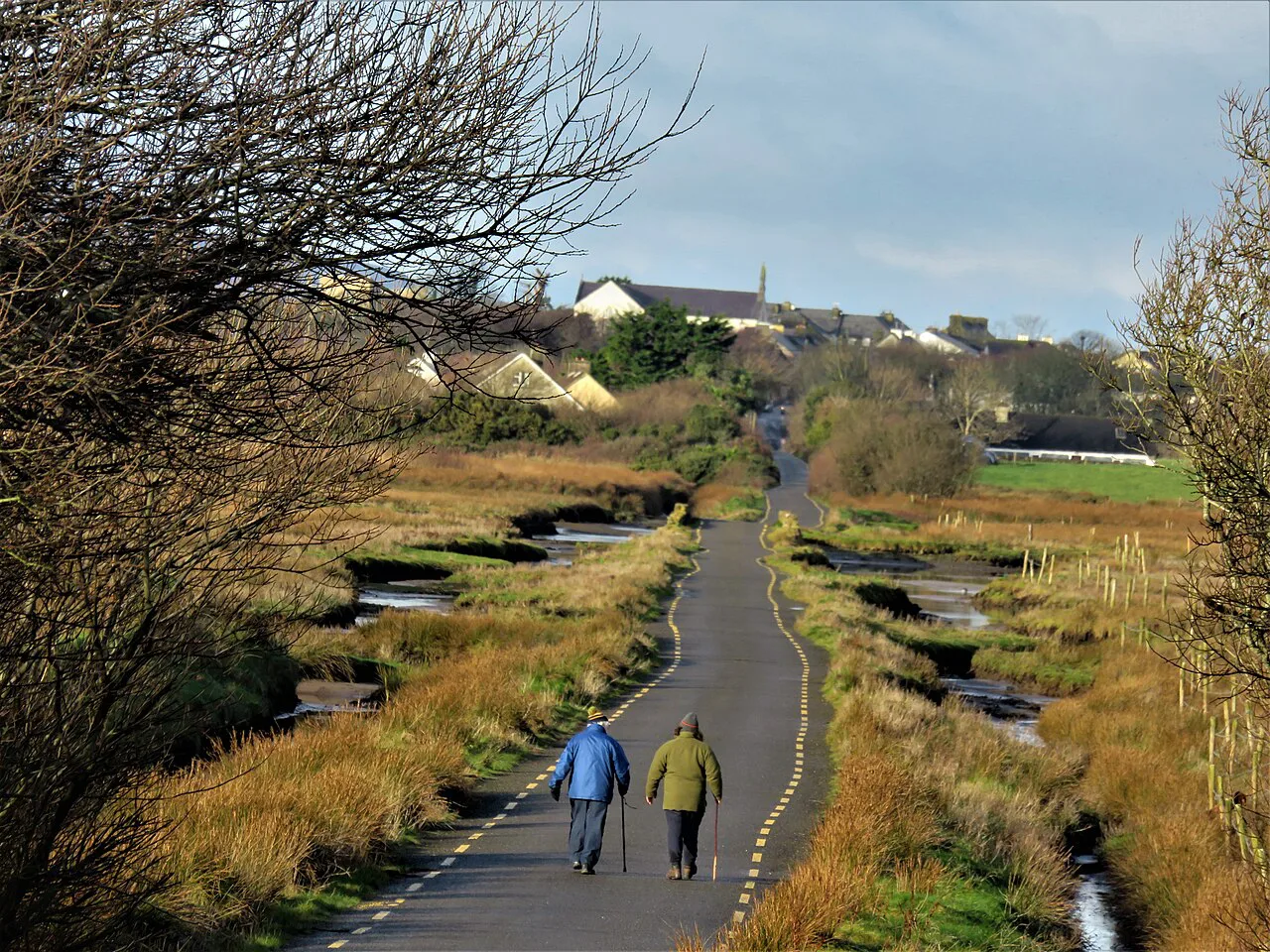
Killarney is the conventional start and finish, and the trail is walked anticlockwise. Since the route is largely circular with a few spurs, you can start and finish anywhere on the circuit and still walk the whole thing. That flexibility matters for anyone travelling by bus or train to a village partway round.
Killarney is the practical base for the first and last stages and for rest days: it has the widest choice of beds, shops and transport of any point on the route. Staying there before you start also lets you sort out fuel, maps and any last pieces of kit.
Getting to Killarney and the trailhead
Killarney sits on the main road and rail corridor through County Kerry, and the trail begins in the town itself, so you do not need a car to start walking. Bus and rail services into Killarney, and the local buses linking the villages around the Ring of Kerry, are the part of the plan to pin down first, because village-to-village connections are what constrain a stage schedule.
Distance, ascent and typical walking time
Published figures for the full route differ: the Ring of Kerry tourism site gives approximately 215 km (135 miles) over nine main stages, while Macs Adventure lists 203 km (126 miles) for its 12-day, 11-night itinerary. The gap reflects route variants and how the section out of Waterville is handled rather than an error. Choose one figure for planning and expect your own total to differ slightly with detours and accommodation.
Allow around nine days for the whole route on the nine-stage breakdown, or ten walking days if you follow the 12-day tour structure, which adds arrival and departure days in Killarney. Daily ascent on the published itinerary ranges from about 270 m to 564 m, and the biggest climbing day is not the longest one, so build the schedule around ascent as well as distance.
Terrain and underfoot conditions
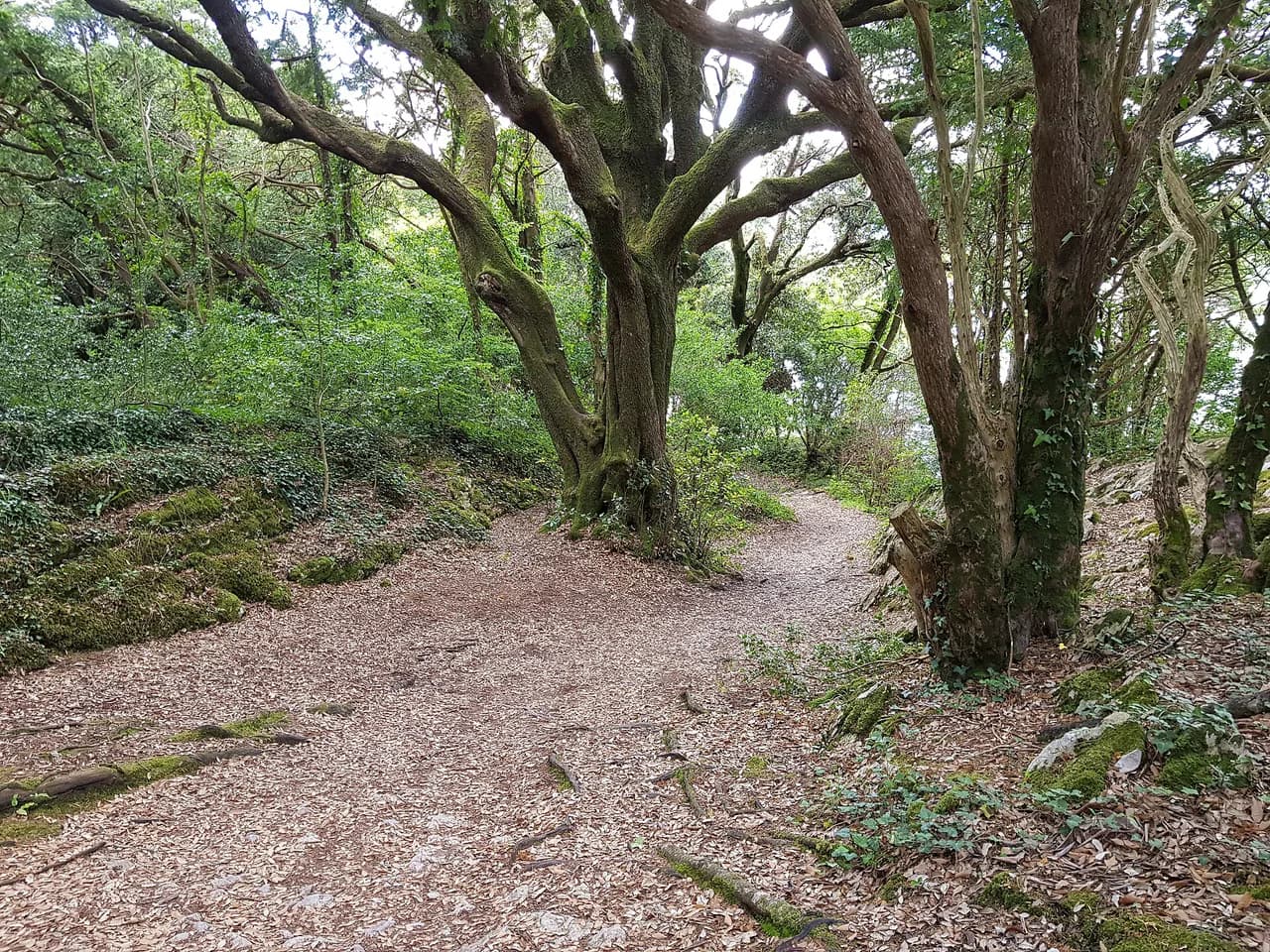
Underfoot, the Kerry Way is generally firm, but parts of the route can be rough and parts can be boggy, and the Black Valley to Glencar section includes a couple of steep, bouldery descents off two passes. Waterproof boots and poles earn their place on those descents after rain. Elsewhere the trail follows old green roads and forest tracks that make for steady, fast walking.
Much of the route crosses private farmland, walked by agreement with local farmers and landowners. Keep to the waymarked line, close gates and keep dogs under control; the access exists because walkers respect it.
The nine stages at a glance
The published nine-stage breakdown runs: Killarney to the Black Valley 22 km (14 miles), Black Valley to Glencar 20 km (12 miles), Glencar to Glenbeigh 18 km (11 miles), Glenbeigh to Cahirciveen 28 km (17 miles), Cahirciveen to Waterville 30 km (19 miles), Waterville to Caherdaniel 28 km (17 miles), Caherdaniel to Sneem 19 km (12 miles), Sneem to Kenmare 30 km (19 miles) and Kenmare to Killarney 25 km (16 miles). The two 30 km days are the ones most walkers split or shorten.
Killarney to the Black Valley
Leave Killarney heading south, cross the River Flesk and follow a gravel road shared with horse-drawn jaunting cars towards Castlelough Bay, with views across Lough Leane. The route passes the Victorian house and gardens at Muckross House and then Torc Waterfall before entering open moorland and oakwoods.
Macs Adventure's version of this day covers 24 km (15 miles) with 435 m (1,427 ft) of ascent and 366 m (1,200 ft) of descent, finishing near Lord Brandon's Cottage and the six-arch bridge over the Gearhameen river in the Black Valley. The jaunting cars share part of the road, so keep left and step aside when they pass.
Black Valley to Glencar
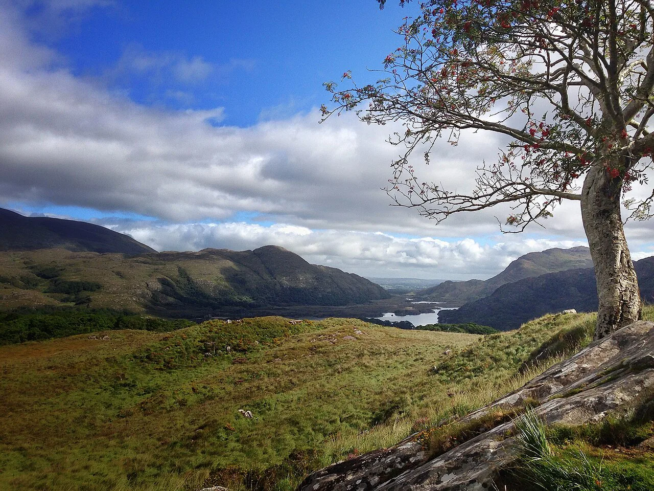
This is the rugged day: climb out of the Black Valley with the Bridia Valley opening ahead, cross two passes and descend steeply and over boulders on the far side of each. Macs Adventure logs 19 km (12 miles) with 564 m (1,850 ft) of ascent and 573 m (1,879 ft) of descent, the most climbing on the itinerary.
Quiet tarmac and gravel roads, forest and field paths lead past the Caragh River Valley and the tilted peak of Mulaghanattin, then along the shore of Lough Acoose with views to the Dingle Peninsula and the western Reeks. The day ends at Glencar on the main road.
Glencar has only one accommodation, The Climbers Inn, so in busy months you may be booked outside the village and your daily mileage will change. The same pattern applies in the Black Valley, where beds are few. Book those two nights before you commit to a stage plan.
Glencar to Glenbeigh
Easy trails characterise this stage: a boreen and then gravel forestry tracks to Lickeen Wood, with panoramic views back over the wooded Glencar valley and Lough Caragh. Past the lower slopes of Seefin you choose between two descents into Glenbeigh.
The shorter option climbs about 100 m to the saddle at Windy Gap and drops to Glenbeigh over 14 km (8 miles) with 369 m (1,211 ft) of ascent, giving views over Inch Strand and the Dingle Peninsula. The longer, gentler approach follows the road for 18 km (11 miles) with 270 m (886 ft) of ascent. Take Windy Gap for the views and the shorter day, or the road route if your legs are tired or the cloud is down.
Glenbeigh to Cahirciveen
At 28 km (17 miles), this is a long day linking the Atlantic edge of Glenbeigh with Cahirciveen, and it is the stage most worth splitting if you have the time. The going is largely on unsurfaced roads and paths, but the distance alone makes it a full day out.
Cahirciveen to Waterville
The longest published stage runs 30 km (19 miles) from Cahirciveen to Waterville along the coast side of the peninsula. Split it with a stop in between or plan an early start, because the distance leaves little margin for a slow morning.
Waterville to Caherdaniel
The published distance from Waterville to Caherdaniel is 28 km (17 miles), but a coastal variant cuts this to 13 km. The shorter line trades inland ground for cliff and beach walking; check the waymarking at the junction so you take the option you intended.
Caherdaniel to Sneem
A shorter day of 19 km (12 miles) gives room to visit Staigue Fort, one of Ireland's best-preserved ring forts and roughly 2,000 years old, which sits close to this stretch. Time the visit for the middle of the day and you still reach Sneem in the afternoon.
Sneem to Kenmare
Another 30 km (19 miles) links Sneem with Kenmare, and like the Cahirciveen to Waterville day it is best treated as a full day rather than an afternoon. Kenmare has a good range of beds and places to eat, which makes it a natural resupply point.
Kenmare to Killarney
The closing 25 km (16 miles) brings you back into Killarney, completing the loop. Save some energy for it: the reward is a town with pubs, music and a bed, and the knowledge that the circuit is closed.
Huts, inns and lodging along the way
There is no hut system on the Kerry Way; you sleep in guesthouses, B&Bs, hotels and inns in the villages and in the few beds available in the Black Valley and at Glencar. The Macs Adventure route lists stays in Killarney, the Black Valley, Glencar, Glenbeigh and onward through the coastal villages. Book the Black Valley and Glencar first, because their limited capacity dictates the shape of the rest of your schedule.
Self-guided operators handle bags and bookings, while independent walkers book each night directly; both approaches carry your own day pack. A guided or self-guided format including luggage transfer and inn-to-inn bookings is listed as available from April to October, which is Macs Adventure's stated season rather than a legal opening window for the trail.
When to go and what the weather brings
The operator runs its Kerry Way itinerary from April to October, which reflects the months when a full circuit is most practical. Spring and early summer bring long evenings and fresh ground; late summer and early autumn tend to be drier underfoot. Outside that window you will find fewer services and shorter days.
Atlantic weather changes fast, and the two passes between the Black Valley and Glencar are exposed to wind and rain even though the route stays low. Carry waterproofs every day, and treat the bouldery descents with care when they are wet.
Maps, waymarking and route-finding on the ground
Waymarking is discreet: where the route leaves a road you look for the walking-man symbol, and elsewhere yellow arrows appear on posts or rocks. No single Ordnance Survey map covers the whole route, so the Discovery Series sheets 78, 83 and 84 together cover most of Kerry.
A guidebook with stage maps is worth carrying alongside the OS sheets, because the markers tell you where to go but not where the next bed or shop is. Load an offline map on your phone as a backup, and keep paper as the primary tool in wet weather.
Plan Your Visit
Build your Kerry Way schedule around the two lodging pinch points first: the Black Valley and Glencar. Once those nights are fixed, fit the long 30 km stages around them, split what you can, and choose Windy Gap into Glenbeigh if you want the shorter, more dramatic day.
Add rest days in Killarney at the start or end to explore the national park, and treat the trail itself as a low-level circuit rather than a summit campaign. If you want the high ground, add a separate outing rather than trying to bolt it onto a stage.
Frequently Asked Questions
How long does it take to walk the Kerry Way?
The Ring of Kerry tourism site breaks the route into nine main stages and suggests allowing around nine days for the full circuit. Macs Adventure structures its version over 12 days and 11 nights, which includes arrival and departure days in Killarney and ten walking days, so the practical answer is nine to ten walking days with a little slack.
What are the different stages of the Kerry Way?
The published nine-stage breakdown runs from Killarney to the Black Valley, then Glencar, Glenbeigh, Cahirciveen, Waterville, Caherdaniel, Sneem and Kenmare before returning to Killarney. Distances range from 18 km to 30 km, and the section out of Waterville has a shorter coastal variant.
Which is better, Kerry Way or Dingle Way?
The Kerry Way is a longer circuit with more village-to-village variety and two demanding 30 km stages, while the Dingle Way is a point-to-point route on the neighbouring peninsula. Choose the Kerry Way if you want a loop from Killarney with the option to start anywhere; choose the Dingle Way if you prefer a linear walk ending on the coast.
How hard is the Kerry Way compared with other Irish long-distance trails?
It is a low-level route with a high point of about 385 m, so most days are long rather than steep. The hardest day is the Black Valley to Glencar crossing with steep, bouldery descents, and the long 28 to 30 km stages test stamina more than technical skill.
Where do you sleep along the Kerry Way?
There are no mountain huts; you stay in guesthouses, B&Bs, hotels and inns in Killarney and the villages along the route. The Black Valley and Glencar have very few beds, so book those nights first before fixing the rest of your schedule.
Can you walk only part of the Kerry Way?
Yes. The route is largely circular with a few spurs, so you can start and finish wherever suits you and walk a few stages as a taster. The Killarney to the Black Valley day and the Glenbeigh to Cahirciveen stretch both work as standalone outings.
When is the best time to walk the Kerry Way?
The itinerary runs from April to October, which covers the months when a full circuit is most practical. Spring brings fresh ground and long evenings, while late summer and early autumn are usually drier. Atlantic rain is possible in any month, so pack waterproofs regardless.
Sources
Trail notes for your next trip
Optional updates when we add or revise hiking guides.
You might also like
Continue reading
More guides you'll find useful