Carrauntoohil Hike: Killarney Routes & Devil's Ladder Guide
Plan the Carrauntoohil hike from Cronin's Yard: the Devil's Ladder and alternative lines, distance, ascent, walking time, terrain and the best months.
On this page
Carrauntoohil is the highest mountain in Ireland at 1,038.6 m (3,407 ft), and it sits in the MacGillycuddy Reeks above the Hag's Glen, west of Killarney in County Kerry. The standard ascent is a full mountain day rather than a quick summit bag: a long glen approach, a steep eroded gully and an exposed final ridge. The hike suits fit walkers with hill experience who are comfortable on loose ground and want Ireland's highest summit under their boots.
Where Carrauntoohil sits in the MacGillycuddy Reeks
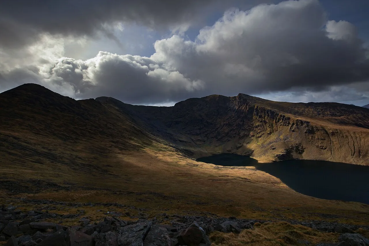
Carrauntoohil is the anchor of the MacGillycuddy Reeks, the range that walls in the Hag's Glen and forms the skyline west of Killarney. The mountain rises above the head of the glen, so the day is built around one long valley approach and then a choice of lines to the summit ridge. Neighbouring summits such as Beenkeragh and Cnoc na Péiste stand close by, which is why the range is treated as serious hill country rather than a lowland walk.
The valley floor itself is gentle and green, with a river and old paths running up the glen toward the crags. The difficulty is concentrated in the last third of the climb, where the ground steepens into the gully and then onto the ridge. Read the day in that order: easy approach, hard upper section, careful descent.
Trailhead at Cronin's Yard and getting there from Killarney
Most ascents begin at Cronin's Yard, a farm-based car park and tea room at the road end below the Hag's Glen, roughly 12 km (7.5 miles) from Killarney by road. The route from the yard heads directly into the glen, making it the natural start and finish point for the Devil's Ladder line. Arrive early on fine weekends, because the car park serves every route on this side of the mountain and fills quickly in summer.
Driving from Killarney is the simplest option; the narrow road beyond the main valley road can make a hired taxi from town the easier choice if you would rather not drive back after a long descent. If you are building a wider trip, the hiking in killarney pages give the trail network and base-town context for the national park trails around the town, and the hiking in Wales guide is the place to look if you are weighing up other Celtic mountain trips.
Distance, ascent and walking time
The most-used line runs from Cronin's Yard into the Hag's Glen and up the Devil's Ladder to a saddle at 734 m (2,408 ft), then along the ridge to the summit. Plan on a long day out rather than a half-day: the approach is several kilometres of valley walking each way, and the climb and descent are slow on loose, steep ground. Give yourself daylight with a margin, and turn around if the weather closes in rather than pressing for the cairn.
Route description via the Hag's Glen and the Devil's Ladder
From Cronin's Yard, follow the track up the glen, crossing the river and keeping the main crags on your right as the valley narrows. The path is clear in dry weather and muddy after rain, with a few easy stream crossings. Stay on the main line; the side paths onto the surrounding shoulders are steeper and less travelled.
The Devil's Ladder is the major access route to the mountain and a badly eroded gully, so treat the climb as the crux of the day. Hands are useful on the loose steps, and the gully is uncomfortable in descent when wet; many parties prefer to climb it and descend a different way. Do not add the ladder to a day when visibility is poor or when the rock is greasy.
The saddle and the final ridge to the summit cairn
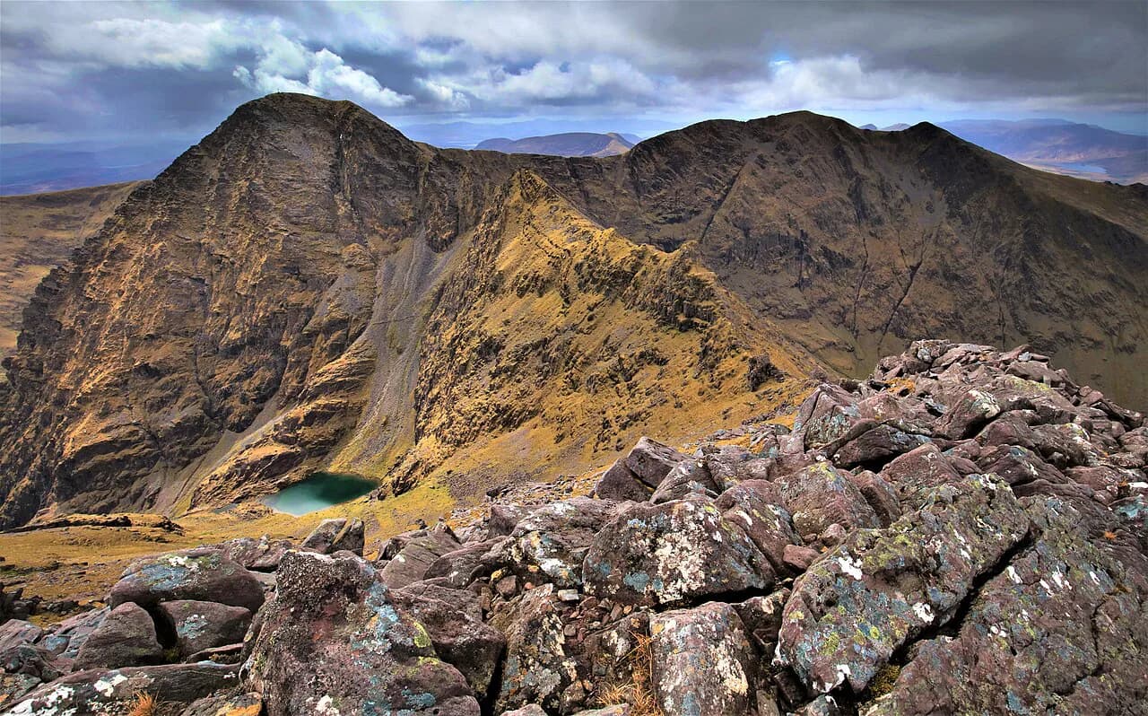
Above the ladder the ground opens onto the saddle at 734 m (2,408 ft), where the ridge line runs left toward the summit. The ridge is airy but walkable on a dry day, with a short scramble on some sections and a big drop into the glen beside you. Take the ridge at a steady pace; the summit cairn and the cross appear sooner than the long approach suggests.
Alternative ascent and descent lines
Instead of reversing the ladder, many walkers descend the Brothers' or the Zig-Zags on the opposite side of the glen, which keeps the descent on more continuous path rather than loose gully. These lines rejoin the valley track lower down, so you can build a circuit without retracing the crux. Check the layout on a paper map before you leave the yard and pick your descent before you commit to the climb.
The upper glen paths also connect with the Kerry Way, the long-distance route that circles the Iveragh Peninsula and passes through the Black Valley beneath the Reeks. If you are extending the trip, the Kerry Way pages explain how the stages link up and how huts and villages fit around them.
Terrain, exposure and hazards
The mountain is loose underfoot in the gully, exposed on the ridge, and prone to sudden changes in cloud and wind on the summit. Afternoon mist and rain can erase the path, so carry a map and compass and know the line back to the glen. In cold conditions the ridge and gully turn into winter ground; a summer route in trainers is not a winter route.
Streams and bog on the approach make wet feet likely, and midges can be a nuisance in the glen on warm, still afternoons according to the national park's tick and biting-insect guidance. Wear gaiters and keep any cuts covered, and check yourself over for ticks after the walk. This is above all a hill day where a late start, a twisted ankle or a missed descent line all compound quickly.
When to go: season, daylight and weather patterns
The best months for the standard route are late spring through early autumn, when the gully is dry and the ridge is clear of snow and ice. Long summer days give the margin you need for the valley walk and the slow rotten ground in the gully. Early and late in the season the ridge still holds cold weather and weak daylight, so check the mountain forecast the evening before and be ready to choose a lower glen walk instead.
Killarney's lowland trails are open and popular in every season, the national park publishes its walking routes with distances and grades, and these make good bad-weather alternatives. The Old Kenmare Road and the Killarney National Park trails around Muckross and Ross Island are the obvious escapes if the summit is in cloud.
Guided hikes and when a guide makes sense
A guided ascent takes much of the uncertainty out of the eroded gully and the descent choice, and guided companies run the Devil's Ladder route from Cronin's Yard. It suits anyone new to Irish mountain ground or walking alone, and it is worth it when you want a leader on the ridge navigation. Book ahead in summer, and ask the guide what the day demands of your fitness before you commit.
Gear for a long mountain day
Sturdy boots with good grip are a better match for the loose gully than trainers, and walking poles help on the long valley walk and the descent. Bring waterproofs, a warm layer, water and food for the full day, and a paper map in a case; phone batteries and signal both fail in the glen. A headlamp and a small first-aid kit are sensible weight to carry in case the day runs longer than planned.
For the lowland days either side of the summit, lighter shoes and a rain jacket are enough on the national park trails, which vary from paved paths to rough and muddy ground. The park grades each walk, so match your kit to the trail rather than to the summit.
What to do after the hike around Killarney
Killarney town is the natural base: guesthouses, pubs and restaurants are within walking distance of the park entrances, and you can stroll into Knockreer and along the River Deenagh on a recovery day. The town's position at the park gate makes it the easiest place to stay for both Carrauntoohil and the lakeside walks.
If you want a shorter outing after the big day, the gap of dunloe walk starts at Kate Kearney's Cottage a short drive from Killarney and threads a mountain pass without the exposure of the summit ridge. The Muckross lake loop offers an easier circuit from Muckross House if your legs need something flat.
Plan Your Carrauntoohil Day
Build the day around Cronin's Yard, an early start and a clear decision on how you climb and descend the Devil's Ladder; the glen walk is generous, the gully and ridge are not. Carry a map, watch the forecast, and leave the summit for a settled day rather than pressing on into cloud.
Frequently Asked Questions
How high is Carrauntoohil?
Carrauntoohil is 1,038.6 m (3,407 ft) high, making it the highest mountain in Ireland. It stands in the MacGillycuddy Reeks above the Hag's Glen, west of Killarney in County Kerry.
Where does the Carrauntoohil hike start?
Most ascents start at Cronin's Yard, the farm car park and tea room below the Hag's Glen, about 12 km from Killarney by road. The route from the yard heads directly up the glen toward the Devil's Ladder.
What is the Devil's Ladder on Carrauntoohil?
It is the badly eroded gully that forms the major access route to the mountain, climbing from the head of the Hag's Glen to the saddle at 734 m. Expect loose, steep ground where hands are useful, especially when wet.
How long does the Carrauntoohil hike take?
Plan a full day with daylight to spare. The valley approach, the eroded gully and the ridge are slow in both directions, so an early start matters more than a fixed time target.
Do you need a guide to climb Carrauntoohil?
Experienced hill walkers manage the standard route without one, but a guided ascent is a sound choice if you are new to Irish mountain ground, walking alone, or unsure about route-finding on the ridge.
Can you hike Carrauntoohil in winter?
The ridge and gully become winter ground in cold conditions, and the summer route no longer applies. Treat the mountain as a winter objective only with the right equipment and experience, or choose a lower glen walk.
Sources
Trail notes for your next trip
Optional updates when we add or revise hiking guides.
You might also like
Continue reading
More guides you'll find useful