Hiking in Killarney: Best Trails in Killarney National Park
Plan hiking in Killarney National Park with published distances, grades and start points for lakeside walks, Ross Island, Torc Waterfall and the Old Kenmare Road.
On this page
Killarney National Park suits hikers who want variety within a short radius: flat lakeside paths from town, wooded loops around Muckross and Ross Castle, and two rougher upland routes that climb away from the lakes. The park grades its trails from easy to strenuous and publishes a distance for each, so fitness and available time decide the day more than navigation does.
Base yourself in Killarney town and you can walk into the park at Knockreer without moving the car, then use short drives or a taxi to reach Muckross, Ross Castle and the Torc car parks for the longer routes. This guide groups the walks by grade, gives the published start and finish points, and flags the surfaces that slow you down.
Where the main trailheads are
Four access points cover nearly every trail in the park. Killarney House and Gardens, on the edge of town, is the start of the Knockreer Circular Walk; Muckross House, about 5.5 km (3.4 miles) from town on the N71 Kenmare road, serves the lakeside and peninsula walks; Ross Castle, on the eastern shore of Lough Leane, serves Ross Island; and the Torc car parks sit below Torc Waterfall for the upland routes.
The Lakeside Walk begins from a car park directly across the N71 from the gated park entrance, opposite the jaunting car park, and runs to Muckross House. That layout lets you leave the car once and link several easy paths, though you should plan the return leg before setting off.
For the Old Kenmare Road and the Mass Path you need a vehicle or a drop-off: the Old Kenmare Road starts at the Upper Torc car park, and the Mass Path starts across the road from the Derrycunnihy Church car park, where a second car can wait if you walk one way.
Easy lakeside and woodland walks under 5 km (3 miles)
The shortest options are genuinely short. The Old Boathouse Trail runs 1 km with about 10 m (33 ft) of ascent, skirting Dundag Point and its yew wood to a panoramic view over the lakes and the secluded Dundag Beach beyond. The Dinis Cottage trails cover about 1 km around the Old Weir Bridge and the Meeting of the Waters, but the start can flood and the boardwalk gets slippery.
The Mining Trail is a 3 km easy loop from the Ross Castle car park: walk past the castle on the tarred road, turn right off it after about 50 m, then take the left fork after 800 m to follow the Copper Mines shoreline loop back. Discover Ireland describes the same circuit as roughly 2 km with a 17-stop trail map and about 1.5 hours on foot, so expect to stop often at the mine ruins.
The Dundag to Torc Path covers 2.5 km as a return on mostly flat ground, with views across Muckross Lake and open fields where red deer often graze, and it ends near Torc Waterfall. An alternative return line is rough and muddy, so boots beat trainers if the ground is wet.
Library Point is a 5 km easy return from Ross Castle along the left-hand path, passing limestone above the Lough Leane shore with views to Innisfallen Island and its monastery remains. Governor's Rock is a 4 km return from the same car park, with a loop of about 3 km past the Copper Mines that can be combined with Library Point to push the day beyond 5 km.
Knockreer Circular Walk from town
Knockreer is the walk to choose if you are staying in Killarney without a car. It is a 5 km easy circuit from Killarney House and Gardens, climbing to 45 m (148 ft) and taking about two hours at a steady pace, with views over Lough Leane toward the MacGillycuddy Reeks.
The route leaves the house along the long avenue, turns left at the bridge to follow the River Deenagh, crosses the second bridge and turns right, then heads left over a cattle grid across open parkland. Discover Ireland notes a few reasonable inclines on a smooth paved surface that also carries cyclists, so walk on the correct side and expect company.
Deenagh Lodge, a thatched cottage café at the park entrance, sits at the natural start and finish of this loop, which makes it a sensible first or last walk of a trip. Keep an eye out for red deer on the open sections, particularly early and late in the day.
Lakeside Walk to Muckross House and Muckross Abbey
The Lakeside Walk is a 5 km return on a rough, meandering trail that follows Lough Leane from the N71 car park to Muckross House. It is the easiest way to reach Muckross Abbey, which you can add en route, and the views stay open across the water for most of the way.
Muckross House itself is a Victorian mansion open for guided tours throughout the day, with gardens that are particularly colourful in May and June. Treat the walk as transport between sights rather than a summit day: the surface is uneven underfoot, but the gradients are gentle and the distance is short enough for a half-day with stops.
Muckross Abbey, a 15th-century Franciscan friary with a vaulted cloister and an ancient yew in the courtyard, stands a short walk from the N71 car park and is open to the public. If you want a longer water-level circuit instead, the Muckross House to Torc Waterfall lake loop adds Dundag Point and the stone steps down to the falls.
Moderate half-day walks around Muckross
Arthur Young's Walk is a 5.6 km moderate circuit from the front door of Muckross House, skirting the Muckross Peninsula between Lough Leane and Muckross Lake through oak woodland and open meadow. It passes Reenadinna yew wood, one of only three such woods in Europe, and the ground is mostly flat with only about 10 m of ascent.
Mossy Woods is only 2 km from Muckross House but graded moderate because the terrain is rough and boggy in places. From the house, follow the road toward Torc, round the bend and pick up the path on the right by Muckross Lake after about 100 m.
Killegy Woods and Queen's Drive make a 3 km moderate woodland loop that can be muddy, starting from the Blue Pool nature trail entrance with a good chance of seeing native red deer. Walk about 200 m along the Mangerton Road, take the minor road into the trees at the bend, go through the barrier and keep left up the track, then right at the next junction and right again at the bottom.
The Cloghereen nature trail is a 1 km moderate woodland path marked with a guide rope, the first trail in Ireland designed for visually impaired walkers; follow the rope with your right hand from the Cloghereen Pool Wood entrance. It is muddy in parts, so it pairs well with a spare hour before or after a longer Muckross walk.
Old Kenmare Road from Upper Torc to Incheens
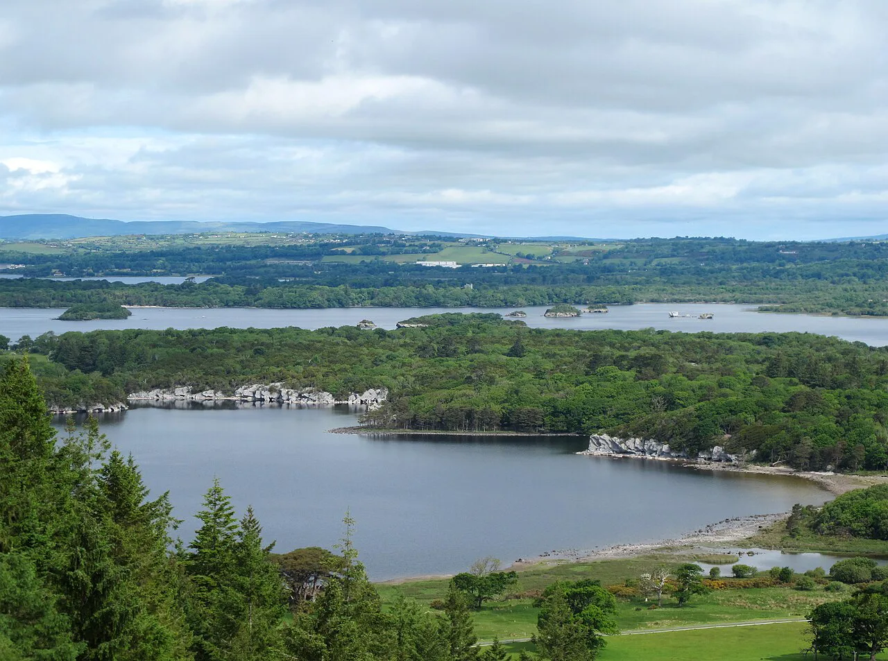
The Old Kenmare Road is the park's 7 km strenuous upland route, starting at the Upper Torc car park and finishing at Incheens, through woodland trails, boardwalk, river stepping stones and sections of muddy, uneven ground. Discover Ireland gives about two hours for the Torc to Incheens stretch and notes that the route crosses the Owengarrif River on a wooden bridge before turning left down through the trees.
This section forms part of the Kerry Way long-distance trail, whose official first leg runs from Killarney town to Torc Waterfall. Hiking boots matter here: a sharp descent leads to the public road, where you turn right to return to Derrycunnihy Church and the second car.
Views open over Lord Brandon's Cottage and back across the uplands toward the lakes, and the river crossings are the places to slow down after rain. If you want the full Kerry Way context, the longer route continues through the Black Valley and on toward Kenmare.
The Mass Path from Derrycunnihy Church to Lord Brandon's Cottage
The Mass Path is 4 km one way and graded strenuous, running from Derrycunnihy Church to Lord Brandon's Cottage along the Upper Lake. It is rough underfoot and prone to flooding in winter, so save it for drier months or a settled spell.
The start is across the road from the Derrycunnihy Church car park, where wooden steps and boardwalk drop into oak woodland. The path crosses streams, passes abandoned ruins, follows the Upper Lake shore with mountain views ahead, and gives a chance of spotting a white-tailed sea eagle. Discover Ireland puts the walk at about 1.5 hours.
At Lord Brandon's Cottage a lakeside café serves summer visitors, and the classic return is by boat across the lakes to Ross Castle rather than back on foot. Book that boat leg ahead if you are walking one way, since the day's plan depends on it.
Linking walks to the Kerry Way
Two park trails are also stages of the Kerry Way: the Old Kenmare Road from Upper Torc and the Mass Path from Derrycunnihy Church. That makes Killarney a good place to sample the long-distance route without committing to a multi-day walk, using the church car park or a boat as your shortcut back.
Boat trips run from the Old Boat House near Muckross House and from Ross Castle, with routes covering Lough Leane, Innisfallen Island, Lord Brandon's Cottage and the Dinis Peninsula. The boat back from Lord Brandon's is the practical finish to a one-way Mass Path crossing, and it turns a rough linear walk into a loop.
Hikers continuing beyond the park can link these stages with the higher ground outside it, including the Gap of Dunloe walk and the MacGillycuddy Reeks, where the carrauntoohil hike starts from Cronin's Yard; both lie outside Killarney National Park, so plan separate days for them.
Distance, ascent, grade and walking time at a glance
Easy: Knockreer 5 km with 45 m of ascent and about two hours; Dundag to Torc 2.5 km return; Mining Trail 3 km; Lakeside Walk 5 km return; Old Boathouse 1 km with 10 m of ascent; Library Point 5 km; Governor's Rock 4 km return. These are the walks for short days, mixed groups and anyone carrying a child or a picnic.
Moderate: Arthur Young's Walk 5.6 km with about 10 m of ascent; Mossy Woods 2 km; Killegy Woods and Queen's Drive 3 km; Dinis Cottage trails 1 km; Cloghereen 1 km. The moderate grade here reflects surface and wet ground more than climbing, so boots and ankle support matter more than fitness.
Strenuous: Old Kenmare Road 7 km from Upper Torc to Incheens and the Mass Path 4 km one way from Derrycunnihy Church to Lord Brandon's Cottage. Allow the better part of a day for either once you add the drive to the start and the return leg by car or boat.
Best months and what each season changes
Late spring and early summer give the gardens at Muckross their rhododendron and azalea colour, with long daylight for the upland routes. Summer brings the warmest days and the most people on the Knockreer and Torc paths, plus seasonal opening of the lakeside café at Lord Brandon's Cottage.
Autumn is the season for red deer sightings in the park and gives firm ground after summer, while winter soaks the low paths and floods the Mass Path at its start. On any upland section, take a weatherproof layer and turn back if cloud drops over the higher ground, because the views are the point of those routes.
Match the walk to the forecast rather than the calendar: Knockreer and the Ross Island loops stay pleasant in drizzle, while the Old Kenmare Road and the Mass Path are better saved for a dry day with good visibility. Early starts also reduce midge trouble on warm, still evenings by the lakes.
Midges, ticks and red deer
Warm, humid days bring swarms of midges near the lakes, and walkers who leave the tracks may pick up ticks, which can in rare cases carry Lyme disease. A head net, long sleeves and a check of legs and clothing after the walk are sensible precautions on the wetter routes.
Red deer are common in the open fields around Torc and in Killegy Woods. Keep your distance and do not feed them, particularly during the autumn rut, when stags behave unpredictably and the fields around the Torc paths can be busy with onlookers.
Access, bikes and dogs
Surfaced tracks in the Muckross, Knockreer and Ross Island areas suit both cyclists and walkers, and bicycles can be rented in and around Killarney town, with most shops supplying cycle maps. Watch for one-way cycle routes and use the marked cycle parking bays at the main sites.
Dogs are permitted on all park trails but must be kept under control at all times, which matters around red deer and on the narrow boardwalks. Swimming is allowed in some areas but not managed for it, so ask a ranger for advice on safe bathing sites rather than choosing a spot by appearance.
Canoeing and kayaking on the lakes needs a permit, and vessels must be power-washed in advance. Horse riding is limited to three permitted companies working the Muckross Forest and Knockreer area, so pony trekking elsewhere in the park is not allowed.
Gear for wet ground, boardwalks and stepping stones
Waterproof boots with decent tread are the single most useful item for this park, because the moderate and strenuous routes mix boardwalk, river stepping stones, muddy woodland and flooded trail starts. The Mass Path descends old wooden steps and the Dinis boardwalk can be slippery, so grip matters more than bulk.
Carry a light waterproof layer and a dry bag for electronics on the lake routes, since showers arrive quickly and the Lakeside Walk has little cover. A head net and insect repellent earn their weight on still summer evenings by the water.
Plan Your Trip
Plan around the grade rather than the photograph: Knockreer and the Ross Island loops give you a short, reliable day from town, Muckross holds the moderate half-days, and Upper Torc and Derrycunnihy Church are the doorways to the strenuous uplands. Line up the second car or the boat before you set off on the linear routes.
Visitor information is available at the Killarney National Park Visitor Centre at Killarney House, and a duty ranger can be reached on +353 64 6635215 between 9:00am and 5:00pm for trail conditions. For police, fire, ambulance or mountain rescue, call 999 or 112.
If you want a wider view of Irish trails before booking, the hiking in ireland guide covers other mountain and coastal routes, but Killarney alone offers enough variety to fill a long weekend with lakes, woods and two upland days.
Explore more Killarney hiking guides
Frequently Asked Questions
What is the easiest walk in Killarney National Park?
The Old Boathouse Trail is the shortest at 1 km with about 10 m of ascent, and the Mining Trail at Ross Castle is a 3 km easy loop that the park grades easy throughout. Both avoid the muddy upland ground and suit a short stop.
How long does it take to walk the Knockreer Circular Walk?
About two hours for the 5 km circuit from Killarney House and Gardens, which climbs to 45 m and returns to the same point. It is the most convenient walk if you are staying in town without a car.
How hard is the Old Kenmare Road from Upper Torc?
It is graded strenuous over 7 km from the Upper Torc car park to Incheens, with boardwalk, river stepping stones and muddy, uneven ground. Boots and a lift back from Incheens make the day much easier.
Where does the Mass Path start and finish?
It runs 4 km one way from the Derrycunnihy Church car park to Lord Brandon's Cottage, following the Upper Lake shore through oak woodland. Many walkers return by boat to Ross Castle rather than retracing the path.
Can you walk from Killarney town into the national park?
Yes. The Knockreer Circular Walk starts at Killarney House and Gardens and returns there, and the park entrance at Knockreer sits close to town, so you can reach the paved paths on foot in a few minutes.
When is the best time to hike in Killarney?
Late spring and early summer give long daylight and garden colour at Muckross, while autumn brings red deer and firmer ground on the upland routes. Winter floods the start of the Mass Path, so keep to the low lakeside paths then.
Do I need a permit to hike in Killarney National Park?
No permit is required for walking the trails; dogs must simply be kept under control. Canoeing and kayaking on the lakes do need a permit and a power-wash beforehand.
Sources
Trail notes for your next trip
Optional updates when we add or revise hiking guides.
You might also like
Continue reading
More guides you'll find useful