Hiking in Kotor: Ladder of Kotor and Fortress Trails Guide
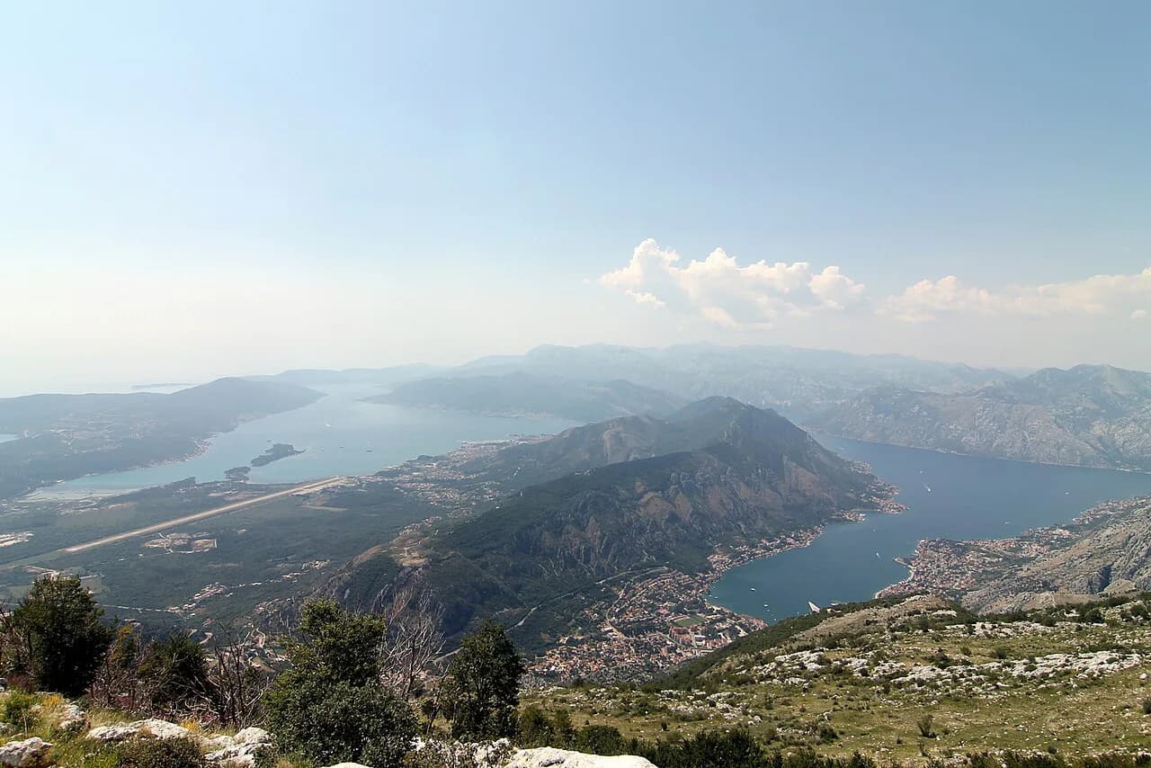
Hiking in Kotor means switchbacks above the old town, bay views from 3,000 feet and a two-to-four-hour climb. Here is how the routes, timing and kit work.
On this page
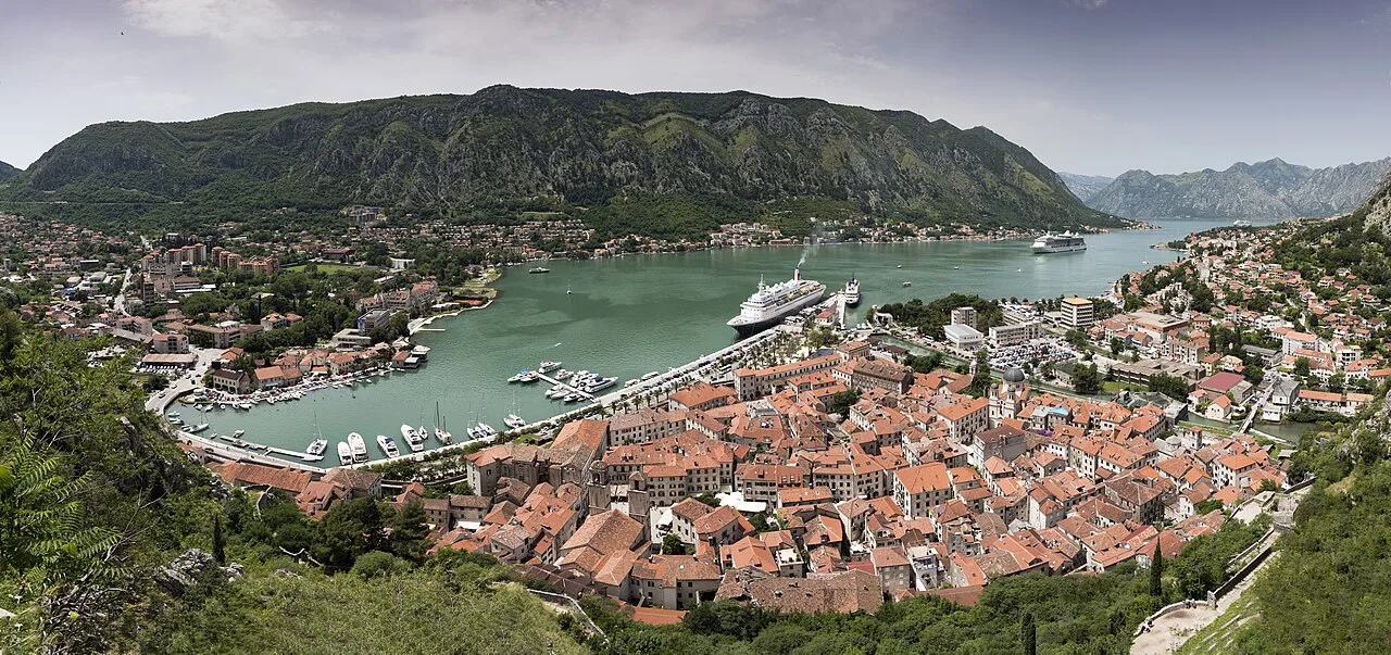
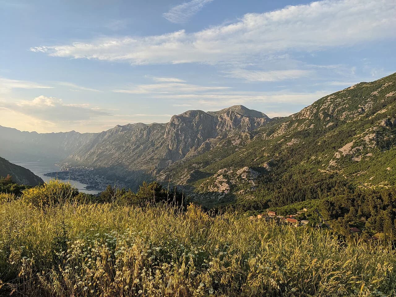
Kotor sits at the head of Boka Kotorska Bay with a walled old town at sea level and the steep face of Mount Lovćen rising directly behind it. That layout is what makes hiking here so immediate: you can leave the lanes of the old town on foot and be on a switchbacked mountain path looking down on the rooftops within the hour. The trails suit fit walkers on a half-day outing rather than serious mountaineers, and no car is needed.
Two climbs dominate planning: the zigzag path known as the Ladder of Kotor, which cuts up the mountain face in a ladder-like line, and the fortress path above the town walls. Decide first how much time and climbing you want, then read the route descriptions below to match a trail to your pace.
Where the hikes start
Both routes begin around the old town. The first step is getting outside the city walls, which is where the path toward the Ladder of Cattaro and the fortress climb picks up.
If you are staying in Kotor or arriving by cruise ship, you can walk from the port and the old town to the trailheads without transport, which makes a morning climb easy to fit around a day in town. Wear your hiking shoes off the ship or from the hotel rather than carrying a second pair, because the lanes and the lower path are cobbled and uneven.
Ladder of Kotor: distance, ascent and time
The Ladder of Kotor climbs the sheer face of Mount Lovćen by way of 70 hairpin bends, gaining more than 3,000 feet (around 900 m) above the UNESCO-protected old town. Allow two to four hours for the climb to the top, depending on your pace and how often you stop for photos.
Treat the four-hour figure as a realistic planning number for a steady hiker with breaks, and the two-hour figure as the pace of someone climbing without stops. Because the route switchbacks up an open face, the total climbing matters more than the horizontal distance for most walkers.
Route description
From the town the path works through forest and then rocky terrain, with narrow sections between the turns. Red-and-white striped signs mark the way and give you a running sense of progress as you gain height.
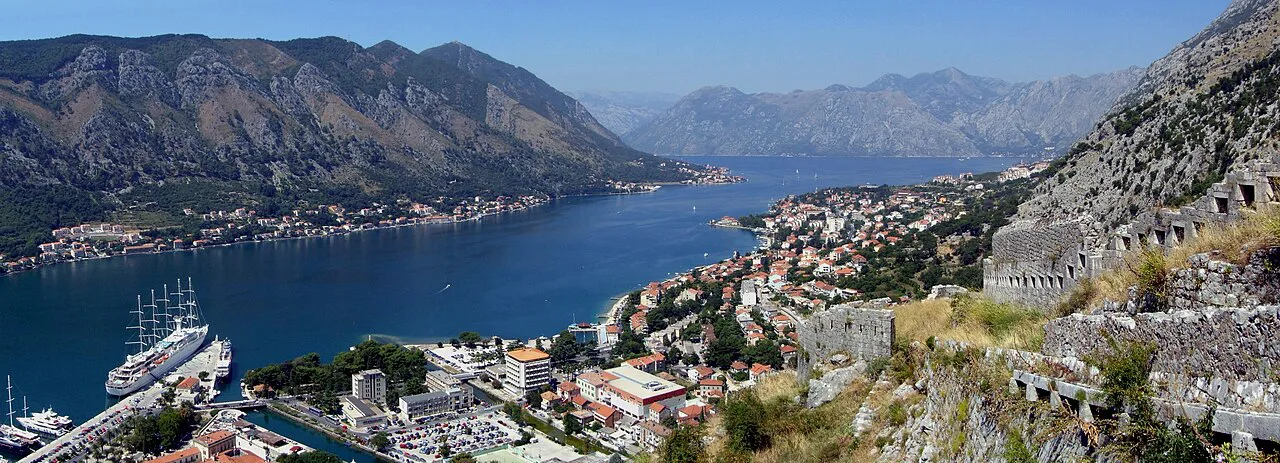
The views open up as you climb, with the bay of Boka Kotorska spreading below and the old town shrinking to a tight cluster of roofs. The upper trail gives the widest panorama over the bay and beyond, so pace yourself to reach the higher switchbacks rather than treating the first viewpoint as the finish.
Expect loose rock on the turns and short stretches where the path is narrow enough to need care when passing others. Walking poles help on the descent, when the same loose ground is harder to read underfoot.
The 70 hairpin bends on the ground
The ladder-like line you see on the mountain face is exactly what you walk: a long series of tight switchbacks stacked up the slope. On the ground, each bend is a marker of height gained, and counting them is a reliable way to judge how far you still have to climb.
Because the path zigzags rather than running straight up, the walking is steady rather than brutally steep, but the turns are where the ground is most worn and where loose stones collect. Keep to the inside of the bend on the way down and shorten your steps.
Walking the Ladder downhill instead of up
The route also works from the top down if you would rather not face the full ascent, which suits walkers who have transport to a higher starting point or who prefer descending steep ground to climbing it. The trade-off is that the loose sections demand more attention going down, and your legs take the load on the turns rather than on the climb.
If you are on foot from the old town, the up-and-back format is the practical choice, since you return the same way. Plan to start early so the climb happens in cooler air and the descent does not run into the heat of the afternoon.
Other options from Kotor
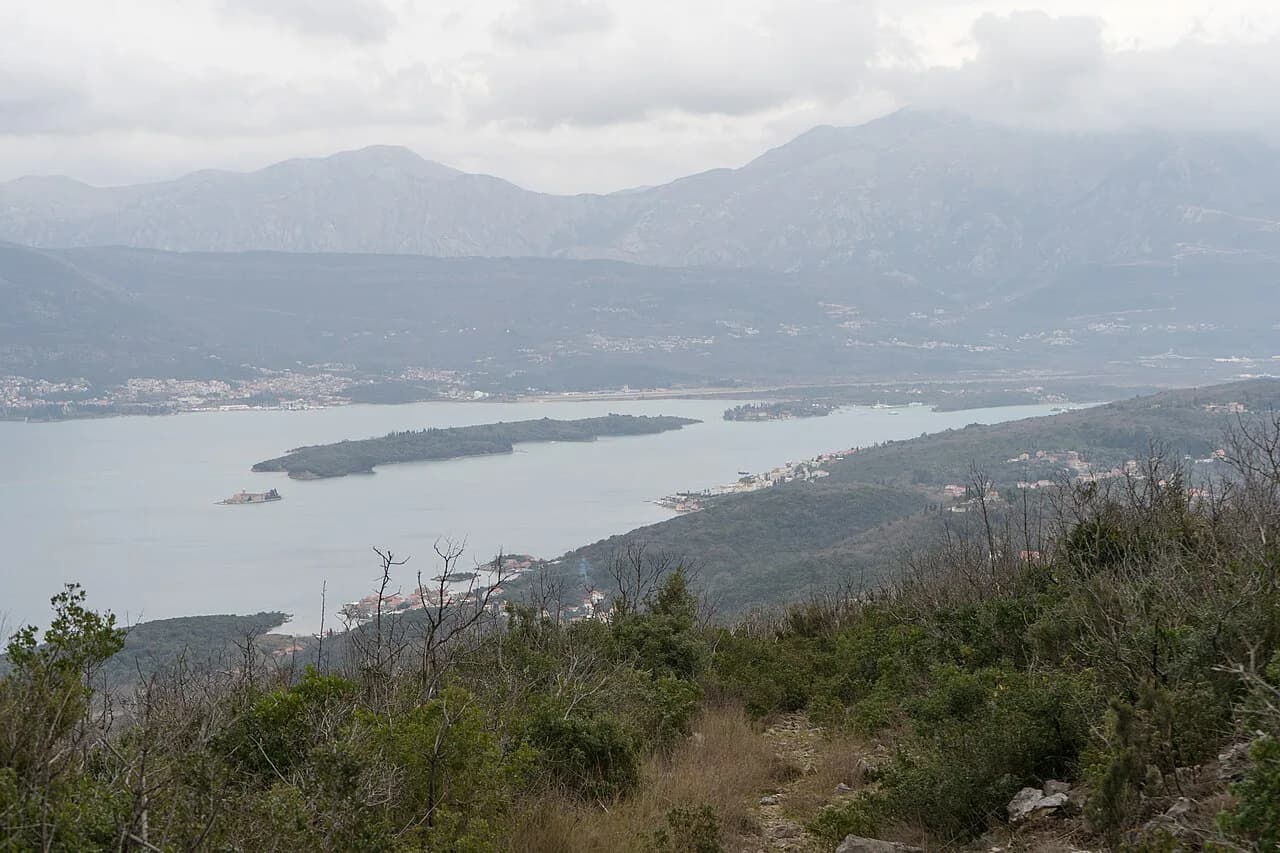
Beyond the ladder and the fortress path, the Vrmac ridge gives a longer traverse from Kotor toward Tivat along the top of the ridge, with views on both sides of the mountain. It rewards walkers who want a fuller day and a different angle on the bay than the face above the old town. If you are weighing this against trails elsewhere in the country, our guide to hiking in Montenegro puts the coastal routes at Kotor alongside the national park and mountain walks.
A second alternative is the approach to Lovćen National Park from Cetinje, which links the old Montenegrin capital with the mountain park above Kotor. It makes sense if you are already moving between the two towns and want to combine transport with a walk rather than returning to Kotor the same way.
When to go
Early summer brings workable climbing conditions on the ladder without scorching heat, though you still need to carry plenty of water. Later in the season the open face above the bay gets hot, so an early start matters more than the month you choose.
Spring and autumn give the most comfortable temperatures for the climb, and clear days deliver the best bay views from the upper trail. Whatever the season, watch the sky over the mountains, since storms build over Lovćen in the afternoon and the exposed switchbacks offer no shelter.
Water, food and kit
Carry more water than you would for a flat walk of the same length, because the climb is continuous and the face is sunny for much of the day. A refillable bottle and a small filter or purification tablets give you flexibility if you are out longer than planned.
Pack a charged phone or camera for the views, a light layer for the wind on the upper turns, and snacks for a half-day out. Sturdy shoes with grip are the key item, since loose rock on the bends is the main footing hazard.
Markings and navigation
The red-and-white striped signs guide you along the route, and following them keeps you on the marked line through the forest and the rocky stretches. Where the path is narrow and the signs are spaced out, keep the switchbacks in view and stay on the worn ground rather than cutting the turns.
Download an offline map before you leave the old town, since signal on the mountain face can be patchy. Tell someone at your hotel or on your ship which route you are taking and when you expect to be back.
Huts and lodging
This is a day hike based in Kotor rather than a hut route. There are no mountain huts on the ladder itself, so you sleep in the old town or nearby and climb with a light pack.
Kotor has accommodation inside and outside the walls, including historic properties such as Hotel Cattaro in the old town. Book ahead in summer, when the town fills with visitors from cruise ships and tour groups.
Practical notes on the fortress path
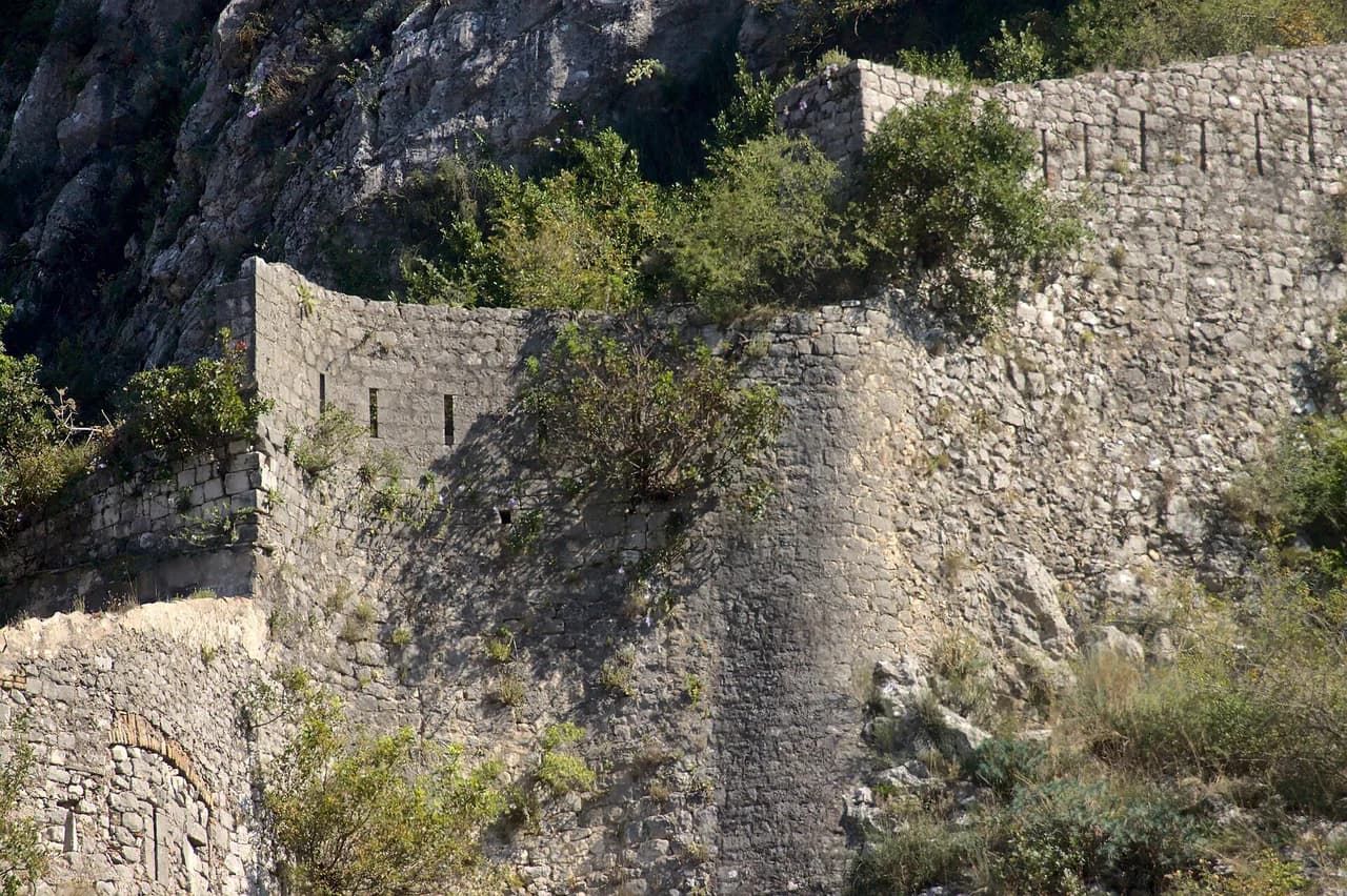
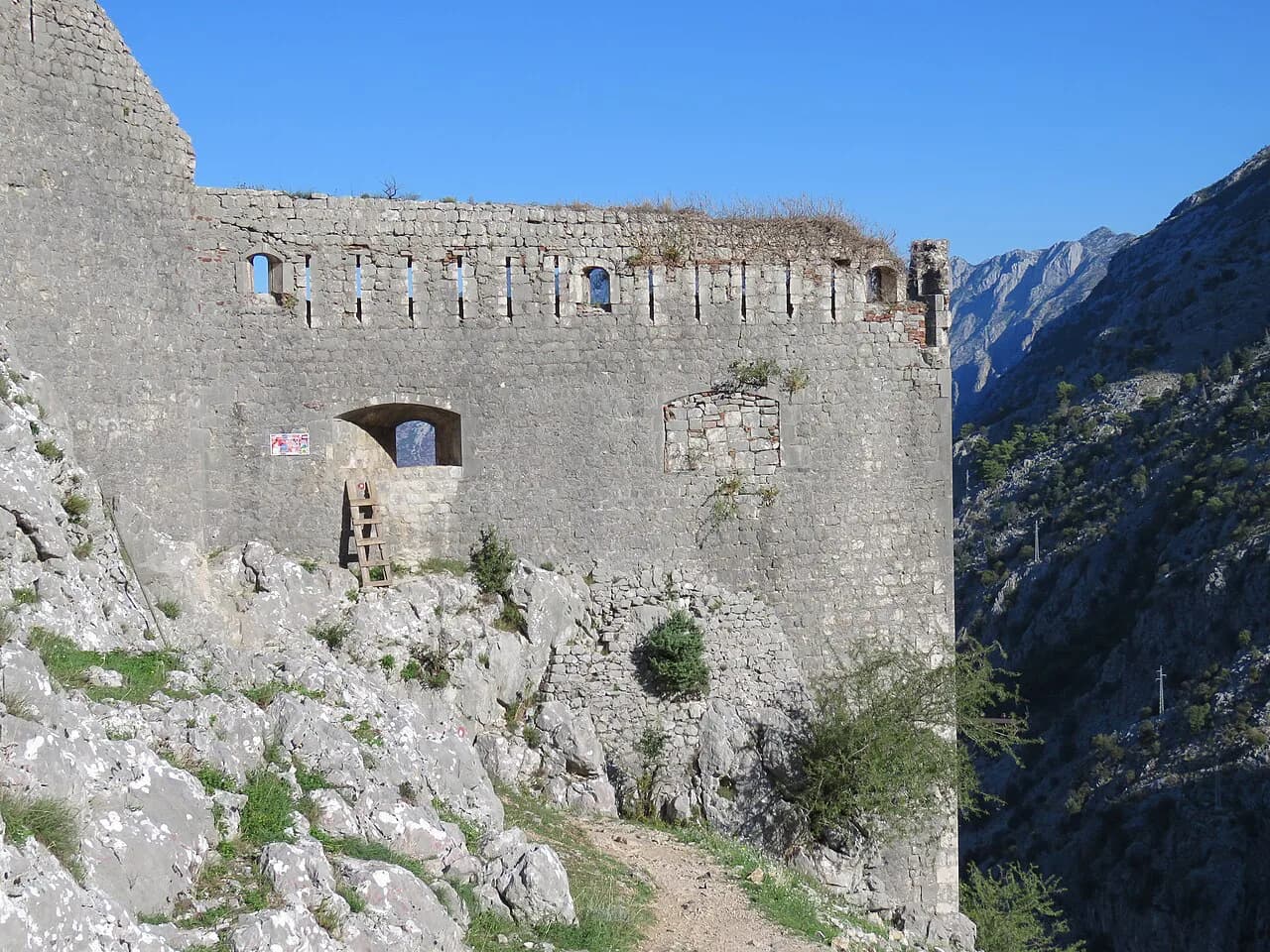
The fortress path above the town is a separate objective from the ladder and is often paired with it. Walkers heading for it leave the old town through the city walls and pick up the route from there.
Any entrance charge for the fortress or a managed section of path is set locally and changes, so ask at the ticket point or your accommodation before setting out rather than budgeting on an old figure. Carry small cash in case a fee applies at the point of entry.
Safety on the route
The main hazards are exposure on the open face, loose rock on the switchbacks and heat later in the day. Start early, carry water, and turn back if a storm is building over the mountain.
The descent deserves as much attention as the climb: tired legs and loose stones are a poor combination on the bends. Take the downhill slowly, keep your weight over your feet, and use poles if you have them.
Hiking the Ladder of Kotor with a dog
The ‘Ladder of Kotor’ is not a groomed path but a sequence of 70 hairpin bends climbing the sheer face of Mount Lovćen from the historic town of Kotor, and it passes through forests, rocky terrain and narrow paths marked with red-and-white striped signs. A dog on this route is walking on the same rocky and narrow ground as you, so its pace and fitness matter as much as yours. The hike to the top can take anywhere between two to four hours depending on your pace, and a dog will not shorten that estimate.
Because the trail can also be done from the top down if you are not too keen on the ascent, an alternative for a dog is to avoid the climb altogether: start higher up and walk the Ladder downhill, with the panoramic views of Boka Kotorska Bay opening below as you descend the hairpins. Water is the practical concern either way. Hiking the Ladder during early summer means the climate isn’t scorching, but you will still need plenty of water, so plan to carry enough for a dog as well as yourself.
For a shorter alternative that stays near the town, the Ladder of Cattaro hiking trail up to Kotor fortress begins outside Kotor’s city walls, so you will exit the walls before you reach the start. A fully-charged camera is worth packing alongside the water.
Plan Your Climb
Hiking in Kotor comes down to a simple choice: the Ladder of Kotor for a switchbacked climb with bay views from more than 3,000 feet, or the fortress path for a shorter objective above the walls. Both start on foot from the old town and the cruise port, so no car or lift is needed.
Give yourself two to four hours for the ladder, start early, and carry enough water for a hot, exposed climb. If you want a longer day or a different angle on the bay, the Vrmac ridge and the Lovćen approach from Cetinje give you two alternatives without leaving the Kotor area.
Explore more Kotor hiking guides
Frequently Asked Questions
How long does it take to hike the Ladder of Kotor?
Plan on two to four hours for the climb to the top, depending on your pace and how many stops you make. Steady walkers with breaks tend to sit at the longer end of that range, while someone climbing without stops can be quicker. Add time for the descent, which is slower on the loose turns.
Is Kotor walkable from the cruise port and the old town?
Yes. The trailheads for both the ladder and the fortress path sit around the old town, so you can walk from the port and the town lanes without arranging transport. That makes a morning climb easy to fit around a day in town, provided you set off early enough to be back before the afternoon heat.
Can you hike the Ladder of Kotor downhill instead of up?
The route works in both directions, and descending suits walkers who have transport to a higher starting point or who prefer going down steep ground to climbing it. From the old town on foot, an up-and-back day is the practical option because you return the same way. Loose rock on the bends needs more care on the descent.
Are the trails above Kotor marked?
The ladder is marked with red-and-white striped signs that keep you on the line through the forest and the rocky stretches. Where the path is narrow the signs are spaced further apart, so keep the switchbacks in view and avoid cutting the turns. An offline map is worth having because signal on the face can be patchy.
Sources
Trail notes for your next trip
Optional updates when we add or revise hiking guides.
You might also like
Continue reading
More guides you'll find useful