Kotor Fortress Hike: Ladder of Kotor Trail Guide
Climb the Kotor fortress hike on the Ladder of Kotor, with 70 hairpin bends, a two to four hour ascent and wide bay views. Route, timing and gear explained.
On this page
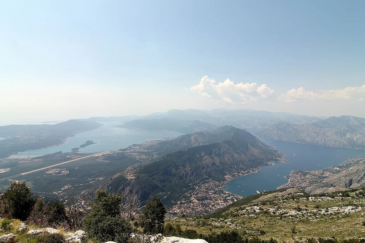
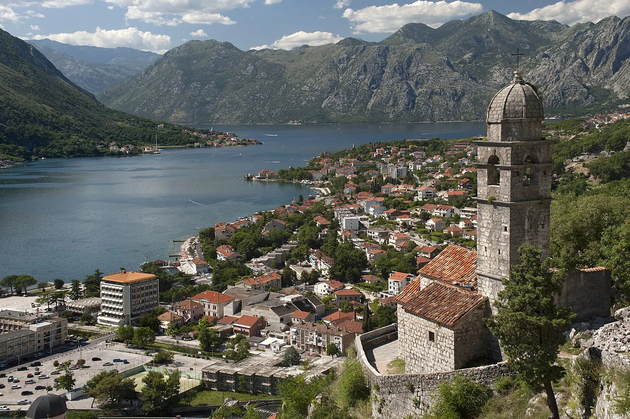
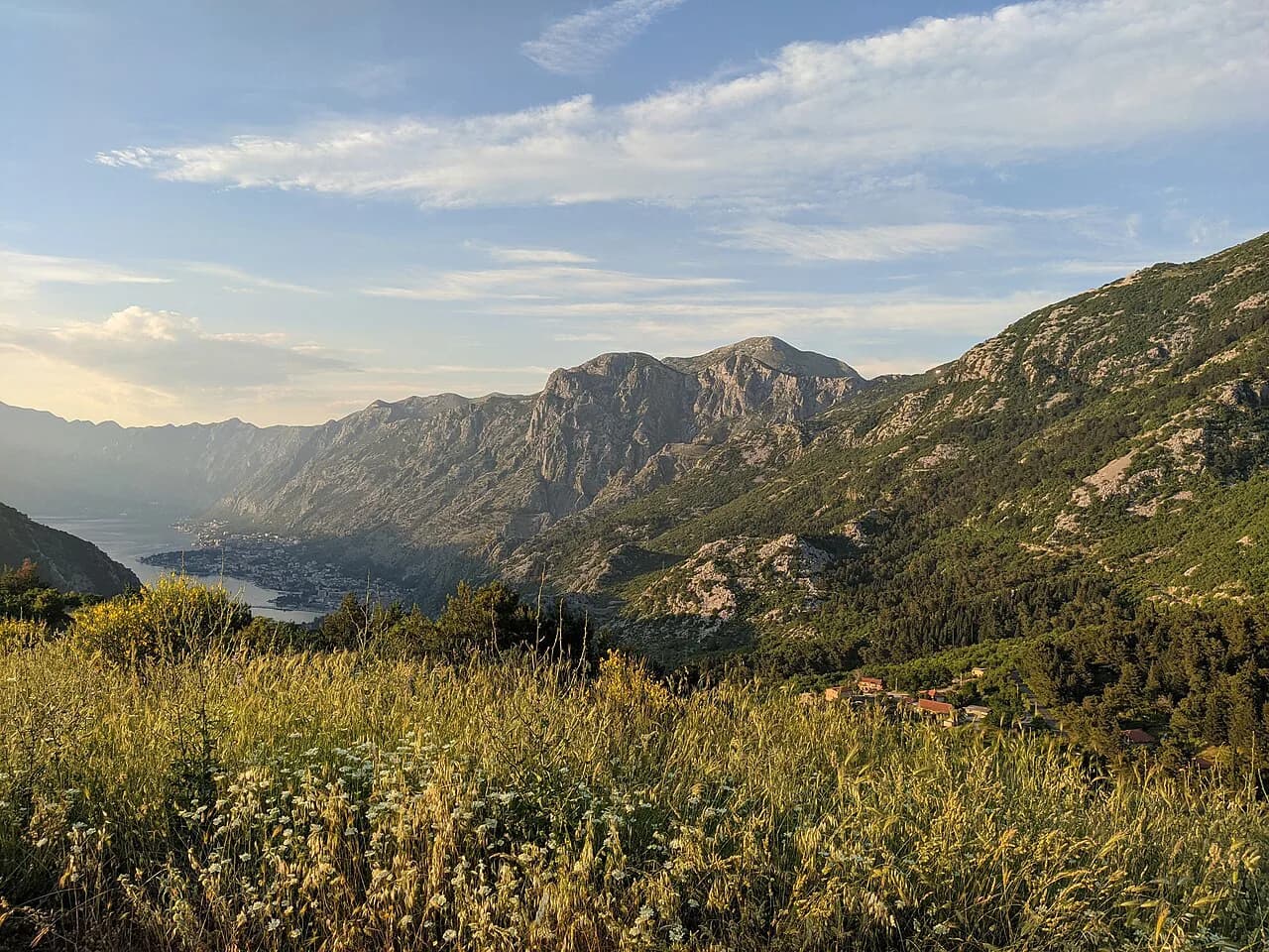
The Kotor fortress hike puts you on the mountainside that every photograph of the town is framed around: the walled Old Town at the head of the bay, with fortifications and a zigzag path climbing the sheer face behind it. The route is short in horizontal terms and relentlessly steep, which makes it a half-day outing for fit walkers and a slow, sweaty morning for everyone else. It suits hikers who want a big view for modest mileage and who are happy to gain height fast on rough stone.
The path is best known as the Ladder of Kotor, named for the series of roughly 70 hairpin bends that stack up the face of Mount Lovćen, giving the hillside its ladder-like look from town. The climbing starts within a few minutes of the Old Town lanes, so there is no bus, lift or car park to arrange. Pack for heat and for grip rather than for distance.
What the climb involves and who it suits
This is a vertical outing rather than a long one. The path gains height directly above the UNESCO-listed Old Town, and the first stretch does most of the work, so you are breathing hard early and enjoying the view sooner than you would on a valley approach. Anyone comfortable on steep stone stairs for an hour or two will manage it; anyone nursing a knee problem should treat the descent as the real challenge.
Treat it as a morning or a half day, not a full-day expedition. Hikers who want a shorter Kotor outing with a summit feel will find this the obvious choice, while those chasing a full day of distance should look at the ridge traverse instead. The climb also works as the first leg of a longer push toward the Lovćen ridge, described below.
Where the trail starts and how to reach the trailhead
The path begins at the edge of the historic town, which means you reach the trailhead on foot from anywhere in the center. Once you are through the back streets, follow the red-and-white striped waymarks that mark the route as it leaves the buildings and starts to climb. The markers are the reliable guide on the lower path, where side lanes and garden steps branch off in several directions.
Because the start sits inside town, there is no trailhead car park to hunt for and no bus timetable to match. If you are staying outside the center, walk in and begin; drivers should leave the car at their accommodation rather than trying to park near the walls. An interactive map of the Kotor Ladder helps you see the line of the path before you set off, particularly the point where it swings above the rooftops.
The Ladder of Kotor: 70 hairpin bends up the face of Lovćen
Above the last houses the route settles into its signature shape: a stack of tight switchbacks climbing the sheer face, roughly 70 hairpin bends in all, which is what gives the hillside its ladder appearance from below. Each bend buys a little more height and a wider slice of the bay, and the town shrinks quickly. It is steady, steep work with no flat sections to recover on, so set a rhythm you can hold rather than sprinting between turns.
The full Ladder of Kotor route is one of the most scenic walks in the country, and the reward comes early and keeps improving: forests on the lower slope give way to rocky ground and narrow traverses as you gain height. Markers continue at intervals, so navigation is mostly a matter of staying on the built path and ignoring thinner side trails. Above the town the exposure increases and there is little to break the wind or the sun.
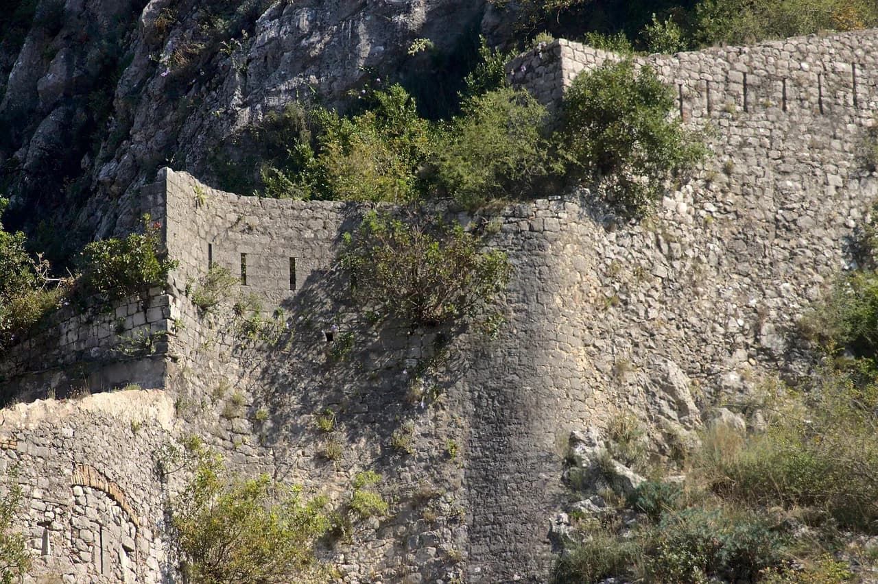
The fortress walls above the Old Town
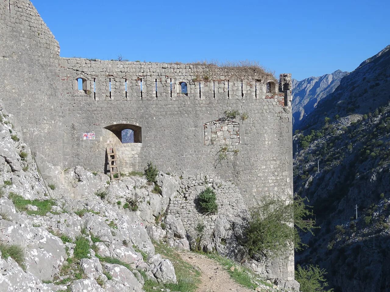
The fortress walls are the natural stopping point, and for many hikers the top of the day. From the ramparts you look straight down on the red roofs and the bay, with the same walls you walked past that morning now spread below you. How long the climb to this level takes depends on pace and how many photographs you stop for, so plan a generous window rather than a fixed target.
Approach the walls as the objective and you keep the day simple. Continuing beyond them toward the ridge is a bigger commitment with more climbing and a longer return, and it should be a deliberate second decision made at the top, not a vague intention formed at the bottom. If the weather is closing in or your legs are done, turning around at the walls is a good day out.
Distance, ascent and walking time
Allow two to four hours for the climb to the top, depending on pace and how often you stop. That figure covers the ascent; the descent is quicker but harder on the legs, so budget time for it separately. The upper path tops out more than 3,000 feet (roughly 900 m) above the Old Town, which gives a sense of the vertical gain without pretending the trail is long.
Set your turnaround time before you start, especially in summer, and stick to it. It is better to stop a little short with energy in reserve than to reach the walls and then face a long descent tired and dehydrated. Hikers testing fitness for bigger Montenegro days often use this climb as a gauge.
Exposure, heat and footing
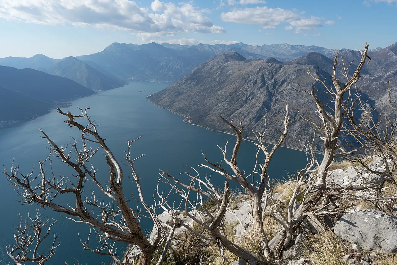
The face is sun-exposed for much of the day and the switchbacks offer almost no shade once you are above the trees, so midday in summer is punishing rather than pleasant. Grip matters on the zigzags too, where worn stone and loose grit make a slick surface on the turns. After rain the descent gets slippery, and much of the upper route is open to the drop below.
Start early in summer and keep the climb short if the heat is building. Late afternoon works in spring and autumn, but allow enough daylight for the way down, since the descent takes longer than you expect on tired legs. The companion piece on the Old Town of Kotor hiking base covers where to stay and how the town's other walks fit together.
Water, footwear and what to carry
Carry plenty of water. The climb is short enough to tempt people into setting off with a small bottle, but the combination of heat, exposure and 900 m of gain makes that a bad trade; two litres is a safer starting point on a warm day. There are no huts, cafés or fountains on the upper route to refill from, so everything you need comes up with you.
Wear shoes with real grip rather than smooth-soled trainers, and take a light layer for the top even when the town is baking. Sun protection and a hat matter more here than the mileage suggests. The map for the Kotor Ladder is worth downloading to a phone before you leave, since signal on the face is unreliable.
When to go: season and time of day
Early summer gives comfortable temperatures on the climb while still leaving the bay clear, and you will want water and a charged camera for the view. Spring and autumn are the kindest months overall, with cooler air on the exposed face and better light on the water below. High summer works only with a dawn or evening start, when the stone is not radiating heat.
Aim for morning if you want the classic view with the sun on the bay rather than haze over it. Evening light is beautiful but shortens your margin, so check sunset and leave a clear hour for the descent. Wind is rarely the problem on this face; heat is.
Coming down: the same path or a loop
Most hikers retrace the switchbacks, which is the simplest and safest option. Shortcut paths that appear on the hillside above town often fade into scrub or end at walls, and following one costs more time than it saves. Stay with the marked line of the path on the way down, particularly where the zigzags overlap and it is easy to skip a turn.
Descending 900 m of stone stairs loads the knees and quads more than the climb does. Take it slower than feels necessary, keep your weight back on the turns, and use trekking poles if you have them. If the stone is wet, shorten your stride and avoid the polished edges.
Climbing above the fortress toward the Lovćen ridge
Above the walls the path keeps going, gaining the ridge line of Lovćen on a historic mountain route that eventually reaches the plateau. This is a considerably bigger day: the full ascent from the Old Town area to the Lovćen ridge runs roughly four to five hours of very steep climbing, and the descent has to be added on top. It rewards fit hikers with high ground and long views but is not an extension to add casually after a late start.
On the Lovćen plateau itself, the Njegoš Mausoleum sits on the 1,660 m (5,446 ft) summit, built into the rock with a final approach of 461 stone steps. The summit runs 8 to 10°C cooler than Kotor, so a light jacket belongs in the pack even in summer. A cable car also links the lower station in Kotor with the upper Lovćen station, which is a way to reach the high ground without the climb if the weather or your schedule changes.
Getting back to Kotor town
Because you start and finish in the same place, the return is just the walk back through the Old Town lanes to wherever you are staying. There is no transport leg to arrange and no timetable to catch. That simplicity is the main practical argument for this climb over the longer traverses around the bay.
Leave the rest of the day light. A late lunch in town and an easy afternoon beside the water is a sensible plan after the descent, and it keeps the day from turning into a forced march. If you want a second walk, save it for the next morning.
Combining the climb with other Kotor walks
The obvious alternative day is the Vrmac ridge traverse from Kotor to Tivat, a much longer outing at roughly 14 km (8.7 mi) with about 850 m (2,790 ft) of climbing and around six hours of walking. It climbs to the Austro-Hungarian Vrmac fort, then follows open ridge with the bay on one side and Tivat on the other. The ridge is exposed with long stretches of no shade, and the descent gets slippery after rain.
Walk that route from Kotor to Tivat so the steepest climbing comes early and you finish at the beach bars, then return by taxi, the Blue Line bus or a water taxi. The route description flags the turn where the Vrmac ridge walk goes wrong: the direct path down into Tivat fades into overgrown, thorny ground, so descend to Donja Lastva instead. Choose the fortress climb for a short, steep half day and the ridge for a full day of distance. If you are weighing up other short, steep coastal climbs in the region, the Corfu hiking guide covers similar half-day options.
Planning Your Kotor Fortress Climb
Build the day around an early start, two litres of water and shoes that grip stone, and the Kotor fortress hike delivers one of the best views on the Adriatic for a half day of effort. Decide at the walls whether to stop or continue toward Lovćen, and retrace the switchbacks on the way down rather than trusting a shortcut. If you have a second day in Kotor, pair the climb with a walk along the bay.
Frequently Asked Questions
How long does it take to hike the Ladder of Kotor?
Allow two to four hours for the climb to the top, depending on pace and how long you spend at the walls and viewpoints. Add separate time for the descent, which is quicker but harder on the knees than the climb. Hikers continuing toward the Lovćen ridge should plan a much longer day.
How hard is the Kotor fortress hike?
It is short but steep, with roughly 70 tight switchbacks gaining about 900 m (3,000 ft) on an exposed face. Fit walkers manage it in a morning; anyone with knee trouble should be cautious about the descent. Heat and slippery stone are bigger factors than distance.
Where does the Kotor fortress hike start?
The path leaves from the back streets at the edge of the Old Town, within walking distance of anywhere in the center. Follow the red-and-white striped waymarks from the lanes onto the hillside. There is no car park or bus to arrange at the trailhead.
Do you need to pay to climb to the Kotor fortress?
Access rules and any charges are managed locally and have changed over time, so decide on the day from what is posted at the entrance rather than from older trip reports or forum posts. Nothing on the route requires a guide. Bring cash in case a payment point is operating.
Can you hike the Ladder of Kotor from the top down?
Yes, the path works in either direction if you arrange transport to a high starting point, but the standard route begins in town and climbs. Starting at the top means committing to the descent first and then facing the climb back up if you return the same way. Most hikers go up from Kotor and come back down the switchbacks.
What should you bring on the Kotor fortress hike?
Carry at least two litres of water, since there is no refill or café on the upper route, plus a hat, sun protection and a light layer for the top. Wear shoes with real grip for the stone turns and take trekking poles if your knees dislike long descents. Download a map before you start because phone signal on the face is unreliable.
Sources
Trail notes for your next trip
Optional updates when we add or revise hiking guides.
You might also like
Continue reading
More guides you'll find useful