Masca Gorge Hike, Tenerife: Descent, Access and Boat Return
Plan the Masca Gorge hike in Tenerife: the 5 km descent, the mandatory bus from Santiago del Teide, booking slots, kit rules and the boat back from the bay.
On this page
The Masca Gorge hike is a one-way descent through a narrow volcanic canyon in the Teno Rural Park, from the hamlet of Masca down to a bay beneath the Los Gigantes cliffs. It suits hikers with a good level of fitness who want a short but genuine canyon day rather than a mountain summit, and who are happy to plan a bus in and a boat out.
The route is not an out-and-back walk. Under the current pilot trial the only option on offer is the descent to Masca Bay, with departure by boat, and the booking page sets out the transport, kit and ticket rules you must meet before you set off.
What the Masca Gorge hike is and who it suits
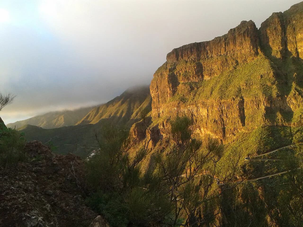
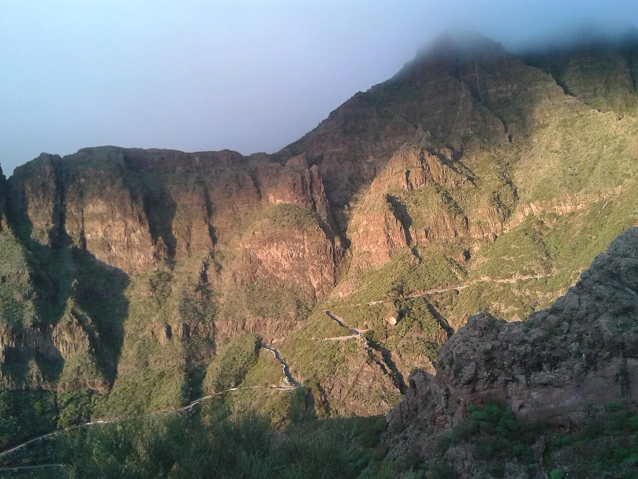
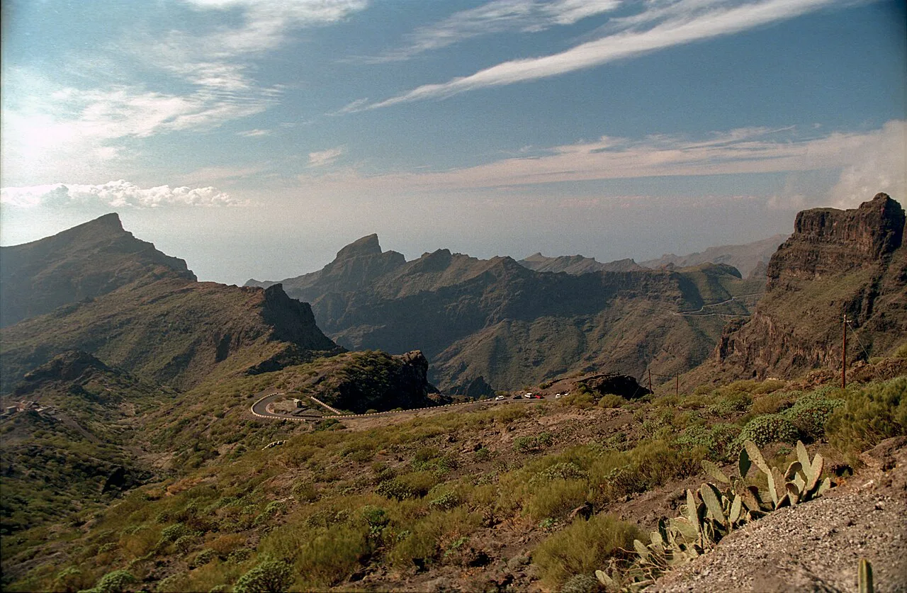
Masca Gorge cuts through the Teno massif in the northwest of Tenerife, and the walk follows the canyon floor between steep rock walls down to the sea. The organisers grade the descent as high difficulty, citing uneven ground, steps, sloping sections and a real chance of slipping and falling from height.
It suits confident walkers who are steady on rough, loose ground and can handle about four hours of continuous downhill work. It is not adapted for people with reduced mobility or sensory disorders, and children under eight are not allowed. If you want a shorter, drier canyon walk with a similar feel, the Barranco del Infierno Hike, Tenerife is a separate reserve route above Adeje and makes a useful comparison point.
Distance, descent and walking time
The trail is approximately 5 km (3.1 mi) one way, dropping from about 750 m (2,460 ft) at Masca hamlet to sea level, with small intermediate climbs along the way. The official estimate for the descent is about four hours, though faster walkers report shorter times on review and tracking sites.
Treat the four-hour figure as the planning number rather than a target. The surface is rough enough that pace is dictated by footing, and building in slack means you are not hurrying on the steepest steps.
How the one-way route works: Masca hamlet down to the bay
You start at the Masca Visitors' Centre in the hamlet, pass the access check, and follow the signposted canyon floor downhill to the jetty at Masca Bay. A protective helmet is loaned to you at the start and must be returned at the end, and there is no drinking water along the route, so you carry at least 1.5 litres per person.
At the bay you board a boat to Los Gigantes, which you must have booked separately before you are allowed onto the trail. The crossing is short, but the boat is the only way out on a normal day, so the ticket is part of the hike rather than an optional extra.
Getting to the trailhead: Titsa route 355 from Santiago del Teide
You cannot drive to the start. Arrival by collective transport is compulsory, and the Masca Gorge Trail booking rules require you to use Titsa route 355 from Santiago del Teide to Masca hamlet, a journey of roughly 20 minutes. You need to be at the Santiago del Teide pick-up point at least one hour before your booked descent slot, and you must show proof of having used the bus or you will be refused access.
Private vehicles are turned away at the trailhead, and the descent ticket does not include the bus, so budget for it as a separate purchase. Bus times and fares are not fixed here; the Titsa website is the place to match a service to your slot.
Parking near the Santiago del Teide meeting point
If you drive to Santiago del Teide, park in the cemetery car park and walk about ten minutes to the Titsa stop where the group meets. That short walk is part of the timing: add it to your buffer so you are waiting at the stop an hour before your slot, not arriving at the car park then.
Leave nothing valuable visible in the car, since you will be away for most of the day and returning by bus from Los Gigantes. The same page explains where to find the stop and the meeting point on a map.
Tickets, time slots and the boat booking requirement
Every hiker needs an individual, non-transferable ticket with an allocated date and time, and you show ID at the access control. Descent slots run from 8.30am to 1.00pm in batches of 25 visitors every 30 minutes, with the 9.00am slot taking 50, and the trail itself is open from 8.30am to 6.00pm.
The booking page currently advertises tickets from €40.66, with the price going toward conservation and safety costs; Canary Islands residents, under-18s and members of a Canary Islands mountaineering or caving federation get special rates, and Tenerife residents and federation members are admitted free. You must also book your boat out of Masca Bay with one of the partner operators no more than four hours after your descent slot.
Because these prices and slot times are set by the Camino del Barranco de Masca booking system and can change, check the live figures on the official booking page when you reserve.
Compulsory kit and the helmet loan
Access depends on your kit. Closed mountain hiking footwear with lugs is mandatory, and sandals, smooth-soled shoes and trainers mean you are turned away even with a booking. Bring ID, your trail ticket, your transport proof and your boat ticket, plus at least 1.5 litres of water, energy food, a charged phone and any prescribed medication.
You must arrive at the visitors' centre 30 minutes before your slot so staff can check documents and equipment. The helmet is supplied and returned at the end; trekking poles and sun protection are recommended but not compulsory.
Start of the route: Masca Visitors' Centre and the hamlet
Masca hamlet sits on the TF-436 between Buenavista del Norte and Santiago del Teide, and its lanes and terraces are worth an hour before your slot. The visitors' centre opens 9.00am to 5.00pm Sunday to Tuesday and 8.00am to 6.00pm Wednesday to Saturday, so on an early slot you meet staff at the trailhead rather than inside.
If you are staying in the northwest of the island and want other days out, the Parque Rural de Teno that holds the gorge is the obvious anchor, and the wider guide to hiking in Tenerife sets out how it fits with the rest of the island. If you are weighing up island-hopping for more canyon and ridge days, hiking in Gran Canaria covers similar decisions on trails, base towns and seasons.
Route description: the gorge floor to Masca Bay
From the visitors' centre the path drops steadily through terraced ground and then into the canyon, where the walls close in and the surface alternates between rock steps, loose gravel and damp slabs. The gradient is almost all downhill, but the small climbs and the rough footing keep the effort honest over the four-hour estimate.
Near the bottom the gorge opens onto the bay, where the pebble shore sits below the cliffs. Wait for the boat at the jetty, keep your ticket to hand for the checkpoint, and do not plan to linger on the shore if the sea is turning.
The boat out from Masca Bay and the bus back from Los Gigantes
The boat takes you from Masca Bay to the landing port at Los Gigantes, and your return transfer from Los Gigantes to Santiago del Teide is not included in the trail ticket. Two Titsa services, route 462 and route 325, run between Los Gigantes and Santiago del Teide at regular intervals; current schedules are listed on the Titsa site.
Plan the return leg before you start: know the last useful bus from Los Gigantes and leave slack for a delayed boat. If you are building a week of walks, tiring days like this sit well alongside gentler outings such as the Roque del Conde Hike, Tenerife in the south.
When to go: opening season, times and heat
The trail operates between 8.30am and 6.00pm, with descents only in the morning window from 8.30am to 1.00pm. Morning slots also mean cooler walking, which matters because the gorge is sheltered and the sun climbs high by midday.
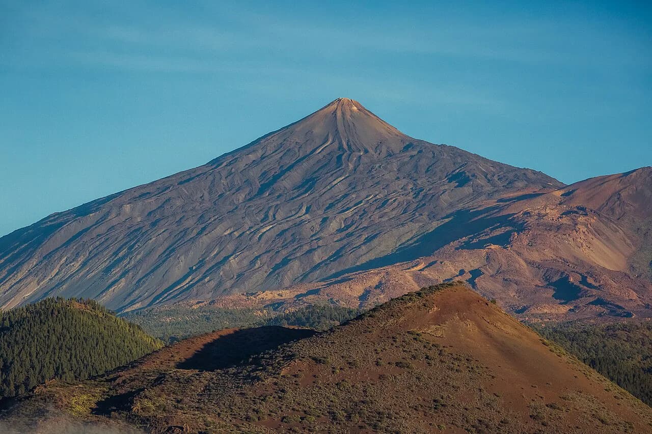
The Camino del Barranco de Masca calendar shows which days are on sale, and its booking page is the place to check availability for your dates. If you want a high-mountain day in the same week, the Mount Teide Hike is a completely different proposition and needs its own weather window.
Hazards and what to do if the jetty closes
The real hazards are the uneven, slippery ground and the sea state at the bay. If sea conditions change suddenly, the jetty can close for safety, and hikers are then required to walk back up to the visitors' centre from wherever they are when notified, which is why a good level of fitness is required for a descent that is otherwise all downhill.
Carry the emergency locator information and call 112 if you need help, quoting the number on the nearest location sign. Use only the signposted route; swimming in pools and watercourses, camping, fires, dogs and recreational drones are all prohibited, and Masca Beach is closed to the public.
Closures, changes and cancellation windows
The trail authorities can close the trail or jetty for weather, conservation or maintenance, in which case you can move your date or request a refund. If you booked directly, changes and cancellations are free of charge with 72 hours or more notice, while inside 72 hours you can cancel but you are charged the full booking fee; not turning up gives no refund.
If you booked through a collaborating company, that company's conditions apply. Check the booking office website the evening before you travel, since that is where unexpected closures are announced.
Is the Masca Gorge hike worth it for your fitness level?
Yes, if you are comfortable with four hours of rough, slippery downhill and can climb back out if the boat cannot run. No, if you want an easy stroll, dislike exposure on steps, or are travelling with anyone who finds uneven ground hard. The canyon scenery and the boat ride out are the reward, and the planning cost is real: a bus in, a separate boat booking, and a bus back from Los Gigantes.
Plan Your Descent
Book the descent slot and the boat first, then fit the Titsa buses around them. Arrive in Santiago del Teide at least an hour before your slot, park at the cemetery car park, and carry the mandatory kit so the access check is a formality.
If you are still deciding how this fits with the rest of the island, compare it with the Barranco del Infierno hike and with the wider hiking in Tenerife, and give the gorge its own day rather than bolting it onto a summit plan.
Frequently Asked Questions
How long is the Masca Gorge hike?
The descent is approximately 5 km (3.1 mi) one way, from Masca hamlet at about 750 m (2,460 ft) down to the bay. Allow about four hours; many hikers move faster, but the rough ground sets the pace.
Is the Masca trail difficult?
The descent is rated high difficulty because of uneven ground, steps and slippery sections. It is all downhill overall, but there are small climbs and a good level of fitness is required.
Do you need a booking for the Masca Gorge?
Yes. Every hiker needs an individual ticket with a date and time slot, shown with ID at the access check. You also need a separate boat ticket out of Masca Bay before you are allowed onto the trail.
How do you get to the start of the Masca Gorge trail?
Access is by Titsa route 355 from Santiago del Teide to Masca hamlet, and private vehicles are refused at the trailhead. Be at the pick-up point at least one hour before your slot, and bring proof of having used the bus.
How do you get back from Masca Bay?
A boat takes you from Masca Bay to Los Gigantes, and you then return to Santiago del Teide by Titsa route 462 or 325. The return transfer is not included in the trail ticket, and if the jetty closes you must walk back up the gorge.
Where do you park for the Masca Gorge hike?
Park in the cemetery car park in Santiago del Teide and walk about ten minutes to the Titsa meeting point. The car stays there for the day while you take the bus to Masca and return via Los Gigantes.
What kit is compulsory on the Masca Gorge Trail?
Closed mountain hiking footwear, ID, your trail ticket, transport proof, boat ticket and at least 1.5 litres of water per person are required. A helmet is loaned at the start and returned at the end.
Is the Masca Gorge hike worth it?
It is worth it if you can handle four hours of rough, slippery downhill and the possibility of walking back out. It is not a gentle stroll, and the transport chain means the day needs booking and planning before you go.
Sources
Trail notes for your next trip
Optional updates when we add or revise hiking guides.
You might also like
Continue reading
More guides you'll find useful