Mount Teide Hike: Routes, Cable Car and Summit Permit
Plan a Mount Teide hike on Tenerife: the Montaña Blanca route, the cable car to La Rambleta, the summit permit and the short trails at the top station.
On this page
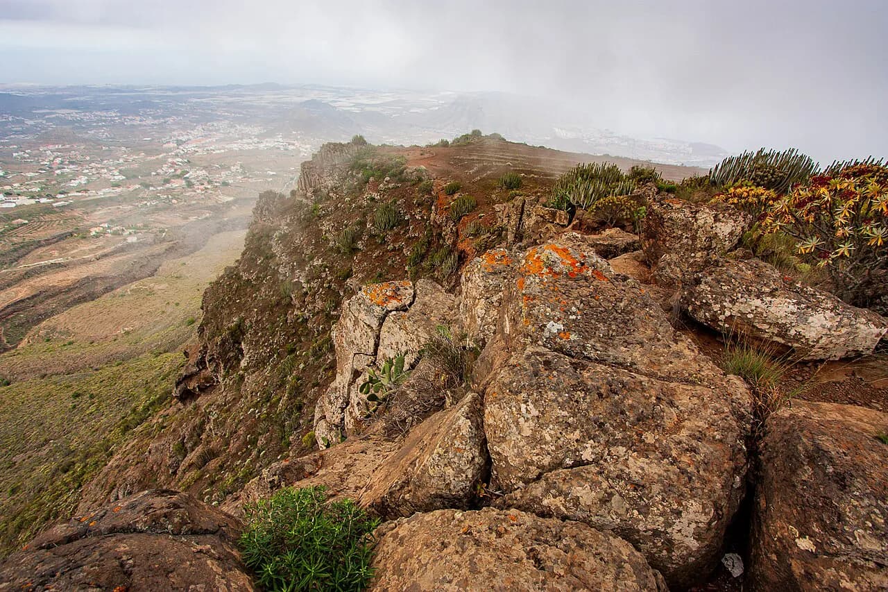
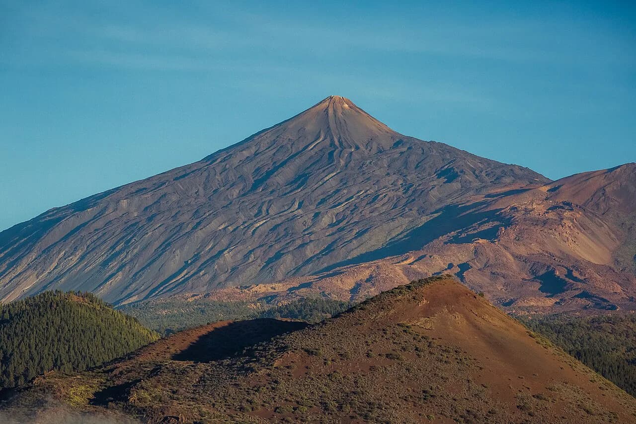
The Mount Teide hike is the reason many hikers come to Tenerife at all. At 3,718 m (12,198 ft) the volcano is the highest point in Spain, and its summit rises above a national park of lava flows, coloured crater walls and wide-open calderas. What makes it unusually accessible is the combination of a long foot route from Montaña Blanca, a cable car that lifts you to La Rambleta at the top station, and a set of short marked trails that start from there.
The trick to a good day is choosing the right objective. A fit hiker with a full day can go for the summit on foot; a hiker with less time or less appetite for altitude can ride up and walk one of the short top-station trails; and anyone who wants the volcano's wilder side without the crowd should look at the Pico Viejo crater from Narices del Teide. If you want the wider island context first, the guide to hiking in tenerife puts Teide alongside the island's coastal and forest routes.
Where Teide National Park sits and how to reach the trailheads
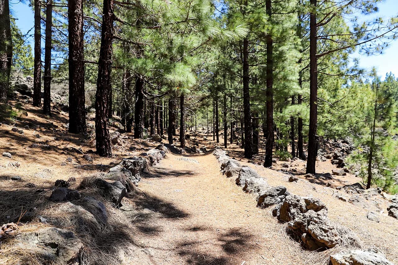
Teide National Park occupies the high centre of Tenerife, and the road up from the coast is part of the day: you climb through pine forest before the landscape opens into bare lava around the caldera. The two trailheads that matter most are the Montaña Blanca car park on the south-east approach to the peak and the Teide cable car base station, which sits just off the same high road. Both are signed from the main access roads and both have parking, though the cable car car park fills early on clear days.
There is no train, and public buses up to the park are limited, so most hikers arrive by car or on an organised tour with transport included. The cable car operator sells tickets that bundle the ascent with transport to the national park, which suits hikers staying on the coast without a car. If you drive, fill up and buy water low down, because services in the park are concentrated at the cable car base.
What the Mount Teide hike offers and who each route suits
Think of the mountain as three separate hikes. The full climb from Montaña Blanca is a serious day out with roughly 1,300 m (4,265 ft) of ascent, suited to hikers with good fitness and a head for altitude. The cable car plus a short top-station trail is a half-day for almost anyone who can walk on rough volcanic ground. The Pico Viejo crater route from Narices del Teide is the connoisseur's option: fewer people, bigger lava views, and no summit permit needed.
Altitude, not technical difficulty, is the real filter here. Above 3,000 m (9,842 ft) the air thins, the temperature drops and the wind picks up, so a route that looks short on paper can feel much longer than the kilometre count suggests. Hikers who feel the height should treat the top station as the day's high point rather than pushing for the crater, and anyone with a heart condition should take the health rules for the cable car seriously before booking.
Route 1: Montaña Blanca to the summit and Pico Viejo
The classic on-foot ascent starts at the Montaña Blanca car park and follows a broad volcanic track up the south-east flank, gaining height steadily with views back across the caldera. Higher up the path narrows and becomes steeper, and near the top station you join the summit trail for the final push to the crater rim. The route is mostly on accessible paths but demands sure-footedness and very good fitness for the full climb.
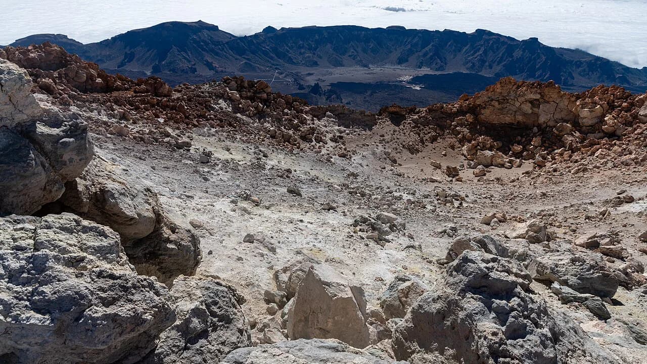
There are two ways to finish. The shorter option goes up and back down the same path from Montaña Blanca, a 17 km (10.6 mi) round trip as described by Natour. The more adventurous line continues over the rim and descends via Pico Viejo, passing the huge crater of the older volcano, an extinct lava outlet around 800 m (2,625 ft) across.
That descent via Pico Viejo is not a shortcut in effort, only in scenery: you trade the crowded summit path for a long traverse over open lava with less shelter and fewer people. Carry more water than you think you need, because there is nothing to refill once you leave the trailhead, and watch the weather building over the caldera in the afternoon.
Distance, ascent and time for the Montaña Blanca route
The Montaña Blanca ascent to the summit is listed as 9.36 km (5.8 mi) one way with 1,300 m (4,265 ft) of ascent and an estimated 4 h 33, graded hard: very good fitness required, sure-footedness required. Those figures cover the climb, so plan a full day once you add the descent, breaks and the time spent at the top.
The Telesforo Bravo summit trail, measured as a there-and-back from the top station, is listed at 6.19 km (3.8 mi) with 1,290 m (4,232 ft) of ascent and 1,300 m (4,265 ft) of descent and about 1 h 59, also graded hard. Read those numbers as a measure of steepness rather than distance: the path climbs sharply from La Rambleta to the crater rim and back down the same way.
For a gentler high-level walk, the loop from the national park road to the Pico Viejo crater viewpoint is 2.85 km (1.8 mi) with 180 m (591 ft) of ascent and descent, about 1 h 19, graded moderate. It is the best-value short walk on the mountain if you want volcanic scenery without committing to the summit.
Route 2: cable car to La Rambleta, then Trail 10 Telesforo Bravo
The cable car runs from the base station beside the road up to La Rambleta, the top station on the shoulder of the volcano. From there, Trail 10, the Telesforo Bravo path, is the only walking line to the summit crater, and it is the trail the park's free permit covers. Without that permit you can still ride up and walk the other top-station trails, but not the final climb to the highest point.
Book the cable car for a morning slot if you intend to walk Trail 10 and descend on foot, because the last ascent of the day and the changing weather both squeeze your margin. Riding up and walking down the Montaña Blanca path is a legitimate combination for strong hikers with good knees, but it commits you to a long descent on loose volcanic ground with no water on the way.
Trails from the top station: La Fortaleza and the Pico Viejo viewpoint
Two short trails leave La Rambleta and need no summit permit. Trail 11, to the La Fortaleza viewpoint, looks north over the greenest part of Tenerife and the La Orotava Valley, and is the place to watch the sea of clouds that often settles below the summit under the trade winds. Trail 12 runs to the Pico Viejo viewpoint, 800 m (2,625 ft) out, with views into the multicoloured crater and, on a clear day, across to La Gomera, El Hierro and La Palma.
The La Fortaleza walk is famously short, around 30 minutes from the top station, which makes it the obvious choice for families and for hikers whose first hour at altitude has left them breathless. Neither top-station trail is a substitute for the summit, but together they give you the crater views and the island panorama without the permit and the extra climbing.
The Pico Viejo hike from Narices del Teide
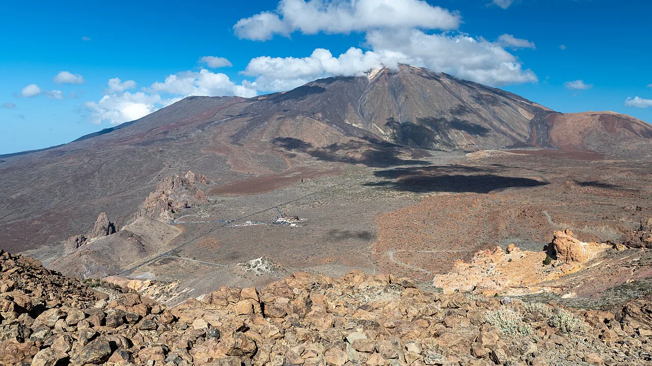
The Narices del Teide viewpoint is the start of a quieter route of roughly 9.5 km (5.9 mi) that begins around 3,500 m (11,483 ft) and is rated medium-high difficulty, with gradients approaching 1,500 m at points along the way. You walk across the youngest lava flows on the volcano before reaching the rim of Pico Viejo, the older crater that sits beside Teide's cone.
Because it starts high and stays high, this route is cooler than the Montaña Blanca climb even in midsummer, but it is also more exposed to wind and to sudden cloud. Treat the crater rim as the turn-around point if the weather closes in, and keep something warm in your pack even on a sunny morning at the coast.
The free summit permit and how to reserve it
Access to the summit crater on Trail 10 is controlled by a free permit issued by the national park, and it must be requested well in advance through the park's reservation system. The permit is checked on the trail, so carry a printed or downloaded copy with your name on it. The Teide summit permit page explains the reservation route and how far ahead to apply.
The permit covers the final summit trail only. The Pico Viejo viewpoint trail from La Rambleta and the crater route from Narices del Teide both leave the permit question out of the day, which makes them the practical choices if the quota is full for your dates.
Cable car practicalities: shoes, health restrictions and what is not permitted
Closed mountain or sports shoes with high-grip, non-slip soles are compulsory on the cable car, and Volcano Teide expressly prohibits heels, wedge heels, platforms, water shoes, flat-soled shoes and open shoes for safety reasons. Pregnant women, children under three and people with heart conditions may not ride for health reasons, and people whose weight or reduced mobility would make an emergency descent on steep ground unsafe are also excluded. Read the access rules before you buy, since they affect who in your group can ride at all.
The top station is a high mountain environment, not a viewpoint with a lift: strong sun, cold wind and sudden cloud are normal in the same hour. Pack sunglasses, a warm layer, a hat, sun cream and a water bottle, and leave anything with heels in the car.
When to go: season by season on the volcano
Teide can be walked all year, but each season gives a different day. From late March to mid-September the slopes green up after the thaw, the ground can be muddy in patches, and temperatures on the slopes rarely exceed about 20°C even when the coast is hot. Summer days are pleasant up high but the nights are cold, so an early start still means a jacket.
From October to mid-March the mountain is genuinely cold: temperatures can drop below -5°C, with -10°C recorded, and wind chill makes it colder the higher you go. Winter is still a fine time for the lower trails and the crater viewpoints, but ice and snow on the upper paths change the day, and the summit should be left for settled weather.
Whichever month you choose, start early. The mountain makes its own weather through the morning, cloud often builds over the caldera by afternoon, and an early start gives you the clearest views on the summit and the top-station trails.
Weather, altitude and exposure
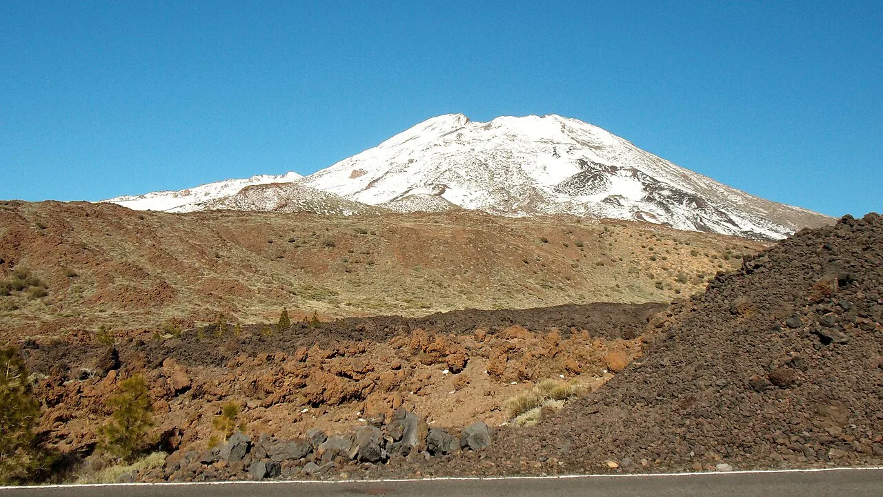
The volcano stands above the normal island climate, so the forecast for your coastal hotel tells you little about conditions at La Rambleta. Check the live weather and webcam pages on the Volcano Teide website on the morning of your hike, and be ready to switch from the summit to a top-station trail if the cloud is down or the wind is strong.
Above 3,500 m (11,483 ft), altitude affects hikers who are perfectly fit at sea level: breathlessness, headache and slow progress are normal signals to turn around. The upper routes are exposed to sun and wind with little shade or shelter, so pace yourself, drink before you feel thirsty, and keep the group together rather than splitting on the descent.
The Altavista refuge and hiking at night
The Altavista refuge sits on the mountain below the summit and is run as a booked mountain hut, which lets hikers split the climb or position themselves for sunrise. Check current prices and availability with Volcano Teide well before your trip; the number of beds is small compared with the number of people who want to be up there at dawn, and the refuge is the only indoor bed on the mountain.
Walking up at night is a popular way to reach the summit for sunrise, and the path is clear enough to follow with a head torch if you are used to night hiking. It is also cold, dark and exposed, so go with someone, carry layers and a charged phone, and remember that the summit still requires the permit.
Stargazing walks on Teide
Teide National Park is one of the best stargazing sites in Europe, and short evening walks from the road and the cable car base give you dark skies with almost no effort. The cable car operator runs sunset and stargazing experiences that include the ascent, which removes the drive back down in the dark.
If you go independently, stay on marked paths, take a torch with a red-light mode to protect night vision, and dress for temperatures close to freezing even in summer. The night sky is the attraction, so choose a moonless window and give your eyes time to adapt away from vehicle lights.
What to wear and carry
Dress for three climates in one day: a warm base layer, a windproof shell and sun protection for the climb, plus gloves and a hat if you are starting before dawn or going above the cable car. Sturdy closed shoes with grippy soles are not optional on the cable car, and they are the right choice on the volcanic paths in any case.
Carry at least two litres of water per person, food for the whole route, a head torch, a map or offline route on your phone, and a power bank. There is nowhere to refill above the trailheads, and the café at the cable car base is the last reliable stop for supplies.
Plan Your Visit
The best Mount Teide hike is the one that matches your time and your head for altitude. If you have a full day and good fitness, take the Montaña Blanca climb and secure the free summit permit well ahead; if you have half a day, ride to La Rambleta and walk Trail 11 or Trail 12, which need no permit; and if you want solitude, head to Narices del Teide for the Pico Viejo crater. Hikers weighing a volcano day against a lower, greener island often compare it with hiking in Gran Canaria before deciding.
For the rest of the island, from the forest trails of the north to the coastal paths and the dry barrancos of the south, the Tenerife walking holidays pages show how a Teide day fits into a longer trip. If you want a low-altitude contrast day, the Barranco del Infierno Hike, Tenerife is a booked gorge walk that asks for a reservation just as the summit does.
Frequently Asked Questions
How hard is the Mount Teide hike?
The full climb from Montaña Blanca to the summit is graded hard, with about 1,300 m of ascent over roughly 9.4 km one way, and needs very good fitness plus sure-footedness. The short trails from the cable car top station are much easier and suit most walkers who can manage rough volcanic ground.
Do you need a permit to hike Mount Teide?
Yes for the summit. Trail 10, the Telesforo Bravo path from La Rambleta to the crater, requires a free permit issued by the national park, requested well in advance. The La Fortaleza and Pico Viejo viewpoint trails from the top station, and the crater route from Narices del Teide, do not need it.
Can you hike Mount Teide without the cable car?
Yes. The Montaña Blanca route climbs on foot from the road to the summit and back, or continues over the rim to descend via Pico Viejo. It is a long, hard day, so plan a full day and carry all your water because there is no refill on the route.
How long does the Mount Teide hike take?
The Montaña Blanca ascent is estimated at about 4 h 33 for the climb alone, so a full day with the descent, breaks and time at the top. The short top-station trails take from around 30 minutes to a couple of hours, and the Pico Viejo crater loop from the road is about 1 h 19.
What is the best time of day to hike Mount Teide?
Start early. Cloud often builds over the caldera by afternoon, and the clearest views on the summit and the top-station trails come in the morning. Early slots also give you a safety margin if the weather turns on the upper mountain.
What should you wear to hike Mount Teide?
Closed hiking or sports shoes with high-grip soles are compulsory on the cable car, and heels, open shoes and flat-soled shoes are not permitted. Bring a warm layer, a windproof shell, sunglasses, a hat, sun cream and plenty of water, because the mountain is cold and exposed even when the coast is hot.
Sources
Trail notes for your next trip
Optional updates when we add or revise hiking guides.
You might also like
Continue reading
More guides you'll find useful