Buachaille Etive Mòr Hike: Route, Distance and Ascent
A stage-by-stage guide to the Buachaille Etive Mòr ridge hike in Glencoe, covering the Altnafeadh trailhead, the two Munros and when to go.
On this page
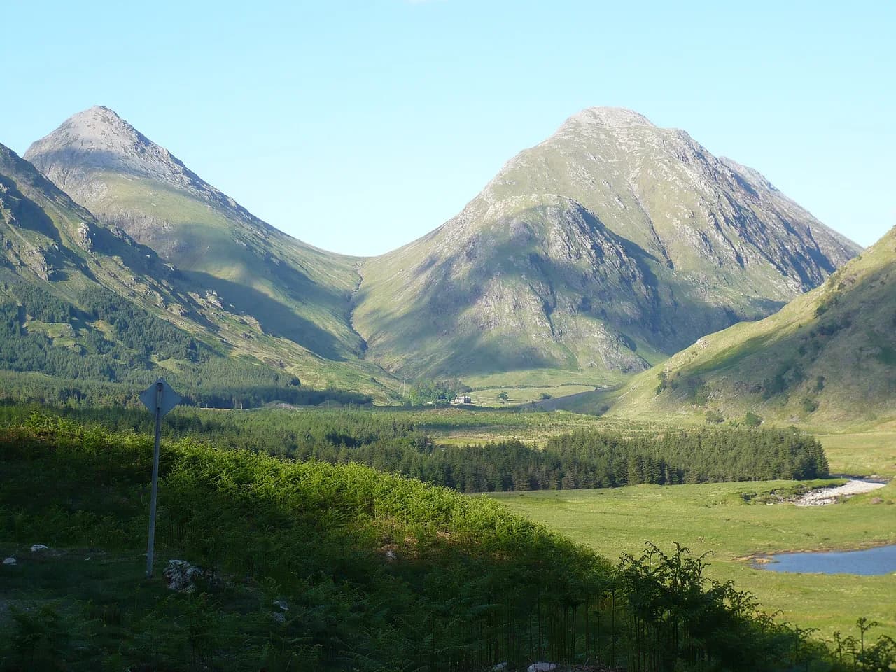
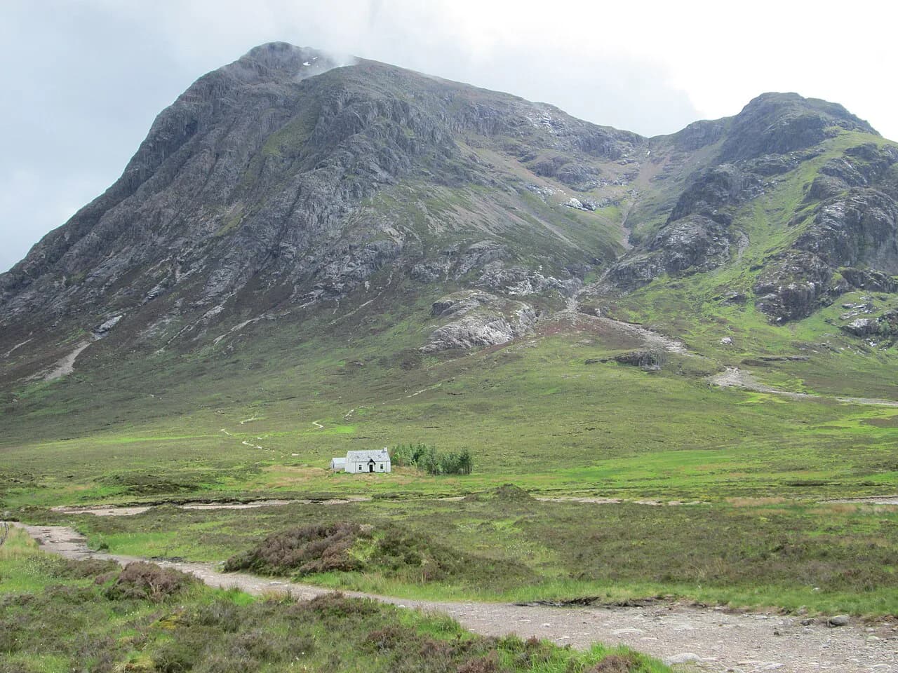
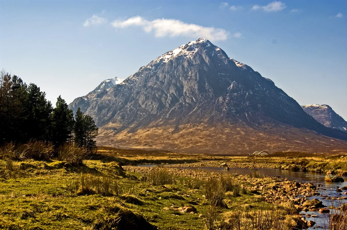
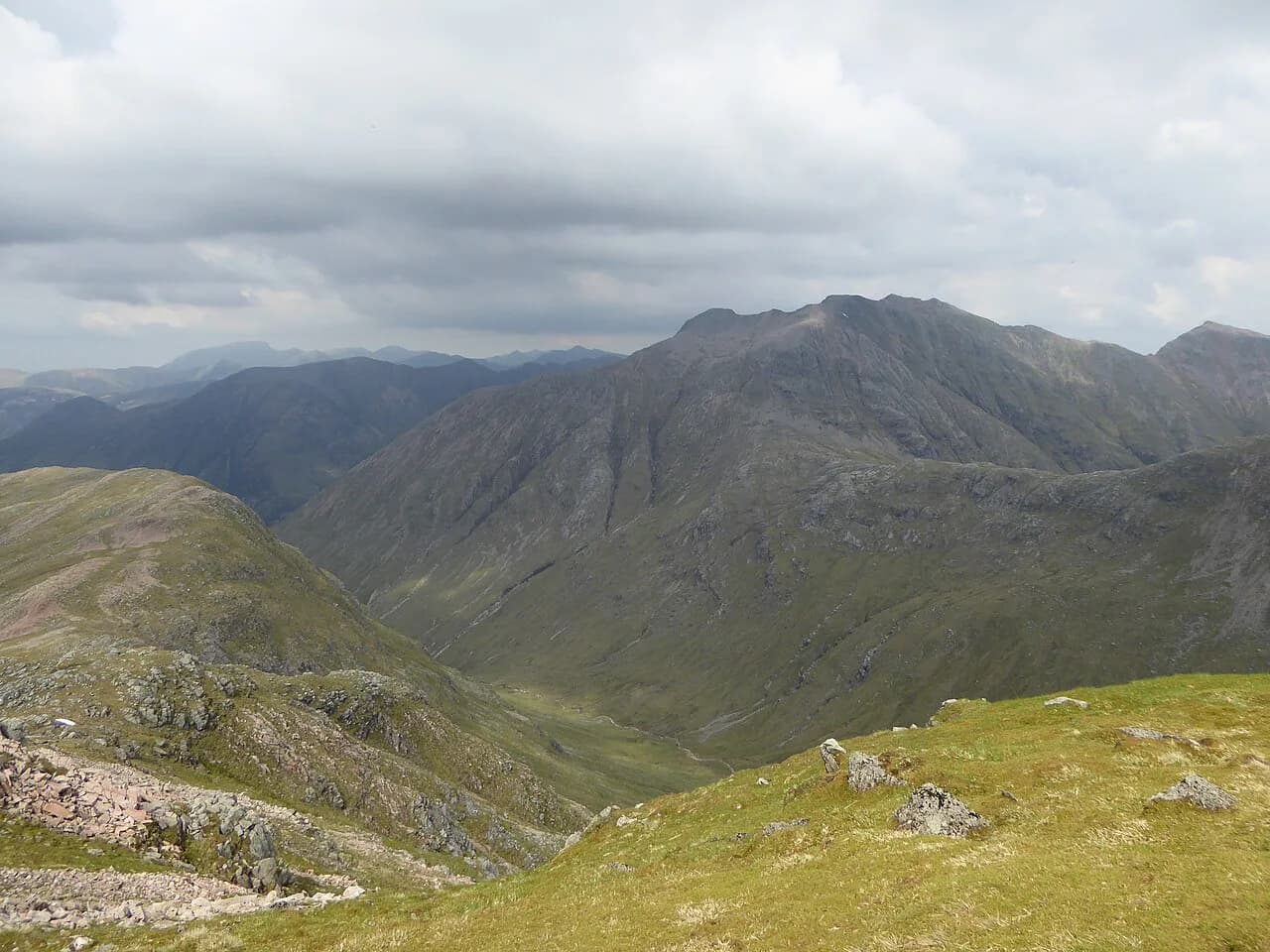
Buachaille Etive Mòr is the great pyramid of rock and grass that stands where Glen Etive meets Glen Coe, and it is the mountain most photographers stop for on the A82. Walkers come for the same reason photographers do: a long ridge with two Munros, big drops on the Glen Coe side and a view over Rannoch Moor that barely changes for the whole climb. The full traverse suits hillwalkers with Munro experience and a head for steep, rough ground in poor visibility.
This is not a path you follow on signposts. The mountain is a ridge roughly five miles (8 km) long, almost entirely encircled by the River Etive and its tributary the River Coupall, so almost every route up it is steep and almost every descent drops you somewhere different from where you started. That single fact decides your day: the classic traverse needs a car or a pre-arranged pick-up at the far end.
Where the mountain sits and how the ridge is laid out
The mountain rises between Glen Coe to the north and Glen Etive to the south, with the A82 running past its northern foot. From the road, the sharp face above the River Coupall is Stob Dearg, the big red peak at the eastern end. The ridge then runs west over a high connecting crest to Stob na Bròige, the second Munro, before the ground falls away into the Lairig Gartain.
Understanding that east-to-west layout is the key planning decision. The eastern summit comes first and carries the drama; the western summit is quieter and gives you the long view back along your own ridge line. If you only have time or confidence for one summit, take the eastern one and leave the ridge walk itself for another trip.
Trailhead and parking at Altnafeadh on the A82
The usual starting point for the eastern summit sits on the A82 at Altnafeadh, at the head of Glen Coe where the road opens out towards Rannoch Moor. Parking here is in roadside lay-bys, and these fill quickly on weekends and through the summer tourist months because the same pull-ins serve the Three Sisters viewpoints. Arriving early in the morning is the practical fix.
Park responsibly and keep passing places and gates clear, since this is a working glen road with farm traffic. The other common descent, at the western end, puts you on the glen road lower down, so check where your exit point sits before you set off and never plan to leave a car where it obstructs the road.
Reaching the start by bus or car
Citylink coaches run along the A82 between Glasgow and Fort William and pass through Glen Coe, and you can ask to be set down at roadside stops, which gets you close to the pyramid and the Three Sisters trailheads. Bus access is one-way planning, though: the linear traverse ends several kilometres from where it began, so you either arrange a lift or walk the road back with a long day already in your legs.
By car, the approach from Glencoe village and Ballachulish is short, and from Fort William or Glasgow the A82 brings you straight to the trailhead lay-bys. Arriving early also gets you onto the mountain before the main crowds leave the roadside, which matters more for the parking than for the walking.
Distance, ascent and time for the full traverse
Treat the full ridge as a long mountain day rather than a short hill walk. Any figure you plan around should come from a recorded route you have chosen, with its own start and finish points, distance, total ascent and descent laid out before you commit. Compare two or three recorded lines on a map and pick the one whose start and finish you can actually service with transport.
The numbers that matter most are the ones nobody lists: the time spent on the connecting ridge, where the ground is slow and you cannot rush, and the walk back to a road at the end. Add generous margin for both. A party moving well on the climb can still lose an hour on the crest in wind or wet rock.
Route description: Coire na Tulaich to Stob Dearg
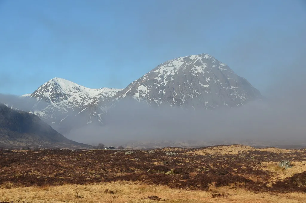
From Altnafeadh the line of ascent aims for Coire na Tulaich, the deep bowl cut into the northern face, and climbs through it on steep, eroded ground to a bealach on the ridge. Above the coire mouth the path steepens and braids across loose rock, with the crags of Stob Dearg closing in on your right. Snow lingers in this coire well into spring, and in a cold winter the top of the gully demands an ice axe and the skill to use it.
From the bealach, turn east and follow the ridge up to Stob Dearg's summit, where the ground opens and the view north over Glen Coe and south to Rannoch Moor arrives all at once. Anyone content with one summit can descend the same way. Continue west instead and you commit to the whole ridge and a completely different exit.
Along the ridge to Stob na Bròige
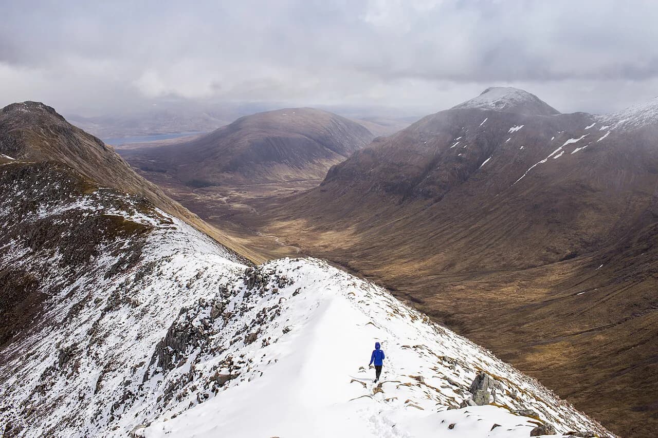
The connecting ridge is the part that earns the mountain its reputation. There is a high point between the summits, and the ground is stony and broken with drops on the Glen Coe side that feel sharper than the map suggests. Do not treat the crest as a place to make up time.
Stob na Bròige marks the western end of the main ridge and is the point to reassess. In cloud, at dusk or in wind, decide here whether you are descending smartly or pushing on. The view back east along your own route, with Stob Dearg still holding the skyline, is the best on the mountain.
Descent to Lairig Gartain and the walk back to the road
From the western end, descend north-west towards the Lairig Gartain, the pass that divides this mountain from its neighbour across the glen. The ground drops steeply from the ridge and then eases into a boggy, pathless-feeling approach to the glen floor that always takes longer than it looks. Wet feet are the usual price of the exit.
Once you reach the glen road, you still have a walk back along the A82 to Altnafeadh, which is why so many parties run two cars or arrange a lift. If you are relying on the bus, confirm the service you intend to catch with Citylink before the day, because timings and stops on this stretch shift with the season.
Stob Dearg on its own: the shorter out-and-back option
Many strong walkers take the single summit and leave the ridge to those who want it. Up through Coire na Tulaich, up to Stob Dearg and back down the same way avoids the transport problem entirely and keeps the day inside a normal daylight window. It also keeps you on ground you have already seen, which counts for a lot in mist.
The trade-off is real: you miss the ridge and the Lairig Gartain, the two features that make the mountain famous. It is still a proper mountain day, and it is the sensible first visit if you are new to Highland terrain or working out how you move on steep ground with a pack.
Exposure, scrambling and snow on the ridge
The ridge involves scrambling in places and sustained exposure, and it is not the mountain for a first outing with either. Wet rock makes every step slower, and strong wind on the crest is the condition that most often turns a good party around. Turn back early rather than press on for the second summit.
In winter and in late snow years, the northern coire and the ridge crest hold ice and old snow long after the glen floor has cleared, so an ice axe and crampons belong in the pack. Storms build through the afternoon in the Highlands at any time of year, and a ridge walk has no shelter once you are on the crest. Start early enough to be off the top half by mid-afternoon.
When to go: seasons, daylight and weather windows
Late spring to early autumn, roughly late May to September, gives the longest daylight and the best chance of dry rock, but Highland weather changes quickly at any time of year. Milder, longer days matter most on this mountain because the traverse can eat a whole day once the descent is included.
Plan a day with a spare one either side if your trip allows, and read a mountain-specific forecast for Glen Coe rather than a village forecast. Early autumn brings shorter days quickly, and the midges disappear, which locals consider a fair trade.
Dogs, livestock and Highland etiquette
Sheep graze the lower slopes and glen floor, so keep any dog under close control and on a lead around livestock. The same applies through the bird nesting season, when ground-nesting birds are present on the open hillside.
Leave gates as you find them, carry out everything you bring, and give the roadside views the same respect: the lay-bys are shared with photographers, tour traffic and locals. These are simple courtesies, and they keep access to a very popular glen pleasant for everyone.
Where to stay and eat near the trailhead
Glencoe village and Ballachulish, a short drive west, make the best base, with hostels, guesthouses and inns, including the long-standing walkers' stop at the Clachaig Inn. Further east, the Kingshouse area puts you close to the trailhead and the Rannoch Moor road, which suits a dawn start on the mountain.
Book ahead in summer and at weekends, because this glen is busy and the nearest beds sell out first. For a second day, our hiking guide to the glen sets out the shorter walks near Glencoe Lochan and the Lost Valley so your legs get a different kind of day.
Buachaille Etive Beag: the easier neighbour across the road
Across the glen from the Mòr stands the Beag, a twin-topped ridge reached from the same stretch of the A82 and far kinder underfoot. Its two Munros, Stob Dubh and Stob Coire Raineach, are linked by a walking ridge with a well-worn path rather than sustained scrambling, which makes it the natural step down in difficulty from the Mòr.
If you want a full day on the bigger mountain and a gentle one afterwards, pair the traverse with the Beag on separate days rather than trying to do both in one outing. For more Munro terrain in the same glen, Bidean nam Bian and the Lost Valley lie on the southern side of the road.
Plan Your Visit
Decide first which day you are having: the single summit of Stob Dearg, or the full ridge with a transport plan for the far end. If the ridge is the goal, settle the pick-up before anything else, then plan an early start at Altnafeadh and a finish that leaves daylight for the Lairig Gartain descent. If you are still weighing how this mountain compares with other big days out, our Scotland hiking guide sets out the options elsewhere in the Highlands.
Once those two decisions are made, the rest is ordinary Highland preparation: a mountain forecast, boots that grip wet rock, and a turn-around time you will actually honour. Do that, and the pyramid delivers the view over Rannoch Moor that made you stop the car in the first place.
Frequently Asked Questions
How hard is the Buachaille Etive Mòr hike?
The out-and-back to Stob Dearg through Coire na Tulaich is a steep but straightforward hillwalk for fit walkers. The full ridge adds broken, stony ground, sustained exposure on the Glen Coe side and a long descent into the Lairig Gartain, so it suits hillwalkers with Munro experience rather than beginners.
How long does it take to climb Buachaille Etive Mòr?
Build the day around a recorded route with its own start and finish, and allow extra time for the connecting ridge and for walking back to the A82 afterwards. The traverse fills a full day once the descent is included, while the single summit leaves daylight in hand.
Can you walk up Buachaille Etive Mòr without scrambling?
Yes, if you keep to Stob Dearg by the Coire na Tulaich line and return the same way, where the ground is steep and eroded rather than genuinely scrambly. Continue west across the ridge and you meet broken rock and exposure that call for scrambling confidence.
Where do you park for the Buachaille Etive Mòr hike?
Use the roadside lay-bys on the A82 at Altnafeadh, at the head of Glen Coe. They are shared with visitors stopping for the Three Sisters views and fill quickly at weekends and in summer, so an early morning arrival is the practical answer.
Is there a bus to the Buachaille Etive Mòr trailhead?
Citylink coaches between Glasgow and Fort William run along the A82 through Glen Coe and can set you down at roadside stops near the trailheads. The full traverse finishes several kilometres from its start, so you need a lift or a second car for the return.
What is the difference between Buachaille Etive Mòr and Buachaille Etive Beag?
The Mòr is the long ridge with Stob Dearg and Stob na Bròige, steep, exposed and a full day for the traverse. The Beag is the twin-topped neighbour reached from the same stretch of road, with a well-worn walking ridge between Stob Dubh and Stob Coire Raineach and no sustained scrambling.
Sources
Trail notes for your next trip
Optional updates when we add or revise hiking guides.
You might also like
Continue reading
More guides you'll find useful