Glen Etive Walk: The Lairig Gartain Circuit Guide
Walk the Glen Etive circuit over Lairig Gartain: 13.9 km (8.6 miles) with 561 m (1,841 ft) of ascent, two river fords and views across the glen.
On this page
Glen Etive delivers a Highland day out that feels bigger than its modest road suggests: two deep glens, a pass between them and a ring of mountains over 900 m (2,950 ft) on every side. The circuit over Lairig Gartain suits hillwalkers with a full day to spare and a reasonable level of fitness, rather than anyone looking for a short leg-stretch.
The walk starts at the River Coupall car park, where the view west into the glen alone justifies the drive, and returns through a second glen with waterfalls and quiet pools. The catch is the finish: two burn crossings on the return leg, which decide your footwear and your timing more than anything else on the route.
Glen Etive and who the circuit suits
This is a Munro-country walk without a Munro summit, which is exactly why it appeals to hikers who want distance and atmosphere rather than a steep pull onto a ridge. The terrain ranges from a clear riverside path to open glen floor and two passes, with mountains in excess of 900 m (2,950 ft) framing the route throughout. If your group includes someone who would rather climb one well-graded hill, the Pap of Glencoe and other routes in the area are covered in the hiking in glencoe guide, and they make a better fit for a half day.
Treat the circuit as a full day out rather than a morning add-on. The route sticks largely to two wide glens, which offers some shelter when the wind is blowing in the right direction, but you still negotiate two mountain passes where conditions can be quite different from the valley floor.
Where the walk starts: the River Coupall car park
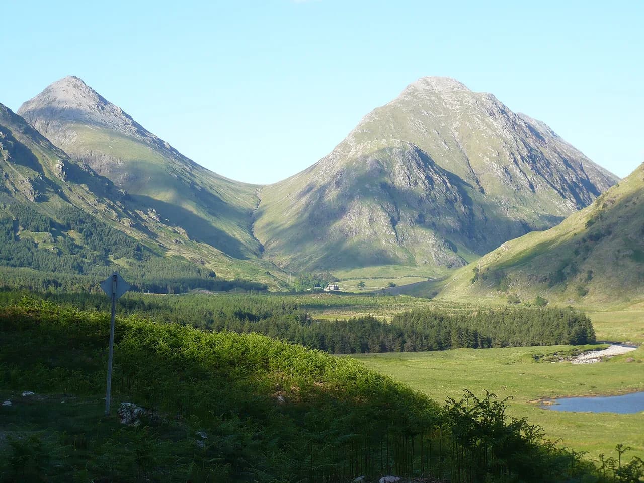
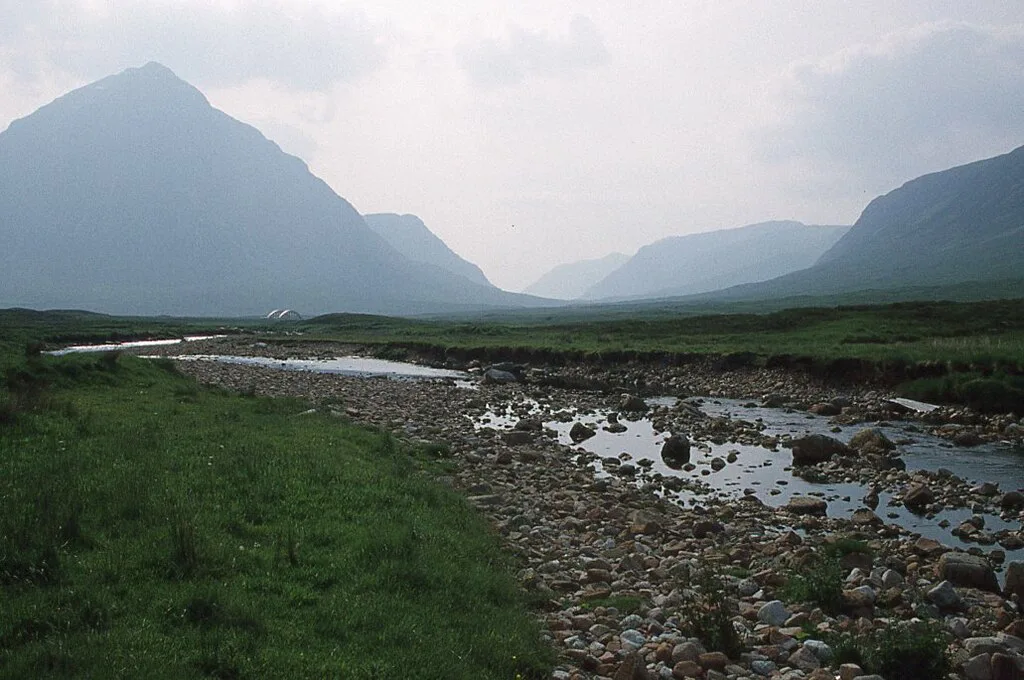
The walk begins at the car park beside the River Coupall, the well-known viewpoint where the road into Glen Etive meets the open glen. Expect company in the car park even early in the day, because the view west towards the mountains draws passing drivers as well as hikers, and the first leg of the walk follows a clear path close to the river from the outset.
Navigation on the opening stretch is simple: stay with the river and the established path, which climbs gradually as the glen narrows. The rapids and cascades alongside the path give the first hour a soundtrack, and the gradient is gentle enough that you reach the pass without noticing much of the height gained.
Getting there: A82 access and parking at the trailhead
Glen Etive branches off the A82, the main road through Glen Coe between Glasgow and Fort William, and the trailhead car park sits near that junction. Citylink services run along the A82 through Glencoe and the driver can drop you at several points along the road, which works for hikes like Buachaille Etive Mòr and the Three Sisters. The single-track road into Glen Etive itself has no bus service, so reaching this circuit's start under your own power means a car, a bike or a long walk in.
Parking along the A82 and in Glen Etive is limited to designated lay-bys and car parks, and these fill quickly at weekends and in peak season. Arrive early, and on the single-track road keep passing places clear rather than parking in them.
Distance, ascent and time
The circuit measures 13.87 km (8.6 miles) with 561 m (1,841 ft) of total ascent, and hikers typically allow around 4.5 hours of walking. Add time for the fords on the return leg, where boots come off and feet dry, plus stops at the viewpoints, and a comfortable day out lands nearer six hours.
The figures split unevenly across the day: the climb to the first pass is gradual, the descent and second climb on the return side feel more work, and the two burn crossings cost real time in cold weather. Plan your turnaround on daylight rather than on the book time, especially in autumn when the glen falls into shadow early.
Route description below the pass
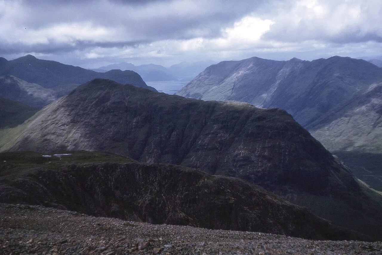
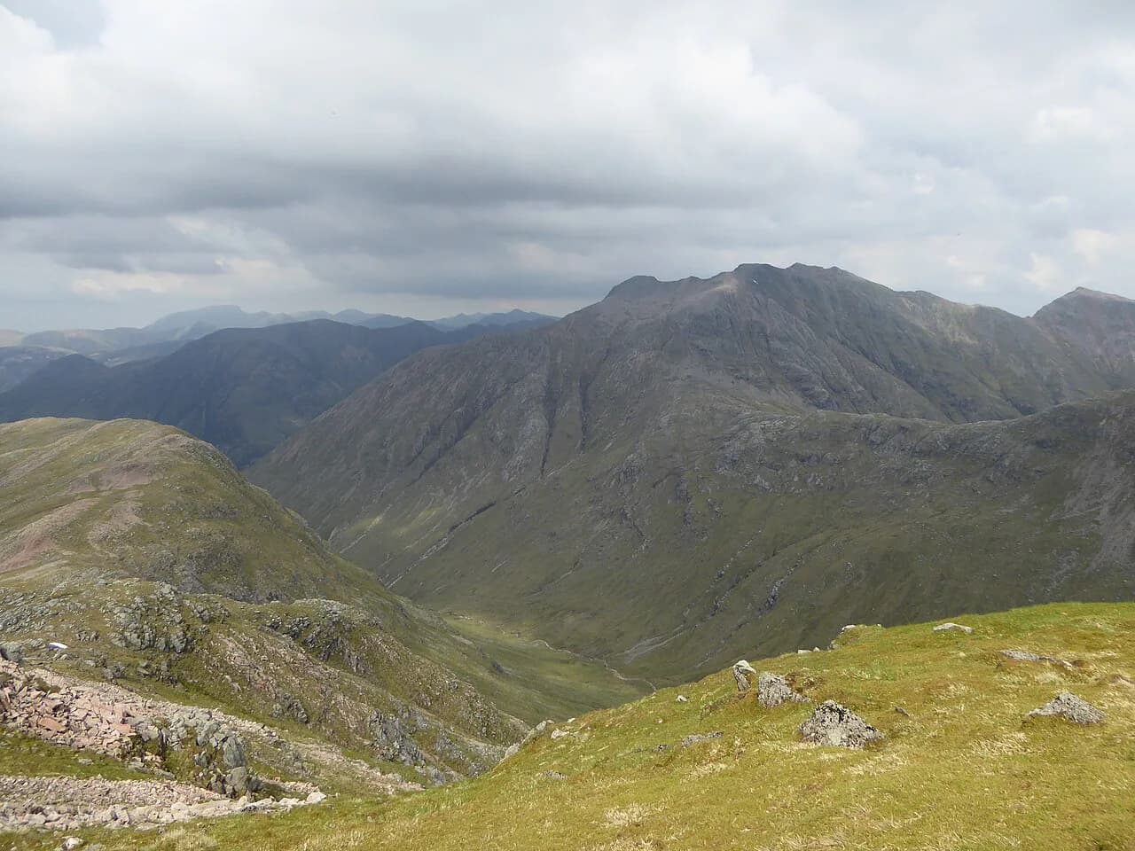
From the car park, follow the path beside the River Coupall as it works west into the glen, with Buachaille Etive Mòr dominating the skyline behind you. The path stays clear and the ascent gradual all the way to the top of the pass at 489 m (1,604 ft), where a pile of stones marks the high point. Underfoot conditions change noticeably as you gain height, and patches of snow and ice can linger near the cairn when the valley below is clear.
The view from that cairn is the reward: a long, varied prospect over crags, a mountain river, a freshwater loch and, beyond, a sea loch. It is the natural lunch stop and the point to check the weather ahead before committing to the return side.
The return glen and the two fords
Past the pass the route drops into the second glen, where a fork in the path marks the start of the return leg. From there you follow another burn gently uphill through a fine glen, passing waterfalls and secluded pools that invite a dip on a warm day. Deer are frequently seen on the surrounding slopes, so keep voices low and give them room.
The crux of the day comes near the end: the terrain requires fording the burn twice, and the water is snowmelt-cold even in summer. The crossings are manageable when the burn is not in spate, so check levels before you set out and turn back rather than wade a rising river. Carry footwear you can cross in, a towel and dry socks, and treat the second crossing as the decision point for the whole return leg.
Weather, snow and when to go
Late spring to early autumn, roughly May to September, gives the mildest weather and the longest daylight, and is the sensible window for this circuit. Highland weather changes fast, and a rain shower in the glen can be snow on the passes, so carry layers and a shell rather than judging the day by the car park.
In winter the passes hold snow and ice, and the fords are at their coldest; microspikes earn their place near the cairns and on shaded sections of path. Dogs are welcome on these trails but belong on a lead around livestock and during the bird nesting season in spring and early summer.
Extended options: Buachaille Etive Mòr and the surrounding Munros
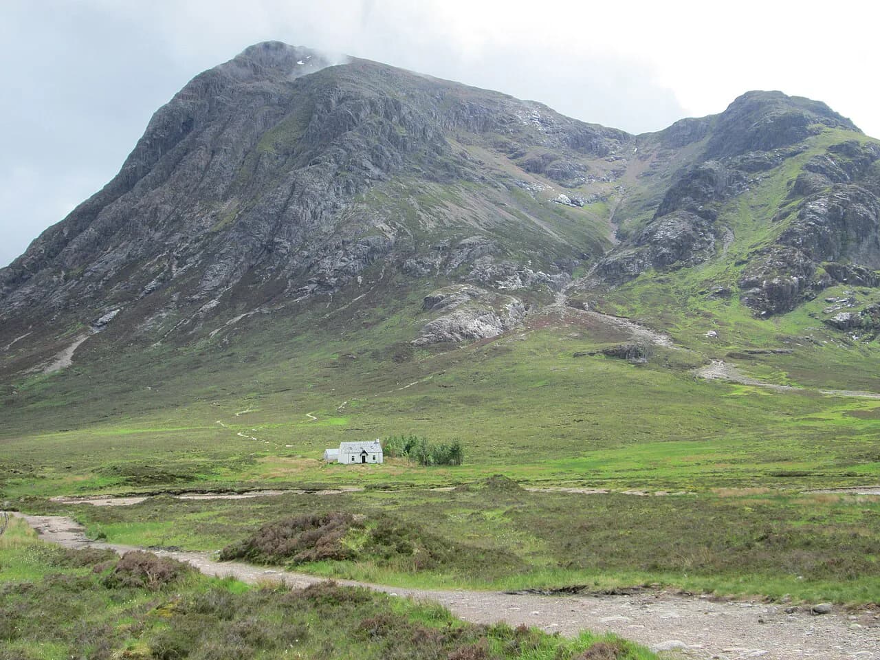
Buachaille Etive Mòr looks unclimbable from the car park, but the easiest route up starts from the Glen Etive side and is a realistic extension or a separate day for fit hikers with scrambling confidence. If you want the mountain on its own terms, the Buachaille Etive Mòr route guide sets out the line and the effort involved.
Across the road, Buachaille Etive Beag gives two Munros, Stob Dubh and Stob Coire Raineach, on an 8.42 km (5.2 mile) route with 760 m (2,493 ft) of ascent that is far less technical than its bigger neighbour. Farther east, Bidean nam Bian and the Aonach Eagach Ridge offer harder days that belong to a Glen Coe trip rather than this glen. If you are weighing up a longer trip, hiking in Scotland covers how to string together days like these across the Highlands.
Glen Etive Lochan and easier low-level walks
Not every day in this glen needs a pass. The Glencoe Lochan loop near Ballachulish is a 2.52 km (1.6 mile) path with just 70 m (230 ft) of ascent, finished in around 36 minutes, and its well-made trails suit families and rest days.
The lower reaches of Glen Etive, with their waterfalls and pools, also make good short outings after heavy rain, and the single-track road gives walkers a way to link sections on foot. Even on these gentler days, the glen road is narrow enough that you should park only in recognised spaces and walk facing oncoming traffic.
Plan Your Visit
Build your day around the car park at the River Coupall, an early start and a conservative turnaround time, then let the fords decide the pace of the return. Carry crossing footwear and dry socks, and check the mountain forecast and burn levels the morning you go.
If you have a second day in the area, trade this circuit for a Munro or a low-level loch walk depending on the weather, and keep an eye on conditions on the passes as the season turns.
Frequently Asked Questions
How long is the Glen Etive circular walk?
The circuit is 13.87 km (8.6 miles) with 561 m (1,841 ft) of total ascent, and hikers typically allow around 4.5 hours of walking. Two burn fords on the return leg add time, so plan for a full day rather than a half day.
Where do you park for the Glen Etive walk?
The walk starts at the car park beside the River Coupall, near where the Glen Etive road leaves the A82. Spaces along the A82 and in Glen Etive are limited, so arrive early and keep passing places on the single-track road clear.
Do you have to ford rivers on the Glen Etive circuit?
Yes. The return leg requires fording the same burn twice, and the water is snowmelt-cold. Cross only when the burn is low, carry footwear you can wade in, and be ready to turn back if the water is rising.
Can you reach Glen Etive without a car?
Citylink coaches run along the A82 through Glencoe and can drop you at points along the road, but the single-track road into Glen Etive has no bus service. Without a car, you need a bike or a long walk in from the junction.
When is the best time to walk in Glen Etive?
Late spring to early autumn, roughly May to September, offers the mildest weather and longest daylight. Snow and ice can linger on the 489 m pass into spring, and winter walking here calls for spikes and experience.
Sources
Trail notes for your next trip
Optional updates when we add or revise hiking guides.
You might also like
Continue reading
More guides you'll find useful