Aonach Eagach Ridge Hike: Glencoe Traverse, Grade and Route
The Aonach Eagach is a Grade 2 to 3 knife-edge scramble above Glen Coe. Here is the traverse layout, exposure, time, gear and how to reach the start.
On this page
The Aonach Eagach is the ridge that gives Glen Coe its sharpest skyline, a notched crest running along the north side of the glen and linking two Munros through sustained, exposed scrambling. It suits hikers who are already comfortable on Grade 2 ground in summer and who accept that once the pinnacles begin there is no easy way off. Plan it as a one-way day, not a loop.
If you want a Glen Coe day with airy views but no rope work, this is the wrong objective; the ridge demands a confident head for heights and the stamina for many hours of concentration. Hikers building up to it should first test themselves on simpler ground and study the wider range of hiking in glencoe before committing to the traverse.
What the ridge offers and who should attempt it
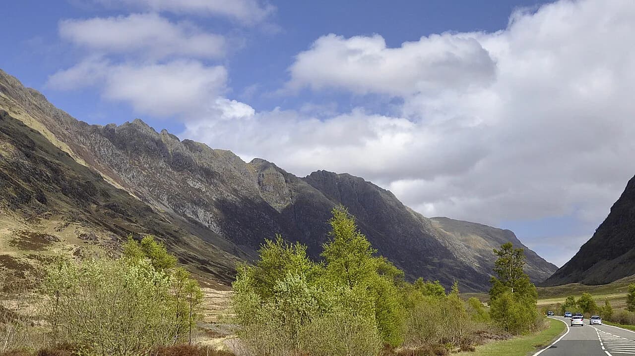
The Aonach Eagach, Gaelic for notched ridge, runs along the northern rim of Glen Coe between the A82 road and the deep valley of Glen Coe itself. Its two Munros are Meall Dearg, at 952 metres (3,124 feet), and Sgorr nam Fiannaidh further west, joined by a serrated crest of pinnacles and rocky steps. The traverse is generally done east to west, so you start high on the road side and walk toward the western end above Glencoe village.
This is a route for scramblers, not for walkers who merely want a summit. The middle section involves steep down-climbs and narrow crests with serious drops on both sides, and a slip on the ridge can be fatal. If you have never moved on exposed rock with your hands, build experience on easier ridges first, and consider going with someone who has done the traverse before.
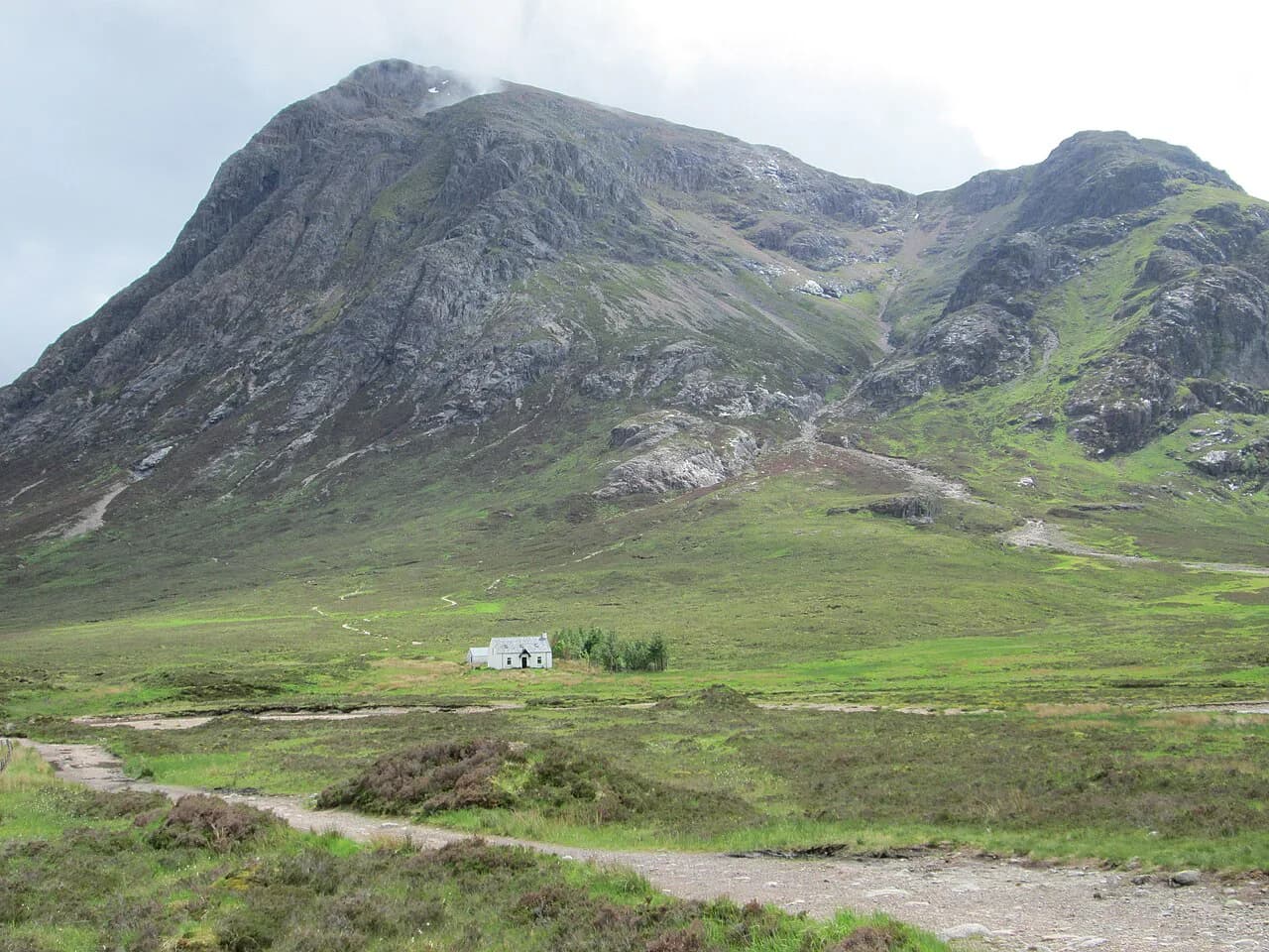
The nearest comparable objectives in the glen, such as the Buachaille Etive Mòr, are big mountain days but not knife-edge traverses. Treat the Aonach Eagach as a step up in commitment rather than another Glen Coe hill.
Where the ridge sits above Glen Coe
The ridge lies entirely within the Glen Coe area, its eastern end rising above the A82 near Allt-na-reigh and its western end above Glencoe village and the road toward Ballachulish. Because it runs one way along the glen, the route is linear: you start at one road point and finish at another, with the A82 as the corridor connecting them.
That layout shapes everything about the day. The eastern approach gains height quickly from the road, the crest then trends west over Meall Dearg and the pinnacles, and the final Munro stands above the western end of the glen. Before you commit, be clear which end you will finish at and how you will return to the start.
Trailhead, parking and getting back to the car
The common starting point for the traverse is near Allt-na-reigh on the A82 in Glen Coe, where parking is often available but fills quickly in summer and at weekends, so an early arrival matters. The finish at the western end is above Glencoe village, which means you either walk back along the glen or arrange a lift or bus.
Public transport along the A82 through Glen Coe connects the glen with larger towns such as Fort William and Glasgow, but stops and timings need to match your chosen start and finish points. Because the traverse is linear, arranging the return journey from the descent point is the part most often overlooked. Check the current bus timetable for the glen before you fix your start time, and have a fallback plan if you finish later than expected.
Glencoe village and Ballachulish both work as bases, and the Clachaig Inn in Glencoe and the Kingshouse Hotel further east offer food and accommodation close to the glen. Staying in the glen the night before shortens the morning drive and lets you start early.
Distance, ascent and walking time
The full traverse, including both Munros, the approach and the descent, can take anywhere from six to ten hours depending on weather, group experience and fitness. That range is wide because the scrambling itself slows parties down far more than the distance suggests. Plan for the upper end unless your group is fast and the rock is dry.
For a sense of scale, an extended version of the route running from Glencoe to White Corries is recorded as 22.3 kilometres (13.8 miles) with 1,310 metres (4,302 feet) of ascent and 1,030 metres (3,379 feet) of descent, taking around seven hours and forty minutes of moving time. That is the extended traverse, not the standard crossing, so do not use it as the figure for a straightforward east-to-west day.
Start early enough that you are off the crest before darkness or evening weather arrives. A late start on a November day, with the intention of walking off in the dark, is exactly the pattern described in a near-miss account from Mountaineering Scotland in which the party carried no crampons or ice axes and encountered deeper snow than expected.
Scrambling grade and exposure
The Aonach Eagach is typically graded as a Grade 2 or Grade 3 scramble in summer, and it is widely considered one of the most challenging scrambles in mainland Scotland. It requires significant scrambling experience, a good head for heights and comfort in exposed positions. Once you are committed to the main scrambling sections there are no bypass paths.
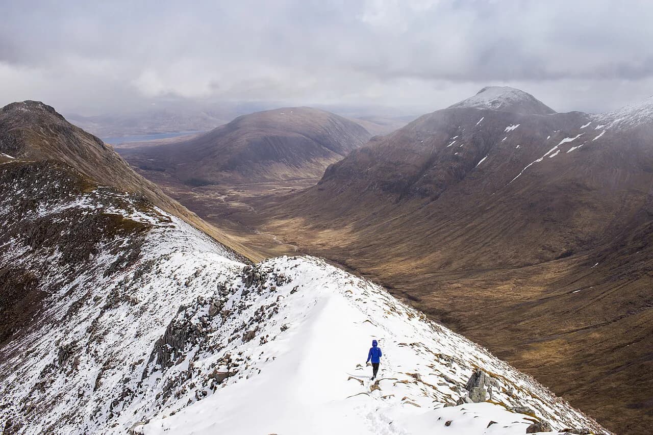
In winter the proposition changes entirely: a winter traverse becomes a serious Grade 3 mountaineering challenge rather than a scramble. Ice axe, crampons, a helmet, winter clothing, a headtorch, navigation tools and emergency shelter all become baseline kit, and only experienced mountaineers with advanced winter skills should consider it. Do not drift onto the ridge in early snow simply because you have summered on it.
Exposure is the defining feature. The crest is narrow, the drops are long, and the difficulties are sustained rather than concentrated in one move. A party that is slow or hesitant on the first down-climb will be slow throughout, so the decision to continue should be made honestly and early.
Route description: the eastern start to Meall Dearg
From the road near Allt-na-reigh, the route climbs steeply onto the eastern shoulder before the ridge proper begins. The first scrambling arrives soon after, and the initial down-climb is a fair test of how the rest of the day will feel. If it unsettles you in good conditions, turning back there is a sensible outcome rather than a failure.
The ridge then leads west to Meall Dearg, the first Munro at 952 metres (3,124 feet). For most parties this is the first of the two Munros linked by the knife-edge, and the views along the serrated crest toward Sgorr nam Fiannaidh open up from the summit. From here the route continues into the pinnacles with no option to drop off the crest.
The pinnacles and the middle section
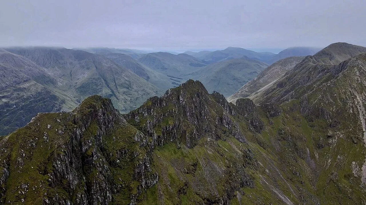
The middle of the ridge is the part people remember. It includes the Chancellor, an immense rock pinnacle, and the Crazy Pinnacles toward the western end, with steep descents and highly exposed scrambling between them. The crest is serrated throughout, with short scrambles and steep rocky chimneys that demand steady hands and careful footwork.
Rope use on this ground is a decision to make in advance. A short rope can help a competent second on selected steps, but it does not remove the exposure for a party that is not moving confidently, and it slows progress. The near-miss account describes a party of mismatched experience where one person was pushed well beyond her limits, which is the outcome to avoid by choosing your partner and your conditions deliberately.
Weather governs the difficulty here more than any other factor. Wet rock makes the steps much slipperier and raises the grade in practice, and strong wind on an exposed crest is hazardous in its own right. Check a mountain-specific forecast immediately before you set out, and save the traverse for dry, calm, clear conditions.
Sgorr nam Fiannaidh and the descent
Beyond the pinnacles the angle eases and the ridge runs on to Sgorr nam Fiannaidh, the western Munro above Glencoe village. The character changes here from technical scrambling to steady ridge walking, though the ground remains rough and the day is not over. From the summit you descend north toward the A82 and the glen road.
The descent is steep and hard on the legs after hours of concentration, and it lands you well west of your starting point. Have your return transport fixed before you leave the car, and carry enough food and water to cover a longer day than the distance suggests.
When to go and winter conditions
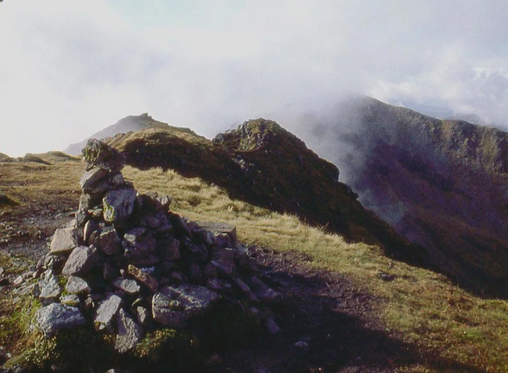
Summer and early autumn give the best chance of dry rock and long daylight, which is what this route wants. Late-autumn and winter conditions on the ridge are a different sport: snow on the crest, short days and the need for full winter kit. The Mountaineering Scotland account of a November attempt with light snow, a midday start and no crampons or ice axes shows how quickly a summer plan becomes a winter problem.
If you are aiming for a winter traverse, treat it as a mountaineering objective and go with experienced winter partners or a guide. Scottish Rock & Water runs winter mountaineering, winter skills and scrambling courses in the Scottish Highlands, including on the Aonach Eagach, which is one way to gain the skills before going independently.
Huts and bases near the ridge
There are no huts on the ridge itself, and the traverse is normally done as a single long day from a valley base. Glencoe village and Ballachulish give the shortest access to the western end, while the Kingshouse Hotel further east puts you closer to the Allt-na-reigh start. Choose your base according to which end of the traverse you expect to finish nearest.
If you want an easier Glen Coe day on the same trip, the Pap of Glencoe is a short, steep hill above the village with a fraction of the commitment, and the Lost Valley (Coire Gabhail) Hike in Glen Coe gives a dramatic valley walk without exposure. Both make good recovery days either side of the traverse. If you would rather trade Glen Coe for lower, gentler ridges, the Lake District hiking guide covers comparable valley and fell days.
Bagging Meall Dearg without the ridge
You can reach Meall Dearg without traversing the full ridge. Walking routes from the east allow you to reach the Munro while avoiding the extreme exposure of the knife-edge, though they still involve some scrambling. This is the option for hikers who want the summit and the views but not the pinnacles.
On this version you go up and back by the same side of the mountain, so the logistics are far simpler: one parking place, no one-way transport. If your main goal is a Glen Coe Munro rather than the crest, compare it with gentler objectives such as Buachaille Etive Beag before deciding.
Plan Your Traverse
The Aonach Eagach rewards preparation more than most Glen Coe days. Fix your start near Allt-na-reigh, arrange your return from the western end above Glencoe village, and set off early enough to be off the crest with daylight to spare.
Choose your season and your partner honestly: dry summer rock for a Grade 2 to 3 scramble, full winter kit and experience for anything with snow on it. If the pinnacles are beyond you this year, take the eastern route to Meall Dearg and come back to the traverse when the ground and your confidence match it.
Frequently Asked Questions
What grade is the Aonach Eagach ridge?
It is typically graded as a Grade 2 or Grade 3 scramble in summer, and it is widely considered one of the most challenging scrambles in mainland Scotland. In winter it becomes a serious Grade 3 mountaineering challenge requiring ice axe, crampons and advanced winter skills.
How long does the full Aonach Eagach traverse take?
The full traverse, including both Munros, the approach and the descent, can take six to ten hours depending on weather, group experience and fitness. Plan for the upper end of that range unless your party is fast and the rock is dry.
Is the Aonach Eagach suitable for beginners?
No. It demands significant scrambling experience, a good head for heights and comfort in exposed positions, and there are no bypass paths once you are committed to the main scrambling sections. Build experience on easier ground first.
Can you hike Meall Dearg without the ridge?
Yes. Walking routes from the east reach the Munro while avoiding the extreme exposure of the knife-edge, though they still involve some scrambling. That version goes up and back on the same side, so you need only one parking place.
Where do you park for the Aonach Eagach?
The common starting point is near Allt-na-reigh on the A82 in Glen Coe, where parking fills quickly in summer and at weekends, so arrive early. The traverse finishes above Glencoe village, so arrange a lift or bus for the return.
What gear do you need for a winter Aonach Eagach traverse?
An ice axe, crampons, a helmet, appropriate winter clothing layers, a headtorch, navigation tools and emergency shelter are all baseline kit. Only experienced mountaineers with advanced winter skills should attempt it.
How do you get back to the start after the traverse?
The traverse is linear, so you finish west of where you started. Buses run along the A82 through Glen Coe, but you need to match stops and times to your start and finish points, or arrange a lift in advance.
Sources
Trail notes for your next trip
Optional updates when we add or revise hiking guides.
You might also like
Continue reading
More guides you'll find useful