Lost Valley Glencoe Hike: Coire Gabhail Route Guide
Walk the Lost Valley in Glen Coe from the Three Sisters car park: 5 km with 300 m of ascent, rough riverside ground and an easy scramble, in about 2.5 hours.
On this page
The Lost Valley gives you the heart of Glen Coe in a half day: a short climb from the roadside into a hidden coire ringed by the Three Sisters, with the Aonach Eagach and the glen opening out behind you. It suits hikers with limited time who still want rough Highland ground underfoot, and anyone building a first day in the glen before bigger objectives.
Why the Lost Valley suits hikers short on time in Glen Coe
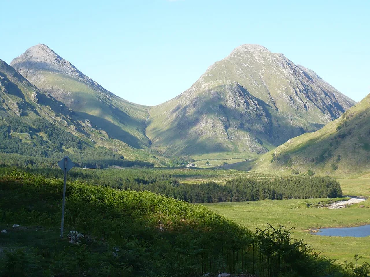
Coire Gabhail, the valley's proper name, sits tucked between Beinn Fhada and Gearr Aonach, two of the three buttresses that frame the classic Glen Coe view. The walk is an out-and-back of modest length, so you can fit it into a morning or an afternoon and still drive on to other parts of the glen. The reward is the moment the ravine opens onto the flat coire floor, with the high ground of Bidean nam Bian above.
It is a good warm-up for the longer ridges and Munros around the glen, but it is not a stroll: the path is rough and steep in places, and the upper section crosses boulders. Treat it as a half-day hill walk rather than a viewpoint amble, and wear boots with grip.
Where the walk starts and how to park at the Three Sisters viewpoint
The route starts and finishes at the Three Sisters viewpoint car park on the A82, about 5 mi (8 km) east of Glencoe village. The grid reference is NN 171569 and the GPS coordinates are 56.667738, -4.986430, which put you on the south side of the road facing the buttresses. Additional car parks lie further west and east along the same stretch of road.
From the car park the path heads southeast, drops to a footbridge over the River Coe, then climbs the west bank and later the east bank of the Allt Coire Gabhail. The car park is the obvious meeting point for a group, and it is also where you pick up the path if you are walking in from the road.
Getting there without a car: the A82 and the bus situation
Buses run along the A82 past the start, but there is no official stop at the Three Sisters viewpoint, so a public transport plan has to include a walk along the road shoulder to reach the car park. The road is fast and narrow in places, so keep to the verge and wear something visible if you are walking in. Check the current timetables with the operator before you commit to a bus-based day.
Distance, ascent and walking time
The walk is 5 km (3 mi) out and back with about 300 m (985 ft) of ascent, and guidebook timing for the round trip is around 2.5 hours including time in the coire. The figures are modest, but the ground is slow: rocky steps, a boulder field near the top and a rough riverside path all eat into your pace. Plan for the stated time at least, and add more if the rock is wet.
A route log for the same trail records 5.33 km with 290 m of ascent and a walking time of about 1 hour 43 minutes for a fit hiker moving steadily. The difference is mostly stops: the coire floor and the looking-back view are worth the pause, so budget closer to the 2.5-hour figure if you want to enjoy them.
Route description: from the car park to the River Coe crossing
Leave the car park on the path heading southeast and follow it down through birch woods to the River Coe. A metal staircase helps you down a rocky step to the footbridge, which is the first key route-finding moment: cross here and pick up the path on the far bank. The river crossing is straightforward in normal conditions, but the rocks are slippery after rain.
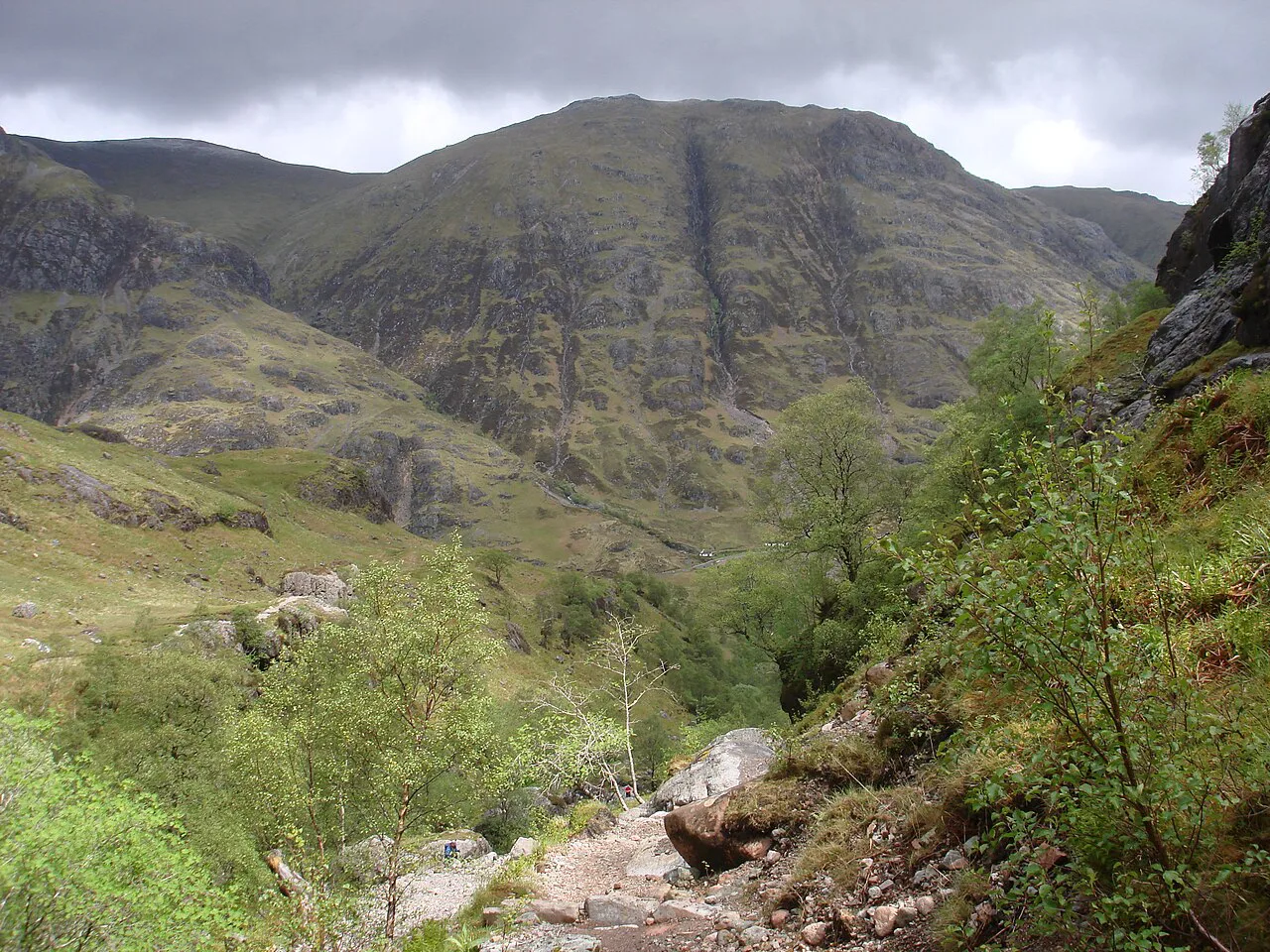
Beyond the bridge the path climbs steeply alongside the Allt Coire Gabhail, crossing from the west bank to the east bank as the gorge narrows. Watch for the small waterfalls on this section, which make a good breather stop. The path is clear on the ground but rough underfoot, with loose stone and tree roots.
The climb up Coire Gabhail and the rocky steps
The middle section is the toughest: the path threads through a narrow gorge between Beinn Fhada and Gearr Aonach, with steep drops close to the trail in places and a few rocky steps that need a hand. In wet conditions these steps verge on easy scrambling, so keep your hands free and take your time. This is where the walk earns its moderate grade.
Above the gorge the path crosses a boulder field at the foot of the coire, which is slow going but not technical. Follow the worn line through the boulders rather than improvising, and keep an eye on the sky: the upper valley is exposed to wind and rain once you are out of the trees.
Emerging into the coire floor and the view back
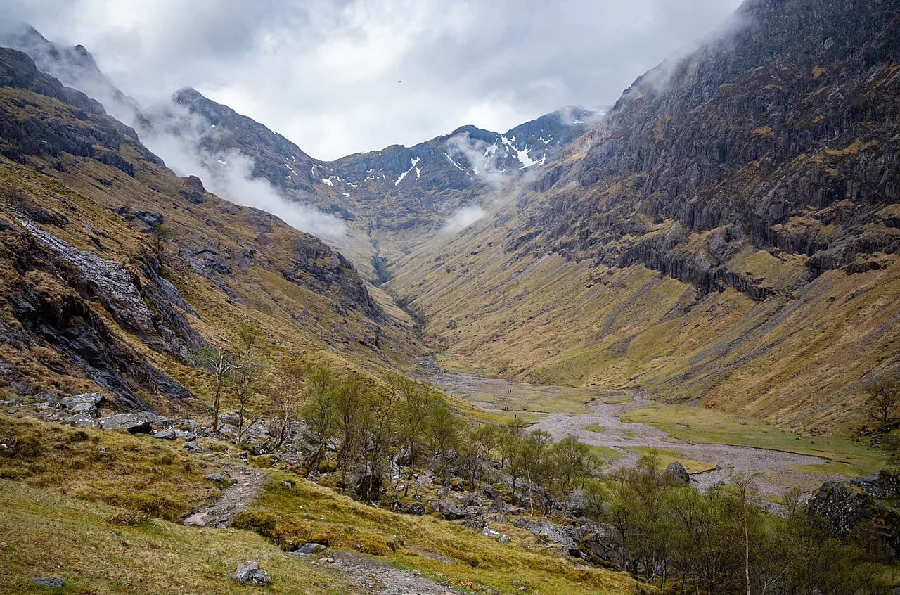
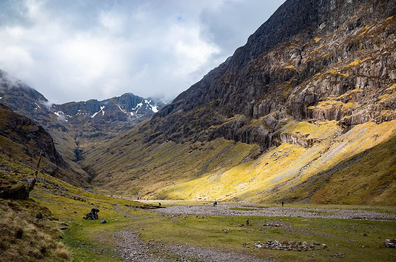
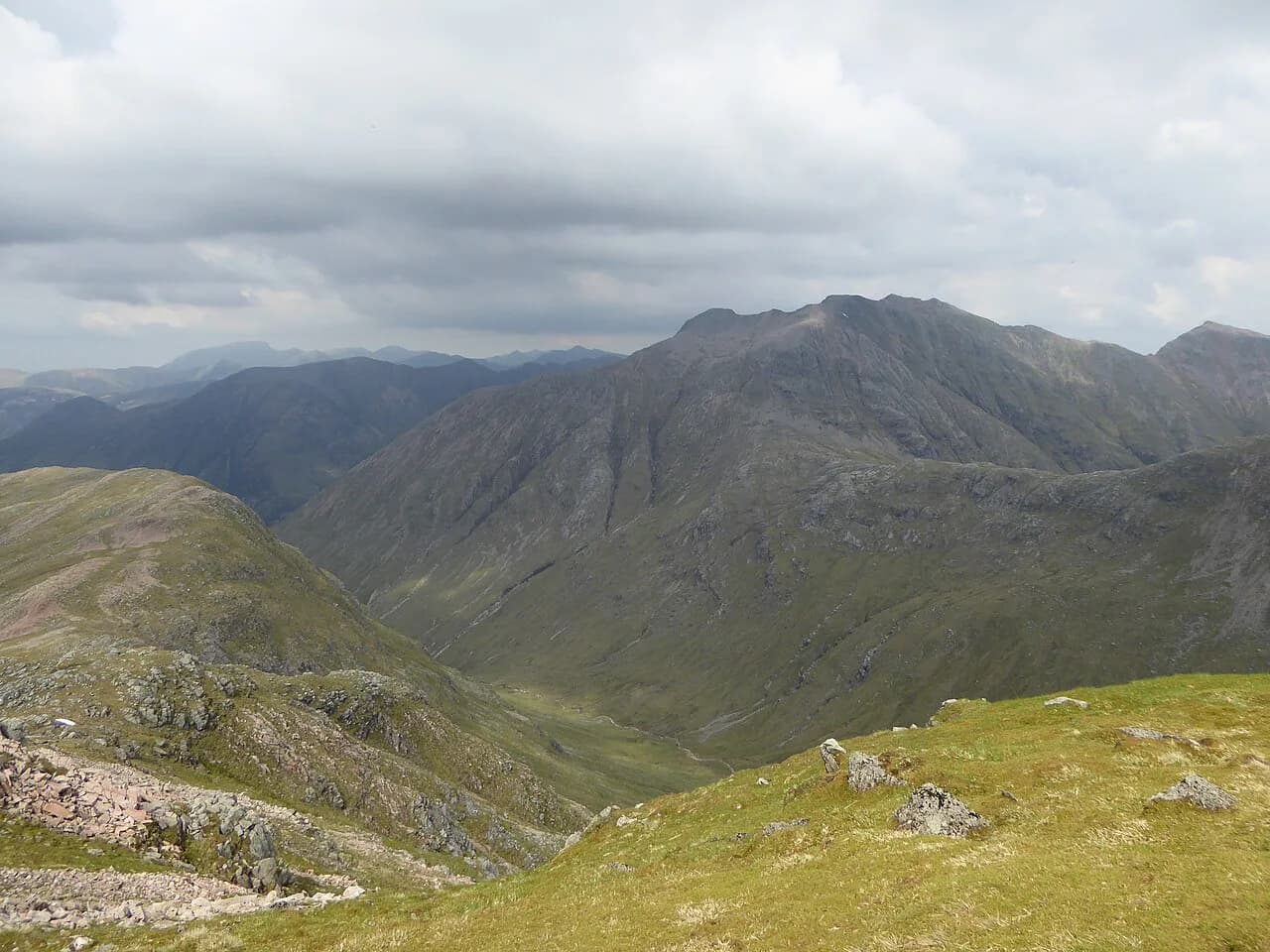
The path opens onto the flat floor of Coire Gabhail, a wide grassy basin hidden from the road below. Walk on to the far end of the flat area for the classic view looking back down the valley toward the glen, which is the photograph most people come for. Give yourself twenty minutes here; it is the payoff for the climb.
From the coire floor a path continues up to Bealach Dearg, the pass that leads on toward Bidean nam Bian. That is a much bigger day with more ascent and exposed ground, so unless you have planned for it, turn around at the flat floor and retrace your steps.
The geology and clan history of the hanging valley
Coire Gabhail is a hanging valley, cut by glacial meltwater and left perched above the main glen, which is why the approach climbs so abruptly through the gorge. The flat floor is a remnant of that glacial floor, and the surrounding walls show the shape of the ice-carved landscape. The name Lost Valley comes from its reputation as a hiding place for cattle raided by the MacDonalds of Glencoe.
The story is part of the valley's appeal, but keep it in proportion: the ground you walk is a working Highland landscape, and the coire is within the Glencoe National Nature Reserve. Treat the old walls and vegetation with respect and leave the place as you find it.
Difficulty, terrain and exposure: what the ground is really like
The route is graded moderate, and the grade is fair for the distance: the path is clear throughout but very rough, steep and close to drops in places. There are rocky spots that need a hand, and the boulder field near the top is awkward underfoot. There have been fatalities on this route, so the short distance is no guarantee of easy ground. Check current conditions and daylight hours before setting out.
Navigation is not difficult in good visibility, but the gorge is enclosed and the upper valley is exposed, so carry a map and compass and know how to use them if cloud comes down. In winter and early spring the rocky steps can be icy, and snow may linger on the upper ground. Turn around if conditions are beyond your comfort level; the valley will still be there next time.
When to go: seasons, weather and daylight
Late spring to early autumn gives the most reliable conditions, with longer daylight and drier rock. Summer brings midges in the wooded lower section, so a head net and repellent are worth packing. Afternoon rain is common in the Highlands, and the gorge can funnel water onto the path; start early and aim to be down before the weather turns.
Autumn is quieter and the birch woods turn gold, but the days shorten quickly and the boulder field is slippery with wet leaves. Winter and early spring are for experienced hill walkers with winter gear, and even then the icy steps may stop you short. Check the mountain weather forecast before you set out and be prepared to change plans.
Gear and footwear for rough, wet ground
Waterproof boots with stiff soles are the right choice for the rocky steps and boulder field; trail shoes work in dry weather but give less protection. Carry a waterproof jacket and trousers, a warm layer and a headtorch even on a short day, because the glen darkens early under cloud. A trekking pole helps on the descent through the gorge, where the steps are steep.
Bring water and a snack: there are no facilities in the coire, and the nearest shops are in Glencoe village. If you are walking in from the road, add a high-visibility layer for the verge section along the A82.
Combining the Lost Valley with other Glen Coe walks
The Lost Valley makes a natural first day in the glen, with bigger objectives saved for later in your trip. Buachaille Etive Mòr is the shapely peak that guards the entrance to Glen Coe and offers a long, steep day with real exposure, while Buachaille Etive Beag gives a shorter alternative with two summits. The Aonach Eagach ridge is a scrambling route for experienced parties only, and the Pap of Glencoe is a shorter hill above Glencoe village with a steep final pull.
If you want the full Bidean nam Bian massif, plan a separate day: the continuation over Bealach Dearg from the coire is a much longer outing than the valley walk. Ben Nevis and Glen Nevis lie outside Glen Coe to the north and are a different day's objective entirely.
Where to stay and base yourself near Glen Coe
Glencoe village is the closest base, with guesthouses and a small shop, and it puts you a short drive from the Three Sisters car park. Kinlochleven and Ballachulish offer more accommodation and are within easy reach of the glen by road. Fort William, further north, is a larger hub but adds driving time each day. If you would rather spend your trip base-hopping between Highland glens, the Scotland hiking guide covers other areas and where to stay in each.
There are no huts or bothies on the Lost Valley route itself, so plan your day from a bed in the glen rather than a mountain refuge. Book accommodation in advance during summer and around holidays, when the glen gets busy.
Plan Your Visit
The Lost Valley is the most efficient way to get a real taste of Glen Coe on foot: 5 km, 300 m of ascent and about 2.5 hours, with a hidden coire as the reward. Wear boots, carry waterproofs and a map, and start early enough to enjoy the quiet before the coaches arrive. Park at the Three Sisters viewpoint, and if you are coming by bus, plan the walk-in from the A82.
Frequently Asked Questions
Where do you park for the Lost Valley in Glen Coe?
Use the Three Sisters viewpoint car park on the A82, about 5 mi east of Glencoe village. The grid reference is NN 171569 and the GPS coordinates are 56.667738, -4.986430. Further car parks lie west and east along the same road.
How long does the Lost Valley walk take?
Most hikers take around 2.5 hours for the 5 km out-and-back with 300 m of ascent, including time in the coire. A fit hiker moving steadily can do the walking in about 1 hour 43 minutes, but the rough ground and the view back make the longer figure realistic.
How hard is the Lost Valley hike?
It is graded moderate. The path is clear but very rough, steep and close to drops in places, with rocky steps that verge on easy scrambling and a boulder field near the top. Boots with grip and sure footing are essential, especially when wet.
Can you reach the Lost Valley by bus?
Buses pass the start on the A82, but there is no official stop at the Three Sisters viewpoint. You will need to walk along the road verge to the car park; check current timetables before you travel.
Is the Lost Valley the same as Coire Gabhail?
Yes. Coire Gabhail is the Gaelic name for the valley, and Lost Valley or Hidden Valley are the common English names. The walk from the Three Sisters viewpoint leads into the same coire between Beinn Fhada and Gearr Aonach.
What is there to see at the top of the Lost Valley?
The path emerges onto a flat grassy coire floor hidden from the road, with the classic view back down the valley toward Glen Coe. Walk to the far end of the flat area for the best looking-back view. The higher ground of Bidean nam Bian rises above.
Sources
Trail notes for your next trip
Optional updates when we add or revise hiking guides.
You might also like
Continue reading
More guides you'll find useful