Glencoe Lochan Walk: Lochan, Woodland and Mountain Trails
The Glencoe Lochan walk offers three waymarked trails: an easy 1.6 km lochan circuit plus steeper woodland and mountain paths with Loch Leven views.
On this page
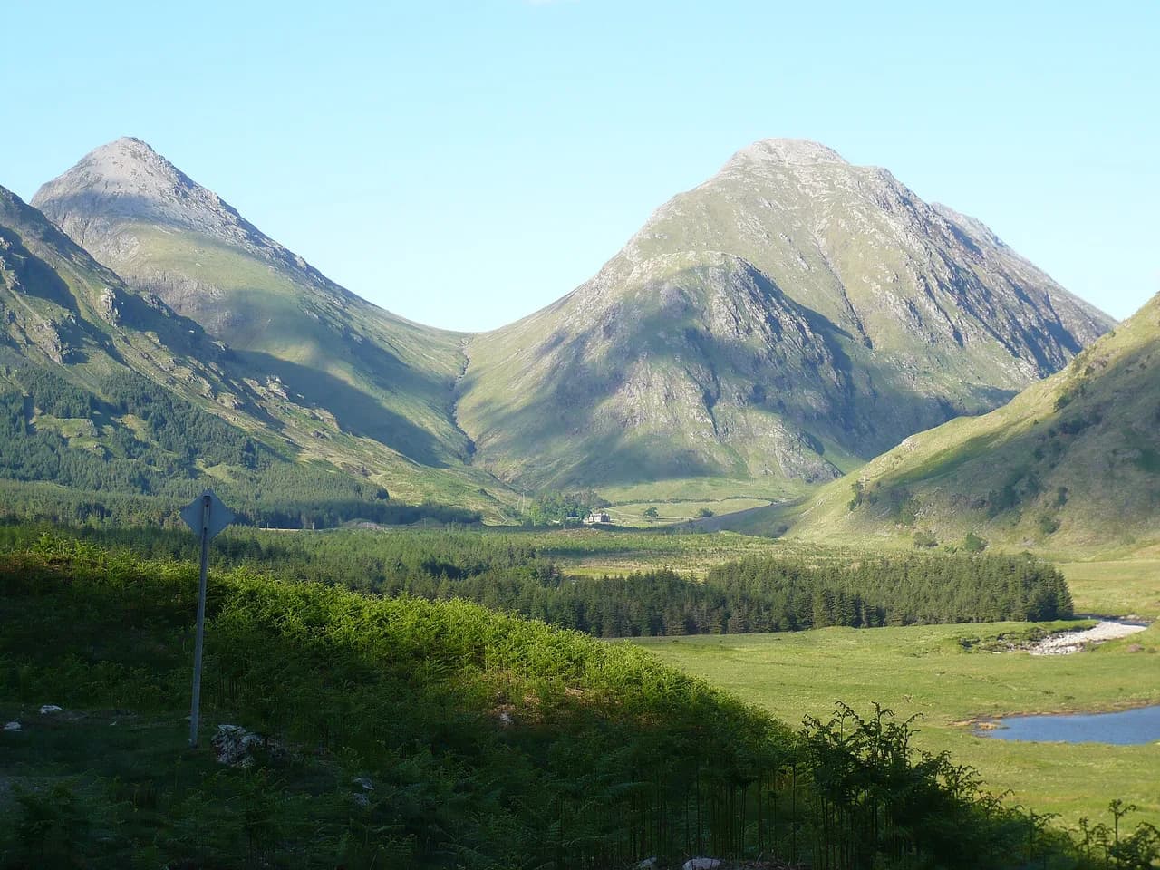
Glencoe Lochan is the gentlest walking in the glen: a small loch ringed by forest beneath the bigger hills, with three waymarked trails that range from a flat half-hour circuit to a short, sweaty climb to a Loch Leven viewpoint. It suits anyone who wants a walk without committing to a Munro, from families and wheelchair users on the lochan path to hikers stealing an hour before or after a longer day of hiking in glencoe.
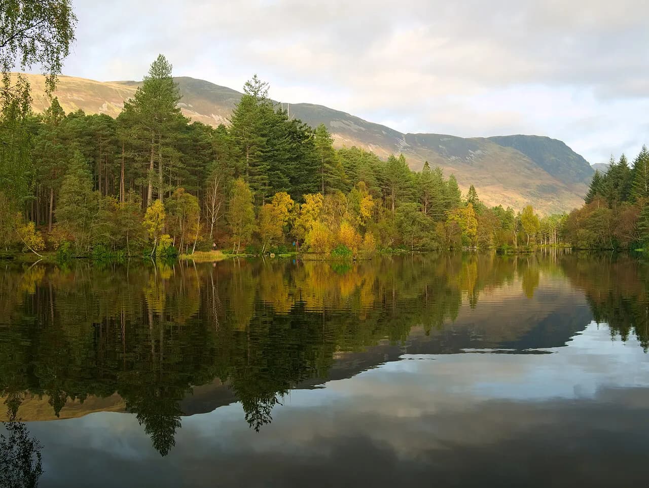
The lochan, Lochan Ghleann Comhainn, is man-made: Lord Strathcona created it for his homesick Canadian wife, and the surrounding woods were planted with North American conifers in the 1890s. That history gives the walk its character, with pine-scented plantation on the upper trails and the water reflecting the surrounding ridges.
What Glencoe Lochan offers and who each trail suits
All three routes begin from the same spot and can be walked in under an hour each, which makes the site unusually flexible for a short stop. The Lochan Trail is the flat one, the Woodland Trail is a rolling forest loop, and the Mountain Trail is a short, steep pull to a viewpoint. If you have only 30 minutes, take the lochan circuit; if you have three-quarters of an hour and want trees and water views, take the woodland loop.
The Mountain Trail is the best pick for hikers who want a view payoff and don't mind working for it. It climbs the slopes of Stac a'Chlamhain (the steep hill of the buzzard) for a wide look over Loch Leven, the Ballachulish bridge and the hills of Morvern beyond. The trade-off is a loose, uneven surface with long steep gradients, so it is not a trail for a casual stroll in smooth-soled shoes. If you like matching a short climb to your fitness, the same approach of choosing a walk by level applies to hiking in the Lake District, where the Lake District hiking guide sorts routes the same way.
Where Glencoe Lochan sits and how to reach the trailhead
Glencoe Lochan lies just off the village of Glencoe, on the north side of the glen near the head of Loch Leven. The main road through Glencoe village puts you within a short walk or drive of the trails, and buses running through the glen stop in the village rather than at the lochan itself, so the last stretch is on foot. Check current timetables before relying on a bus connection.
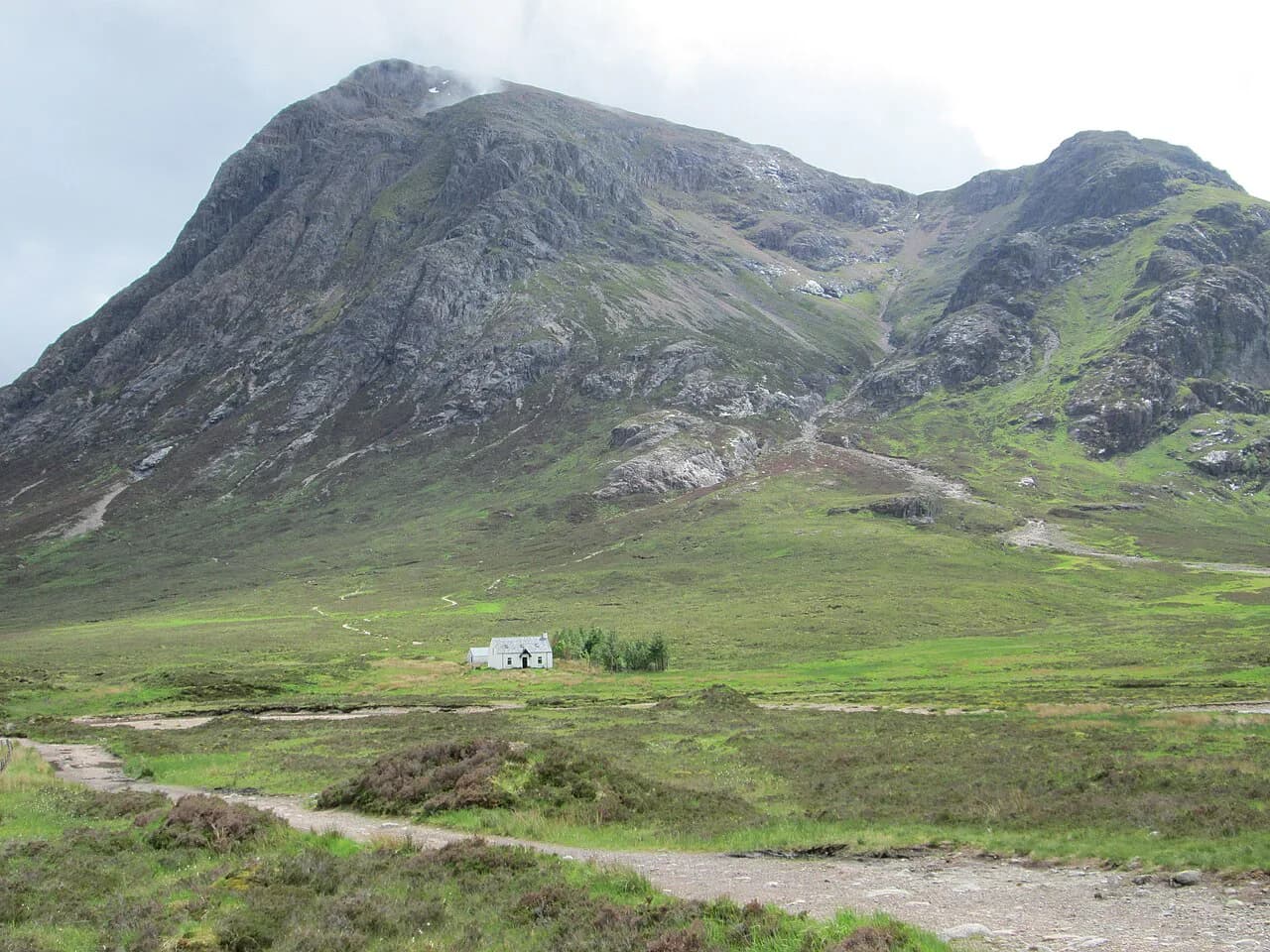
If you are basing yourself in the village, the lochan is easy to reach on foot and needs no separate journey. If you are driving through, treat it as a short detour rather than a destination in itself, and pair it with one of the bigger Glencoe days such as the climb of Buachaille Etive Mòr, which starts further east along the glen.
Trailhead parking and facilities
Forestry and Land Scotland manages the site and publishes the trail information, including any active notices, on its Glencoe Lochan pages. Parking is the practical question for most visitors, and it fills quickly on fine summer days and in the autumn colour season; arriving early or late in the day gives you the best chance of a space.
Bring what you need for a short walk with you, because the site is a forest trailhead rather than a visitor centre. That means water, a waterproof layer and proper footwear for the rougher two trails, especially after rain. The Lochan Trail's hard, smooth surface makes it the most forgiving option if conditions are wet or you are pushing a buggy.
Lochan Trail: the easy circuit
The Lochan Trail is 1.6 km (1 mile) around the water and the surrounding woodland, and Forestry and Land Scotland suggests allowing half an hour. The path is wide, firm and smooth, generally flat with short gentle gradients, and broken up with rest points. Forestry and Land Scotland currently grades it Easy rather than Easy All Abilities.
The one snag is surface water at the far end of the lochan in times of high rainfall, where up to 3 m (about 10 ft) of path can be covered. Waterproof boots or a willingness to turn back solve it, and the rest of the circuit stays dry. Reflections of the Glencoe ridges on the water are the reward, and the circuit is short enough to walk twice if the light changes.
Woodland Trail: conifers, loch views and spring bluebells
The Woodland Trail is also 1.6 km (1 mile) but takes about 45 minutes, meandering through the huge North American conifers planted by Lord Strathcona in the 1890s. Forestry and Land Scotland grades it Strenuous: the path is firm but has rough rocky and rooty sections, undulates constantly, and turns muddy in places after rain.
The rewards are pine-scented air, loch views through the trees and, in spring, carpets of bluebells under the conifers. It is the best of the three for anyone who wants a proper short walk with texture underfoot rather than a flat circuit, and the undulations mean you gain and lose height constantly without ever committing to a long climb.
Mountain Trail: Stac a'Chlamhain and the Loch Leven viewpoint
The Mountain Trail is 1.61 km (1 mile) and takes about 45 minutes, but short does not mean easy. It climbs the slopes of Stac a'Chlamhain on a loose gravel path with uneven stone steps, rooty sections and long very steep gradients, graded Strenuous by Forestry and Land Scotland.
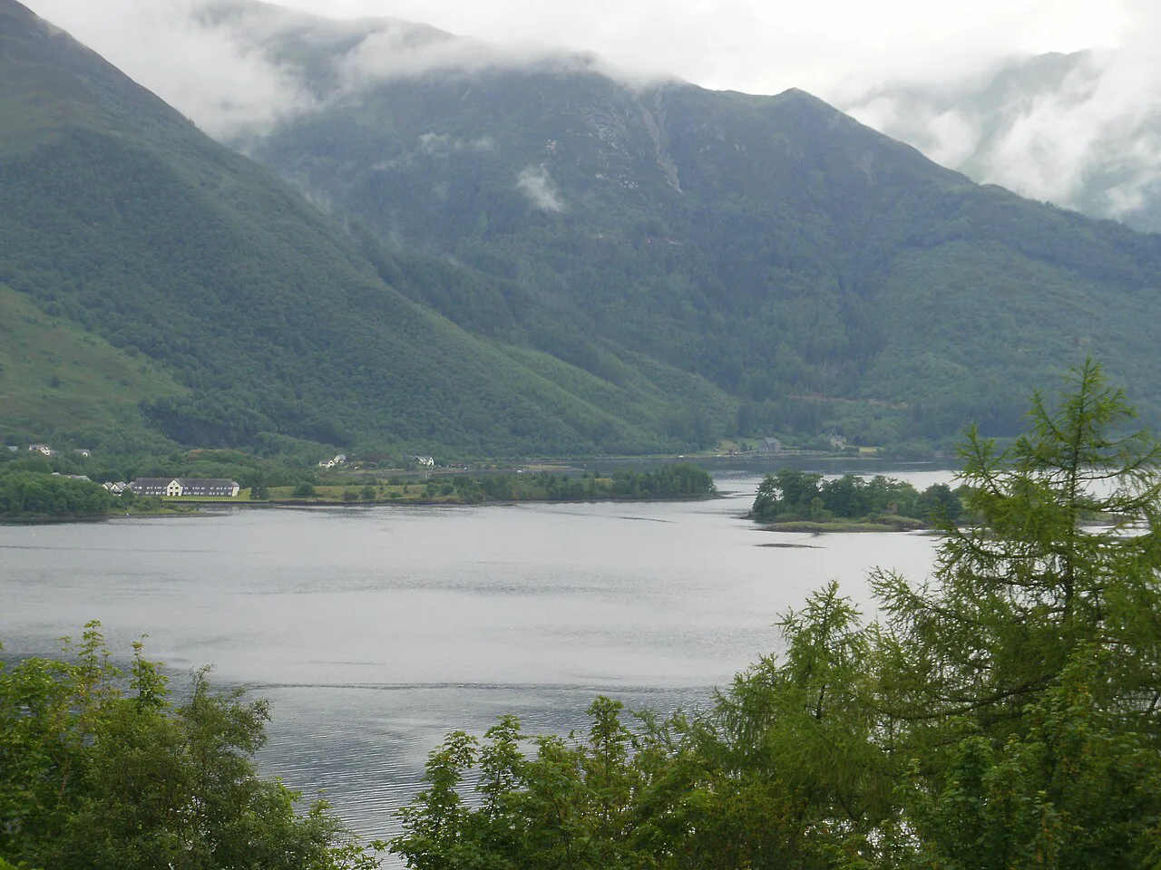
From the slope the view opens over Loch Leven, dotted with islands and stretching away towards the Ballachulish bridge and the hills of Morvern. Look for the ruined chapel on one of Loch Leven's islands. The descent is where the loose gravel matters, so take it slowly and keep your weight back on the steeper steps.
Loch Leven islands and the ruined chapel
The islands scattered across Loch Leven are the distinctive feature of the view from the mountain path, and the ruined chapel on one of them is the detail worth spotting. Low light, whether early morning or late afternoon, shows the islands and the bridge best, while flat midday light flattens the water. The chapel is seen, not visited; the walk stays on the hillside above the loch.
For a bigger view of the same body of water, the ridges above the glen give a wider perspective. The Aonach Eagach Ridge is a scrambling route for experienced hillwalkers rather than a casual extension of the lochan trails, and it demands a head for exposure and a long day out.
Distance, ascent and time for each trail compared
The three routes make a neat ladder of effort. Lochan Trail: 1.6 km (1 mile), flat with short gentle gradients, about 30 minutes, Easy. Woodland Trail: 1.6 km (1 mile), constantly undulating with rough sections, about 45 minutes, Strenuous. Mountain Trail: 1.61 km (1 mile), long very steep gradients on loose gravel, about 45 minutes, Strenuous.
None of the published trail cards gives a total ascent figure, so judge effort by the gradings rather than a number on a page. The woodland and mountain routes both earn their Strenuous label through surface and gradient rather than length, which is why an hour on either feels longer than the distance suggests.
When to go: seasons, rainfall and bluebells
Spring is the standout season for the Woodland Trail, when bluebells carpet the ground under the conifers. Summer gives the driest, brightest conditions for the Loch Leven viewpoint, though the woodland paths stay muddy in wet spells. Autumn colour on the lochan circuit is the other high point, and winter light on the water is quiet but short.
Rainfall matters more here than temperature, because the far side of the lochan floods in high rainfall and the forest trails hold water and mud. Keep an eye on the weather in the days before you walk and choose the Lochan Trail if the ground is saturated. Midges are a real presence in still, damp summer conditions, so a head net helps on the wooded sections.
Footwear and what the path surfaces demand
The Lochan Trail is the only route where trainers or a smooth-soled shoe are genuinely sensible, given the wide, firm, smooth surface and short gentle gradients. The Woodland Trail needs a boot with grip for rocky, rooty and muddy sections. The Mountain Trail needs the same plus confidence on loose gravel and stone steps, especially on the way down.
A light waterproof jacket earns its place on all three, because the plantation and the open slope both catch showers. Trekking poles help on the mountain path's steep steps and cost little in weight. If you are combining the trails into one walk, do the mountain path first while your legs are fresh and finish on the flat circuit.
Ticks and open water at the lochan
Forestry and Land Scotland posts active notices at Glencoe Lochan for ticks and for open water, so treat both as real conditions of the visit. Ticks are a hazard in the long vegetation and bracken around the woodland trails; wearing long trousers and checking yourself afterwards is the practical response. The open water notice applies to the lochan itself, so keep to the paths and out of the water.
Beyond those, the hazards here are ordinary hill-walking ones on a small scale. The mountain path's loose gravel and steep steps are where most slips happen, and wet roots on the woodland trail are the other trip hazard. Neither is dangerous with care, but both reward slower feet than the short distances might suggest.
Combining the lochan trails with a longer Glencoe day
Glencoe Lochan works best as an appetiser or a leg-stretch rather than the main event, because the three trails together are only a few kilometres of walking. Pair it with a bigger objective in the glen: Buachaille Etive Beag gives a straightforward high-level day, while Bidean nam Bian is the bigger, rougher outing. The lochan's own link to the wider hiking in glencoe is that it lets you fit a short walk around a longer mountain day.
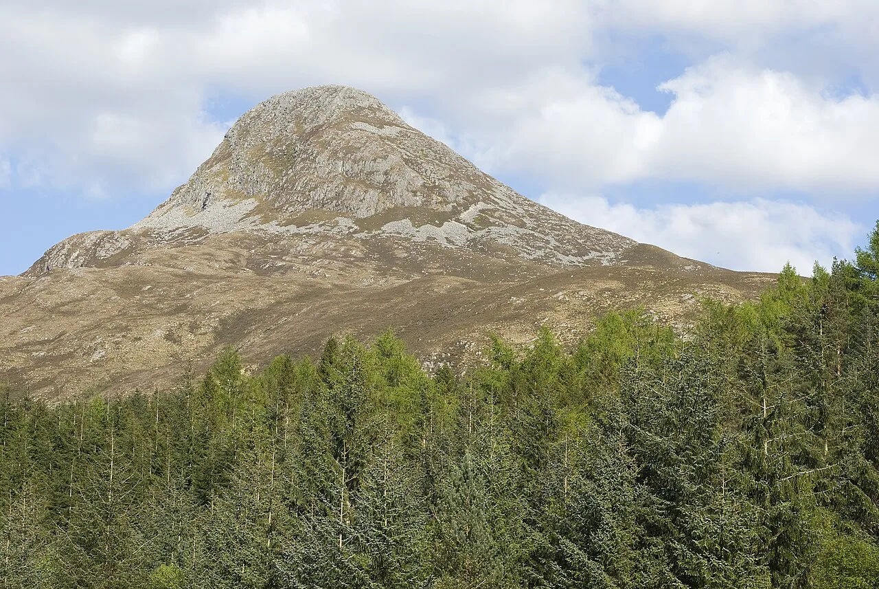
If you want a half-day rather than a full one, the Pap of Glencoe gives a shorter, sharper climb with a big outlook over the village and the loch. Walking the lochan trails early and the Pap later is a sensible split, with a proper breakfast in between. The lochan's flat circuit is also the obvious recovery walk the day after a long ridge day.
Where to stay near Glencoe Lochan
Glencoe village is the natural base, putting the lochan within walking distance and the bigger hill starts within a short drive. Staying in the village also means you can walk the lochan trails in the evening when day visitors have gone and the light on the water is at its best. Book well ahead in summer and in the autumn colour window, when rooms in the glen fill fast.
Wherever you stay, plan the lochan walk as a flexible option for a changeable day, since all three trails can be done in under an hour each and abandoned without wasted effort. That makes the site a useful fallback when the cloud is down on the bigger summits but the village level is clear.
A Short Walk With a Real View
Glencoe Lochan is the walk to choose when you want a view of Loch Leven without a full mountain day: a flat 1.6 km (1 mile) circuit, a rooty woodland loop and a steep, short climb to a viewpoint above the islands. Pick the Lochan Trail for accessibility and speed, the Woodland Trail for bluebells and forest, the Mountain Trail for the best outlook.
Wear boots on the two Strenuous routes, expect mud after rain and keep an hour in reserve. Then use the saved time on one of the glen's bigger hills, which is where Glencoe's reputation really lives.
Frequently Asked Questions
How long is the Glencoe Lochan Trail?
The Lochan Trail is 1.6 km (1 mile) around the water and the surrounding woodland, and Forestry and Land Scotland suggests allowing half an hour. The Woodland Trail is the same length but takes about 45 minutes, and the Mountain Trail is 1.61 km (1 mile) with about 45 minutes needed.
Is the Glencoe Lochan walk suitable for wheelchairs and pushchairs?
The Lochan Trail has a wide, firm, smooth surface that is generally flat with short gentle gradients and rest points, and it is currently graded Easy rather than Easy All Abilities. It is the best of the three for wheels, but expect up to 3 m (about 10 ft) of surface water at the far end in times of high rainfall.
Which of the three Glencoe Lochan trails has the best views?
The Mountain Trail gives the widest outlook, climbing the slopes of Stac a'Chlamhain over Loch Leven towards the Ballachulish bridge and the hills of Morvern. The Woodland Trail gives loch views through the conifers, and the Lochan Trail gives reflections of the Glencoe landscape on the water.
How long does the Woodland Trail take?
Allow about 45 minutes for the 1.6 km (1 mile) Woodland Trail. It is graded Strenuous because the path has rough rocky and rooty sections, undulates constantly and can be muddy after rain, so the time is more about surface than distance.
Is the Mountain Trail at Glencoe Lochan steep?
Yes. The Mountain Trail is short at 1.61 km (1 mile) but has long very steep gradients on a loose gravel path with uneven stone steps and rooty sections, and Forestry and Land Scotland grades it Strenuous. Take the descent slowly, as loose gravel is where most slips happen.
Can the Glencoe Lochan path flood?
At the far end of the lochan, up to 3 m (about 10 ft) of the Lochan Trail can be covered in surface water during times of high rainfall. Waterproof boots solve it, and the rest of the circuit stays dry.
Are there toilets and parking at Glencoe Lochan?
Forestry and Land Scotland manages the site and publishes trail and visitor information on its Glencoe Lochan pages, so check there for what is currently available. The site is a forest trailhead rather than a visitor centre, so bring water and a waterproof layer with you.
What can you see from the top of the Mountain Trail?
The view runs over Loch Leven, dotted with islands, towards the Ballachulish bridge and the hills of Morvern. Look for the ruined chapel on one of Loch Leven's islands, which is visible from the slope but not visited on the walk.
Sources
Trail notes for your next trip
Optional updates when we add or revise hiking guides.
You might also like
Continue reading
More guides you'll find useful