Col de la Forclaz Hike: Annecy Trails, Times and Trailheads
Plan a Col de la Forclaz hike above Lake Annecy, from the Verthier climb to the Pointe de la Rochette loop and the full-day Talamarche route.
On this page
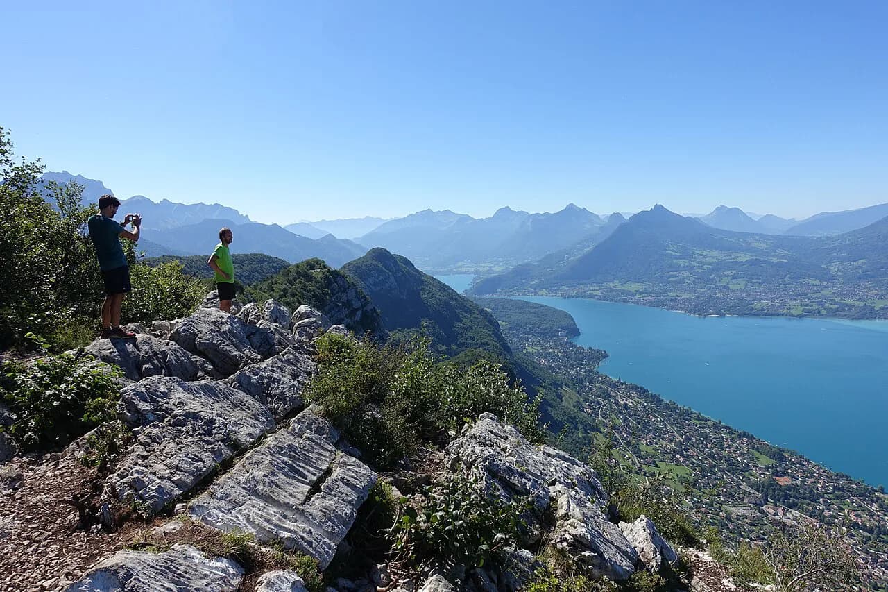
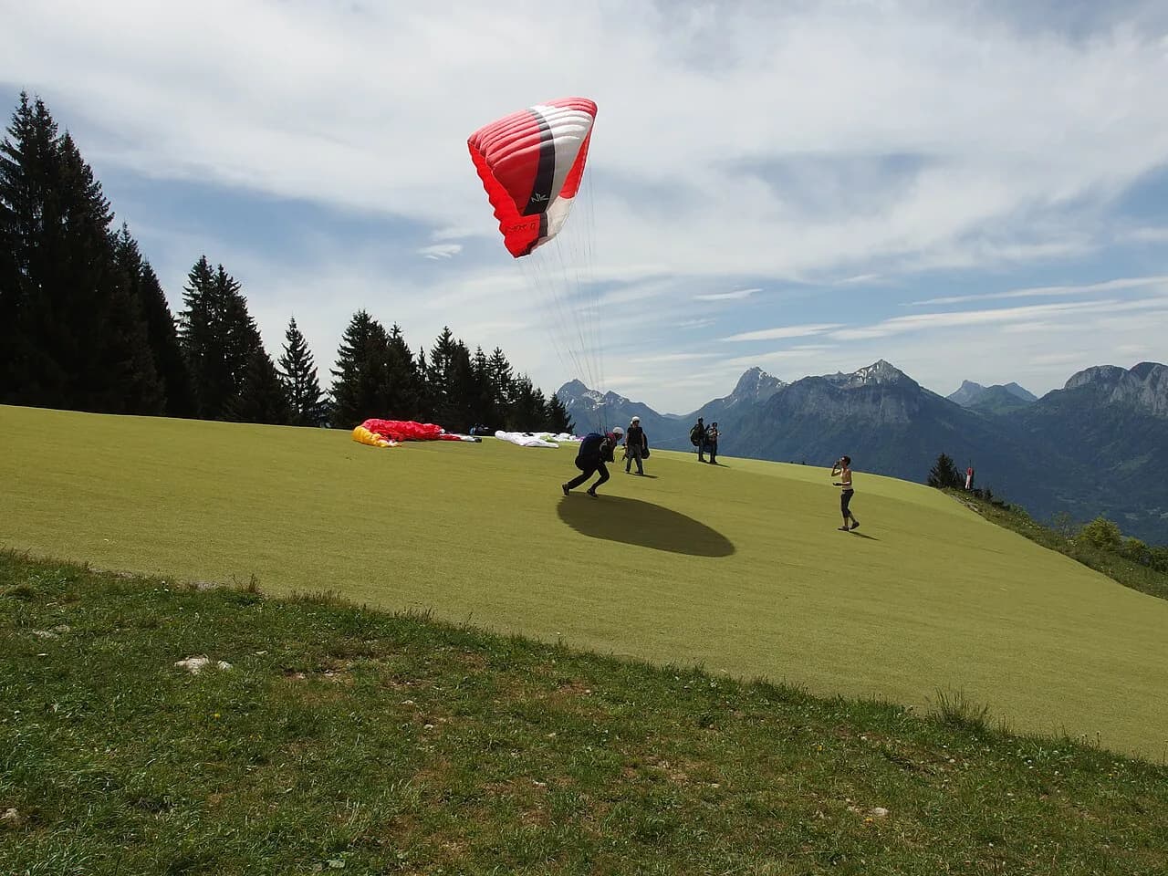
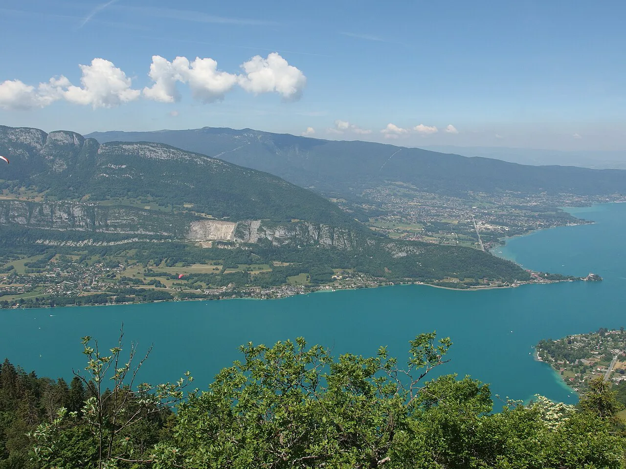
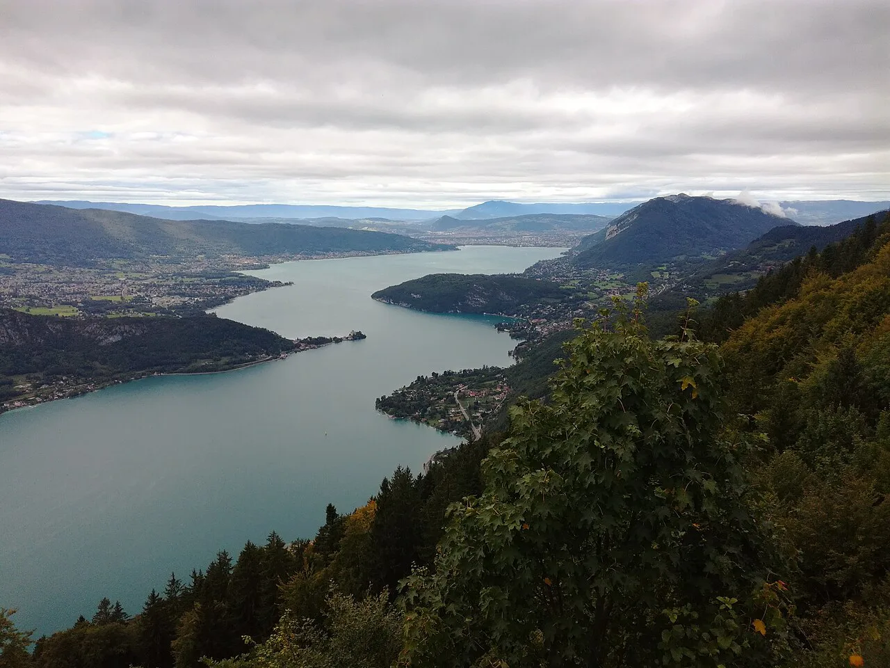
The Col de la Forclaz is a road pass on the eastern side of Lake Annecy, high enough to look straight down on the water and the paragliders who launch from its slope. It suits hikers who want a half-day viewpoint walk, a two- to five-hour loop, or a full day on a quiet summit path.
The key decision is where you start. Beginning at the pass parking lot keeps the climbing modest; beginning at Verthier near Doussard at the end of the lake turns the same pass into an all-day ascent of around 11 km (6.8 mi).
What the pass offers and which hike suits you
From the pass, the shortest outing is a 15-minute walk to the top of the col and a paraglider launch area, returning in about half an hour. Hikers with children or limited time can push on to Pointe de la Rochette on a 4 km (2.5 mi) round trip with 350 m (1,150 ft) of ascent, roughly two hours including the descent.
For a half-day loop, the route from the pass to Chalet de l'Aulp and back over Pointe de la Rochette covers 9.5 km (5.9 mi) in about 4.5 hours. The full-day option, Pointe de Talamarche, is 16 km (10 mi) and about six hours of walking, best started early so you park without stress at the pass.
Getting to the Col de la Forclaz trailhead
The road pass is reached by car, and the parking lot at the top is the trailhead for the Rochette, Aulp and Talamarche routes. It fills on fine mornings, so the Talamarche walk in particular rewards an early arrival.
If you start from the valley, the Verthier climb begins at the hamlet of Verthier near Doussard, at the end of the lake, and is waymarked as a GR route with white and red marks. It is a round trip rather than a loop, so plan to descend the way you came unless you arrange a pick-up at the pass.
Climbing from Verthier at the end of the lake
This is the long way up, and it is a genuinely hard day out. One route description gives 7.2 mi (11.6 km) with 2,687 ft (819 m) of gain and 5 to 5.5 hours; the local figure is 11 km in around four hours on a medium-difficulty route.
Most of the climb runs through undergrowth, which keeps it shaded but hides the lake until the pass and belvedere come into view, just under 6 km (3.7 mi) above Verthier. Treat the higher time estimate as the safer planning figure and carry water for the full ascent.
Pointe de la Rochette from the pass: the short family option
The Rochette viewpoint is signposted from the parking lot, so navigation is easy. The round trip is 4 km (2.5 mi) with 350 m (1,150 ft) of ascent, about 1 hour 15 minutes up and 45 minutes down.
The reward is the view over the lake and the paragliders launching and riding the slope below you. Children who can handle a steady climb will manage it, and you can finish with a drink at the refreshment bar at the pass.
Col de la Forclaz to Chalet de l'Aulp loop
This loop leaves the pass parking lot and follows the Nant through several hamlets to the Chalet du Col de l'Aulp, then returns over Pointe de la Rochette. It measures 9.5 km (5.9 mi) and takes around 4.5 hours, with repeated views over the lake.
The Rochette high point doubles as a paraglider observation spot, so time your lunch stop there if the thermals are working. The descent back to the pass is on clear paths, making this the best all-round choice if you want a proper half-day without committing to a summit.
Pointe de Talamarche via Col de la Forclaz: the full-day route
Start at the Chalet de la Forclaz, head for the nearby paragliding launch area, then take the path up to the Col de la Cochette. From there the route continues to Roux rock, where the lake opens out below you.
Beyond Roux rock you pass the Chalet de l'Aulp, the Chalet des Crottes and the Col des Nantets before a narrow path leads to the Pointe de Talamarche. The return is by the same route, so the 16 km (10 mi) and six hours of walking are out-and-back mileage.
The narrow summit path is the one place on this route where footing needs attention, and it is exposed in wind. Give yourself the full day rather than squeezing it into an afternoon.
The 15-minute walk to the paraglider launch area
From the parking lot, a path climbs to the top of the pass and the paraglider launch area in about 15 minutes, with half an hour for the return. Picnic tables and toilets sit at the arrival point, and the view opens immediately.
The access road is used by paragliding club vans, so walk with traffic in mind rather than treating the surface as a closed footpath. This is the option for very young children or anyone who cannot walk far but still wants the pass panorama.
Landmarks, terrain and where the lake views open up
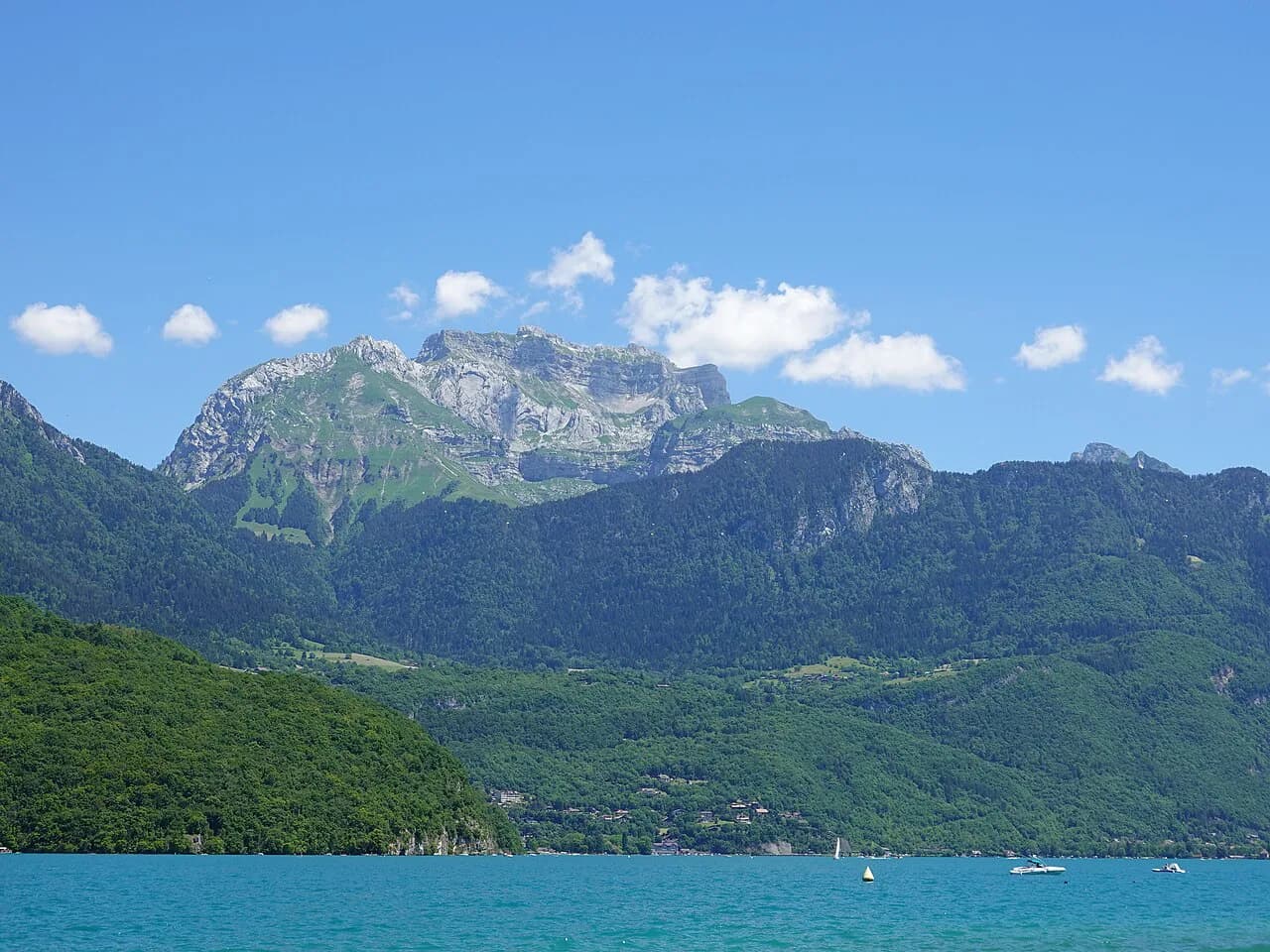
Below the pass, the Verthier route climbs in undergrowth, so the lake appears late, at the belvedere just short of the col. Above the pass, the views come sooner: the launch area, Pointe de la Rochette and Roux rock each give a clear line over the water.
The Talamarche route is the most varied, linking hamlets, chalets and two cols before the summit path. Much of it is on narrow singletrack, so the descent takes as long as the climb on tired legs.
Distance, ascent and time at a glance
Launch-area walk: 15 minutes up, 30 minutes round trip, minimal ascent. Pointe de la Rochette: 4 km (2.5 mi) round trip, 350 m (1,150 ft) of ascent, about 2 hours. Aulp-Rochette loop: 9.5 km (5.9 mi), about 4.5 hours. Talamarche: 16 km (10 mi), about 6 hours, out and back.
The Verthier climb from Doussard: 11 km (6.8 mi) round trip in around 4 hours on a medium route, with a harder 7.2 mi (11.6 km) and 5 to 5.5 hour rating on the other entry. Pick the longer figure if you climb slowly or stop often.
When to go: months, snow and afternoon weather
The pass sits above the lake and holds snow later than the shoreline, so spring hikes can meet old drifts on the upper stretches to Talamarche and the Col des Nantets. Late spring through early autumn gives the most reliable footing and the best paragliding displays.
Afternoon storms build over these summits in summer, so start the Talamarche route in the morning and be off the narrow summit path by early afternoon. In hot weather the shaded Verthier climb is the more comfortable choice.
Facilities at the pass and what to carry
At the pass you will find a refreshment bar at the Chalet de la Forclaz, plus picnic tables and toilets near the launch area. That makes it easy to travel light, but the Talamarche and Verthier routes have no reliable water on the way, so carry your own.
Take a map even though the main routes are signposted, because the hamlet network around the Nant has several junctions. Sturdy shoes are enough for the pass-based walks; the Talamarche summit path and the long Verthier descent justify boots and a wind layer.
Where to stay: Doussard, Verthier and the lake shore
Doussard and Verthier put the long climb from the lake on your doorstep and keep you close to the shore for rest days. Staying at the pass itself shortens every route and lets you start before the parking fills.
Menthon-Saint-Bernard on the lake shore is another base, with the pass reachable by road above it. If you are stringing together several days in the area, the wider hiking in Annecy guide covers how these bases connect.
Other hikes above the lake
The Cascade d'Angon and the Roc de Chère are nearby walking options with lake views, but they sit outside the pass itself and are better treated as separate outings. For a bigger day on the opposite side of the water, the Mont Veyrier Hike from Annecy gives a longer ridge walk above the shore. If you want a multi-day alpine objective rather than a lakeside day, the Mont Blanc hiking guide covers the classic stages and planning.
Hikers chasing the highest summit over the lake head for La Tournette instead, which is a far more demanding objective than anything based at the Col de la Forclaz.
Plan Your Col de la Forclaz Day
Choose the Verthier climb if you want a hard day from the lake shore, and base yourself at the pass if you want the Rochette or Aulp loop within easy reach of the car. The Talamarche route is the one to save for a full day with an early start and settled weather.
Whichever you pick, the pass puts you above the lake with the paragliders for company, and the short launch-area walk is a good warm-up or a fallback when cloud sits low on the summits.
Frequently Asked Questions
How long is the Col de la Forclaz hike from Doussard?
Count on around 11 km (6.8 mi) round trip and four hours of walking from Verthier near Doussard, or 5 to 5.5 hours if you follow the harder 7.2 mi (11.6 km) rating. It is a round trip, not a loop.
Where do you park for the Col de la Forclaz hike?
The parking lot at the top of the pass is the trailhead for the Rochette, Aulp and Talamarche routes. It fills on fine mornings, so arrive early for the full-day Talamarche walk; the Verthier climb starts down at the hamlet instead.
Is the Col de la Forclaz hike difficult?
The pass-based routes are moderate: Pointe de la Rochette is about two hours with 350 m (1,150 ft) of ascent, and the Aulp loop takes about 4.5 hours. The Verthier climb from the lake and the 16 km (10 mi) Talamarche route are hard days.
How long does the walk to Pointe de la Rochette take?
About 1 hour 15 minutes up and 45 minutes down, roughly two hours round trip for 4 km (2.5 mi) and 350 m (1,150 ft) of ascent. It is signposted from the parking lot and suits families who can manage a steady climb.
When is the best time to hike at Col de la Forclaz?
Late spring through early autumn gives the most reliable footing and the best paragliding displays, with late-lying snow possible on the higher stretches in early season. Start the Talamarche route in the morning to avoid summer afternoon storms.
Sources
Trail notes for your next trip
Optional updates when we add or revise hiking guides.
You might also like
Continue reading
More guides you'll find useful