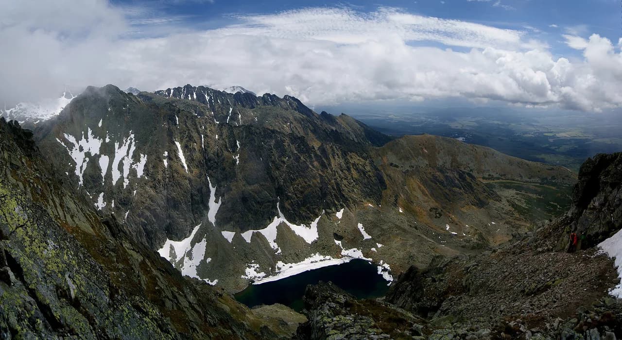
Easy Hikes in the High Tatras: Which Trails to Choose
Easy hikes in the High Tatras, from Morskie Oko to Popradské pleso: distances, ascent, walking times, lift access and when the high trails close for winter.
On this page
The High Tatras run for roughly 64 km (40 mi) along the Slovak-Polish border and hold over 600 km (373 mi) of marked trails, so a short easy day is a realistic plan rather than a compromise. Lakeside paths, forest valleys and lift-assisted ridges let you see the range's granite spires without committing to a full summit push. This guide groups eight low-effort routes by where you sleep, from Štrbské Pleso to Zakopane, and flags which ones keep working when the high trails shut.
Most of these walks sit between one and four hours, and the biggest single climb among the classics, Popradské pleso, gains only 326 m (1,070 ft) from Štrbské Pleso. Choose by base: Štrbské Pleso puts four of the Slovak routes on your doorstep, while Zakopane serves the Polish trailheads at Kuźnice and Palenica Białczańska. If you want the wider picture of stages, huts and connections, start with the hiking in high tatras overview before picking days. For a wider choice of routes once these short days feel too gentle, compare these with hiking in Tatra Mountains across the full range.
Why the High Tatras suit easy hiking days
The range is compact and densely waymarked, and the valleys funnel walkers toward lakes and huts rather than forcing them onto exposed ridges. That means an easy day here is not a flat stroll by default: many routes start with a steady forest climb and then open out. Judge each option by its total ascent rather than distance alone, because the Štrbské Pleso lake circuit covers 2.2 km (1.4 mi) with only 54 m (177 ft) of gain, while the walk to Zelené pleso Kežmarské from Kežmarská Biela voda covers 7.7 km (4.8 mi) with 650 m (2,133 ft) of climb.
Huts anchor most easy routes: Majláthova chata and the hotel at Popradské pleso, Murowaniec in Gąsienicowa Valley, and Chata pri Zelenom plese all give you a lunch stop and a reason to turn around. Trails to mountain huts generally stay open year-round, with Chata pod Rysmi the stated exception, so hut walks are your winter and shoulder-season standbys.
If you are new to the range, keep your first day on a valley floor or a lake shore, then add a short climb once you have a feel for the terrain and the afternoon cloud build-up. Walking poles help on the stony descents from the higher huts, and a paper map from a tourist information office complements the colour-coded signposts, which use Slovak names such as pleso for lake and dolina for valley.
How to read the trail colours and waymarks
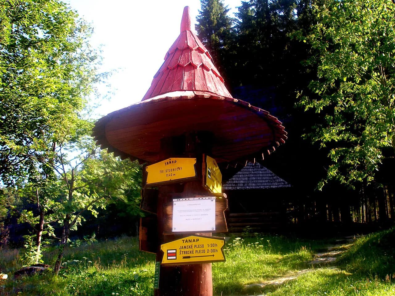
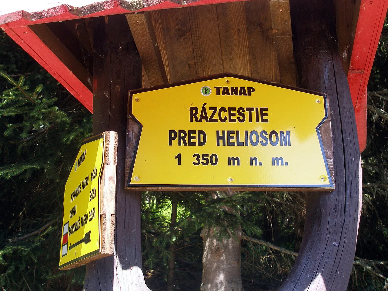
Slovak and Polish trails use painted colour routes with signposts at every junction giving destination names, walking times and altitudes. Follow the colour, not a trail number: junctions carry names like Nad Matliarmi, Šalviový pramen and Nizna Folvarska Polana on the way to Zelené pleso, and the signpost times are usually conservative.
Where a route forks, the colours often lead to the same hut by different lines, and choosing one up and another down is the best value you get from an easy day. On the Gąsienicowa Valley approach from Kuźnice, the yellow via Jaworzynka Valley and the blue over Boczań hill match each other in length and time, joining at Między Kopami Pass. Take one each way and you see two valleys for the price of one climb.
Štrbské Pleso lake circuit
The short walk around Štrbské pleso is the gentlest entry point in the range, covering 2.2 km (1.4 mi) with 54 m (177 ft) of ascent in half an hour to an hour. Information boards around the shore explain the local flora, and a boat lets you see the peaks from the middle of the lake. Come early morning or late afternoon to have the path more to yourself.
The lake sits at about 1,489 m (4,885 ft) beside the resort of the same name, which makes it a comfortable first afternoon after arriving rather than a destination in its own right. Use it to acclimatise and to check the signposts for your next day; the trailhead for the Popradské pleso route and the yellow route toward Skok waterfall both start from the village.
Popradské pleso from Štrbské Pleso
This is the classic easy half-day: 5.7 km (3.5 mi) each way with 326 m (1,070 ft) of climb, taking around 1 hour 40 minutes one way. Two lines run from Štrbské Pleso, an asphalt blue route suited to cyclists and prams, and a stonier red route that is the more scenic of the two. Walk the red up and the blue down if your knees prefer an even surface on the descent.
At the lake, Majláthova chata has only 16 beds and serves traditional Slovak food, while the larger hotel on the shore has 155 beds, a sauna and a restaurant open to non-residents. A 1.3 km (0.8 mi) path circles the lake in about half an hour, and a short yellow spur reaches the symbolic mountaineers' cemetery. The cemetery is open from 15 June to 1 November.
If you want a longer day with more height, continue on the blue route toward Velké Hincovo pleso and the saddle above it, which adds real climbing and a steeper return. Keep that extension for settled weather, since the upper section is exposed and slow in wet conditions.
Jamské pleso and the Tatranská Magistrála
The walk from Štrbské Pleso to Jamské pleso is 10.2 km (6.3 mi) with 359 m (1,178 ft) of gain, rated easy and taking three to four hours. The lake is a small tarn just over two-thirds of a hectare across, with shaded seating around the shore that makes it a natural picnic stop. The route forms part of the Tatranská Magistrála, the 71.9 km (44.7 mi) long-distance path that links the eastern and western ends of the range.
Because the trail is smooth and the gradients are gentle, this is one of the best options for families with young children or for a recovery day between harder outings. It also gives you a taste of the Magistrála without committing to a multi-day traverse; use the signposts to gauge how far along the through-route you want to walk before turning back.
Skok waterfall in Mlynická dolina
The out-and-back to Skok waterfall climbs the peaceful Mlynická valley from Štrbské Pleso on the yellow route, taking around 3.5 hours at an easy to moderate grade. Staying with the waterfall as your turnaround keeps it family-friendly; continuing over the Bystrá lávka saddle into Furkotská dolina turns it into a 16.5 km (10.3 mi) loop with 969 m (3,179 ft) of ascent and chains, so only add that if everyone is comfortable using hands on rock.
The full loop is graded hard and takes five and a half to eight hours, with poles useful on the descent. Check where your chosen line sits relative to the winter high-trail closure before planning it late or early in the season, because the section over the saddle is part of what shuts from 1 November to 15 June.
Zamkovský chalet from Hrebienok
Starting at Hrebienok above Starý Smokovec, the trail to Zamkovského chata runs 6 km (3.7 mi) with 461 m (1,512 ft) of gain in two and a half to three and a half hours, through pine forest and across streams with widening mountain views. The grade sits between easy and moderate, which makes it a good step up once the lake circuits feel too short. Hrebienok is lift-served from Starý Smokovec, so you can cut the climb to the trailhead itself.
For a second, shorter outing from the same area, the Nad Dlhým vodospadem interpretive trail covers 1.7 km (1.1 mi) with 122 m (400 ft) of climb in half an hour to an hour, passing Bilíkova chata and a waterfall. Information panels along the way introduce the range's animals, including brown bear, wolf and lynx, and children tend to enjoy the boulders near the falls.
Morskie Oko from Palenica Białczańska
On the Polish side, Morskie Oko is the signature easy walk: 10.3 km (6.4 mi) round trip with 567 m (1,860 ft) of gain, about 3 hours 20 minutes, mostly on a gently rising asphalt road with steeper forest shortcuts as alternatives. The lake sits at 1,395 m (4,577 ft), covers almost 35 hectares and reaches 51 m (167 ft) deep, with the Wodogrzmoty Mickiewicza waterfall on the way. The path is suitable for prams and wheelchairs, there are benches and toilets, and the hut by the lake serves food.
Allow an extra hour to walk around the lake, where the surface is a proper mountain dirt trail rather than asphalt. A forest shortcut saves distance but is steep and stony, so save it for the way down if you are with children. Swimming in the lake is forbidden.
The trailhead at Palenica Białczańska has a large car park that requires a space reserved in advance, bookable online or through the tourist information office in Zakopane. Minibuses run from the Zakopane bus station, marked for Łysa Polana, Morskie Oko or Palenica Białczańska, with tickets sold by the driver for cash. Road 960 to both Palenica Białczańska and Lysá Poľana jams regularly, so an early start or a weekday in September makes a real difference.
Gąsienicowa Valley from Kuźnice
From Kuźnice in Zakopane, the walk to Hala Gąsienicowa and the Murowaniec hut is 5 km (3.1 mi) with 593 m (1,946 ft) of gain, roughly 2 hours 20 minutes. The valley sits below Kościelec, the pointed peak locals nickname the Polish Matterhorn, but the route itself stays on well-marked paths with plenty of signposts. Add about half an hour to reach the lower station of the Gąsienicowa chairlift if you want to ride up toward Kasprowy Wierch.
Kuźnice is busy: it holds the lower station of the Kasprowy Wierch cable car and several trailheads, and the private car parks fill early. Arrive in the morning, or park near the John Paul II roundabout and walk up the Aleja Przewodników Tatrzańskich promenade. The Murowaniec hut kitchen is a highlight of the day, though expect a queue at peak lunch time.
Bielovodská dolina from Lysá Poľana
The White Water Valley is the quiet alternative: 9.2 km (5.7 mi) with 415 m (1,362 ft) of climb, about 2 hours 40 minutes, following the Bielovoda river on a wide, nearly flat path. It is the least crowded of the Polish valleys and works well with children. The first 3 km (1.9 mi) to Bielovodská poľana allow bikes, after which the route is on foot only, ending at the clearing of Poľana pod Vysokou at 1,303 m (4,275 ft).
Parking at Lysá Poľana uses the same advance reservation system as Morskie Oko, and the same road 960 traffic applies. In winter a barrier closes the route beyond Bielovodská poľana, so the valley remains a short there-and-back rather than a longer outing.
Zelené pleso and other lift-assisted days
The Green Lake route to Zelené pleso Kežmarské measures 7.7 km (4.8 mi) with 650 m (2,133 ft) of climb and takes around 3 hours 10 minutes from the Kežmarská Biela voda bus stop on the Cesta Slobody road, finishing at Chata pri Zelenom plese. It suits preschoolers and older children but not prams, and the forest path with bridges and benches is the reward.
Tatranská Lomnica is the base for lift-assisted days: a cable car climbs to Skalnaté Pleso, from where a red route heads toward Zelené pleso, and a second stage continues to Lomnický štít. Those lifts cut the ascent but not the exposure, and the descent into the Green Lake valley is steep with chains. Buy cable car tickets in advance and start early to avoid long queues; check the cable car company's own pages for operating dates, since these vary by season.
Distance, ascent and time at a glance
Short and flat: Štrbské pleso circuit 2.2 km (1.4 mi), 54 m (177 ft), 0.5 to 1 hour; Nad Dlhým vodospadem 1.7 km (1.1 mi), 122 m (400 ft), 0.5 to 1 hour. Short with a climb: Skok waterfall out-and-back about 3.5 hours; Gąsienicowa Valley 5 km (3.1 mi), 593 m (1,946 ft), about 2 hours 20 minutes.
Medium days: Popradské pleso 5.7 km (3.5 mi) one way, 326 m (1,070 ft), about 1 hour 40 minutes; Jamské pleso 10.2 km (6.3 mi), 359 m (1,178 ft), 3 to 4 hours; Morskie Oko 10.3 km (6.4 mi) round trip, 567 m (1,860 ft), about 3 hours 20 minutes; Bielovodská dolina 9.2 km (5.7 mi), 415 m (1,362 ft), about 2 hours 40 minutes; Zelené pleso 7.7 km (4.8 mi), 650 m (2,133 ft), around 3 hours 10 minutes. These figures come from the route guides, so treat signpost times as the on-the-ground check.
When to go and when the high trails close
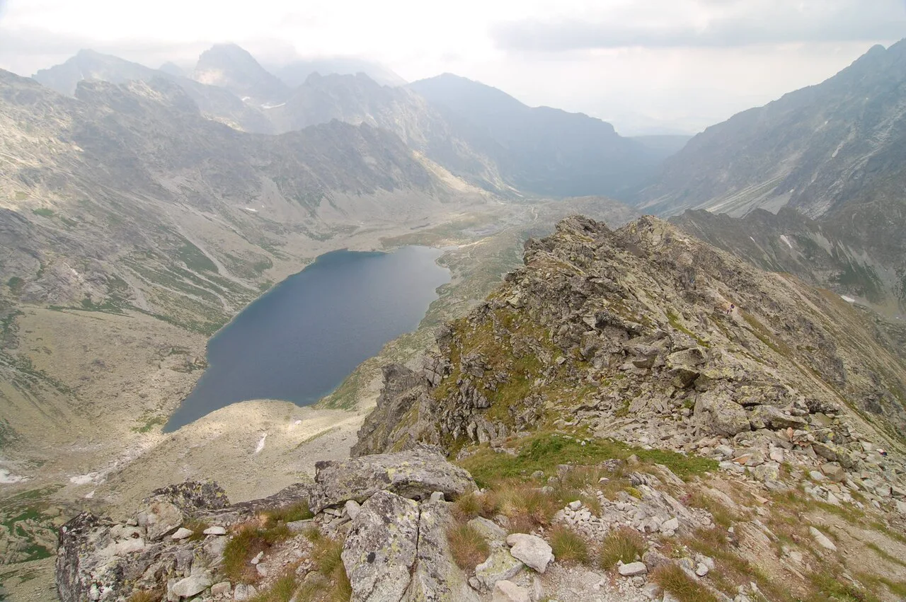
The reliable hiking window runs from mid-June to the end of October, and September into early October brings milder, drier weather and autumn colour with fewer people. Snow can linger on high ground into May or early June, so early-season plans belong in the valleys. August weekends are the busiest, particularly on the Slovak trails close to the resorts.
Tatra National Park closes its higher marked trails, saddles and peaks from 1 November to 15 June, which takes out Mount Rysy, Slavkovský štít and the high section of the Mlynická to Furkotská loop. Trails to mountain huts generally stay open year-round apart from the path to Chata pod Rysmi, so Popradské pleso, the Štrbské lake circuit and the valley walks remain usable in the closed months. Read the closure against your intended route before you commit to a winter or spring date.
Bears, weather and afternoon storms
The High Tatras hold brown bear, wolf and lynx, with conservationists counting 45 brown bears in the range, about 15 of them mostly on the Polish side. Make noise on wooded and lakeside trails, never leave food unattended at huts or picnic spots, and keep your distance if you do see an animal. Encounters are uncommon and the animals are shy.
Weather changes fast here, and a clear morning can turn to cloud and rain by mid-afternoon. On any route that gains height, plan to be descending by early afternoon, carry a shell and a warm layer, and turn back if the cloud drops onto the ridge. In winter and spring, ice and avalanche terrain affect the higher valleys even when the resort paths look clear.
Bases: Štrbské Pleso, Tatranská Lomnica, Zakopane and Poprad
Štrbské Pleso suits the lake circuit, Popradské pleso, Jamské pleso and Skok waterfall, all of which start from the village or its edges. Tatranská Lomnica serves the lifts to Skalnaté Pleso and Lomnický štít and the Green Lake route from Kežmarská Biela voda, while Starý Smokovec is the access point for Hrebienok and the Zamkovský chalet walk.
Zakopane covers the Polish trailheads at Kuźnice, Palenica Białczańska and Lysá Poľana, with minibuses and reserved parking as the two practical ways in. Poprad, 30 minutes' drive from the mountains, is a cheaper base if you have a car and do not mind the commute. Fly into Poprad or Kraków and rent a car if you want to move between trailheads freely, calling ahead to confirm cross-border use.
Where these hikes sit in a longer High Tatras itinerary
Three full days is a sensible minimum for the easy routes alone: one day of lakes from Štrbské Pleso, one lift-assisted ridge day, and one Polish valley day from Zakopane or Palenica Białczańska. If you want to extend beyond the range, Slovak Paradise National Park lies about an hour's drive away and offers gorge walks on ladders and walkways, a different style of day entirely. See the Slovak Paradise Hiking Guide for that alternative.
Within the range, build upward: start with the Štrbské circuit, add Popradské pleso, then take on Jamské pleso or the Green Lake route once your legs have adjusted. Keep the longer, higher options for settled weather and a full day, and leave one rest day between bigger outings if you are travelling with children or older walkers.
Plan Your Easy High Tatras Day
Pick your base first, then your route: Štrbské Pleso for four lake and valley walks from the door, Tatranská Lomnica or Starý Smokovec for lift-assisted days, and Zakopane for the Polish valleys. Match the day to the season, since the high trails shut from 1 November to 15 June while the hut and lake routes generally stay open. Reserve Palenica Białczańska or Lysá Poľana parking in advance and start early to beat the road 960 traffic.
Carry a map, a warm layer and enough water for a longer-than-planned day, and treat signpost times as realistic rather than generous. The reward for keeping it short is seeing the range's granite walls, tarns and huts without needing a summit-grade effort.
Frequently Asked Questions
What are the easiest hikes in the High Tatras?
The Štrbské Pleso lake circuit is the gentlest walk in the range, a 2.2 km (1.4 mi) loop with 54 m (177 ft) of gain that takes under an hour. The Nad Dlhým vodospadem interpretive trail is similarly short at 1.7 km (1.1 mi). If you want a lake with more of a walk, Popradské pleso gains 326 m (1,070 ft) over 5.7 km (3.5 mi) and Morskie Oko stays on a gently rising road.
Can you hike in the High Tatras in winter?
Yes, but only on the lower routes. Tatra National Park closes its higher marked trails, saddles and peaks from 1 November to 15 June, which includes Mount Rysy, Slavkovský štít and the high section of the Mlynická to Furkotská loop. Trails to mountain huts stay open through the winter apart from the path to Chata pod Rysmi, so lake and valley walks such as Popradské pleso and the Štrbské circuit remain an option.
Are there bears in the High Tatras?
Brown bears live in the range, with conservationists counting 45 in the High Tatras and about 15 of those mostly on the Polish side. Wolves and lynx are also present. Encounters are uncommon and the animals are shy; make noise on wooded and lakeside trails, keep food attended at huts and picnic spots, and keep your distance if you see one.
Which base suits easy hikes best?
Štrbské Pleso is the strongest base for low-effort days, with the lake circuit, Popradské pleso, Jamské pleso and Skok waterfall all starting from the village. Tatranská Lomnica and Starý Smokovec give you lift access for shorter climbs, and Zakopane puts the Polish trailheads at Kuźnice, Palenica Białczańska and Lysá Poľana within reach.
Sources
Trail notes for your next trip
Optional updates when we add or revise hiking guides.
You might also like
Continue reading
More guides you'll find useful