Levada dos Tornos: Madeira's Longest Levada Walk
Levada dos Tornos is Madeira's longest irrigation channel. Walk the Monte section from Choupana to Palheiro Ferreiro with distances, times and trailhead access.
On this page
The Levada dos Tornos is the longest irrigation channel on Madeira, carrying water from Boaventura across the island's green northern and central slopes. For hikers, its most practical outing is the Monte section above Funchal: an easy, largely level walk that trades summit views for constant glimpses of the bay, gardens and the channel itself.
It suits anyone who wants a half day on their feet without steep climbing, including families and hikers resting between bigger days on the island's peaks. The catch is logistics: the walk runs point to point, so you need transport at both ends rather than a loop back to the start.
What the Levada dos Tornos is and who the walk suits
A levada is a hand-dug water channel, and the Tornos is the longest of them all, beginning at Boaventura on the north coast and running across the island's interior. Its name comes from the twists and turns the channel makes as it contours around ridges and valleys, which is why the walking stays gentle almost throughout.
The Monte stretch above Funchal is graded easy and is only lightly frequented, so it delivers a quiet levada day without the crowds of the island's headline routes. Walkers who want big ascents and summit views should look instead at the ridge routes between Pico do Areeiro and Pico Ruivo, which are a very different proposition in effort and exposure.
Where the route starts and ends: Choupana to Palheiro Ferreiro
The Monte section is a point-to-point walk from Choupana, a hamlet on the hillside above Funchal, to Palheiro Ferreiro on the eastern edge of the city's upper suburbs. That one-way layout is the key planning fact: you start high on the western side and finish on the eastern side, with no path looping you back.
The original start sat at Babosas in Monte beside the cable car station, but that opening section is interrupted, so Choupana is the working alternative trailhead for now. Plan your day around a drop-off at Choupana and a pick-up at Palheiro Ferreiro rather than expecting to walk out and back from the same car park.
Trailhead access: getting to Choupana and back from Palheiro Ferreiro
Choupana sits on the road that climbs from Funchal past the Monte district, and the simplest approach is a taxi or pre-booked transfer from the city to the trailhead. Palheiro Ferreiro is a residential area on the upper edge of Funchal, so arrange your return lift before you set off, or have the driver meet you at the finish.
Local buses run on the Funchal hillside roads, but routes and timetables change often enough that the useful move is to confirm the current service on the day. If you would rather not solve the transport yourself, guided versions of the Tornos walk include pickup from Funchal and handle the logistics in both directions.
Distance, ascent and time
The Choupana to Palheiro Ferreiro section measures 4.70 km (about 2.9 miles) one way, with a typical walking time of 1 hour 45 minutes. Cumulative ascent is just 34 m (about 110 ft) and descent 39 m (roughly 130 ft), which tells you almost all of the height is lost gently rather than climbed.
The route's high point is 604 m (about 1,980 ft) and its low point 591 m (about 1,940 ft), so the channel contours along the hillside at an almost constant altitude. Add time for the tea house stop and photo pauses; a relaxed half day covers it comfortably.
Route description: Choupana, the levada path and the Funchal bay views
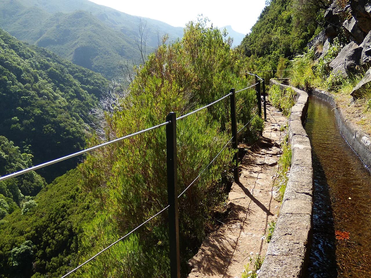
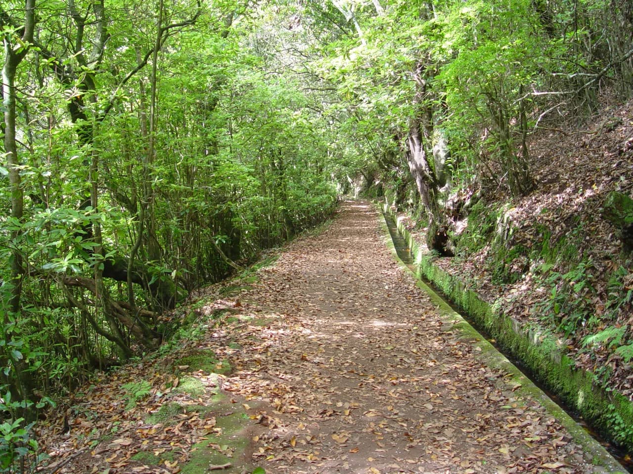
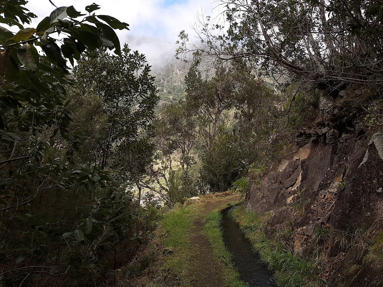
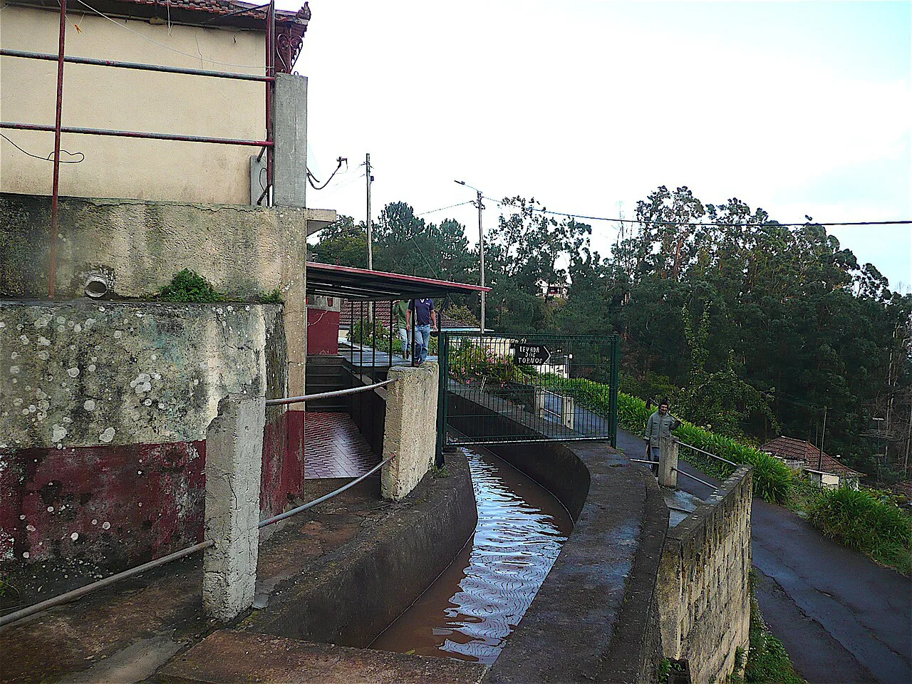
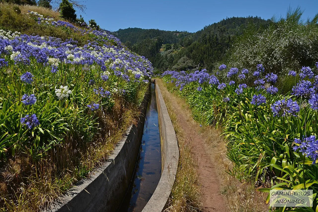
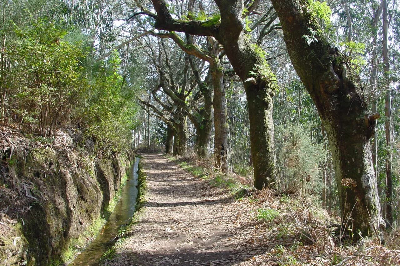
From Choupana the path runs beside the channel through a mix of endemic flora, smallholdings and laurel-style woodland, with the water itself as your constant guide. Because the levada contours, the walking is steady and the navigation simple: follow the channel and its maintenance path rather than striking uphill.
Repeatedly the trees open onto views over Funchal bay, giving a full sweep of the city's dense white housing against the deep blue Atlantic. Near the Palheiro Ferreiro end the perspective changes, and you look back on Funchal from a different angle than at the start.
Watch your footing on the narrow stretches where the channel edge drops away, and keep an eye out for damp, slippery stone after rain. Madeira's weather turns quickly on these hillsides, so a light waterproof belongs in the pack even on a morning that starts clear.
The tea house and gardens at the trail's end
Near the Palheiro Ferreiro end of the walk, a tea house and its gardens make a natural finish, with hydrangeas and flowering borders brightening the last stretch. It is a real stop rather than a passing attraction, so build in time for a drink before your transport arrives.
Flora, fauna and the levada channel itself
The Tornos waters farmland and woodland the whole way, and the path beside it passes a rich mix of endemic plants, birds and the small terraced plots that still depend on the channel. Walking the levada is as much a lesson in how Madeira moves water as it is a hike, and the channel crossings and small bridges keep the route varied.
When to go
The Monte section is walkable year-round, and because it sits around 600 m (roughly 1,970 ft) it avoids both the coldest upland air and the full heat of the coast. Spring and early summer bring the gardens and roadside flowers into their best condition, while autumn offers quieter paths and softer light over the bay.
Winter rain can leave the channel path slick and cloud can hide the bay views entirely, so pick a settled day rather than a fixed date. Morning starts give the best chance of clear views before cloud builds on the hillside.
Trail reservation on Madeira's PR trails
Some of Madeira's official PR trails now require a paid online reservation through the island's SIMplifica platform, and the rule is enforced at the trailhead rather than left to chance. Check whether your chosen route is on the reserved list before you travel, and book your slot through the platform if it is.
Certified operators handle the reservation for their groups as part of the booking, which removes one piece of admin from a guided day. Self-guided walkers on the Tornos simply arrange their own slot if the route requires one.
Longer and shorter variations along the Tornos
The Tornos runs all the way from Boaventura, so the Monte section is a short window onto a much longer channel. Near Boaventura, the Lombo do Urzal to Madre da Levada dos Tornos route is a 3.2-mile (about 5 km) out-and-back graded moderately challenging, a different day out with more climbing than the Funchal-side walk.
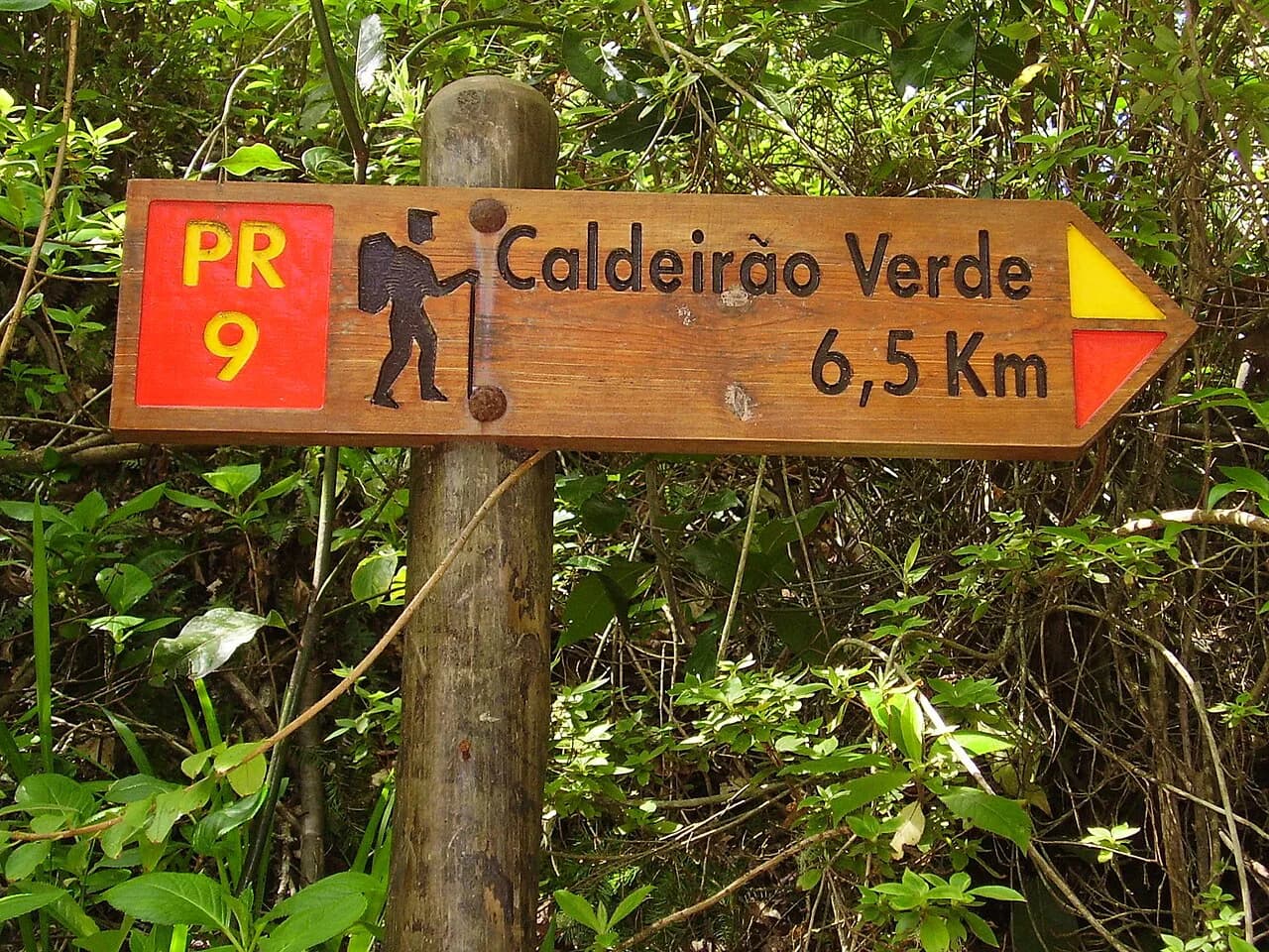
Hikers building a levada itinerary often pair the Tornos with a wetter, more enclosed route such as Levada do Caldeirão Verde, where the channel leads into laurisilva and a waterfall-fed gorge. The Tornos is the gentler, more open of the two, and works well as a recovery day between steeper outings. If you are weighing up island bases for a walking trip more broadly, hiking in Tenerife offers the same decision between valley routes and summit trails.
What to wear and carry
Sturdy shoes with grip matter more than boots on this route, because wet stone beside the channel is the main hazard. Carry water, a light rain shell and sun protection; the path is exposed in places where the trees thin out, and the tea house near the finish makes a natural refreshment stop.
Where to stay for this walk
Funchal is the obvious base: it puts you close to the Choupana trailhead and to Palheiro Ferreiro for the pickup, and it gives you the widest choice of places to stay and eat. Staying in Monte or on the hillside above the city shortens the morning transfer, while a coast-side hotel in Funchal keeps the evenings easy.
Walking the Levada dos Tornos with a dog
Madeira's levadas are working irrigation channels, and many of the paths that follow them run as narrow, engineered shelves cut into the hillside — consider what that means before you set out with a dog on the Levada dos Tornos. The Choupana to Palheiro Ferreiro stretch is a point-to-point route of 4.70 km, easy in grade, with 34 m of accumulated ascent, 39 m of descent and a maximum altitude of 591 m, and it is described as pouco frequentada, or little frequented. A quieter trail is welcome for a reactive or nervous animal, but a quiet trail also means fewer people to help if something goes wrong. Where the path passes close to the channel itself, keep the lead short and the dog on the uphill side.
Because the walk ends at Palheiro Ferreiro rather than looping back to Choupana, plan the dog's transport as carefully as your own. The route is point-to-point and finishes in the Palheiro Ferreiro area; walk it in the direction that leaves you with the easier onward journey. Note that the traditional start at the Babosas in Monte, beside the teleférico, has been affected by interruptions at the beginning of the path, and an alternative temporary start in the Zona da Choupana is proposed instead — so arrive at the trailhead you have actually planned for, not the one on older maps.
On timing, the levada sits in a landscape where the walk is paired with a famous tea house and gardens near the end, so water and shade for the dog matter more than distance. If you would rather have logistics handled for you, guided Levada dos Tornos walks are booked through an operator that manages the required IFCN/SIMplifica trail reservation for the group, so you never book or pay for it separately. The same operator offers free cancellation up to 48 hours before and a WhatsApp line every day from 8am to 9pm. Ask directly whether dogs can join a guided departure before booking.
Plan Your Visit
The Levada dos Tornos Monte section is the island's easiest introduction to a levada: 4.70 km (about 2.9 miles), 1 hour 45 minutes, and barely 40 m (around 130 ft) of height change in either direction. Treat it as a one-way half day from Choupana to Palheiro Ferreiro, with transport booked at both ends.
If you want a full day on the channel, the guided version includes Funchal pickup and handles the SIMplifica reservation for you. Either way, walk it on a settled morning, watch the wet stone beside the water, and leave time for the gardens at the finish.
Frequently Asked Questions
How long is the Levada dos Tornos walk?
The Monte section from Choupana to Palheiro Ferreiro is 4.70 km (about 2.9 miles) point to point, with a typical walking time of 1 hour 45 minutes. The full levada is far longer, beginning at Boaventura, and walkers only cover a section of it in a day.
Where does the Levada dos Tornos start and finish?
The walkable Monte section starts at Choupana and finishes at Palheiro Ferreiro above Funchal. The original start at Babosas beside the Monte cable car is interrupted, so Choupana is the practical trailhead, and you arrange transport at both ends.
Can you walk the Levada dos Tornos without a guide?
Yes. The route follows the channel on an easy, well-defined path with little climbing, so self-guided walkers can manage it with a map and a plan for transport. A guided version with pickup from Funchal exists for anyone who prefers the logistics handled.
Do you need to book the Levada dos Tornos trail?
Some Madeira PR trails require a paid online reservation through the SIMplifica platform, so check whether your route is on the reserved list before setting out. Guided operators handle the reservation for their groups as part of the booking.
Is the Levada dos Tornos walk easy?
Yes, the Monte section is graded easy, with only 34 m (about 110 ft) of cumulative ascent and 39 m (about 130 ft) of descent over 4.70 km. The main thing to watch is slippery stone beside the channel after rain.
When is the best time to walk the Levada dos Tornos?
The route is open year-round at around 600 m (about 1,970 ft), which keeps it cooler than the coast in summer and milder than the uplands in winter. Spring and early summer are the liveliest for flowers, and settled mornings give the clearest bay views.
Sources
Trail notes for your next trip
Optional updates when we add or revise hiking guides.
You might also like
Continue reading
More guides you'll find useful