Oeschinensee Hike in Kandersteg: Cable Car or Route?
Plan the Oeschinensee hike from Kandersteg: cable car access to the trailhead, the shoreline walk, steeper mountain paths and the best months to go.
On this page
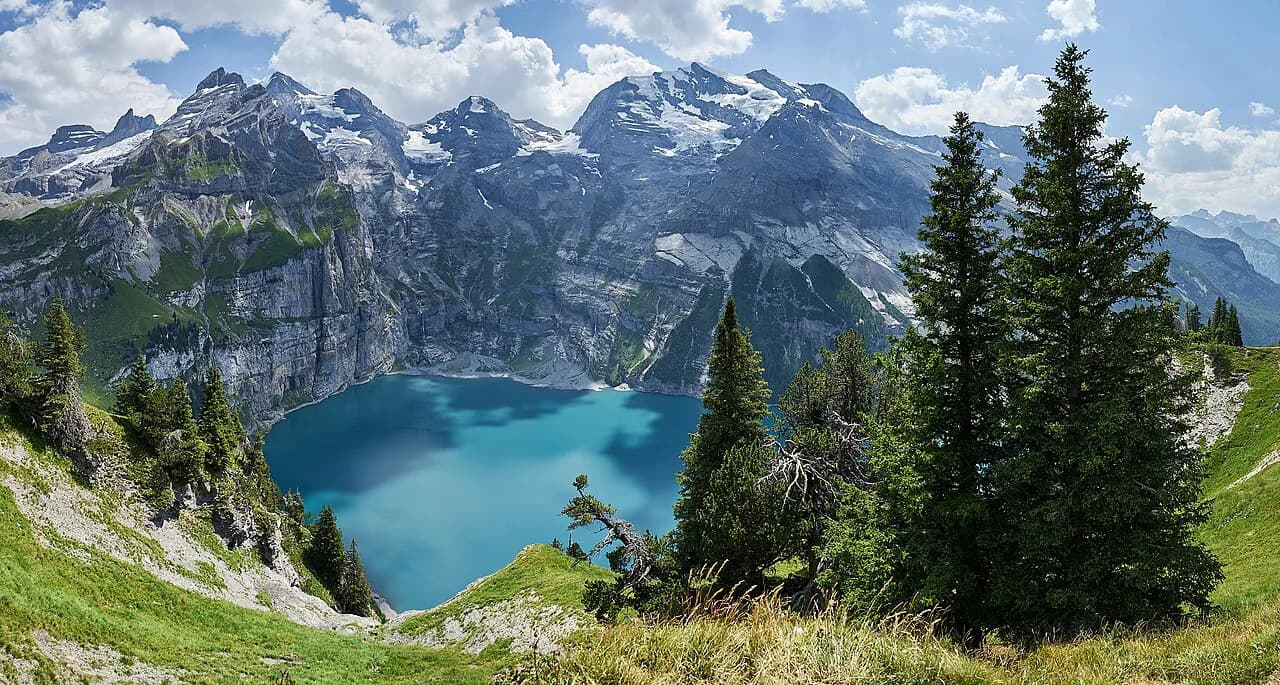
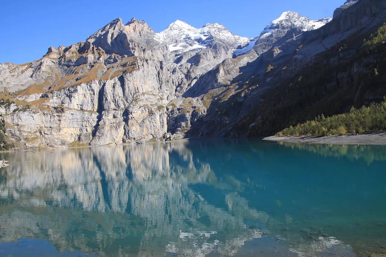
The Oeschinensee basin sits in a bowl of cliffs and scree above Kandersteg, holding a cold blue lake that has become one of the most photographed corners of the Bernese Oberland. The hike suits a wide range of walkers: a short descent to the shore, an easy circuit of the water and, for those with mountain boots and more hours, steep paths up to the pastures that ring the basin.
Half the planning is deciding how much climbing you want. The cable car cuts out the valley ascent and puts you at the trailhead within minutes, while walking up from Kandersteg turns the day into a full climb and descent on foot. If you are weighing this lift-assisted start against other trailheads in the region, hiking in Lauterbrunnen offers a useful comparison of valley ascents and high routes.
What the Oeschinensee hike offers
Three distinct days are possible from the same cable car station. A gentle shoreline walk loops around the lake and back, a higher panorama path contours along the slope above the water, and the steep mountain trail toward Läger, Heuberg and Oberbärgli climbs into rough pasture terrain.
The basin setting is what makes the hike memorable: cliffs on three sides, snow patches that linger into summer and water that stays startlingly clear. Pick the shoreline loop if you are hiking with children or want a half day, and the higher paths if you have boots, experience and a full day.
For a wider set of options in the valley, including lifts and longer routes, the hiking in Kandersteg covers the rest of the area.
Getting to Kandersteg and the cable car station
Kandersteg sits on the main rail line through the Lötschberg, so arriving by train is straightforward and drops you in the village centre. From there the Oeschinensee cable car station is a short walk or local bus ride at the edge of the village, signed from the station area.
Drivers reach Kandersteg on the road from Frutigen and park in the village or at the cable car car park, which fills on sunny summer weekends and public holidays. Arriving before mid-morning gives you the best chance of a space and a quiet start on the trail.
Cable car season, hours and the last descent
The Oeschinensee cable car runs daily from 8:30 a.m. to 5:00 p.m., with the last descent back to Kandersteg also at 5:00 p.m. Plan your route so you are back at the top station well before that final cabin, especially if you add the panorama path or the climb to Oberbärgli.
The lift runs to a seasonal timetable, so the daily window can differ outside high summer. Check the operator's page for the day you plan to travel, and remember that ticket prices are set by the operator rather than by the trail.
Hiking up from Kandersteg without the lift
You can walk from Kandersteg to Oeschinensee on foot, following the signed valley trail from the village up through forest to the top station and then continuing to the shore. It turns a half-day outing into a full one, with a steady climb on the way up and a long knee-friendly descent at the end.
The valley trail is the better choice in autumn, when the cable car schedule shortens and the forest is at its best, or for hikers who want a genuine all-day ascent rather than a lift-assisted start.
From the top station to the shore
At the top station the path descends across open alps to the lake, with the water appearing below you as you walk. The gradient down is easy, which means an uphill return at the end of the day, so leave enough time and energy to climb back to the cable car.
A mountain restaurant with self-service operates on the lakeshore daily from 9:00 a.m. to 5:00 p.m., and a café-bar on the shore is listed as open for meals, snacks and drinks. Treat both as your food and water plan for the day.
The lake circuit
The shoreline circuit is the standard introduction to the basin: you walk down from the top station, follow the water's edge and return by the same or a parallel path, generally taking a couple of hours at an easy pace. The surface is a mix of gravel and dirt path, worn and busy in the middle of the day.
Hikers who combine the shoreline with the higher path back to the gondola station describe a loop of around three hours twenty minutes, which is a realistic figure for a fit walker who stops for photographs.
There is no exposure on the lakeside path, so it suits families and casual walkers, but it is not a flat promenade: expect short ups and downs and some uneven ground.
The panorama trail above the lake
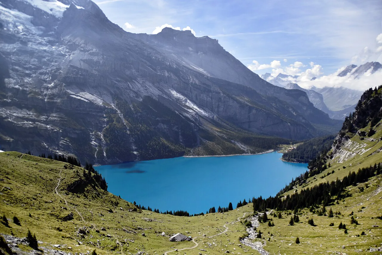
The higher path leaves the shore and traverses the slope above the lake, giving the view that most photographs of Oeschinensee are taken from. It is the best choice for hikers who want the classic outlook without committing to steep, rough ground.
The full Oeschinensee panorama trail adds height and time to the shoreline walk, so start earlier and treat it as a half to full day rather than an hour's stroll.
The Huble Mountain Trail is currently closed as a construction zone with no through route, so plan your loop on the shoreline and panorama paths instead.
Steeper options: Läger, Heuberg and Oberbärgli
The mountain trail toward Läger, Heuberg and Oberbärgli climbs above the lake on rough ground, taking roughly 1 hour 15 minutes for the section Oeschinensee describes. Proper hiking boots and mountain experience are recommended, and the terrain is steeper and looser than the lakeside paths.
Choose this route if you want altitude, quiet and a view down onto the lake rather than a shoreline stroll. Snow can linger on the upper sections into early summer, and afternoon thunderstorms build quickly over the peaks, so an early start matters.
The rockfall zone above the shore
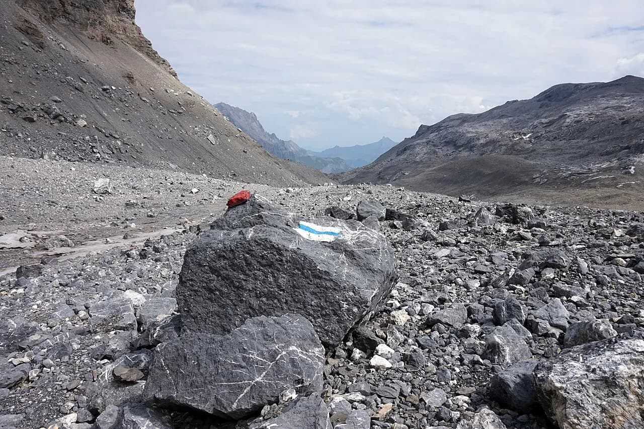
Part of the shoreline area lies in a signed rockfall danger zone, and Oeschinensee's instruction is clear: observe the barriers and do not stop beneath the slopes. Route your walk on the marked path and keep moving through the section rather than picnicking under the cliffs. Check current conditions with the cable car company before setting out.
This is not a reason to skip the lake, but it does mean the shore path should be followed as signed rather than improvised onto the scree below the walls.
Distance, ascent and time at a glance
Treat the three routes separately when you plan the day. The shoreline walk is the shortest and easiest, the panorama path adds height and time above the water, and the Läger–Heuberg–Oberbärgli trail is the demanding option with rougher ground and a longer climb.
Published figures for the loop vary with the exact line taken, with one hiker's account putting the combined lake and panorama loop at about three hours twenty minutes. Use that as a planning number for a fit party and add time for stops, photographs and the climb back to the lift.
Food and water on the hike
The self-service restaurant on the lakeshore runs daily from 9:00 a.m. to 5:00 p.m., and the shore café-bar is listed as open for meals, snacks and drinks. Its closing time matches the last cable car descent, so it is a lunch stop rather than an evening one.
Carry your own water for the higher trails, since the mountain path toward Oberbärgli has no facilities on the way. Fill bottles at the top station before descending to the lake.
When to go: month by month
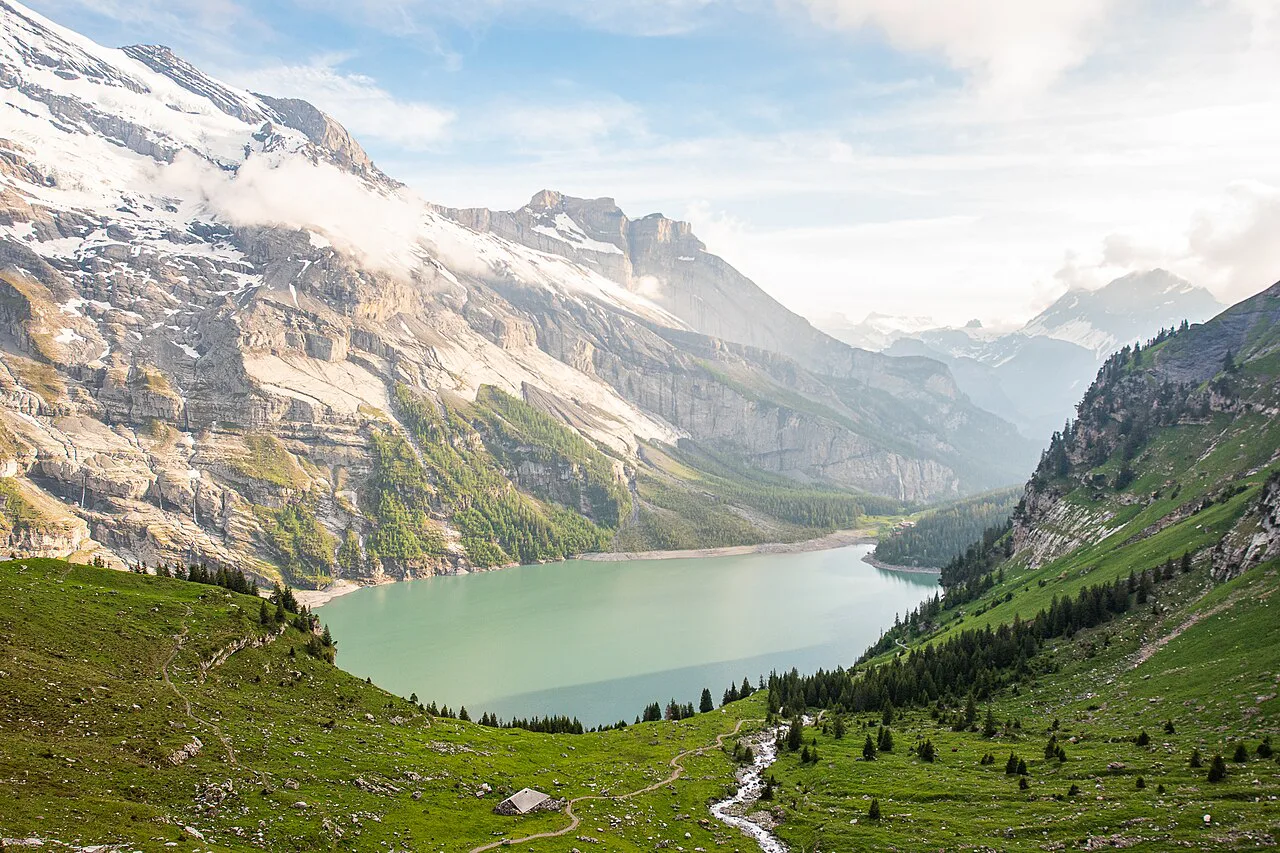
High summer is the busiest and most reliable window, with the cable car running its full daily timetable and the mountain trail open. Late spring and early autumn are quieter and often clearer, but snow can lie on the upper paths and the lift may run a reduced schedule.
Autumn brings golden larch on the slopes and cooler walking, but the days shorten quickly and the last descent still governs your timing. In any month, start early enough to be off the exposed ground before the afternoon build-up.
Swimming, weather and afternoon storms
The lake is cold even in August, fed by snowmelt and glacial water, so swimming is a short plunge rather than a comfortable swim. The basin heats up quickly on summer afternoons and thunderstorms can form over the surrounding peaks with little warning.
Plan to be back at the top station or on the valley trail by early afternoon when storms are forecast, and carry a shell jacket even on a sunny morning.
Where to stay in Kandersteg
Staying in Kandersteg village puts you within walking distance of the cable car station and the valley trailhead, which matters if you want the first cabin or a full on-foot ascent. Village hotels and guesthouses cluster around the rail station and along the main street.
An overnight stay also lets you pair the lake with a second day in the valley, such as the Gemmi Pass Hike from Kandersteg up to the pass and its high plateau.
Other hikes in the Kandersteg valley
Beyond the lake, the valley has a via ferrata for climbers with the right kit and a guide, adding a vertical day to a hiking trip. The Kandersteg via ferrata is a separate undertaking from the lake paths and needs its own planning.
The Gemmi Pass route climbs from Kandersteg to a high pass with long views, and hikers often combine it with a night at a mountain guesthouse. It lies outside the Oeschinensee basin, so treat it as a second day rather than an extension of the lake walk.
Plan Your Oeschinensee Day
Decide first which hike you are doing: the shoreline circuit for an easy half day, the panorama path for the classic view, or the steep mountain trail for altitude and quiet. Then fix your lift times around the last descent at 5:00 p.m. and build the day backwards from there.
Hikers who want the full climb can walk up from Kandersteg and skip the cable car entirely, while those with a second day in the valley can add the Gemmi Pass or the via ferrata. Either way, boots and an early start make the basin far more rewarding.
Frequently Asked Questions
Can you hike to Oeschinensee without taking the cable car?
Yes. A signed valley trail climbs from Kandersteg through forest to the top station and continues down to the shore, turning a half-day lift-assisted outing into a full day on foot. The climb is steady on the way up and long on the descent, so allow more hours than the shoreline walk alone.
How long is the walk around Oeschinensee?
The shoreline circuit on its own generally takes a couple of hours at an easy pace. Hikers who combine the lakeside path with the higher panorama route back to the gondola station report a loop of around three and a half hours, so add time for stops and the return climb to the lift.
How hard is the Oeschinensee hike?
The lakeside path has no exposure and suits families and casual walkers, though the surface is uneven in places. The mountain trail toward Läger, Heuberg and Oberbärgli is a different proposition, with rough, steeper ground where proper hiking boots and mountain experience are recommended.
Can you swim in Oeschinensee?
The lake is fed by snowmelt and stays cold even in August, so a swim is a brief plunge rather than a comfortable one. Afternoon storms build quickly over the surrounding peaks in summer, so plan any time on or in the water for the morning.
When is the best time to hike to Oeschinensee?
High summer offers the fullest cable car timetable and open mountain trails, while late spring and early autumn are quieter but can leave snow on the upper paths. In any month, start early and plan the day around the 5:00 p.m. last descent to Kandersteg.
Sources
Trail notes for your next trip
Optional updates when we add or revise hiking guides.
You might also like
Continue reading
More guides you'll find useful