Oeschinensee Panorama Trail: Route, Distance and Difficulty
Plan the Oeschinensee Panorama Trail from Kandersteg: gondola access, distance, ascent, walking time, exposed sections and the lakeshore return.
On this page
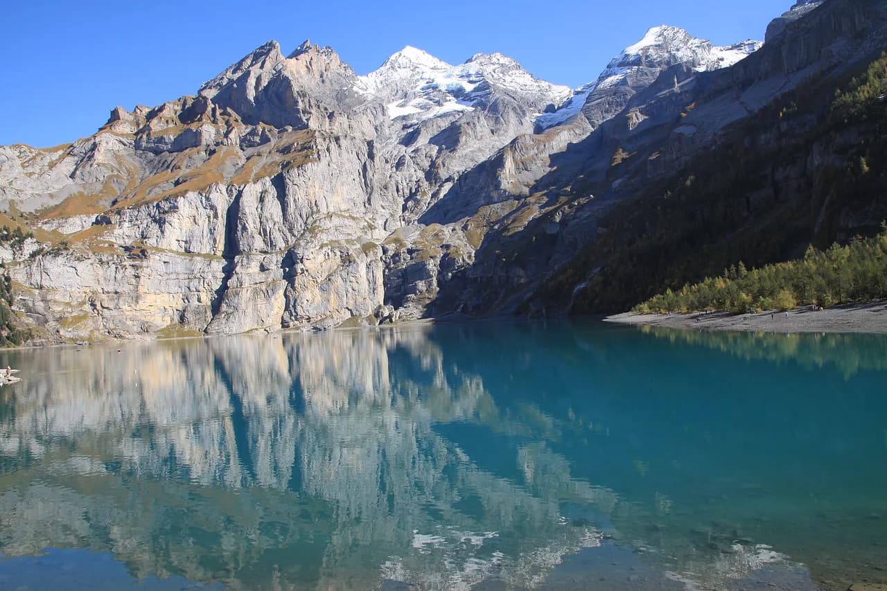
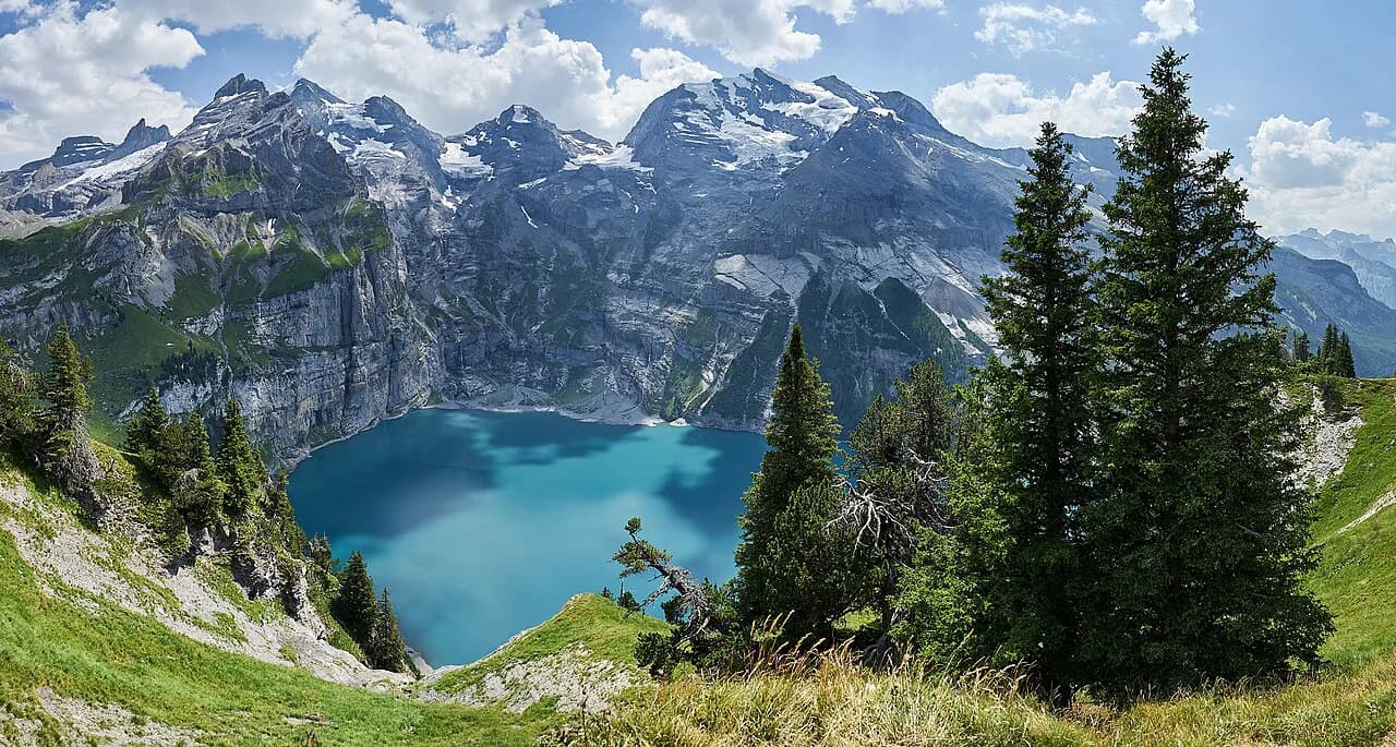
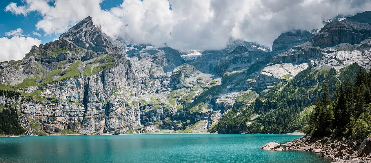
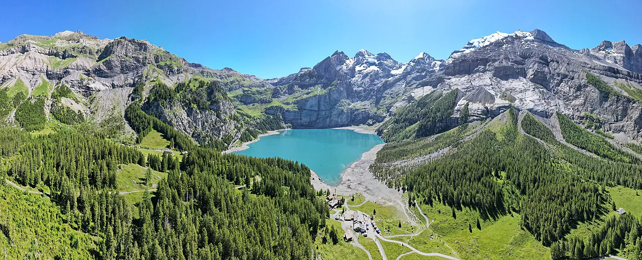
The Oeschinensee Panorama Trail is the high line above Lake Oeschinen, a milky-turquoise lake pinned under the Blümlisalp massif in the Bernese Oberland. It suits hikers with steady footing and hill fitness who want the lake seen from above rather than from its shore, and who are happy to climb steadily for an hour or two before the reward.
The shape of the day is simple: ride the gondola up from Kandersteg, gain height on the mountain path toward Heuberg and Oberbärgli, then descend to the lakeshore and walk the flat shore path back to the top station. That one-way logic matters, because it means the climbing comes first and the easy lakeside strolling comes last. If you want the gentler version, read this alongside the shorter Oeschinensee hike, which covers the direct walk to the water.
What the Panorama Trail offers and who it suits
The appeal is the elevated view: the lake below, the waterfalls feeding it, and the Blümlisalp walls across the water. Because the route starts at the gondola top station, you bank most of the vertical gain in the lift and spend your legs on the scenic balcony instead. If you like this balcony-style walking, the Lauterbrunnen hiking guide shows similar terrace and valley-edge routes one valley over.
This is not a stroll. Oeschinensee classes the Heuberg route as a mountain hiking trail for experienced hikers with very good stamina and a head for heights, and describes the path as narrow and exposed in places. If you want a family-friendly day with a picnic and a rowing boat, the flat walk to the shore is the better pick; if you want a half-day hill effort with big views, take the panorama line.
It fits comfortably into a single day from Kandersteg with time left for the lakeshore, a drink at the mountain restaurant, or the mountain coaster by the top station. Hikers with a full day and a taste for bigger objectives can use the same trailhead as a springboard into the wider hiking in Kandersteg, including the higher huts and passes above the valley.
Trailhead and gondola access from Kandersteg
The trailhead is the Oeschinensee gondola top station above Kandersteg. You reach the valley station from the village by foot or local transport, and the lift runs daily from 8:30 a.m. to 5:00 p.m.; check the operating status page before you travel, since lifts go down for maintenance.
Book a gondola ticket with a boarding pass online and your ascent comes with a time slot; a rail or third-party ticket alone does not include one, and on busy days the on-site slots sell out. Arriving before 9:00 a.m. or after 1:00 p.m. gives the best chance of a slot for a mountain trip, and a parking space cannot be reserved without a gondola ticket, so public transport is the simpler choice.
Downhill tickets need no time slot, and once you have ascended you can buy a discounted connecting ticket at the machine on the mountain. That makes the classic day flexible: ride up, walk the panorama route, and decide at the lake whether to ride down or walk.
Distance, ascent and walking time
The lift operator publishes route descriptions and status labels for the panorama and Heuberg paths but no distance or ascent figures for the loop. The working numbers come from AllTrails, whose Lake Oeschinen to Oberbärgli loop measures 4.7 mi (7.6 km) with 1,420 ft (430 m) of elevation gain and a walking time of about 3 to 3.5 hours.
Treat those figures as the plan, not a promise. The loop counts the descent to the lakeshore and the return along the water, so a walk that finishes at the restaurant rather than the top station is slightly shorter, while time spent at Oberbärgli for photos or lunch adds on top.
If you skip the gondola, the lower station to lake trail climbs about 450 m (1,475 ft) and takes roughly 90 minutes on a challenging path where hiking boots are recommended and strollers are out. That is the honest alternative: more climbing, no ticket, and you join the panorama route partway up.
Route description: mountain station to the high viewpoints
From the top station, take the mountain hiking trail signposted for Läger, Heuberg and Oberbärgli rather than the wide gravel path straight to the lake. The route leaves the station area on a climbing path, opening views back over the Kandertal valley before the lake comes into sight below you.
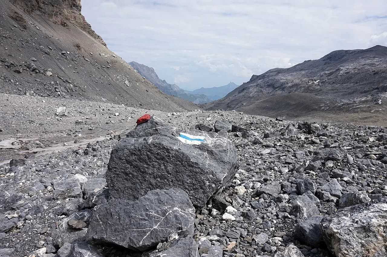
The Läger to Heuberg to Oberbärgli leg is given as about 1 hour 15 minutes and calls for proper boots and mountain hiking experience. The path is narrow and traverses open slopes above the water, which is where the head-for-heights element comes in: the drop is real, the trail is not fenced, and wet or loose ground needs attention.
Keep an eye on the sky on this leg. Afternoon storms build quickly in the Bernese Oberland, and the Oberbärgli plateau offers little shelter, so an early start is worth more here than on a forest trail.
Route description: Oberbärgli and the descent to the lakeshore
Oberbärgli is the high point of the circuit and the natural lunch stop, with the lake laid out below and the Blümlisalp ice walls behind it. From here the path swings down toward the water, meeting the lakeshore trails near the mountain restaurant and the boat landing.
If you want more, the mountain trail from Oberbärgli on to the Hohtürli takes about 2 hours 20 minutes and is rated challenging, requiring proper gear. That continuation leads to the Blüemlisalphütte and over toward Kiental, so only take it if a hut night or a long day is already in your plan.
Hikers aiming at the SAC huts should read the local route notes carefully: the Fründenhütte sits at 2,562 m (8,405 ft) and its alpine approach via Underbärgli is a separate, harder route that opens around June and involves secured ground and via ferrata equipment for some parties. Do not fold it into the panorama loop by accident.
Exposure, scrambling and hazards on the high section
The Heuberg stretch is a mountain hiking trail, not a walking path: narrow, sometimes exposed, and secured with ropes or chains only at the trickiest passages. Sure footing and a head for heights are the entry ticket, and hiking poles help on the loose downhill sections.
Rockfall is a genuine concern after rain and sharp day-night temperature swings, and the more exposed the trail, the higher the risk; move through such stretches briskly rather than stopping for photos. Cell service is patchy in parts of the area, so carry a charged phone with emergency numbers stored.
The area also holds venomous snakes, so stay on the trail and keep dogs on a short leash. Oeschinensee asks hikers to report incidents to the ranger and to call emergency services on 1414 for injuries.
Return along the lake and the lakeshore path
Back at the water, the return is the easy part. The shore path along Lake Oeschinen takes about 10 minutes between its nearest points on wide, stroller-suitable ground, and the walk from the lake up to the top station is roughly 25 minutes on an easy path.
The panorama walk from the top station to the lake is the other gentle option, about 35 minutes with alpine meadows and a viewpoint over the water. Combined with the shore path it makes a flat, scenic finish to the high loop, or a stand-alone outing for a rest day.
At the lake you will find a mountain restaurant and a café-bar by the shore, fireplaces where you can grill if you buy wood locally or bring your own, and rowing boats for a different view of the walls.
The Spitze Stei restricted zone
A large section of the southeastern shore of Lake Oeschinen is a restricted area designated by the Canton of Bern, and access is strictly prohibited. Oeschinensee marks it as life-threatening and asks hikers to warn anyone heading in and to call the ranger. Plan your lakeshore wandering on the open northern and western shore.
This is a hard rule rather than a caution, and it changes how you read the map: the shore path does not go all the way around, so do not count on a full circumnavigation of the lake when timing your return to the gondola.
When to go: season and best months
The gondola and the walking trails operate through the summer season, and Oeschinensee posts current open and closed status for each route, including construction closures such as the Huble mountain trail. Read that status page the day before you go, because a closed connector can change which loop works.
The high panorama path is best once the snow has gone from the Oberbärgli slopes, typically from midsummer into early autumn, when the alpine meadows are clear and the days are long. The Fründenhütte approach opens around June, a useful marker for when the higher ground becomes walkable.
Autumn brings crisp air and fewer crowds on the Heuberg leg, but shorter days mean you should start early enough to be off the exposed section before the afternoon weather turns.
Lifts, ticketing and time slots
Ascents on the Kandersteg to Oeschinensee gondola require a time-slot reservation during the summer season through November 8, 2026, even if you already hold a valid ticket from another seller. Book the slot in the Oeschinensee ticket shop, where the boarding pass is issued with your gondola ticket, and reschedule free of charge if plans change.
Tickets bought elsewhere can only be exchanged in person at the information center at the valley station, so buying direct keeps things simple. A parking ticket can be added to a gondola booking, but reservable spaces are limited and no space is held without a lift ticket.
Prices and exact departure intervals are published in the ticket shop and timetable pages, so confirm the current fare when you book rather than budgeting from secondhand figures.
Huts and food on the route
Food is straightforward: the mountain restaurant and Chalet Arva sit near the lake, and the Bergstübli is at the mountain station, so you can eat before, during or after the loop. Chalet Arva is the only place to stay overnight in the immediate lake area during summer, and reservations are required.
For a hut night, the Swiss Alpine Club huts in the area are the Doldenhornhütte at 1,915 m (6,283 ft), the Blüemlisalphütte at 2,840 m (9,318 ft) and the Fründenhütte at 2,562 m (8,405 ft). Each is reached by its own route, and the Blüemlisalphütte sits beyond the Hohtürli pass toward Kiental rather than on the panorama loop.
Camping near the lake is not part of the picture: Oeschinensee directs campers to the Rendez-Vous campground by the valley station and other sites in Kandersteg.
The easier alternatives: Direttissima and the panorama walk
The Direttissima from the mountain station to the lake is a wide gravel and partly asphalted path that takes about 20 minutes and works with a baby carriage. It is the right choice for families, for a first visit, or for anyone recovering from a big day.
The panorama walk to the lake is about 35 minutes on easy ground and adds wildflower meadows and a viewpoint; both let you spend the day at the water with a rowing boat, a swim-free picnic and the mountain coaster at the top station.
Hikers who want a bigger day once the lake is done can look at the Kandersteg via ferrata for a vertical change of pace, or the Gemmi Pass Hike for a longer valley-to-valley traverse.
What to wear and carry
Boots with a non-slip sole are the baseline for the Heuberg path; Oeschinensee recommends sturdy footwear, weather layers, sun protection and a change of clothes for the higher trails. Carry enough water and food for the full loop, since the high section has no facilities, and check current prices and dates before you travel.
Add a paper or offline map, a first-aid kit, a headlamp and a charged phone; service drops in parts of the area, so downloaded maps beat live ones. If you plan the Fründenhütte approach, take via ferrata gear and only go if you are confident on secured ground.
Plan Your Visit
Build your day around the time slot: book the gondola ascent online, aim for an early or early-afternoon departure, and walk the Heuberg and Oberbärgli high line before the weather builds. Finish at the lakeshore with the flat path back to the top station, and decide there whether to ride down or walk.
If your group mixes abilities, split the day: stronger walkers take the panorama loop while others use the Direttissima to the lake and meet at the restaurant. Either way, respect the Spitze Stei closure on the southeastern shore and keep the exposed section for settled weather.
For the wider valley, including the Oeschinensee Hike from Kandersteg and other routes from the village, use the Kandersteg guide to line up a second day.
Frequently Asked Questions
How long is the Oeschinensee Panorama hike?
The full loop from the gondola top station over the Heuberg and Oberbärgli and back via the lakeshore is measured by AllTrails at 4.7 mi (7.6 km) with about 1,420 ft (430 m) of ascent and a walking time of 3 to 3.5 hours. That excludes time at viewpoints or lunch, and it assumes you ride the gondola up. Shorten it by returning from the lake to the top station rather than walking every shore section.
How difficult is the Oeschinensee Panorama hike?
The Heuberg route is a mountain hiking trail for experienced hikers with very good stamina and a head for heights, with narrow and exposed passages and some rope or chain protection. It is harder than the flat walk to the lake but well short of the alpine routes to the Fründenhütte, which need more gear and experience. If exposure worries you, the panorama walk and shore path give the views without the drop.
Where does the Oeschinensee Panorama Trail start?
It starts at the Oeschinensee gondola top station above Kandersteg. Take the lift from the valley station, then follow the mountain hiking trail signs toward Läger, Heuberg and Oberbärgli. Hikers without a lift ticket can climb from the lower station on the roughly 90-minute trail with about 450 m of ascent and join the high route from there.
Can you hike the Oeschinensee Panorama Trail without the gondola?
Yes, by walking up from the Kandersteg valley station on the lower trail, which climbs about 450 m and takes roughly 90 minutes on a challenging path where boots are recommended. The panorama route then continues from where you meet it. The trade-off is a longer, steeper day with more total ascent, and no time-slot booking to manage.
When is the best time to hike the Oeschinensee Panorama Trail?
The high path is at its best once the Oberbärgli slopes are clear of snow, generally from midsummer into early autumn, when days are long and the meadows are open. The Fründenhütte approach opening around June is a useful signal that higher ground is becoming walkable. Autumn brings quieter trails but shorter daylight, so start early enough to clear the exposed section before afternoon storms.
Do you need to book the Oeschinensee cable car in advance?
During the summer season through November 8, 2026, ascents require a time-slot reservation, and a ticket from another seller does not include one. Booking online through the ticket shop issues the boarding pass with a slot, and slots can be rescheduled free of charge. On busy days, on-site slots are limited and morning departures before 9:00 or afternoon ones after 1:00 have the best availability.
Is there food and lodging on the Oeschinensee Panorama Trail?
The mountain restaurant and Chalet Arva sit near the lakeshore, and the Bergstübli is at the mountain station, so food is available at either end of the high section rather than along it. Chalet Arva is the only summer overnight option in the immediate lake area and requires a reservation. For hut nights, the Doldenhornhütte, Blüemlisalphütte and Fründenhütte are each reached by their own routes.
Why can't you walk around the whole lake at Oeschinensee?
A large part of the southeastern shore is a restricted zone designated by the Canton of Bern, and access is prohibited because of rockfall danger. Hikers are asked to stay out, warn others heading in and call the ranger if needed. Plan your lakeshore time on the open shore and do not count on a complete circuit when timing your return to the gondola.
Sources
Trail notes for your next trip
Optional updates when we add or revise hiking guides.
You might also like
Continue reading
More guides you'll find useful