Seceda Hike, Val Gardena: Routes, Lifts and Times
Plan the Seceda hike in Val Gardena: lift access from Ortisei or Col Raiser, the 9.7 km circuit via Lake Iman, ascent figures and the best months to walk.
On this page
The Seceda hike is the classic Val Gardena day out: a grassy ridge at 2,519 metres (8,264 feet) facing the Odle peaks, reachable by lift or on foot above Ortisei and Santa Cristina. It suits hikers who want big Dolomite scenery without a long approach, and equally those who prefer to earn the ridge on a half-day climb. The choice that shapes your day is which lift you use and how far you walk once you are up there.
Where Seceda sits
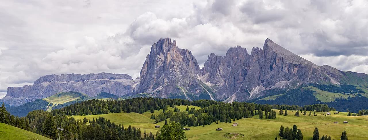
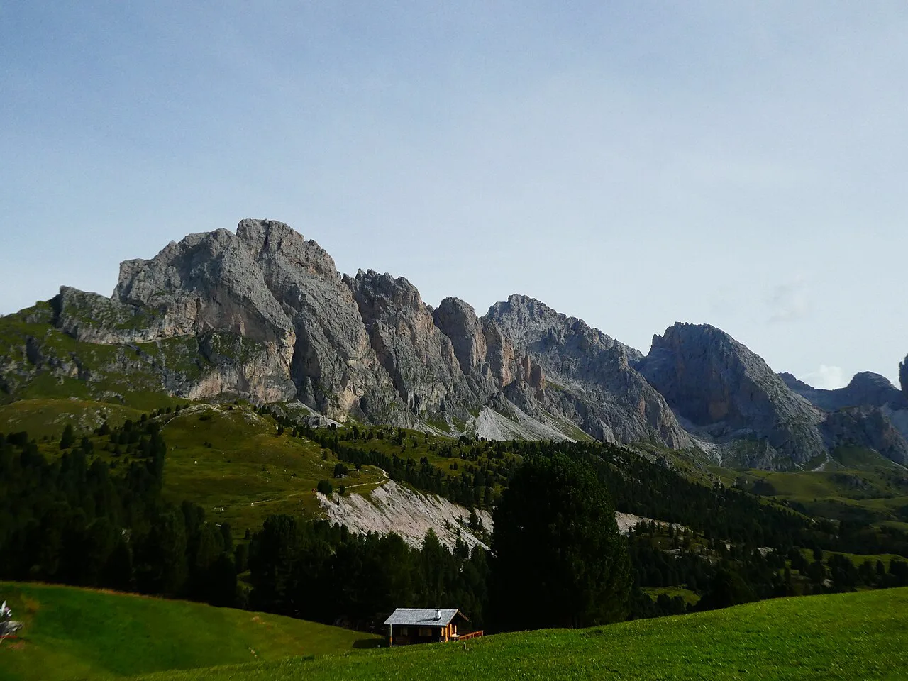
Seceda is the 2,519 m (8,264 ft) mountain and alpine pasture on the sunny side of Val Gardena, inside the Puez-Odle Nature Park in South Tyrol. The Odle peaks (Geisler group) rise directly opposite, and the ridge looks west over Ortisei and the Alpe di Siusi. Ortisei, Santa Cristina and Selva are the three villages that serve it, with Ortisei the main gateway because its two-stage lift ends close to the viewpoints.
The area is a dense network of trails rather than a single route, with options from short family walks to steep climbs. If you want to see how Seceda fits into the wider valley, our guide to hiking in val gardena covers the other trailheads and base villages. For comparison, the Sassolungo Circuit, Val Gardena is the valley's other signature loop and needs a full day from Selva. If you are weighing this against a base further east, our hiking in Cortina d'Ampezzo covers a similar mix of day hikes.
Getting to the trailhead: Seceda lift from Ortisei
The quickest access is the two-stage lift from central Ortisei: a gondola followed by a cable car that lands near the ridge at roughly 2,500 m (8,202 ft). It is walkable from most Ortisei hotels, and there is a garage and outdoor lot at the station. Seceda cable car tickets must be booked in advance through the Val Gardena lift company's booking system, so reserve your date and time before you travel.
Arriving at the station for the first ascent puts you on the ridge before the day-trippers, while midday in July and August brings long ticket lines and crowded viewpoints. The gondola ride itself takes only about 15 to 20 minutes, so the timing decision is about queues and light rather than travel time.
Alternative access: Col Raiser from Santa Cristina
From Santa Cristina, the Col Raiser cable car climbs to the Raiser hut at 2,100 m (6,890 ft), a quieter and more hiking-oriented start. From the mountain station you walk rather than ride to the Seceda ridge, joining the classic circuit described below. Santa Cristina is the better base if you plan to use this lift, while Ortisei suits the direct ridge lift.
From the Raiser hut, the walking route to the Seceda ridge continues on foot past the Fermeda and Troier huts, adding time to the day. The Fermeda chairlift runs only in late summer, from late June to late September, so check its dates before counting on it.
Parking and public transport
Both lift bases have valley stations with parking: Ortisei's Seceda station has an attached garage and an outdoor lot, and the Col Raiser station in Santa Cristina serves the Raiser hut line. Parking in the village centers fills first on summer weekends, so using the valley's buses between Ortisei, Santa Cristina and Selva removes the parking question entirely. Check the current timetable with the local transport operator before you rely on a specific departure.
The Seceda lift station sits in the center of Ortisei, so if you stay in the village you can leave the car parked for the whole trip. Hikers based in Selva generally reach both lift bases by bus or by driving down the valley.
The classic circuit: Col Raiser to the Seceda summit
The full circuit from the Col Raiser cable car mountain station to the Seceda summit cross and back covers 9.7 km (6 miles) with about 484 m (1,588 ft) of ascent and the same descent, taking roughly 3 hours 20 minutes of walking. It is rated moderate, with the altitude range running from 2,035 m to 2,495 m (6,677 to 8,186 ft). The route uses signposted paths 4, 1, 1A, 2 and 4A.
Because the circuit starts at 2,100 m (6,890 ft), the climbing is modest compared with walking up from the valley floor, but the distance and the hairpin section make it more than a stroll. If you ride the Seceda lift to the ridge instead, you can walk only the summit stretch and the ridge viewpoints, which makes a short half-day outing.
Route description
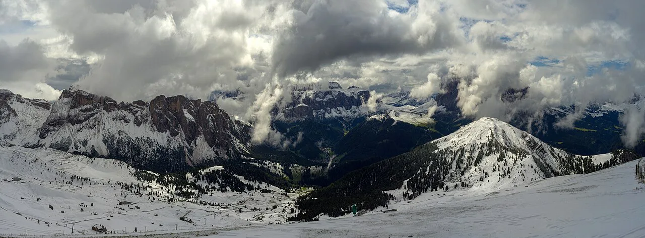
From the Col Raiser mountain station, path 4 crosses meadows and light forest past the Odles hut toward the Firenze hut at the foot of the Stevia, with the Fermeda and Sass Rigais filling the skyline. From the Firenze hut, path 1 begins easily and then climbs through steep hairpin bends where sure-footedness is required, passing Lake Iman before reaching the Troier hut at 2,250 m (7,382 ft).
From the Troier hut the trail runs gently uphill across the Seceda alp to the chairlift mountain station at about 2,500 m (8,202 ft), and a short final climb brings you to the summit cross and the circular panoramic platform. The descent follows paths 1A, 2 and 4A past the Sofie, Daniel, Fermeda and Odles huts, with broad views toward the Sella Group, Sassolungo and the Alpe di Siusi. The panoramic platform's rings label the surrounding peaks, so the summit is a good place to identify the skyline before you drop back down.
If the steep hairpins on path 1 sound like more than you want, ride the lift to the ridge and walk the upper trails only, or approach from the Seceda lift instead. The transfer between the two areas can also be shortened with the Fermeda chairlift when it is operating.
Seceda from the Ortisei lift: the short ridge walk
Hikers who ride the Ortisei lift step out close to the main viewpoints: the Fermeda towers are a short uphill walk from the top station, and the view along the ridge is the image most people come for. Continuing along the upper trail toward the twin peaks of Pieralongia, roughly 45 minutes from the station, leaves the first overlook crowds behind and reaches a simple hut in open pasture.
Treat the ridge as somewhere to keep walking. The first platform fills fastest, so carry water and food and make a two- to three-hour loop rather than a 15-minute photo stop. Our Ortisei hikes page covers other walks from the same village.
Difficulty, exposure and the steep section
The circuit is moderate overall, but the hairpins on path 1 are the crux: the trail steepens progressively and sure-footedness matters there, especially in wet weather or after rain. The rest of the route is on open pasture and established trail with no technical scrambling, so hiking shoes and poles are enough for most walkers. There is little shade on the upper meadows, so sun protection and water matter on warm days.
At around 2,500 m (8,202 ft), afternoon thunderstorms are the main summer hazard on exposed ground; start early and plan to be off the ridge by mid-afternoon. Early and late in the season, snow can linger on the passes and meadows, so check conditions with the valley's tourist office before committing to the summit.
Huts on the route
The circuit passes a long list of places to stop: the Firenze hut, the Troier hut, the Sofie, Mastré, Daniel and Odles huts, plus the Raiser hut near the cable car. The Troier hut is about 20 minutes from the main ridge viewpoints and the Sofie hut sits a few minutes from the top lift station, so both are easy lunch stops. The Pieralongia hut serves simple food and fresh milk for walkers who continue past the main viewpoints.
For an overnight on the mountain, the Almhotel Col Raiser, Rifugio Fermeda and Rifugio Firenze offer beds, and staying up high lets you start before the lifts run. Pitching a tent is not allowed on Seceda, so book a hut bed if you plan to be there at dawn or dusk.
When to go
June and September are the sweet spot: trails are generally clear of snow, wildflowers peak in early summer, and the crowds are manageable in the first two weeks of June and the last two weeks of September. July is busier but still good if you start early, and August is the peak month, when the ridge and the ticket lines fill by mid-morning. In winter, Seceda becomes a ski area rather than a hiking destination.
The Ortisei–Seceda lift runs 8:30am–5:30pm daily from late May to early November, and the valley's cable-car overview lists summer operating dates and how bikes are carried. For the Col Raiser line, the Val Gardena tourist office publishes the season dates, so check those before planning the circuit. Aim to be on the ridge by mid-morning and plan your descent around the last lift down.
Descending without the lift
Walking down to Ortisei or Santa Cristina is possible from the ridge via the marked trails, but the descent is long and hard on the knees after a day on the pasture. Many hikers ride the Col Raiser cable car down after the circuit and save the legs. If you want a longer day, the Puez-Odle Altopiano Hike extends the territory above the valley, though it is a separate outing.
What to carry
For a lift-served ridge day, pack a light shell, a warm layer, sun protection and at least one litre of water per person; the huts are stops, not a guaranteed supply on every trail. Hiking shoes with grip are sensible for the hairpins on path 1 and for the rough stretch toward Pieralongia. Check the valley weather forecast and Seceda webcam before you set out, since conditions on the ridge differ from the village.
Where to base yourself
Ortisei is the best base for the direct Seceda lift: the station is in the center, most hotels are within a short walk, and you can be on the ridge early. Santa Cristina suits the Col Raiser cable car and the longer circuit, with Selva a good third option if you plan several days in the valley. The village streets are worth an evening, and our Santa Cristina notes on the main guide cover how the villages connect.
Plan Your Seceda Hike
Decide first whether you want the short ridge day or the full circuit: the Ortisei lift puts you near the viewpoints in minutes, while the Col Raiser cable car starts the 9.7 km (6.0 mile) walk to the summit cross. Book the Seceda lift in advance, start early, and carry enough for a full half-day on the mountain. That leaves the view of the Odle peaks as the only thing on your mind.
Frequently Asked Questions
How do I get to Seceda in the Dolomites?
The fastest way is the two-stage lift from Ortisei, which takes you near the ridge. The alternative is the Col Raiser cable car from Santa Cristina, followed by a walk of about 9.7 km round trip to the summit. You can also climb on foot from the valley, which takes several hours.
How long is the hike from Col Raiser to Seceda?
The circuit from the Col Raiser mountain station to the summit cross and back covers 9.7 km with about 484 m of ascent and descent. It takes roughly 3 hours 20 minutes of walking at a steady pace.
Is the Seceda hike difficult?
It is rated moderate. The route is on established pasture trails, but the hairpin section on path 1 is steep and needs sure-footedness. If you ride the lift to the ridge, the walking is short and gentle.
Can you hike Seceda without the cable car?
Yes. You can walk up from Ortisei or Santa Cristina, but it makes a long day with significant ascent. A good compromise is to use the Col Raiser cable car and hike the rest of the way.
When is the best time to hike Seceda?
June and September offer the best balance of clear trails, good light and manageable crowds. July is busier but fine with an early start, while August is the peak month. In winter, the area operates as a ski resort.
Sources
Trail notes for your next trip
Optional updates when we add or revise hiking guides.
You might also like
Continue reading
More guides you'll find useful