Hut to Hut Hiking Austria: Choose Your Trail by Fitness
Compare Austria's hut-to-hut high trails, including the Venediger, Karwendel and Stubai routes, by distance, ascent, stages and difficulty, plus how hut nights work.
On this page
Austria's high trails do one thing exceptionally well: they keep you above the valleys for days at a time, moving between staffed mountain huts rather than descending to a hotel each night. Above roughly 2,000 m (6,560 ft) there are no cable cars, ski slopes or mobile signal, which is exactly why hikers come. The three routes most often compared are the Venediger High Trail in East Tirol, the Stubai High Trail south of Innsbruck and the Karwendel High Trail above the Inn Valley, and they demand very different things of your legs, your head for exposure and your calendar.
This guide treats them as what they are: three separate week-long projects with published distances, ascents and stage counts, each with shorter entry points if a full traverse does not fit your trip. If you want the wider picture of regions, day hikes and bases first, start with the hiking in austria overview and come back here once you have picked a range.
How Austrian high trails work
A high trail, or Höhenweg, is a long-distance route that links mountain huts across high ground instead of following valley floors. You walk stage by stage, sleep in huts, and carry only what you need for the day between them. The classic Austrian examples are the Venediger, Stubai and Karwendel routes, all in Tirol, where the terrain rises steeply enough that huts sit a full day's walk apart.
The huts on these routes are mostly Alpine Club huts, and several trails deliberately avoid lifts and ski infrastructure, so once you are up you stay up. That shapes your planning more than any single stage: you cannot usually bail out to a valley bed and rejoin the next morning without losing a day. Treat each stage as a fixed unit and build your schedule around the hut bookings you can secure.
The trade-off is comfort versus continuity. A hut night means a dormitory, a set dinner and an early start, in exchange for being in the middle of the range at sunrise. If you prefer a bed and a shower every night but still want mountain days, compare this with austria walking holidays, which run on a different rhythm of valley bases and day stages.
The Venediger High Trail: 56.8 km around the Großvenediger
The Venediger High Trail circles the Großvenediger, Austria's fifth-highest mountain, over 56.8 km (35 miles) and 3,614 m (11,857 ft) of elevation gain. It runs for 6–7 stages between the Ströden car park and the Matreier Tauernhaus, staying between roughly 2,000 and 2,500 m (6,560–8,200 ft). Austria's national tourism board rates it moderate with partly challenging sections, which makes it the most approachable of the three big Tirol routes for a first multi-day hut trip.
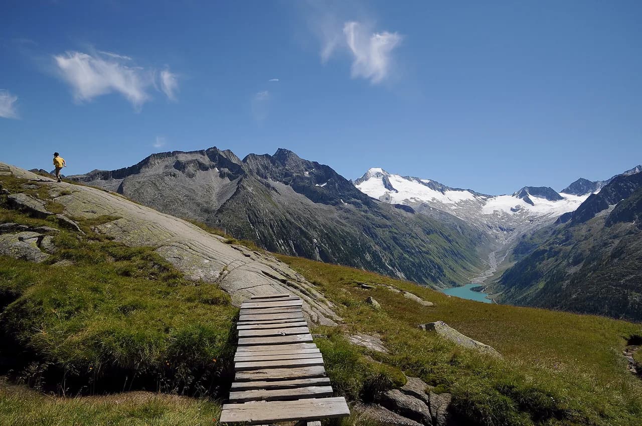
The route's appeal is that it never needs a summit day to feel alpine. You get close views of the Großvenediger and its glacier landscape from the trail itself, with the turquoise Eissee lake sitting between steep rock faces as a natural rest stop. Hikers who want the scenery without the full circuit should note that the route passes several huts reachable individually, so it doubles as a sampler.
Venediger stage by stage
The published stage plan starts at the Ströden car park with a 2.5-hour walk to the Essener-Rostocker Hütte at 2,208 m (7,244 ft), passing the Stoan-Alm below glacier walls. The second stage crosses the Türmljoch at 2,791 m (9,157 ft), a pass scattered with small stone towers that hikers add to as they pass, before descending to the Johannishütte in about 3.5 hours. The Johannishütte at 2,121 m (6,959 ft) is the base camp for many Großvenediger summit parties.
From the Johannishütte the route climbs to the Neue Sajathütte at 2,575 m (8,448 ft) in 3 to 4 hours; its architecture earns it the nickname Castle in the Mountains. A flower-filled high traverse leads into the quiet Timmeltal towards the Eisseehütte at 2,521 m (8,271 ft) in about 2.5 hours, with a detour to the Eissee worth the extra time. The next day is easy walking but stays along rocky ridges to the Bonn-Matreier-Hütte at 2,750 m (9,022 ft), around 3 hours.
The longest stage, roughly 4.5 hours, runs from the Bonn-Matreier-Hütte to the Badener Hütte at 2,608 m (8,557 ft) through high alpine scenery as the route completes its circle of the Großvenediger. The final day crosses the Löbbentörl at 2,770 m (9,088 ft) and follows the glacier path of Innergschlöss down to the Alpengasthaus Venedigerhaus at 1,689 m (5,541 ft) in about 3 hours. Snow can linger on the Türmljoch and Löbbentörl well into early summer, so carry traction and an ice axe only if you have the skills to use them, and otherwise time your trip for late summer.
Venediger shortcuts and valley exits
The Venediger route is unusually forgiving for a high trail because you can sample it without committing to the week. The Johannishütte at 2,121 m (6,959 ft) is about two hours from the Wiesenkreuz car park in Dorfertal on a path the tourism board describes as suitable for seniors and children, and it gives one of the best views of the Großvenediger and its glaciers. A hut taxi can also run you up to the hut if you would rather save your legs for the high ground.
If the weather turns, you can descend to the valley from any hut, and hut taxis shuttle from the valley car parks. That flexibility is the reason this circuit suits hikers new to hut-to-hut travel: a rough forecast costs you a stage, not the whole trip. Just remember that the escape routes are still your backup, not a replacement for reading the morning forecast before you set out.
The Stubai High Trail: 100 km and a 2,880 m ceiling
The Stubai High Trail is the longest of the three, a 100 km (62 miles) loop around the Stubai Valley with about 8,000 m (26,250 ft) of elevation change, split into roughly 4,440 m of ascent and 4,230 m of descent. It runs seven stages across eight days, with a high point of 2,880 m (9,449 ft). Austria's tourism board classes it as hard, so it rewards hikers who already know how their body copes with consecutive long days.
The scenery is the payoff: views of the Zuckerhütl, the highest peak in the Stubai Alps, and the turquoise Blaue Lacke along the Wild Water Trail, colored by glacial melt. Meadows, streams, rock and quiet lakes alternate, with glaciers above for much of the loop. Because the route is a circuit, one stage's weather rarely ruins the whole plan, but the sheer daily distance means you should arrive fit rather than plan to walk yourself into shape.
Stubai access and stage planning
The trail runs between the Innsbrucker Hütte above Neder and the Starkenburger Hütte above Fulpmes, in either direction, with eight huts along the way. You can return to the valley from any of them and take public transport back to Neder or Fulpmes, which makes single stages realistic if you want a taste of the route. Start and finish sit on opposite sides of the valley, so plan your transport before you commit to a direction. If you would rather base yourself in the city between stages, see this hiking in Innsbruck guide for trail options.
For a first Stubai visit, choose the direction that puts your longest days early, while your legs are fresh and the forecast is still likely to be stable. The eight huts mean you are never far from a bed, but they also mean your itinerary is only as good as your reservations: a full hut in the middle of the loop forces a longer day than you planned.
The Karwendel High Trail: 70 km and the hardest profile
The Karwendel High Trail is shorter than the Stubai at 70 km (43 miles) but harder in character: six stages, 4,400 m (14,436 ft) of ascent and 4,600 m (15,092 ft) of descent between 1,130 m and 2,726 m (3,707–8,944 ft). The national tourism board rates it hard, on a par with a black mountain path. Most of that climbing is packed into repeated climbs and drops rather than one long pull, so the route punishes knees and stamina more than altitude.
It crosses the southern Karwendel, where alpine meadows and moorland give way to gorges and rock walls, with the Inn Valley never far below. Chamois and ibex are common on the steep slopes, and golden eagles and protected orchids such as lady's slipper are among the rewards for walking quietly. Late summer is the recommended window because the weather tends to be more stable then.
Karwendel stages from Reith bei Seefeld to Scharnitz
The trail starts from Reith bei Seefeld train station on the Seefeld Plateau and finishes at Scharnitz, both straightforward to reach by rail. It crosses five Alpine Club huts over six days, which means each night sits roughly one hard day from the next. The start and finish are on the same railway line, so you can leave a car at one end or simply ride the train back to your start point.
Given the 4,400 m of ascent and 4,600 m of descent, expect the steepest days to be the ones that climb onto and off the range's high ridges rather than the valley approaches. Pack light, because every extra kilogram tells on the descents. If you want a shorter taste of the Karwendel without the full traverse, the western stages near Seefeld are the easiest to reach for a day or two.
Elevation profile and where the steepest days fall
Read the profiles before reserving huts. The Venediger gains 3,614 m over 56.8 km, a gentler average than the other two, and its stages run 2.5 to 4.5 hours, so it is the most forgiving day-to-day. The Stubai and Karwendel both involve roughly 8,000–9,000 m of combined up and down, and on the Stubai that is spread over 100 km rather than 70 km, so the Karwendel's daily climbing is more concentrated.
On the Karwendel, the up-and-down character means a day with little net height change can still be brutal; count total ascent rather than net. On the Stubai, the 2,880 m ceiling makes the high days the ones to watch for snow and afternoon storms. On the Venediger, the pass crossings around 2,770–2,791 m are the places where early-season snow matters most.
Huts, booking and what a night includes
A typical hut night means a dormitory bed, a hot dinner and breakfast, and an early start. The Venediger huts are run by families, and the tourism board notes that hosts serve dishes made with ingredients from their own farms, which is part of the appeal of sleeping high. Rooms in the most popular huts fill well ahead in July and August, so reserve as soon as your dates are fixed.
Carry a hut sleeping bag, a head torch, earplugs and a small towel, and pack layers rather than a heavy spare outfit. Huts sit above 2,000 m on these trails, where evenings are cold even in midsummer. Expect to pay in cash for extras; check the payment options with each hut when you book, as card acceptance varies by hut.
Getting to the trailheads and back
The three trails have distinct approaches. The Venediger starts at the Ströden car park in the Virgental and ends at the Matreier Tauernhaus; the Karwendel begins at Reith bei Seefeld station and ends at Scharnitz on the same rail line; the Stubai starts above Neder and finishes above Fulpmes. Public transport back to the start is available from the Stubai huts when you exit, and the Seefeld and Scharnitz ends sit on the railway.
Because start and finish differ on all three routes, decide early whether you will use trains and buses or leave a vehicle. On the Venediger, hut taxis shuttle from the valley car parks to the huts. For the Stubai, exiting at any of the eight huts and riding back to Neder or Fulpmes is a real option if a stage goes wrong.
When to go: late summer, snow and storms
Late summer is the recommended window for the Karwendel because the weather tends to be more stable, and the same logic applies across the Austrian high trails. The Venediger's Türmljoch and Löbbentörl crossings at around 2,770–2,791 m can hold snow early and late in the season, and the Stubai's high point at 2,880 m is not a place to be caught out. Aim for July into September for the best combination of open passes and settled weather.
Storms build through the afternoon on all three routes, so plan to be at a hut or below a ridge by early afternoon on exposed sections. On the Karwendel's rocky ridges and the Venediger's pass crossings, turn back rather than push through lightning risk. Snow on the passes means carrying the right gear and knowing how to use it; otherwise, choose a later date.
Shorter alternatives and single stages
You do not need a week to experience Austrian hut-to-hut life. The Johannishütte is two hours from the Wiesenkreuz car park and suits families, and the Stubai allows a single stage with a valley exit at any of its eight huts. The Karwendel's Seefeld end is the easiest part of the traverse to reach by train for a day or two.
Inside Austria there is plenty more high ground to explore once you have cut your teeth. The Schladminger Tauern are known for the Klafferkessel lake plateau, the Berlin High Trail crosses the Zillertal Alps Nature Park, and the Karnische High Trail follows First World War reminders on its Peace Trail. The Salzburger Almenweg stays below the tree line and passes 120 managed huts, which suits hikers who prefer gentler days and more comfort; our Berliner Höhenweg guide covers that Zillertal circuit in detail.
Guided versus self-guided formats
Guided hut-to-hut trips in Austria pair you with a mountain guide who handles route-finding, hut bookings and weather calls, which helps if you have not done a multi-day Alpine traverse before. Self-guided formats typically book your huts and provide route notes, leaving you to walk the stages on your own. The reviews page for Austria hut trips shows what travelers value most in organized trips: huts reserved, luggage handled, plans adjusted when rain sets in.
Choose guided if you want the decision-making off your shoulders, especially on the Karwendel or Stubai where a wrong call on a stormy day matters. Choose self-guided if you are comfortable reading a map, judging weather and adjusting your own plan. Either way, confirm what is included, particularly hut dinners and any luggage transfer, before you commit.
Packing for a hut night
Pack for a night above 2,000 m even in August: a warm layer, a hat, gloves and a waterproof shell earn their place. Add a hut sleeping bag, head torch, earplugs, a small towel and a bag for your waste. Trail shoes or light boots with good grip suit these routes if you are sure-footed; the Karwendel's rocky ridges and the Stubai's long days argue for more support.
Keep your pack light, because a heavy bag on 4,400 m of Karwendel ascent is a different proposition from a heavy bag on a valley walk. Water refills are available at the huts, so carry one bottle and top up rather than hauling litres. Finally, hold a day's food margin in case a stage runs long.
Choose Your Austrian High Trail
Pick the Venediger High Trail if you want a first hut-to-hut week with a manageable 56.8 km and the option to exit at every hut; pick the Stubai if you are fit and want a long, varied circuit with a high ceiling; pick the Karwendel if you are strong on repeated climbs and descents and can travel light. Match the route to your available days first, then to your fitness, then to the season.
Book your huts early, resolve your start and finish transport before you go, and leave room in the plan for a weather day on the high passes. With those basics settled, Austria's high trails deliver exactly what they promise: days above the valleys, evenings in a hut, and no distractions.
Frequently Asked Questions
Which Austrian high trail is easiest for a first hut-to-hut trip?
The Venediger High Trail is the most approachable of the three big Tirol routes. It covers 56.8 km with 3,614 m of gain over 6–7 stages, is rated moderate with partly challenging sections, and allows a valley exit from any hut. Its stages run 2.5 to 4.5 hours, and the Johannishütte can be reached in about two hours from the Wiesenkreuz car park on a path suited to families.
How many stages does the Venediger High Trail have?
It has six to seven stages, usually walked over six days. The route runs from the Ströden car park to the Matreier Tauernhaus, crossing the Türmljoch and Löbbentörl and sleeping at huts such as the Essener-Rostocker Hütte, Johannishütte, Neue Sajathütte, Eisseehütte, Bonn-Matreier-Hütte and Badener Hütte.
How difficult is the Stubai High Trail compared with the Karwendel?
Both are rated hard, but for different reasons. The Stubai covers 100 km over seven stages with about 8,000 m of elevation change and a 2,880 m high point, so endurance matters. The Karwendel is shorter at 70 km but packs 4,400 m of ascent and 4,600 m of descent into six stages, making the daily climbing more concentrated.
What is the most beautiful high-altitude trail in Austria?
That depends on what you want from the scenery. The Venediger route circles the Großvenediger with glacier views from the trail itself and the turquoise Eissee as a highlight. The Stubai offers views of the Zuckerhütl and the glacial Blaue Lacke, while the Karwendel mixes meadows, gorges and rocky ridges above the Inn Valley.
Do you need to book Austrian mountain huts in advance?
Yes, especially in July and August, when the most popular huts fill well ahead. Book each hut on your route as soon as your dates are fixed, and confirm what your booking includes, such as dinner and breakfast. Ask each hut about payment options for extras when you book.
When is the best time for hut-to-hut hiking in Austria?
Late summer, from July into September, gives the most stable weather and the best chance of snow-free passes. The Karwendel is specifically recommended in late summer, and the Venediger's crossings above 2,770 m and the Stubai's 2,880 m high point can hold snow early and late in the season. Plan to be off exposed ridges before afternoon storms.
Can you hike just one stage of an Austrian high trail?
Yes. The Stubai lets you return to the valley from any of its eight huts and ride public transport back to Neder or Fulpmes, and the Johannishütte on the Venediger is a two-hour walk from the Wiesenkreuz car park. The Seefeld end of the Karwendel is also easy to reach by train for a shorter outing.
Sources
Trail notes for your next trip
Optional updates when we add or revise hiking guides.
You might also like
Continue reading
More guides you'll find useful