Hiking in Innsbruck: Which Alpine Trails to Choose
Hiking in Innsbruck ranges from the high Zirbenweg traverse to the climb to Hungerburg, with distances, ascents and lifts for every route.
On this page
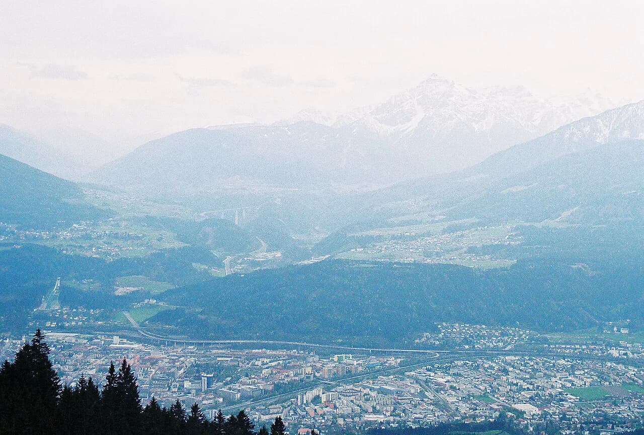
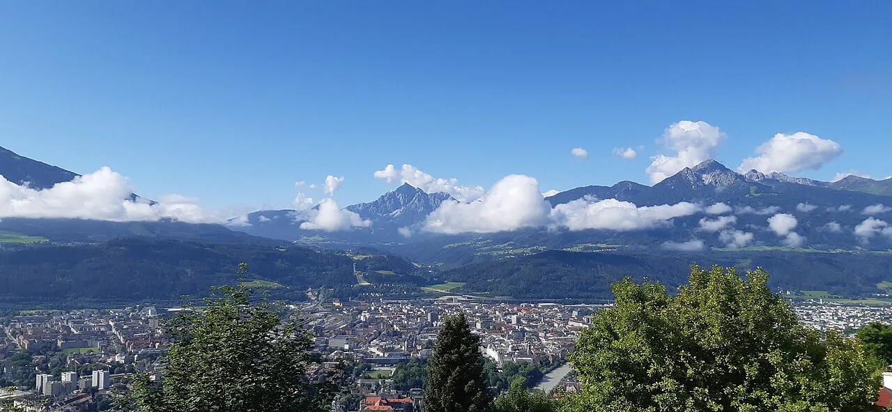
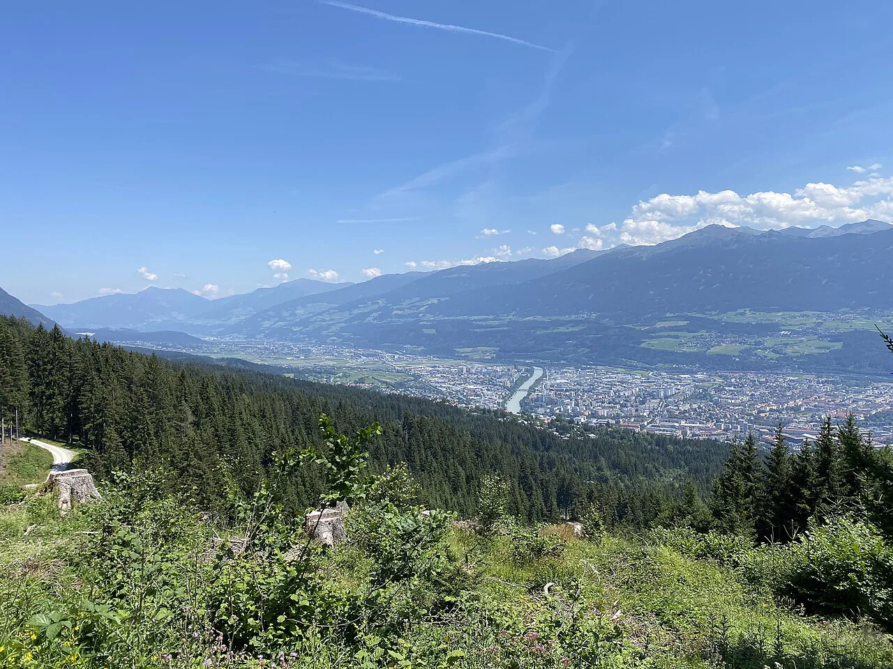
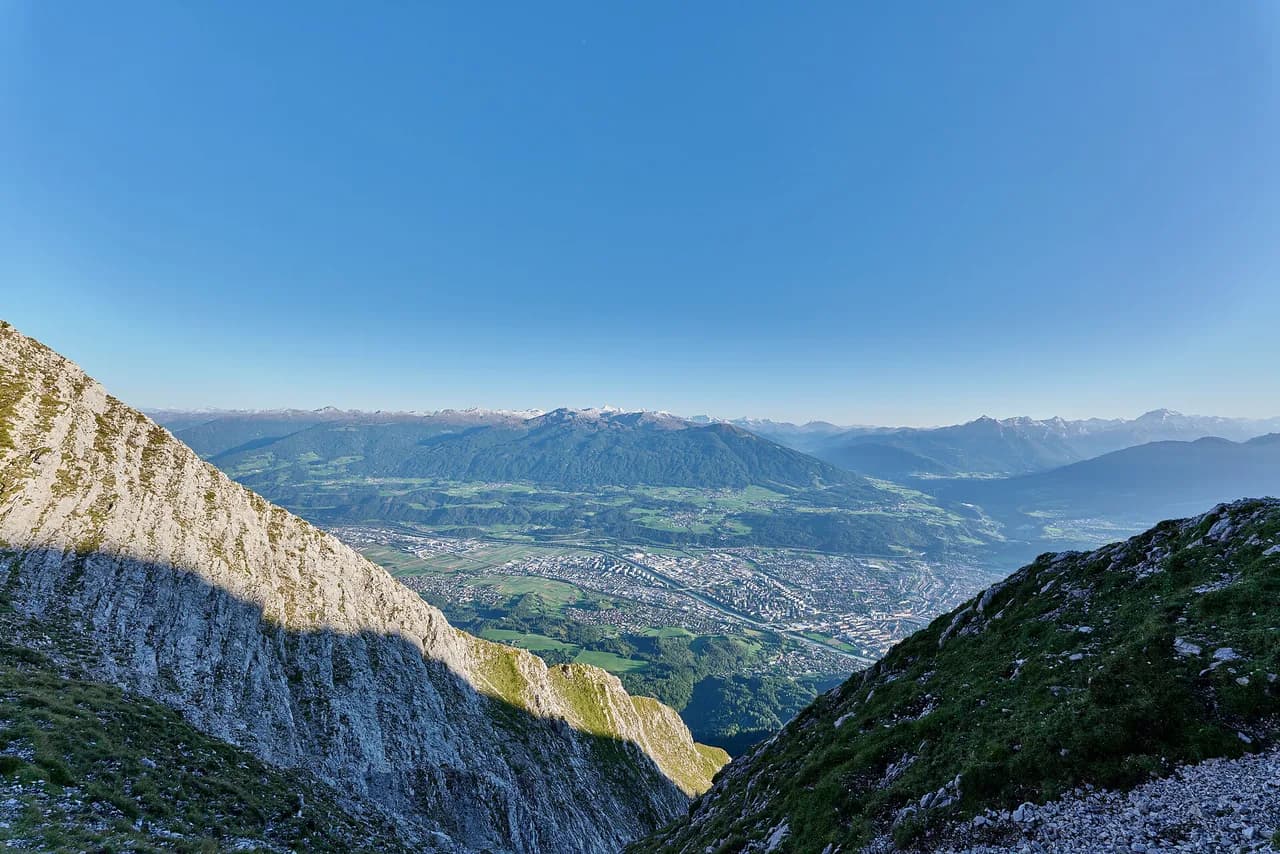
Innsbruck sits in a bend of the Inn Valley with the Nordkette rising directly above the city and gentler mountains to the south and west, so you can walk out of a historic street and onto a mountain path the same morning. Cable cars strip much of the climbing from several routes, and trams and buses reach villages such as Igls, Mutters, Natters, Götzens and Oberperfuss. That combination makes the city a practical base for hikers who want real Alpine scenery without committing to exposed ridges or multi-day mountaineering.
The catch is that "easy" in the Alps rarely means flat. A route can be technically simple and still ask for several hundred metres of sustained climbing, and some near-level paths run at around 2,000 m (6,560 ft) where the weather turns quickly. Judging a trail by its ascent and altitude rather than its distance is the single most useful habit here. Note also that Innsbruck is a via ferrata destination in its own right, so keep the iron-worked routes separate from a family stroll.
The main hiking areas around Innsbruck
South of the city, Patscherkofel and the village of Igls form the most rewarding beginner zone. The Patscherkofelbahn lifts you to roughly 2,000 m (6,560 ft), from where the celebrated stone-pine traverse runs across the slope, while Igls itself is the start of a circular walk and a mostly downhill route back to the city. Staying in Igls makes sense if you plan several days of easy walking rather than a single outing.
Above the city, the Nordkette and Hungerburg are the quick-access option: a trail climbs straight from the river to Hungerburg on the lower slopes, and the Hungerburg funicular runs the same line for the descent or the easier direction. Do not assume every path from the top station is beginner terrain, though; the traverse beyond the Nordkette stations is narrow and exposed. If you want the cable car without the exposure, plan a separate outing and read the route description for the Nordkette hike from Innsbruck before committing.
West of town, the villages of Natters, Götzens, Birgitz, Axams and Oberperfuss sit lower than the Patscherkofel slopes, which makes their lanes and forest paths the first to dry out in spring. Oberperfuss adds a gondola to Stiglreith at about 1,363 m (4,472 ft), where short panoramic walks begin without a long climb. The Muttereralmbahn above Götzens and Mutters is another lift-assisted entry point, though the full forest-road ascent from the valley is a different proposition entirely.
Easy hikes at a glance: distance, ascent and time
The Zirbenweg is the headline route: about 7 km (4.3 miles) with roughly 200 m (660 ft) of ascent and 100 m (330 ft) of descent, graded easy and normally taking around two and a half hours of walking, excluding lifts and stops. The Hungerburg climb from the city covers about 3.5 km (2.2 miles) and 327 m (1,073 ft) of ascent in around an hour, easy in grade but consistently uphill. The Gletscherblick-Runde from Igls is a circular 6.4 km (4 miles) with about 150 m (490 ft) of ascent, allowing one and a half to two hours.
For shorter days, the Akademikersteig between Götzens and Birgitz runs about 1.65 km (1 mile) with only around 23 m (75 ft) of ascent and takes up to an hour at a relaxed pace, while the Sonnenrainweg above Oberperfuss covers about 4.4 km (2.7 miles) with 117 m (384 ft) of ascent and 123 m (404 ft) of descent, around 45 minutes of continuous walking from the Stiglreith gondola station. Two further options round out the easy list: Natterer See to Götzens at about 5.3 km (3.3 miles) with 218 m (715 ft) of ascent and 146 m (479 ft) of descent, roughly one and a half hours, and the village route through Axams, Birgitz and Götzens at about 7.7 km (4.8 miles) with 140 m (460 ft) of ascent in around two hours. The descent from Igls to Innsbruck is about 4.5 km (2.8 miles), gaining only 50 m (165 ft) but dropping 332 m (1,089 ft).
Zirbenweg: cable-car start at Patscherkofel, traverse to the Glungezer side
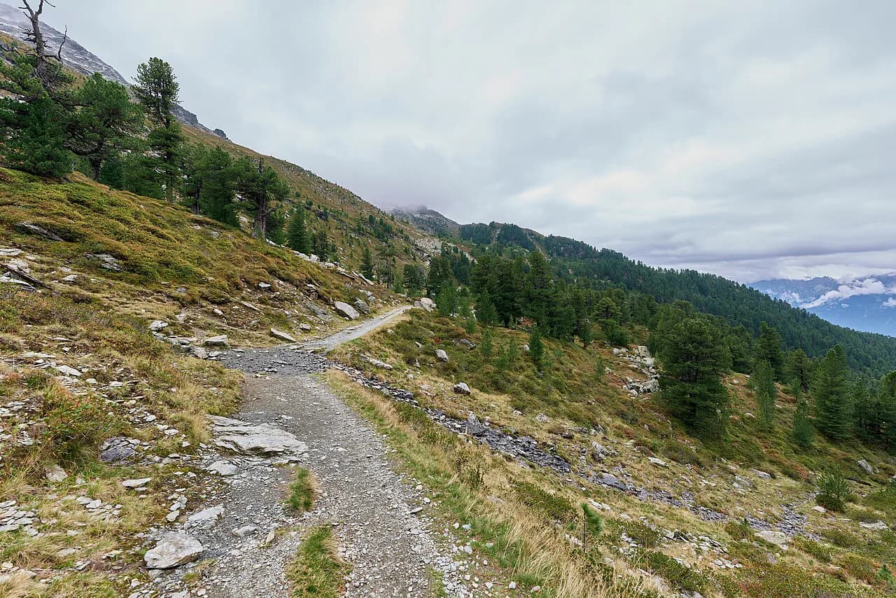
This is the classic high-level walk above the Inn Valley, crossing the slopes at roughly 2,000 m (6,560 ft) through one of Europe's largest stone-pine forests, with the Nordkette and the Tyrolean peaks filling the view on clear days. The surface mixes broad path with uneven mountain trail, small stones and gentle rises, so it is a walking route rather than a promenade.
The route is not a circuit. You normally ride the Patscherkofelbahn up to the mountain station, walk across, and descend with the Glungezerbahn on the Tulfein side, with a bus completing the link between the two lift stations. That transport detail is the crux of the day: the Zirbenweg traverse is a one-way walk of about 7 km (4.3 miles) with 200 m (660 ft) of ascent and 100 m (330 ft) of descent, taking around two and a half hours before lifts, lunch and the return journey are counted.
Families with older children do well here, but toddlers belong in a carrier because the uneven ground rules out an ordinary stroller. Huts and benches along the treeline give you somewhere to stop, though opening days vary through the season. If you want to add a summit, the path from the Patscherkofel mountain station to the top gains about 280 m (920 ft) over a 6 km (3.7 mile) return and is graded moderate, a sensible second step rather than a first Alpine outing.
Gletscherblick-Runde from Igls: the circular option
If you would rather finish where you started, this loop from Igls is the answer. It leaves the village through the Kurpark, passes woodland and the Rosengarten nature area, and opens views toward the Stubai Alps and the Habicht on clear days. At about 6.4 km (4 miles) with around 150 m (490 ft) of ascent, it spreads the climbing across the walk instead of concentrating it in one steep push.
The absence of lift logistics is the real advantage: no second cable car to catch, no bus back from another valley. Allow one and a half to two hours, and treat Igls as a base if you want several gentle days in a row, since the village also serves as the access point for the Patscherkofel lifts.
Hungerburg via the Alpenzoo: the walk straight from the city
This is the most convenient route for anyone staying in the center without a car. From Rennweg near the old town you cross the Inn and follow signs toward the Alpenzoo and Heinrich-Süß-Weg, climbing through a mix of woodland and residential streets to Hungerburg on the lower Nordkette. The route measures about 3.5 km (2.2 miles) with 327 m (1,073 ft) of ascent and takes roughly an hour of walking, easy in grade but steadily uphill.
The Alpenzoo, which specializes in Alpine wildlife, sits on the way, so families can hike up, spend time among the exhibits and continue to Hungerburg, or ride the funicular back down. Zoo opening hours and last admission decide how late you can start, so check the Alpenzoo's published times before setting out. Hikers worried about the climb can reverse the whole thing, riding the Hungerburgbahn up and walking down to the zoo and the city, accepting that sustained descent loads the knees more than the climb does.
Natterer See to Götzens and the Akademikersteig
The walk from Natters past Natterer See to Götzens is the low-level choice for spring and changeable days: lanes and woodland paths, interpretation panels on local plants and wildlife, a summer bathing lake and meadows leading on to the village. It covers about 5.3 km (3.3 miles) with 218 m (715 ft) of ascent and 146 m (479 ft) of descent in around one and a half hours. The trail ends in Götzens rather than looping back, so plan a local bus return or shorten it to an out-and-back from Natters to the lake.
The Akademikersteig is the gentlest proper trail in the area: a shaded forest link between Götzens and Birgitz of about 1.65 km (1 mile) with 23 m (75 ft) of ascent, taking up to an hour at a relaxed pace. Choose it for a first countryside walk, for small children, or on a warm day when shade matters more than panorama. It has no lift schedules and no altitude concerns, and pairs easily with time in either village or with the longer Axams-Birgitz-Götzens route.
Sonnenrainweg above Oberperfuss and the Igls descent
The Sonnenrainweg starts at Stiglreith above Oberperfuss at about 1,363 m (4,472 ft), reached by gondola from the valley, and follows sunny paths with views across the Inn Valley. It runs about 4.4 km (2.7 miles) with 117 m (384 ft) of ascent and 123 m (404 ft) of descent, around 45 minutes of continuous walking that most people stretch to twice that with stops. Staying near the lift station makes it a gentle introduction to walking at altitude, and the wider Stiglreith area adds family-oriented paths and play areas.
The Igls-to-Innsbruck trail is the route for hikers who would rather descend than climb. It covers about 4.5 km (2.8 miles) with only 50 m (165 ft) of ascent but 332 m (1,089 ft) of descent, passing through Vill on the way down. Take short steps on the sustained downhill, use poles if your knees complain, and watch for slippery leaves, mud and roots after rain. A morning bus or tram up to Igls and an afternoon walk back into the city leaves you at your accommodation rather than at a distant trailhead.
Village route through Axams, Birgitz and Götzens
This discovery route links three traditional villages west of Innsbruck on rural paths past churches and historic sites, with places to eat along the way. It measures about 7.7 km (4.8 miles) with around 140 m (460 ft) of ascent and takes roughly two hours, graded easy. The cultural variety is the point: you get cafés, bus stops and shelter within reach the whole way, which makes it the fallback when the forecast rules out the high trails.
Routes graded easy that still need fitness
Three routes around Innsbruck carry an easy grade but demand real stamina, and they make good next steps once a gentler walk feels comfortable. The Rauschbrunnen route from Sadrach climbs through forest past Buzihütte to the mountain restaurant above the city: about 8.8 km (5.5 miles) with 470 m (1,540 ft) of ascent and at least two hours of climbing plus breaks and the return. It suits fit beginners, rewards you with an elevated view over Innsbruck, and pairs with a meal at the restaurant when it is open.
The Mutterer Almweg from the Muttereralmbahn valley station gains about 653 m (2,142 ft) over 4.5 km (2.8 miles) on a maintained forest road, and is graded moderate despite the straightforward surface. Beginners can still enjoy the Muttereralm by riding the cable car up and walking near the mountain station; save the full valley ascent for when you know sustained climbing suits you. The same logic applies to the Patscherkofel summit path, whose 280 m (920 ft) of gain over a 6 km (3.7 mile) return is graded moderate.
Two famous lines belong firmly outside the beginner list. The Goetheweg beyond the Nordkette stations is narrow, rocky and exposed in places, so a cable car ride to the start does not make it a sightseeing walk, and the Kranebitter Klamm gorge involves steep paths and rockfall exposure that call for proper mountain footwear and experience. If climbing gear appeals more than walking, the via ferrata routes above the city are a separate discipline with their own grading and kit requirements.
Getting to trailheads without a car
Innsbruck's trams and buses connect the center with Igls, Mutters, Natters, Götzens and Oberperfuss, which puts most of the routes in this guide within a single ride of the city. The lifts do the vertical work: the Patscherkofelbahn for the Zirbenweg and summit path, the Glungezerbahn for the far end of the traverse, the Hungerburgbahn for the city climb, the Muttereralmbahn above Götzens and Mutters, and the gondola to Stiglreith above Oberperfuss. Which of these run on your dates, and in which season, decides the shape of your day.
Travelling by train and bus is genuinely practical here rather than a compromise, and the wider country is well set up for car-free hiking if you want to extend the trip beyond Tyrol. For a national overview of mountain areas, trail standards and season timing, this guide to hiking in Austria is a useful next read. Lake Achensee, northeast of Innsbruck in the Karwendel and Rofan mountains, is the obvious next stop and lies outside the city's own hiking area.
When to go
Altitude governs the season more than the calendar. Trails starting at around 2,000 m (6,560 ft), such as the Zirbenweg from the Patscherkofel station, can hold snow early and late in the year, and the same height brings faster weather changes than the valley floor. Lower routes, including Natterer See to Götzens and the village paths west of town, come into condition sooner in spring and stay usable later in autumn.
Hut opening days vary through the season along the Zirbenweg, and the bathing lake at Natterer See operates on a seasonal basis, so a summer plan should not assume either is running outside its published period. The lift operators, the lake facility and the city's closure notices are the places to look for the current state of play before you set out.
Huts and refreshment stops
Mountain huts and benches line the Zirbenweg, giving you somewhere to sit and eat on the high traverse, and the Rauschbrunnen mountain restaurant above Innsbruck is the natural lunch stop on that climb. Buzihütte sits on the forest route up from Sadrach. Elsewhere the villages do the work: Igls, Götzens, Birgitz and Axams all have places to eat within walking distance of the trails.
None of these stops is a certainty on any given day, so build the day around the walking rather than around a specific kitchen. If a hut meal matters, check that hut's own opening days for your date and let the route flex around the answer.
Hazards on Innsbruck's trails
The characteristic hazards here are sustained climbs and uneven ground rather than technical difficulty. The Hungerburg path gains 327 m (1,073 ft) in 3.5 km (2.2 miles), the Rauschbrunnen 470 m (1,540 ft) over 8.8 km (5.5 miles), and the upper trails mix loose stones with tree roots underfoot. Pace yourself, wear boots with grip, and do not judge a route by its kilometre count alone.
At around 2,000 m (6,560 ft) afternoon storms build quickly and exposure on open slopes is real, so start high routes early and turn around if cloud thickens. After rain, the Igls descent and other shady forest paths turn slippery on leaves and roots. Rockfall is a genuine concern in the gorge terrain above the city, and storm damage, landslides and forestry work can close paths, with the City of Innsbruck publishing current safety notices.
Where to base yourself
The city itself suits hikers who want museums, restaurants and a bed in town, with the Hungerburg walk starting from Rennweg and trams and buses reaching the other trailheads. Igls is the better base for Patscherkofel, the Gletscherblick-Runde and the downhill walk into Innsbruck, and staying there removes a daily commute. The western villages, including Götzens, Birgitz and Oberperfuss, put you close to the low-level walks and the Stiglreith gondola.
For a short trip, pick one area and walk it properly rather than chasing trailheads across the valley. Booking accommodation near a lift station usually beats saving a few minutes on the tram, because it lets you start earlier and finish later on the high routes.
Which hike fits your group and time
With one day and a head for heights, take the Zirbenweg for the classic high traverse with huts and big views, and accept the two-lift logistics. With one day and no car but a taste for a challenge, climb to Hungerburg from the center or ride up and walk down. With children or uncertain weather, choose the Gletscherblick-Runde, the Akademikersteig or the Axams-Birgitz-Götzens village route.
Fit beginners ready for more should look at Rauschbrunnen or the Patscherkofel summit path, and anyone drawn to cable and steel rather than trail should switch plans entirely to the Innsbrucker Klettersteig, which has its own grading and equipment demands.
Plan Your Innsbruck Hike
Build your Innsbruck days around ascent and altitude rather than distance: a 3.5 km (2.2 mile) climb to Hungerburg will tire you more than a flat 7 km (4.3 mile) village circuit. Match the route to the group, keep one low-level option in reserve for changeable weather, and start the 2,000 m (6,560 ft) routes early enough to be down before storms build.
The work that decides the day is small and unglamorous: knowing which lift you descend with on the Zirbenweg, which bus returns you from Götzens, and which hut is open on your date. Sort those out the evening before, and the trails above the Inn Valley do the rest.
Explore more Innsbruck hiking guides
Frequently Asked Questions
What is the best easy hike near Innsbruck?
The Zirbenweg is the standout for high Alpine scenery: about 7 km with 200 m of ascent, graded easy, and reached by the Patscherkofelbahn. If you want to finish where you start, the Gletscherblick-Runde from Igls is a 6.4 km loop with around 150 m of ascent. For a first outing with children, the Akademikersteig is barely 1.65 km and gains only 23 m.
Can you hike in Innsbruck without a car?
Yes. Trams and buses link the center with Igls, Mutters, Natters, Götzens and Oberperfuss, and lifts including the Patscherkofelbahn, Glungezerbahn, Hungerburgbahn and Muttereralmbahn remove most of the climbing. The Hungerburg route even starts within walking distance of the old town. Check each lift's operating days for your dates before relying on it.
How long does the Zirbenweg take?
Allow around two and a half hours of walking for the 7 km traverse, plus time for lifts, stops and the return journey. It is a one-way route: up with the Patscherkofelbahn, across the slope, and down with the Glungezerbahn, with a bus linking the lift stations. Check both lifts' operating hours before setting off, because a missed descent complicates the day.
Is the walk to Hungerburg difficult?
It is graded easy but consistently uphill, gaining 327 m over roughly 3.5 km in about an hour. Beginners will feel the climb even though the path is technically straightforward. To avoid it, ride the Hungerburgbahn up and walk down past the Alpenzoo to the city, accepting that sustained downhill is harder on the knees.
Which Innsbruck hikes are suitable for families?
The Akademikersteig, the Sonnenrainweg from the Stiglreith gondola, the Igls circular route and the Natterer See to Götzens walk all work well for families. The Zirbenweg suits older children who can walk for several hours, with toddlers in a carrier rather than a stroller because of the uneven surface.
When is the best time to hike around Innsbruck?
Lower routes such as Natterer See and the western village paths come into condition earliest in spring and last longest in autumn. Trails starting at around 2,000 m, like the Zirbenweg, can hold snow early and late in the season and change weather quickly, so plan them for settled summer days and start early.
How many days do you need in Innsbruck for hiking?
Three or four days let you cover a high route, a city climb and a low-level village walk without rushing, and two days are enough for the Zirbenweg plus the Hungerburg path. Base yourself in Igls or near a lift station if hiking is the main purpose, and keep one flexible day for weather.
What is the difference between hiking and trekking here?
Hiking in the Innsbruck area means day walks returning to a lift, bus or hotel each evening, which is what every route here involves. Trekking describes multi-day journeys carrying your kit between overnight stops, such as hut-to-hut stages, and needs different planning for bookings and daily distance.
Sources
Trail notes for your next trip
Optional updates when we add or revise hiking guides.
You might also like
Continue reading
More guides you'll find useful