Hiking in Austria: Mountain Areas, Trails and Seasons
Plan hiking in Austria with the main mountain areas, six family-friendly trails with distances and times, lift access, hut basics and the best months to walk.
On this page
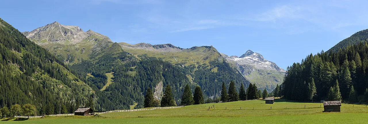
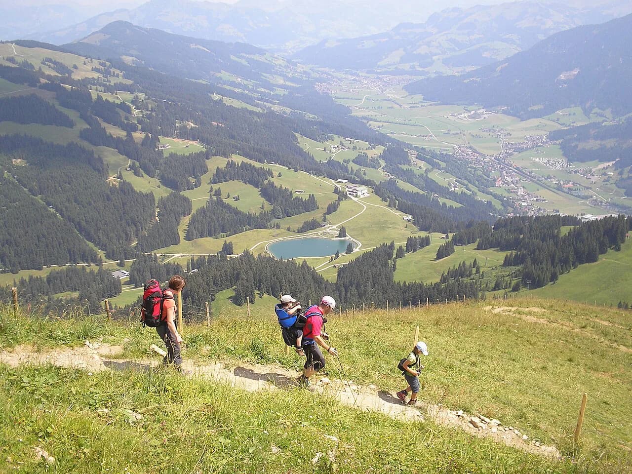
Austria gives hikers an unusual combination: wide, well-established valley paths that suit families and casual walkers, and high mountain terrain reached quickly by cable car or chairlift. You can be above the tree line within an hour of parking, or spend three days moving between serviced mountain lodges. The country's six main hiking regions, Tyrol, Salzburg, Styria, Carinthia, Vorarlberg and Lower Austria, each organize their trails and bases differently.
The trade-off is straightforward. Lift-assisted trails are busy on sunny summer weekends and rarely feel remote, while the quieter high routes demand fitness, early starts and attention to afternoon weather. This guide groups hikes by how much climbing you actually do, names the landmarks in the order you pass them, and flags where the ground is steep or exposed.
How Austria's mountain areas differ
Tyrol holds the densest concentration of marked trails and lift-served trailheads, with regions such as the Ötztal, East Tyrol and the Wilder Kaiser each running their own networks. Salzburg's mountain regions sit around Hohe Tauern National Park and the Dachstein massif, and combine valley walks with cable cars that climb well above 2,000 m (6,560 ft).
Styria is greener and gentler in its eastern half, with alpine pasture country around Krakau and Schladming-Dachstein. Carinthia is Austria's southernmost province and its trails look toward the Italian and Slovenian borders, while Vorarlberg and Lower Austria round out the picture with smaller, quieter networks. The Viennese Alps sit about 60 km (37 miles) from Vienna, which makes Lower Austria the easiest region to reach from the capital.
Planners should pick a base by trail type rather than by province. Lift-served family walks work best from ski resorts that run their gondolas in summer, while hut-to-hut routes need a valley town with bus connections to the start and a lift or bus back from the finish. Note that a guide focused on the Dachstein Mountains and other high routes complements these valley options if you want longer days, and it sits alongside the wider picture in these Europe hikes and Best Hikes in Europe: Where to Walk and What to Choose.
Easy hikes reached by lift: Tauplitz, Weisssee and Wildkogel
The six-lake loop on the Tauplitzalm in Styria is the classic lift-served day out. You start at the Bergstation Tauplitzalm, the top of the Tauplitz ski lift, which you can also reach by driving the Tauplitzalm-Alpenstrasse toll road from the lower station and paying at the gate. The toll road charges per car rather than per person, which changes the cost calculation for a group. The full loop is 13.6 km (8.5 miles) with 5 to 6 hours of walking and rates easy to medium.
Head east first for Tauplitzsee, a small pond in open meadow, then Steirersee, reached by a steep descent to the shore, and Schwarzensee beneath a rock wall. The panorama trail back gives views down to Steirersee without losing the height, though it is narrow and steep in places. The western lakes, Großsee, Märchensee and Krallersee, offer the shortest exit option: turning back at Tauplitzsee trims the day considerably, and some smooth sections suit a stroller even though the full loop does not.
In Salzburg, the Weisssee Glacier World cable car from Enzingerboden climbs to the Rudolfshütte, where the three-glacial-lakes trail begins at about 2,300 m (7,550 ft). The route runs downhill past Weisssee and Tauernmoossee toward the middle station at Grünsee, covering 6.5 km (4 miles) in roughly 2.5 hours one way. Some descents are steep enough to need the fixed ropes, so keep hold of children and take your time.
The Wildkogel Panoramaweg above Bramberg am Wildkogel starts at the top of the Smaragdbahn lift at around 2,100 m (6,890 ft). The loop is 5.3 km (3.3 miles) with about 2 hours of walking and minimal elevation change, passing the 2,224 m (7,297 ft) Wildkogel summit and the Geisl-Hochalm and Ganseralm pastures, where a restaurant serves walkers. A wooden playground stands by the lift station, and shorter paths nearby are stroller-friendly, but the summit path is not.
Waterfall walks: Krimml and Untersulzbachfall
Krimml Waterfalls in Salzburg drops 380 m (1,247 ft) over three stages and ranks as one of Austria's most popular natural sights. The Waterfall Trail is a wide gravel path with several viewing platforms, and it takes about two hours to reach the crossing of the Krimmler Ache above the uppermost fall. Returning via the Alte Tauernweg makes a 7.4 km (4.6 miles) loop of 3 to 4 hours at medium difficulty, with fewer viewpoints but a quieter path.
Both parking at the visitor lot and walking the Waterfall Trail carry a fee, and the lowest fall is wheelchair accessible while the climbing gravel path works for sturdy strollers with effort. Verified current charges are on the operator's own page.
Untersulzbachfall near Neukirchen am Großvenediger is the shorter alternative: a 3.2 km (2 miles) loop of about 1.5 hours around a 110 m (361 ft) waterfall in a green valley. The path climbs and descends beside the fall, so wear proper hiking shoes even though the distance is modest. Parking sits at the end of the road toward Untersulzbachtal, and the route works well as an addition to a Krimml day.
Valley and family trails: Venedigerweg in Obersulzbachtal
The Venedigerweg in Obersulzbachtal, also near Neukirchen am Großvenediger, is a dedicated family path through a glacial valley. It begins at a hanging bridge close to the Hopffeldboden parking area and follows a wild mountain stream past viewing platforms for the Seebachfall and Gamseckfall waterfalls, which are worth the short detours. The full loop is 8 km (5 miles) and takes about 3.5 hours at medium difficulty.
The reward at the far end is Berndlalm, a pasture with a playground, a restaurant and a small animal farm, set against the snow-capped peaks above the valley. Return on the far side of the valley for a wide, comfortable track rather than the themed path. A ten-minute walk from the Gasthof Siggen parking area at the valley entrance brings you to the small Blausee, an easy add-on with picnic benches.
Hut-to-hut and multi-day routes
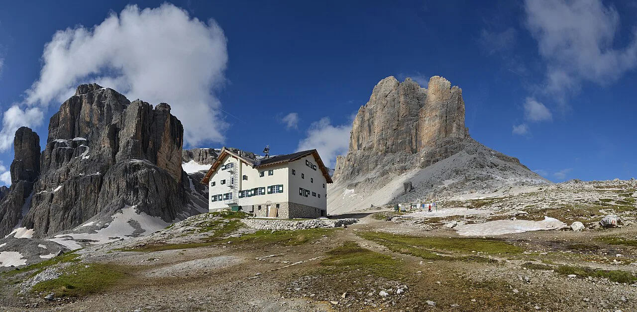
Austria's mountain lodges, the Hütten, are staffed hostels high on the trails, serving dinner, breakfast and drinks, with a mix of shared rooms and a few two-bed rooms that regulars book far ahead. Multi-day circuits usually follow marked long-distance routes such as the Adlerweg in Tyrol or the Ötztal Trek, and the stages are short enough that you carry only a day's water and a little food. Serviced lodges are run by alpine clubs and private operators, and reservations go directly to each lodge.
A representative three-day loop in the Lechtal Alps starts at the Hahntennjoch pass, which you reach by train to Imst and then a bus up to the pass, and climbs about 1.5 hours to the Anhalter Hütte. Day two runs 5 to 6 hours to the Hanauer Hütte, mostly downhill to Boden and then steeply up to the lodge. Day three is the hard one: roughly 7 hours over the rocky ground of the Muttekopf, with red blazes on boulders and sections of fixed chain, before a chairlift carries you down to Hoch-Imst and a footpath or bus returns you to town.
Treat the exposed sections seriously. Snow can linger on passes into early summer and return in autumn, afternoon storms build quickly above the tree line, and parties should start early and turn back if the rock is wet. A guided or self-guided format removes the route-finding and booking work and suits hikers new to alpine terrain, while independent walkers need their own reservations and an offline map. For more stage-by-stage options, see this guide to hut to hut hiking austria.
Getting to the trailheads without a car
Austrian trailheads fall into two groups. Lift-served walks such as Tauplitzalm, Weisssee Glacier World and the Wildkogel Arena need only a base village with a gondola station, and the valley stations generally have parking at or near the base. Valley trails such as the Venedigerweg and Untersulzbachfall start from roadside parking areas at the end of a minor road, so a car or a local taxi is the practical option.
For high starts, public transport works well in Tyrol. Innsbruck is the hub, with frequent trains from Munich and Salzburg, and regional buses climb from towns such as Imst to the passes. Bus frequency on mountain routes is limited, so plan the last descent of the day around the published timetable rather than assuming an evening service. If you base yourself in the city, this hiking in innsbruck guide covers the easy trails and how to reach them.
A guide to walking holidays is useful if you prefer the logistics packaged, including luggage transfer on long-distance routes such as the Hochkönig network, which offers it for hikers moving between lodgings. Independent hikers should confirm lift operating seasons locally, because summer service on some cable cars stops outside the main holiday weeks.
When to go: month by month
The reliable window for high alpine hiking in Austria runs from late June to mid-September, when the lifts operate and the huts are staffed. July and August bring the warmest weather but also the busiest trails and the most frequent afternoon thunderstorms, so start early and be off exposed ridges by early afternoon. The waterfall and valley walks at Krimml, Untersulzbachtal and Obersulzbachtal come into their own in early summer, when snowmelt feeds the falls.
June can still leave snow on passes above 2,000 m (6,560 ft), and September offers quieter paths and clearer air before the first autumn snows. Spring and late autumn suit low-level valley walking, but many mountain lifts and lodges close outside the summer season.
Where to base yourself for which hikes
Tauplitz suits the Styrian lakes loop, with hotels in the village and the toll road or lift to the alpine plateau above. Krimml and Neukirchen am Großvenediger are the natural bases for the waterfall walks and the Venedigerweg, with Uttendorf and Enzingerboden serving the Weisssee cable car. Bramberg am Wildkogel places you at the foot of the Wildkogel Arena lifts.
For multi-day routes, Innsbruck works as a base because it has train and bus links to the surrounding ranges and hotels willing to store luggage during a circuit. Villages in the Ötztal and around Schladming-Dachstein serve shorter hut trips, while the Großarltal is known for its density of serviced alpine pastures and huts.
Fees, parking and toll roads
Most of the routes here carry some cost at the trailhead. Krimml charges for parking and for the Waterfall Trail itself, and the Tauplitzalm toll road charges per vehicle at the gate below the plateau. The Weisssee cable car and the Wildkogel lifts sell tickets per person, so a family of four faces a different budget than on a toll road.
Some valley parking areas are free, including those at Untersulzbachtal and at the Weisssee cable car station in Enzingerboden, while the Obersulzbachtal lot at Hopffeldboden is paid. Prices change with the season, so check the lift operator or tourism office page before you travel.
Mountain hazards and how to respond
The common hazards on Austrian trails are exposure, loose rock and weather. The Muttekopf section of the Lechtal circuit is a black-graded route with scrambling on boulders and fixed chains, where a slip has real consequences and good boots, poles and dry conditions matter. Snow can cover passes early and late in the season, and afternoon storms arrive fast above the tree line, so an early start is the single most useful decision you can make.
At the lakes, the risk is different: steep descents to the shore, narrow panorama sections and wet rocks near waterfalls. Use the ropes where they are fixed, keep children within reach on the lakeshore drops, and take a via ferrata setup and a guide only if you plan to move onto protected climbing routes.
What to pack for a day hike
Pack for a longer and colder day than the valley forecast suggests. Broken-in boots, a waterproof shell, warm layers, gloves, a hat, sun protection and at least 1.5 litres of water per person cover most of the routes here, and hiking poles help on the steep descents at Tauplitz and below the Weisssee. Add a headlamp for the longer hut stages.
Carry local currency for toll gates and parking machines, and for hut meals where cards may not work. An offline map with marked trails, plus a printed copy of the day's route, is more reliable than phone signal on the high paths.
Plan Your Austria Hiking Trip
Match the route to how much climbing you want. Lifts at Tauplitzalm, Weisssee and the Wildkogel Arena do most of the work for you, Krimml and Untersulzbachfall reward short walks with big scenery, and the Lechtal circuit shows what a proper three-day hut traverse demands. Pick a base village with the right lift or road access, book huts early for multi-day plans, and keep the first day short.
Build the trip around a settled weather window from late June to mid-September, start early and leave the high ground before the afternoon build-up. For protected climbing sections, the Austria via ferrata routes give a graded alternative to scrambling on loose rock.
Explore more Austria hiking guides
Frequently Asked Questions
What are the best hikes in Tyrol for a first visit?
The Lechtal Alps circuit from Hahntennjoch is the standout multi-day option, reached by train to Imst and a bus to the pass, with two nights in serviced mountain lodges. Independent day hikers can use the same valleys for shorter outings, and Innsbruck works as a base with frequent rail links.
What is the best month to go hiking in Austria?
Late June to mid-September is the reliable window, when high mountain lifts run and huts are staffed. July and August are warmest but busiest, with the highest chance of afternoon storms, while September brings quieter paths and clearer air. June can still leave snow on passes above 2,000 m (6,560 ft).
Can you hike in Austria without a car?
Yes, for lift-served walks and many high routes. Innsbruck has frequent trains from Munich and Salzburg and buses to trailheads such as Hahntennjoch, and cable cars from villages such as Enzingerboden and Bramberg reach the start of the plateau trails. Valley trails at the end of minor roads are easier with a car or a local taxi.
What is a Hütte and do you need to book one?
A Hütte is a staffed mountain lodge offering dinner, breakfast and drinks, usually with shared rooms and a few two-bed rooms. Booking ahead is sensible for summer weekends and essential for the small private rooms, and reservations go directly to the lodge or its operating alpine club.
Sources
Trail notes for your next trip
Optional updates when we add or revise hiking guides.
You might also like
Continue reading
More guides you'll find useful