Berliner Höhenweg Guide: Hut-to-Hut in the Zillertal Alps
Plan the Berliner Höhenweg above Mayrhofen: stage distances, ascent, the Schönbichler Horn crossing, hut booking basics and the best months to hike.
On this page
The Berliner Höhenweg, also called the Zillertaler Runde, is the signature multi-day circuit of the Zillertal Alps in Tyrol: a high alpine loop through the Zillertal Alps Nature Park that strings together a chain of mountain huts beneath glaciers and rugged summits. It suits hikers who already have multi-day hut experience, a head for heights and the fitness for days of 600 to 1,600 m (2,000 to 5,250 ft) of climbing on rough ground.
Most versions start and finish in the Mayrhofen area, with the historic Berliner Hütte, first built in 1879, as the route's emotional centre. The crossing of the Schönbichler Horn at 3,134 m (10,282 ft) is the highest and most demanding passage.
What the route is and who it suits
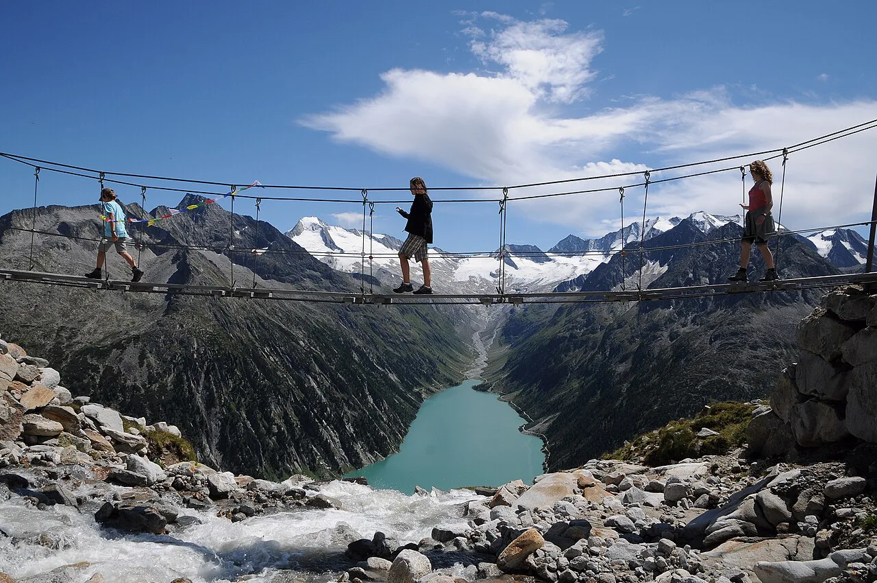
This is not a valley trail with mountain views; it is a genuine high route on steep passes, with fixed-cable protected passages and possible snowfields, as the route log describes it. You need sure footwork, alpine experience and no fear of heights, and stage days can run up to nine hours on the guided versions run by Mountain Sports Zillertal, as its tour programme notes.
First-time hut walkers should cut their teeth elsewhere in the eastern Alps before committing to this circuit; the hiking in austria overview includes gentler hut routes and lower valley trails. Come to the Berliner Höhenweg when you already know how your body handles consecutive long days with a pack. For a shorter alpine sampler at a similar altitude, the Innsbruck hiking guide is a useful warm-up before this one.
Where the circuit starts and finishes
The full route runs from the Gamshütte at 1,921 m (6,303 ft) to the Karl-von-Edel Hütte at 2,238 m (7,343 ft), then drops back to Mayrhofen, with the huts at Friesenberghaus, Furtschaglhaus, Berliner Hütte, Greizer Hütte and Kasseler Hütte in between. Guided groups commonly begin by climbing from Finkenberg at 910 m (2,986 ft) to the Gamshütte on day one.
A seven-day anticlockwise version instead climbs straight from the Mayrhofen side to the Friesenberghütte on day one, then traverses the Schlegeis reservoir shore to the Furtschaglhaus. Both directions work; pick the one whose first day matches your arrival time and the weather window you have.
Distance, ascent and time
The two published itineraries are genuinely different trips rather than a disagreement to resolve. The eight-stage version totals 88 km (55 mi) with 6,080 m (19,948 ft) of ascent and the Schönbichler Horn as its high point.
The abbreviated seven-day version logs 66.2 km (41 mi), 5,080 m (16,667 ft) of ascent and 4,390 m (14,403 ft) of descent across seven walking days. Choose the eight-stage version if you want the full circuit at a steady pace; take the seven-day cut if your holiday window is tighter or you want shorter days.
The eight stages: distance and ascent by day
Day one, Mayrhofen to the Gamshütte, is 6.8 km (4.2 mi) with 1,084 m (3,557 ft) of ascent and about 4.5 hours; strong parties can add the Ahornspitze at 2,973 m (9,754 ft). Day two to the Friesenberghaus is the longest of the circuit at 14.9 km (9.3 mi), climbing 1,207 m (3,960 ft) and descending 650 m (2,133 ft) over roughly seven hours.
Day three to the Furtschaglhaus covers 14.1 km (8.8 mi) with 663 m (2,175 ft) of climbing and 864 m (2,835 ft) of descent in about 5.5 hours. Day four over the Schönbichler Horn to the Berliner Hütte is shorter at 8.3 km (5.2 mi) but climbs 908 m (2,979 ft) and loses 1,159 m (3,802 ft) in around 6.5 hours, all of it on high, exposed ground.
Day five to the Greizer Hütte is the hardest single stage: 10.3 km (6.4 mi) with 1,255 m (4,118 ft) up and 1,071 m (3,514 ft) down across about 7.5 hours. Day six to the Kasseler Hütte eases off to 9.4 km (5.8 mi) and 689 m (2,261 ft) of ascent in around five hours.
Day seven to the Karl-von-Edel Hütte runs 12.9 km (8 mi) with 799 m (2,621 ft) of climbing and 743 m (2,438 ft) of descent over roughly eight hours. Day eight is the exit: 8.8 km (5.5 mi) and 1,614 m (5,295 ft) of descent back to Mayrhofen in about four hours, which is hard on the knees at the end of a week.
Furtschaglhaus to Berliner Hütte over the Schönbichler Horn
This is the stage the whole route is built around. From the Furtschaglhaus at 2,295 m (7,530 ft) you climb to the Schönbichler Horn at 3,134 m (10,282 ft), the route's literal and figurative high point, with views over glaciers, long ridges and the deep valley below. Treat it as the crux of your week and plan it for a settled-weather day.
The descent to the Berliner Hütte at roughly 2,042 m (6,700 ft) is longer than the climb, and snow can linger on this side into late June. Carry an early start and turn around if the pass is still holding hard snow you cannot cross safely without an axe and crampons.
Berliner Hütte and the high huts on the route
The Berliner Hütte was the first mountain hut in the Zillertal and has been protected as a historic monument since 1997, which is why it feels more like an alpine museum than a modern refuge. The 1889 path from the hut over the Schönbichler Horn to the Furtschaglhaus became the basis of today's network of high trails.
Hut altitudes matter for planning sleep and acclimatisation: Gamshütte 1,921 m, Friesenberghaus 2,498 m, Furtschaglhaus 2,295 m, Berliner Hütte 2,042 m, Greizer Hütte 2,227 m, Kasseler Hütte about 2,177 m and Karl-von-Edel Hütte 2,238 m. The Friesenberghaus is the highest overnight, so expect a colder night there than at the Berliner Hütte.
Getting to Mayrhofen and the start
Mayrhofen in the Zillertal is the natural base and the finish point, and Finkenberg, a few kilometres up the valley, is the start for guided groups heading for the Gamshütte. The community route log lists public transport to the start under its practical links, so plan your arrival and your exit day around valley buses rather than a car left at a trailhead.
Using lifts and valley transport to shorten stages or exit
Every hut on the circuit has a descent to the valley where public transport runs, which is the single most useful fact for planning. That makes shortened itineraries realistic: you can walk a few stages, drop to a village on a bad-weather day and rejoin the route higher up rather than abandoning the trip.
On the abbreviated version, the last day is a short walk from the Edelhütte to the Ahornbahn lift, which drops you back to Mayrhofen in under an hour of walking. Guided versions list the lift ticket as an extra cost outside the tour price, so budget for it separately.
When to go: months, snow on the passes and hut season
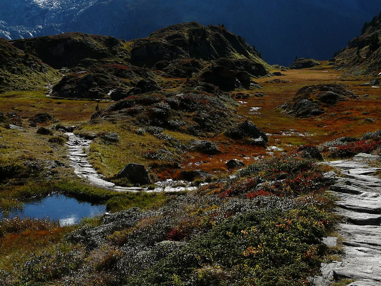
The guided season runs July to September, which reflects when the high passes are normally walkable rather than when the huts open. Late June and early July can still hold snowfields on the Schönbichler Horn and other north-facing slopes, and September brings shorter days and the chance of early snowfall.
If you want the full circuit with the least snow risk, target mid-July to late August and accept afternoon thunderstorms as a real daily hazard; start early and be off the highest ground by early afternoon. For a first week-long hut trip in Austria generally, our hut to hut hiking austria planning guide covers booking rhythms and hut etiquette.
Booking huts and what half board includes
Guided versions include seven touring days, the guiding by a state-certified IVBV mountain guide, and reservation of hut accommodation with half board, but not arrival or drinks. Self-guided hikers book the huts themselves through the hut operators, and the alpine club maps are the standard planning tool for the route.
Two hut basics catch first-timers: a silk or cotton hut sleeping bag is compulsory for hygiene, and debit cards are rarely accepted in mountain huts, so bring enough cash. Cable cars and hotels usually take cards, but do not count on that on the mountain.
Gear and exposure: cables, snowfields and scrambling
The route includes fixed-cable protected passages and possible snowfields, so you need surefootedness, sturdy boots and a head for heights rather than technical climbing gear. Compact ankle-height B/C boots are the operator's recommendation for this kind of multi-day tour.
Early in the season, add an ice axe and crampons for the Schönbichler Horn crossing, and know how to use them. If you want to build confidence on protected ground before the trip, start on easier terrain covered in our austria via ferrata guide.
Shortened and guided options
The seven-day anticlockwise collection trims the full circuit by replacing the Gamshütte start with an opening day up to the Friesenberghaus, logging 66.2 km over seven days. It suits fit hikers with a shorter holiday, but it still crosses the Schönbichler Horn and still requires alpine experience.
Guided versions run from 14 years old and take seven days, with a maximum stage day of up to nine hours. They handle the hut bookings and daily route-finding, which is worth the extra cost for a first high route where navigation in cloud is a genuine concern.
Staying safe on the high passes
The main hazards are objective ones: exposed ground with cables, lingering snow on the passes, and fast-moving afternoon storms on the high sections. The sensible response is a pre-dawn start on the Schönbichler Horn day, a conservative turnaround time, and a willingness to use a hut's valley exit rather than press on.
Reliable mountain forecasts only extend three to five days, so do not over-plan around a long-range outlook; decide on the ground with a current forecast and the hut keeper's advice.
Base villages and day-hike alternatives
Mayrhofen is the best base for the start, finish and lift connections, while Finkenberg makes sense if you are joining a guided group that starts at the Gamshütte. Ginzling, the old mountaineering village, sits close to the Schlegeis reservoir side of the route and works well for short breaks around the Berliner Hütte area.
If a full week is too much, day hikes from the Schlegeis reservoir or up to the Berliner Hütte give you a taste of the circuit without committing to the high passes. For longer-distance alternatives elsewhere in Austria, see the adlerweg.
Plan Your Visit
Decide first whether you want the full eight-stage circuit or the abbreviated seven-day version, then match that to a July-to-September window and a hut plan that leaves you a weather day. Book the huts early, carry cash and a hut sleeping bag, and treat the Schönbichler Horn as the day everything else is built around.
Frequently Asked Questions
How long does the Berliner Höhenweg take?
It depends on the itinerary. The full circuit is published as eight stages totalling 88 km with 6,080 m of ascent, while an abbreviated anticlockwise version covers 66.2 km over seven days with shorter walking days. Most hikers take a week plus travel days, and a spare weather day is worth building in.
How hard is the Berliner Höhenweg?
It is a high alpine route with fixed-cable passages, possible snowfields and stage days of up to nine hours on guided versions. You need good fitness, surefootedness, a head for heights and previous multi-day hut experience. The hardest single stage is usually Berliner Hütte to Greizer Hütte, with around 1,255 m of climbing.
Do you need a guide for the Berliner Höhenweg?
No, the route is waymarked and many hikers do it self-guided with alpine club maps. A guide is worth considering for a first high route, for navigation in cloud, or if you want hut bookings handled for you. Guided versions include guiding and hut accommodation with half board but not arrival or drinks.
Can you shorten the Berliner Höhenweg?
Yes. Every hut has a valley descent with public transport, so you can leave the route on a bad-weather day and rejoin higher up. The seven-day anticlockwise version is the standard shortened itinerary, skipping the Gamshütte start and beginning toward the Friesenberghaus.
When is the best time to hike the Berliner Höhenweg?
The guided season runs July to September, when the high passes are normally walkable. Late June can still hold snow on the Schönbichler Horn, and September brings shorter days and the chance of early snowfall. Mid-July to late August gives the most reliable conditions.
Do you need to book mountain huts in advance?
Yes, book the huts ahead through the hut operators, especially for July and August. Guided versions include hut accommodation with half board, but self-guided hikers arrange each night themselves. Bring cash, since debit cards are rarely accepted in mountain huts, and a hut sleeping bag, which is compulsory.
Sources
Trail notes for your next trip
Optional updates when we add or revise hiking guides.
You might also like
Continue reading
More guides you'll find useful