Grossglockner Hike Guide: Austria Trails and Access
Plan a Grossglockner hike from the High Alpine Road: Kaiser-Franz-Josefs-Höhe trails, tolls and opening season, and how to reach the trailheads.
On this page
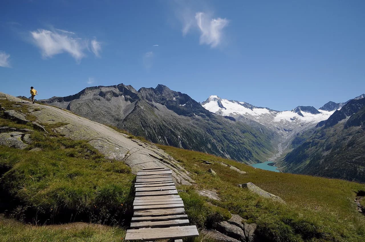
The Grossglockner High Alpine Road climbs into the Hohe Tauern National Park in Salzburg and Carinthia, carrying hikers to trailheads above 2,000 m (6,560 ft) with the Pasterze glacier and Austria's highest mountain in view. It suits walkers who want high views without a long approach and experienced hikers ready for steep, thin-aired ground.
This is road-based hiking rather than a single waymarked trail: you drive or ride to a trailhead, walk for a few hours, and drive on. That makes the toll, the daily opening window and the season as important to your plan as your boots.
What the Grossglockner hiking offers and who it suits
The Grossglockner itself rises to 3,798 m (12,461 ft), the highest mountain in Austria and the highest in the Alps east of the Brenner Pass. Hikers stay below that summit on paths and old high routes, while the mountain's upper flanks and glacier are mountaineering terrain.
Two kinds of day come out of this. Short, high-viewpoint walks from the road suit most visitors, including families and anyone short on time. Longer routes onto the surrounding slopes reward fit hikers with solitude and bigger views, but they are steep, partly pathless and exposed to fast weather changes.
If you want a wider menu of Austrian mountain days before or after this one, the country's long-distance routes and valley bases are worth planning alongside it; the hiking in austria guide covers both.
The High Alpine Road as the trailhead corridor
The road runs between two toll points: Ferleiten in the north, above Fusch an der Grossglocknerstrasse, and Heiligenblut in the south. Whichever way you enter, you pay at the gate and can then use the road repeatedly that day on a car or motorcycle day ticket.
Opening hours change through the year. Until 31 May the road runs 6:00 to 20:00, from 1 June to 31 August 5:30 to 21:00, and from 1 September 6:00 to 19:30, with last entry roughly 45 minutes before closing. Outside those hours an official ban on night driving applies.
Plan your hike so you are back at the car well before last entry, because the gates close on schedule and the descent from a high trailhead takes longer than the climb. Morning starts also dodge the cloud that builds over the ridge later in the day.
Access without a car
The Großglockner Hochalpenstrassen AG (GROHAG) runs bus trips along the road and lists them as a way to visit without driving, with hikers dropped at the main viewpoints and visitor centre. Check the Großglockner bus page for the current timetable and pickup points before you build a walking day around it, since services are seasonal.
A car gives the most flexibility: you can shift trailheads when cloud sits on one side of the ridge, and you are not tied to a bus departure. Without one, base yourself at Heiligenblut in the south, where the village sits at the road's southern gate, or at Fusch in the north.
Kaiser-Franz-Josefs-Höhe visitor centre
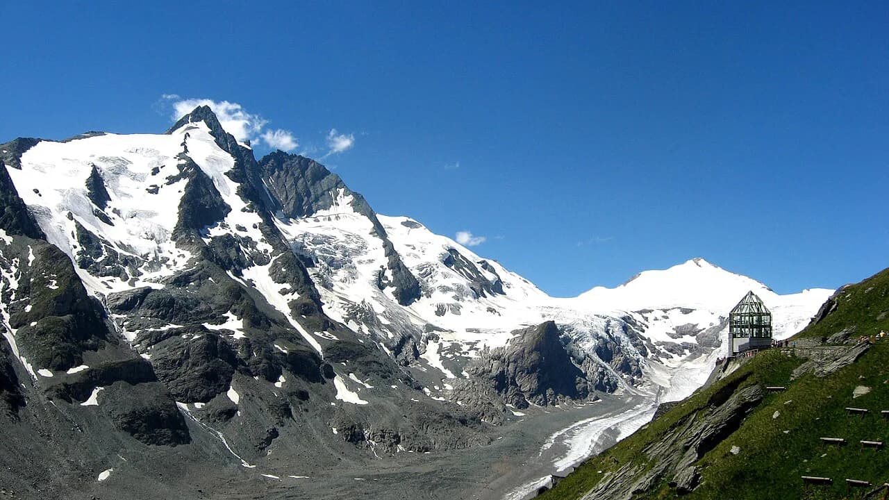
Kaiser-Franz-Josefs-Höhe is the road's main base for short walks, set directly above the Pasterze glacier with the Grossglockner behind it. The visitor centre opens daily from 10:00 to 17:00, the other exhibitions from 9:00 to 17:00, and the Nationalpark Crystal observation tower from 10:00 to 16:00.
Use the centre for orientation first: exhibitions on the mountain, the glacier and the road's history explain what you are looking at, and the terrace gives a clean glacier view before you commit to a path. Allow an hour inside if the weather is marginal.
Hikes from Kaiser-Franz-Josefs-Höhe
The paths around the centre stay high and mostly gentle, hugging the moraine above the Pasterze and linking viewpoints along the glacier's edge. Terrain is rocky and open, with little shelter, so windproof layers and sun protection matter even on a short walk.
Routes heading away from the centre onto the surrounding slopes gain height quickly and cross steeper ground, some of it secured or rough underfoot. Treat these as proper mountain days: turn back if the cloud drops or the rock is wet, and do not follow cairns onto glacier ice, which is crevassed and needs rope and experience.
Higher and harder options below the summit
The ground between the road and the Grossglockner's summit is high alpine: loose scree, snowfields that linger into summer, and glacier ice above. A hike can take you onto the lower slopes, but the summit itself is a mountaineering objective, normally climbed with ropes, an ice axe and a guide.
If you want vertical ground with fixed protection rather than a glacier, Austria's bolted routes are a better match; the austria via ferrata section explains grades, gear and where a guide helps. Hikers without that kit should stay on the marked paths from the road.
Ferleiten and the northern road
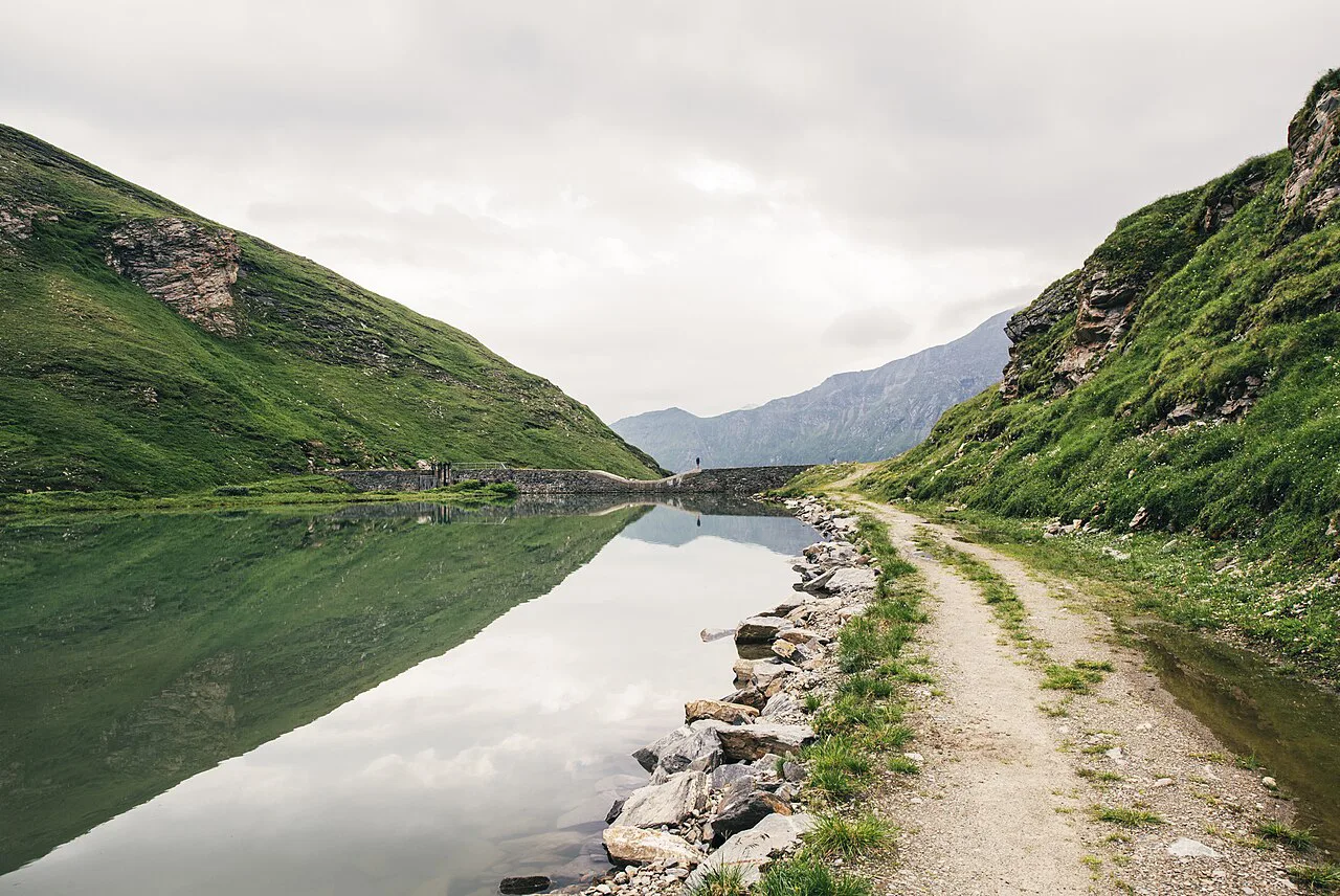
On the northern side, the Ferleiten toll point sits above Fusch and serves as the gateway for short nature and wildlife walks along the valley and lower slopes. The car park at Ferleiten charges 4.00 euros for four hours, 6.00 euros for six hours and 10.00 euros for a day, with a 48-hour maximum stay.
These lower trails make a sensible first day while you acclimatize, and they are the fallback when the high road is in cloud. From Fusch you can also walk valley paths without paying the road toll at all.
Heiligenblut and the southern approach
Heiligenblut am Grossglockner is the southern gate and the better base if you approach from Carinthia: a compact village with the road climbing straight out of it. Valley walks and lower slopes start from the village, so you can hike on days when you would rather not drive the high section.
Staying here also shortens the morning drive to Kaiser-Franz-Josefs-Höhe and puts you on the road before the day-trip traffic. Ask your accommodation how the toll is handled for guests staying along the road, since the Großglockner Hochalpenstrassen AG applies its own rules at the exit point.
Distance, ascent and time
The road operator does not publish distances and ascent figures for the individual paths, so size your day by time on your feet and by the altitude rather than by a target number. Above 2,000 m (6,560 ft) most hikers move noticeably slower, and a short climb can take twice as long as the same gain at valley level.
A realistic road-based day is one main walk of two to four hours plus time at a viewpoint or exhibition, with the drive between trailheads counted separately. Late in the season, daylight shortens and the road closes earlier, so start earlier than you would in July.
If you would rather have the logistics handled, austria walking holidays set out guided and self-guided formats that suit different fitness levels and appetites for route-finding.
When to go
The road opens at the start of May and closes at the start of November, and it is impassable under snow in winter. July and August give the most reliable conditions and the longest opening hours, but also the busiest road.
Autumn is the quieter choice. From 15 October the Grossglockner High Alpine Road applies reduced autumn rates, and from 27 October the road runs 8:00 to 17:00 with last entry at 16:15, which cuts your walking window sharply.
June and early October are the sweet spots for fit hikers: the road is open, the crowds are thinner, but snow can still lie on north-facing passes and shaded gullies. Carry traction aids in those months and be ready to change your route.
Snow, storms and altitude
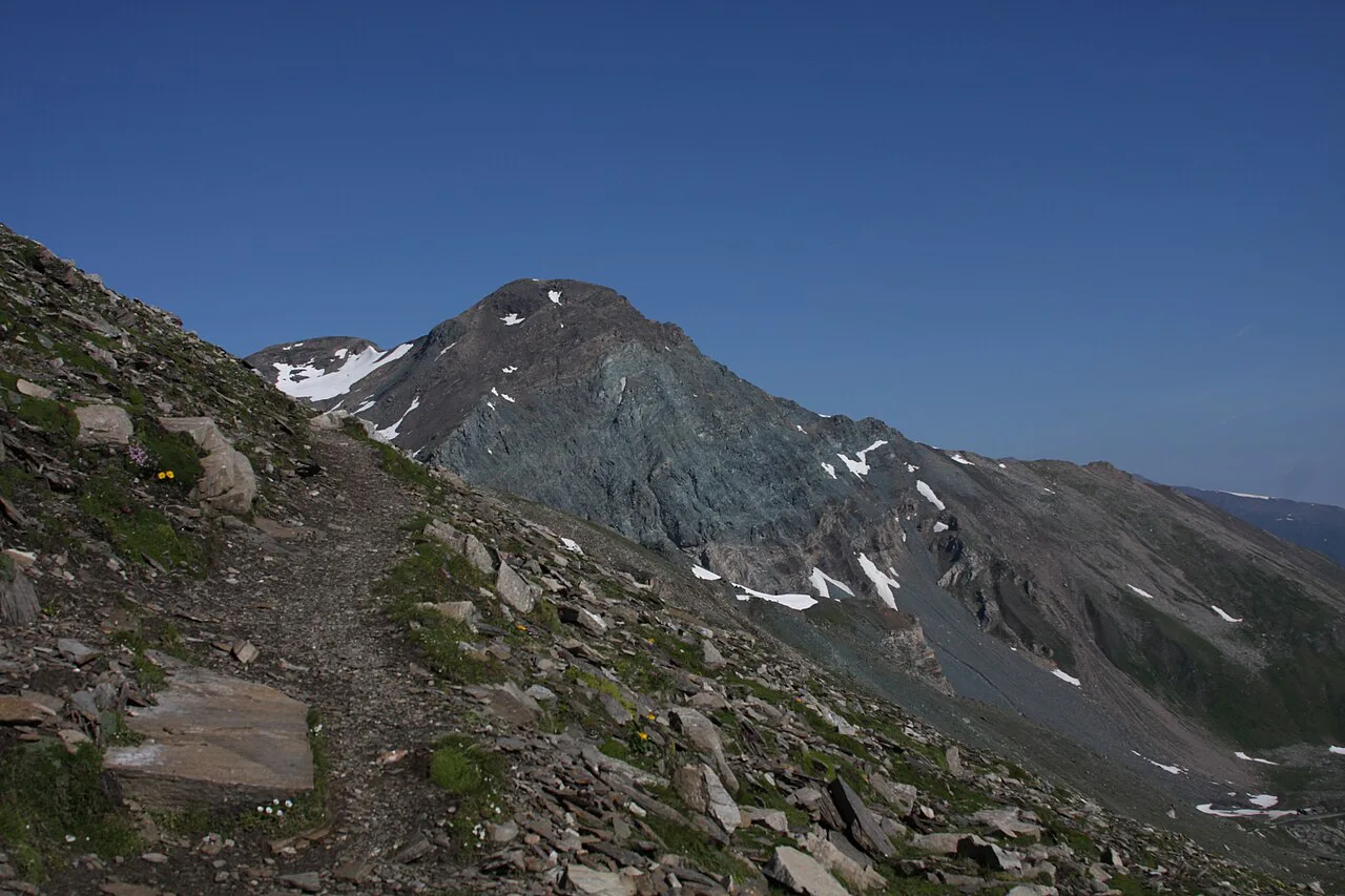
Because the trailheads sit above 2,000 m (6,560 ft), snow patches persist into early summer and return in October, especially on shaded slopes and in gullies below the Pasterze. Microspikes and an early start solve most of it; a slope that holds hard snow is a turn-around, not a scramble.
Afternoon cloud builds quickly in this range and can cut visibility on the road to a fraction of the clear-day view, which matters when your descent depends on seeing the trailhead. Start early, watch the sky, and treat a whiteout as your signal to drop to the road.
Altitude is the other quiet factor: headaches, breathlessness and poor sleep are common on a first day at 2,500 m (8,200 ft), so keep the first walk short and save the bigger day for later in your trip.
Tolls, tickets and parking
A car day ticket costs 46.50 euros, an electric car 40.00 euros, and a motorcycle 36.50 euros; after 18:00 the car rate drops to 36.50 euros. The day ticket covers repeated use of the road that day.
For several days on the road, the Autumn Ticket gives five consecutive days for 65 euros by car or 58 euros for an electric car or motorbike, tied to the vehicle's registration and sold from 15 September at the ticket office.
Camping is not permitted along the road and there are no approved campsites in its immediate vicinity, so plan nights in villages at either end. Hikers staying in accommodation along the road do not pay extra at the exit point.
Where to stay and what to bring
Heiligenblut in the south and Fusch in the north are the natural bases, each with guesthouses and access to the road gates; staying along the road itself puts you above the valley for early starts. Book ahead in the short autumn window, when many valley hotels close.
Pack for three seasons in one day: boots with grip for rock and scree, warm layers, waterproof shell, gloves and hat, sun cream and water carried in, since reliable water points are sparse above the road. A paper map and a charged phone cover navigation when cloud hides the landmarks.
Outside the road: other Hohe Tauern days
Outside the Grossglockner corridor, the Hohe Tauern National Park holds multi-day routes and waterfall walks that reward a separate day, including the Krimml Waterfalls, which the park's visitor network promotes as its own destination.
Further afield, the Dachstein Mountains and Austria's long-distance routes like the Berliner Höhenweg offer hut-to-hut walking if the road-based day leaves you wanting more. Those lie outside the Grossglockner area and need their own planning, much like hiking in Innsbruck, where the trailheads and terrain call for a separate trip.
Plan Your Visit
Treat the Grossglockner High Alpine Road as your trailhead corridor: pick a gate, check the day's opening window, and build a walk that returns you well before last entry. Drive or ride up early, walk the high paths around Kaiser-Franz-Josefs-Höhe, and keep the bigger slopes for a second day once you know how the altitude treats you.
Buy your ticket at the gate or through the Grossglockner online shop, carry layers for snow and storm, and let the season set the plan: long days and full hours in midsummer, a shorter, cheaper window in late October. Check current prices and opening times before you travel. The walking holidays and hiking guides linked above help you extend the trip into the rest of Austria.
Frequently Asked Questions
Is the Grossglockner a hike or a climb?
The summit at 3,798 m (12,461 ft) is a mountaineering objective, normally climbed with ropes, an ice axe and a guide, and the glacier approach is crevassed. Hikers stay on the marked paths from the High Alpine Road, mainly around Kaiser-Franz-Josefs-Höhe and on the lower slopes at either end.
Do you need a ticket to hike from the Grossglockner High Alpine Road?
Yes, reaching the trailheads by road means paying the toll at Ferleiten in the north or Heiligenblut in the south. A car day ticket covers repeated use of the road that day, and multi-day options are sold for longer stays.
How long does a Grossglockner hike take?
The road operator does not publish fixed walking times for individual paths. Plan a two- to four-hour walk plus time at a viewpoint, and remember that altitude above 2,000 m (6,560 ft) slows most hikers noticeably.
When is the Grossglockner High Alpine Road open?
The road opens at the start of May and closes at the start of November, with longer hours in midsummer and a shorter 8:00 to 17:00 window from 27 October. Winter snow makes it impassable outside the season.
Can you camp along the Grossglockner High Alpine Road?
No. Camping is not permitted along the road and there are no approved campsites in its immediate vicinity, so stay in villages such as Heiligenblut or Fusch at either end.
Where do you start a Grossglockner hike?
Most short walks begin at Kaiser-Franz-Josefs-Höhe above the Pasterze glacier, while the Ferleiten toll point in the north and Heiligenblut in the south give access to lower valley paths and slopes.
Sources
Trail notes for your next trip
Optional updates when we add or revise hiking guides.
You might also like
Continue reading
More guides you'll find useful