Feldberg Hike: Black Forest Summit Walk Guide
Plan the Feldberg panorama hike in Germany's Black Forest: distance, ascent, walking time, winter marked walks, family gnome trail and summit conditions.
On this page
The Feldberg gives you the highest ground in the Black Forest with very little technical effort: a signposted panorama walk leads from the road and lift area up to a summit that opens a wide horizon in every direction. It suits hikers who want a big-mountain view without a big-mountain day, and families or short-stay visitors who need a route that stays walkable in changeable weather.
There are two distinct ways to spend a day here. The marked panorama trail is the main outing, while the gnome trail is a short forest circuit built for small children. Pick the first for views and the second for stamina-friendly family time, and plan the season around a summit that sits above 1,400 m (4,600 ft).
Feldberg summit panorama: what the hike offers and who it suits
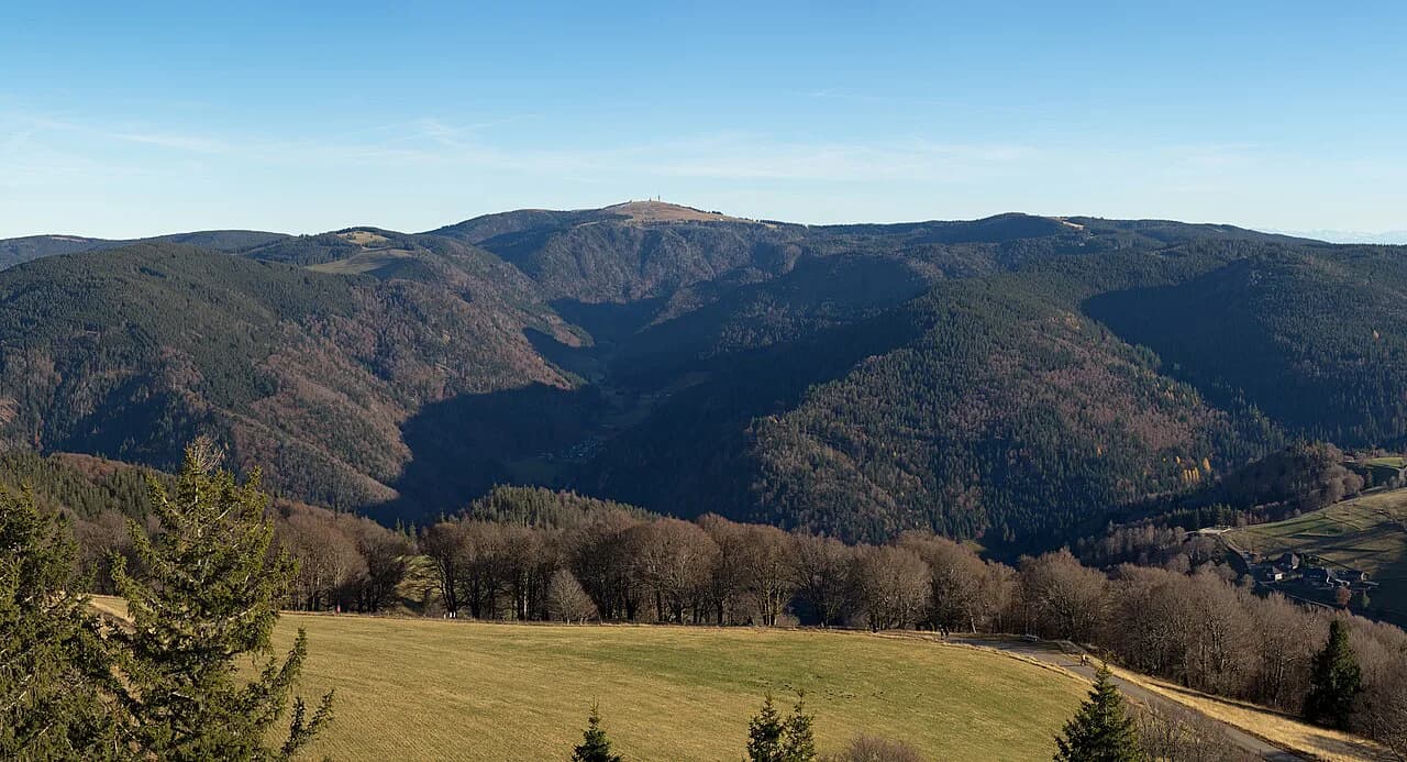
At 1,493 m (4,898 ft), the Feldberg is the highest mountain in the Black Forest and offers vast panoramic views that, on clear days, reach as far as Mont Blanc. That height comes with open, wind-exposed ground near the top, so the day feels bigger than the modest numbers suggest even though the path itself is straightforward.
This is a panorama outing rather than a graded mountain ascent. The route is signposted and follows maintained surfaces, 95% of it gravel path, so hikers with basic fitness and shoes with grip can handle it; the challenge comes from weather exposure on the summit plateau, not from scrambling or route-finding.
Getting to the Feldberg trailhead: arrival, parking and the Feldbergbahn cable car
The trailhead sits in the Feldberg lift and road area above Todtnau, where the Feldbergbahn operates and the marked routes begin. The lift is a convenient way to gain height before walking, but its seasonal operating calendar and ticket prices change through the year, so get current hours and fares from the lift operator before you commit to a lift-assisted start.
By car you approach via the Feldberg pass road and use the signed parking around the lift station and trailheads; winter parking fills early on clear weekends, so arriving in the morning is the practical choice. If you would rather build the whole Black Forest into a longer trip, use the regional planning resources for black forest hiking and transport in the area.
The Feldberg Panorama trail: distance, ascent and walking time
The signposted Feldberg panorama tour measures 8.76 km (5.4 miles) with 210 m (689 ft) of ascent and the same descent, and Hochschwarzwald Tourismus estimates three hours of walking. The route runs between a low point of 1,280 m (4,199 ft) and a high point of 1,382 m (4,534 ft), so the profile stays gentle throughout.
The surface mix tells you what to expect underfoot: 95% of the route is gravel path, with 5% asphalt, and none of it is classified as a nature trail. That makes it a good choice for trail shoes or light boots, and it keeps navigation simple because the path is signposted and maintained.
Treat the three-hour estimate as walking time and add stops for photographs and a break at one of the mountain huts the route passes. If you are linking the summit day into a longer traverse of the region, the westweg long-distance resources help you see how a Feldberg leg fits with multi-day plans.
Route description: signposted path to the 1,493 m summit
From the lift and trailhead area the marked path climbs steadily through open ground and patchy conifer stands, gaining height in short, even stretches rather than steep bursts. Follow the panorama trail signs rather than informal tracks, because the marked line is the one that is checked and kept in walking condition.
Near the top the trees fall away and the route crosses open summit terrain to the 1,493 m (4,898 ft) high point, where the panorama opens across the Black Forest ridges. The descent reverses the climb, and because the highest point of the tour sits below the summit itself, plan your turn with the weather and the state of the ground rather than expecting the top to stay dry.
If you want a second day of narrow-gorge walking and waterfalls in the region, add a lower-level outing such as the Ravenna Gorge Hike in the Black Forest and keep the Feldberg for the clearer forecast morning.
Winter on the Feldberg: marked winter walks and sledging
In winter the same area runs a dedicated network of premium winter walks: specially maintained, signposted routes chosen for scenery and easy walking, inspected and cleared or rolled daily and mostly laid out as circular walks. The Feldberg panorama route appears in this system as a winter hiking trail, and Hochschwarzwald Tourismus recommends winter gear and taking a sledge, since there are several places to sledge along the way.
The winter figures match the summer listing: the winter version is listed at 8.76 km (5.4 miles), 210 m (689 ft) of ascent, about three hours and a highest point of 1,382 m (4,534 ft), with the surface dominated by gravel. Plan your start early, because a rolled snow path softens through the day, and check whether the lift is running before building your day around it.
Family option: the Feldberg gnome trail
For small children, the Feldberg gnome trail is a forest adventure loop of 1.8 km (1.1 miles) with an easy, child-friendly surface and an estimated two hours of walking. The short distance and the slow pace leave room for the play stops that make the difference on a family day.
Use the gnome trail as a morning outing and keep the summit panorama for another day, or split a group so stronger walkers take the longer signposted route while the rest stay low. Both start from the same Feldberg area, which keeps the logistics simple if you are based in a single valley village.
When to go: seasons and mountain weather
Late spring through early autumn is the natural window for the summer panorama route, when the gravel path is clear and the summit plateau is at its most inviting. Summer afternoons often bring build-ups over the ridges, so an early start gets you up and back before storms arrive and leaves the clearest light for the horizon.
Snow can linger on the upper ground into spring and return early in autumn, and the marked winter walks are the proper choice once the paths are prepared for snow. If you are comparing the Feldberg with the southern part of the range, the Schluchtensteig in the Southern Black Forest Nature Park shows how the season shifts between the two areas.
Equipment and mountain hazards on an exposed summit route
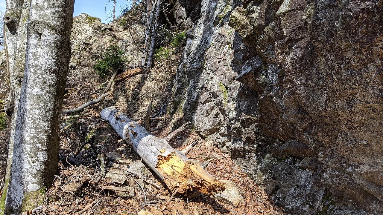
The path is maintained and non-technical, so you do not need climbing gear, but the summit is exposed and the weather turns faster than the distance suggests. Carry a waterproof shell, a warm layer, water and a map or offline route, and turn around if wind or cloud thickens on the plateau.
In winter, add traction and poles for rolled snow and icy patches, and treat sledging slopes as separate from the walking line so you do not descend into someone's run. In every season, tell someone your plan and carry a charged phone, because phone signal on the open upper slopes should not be assumed.
Nearby beyond the Feldberg: the wider Black Forest
Outside the Feldberg itself, the Black Forest offers gorge walks and long-distance trails that reward an extra day, and the region's national park has its own network of marked paths. Use the wider regional guide to match your remaining time to trails that fit your fitness and the season rather than defaulting to another summit. If you are weighing a bigger mountain day on the next trip, hiking in Switzerland offers a useful comparison of what a higher, glaciated landscape demands.
Plan Your Visit
Choose the signposted Feldberg panorama route for the summit views, the marked winter walks once snow is down, and the gnome trail for small children. Plan an early start, confirm current lift operating dates with Feldbergbahnen GmbH, and carry layers for a plateau that is colder and windier than the valley.
Frequently Asked Questions
How long is the Feldberg panorama hike?
The signposted Feldberg panorama tour is 8.76 km (5.4 miles) long with 210 m (689 ft) of ascent and descent, and it is estimated at three hours of walking. Add time for photographs and a hut stop. In winter the same route is maintained as a marked winter walk with the same distance and ascent.
How much ascent does the Feldberg hike have?
The panorama tour gains 210 m (689 ft) and loses the same amount, staying between 1,280 m (4,199 ft) and 1,382 m (4,534 ft). The summit itself is 1,493 m (4,898 ft), so the walking is gentle and the challenge comes from exposed weather on the plateau rather than steep ground.
Can you hike the Feldberg in winter?
Yes. The area runs a network of premium winter walks that are checked, cleared or rolled daily, and the Feldberg panorama route is one of them. Winter gear and a sledge are recommended, since there are several sledging options along the way. Check current details on whether the Feldbergbahn is running before planning a lift-assisted start.
Is the Feldberg hike suitable for families?
The panorama route is non-technical and mostly gravel, so older children with basic fitness can manage it. For smaller children, the Feldberg gnome trail is a 1.8 km (1.1 miles) forest loop with an easy surface and an estimated two hours of walking. Both start from the same Feldberg area, so a group can split between them.
What is the highest mountain in the Black Forest?
The Feldberg, at 1,493 m (4,898 ft), is the highest mountain in the Black Forest. On clear days the panorama from the summit reaches as far as Mont Blanc. The signposted panorama trail approaches the summit on maintained paths, so you do not need climbing skills to reach the top.
Sources
Trail notes for your next trip
Optional updates when we add or revise hiking guides.
You might also like
Continue reading
More guides you'll find useful